Narao Peak attempt II
March 28, 2004
Mountain height: 2,974 m
Elevation gain: 1,380 m (we
came up approx. 100 vertical metres short)
Ascent time: 8:00
Descent time: 4:40
Snowshoeing,
scrambling, and mountaineering with Mark.
I
don’t even know where to begin with this one – some intense and unnerving
scrambling up steep, snow-covered rockbands, the outstanding scenery and
perfect weather, our outrageous 8 hour ascent time, the fabulous scenery, ascending
snowy terrain we couldn’t possibly downclimb, standing at the last false summit
at 5:20 pm (realizing that we had only 1.5 hours of sunlight to descend), an
almost disastrous rappel when the anchor didn’t hold, the breath-taking
scenery, doing the last 3 hours of the decent in darkness, or some of the best
scenery around?? ….looks like when all is said and done, the scenery is the big
winner of the day!
After
our failed attempt two weeks earlier, we decided to wait for a good weather day
and try again. The scenery throughout the trip was simply too outstanding to
pass up another shot at the summit. The first couple of hours were uneventful,
though as long and grueling as the previous attempt. The trail had been covered
in the fresh layer of snow and so, for the most part, we made our own tracks
through the trees and up to the treeline. We ditched our snowshoes here and
started up the rubble slope to the ridge. The weather was cloudy throughout and
it wasn’t until we had made it to our previous highpoint that the skies cleared
and, once again, we were treated to Narao’s magnificent panorama. We left our
backpacks here and started up.
The
fun started right away, as we ascended the first rockband, up a snow gully. It
took us about 10 minutes just to hack away enough snow and ice to get up. At
the top, we made our way easily to the second and most challenging rockband. Here,
we had no options, but to ascend the rockband head-on where there was the least
amount of snow. Even then, the terrain had a fair amount of snow on it and was
steep to the point that downclimbing it was not a possibility. We were roped up
and so upon finding a decent ledge, about halfway up, I belayed Mark up to that
point. Here, snow plastered on the steep walls, prevented us from going any
further and we were forced to ascend a very steep rockface right on the edge of
the ridge. A slip here would have resulted in a fall of over 300 metres.
Thankfully, the ascent was short and soon I was onto easier terrain.
The
next rockband was likewise very steep, but only half the height. We could now
see the false summit with the true summit behind. It was approaching 5 pm at this point and descending a
good portion of the mountain in the dark was a forgone conclusion. Fortunately,
(or unfortunately, depending on your viewpoint) the scenery was so incredible,
we simply couldn’t stop. Just after 5
pm, exactly 8 hours after leaving the car, we made it to the
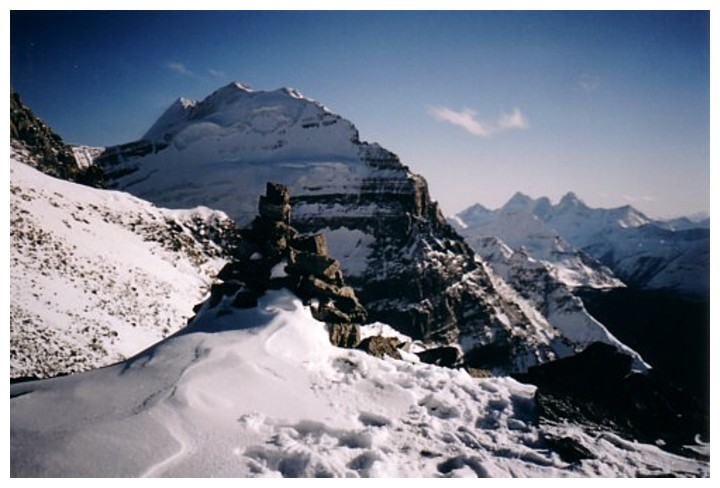
double-cairned false summit. As expected, the view of the north face of Mount Victoria
was fantastic. Also visible, were The Goodsirs, and innumerable, notable peaks
of the Waputik and Wapta Icefields.
We
started the long descent at 5:20 pm. That gave us about 1 hour, 40 minutes of
decent daylight. At the top of the first rockband, we set up a rappel off what
we thought was a solid rock. I went down and Mark followed, however, somehow a
knot had formed in the rope and we weren’t able to pull it down. Mark had to
re-ascend the rockband, untie the knot, and then rappel down again. As he
rappelled, numerous large rocks were dislodged from the crumbly terrain and I
spent a few solid minutes of dodging and ducking some dangerous rockfall. Mark
was almost at the bottom when the anchor gave way, sending Mark flying down
into a snowdrift at the bottom and a huge number of large rocks hurling down on
us. Fortunately, none of the big ones hit us and although I took 4 or 5 off my
head (actually my helmet!), they were too small to be of consequence.
That
incident left us a little shaken, but there was no time to stop and recover.
The simple rappel had taken half an hour and we had to keep moving. The second
rappel was thankfully not the ordeal the first one was. We were able to rappel down
easier snow-covered terrain, as opposed to our ascent route right along the
edge of the ridge. Unfortunately, our 50 m rope was not enough to get us to the
bottom and we had to set-up a second rappel halfway down (we’ll have to return
in the summer to retrieve the three slings we left up there). After that, it
was an easy trek back to our backpacks.
By
the time we recovered our backpacks, the sun had set and we started down in
increasing darkness. The challenge was going to be finding our snowshoes, some
5 or 6 hundred metres down the slope. Fortunately, we were able to find our
ascent tracks in the snow and they led us to the snowshoes. With all the
difficult terrain behind us, we were more than a little relieved! Of course, it
was now almost completely dark and we still had to get down the long slope
through the trees. I had my headlamp, but it was still a little tricky in
places and both of us took a several spills. We arrived back at the car,
completely exhausted, at 10 pm
– 13 hours after leaving. Definitely, our most intense day out so far, but once again, the phenomenal scenery
made it all worthwhile – I love the mountains!
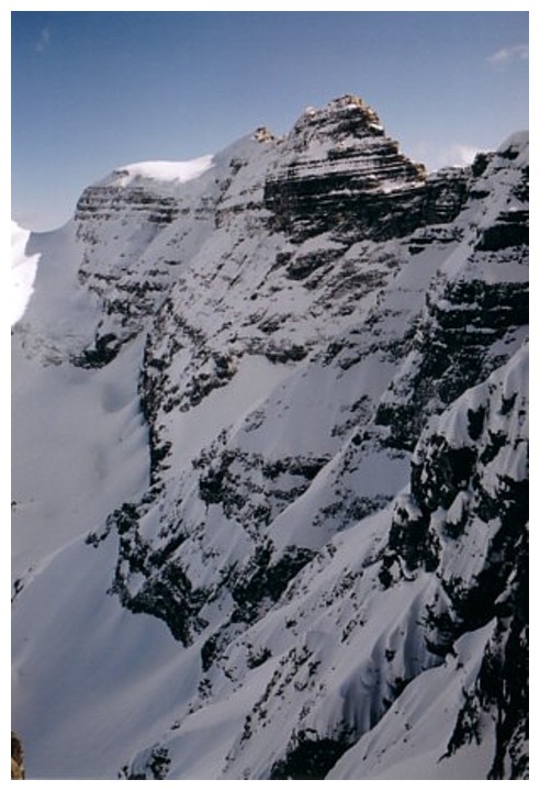
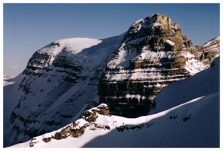
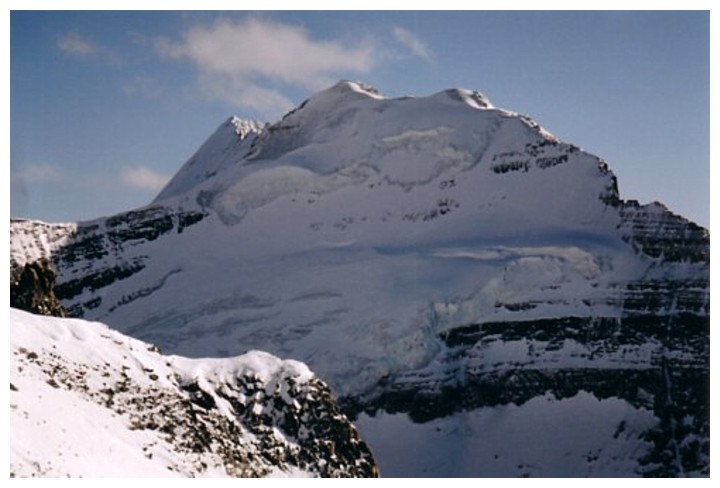
Back again to see the impressive east face of Narao
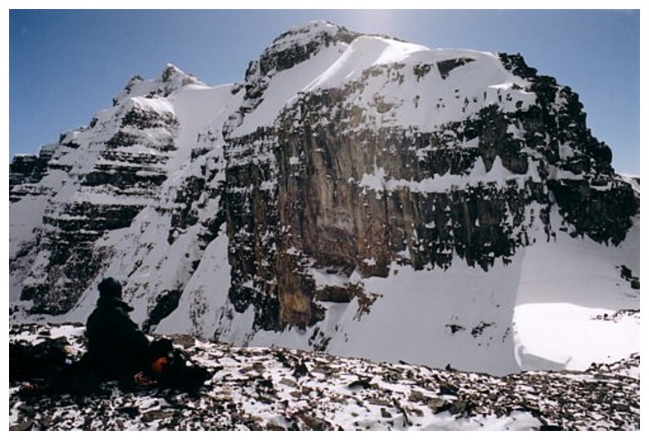
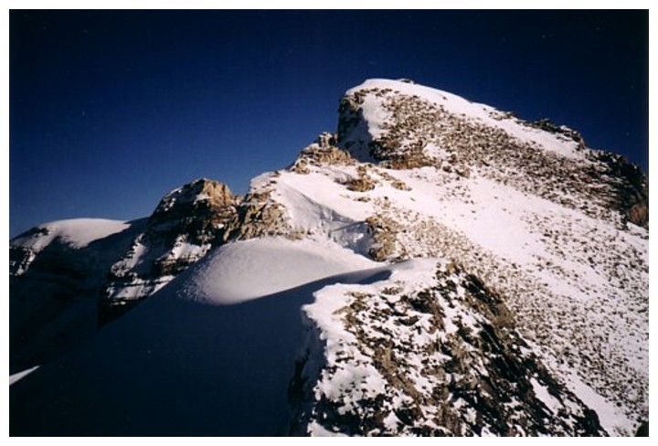
Taking a break. The false summit and true summit at the left
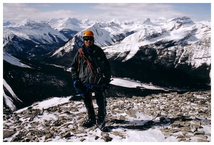
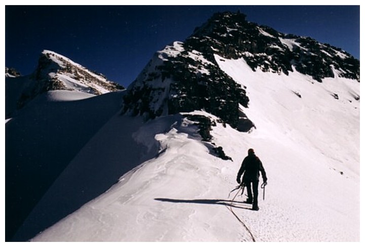
In full mountaineering mode and ready to tackle the challenging terrain ahead
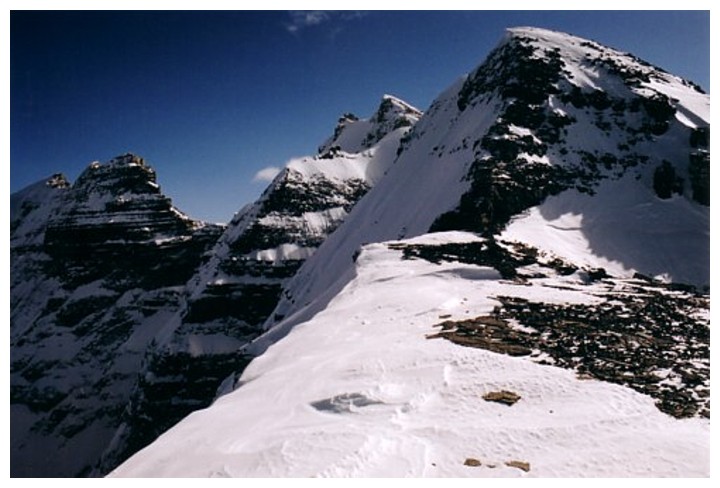
And what beautiful terrain it is!
Approaching the second rockband
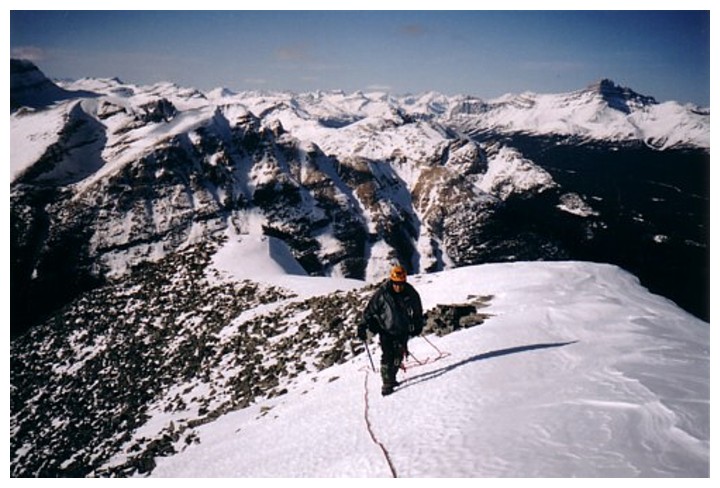
Above it and heading for the false summit
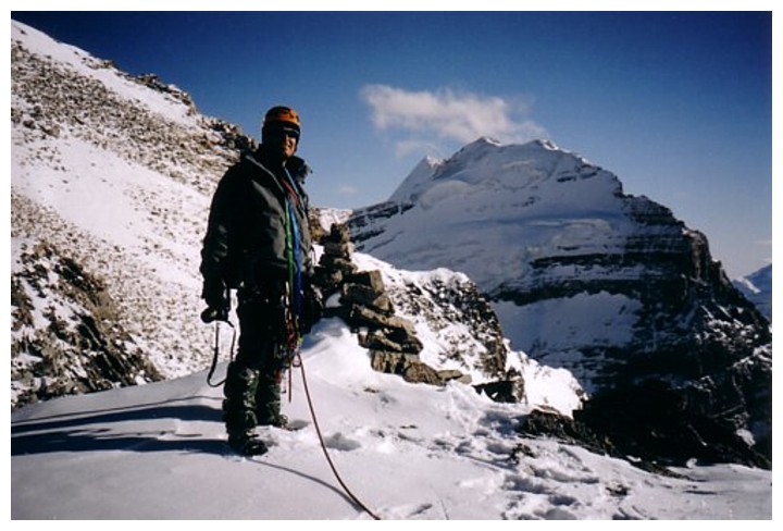
Mark at the false summit
Popes Peak
Close-up of the stunning north face of Mount Victoria
The true summit is so close but will have to wait for another day
Time to leave
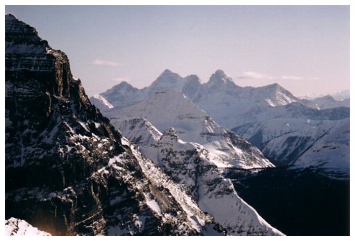
The Goodsirs