Nigel Peak
June 19, 2004
Mountain height: 3,211 m
Elevation gain: 1,175 m
Ascent time: 5:25
Descent
time: 3:20
Scrambling and
mountaineering with Mark.
We seem to be
making a habit out of turning simple scrambles into more technical
mountaineering trips. Lucky that we did bring along crampons, ice axes and a
rope for this ascent, as without them the heavily snow covered slopes would
have been very difficult and dangerous to negotiate.
 A perfect
weather forecast should take you to the most scenic parts of the Rockies and The Columbia Icefield area has few superiors
in that regard….and Nigel
Peak seems to have few
superiors in regards to its views of the Icefield and surrounding mountains,
without actually going onto the ice.
A perfect
weather forecast should take you to the most scenic parts of the Rockies and The Columbia Icefield area has few superiors
in that regard….and Nigel
Peak seems to have few
superiors in regards to its views of the Icefield and surrounding mountains,
without actually going onto the ice.
Basically, we
can divide our ascent of Nigel into two parts – the one with no snow, and the one
with way too much snow! A short hike took us to the pleasant meadows above the Wilcox Pass
trail. Here, the first ascent slope, completely snow-free, came into view. It
looked long and it was - tedious scree with far too few slabs to provide some
relief. It took us almost an hour and a half to reach the top and was quite an
uncomfortable ascent in the considerable heat.
At the ridge, as
well as some great scenery in all directions, there was a terrific (although
somewhat intimidating) view of the remainder of the ascent. The west slope and
north ridge of the mountain were plastered in snow and we became quite
skeptical about making the summit. Nevertheless, it’s always worth a try –
looks can certainly be deceiving in the mountains.
After a long
break, trying to recover some energy expended on the scree slope, we put on our
mini-crampons, roped up, and started along the snow-covered and corniced ridge.
As opposed to Kane’s route, which ascends the ridge then traverses to the north
ridge just below the rockbands, we chose to try descending and traversing to
the north ridge much lower down, where there was less of a chance slipping and
glissading all the way to the bottom, and/or getting caught in an avalanche. Fortunately,
the snow was quite firm and instead of going all the way over to the north
ridge, we opted to take a more direct route up a slope of avalanche debris
(great logic, hey.....we’ll traverse the slope to avoid getting caught in an
avalanche and then go right up the slope where it is the most avalanche prone!).
 Like its
predecessor, this slope was also dreadfully long and the sun reflecting off the
snow made for miserably hot conditions. The scenery, however, became more and
more breath-taking with each step and we weren’t about to stop because we were
in danger of “sweating to death” (?). When we finally reached the north ridge,
we had to take an extended break to rehydrate, rest, and enjoy the amazing
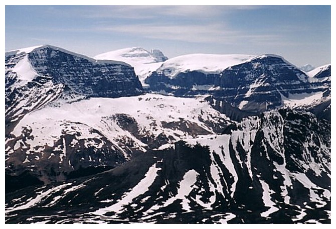
panorama unfolding to the west – the Columbia Icefield and its numerous peaks
over 11,000 feet: Athabasca, Andromeda, Snowdome, Kitchener, North Twin, South
Twin, Stutfield, Alberta, Woolley, Diadem, and Edith Cavell in the distance.
Like its
predecessor, this slope was also dreadfully long and the sun reflecting off the
snow made for miserably hot conditions. The scenery, however, became more and
more breath-taking with each step and we weren’t about to stop because we were
in danger of “sweating to death” (?). When we finally reached the north ridge,
we had to take an extended break to rehydrate, rest, and enjoy the amazing
panorama unfolding to the west – the Columbia Icefield and its numerous peaks
over 11,000 feet: Athabasca, Andromeda, Snowdome, Kitchener, North Twin, South
Twin, Stutfield, Alberta, Woolley, Diadem, and Edith Cavell in the distance.
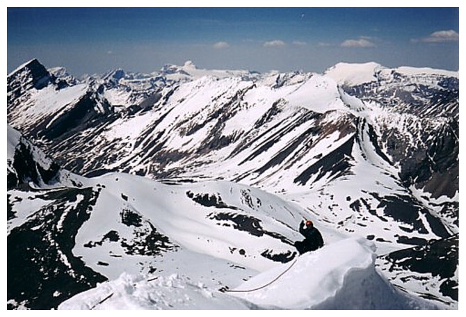
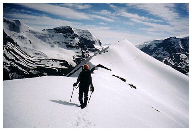
The route up
the north ridge looked dicey at best. We ditched our backpacks and started up
the steep slopes. Some sections were easy and straightforward, but a couple
involved some very steep, snow-covered terrain that required great care and
caution and extensive use of ice axes and crampons. A slip here would have
carried serious consequences. Fortunately, the ridge was not very long and
fairly soon we saw the sizable summit cairn ahead. A short traverse across a
somewhat exposed and corniced ridge took us to one of the best panoramas we’ve
seen to date – easily rivaling that of Narao Peak of May 1st this year.
The descent of
the north ridge was relatively easy except for three sections where we belayed
each other down. Two were quite short, but the middle one took about 40 m of
rope to get down. With the exception of some knee-deep post-holing in the
sun-softened snow, the remainder of the descent was easy. The long scree slope
at the beginning, had some extended sections of very surfable scree, greatly
reduced the time and effort required to descend it. I certainly felt that we
deserved this after a fairly long and grueling ascent.
Overall, a fantastic trip with unbelievable scenery and views of some of
the jewels of the Canadian Rockies. This mountain should be on everyone’s “to
–do” list.
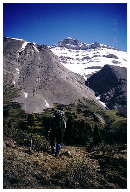
Nigel Peak is dead ahead, but a long way off
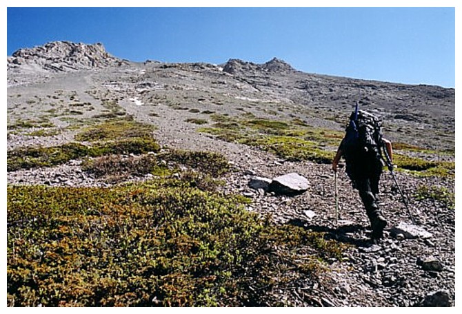
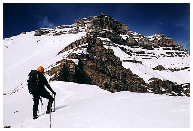
A long scree ascent is required

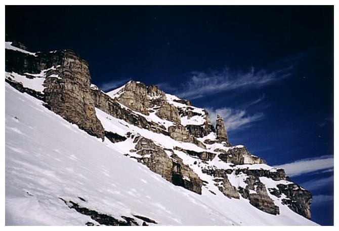
The bulk of Nigel Peak appears and it looks darn snowy!
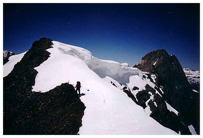
Of course the snow creates amazing scenery
Making progress. we traversed over to the ridge at the left soon after
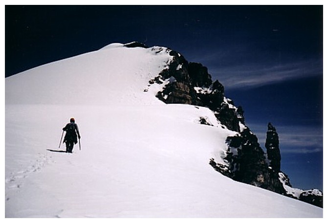
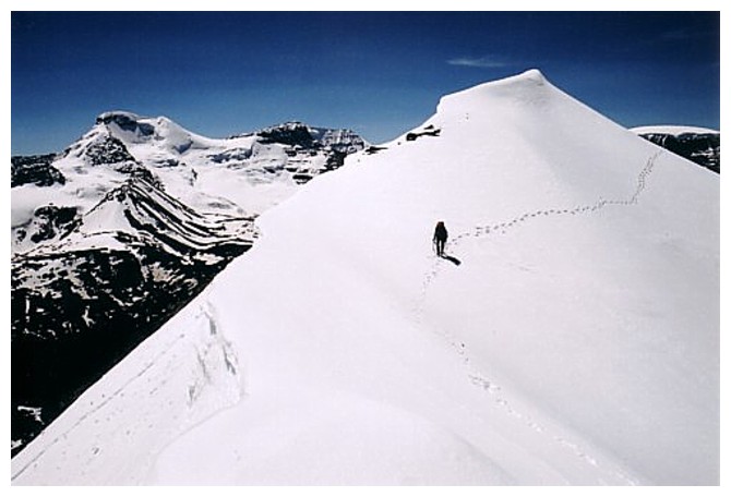
On the ridge and heading to the summit
Beautiful ridge to traverse, with pretty great views of Mount Athasbacas (left)
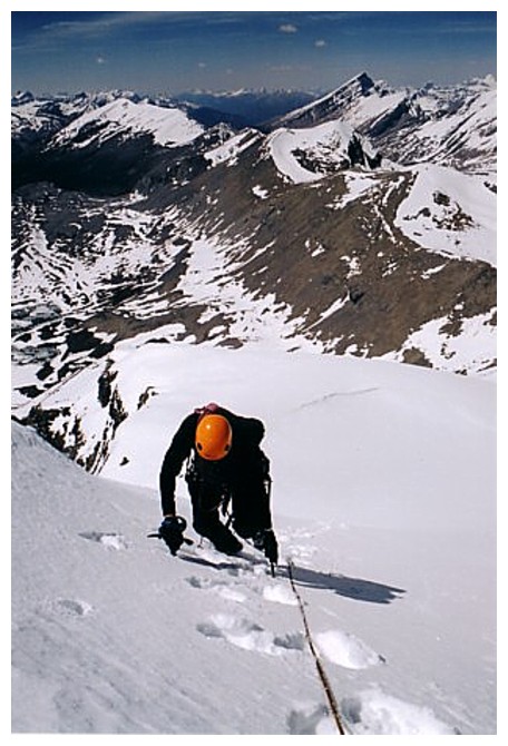
Ascending the steep section
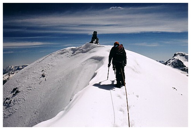
Last few steps
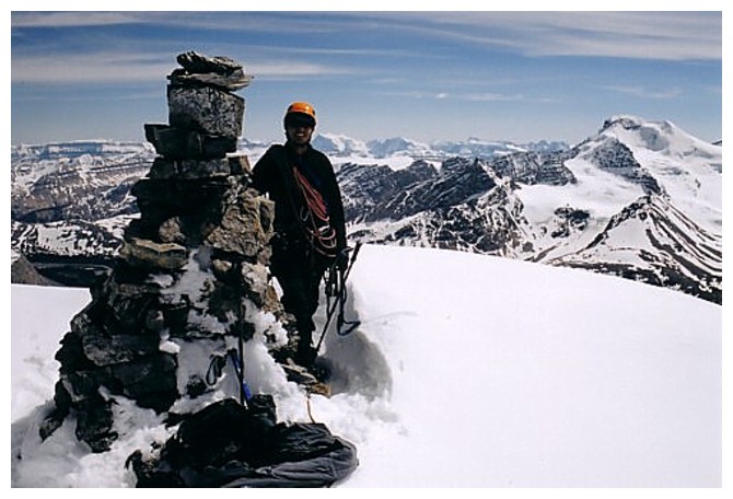
Big summit cairn!
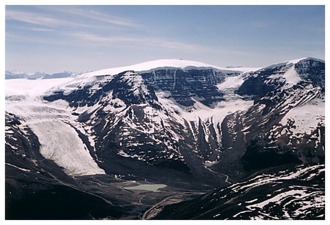
The tongue of the Athabasca Glacier, Snowdome (centre) and Kitchener (right)
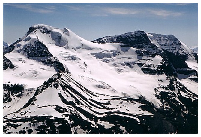
Mounts Athabasca and Andromeda
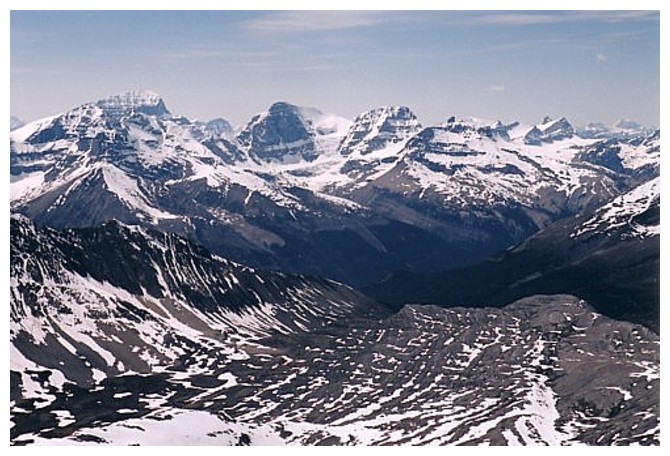
Alberta, Woolley, Diadem and lots of other stuff
Kitchener, North Twin, Twins Tower, and the Stutfields
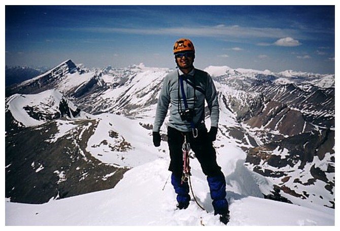
Mark at the summit. The big slopey peak at the left is Sunwapta
Heading down
The End
LOG