Mount Niles II
August 25, 2021
Mountain height: 2972 m
Elevation gain: 1350
m
Round-trip time: 9:30
Scrambling with Dan.
16 years and one day after turning around
about 200 m from the summit of Mount Niles, I was back to try again. I wouldn’t
characterize the 2005 trip as a failed attempt, as I turned around because I
didn’t want to reach the summit in a total whiteout, not because I reached an
impasse.
In
2021, I would be lucky enough to be joined by Dan on
this fine day. Fresh off a longish (and super smoky) day climbing
Achilles
Spire on Mount Andromache, we both agreed that an easy hike and
scramble in
scenic surroundings would make for a nice contrast, as opposed to a
long, roped climb, also in scenic surroundings (not that we experienced much
of that scenery because of the smoke).
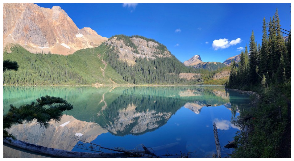
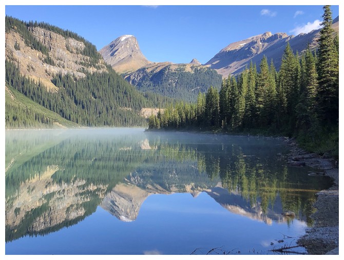
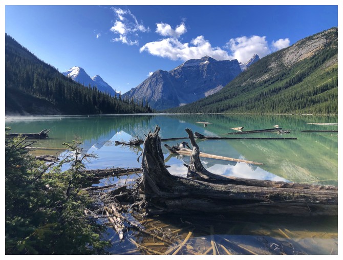
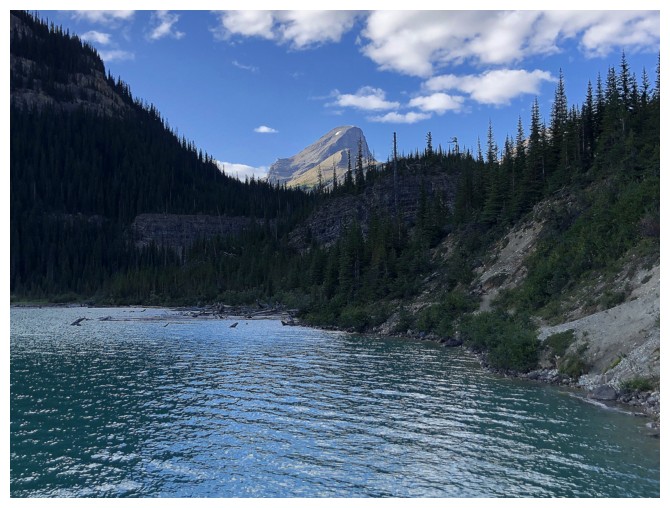
Stop #1: Sherbrooke Lake. This lake can be
one of the most stunning in the Canadian Rockies, especially on a windless day,
and such was the case. The reflections in the milky, turquoise-coloured lake
were as perfect as perfect gets. I could have stayed the entire day at the
lake, but Niles was calling.
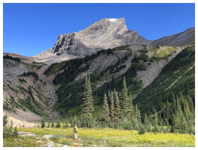
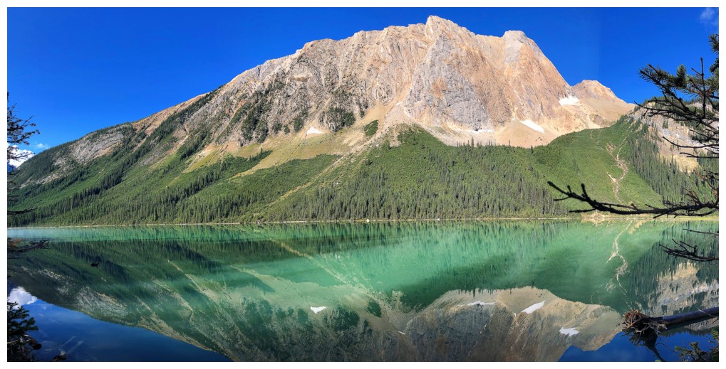
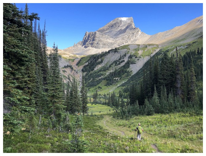
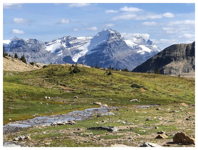
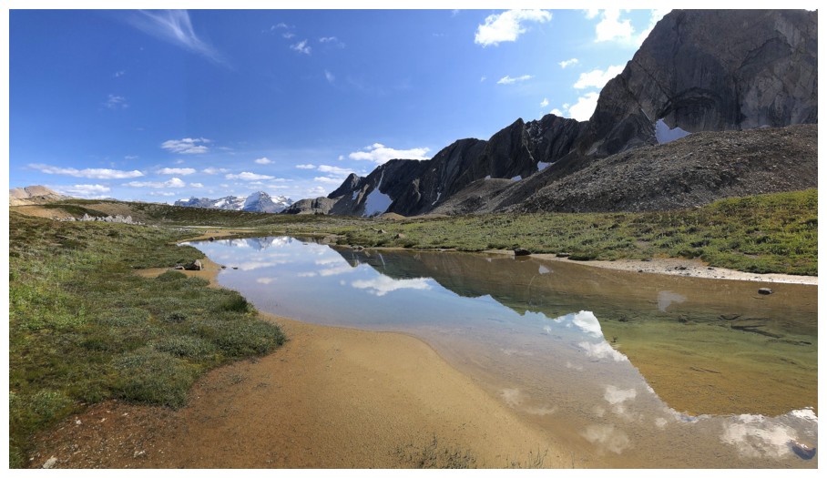
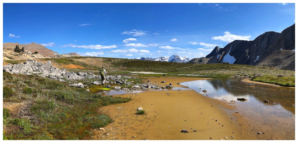
Stop #2: Niles Meadows. Although this was my
second visit to the famous spot, really it was my first. As stated, the 2005
trip was completed in dismal weather conditions with the accompanying
lacklustre scenery. I was less than blown away upon reaching the area.
With mostly clear skies, the meadow, beneath the
spectacular form of Mount Niles, was outstanding.
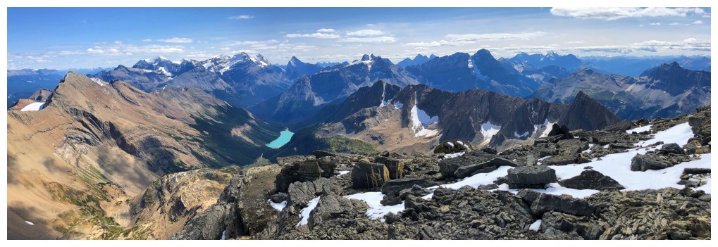
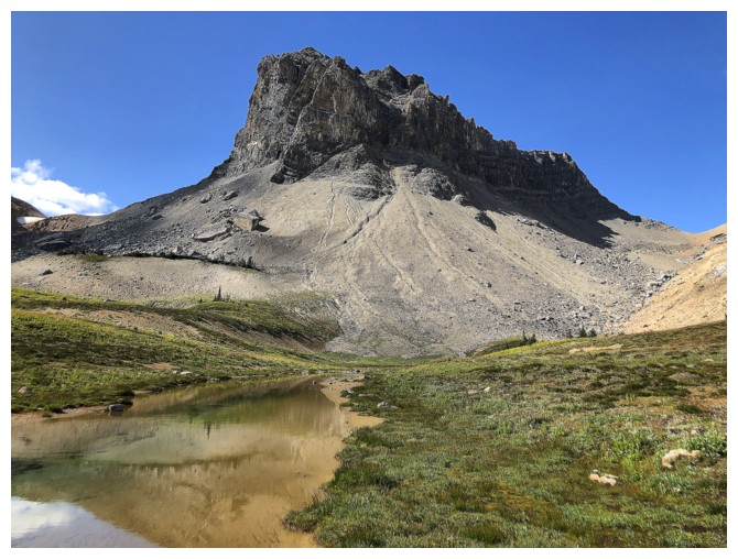
Stop #3: the summit of Mount Niles. But not
before a thoroughly enjoyable ascent, taking in magnificent views of the
surrounding mountains and the Waputik Icefield. The summit view was likewise fantastic,
even with a little cloud cover. We were both surprised to find what appeared to
be a permanent snowfield at the top and dared not go near the edge.
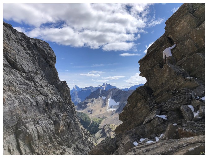
On descent Dan decided to scale a very scary
looking pinnacle. He said it was straightforward, but I actually turned my head
away in fear while he was descending the exposed crux – great climber/brave man
– me, not so much! We also made the descent a little more interesting by
staying high on a bench above Niles Meadows, before finding a beautiful little
drainage that fortuitously led us right back to the trail.
A fantastic trip with fantastic company.
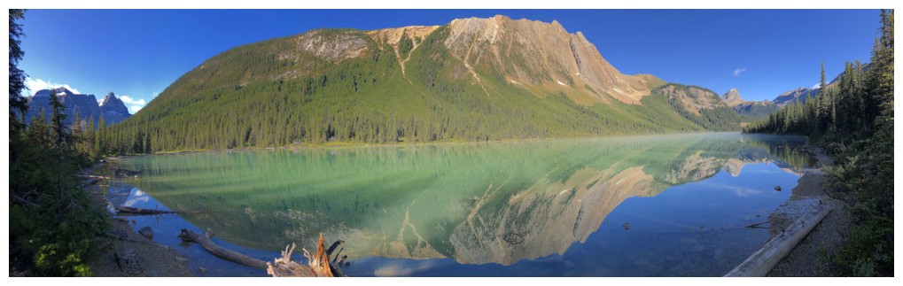
Sherbrooke Lake and Mount Ogden
Mount Niles (left of centre), and Mount Daly (right)
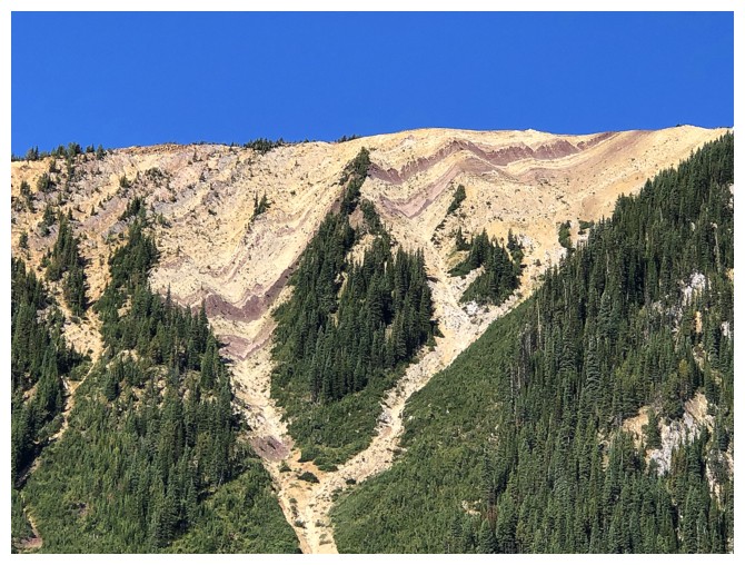
The east face of Ogden has some wild rock layers
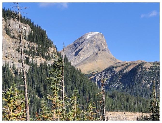
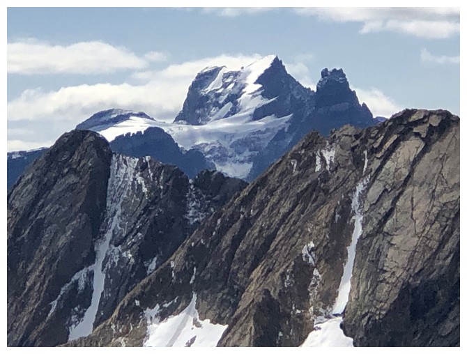
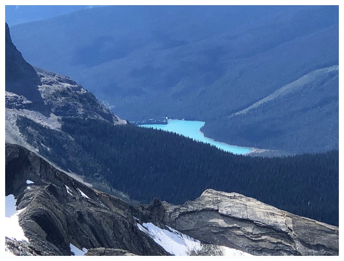
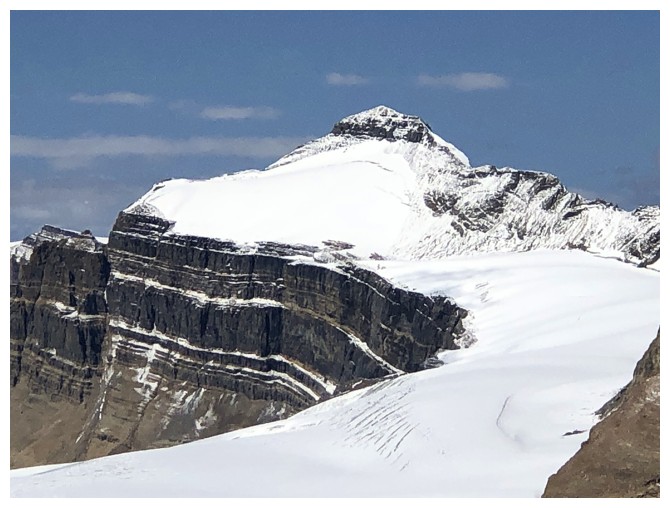
Zoomed-in photo of Niles - it's still a long way off
The awesome lake reflections just keep coming
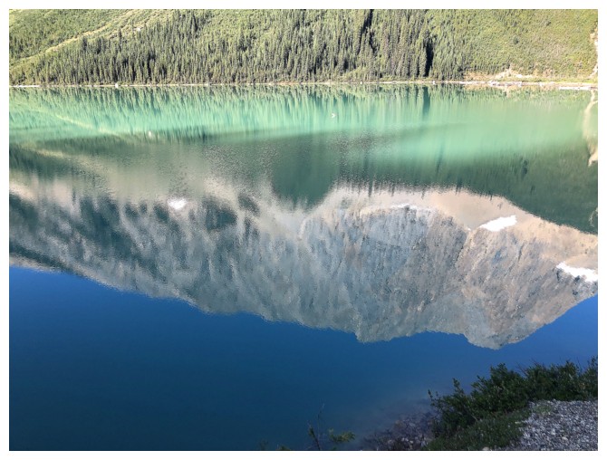
The
milky-turquoise colour of the lake (reflected light actually, not the
colour of the water) is evident on the other side of the lake
Looking back across the lake
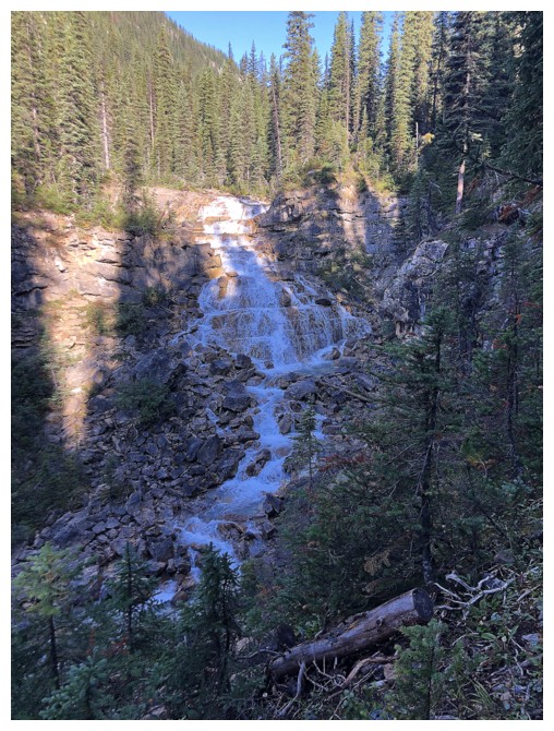
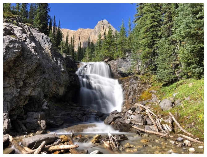
The first of several cool waterfalls en route to Niles Meadow
Same one up close
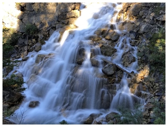
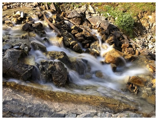
The second
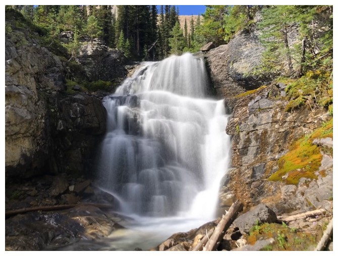
And up close
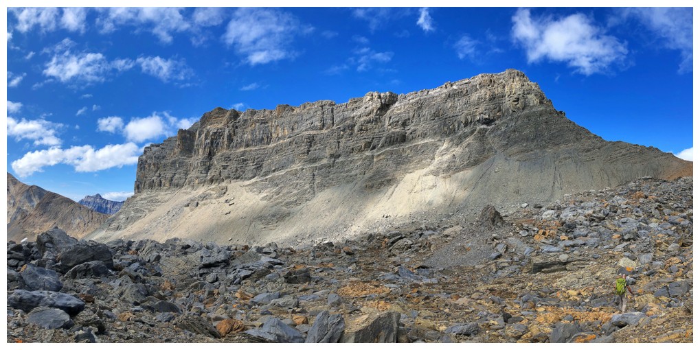
The northeast side of Ogden has tons of cool rock features, such as these slabs
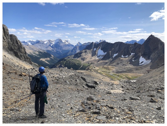
Dan enters Niles Meadow. His backpack blends in with the surroundings, acting as camouflage - a theme for the day!
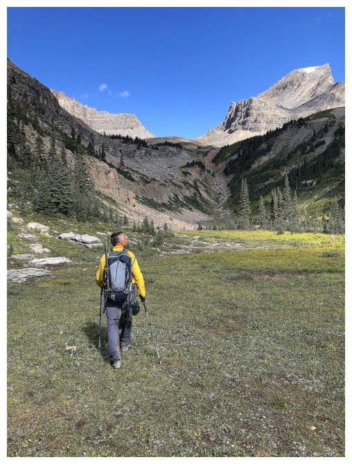
With my bright yellow jacket, I'm always the most obnoxious-looking lifeform out there! (photo by Dan)
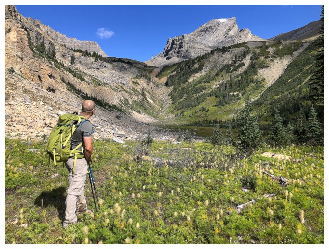
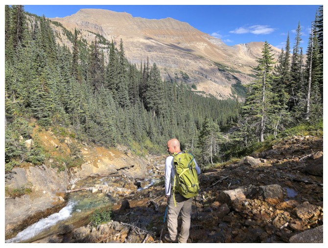
Dan sizes up the objective from the Meadow
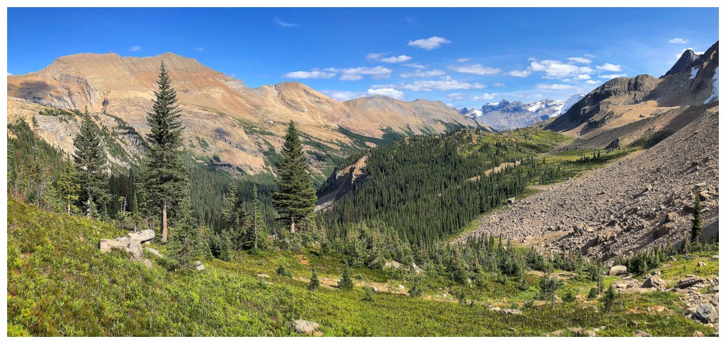
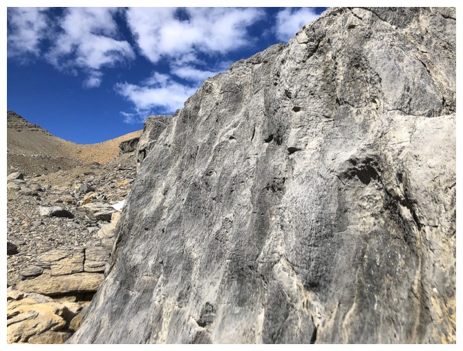
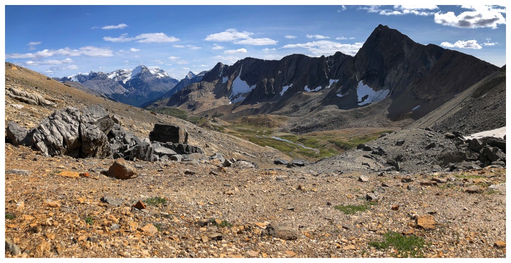
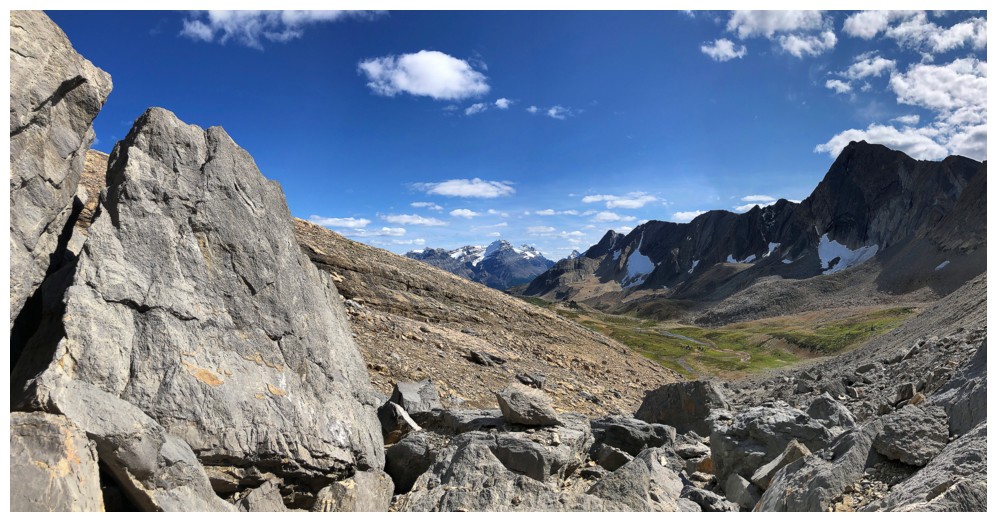
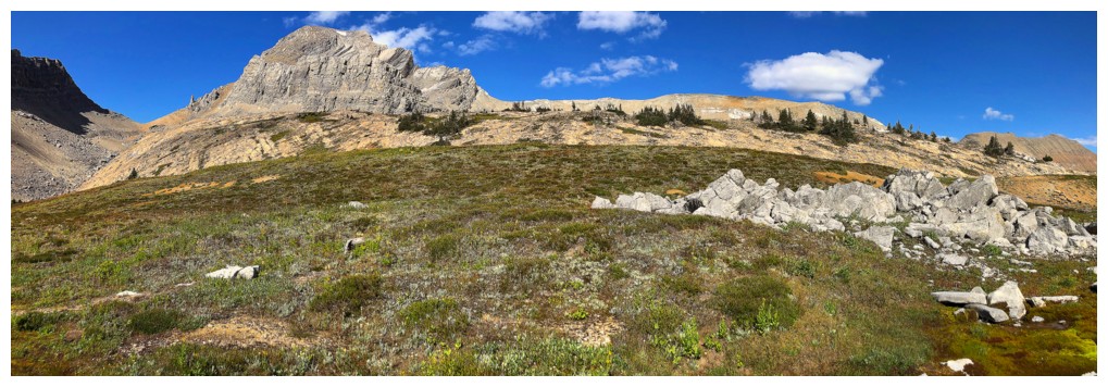
Lots of cool rock beyond the Meadow
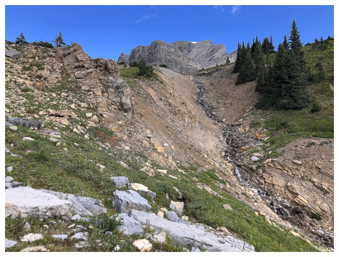
The drainage that leads to the base of Niles
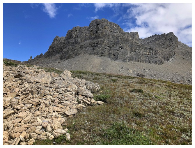
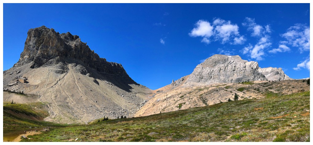
The soutwesth side of Niles
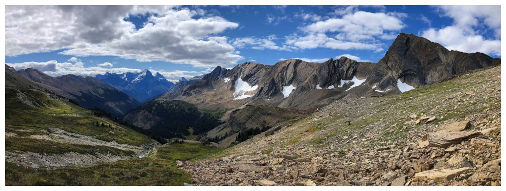
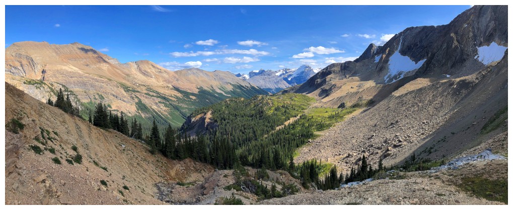
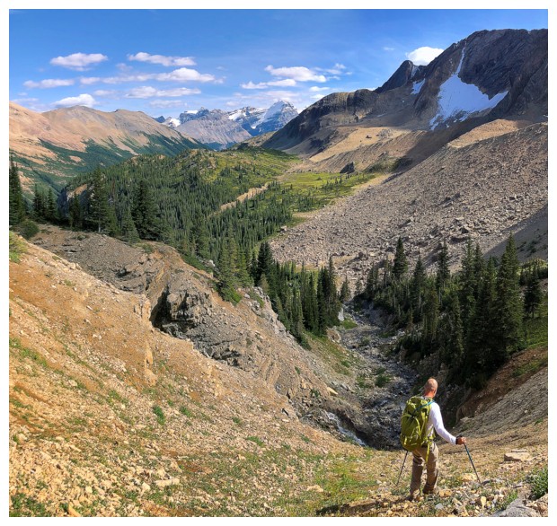
Looking back down the valley
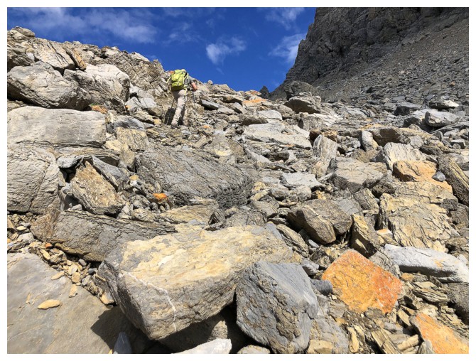
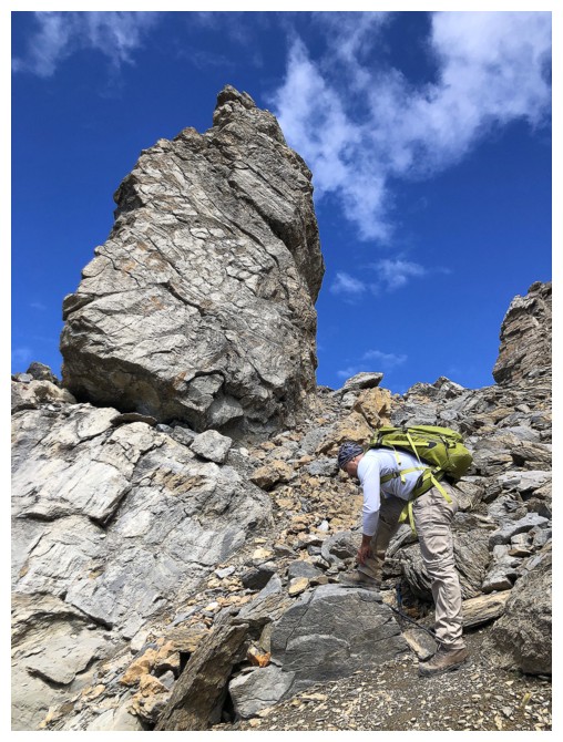
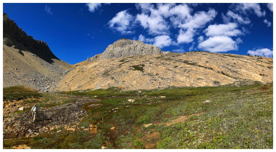
Dan makes his way up the rubble to the col on the west side of the objective
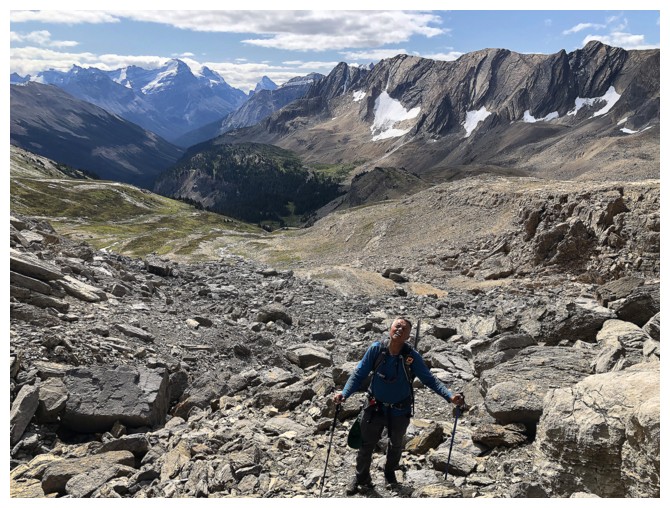
I look tired! (photo by Dan)
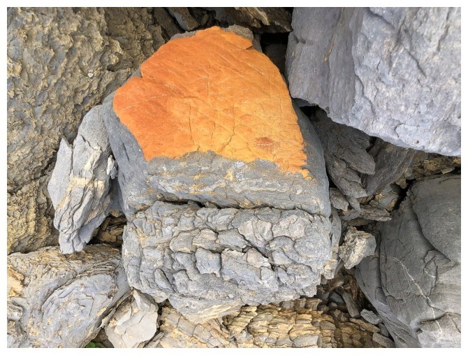
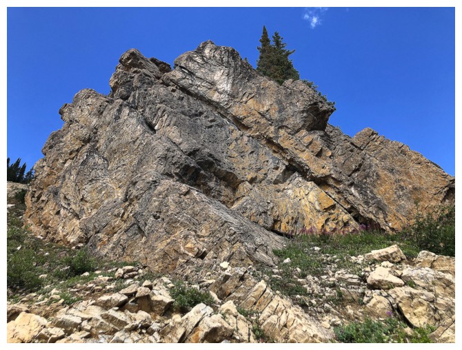
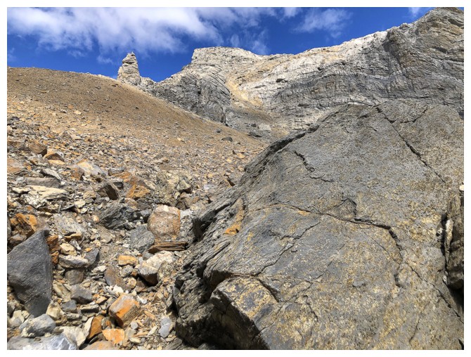
Super cool colouring on this rock
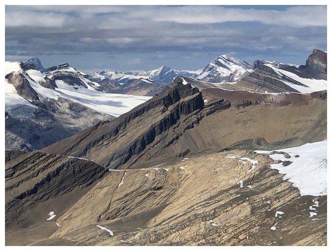
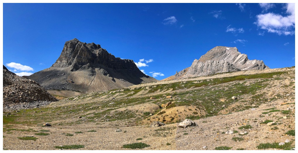
This peak, west of Niles, is described in David Jones' outstanding Rockies West guidebook. It is unnamed but has the proposed name, "Profile Peak". Dan is barely visible at the lower right.
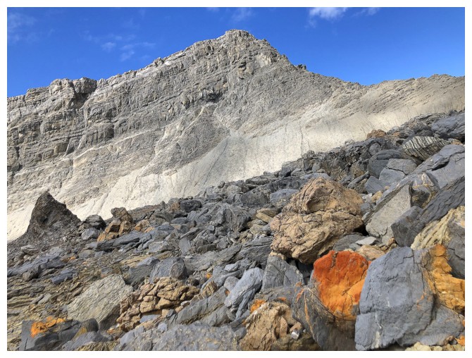
Another shockingly colourful, random rock and Profile Peak
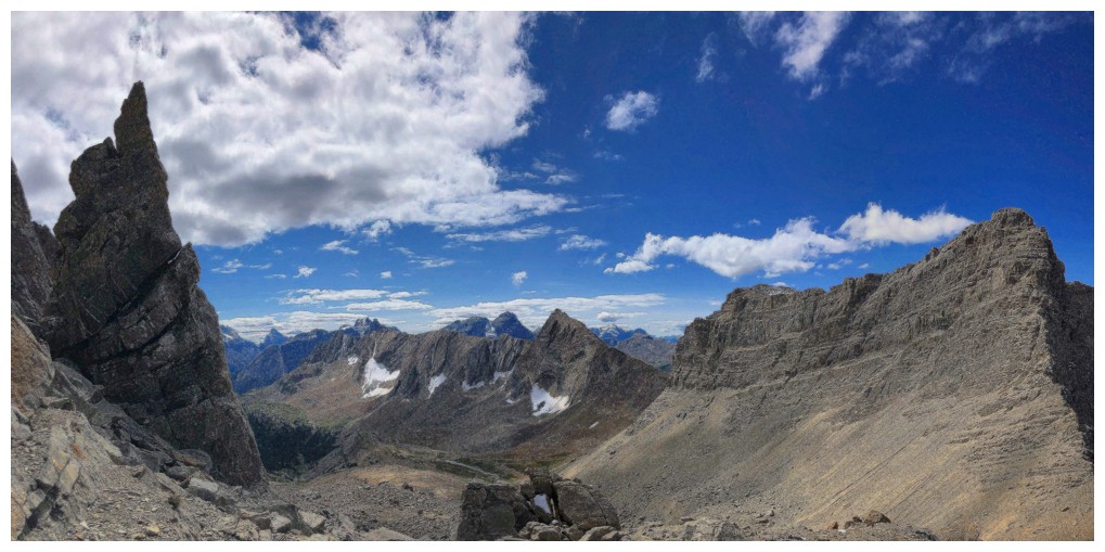
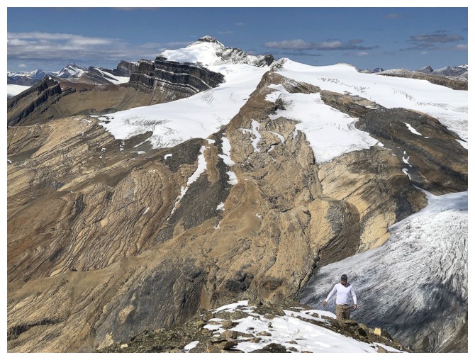
Approaching the west side of Niles and the Kane route up. Yet again, spotting Dan is the "crux" of the photo!
Distant Cathedral Mountain towering above the north ridge of Mount Ogden. 13 years after the fact and still one of our most memorable days in the mountains.
Mount Biddle - no easy routes up that one
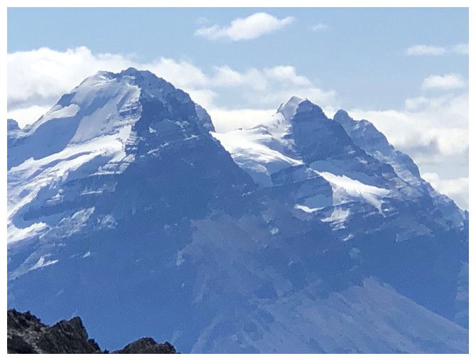
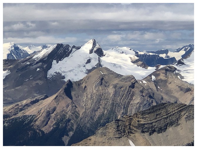
Three 11,000 ers: Victoria, Huber, and Hungabee
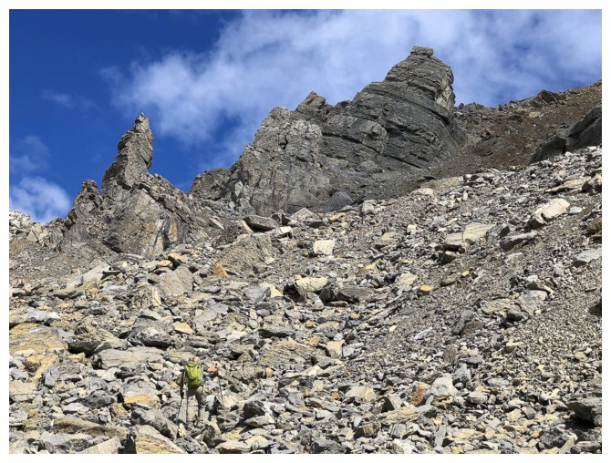
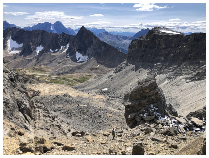
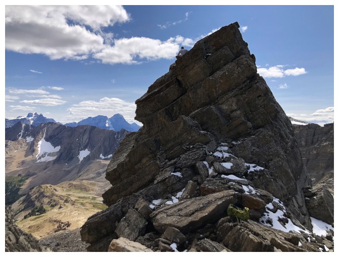
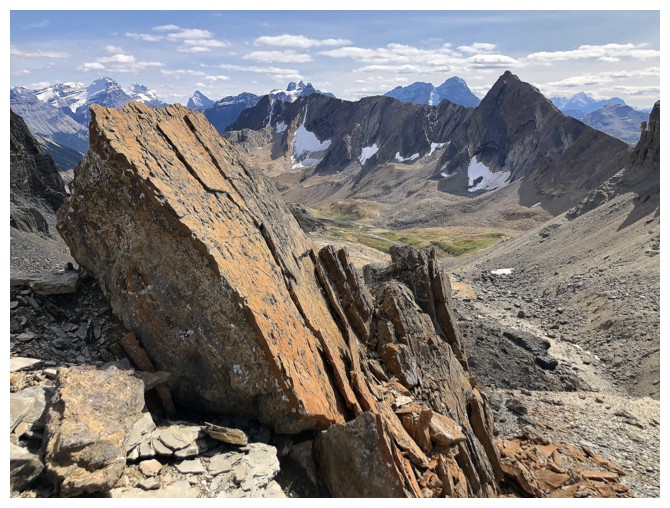
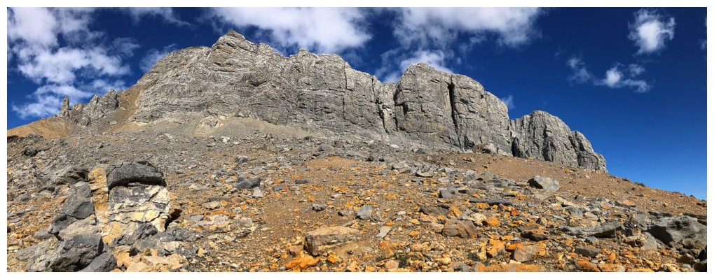
There are several huge pinnacles on the west ridge
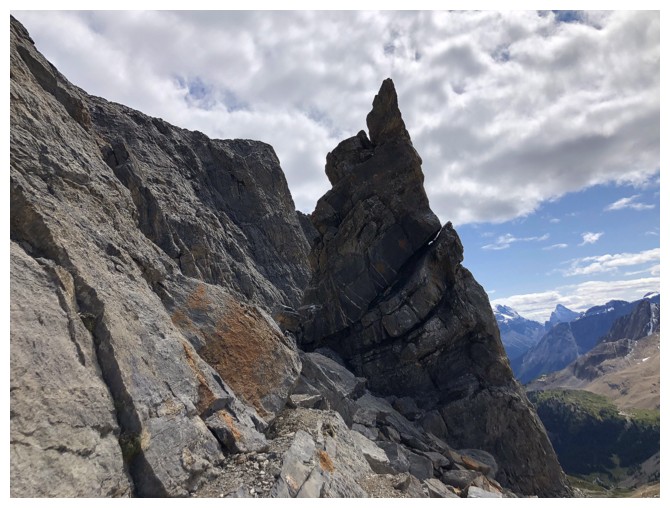
Here's the same one from a different angle
...and with Profile Peak
Dan approaches that one from the other side
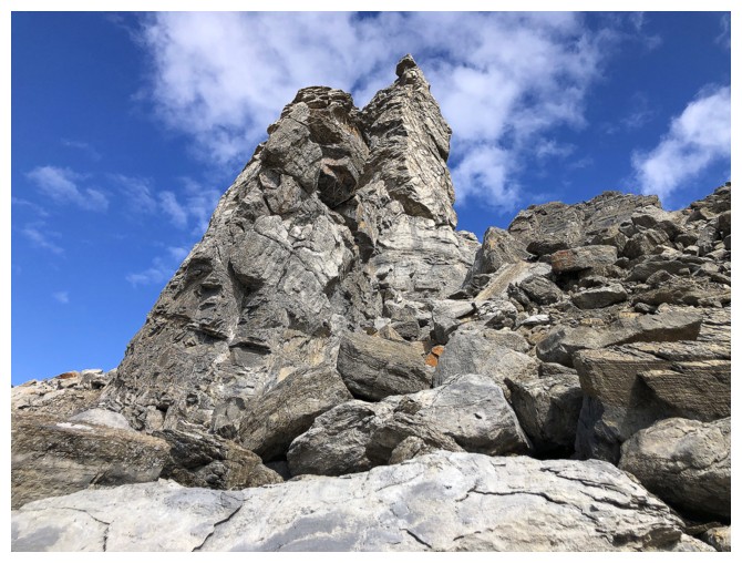
Passed the first pinnacle
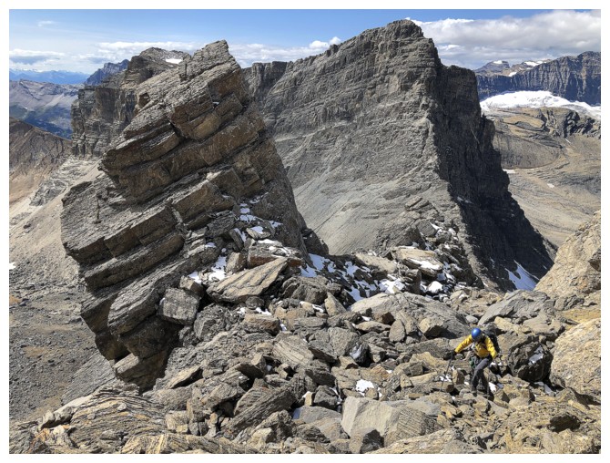
The second pinnacle is the one Dan would climb on descent (photo by Dan)
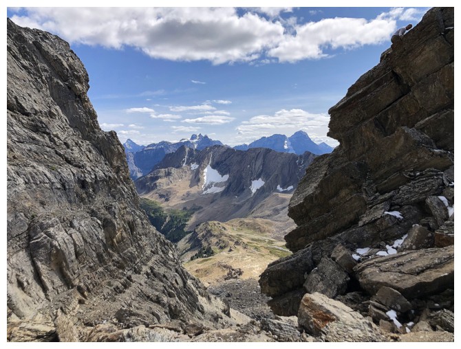
Views to the northwest are about to get crazy!
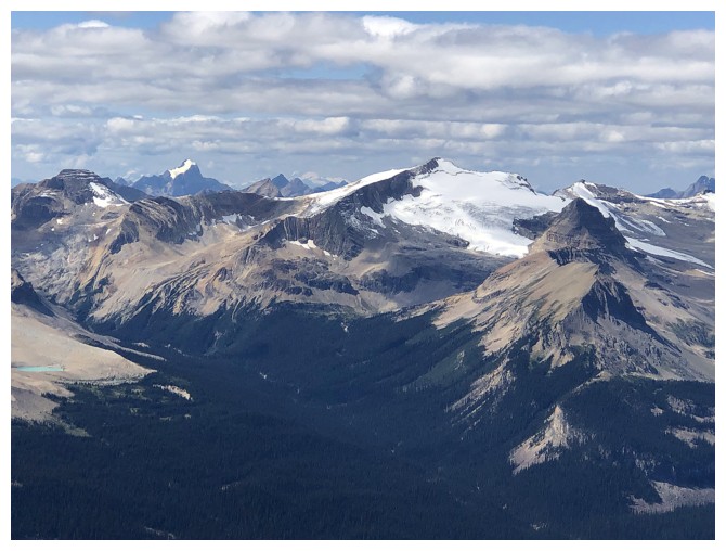
The Emerald Glacier on the east face of The Presidents. Mount Carnarvon just left of centre.
Awesome slab far below us
No yellow jacket, but the blue still stands out (photo by Dan)
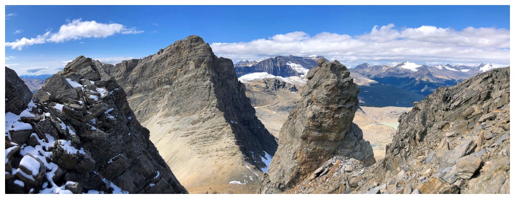
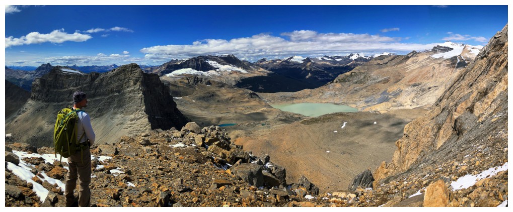
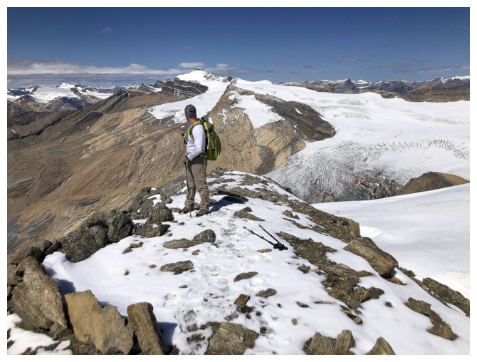
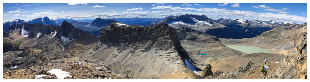
Dan checks out the increasingly amazing view. With an elevation about
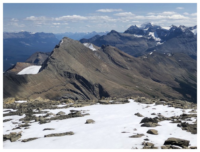
270 m inferior to Niles, Profile (right side) is looking pretty small now.
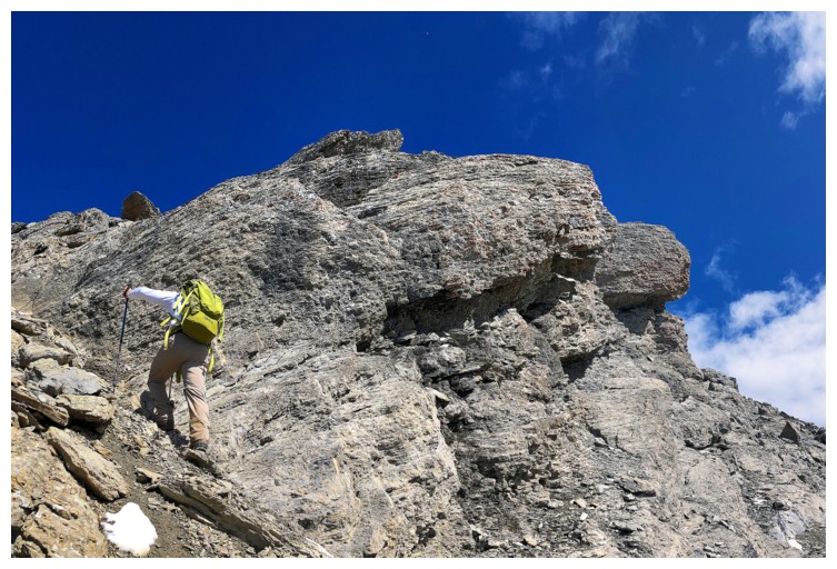
Dan leads the way up the steep, upper slopes
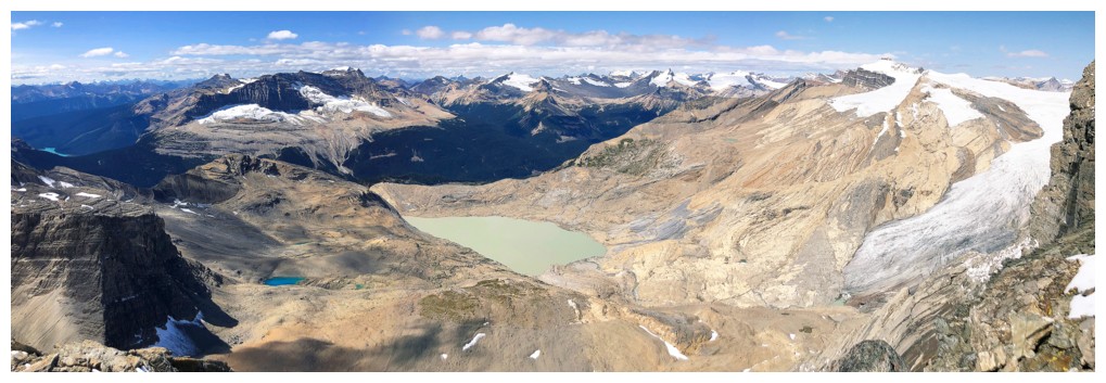
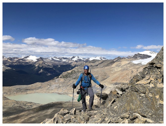
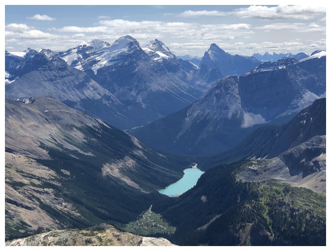
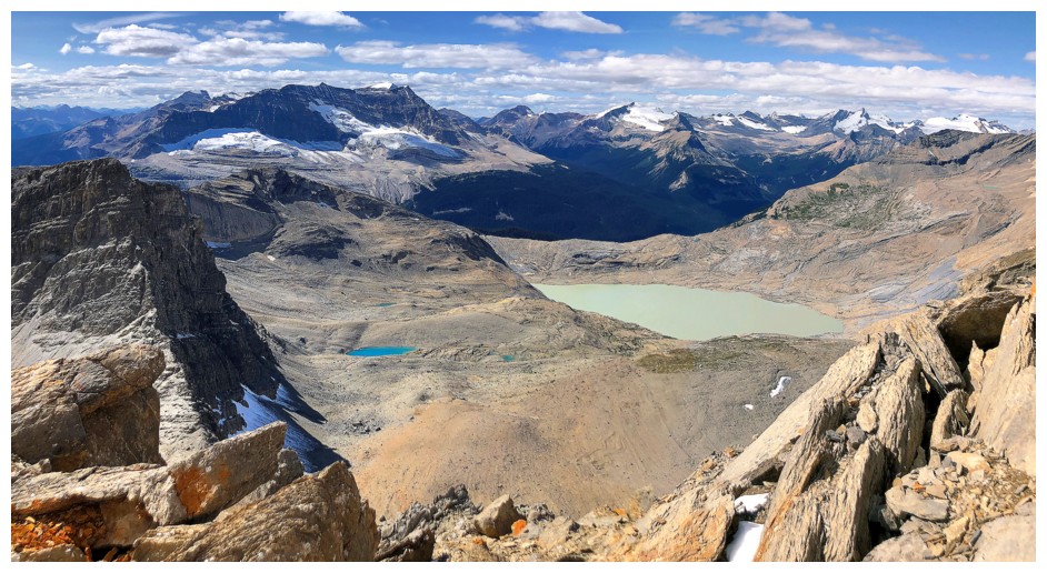
The glacially-fed lake has unofficially been titled "Takakkaw Lake".
Quite appropriate given that it, in turn, feeds one of Yoho's treasures,
Takakkaw Falls.
Like Sherbrooke, Emerald Lake is an absolute stunner
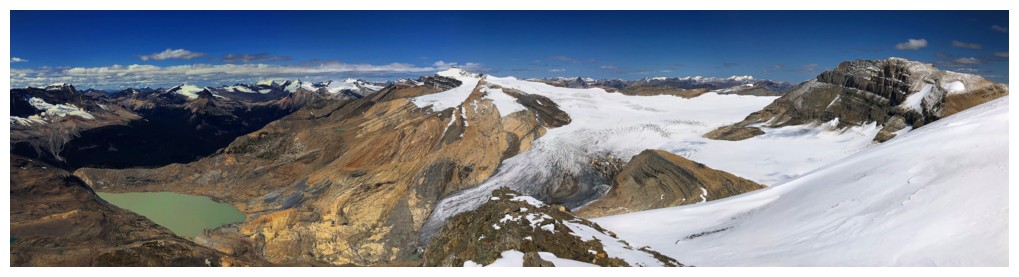
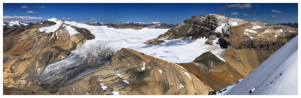
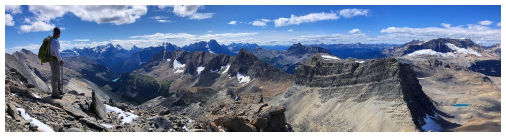
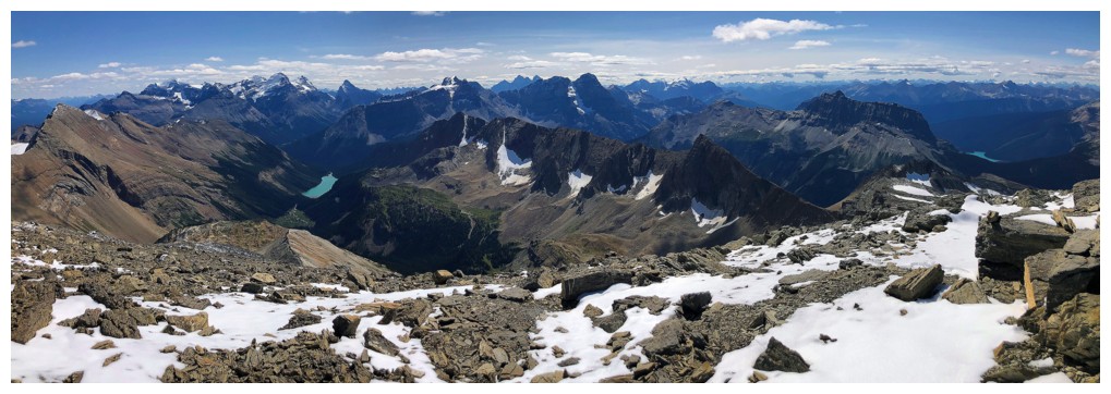
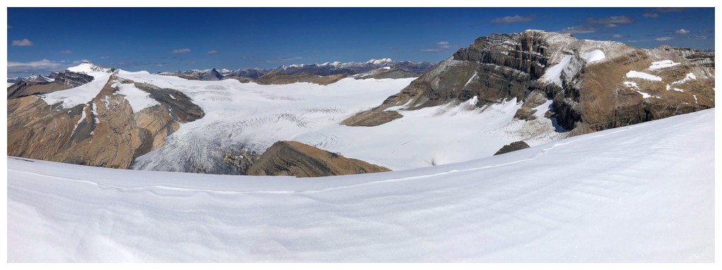
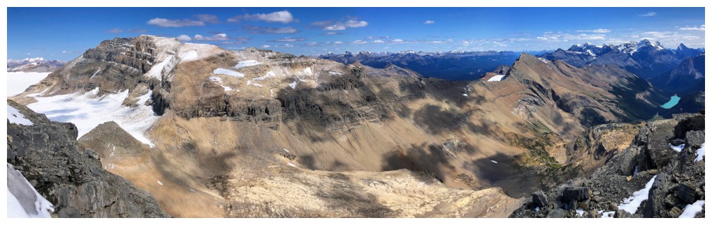
Summit view over the Waputik Icefield
Dan checks it out
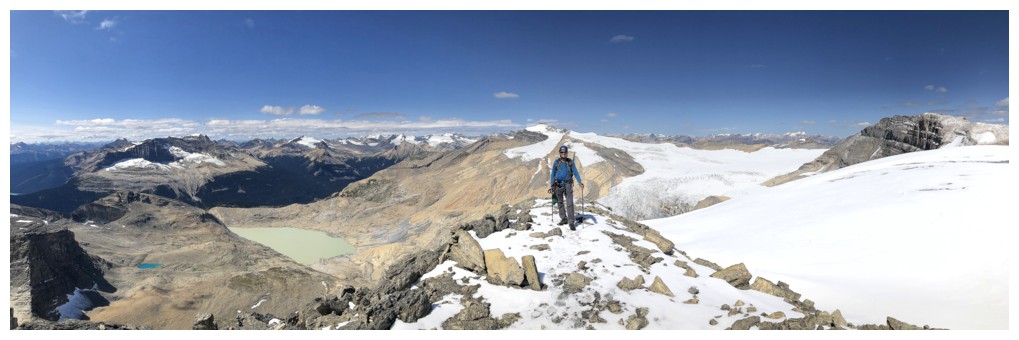
Blue guy at the top (photo by Dan)
Distinctive Mont des Poilus and Yoho Peak in front of des Poilus - two awesome ascents
This outlier of Mount Daly looks very tempting, although its significantly lower than both Niles and Daly
Closer look at Sherbrooke and company
Zoomed-out view in the same direction
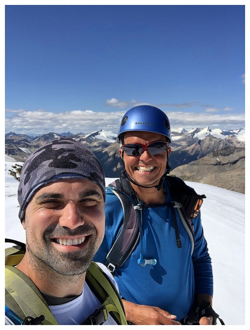
Dan takes a mean selfie! (photo by Dan)
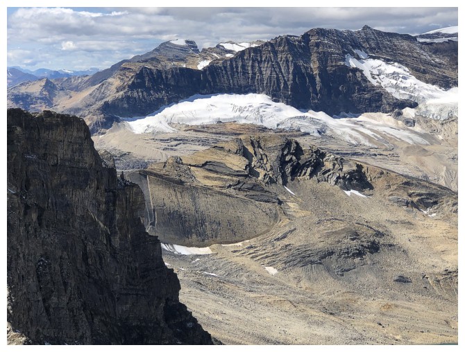
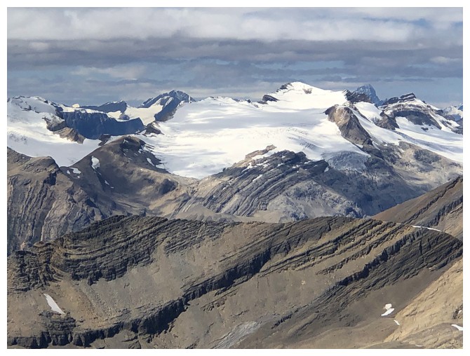
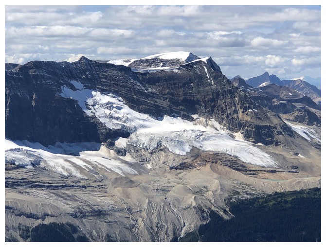
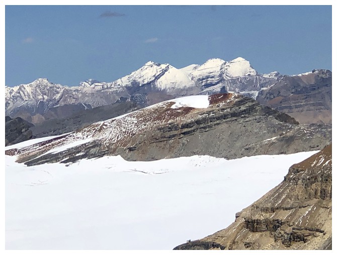
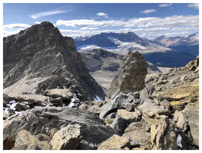
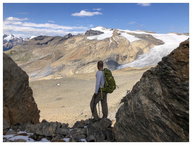
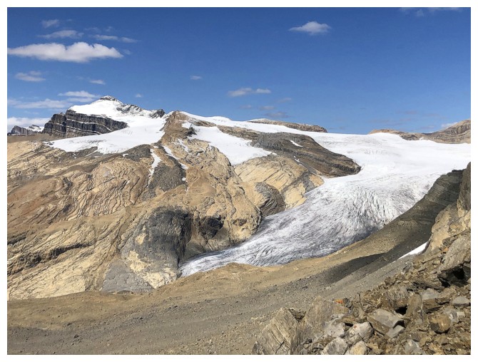
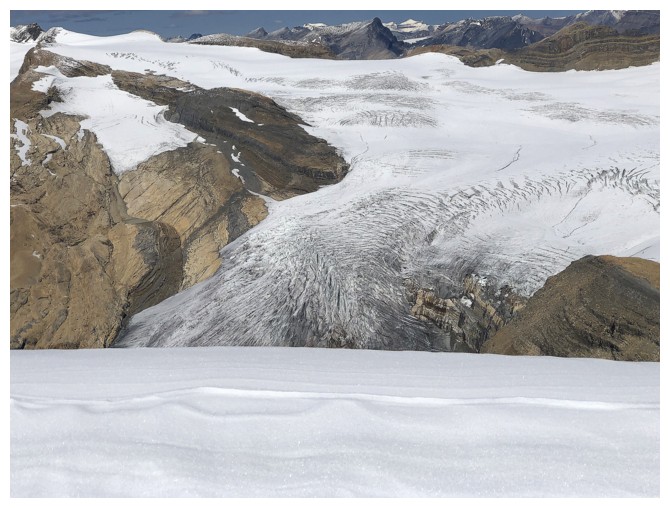 The might Daly Glacier
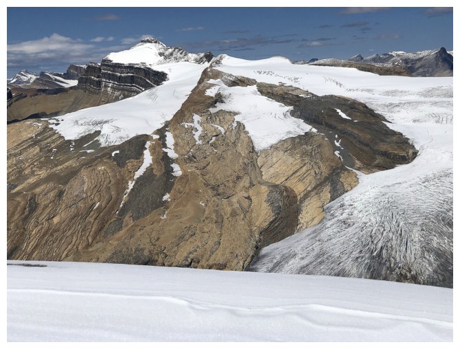 Mighty Mount Balfour is the star of the glacier and the highest peak on the Waputik Icefield
Balfour, the Daly Glacier, and Mount Daly at the far right
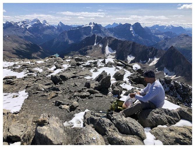
Time for a summit snack
Trolltinder Mountain. Like Biddle, there is no easy route up that one.
Glaciated Mount Collie
The little guy in front is unofficial "Takakkaw Peak". I still have to go back to try that one again.
The Presidents
A host of Kane scrambles around the Stanley Mitchell Hut brings back
memories of another great trip with my old buddy Kevin Barton
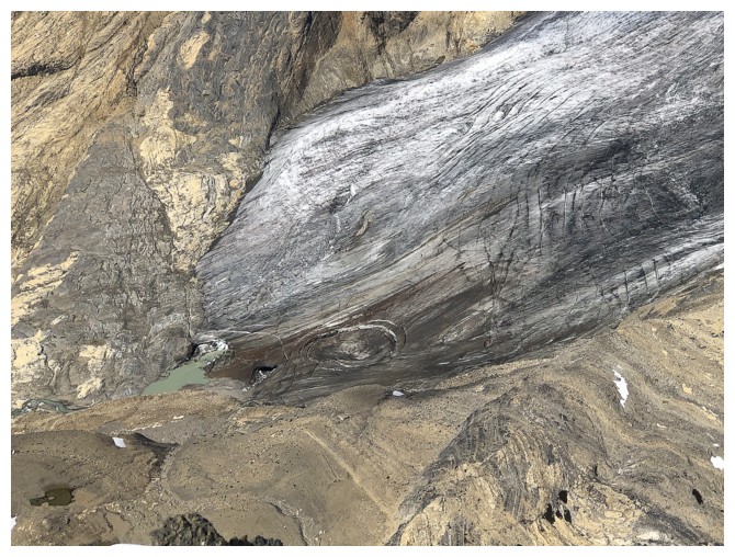
The rapidly receding toe of the Daly glacier
Mount Daly
Closer look at Balfour
Dan does his camouflage tricks again
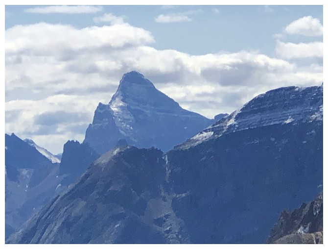
I should know what mountain that beaut is but it escapes me!
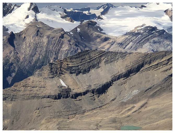
The Mount Daly massif is huge. It extends all the way to Sherbrooke Lake and terminates at Paget Peak
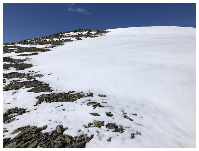
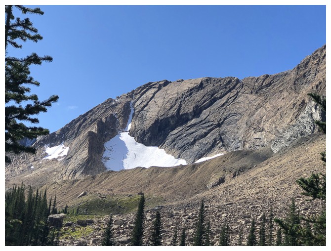
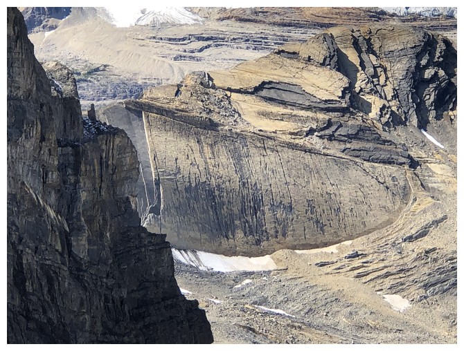
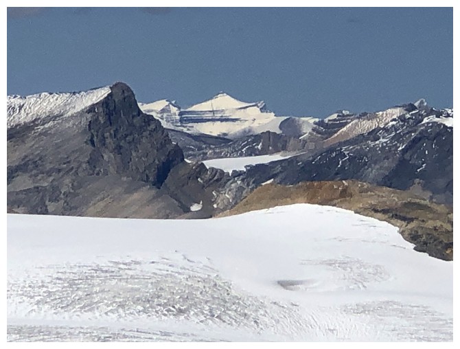
The permanent snowfield (glacier?) on the east side of Niles. Definitely a no-travel zone. (Yes, Dan is in this photo too!)
The Willingdons
Heading down and still enjoying views to the northwest
Dan approaches the pinnacle he will climb
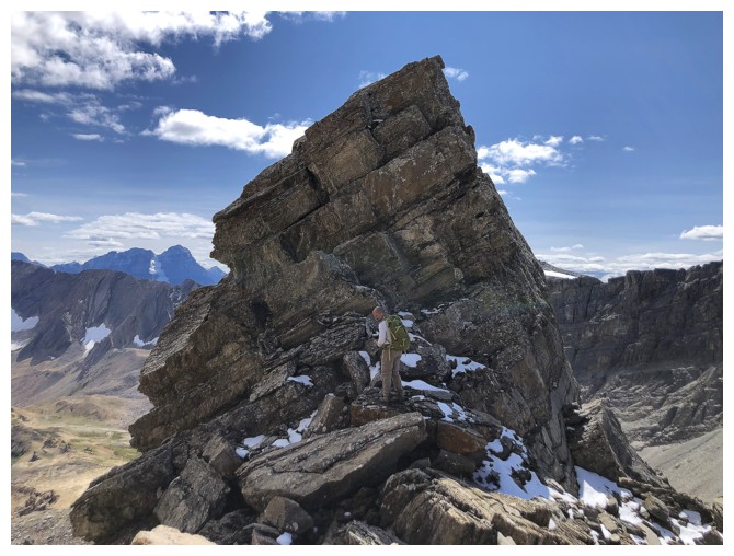
At the base
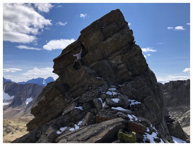
There he goes
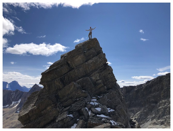
Success!
He starts down
He downclimbs the crux. This is where I turned my head away!
Instead, I just took photos of the other pinnacle
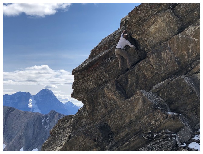
Finishing the descent. Whew!
Dan on safer terrain
Last look at beautiful Balfour
Back near the Niles/Profile col
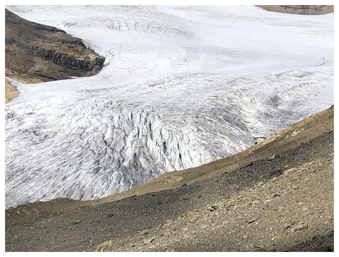
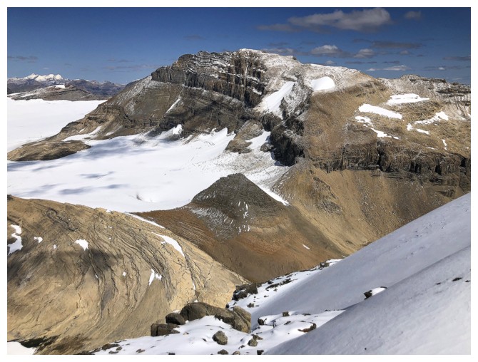
Last look at the heavily crevassed Daly Glacier
Ready for the long hike hike back (photo by Dan)
Another round of great rock to check out
The impressive southwest side of Niles
Heading for the bench above Niles Meadow
The bench is definitely a scenic cousin to Niles Meadows
No camo for Dan here!
Not quite Sherbrooke Lake, but wonderfully scenic anyway
A different profile of Profile Peak is seen from the bench
Awesome alternative to returning the same way
Looking back at Niles
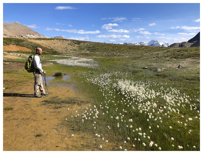
Dan stops to admire the flowers
Niles again
The illusion of Profile and Niles looking approximately the same height
With more time,
I would have liked to stay high on the bench and explore the grassy
area ahead. However, we cut left near this point to regain the hiking
trail.
Dan leads the way
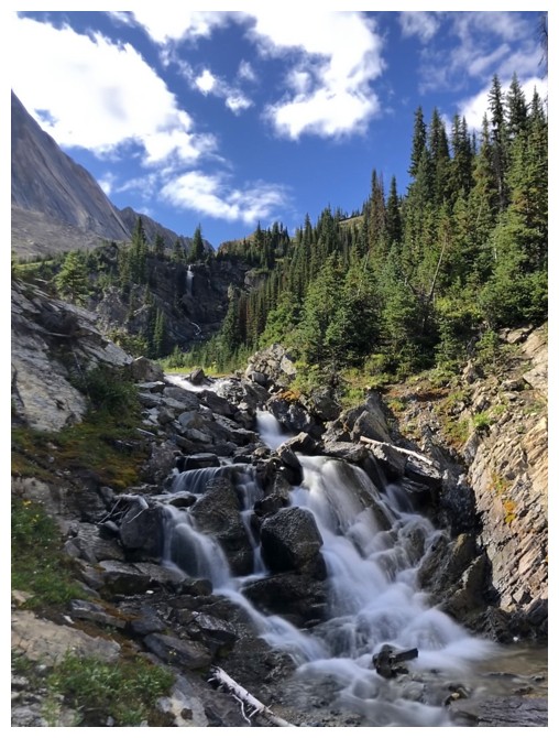
Another round of terrific water scenery
Back at Sherbrooke Lake
The End
LOG