Odlum
Ridge –
Maximum ridge height:
2,496 m (8,187 ft)
Elevation gain:
990 m
Roundtrip time:
6:00
Scrambling with Mark.
Yet another trip that we’ll simply have to repeat on a sunny, winter day. We were expecting bad weather and that’s exactly what we got. Fortunately (or perhaps, unfortunately??), the clouds did clear a little, giving us just a taste of some of the beautiful scenery seen from the top of Odlum Ridge.
We had no intention of doing the full 20 km ridgewalk loop, as suggested in Gillean Dasffern’s Kananaskis Country Trail Guide, Vol. 2 – too little daylight, too much snow. Instead, we planned to ascend directly to the west summit, from the highway 40, and then traverse to the centre summit. Things didn’t go as planned, however the route we ended up taking proved to be a good one and probably better than what we had intended.
Our route-finding troubles started almost immediately. After crossing the Highwood River and bushwhacking through light forest and deep snow, we started up, what we were sure was the beginning of the ridge to the west summit. To our dismay, after about 45 minutes of grueling uphill travel, post-holing in mid-thigh to waist deep snow, we looked to the left to discover that we were on the wrong slope. I have no idea how we made that big of a mistake, but I immediately thought of a great Christmas gift – GPS! Going down and losing all that elevation, was out of the question (in other words, we were too lazy!), and so we continued heading up the wrong slope, having no idea where we might end up. Trees, lightly falling snow, and low-lying cloud made seeing what was above us impossible. To be honest, at that point, I was just hoping that a minor blizzard would hit, giving us an excuse to retreat. The travel was painfully slow and exhausting, due to the steep grade and deep snow, and visibility was terrible. The blizzard didn’t happen and on we went.
After what seemed like an eternity, we finally made it to a ridge, where the grade became far more manageable, and the snow less deep, due to strong and bitterly cold winds blowing it up and over the ridge. The clouds also lifted a little and we were rewarded with a decent view of the lower west summit of Odlum Ridge. A short and very cold, yet enjoyable hike along the scenic, corniced ridge and we were on the centre summit. There certainly is a good deal of satisfaction when making a summit in difficult weather conditions, regardless of the seriousness or difficulty of the route, and this minor summit was no different. Elated might be an overstatement, but we were both quite happy to make the highpoint, when only an hour before, we didn’t even know if we were on the right mountain.
After snapping off a few photos, we continued on towards the east summit - that is, the summit that was our initial goal. Now, the plan was to use that original ascent route as a descent route, thus completing the loop. It took us an hour to get to the east summit (approximately the same height as the center summit) and once again, the hike was scenic (even in the dreary weather conditions), interesting, and brutally cold. We stayed there for a few minutes, but it was too cold to wait for better weather to come in and so we started down – a good decision, given that the weather deteriorated even more as we made our way down. The descent route was quite entertaining. At times, the terrain along the ridge was too steep to downclimb in the winter conditions, and so we bypassed these sections by wading through waist-deep snow on the right side of the ridge. Once passed these sections, the remainder of the descent was fast and easy. Overall, a very satisfying day and surprisingly enjoyable day – bad route-finding, bad weather, waist-deep snow, bone-chilling temperatures – what more could one ask for?
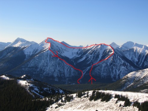
Our route up and down Odlum Ridge, as seen from Mist Ridge, five days later (in much better weather!)
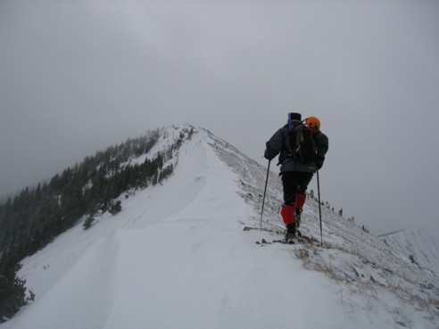
On the ridge ...finally!
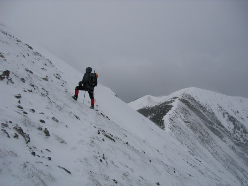
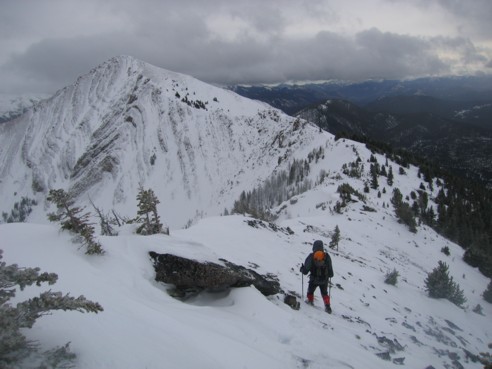
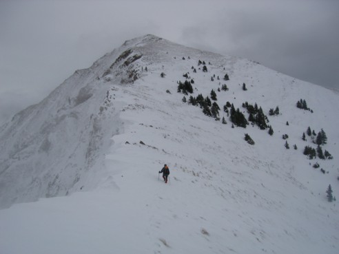
Mark ascending steepish slopes, with the west summit to the right
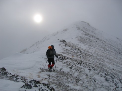
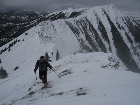
Mark, approaching a false summit, enroute to the centre summit; one of the few times we saw the sun that day
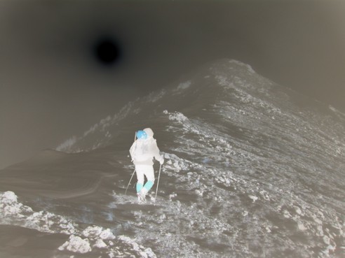
An accident! While reducing the size of the photos, I accidentally turned the above photo into it's negative; I thought it looked kind of neat and so I kept it.
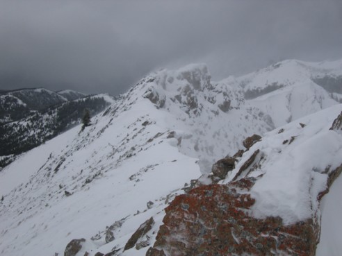
More of the ridge
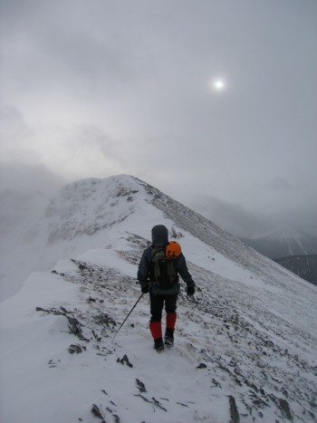
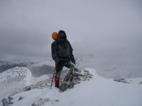
Almost at the summit, which can be seen behind me
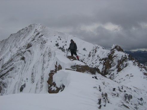
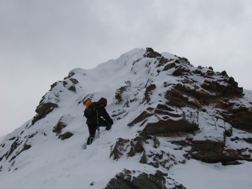
Mark, approaching the true summit; the west summit can be seen at the left and we ascended the ridge seen at the right
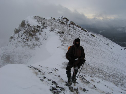
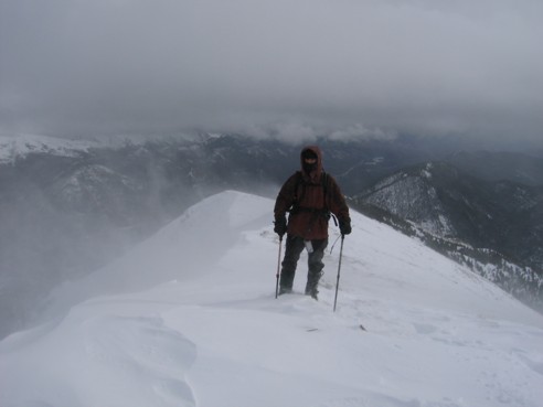
Mark, at the centre summit
Descending from the centre summit towards the east summit at the left
A couple of pinnacles, near the low point of the ridge
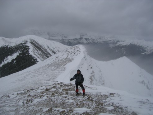
Looking back along the ridge
Mark, with the ascent slope of the east summit in front of him
Mark again, ascending the final few metres of the east summit; the entire ridge and the centre summit behind him
At the east summit, looking to the south east
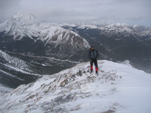
Mark at the summit, looking to the northeast; Mist Mountain is hiding in the clouds at the left
Descending steep terrain on descent
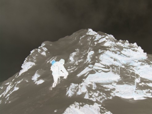
This one wasn't an accident. I went a little crazy after the first "accident" and went and changed all the photos to their negatives!