Old
Goat Mountain II
– August 27, 2006
Mountain height:
3125 m
Elevation gain:
1400 m
Ascent time:
8:05
Descent time: 4:40
Scrambling and a little mountaineering with Mark.
The disappointment of not
making it at least to the start of Old Goat Mountain’s
This approach was fantastic,
yielding great views of the north east side of
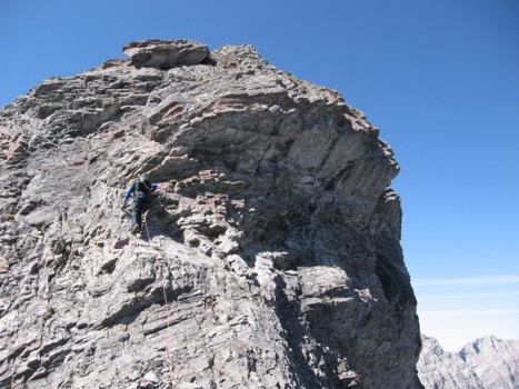
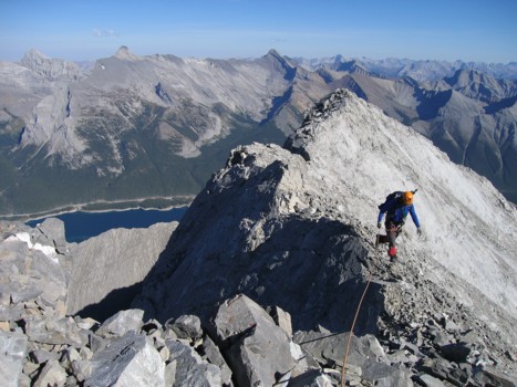
Though we wanted to scramble the entire ridge, we did bring along a rope and a few pieces of protection, just in case. The “just in case” occurred about one third of the way up. Rather than losing elevation to circumvent a particularly difficult rockband, we took the easiest line we could find straight up it. This route was still extremely exposed and I placed two pieces of gear to protect a fall. There was a rappel station at the top of the band.
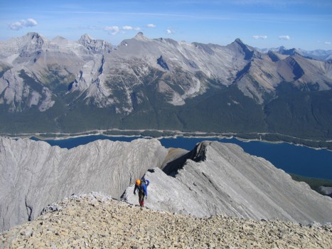
The ridge was a great exercise
in route-finding and difficult scrambling. It was also quite foreshortened and
upon ascending one rockband, a string of others would appear. It ended up taking
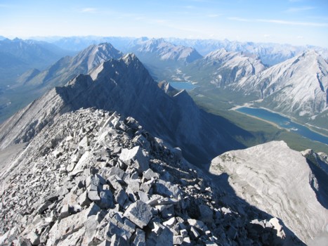
us almost 4 hours to get from the col to the summit, where we enjoyed a
thoroughly breath-taking view.
For descent, we tried to find an easier route down and were successful, except for one section where we hit an impasse. Another rappel station, attested to the fact we weren’t the first only ones to take this route. We could have reascended to find a weakness we could downclimb, however, it was late and we were tired. Rappelling the short step was the best solution. There were no more problems for the remainder of the descent.
Overall, a 13 hour day that was as mentally strenuous as it was physically, but a terrific mountain and a wonderful ascent route.
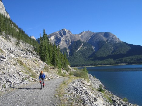
Mark bikes the approach trail, with Rimwall behind
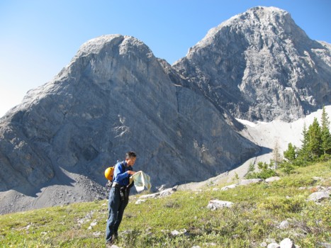
Checking the map to make sure we're on the right mountain; Mount Nestor (far right) and its outlier behind
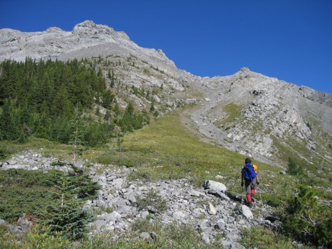
Mark starts up the ascent gully
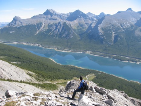
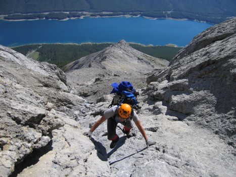
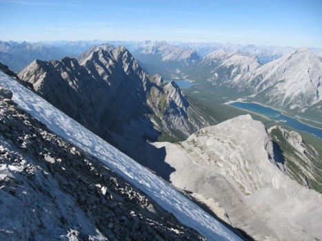
Looking down at Spray Lake; The Windtower, Mount Lougheed and Sparrowhawk behind the lake
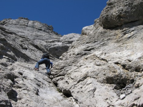
Great scrambling up the water-worn gully
Mark comes up the gully
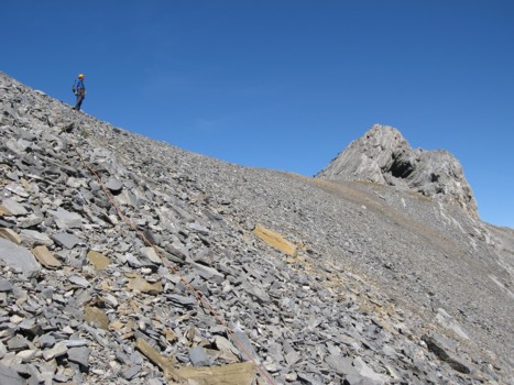
Almost at the col
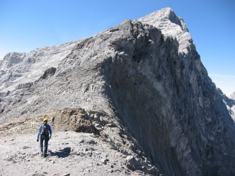
Starting up the east ridge; summit at the right
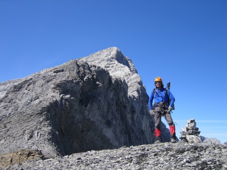
Mark and the east ridge
The difficult scrambling begins
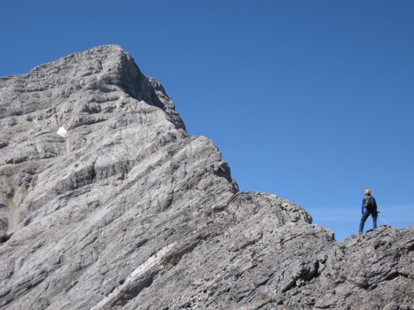
A foreshortened view of the east ridge
The first rockband that couldn't be scrambled up
Looking north
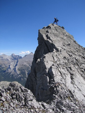
Mark enjoys a great viewpoint
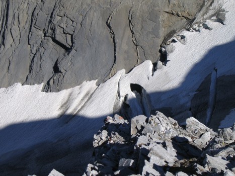
Looking down at the glacier and a small section of the bergschrund; the snow-bridge we wanted to use is in the centre of the photo
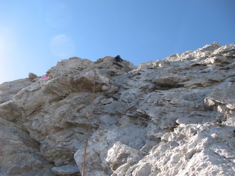
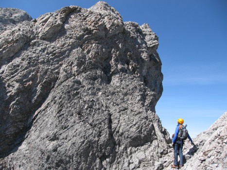
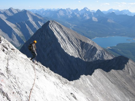
Another section of steep, exposed scrambling
Mark comes up the ridge
Mark ascends the final few metres to the summit
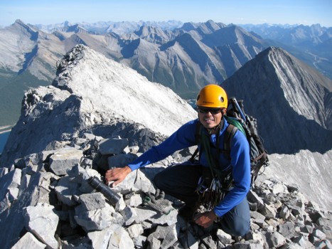
Me at the summit
Looking north
Mount Nestor and the connecting ridge
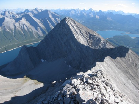
Same as above