Mount
Prince Albert
-
July 22, 2005
Mountain height:
3,209 m (10,526 ft)
Elevation gain:
823 m from bivy at toe of glacier
Ascent time:
Descent time:
Mountaineering with Kevin Barton.
Day five of our mountaineering
trip and Kevin woke me at the lovely alpine hour of
We continued up steep snow slopes, with a running belay, until we finally came to the steep, rocky terrain of Albert’s summit block. From there, we scrambled up very loose rock to the ridge and cautiously traversed over to the true summit. A very large cornice, clinging to the east side of the ridge, kept us on our toes. Unfortunately, the weather had been quite unstable throughout the ascent and we had to hurry a little, to avoid being caught in an approaching downpour (this always detracts from any ascent).
We arrived at the summit at 9:05 am (definitely the earliest I had been on any summit), took a few photos, tried to enjoy the terrific summit view as best we could, and started down right away. The descent was relatively straightforward except for one section that we wanted to rappel down. Kevin spent forever trying the set up an anchor, but the incredibly loose rock gave him nothing to work with. Eventually, we opted to downclimb a steep snow slope to the right of our ascent route and go around the rock outcrop and back up to the crampons we had left at the bottom of the rock. The remainder of the descent was uneventful, but even at the early hour, we both noticed much the snow had softened since our ascent. We were glad to make it down to easier terrain. Overall, an enjoyable ascent that would have been fantastic, were it not for the iffy weather.
All that now remained was the
long hike back to the car. We both felt confident we could retrace the correct
(or shorter) ascent route and so, armed with only a grid reference from the
ascent description, we started down the moraine, heading in the general
direction of Fynn Creek. Right away, we went down the wrong drainage and ended
up thrashing through endless, evil bush, getting absolutely nowhere. We arrived
at the creek, then had to go back up, then came to the edge of a cliff band and
had to traverse around, and then repeated this entire process several times. We
erroneously thought that once at the creek, we could just follow it out to the
We were unbelievably relieved to finally make to the grid reference that marked the start of the trail, and followed it out, both in a state of utter exhaustion. The descent was seven hours of sheer misery, but at least we not what way not to go for the next time.
A totally amazing five days of great mountaineering, backpacking, and scrambling, with visual wonders at every turn. Thanks Kevin!
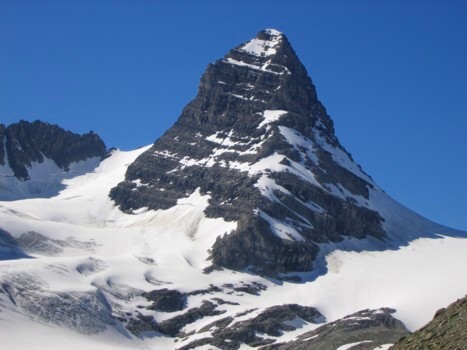
The lower of the double-peaked Mount Prince Albert, as seen the day before our ascent
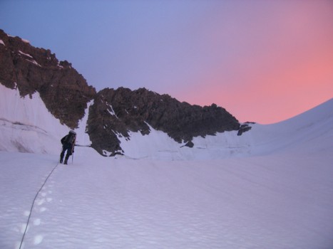
Kevin leads the ascent up the glacier in beautiful morning light
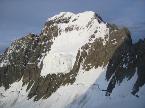
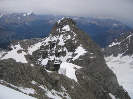
Mount King George, as seen from the King George/Prince Albert col
The view of King George's northeast ridge that made us opt for Prince Albert
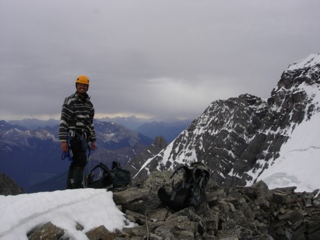
Kevin at the summit of Prince Albert
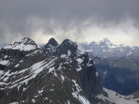
Edward, Henry, and Assiniboine (in the distance)
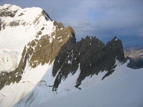
Looking south towards the lower summit of Albert; Joffre to the left
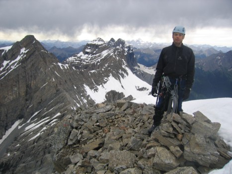
Me of the summit; King George to the right (photo by Kevin)
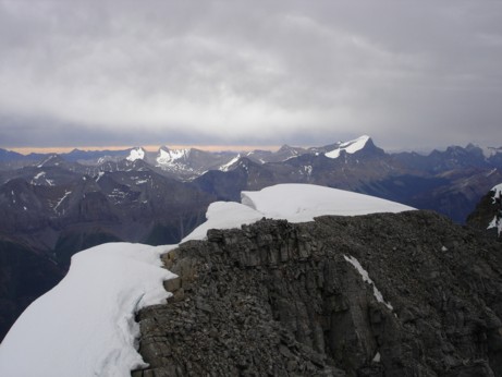
Looking back along the corniced ridge (photo by Kevin); the snow covered peaks at the left are Sarrail and Foch