Pasque
Mountain
–
Mountain height:
2,543 m (8,343 ft)
Elevation gain: 700 m
Ascent time: 3:45
Descent time: 2:10
Roundtrip distance: 13 km
Hiking with Mark.
With the recent re-opening of the winter gate that blocked a small section of Highway 940, just east of Plateau Mountain, Pasque Mountain seemed like a logical choice, for an easy summit on yet another “not so nice” weather day….or was it??
Once again, we were plagued by navigational problems, brought on by: 1. my own complacency regarding the “tricky routefinding”, described on the back on the Highwood & Cataract Creek Gem-Trek map; 2. a typo on the back of the aforementioned map. Note for anyone doing this route: when you enter the large clearcut, near the beginning, stay to the left side and look for a little clearing where the creek runs. That’s the correct route. It’s obvious as long as you stay left - we didn’t and missed the turn-off. Not being terribly concerned about following the exact route, we continued on.
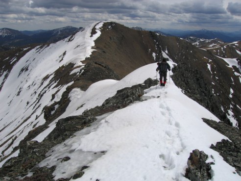
Soon, we realized there was a problem and took out the trusty map and GPS to find out if and where we had gone wrong. According to both, we hadn’t and I programmed in a grid reference that would lead us directly to the trail. Following the GPS compass, it soon became quite evident there was something drastically wrong. We ended up crossing a creek and then scrambling up steep and icy slopes that definitely didn’t seem to be leading to a road. We reached the coordinates and there was no road in sight. Never mind…we knew that we were on the north ridge of the mountain and that simply going up would eventually lead us to the ridge…and it did…but not after some thoroughly grueling postholing. Under the protection of the trees, a large amount of snow remained on the north-facing slope, and at times we found ourselves sinking passed our waists in the soft snow. The best way to travel was from one tree-well to the next, taking advantage of the melting around each tree. This part of the ascent was pretty darn strenuous for a hike that we thought would be effortless.
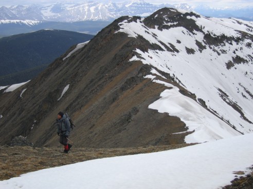
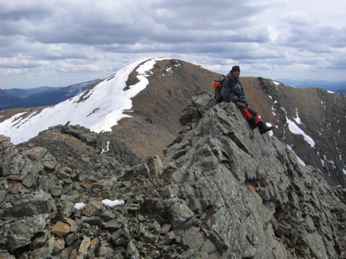
Of course, the snow soon cleared as we ascended above the treeline, and we started the easy and pleasant ridgewalk to the summit. Still miffed about the GPS and map problems, I programmed the summit coordinates in, to see if the GPS was faulty. With good weather, the view from the ridge of Pasque mountain, would have stupendous. The eye-catching forms of the Continental Divide mountains were enough to warrant numerous photos, even though the sky above was overcast and gray. Remaining snow and cornices on the east side of the mountain added further to our enjoyment of the mountain.
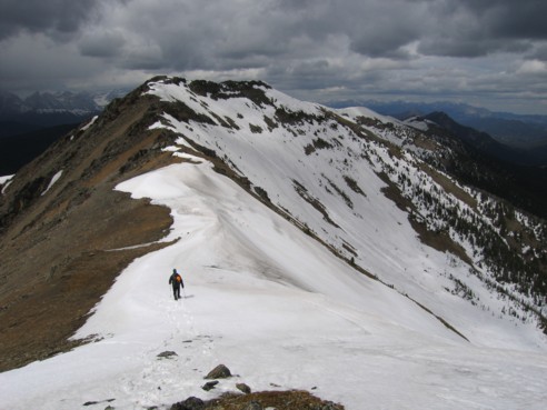
We reached the slightly lower north summit, took a break and then continued on to the true summit about 20 minutes away. This easy traverse was probably the most enjoyable part of the trip, with interesting rock scenery and colours along the way. At the true summit, I was not really surprised to find that the GPS was way off and indicated we were still a significant distance from the summit. Clearly, there was a problem with the unit (or was there??).
We chose not to do the horseshoe route for a couple of reasons: firstly, we were hoping for some clearing to west and better views of the Continental Divide mountains – doing the loop would have blocked off our views in that direction; and secondly, it just didn’t look to be that exciting of a route – a plod down to a col, followed by another plod back up to a highpoint where you would be rewarded with spectacular views of the geologically curious, but visually mundane form of Plateau Mountain, followed by a bushwhack down to the road, and finally, a 3.5 km trudge back to the parking lot. Also, we were quite curious we find the correct route down and where we made our mistake.
Clearing to the west didn’t happen, but we did find the very obvious road leading up to the ridge and followed it down. Initially, travel was mercifully easy, but lower down, we encountered the same problem as we had on ascent – bloody, deep snow! There was no way to avoid it and suddenly, getting down the mountain became as strenuous as getting up it – actually even more so, because we had to cover a greater distance on the gentler grade of the road. We were surprised to find the ascent and descent tracks of two other individuals, who had obviously made the ascent one or two days earlier - credit to them for enduring and completing this grueling and painstakingly slow slog up trying terrain.
At the bottom, we found out where we had missed the turn-off. Since much of the descent was as physically strenuous as the ascent, our navigational mistake was actually in our favour and it did provide us with a longer ridgewalk and more views to the west. Overall, a decent day in an interesting area, but I would definitely wait until summer is in full swing to do this route again.
Post note: after scrutinizing over the information from our GPS and the Gem-Trek map, I discovered that the GPS was fine and a typo on the back of the map caused the confusion. The GR numbers on the bottom skip from 72 to 74. Oh well…no harm done and we did learn a few things about trusting our eyes and instincts rather than various forms of technology.
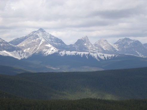
I think the following are Farquhar, unnamed, Holcroft, unnamed, and Scrimger of the Continental Divide
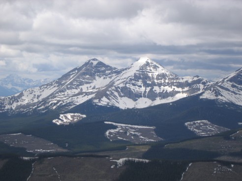
Mount Gass
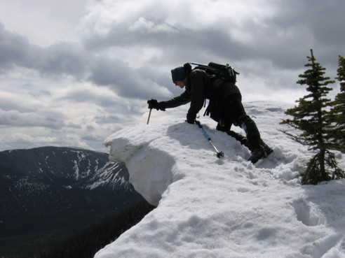
Cornice testing
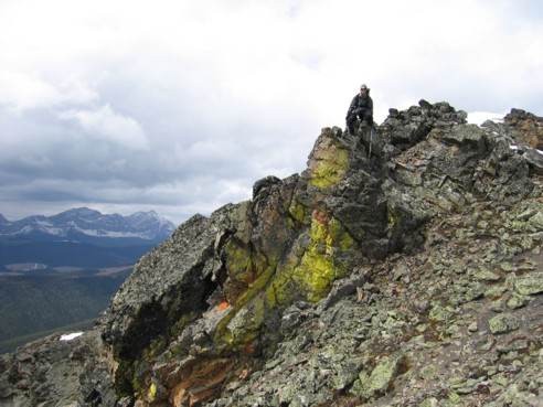
Interesting colours enroute to the summit
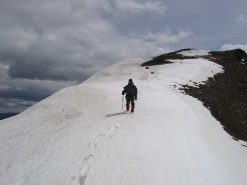
Mark hikes the final few metres of the route, with the slightly lower summit behind
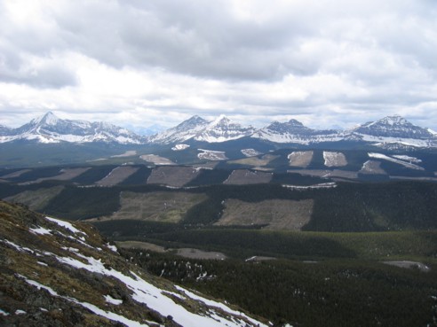
The unsightly and strategically hidden scars of clear-cutting
Descending back to the col between summits
Same as above, from the other direction
Mark takes a little rest, while heading back; true summit in the background
Almost back at the first summit