Pincher
Ridge attempt –
January 7, 2006
Mountain
height: 2,423
m (7,950 feet)
Elevation gain:
870 m (came up 50 vertical metres short)
Roundtrip time:
10:05
Scrambling
with Mark.
I suppose we were about due for
an epic and we did get a minor one on small, but interesting Pincher Ridge,
sandwiched between
The day started off great, as we unexpectedly ran into Dave Stephens, Jason Wilcox, Jess, Blair Piggot, and Chris Goble at the parking area. They were off to do some ice climbing. Having read and heard about Blair and Chris many times over the years, it was a pleasure to finally meet them.
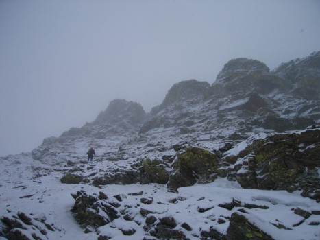
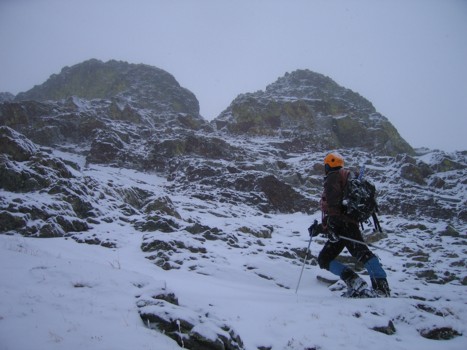
From the parking area, some of the route was visible, however, it was difficult to tell if it would involve technical climbing or just scrambling, so we took with us some climbing gear. All started well, as we gained the northeast ridge and hiked easily along its spine. Unfortunately, almost immediately, a bad weather system rolled, it began to snow and visibility was severely comprised (about 50 or so metres).Having checked the satellite photos in the morning, we were expecting clearer skies in the afternoon and so on we went.
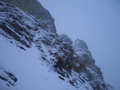
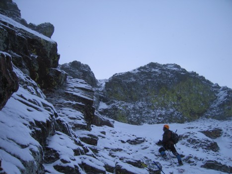
We reached the first rockband and immediately had to take a detour. Ascending the band may have been possible in good conditions, however, not with snow on the route and snow presently falling. We were able to lose elevation and circumvent the band on the north side of the mountain, where we then regained the ridge, to find another equally daunting rockband. At this point, it became clear that this pattern would continue, probably all the way to the summit. We really had no choice but to side-slope around the north side of the mountain, in the hope that a feasible route up would became visible – of course, very little within a 50 metre radius was visible at all, further complicating matters.
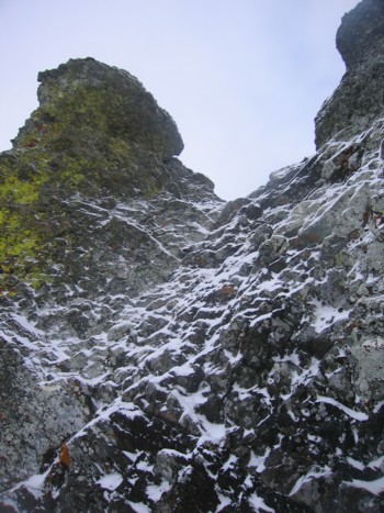
After a good hour of tedious side-sloping, nothing had become obvious and a GPS reading revealed we were still a good distance from a col on the west ridge that would grant easy access to the summit. The topo map did, however, reveal a weakness in the steep terrain of the north face and we gambled that we would be able to find it by just going up the rib we were presently on. The gamble paid-off (sort of?) and after an interesting ascent, weaving in and out of rock outcrops on the rib, we arrived at a steep, but scenic rockband, guarding the summit ridge. Only about 50 vertical metres from the summit, we roped up and went in search of an ascent route. Again, without the snow, an attempt of one of several weaknesses may have been possible, however, the most viable option was covered in verglass and beyond our capabilities.
After an extensive and fruitless search, and now at the late hour of 3:30 pm, we had only the option to retreat. If nothing else, we had found a very interesting summer route, and that is exactly when we’ll return to complete the ascent. The snow continued to fall (apparently our assessment of satellite photos needs some work!) as we started down.
For descent, our intention was
to lose a fair amount of elevation, down north facing slopes and then decide
whether we should regain elevation and return the same way we came, or head
directly to a good trail, north of the mountain and south of
About 1 km from the trail, I made the mistake of checking how far we were from the car in a straight line. GPS indicated we were 2 km. When compared to the 7 km return trip of our present route, we both choose the shortcut route, even though that meant regaining about 200 m of elevation. The elevation gain was tough, but much worse was the fact that it was dark, the falling snow was blowing in our faces, and even with headlamps, visibility was no more than 20 metres. The GPS pointed us in the right direction, but I, for one, was completely disoriented in regards to where we were relative to our ascent route.
After a seemingly endless trudge around the side of hill, we were forced to gain more elevation. Just when we thought we were on the right track, we arrived at the edge of the cliffband, that shouldn’t have been there (well, not according to the topo anyway!). After a short bout of cursing and swearing and considering the most unappealing proposition of going all the way back to the other trail, we decided to head away from the car and down a promising slope to left – as promising as it can get when you can only see 20 metres in front of you. This was a great decision until we arrived at another cliffband that forced us into a steep drainage. At least, by now we had descended below the clouds and could actually see the surrounding terrain, which included the road we were aiming for. The drainage was easy until we hit a drop-off (waterfall in the summer) and had to reascend slopes to get around it. Fortunately, that was the last obstacle of the day and we dragged ourselves back to the car at 8:05 pm. We’ll just chalk this one up as a learning experience.
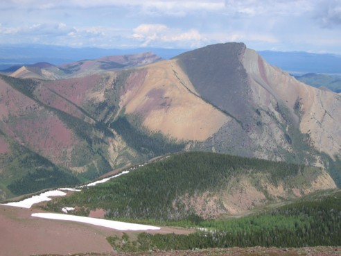
The south side of colourful Pincher Ridge, as seen from Drywood Mountain, on June 25, 2005
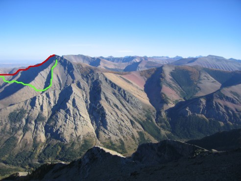
The north side of colourful Pincher
Ridge, seen from Victoria Peak, on September
25, 2004
Red line: our intended route
Green line: our actual route
The east ridge of Pincher Ridge, as seen from Pincher Ridge, on January 7, 2006
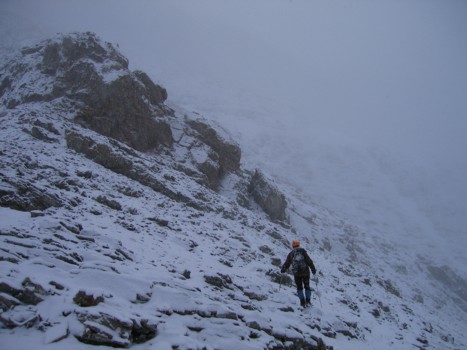
Heading towards the first rockband
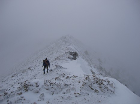
Mark comes up the ridge
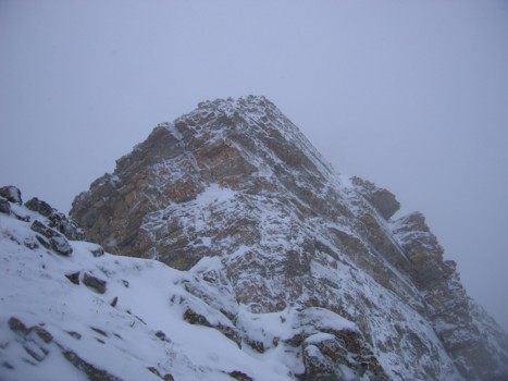
The first rockband
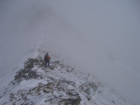
This is where we just decided to go straight for the summit
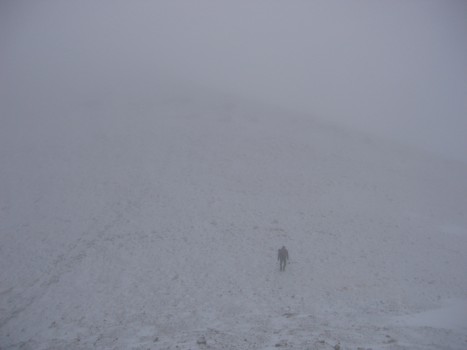
Typical terrain and visibility
Approaching the extensive rockband that guards the summit ridge
Same as above
Looking for a weakness
Same as above
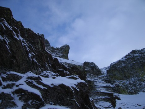
The one and only time we saw the sky; 1 minute later it was gone
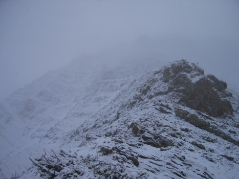
The rockband that stopped us
HOME
SCRAMBLES
MOUNTAINEERING
OTHER
TRIPS
PHOTO
GALLERY
LOG
FAVOURITES
LINKS