August 5, 2010
Mountain height:
3034
m
Total elevation gain:
approx.
2300 m
Ascent time:
6:20
Descent time:
5:00
Solo scramble.
Thank goodness for people like Rick Collier, Graeme Pole, and Bob Spirko, who have and continue to post interesting trip reports of lesser known mountains. These days, were it not for some of those articles, my typical trip report would read as follows: “Couldn’t think of what the heck to do so I stayed at home with a single Moosehead beer and watched reruns of “Seinfeld”.”
 Pulsatilla
The unsigned trailhead was easy to
find, thanks to Mike
Potter’s instructions in Ridgewalks
in
the Canadian Rockies. Hiking the long
At the former lookout site, several routes to the ridge offered themselves up. Initially, I was going to trend south to gain the ridge through up an obvious break in the cliffband guarding the ridge. However, upon gaining a little elevation, a more direct route to the north, through a small scree gully in the band revealed itself and so I went in that direction. Though the shortcut involved only a few moves of scrambling, the rock on either side of the gully was colourful and impressively steep.
From the 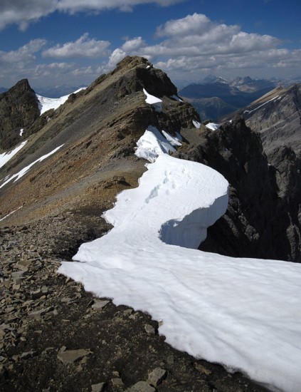 As such, I took an in-between route, losing about 350
vertical
metres of elevation in the process. The ups and downs of the
glacially-scoured
valley below added more to the elevation gains and losses, but they
were all
relatively small.
As such, I took an in-between route, losing about 350
vertical
metres of elevation in the process. The ups and downs of the
glacially-scoured
valley below added more to the elevation gains and losses, but they
were all
relatively small.
Finally at the base of the objective, more route decisions had to be made: 1. short, direct, but least scenic route; 2. longer route that gains elevation immediately and is potentially more scenic. Given that most (but not all) of my decisions in the mountains are based on the potential to see interesting scenery and views I chose route 2.
This route started with some fun scrambling, but quickly turned into a labourious scree/talus traverse. I was also starting to tire of the same scenery and wanted something more. Thus, another route decision was made and I headed straight up the mountain in an attempt to gain the west ridge immediately. This decision had one very positive outcome and one troublesome consequence.
After finding a weakness in the upper
rock-band, I scrambled
up to the ridge to the surprise vista of Pulsatilla’s north
glaciers. I had
completely forgotten about the glaciers, since the map I was using did
not
depict them. Although in magnitude and elegance they paled in
comparison to
those seen recently around
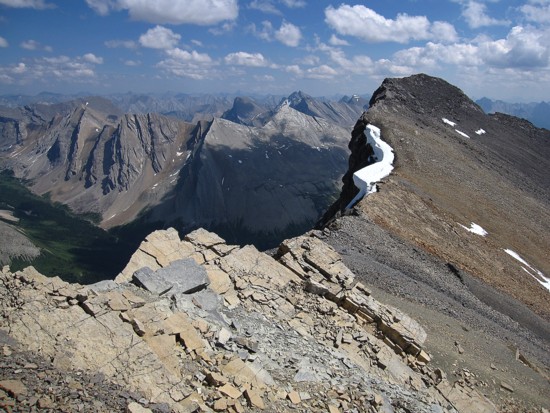
The troublesome consequence reared its troublesome head as I traversed the scenic ridge to suddenly arrive at the dead-end (ie. severe drop-off). Options, at this point were to backtrack, losing an enormous amount of elevation in the process, or to circumvent the drop-off by going onto the glacier on the north side of the ridge. Usually I would agonize for an eternity about these kinds of decisions, but surprisingly, I had crampons on my feet and ice axe in hand within minutes – decision made!
Stepping onto a glacier as a solo,
unroped traveler is
something I vowed never to do (Mark and I are probably two and of a
mere
handful of people who actually roped up to cross the glacier on Warrior
Mountain – though we were halfway across before we realized
it!) 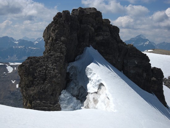 However, in
this specific case the danger appeared to be minimal and foreseeable. That is,
I would be traveling above the bergschrund, the distance was less than
200 m,
and my hiking pole could be used to probe for holes. Calculated risks
are part
of the mountain experience and here was a fine one. The rising traverse
across
the top of the glacier was slow, as I probed for holes on step every.
Thankfully, there was solid ground (or ice) just below the surface of
the snow
and I felt quite safe.
However, in
this specific case the danger appeared to be minimal and foreseeable. That is,
I would be traveling above the bergschrund, the distance was less than
200 m,
and my hiking pole could be used to probe for holes. Calculated risks
are part
of the mountain experience and here was a fine one. The rising traverse
across
the top of the glacier was slow, as I probed for holes on step every.
Thankfully, there was solid ground (or ice) just below the surface of
the snow
and I felt quite safe.
Atop the glacier, the remainder of the ascent was easy and very scenic, courtesy of the terrific drop on the east side of the mountain and an ocean (not just a sea!) of beautiful peaks on the same side. The summit view was likewise absolutely fantastic, even though forest fire smoke obscured much of the panorama to the west. The multitude of unnamed, distinctive peaks to the northeast, east and southeast definitely outshone their more notable counterparts in the Lake Louise/Moraine Lake, to the west. This was perhaps in part due to their close proximity, but also because of their consistent southwest to northeast slope orientation – it was like looking at 100 Mount Rundle’s, all crammed into one area.
I expected the summit register,
placed there in 1994 by
Graeme and Marnie Pole, to contain one or two entries at most, but
there was a
whopping seven, including a very recent ascent by fellow school teacher
Grant
Myers (more commonly known as Granticulus). Grant had not only reached
the
summit Pulsatilla, but also
My summit stay was long, mostly because I was thoroughly enjoying the summit view, but also partly because I was dreading the return trip. The glacier wasn’t an issue. I had already picked an alternate descent route that completely avoids the glacier, long before I stepped onto it. However, the necessary elevation gain back to the ridge of Protection Mountain was certainly less than appealing. I therefore took a slightly more circuitous route back that would lessen the elevation gain by a small amount, and also allow me to see more on this interesting valley.
The descent route started off really well, with terrific
waterfall and rock scenery, and later a host of beautiful tarns. Unfortunately,
my intended route took me too far south and by the time I had reached
Protection’s ridge I was much closer to
A very entertaining day out.
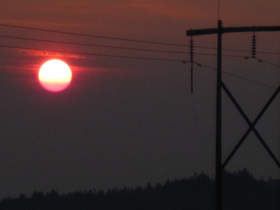
On the drive there; the colours are a good indication that smoke haze is in the air
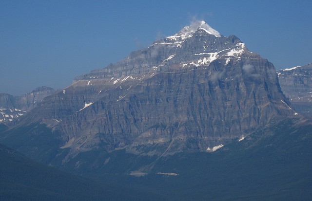
Mount Temple
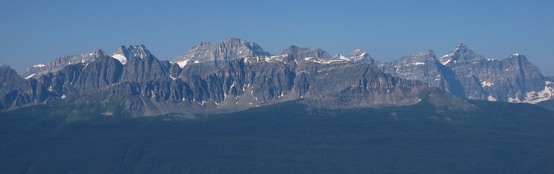
Mountains of the Valley of Ten Peaks; the highest is Deltaform, near the right
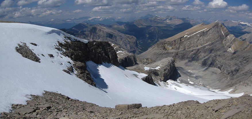
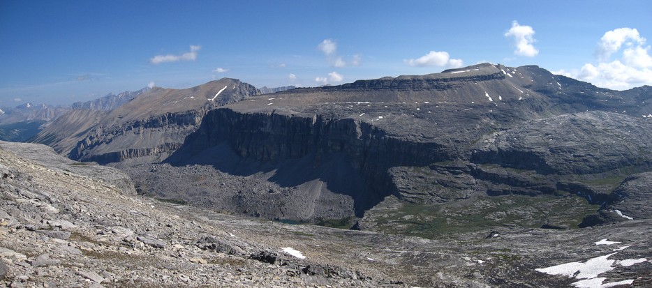
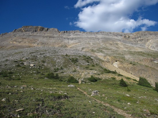
The weakness through the cliffband that gives access to the ridge of Protection Mountain
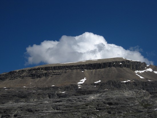
The massive form of Pulsatilla Mountain; summit near the right side

Looking back to the north summit of Protection Mountain (left)
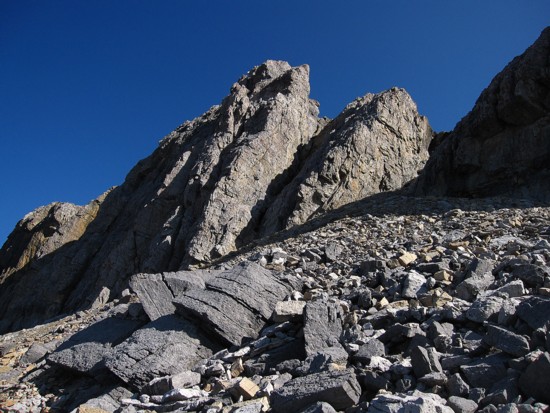
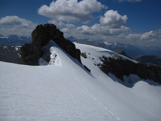
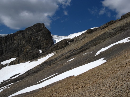
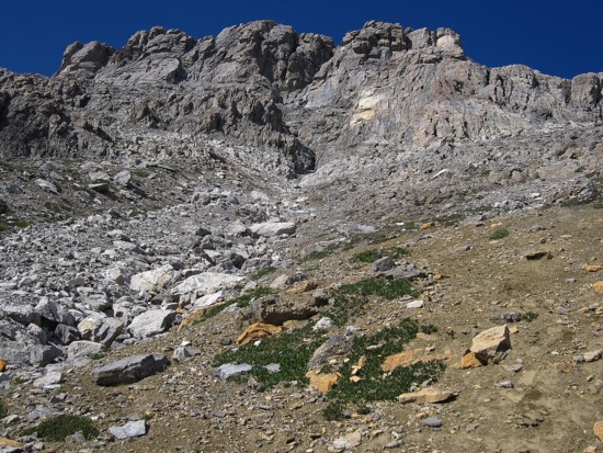
The cliffband that guards the west ridge of Pulsatilla; there is a weakness near the right side, where the highest point is

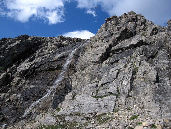
Pleasant waterfall scenery along the way
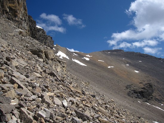
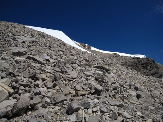
The rubble traverse tot he summit at the right; instead I went up to the cliffs on the left side to find the weakness
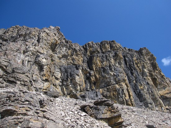
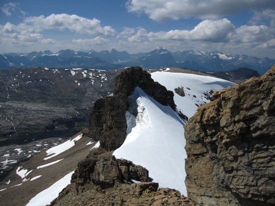
The cliffs; the weakness is just out of sight to the left
Approaching the west ridge
The first section of the ridge
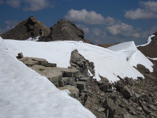
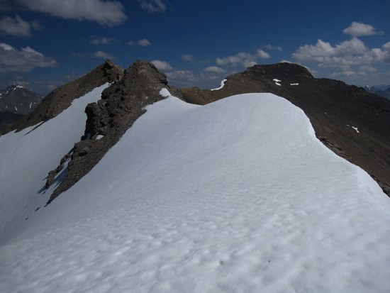
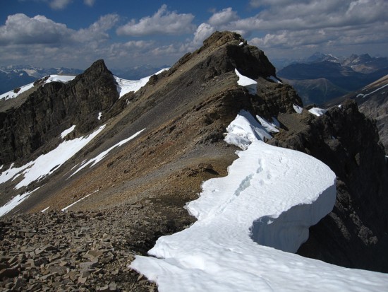
The summit is at the far right; the drop-off is in the centre
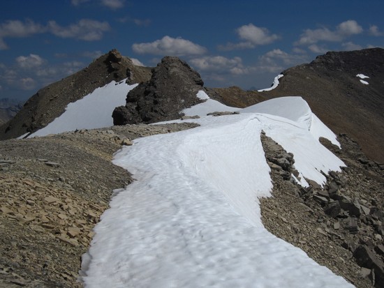
Crossing a snow slope on the ridge
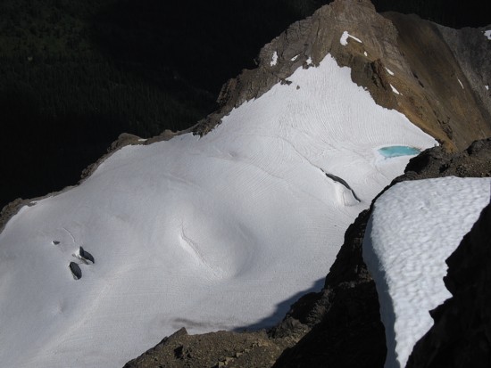
Looking down one of the north glaciers
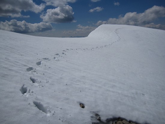
My tracks
More cool snow and ice scenery to the north
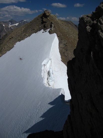
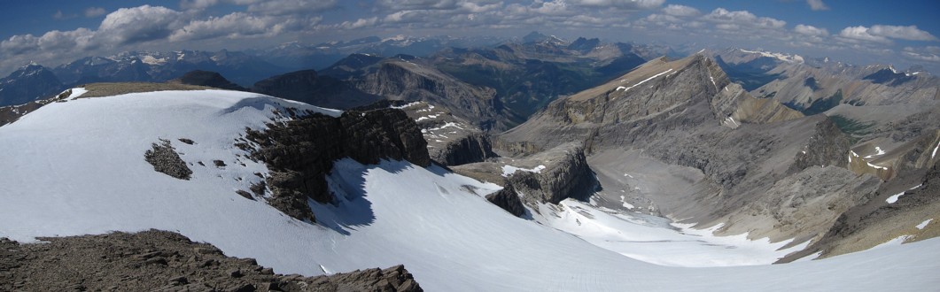
The drop-off and the glacier
Looking back at the section of the glacier I ascended
Same as above
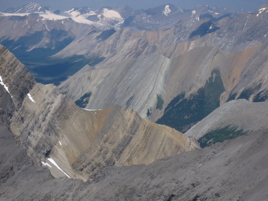
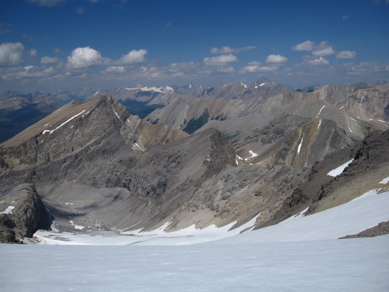
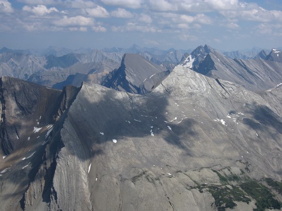
The view towards Castle Mountain and company; T.V. Peak at the right
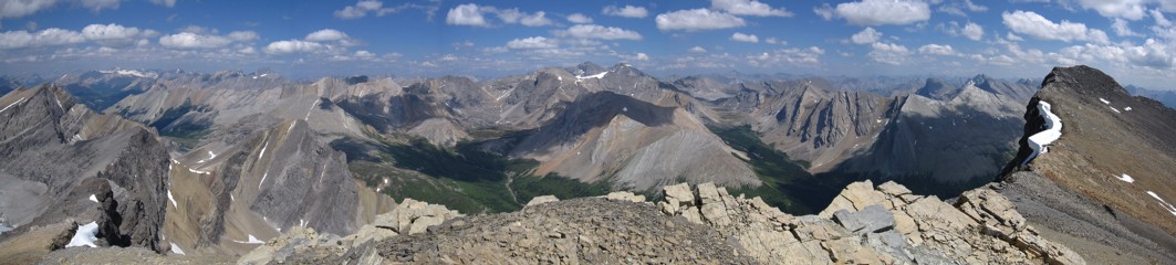
The view to the east; summit at the right
Same as above
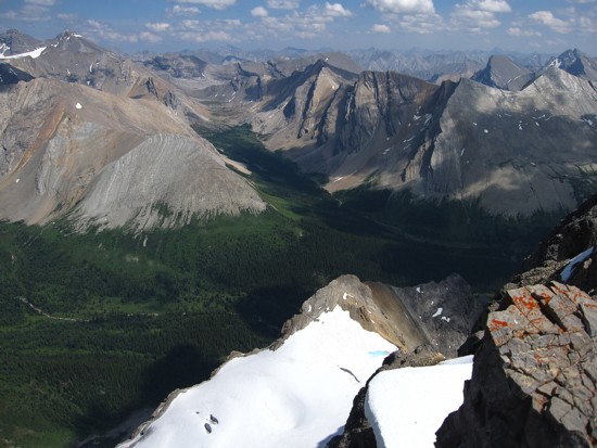
More views to east and another one of the north glaciers below
A close-up
Looking back along the west ridge
Some of the Rundle-like peaks to the east
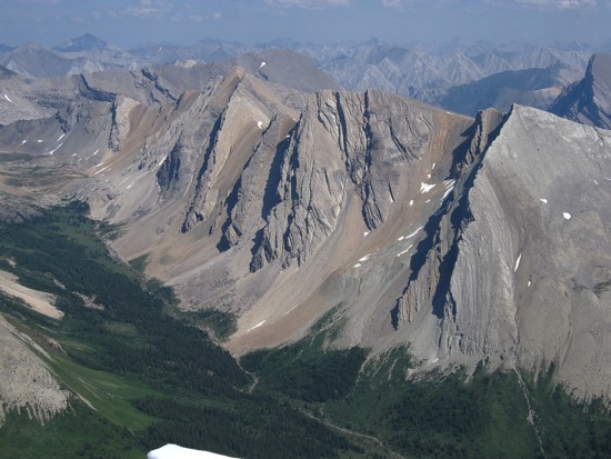
Same as above
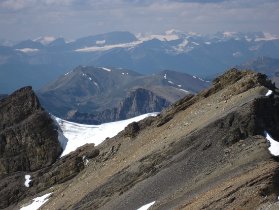
Daly and Balfour can just be made out to the hazy northwest
Descent
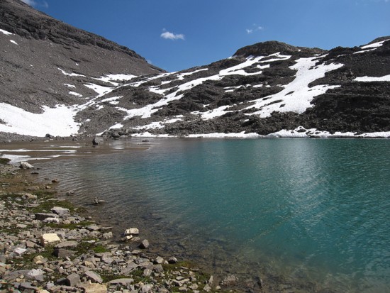
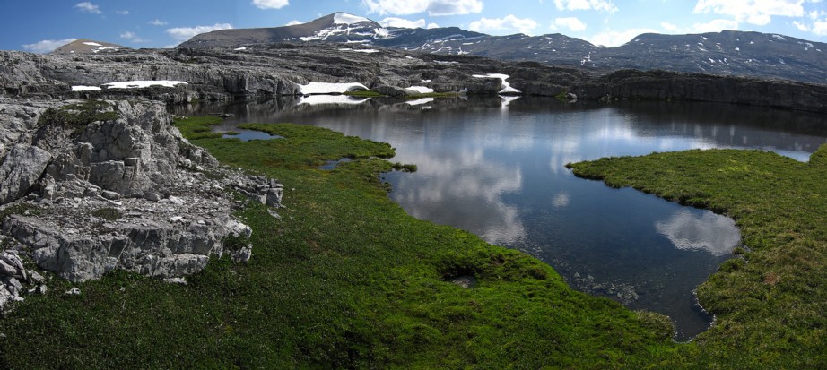
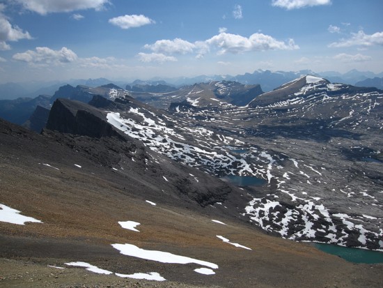
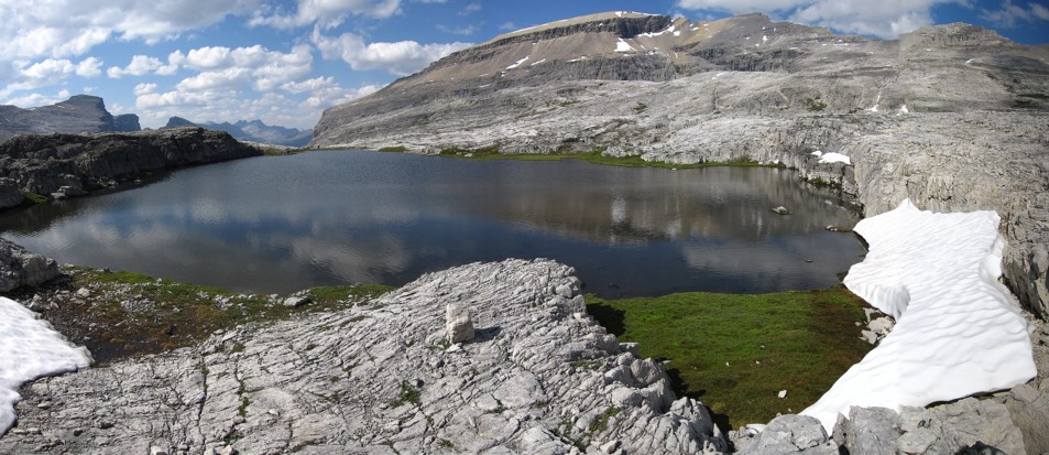
The lake below Pulsatilla
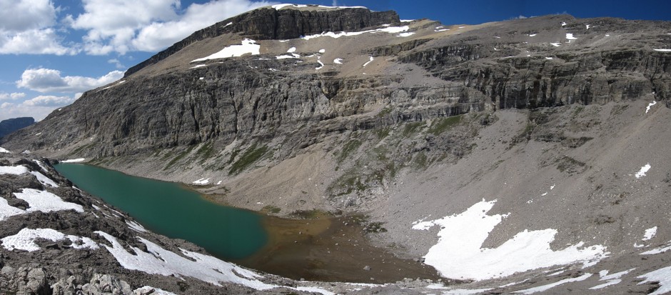
An alternate descent route, however, it still requires a fair amount of elevation gain; Pulsatilla summit is at the right
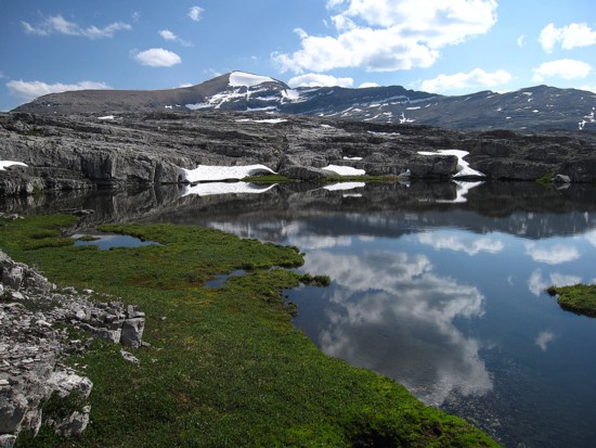
One of numerous interesting tarns, seen on the return trip
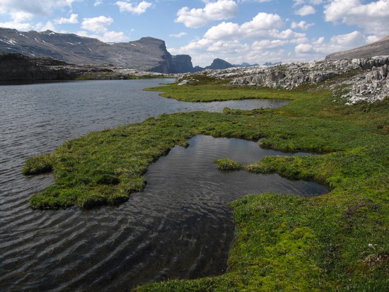
Same as above
Same as above
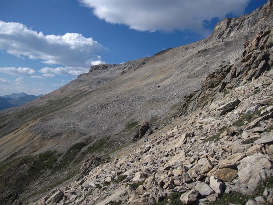
Part of the long traverse back to the original ascent route
Some of the pleasant scenery seen while traversing
Same as above
Looking back at the ascent route to Protection Mountain ridge; the weakness is about one-third the way from the left