Mountain height:
2416 m
Total elevation gain:
approx. 1500 m
Ascent time:
9:30
Descent time:
4:20
Scrambling with Mark.
What a beast!! Neither Mark nor
I expected this diminutive little peak to pack such a punch. We wanted to gain
the northeast ridge as soon as possible and see how much we could scramble. An
eighty minute hike to
We spent the next several hours doing a
significant amount of route-finding and steep and exposed scrambling. Though it
would have been easier to stay far below the ridge, the views from and the
interesting scrambling right on the ridge were terrific and so we kept going
back up each time we had to lose elevation to circumvent a particularly steep
step. This was fun, but extremely time-consuming and after 2 hours of
scrambling, we had only made about 200 metres progress towards the summit.
Nevertheless, with
Eventually, the ridge dropped down to a col and then reared up in a beautiful
fin of red argillite. This is where we had to make a decision to try to scramble
the ridge or bypass the difficulties on the east side of the mountain. It was
not a difficult decision. The ridge appeared to be very steep in some sections,
with huge drop-offs at certain points. More than likely this would have involved
a good deal of technical climbing that we simply didn’t have the time or
inclination to do. As suggested by Dave Stephens on his ascent of Richards, we
followed a good scree trail around the east side of the mountain - not at all a
disappointing route, as the red rock was absolutely terrific.
Reaching the
The summit view was magnificent and included a
wonderful view of
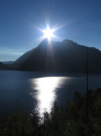
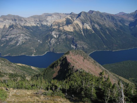
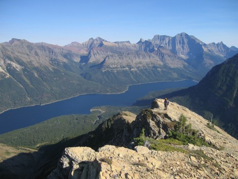
Vimy Peak and Upper Waterton Lake
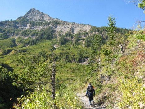
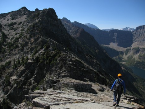
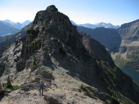
Heading towards Mount Richards; the ascent route follows the right skyline
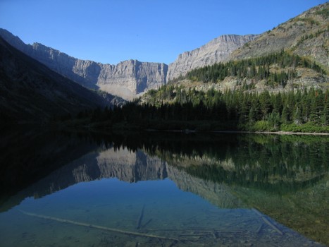
The connecting ridge between Alderson and Richards is reflected in Bertha Lake
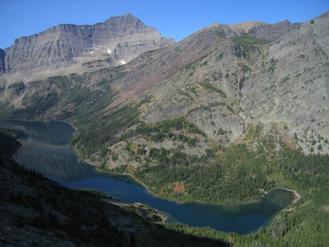
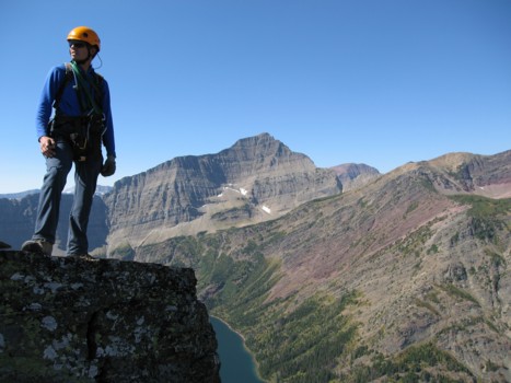
On the ascent slopes, looking down at Bertha Lake and part of Bertha Peak (right); Mount Alderson to the left
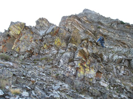
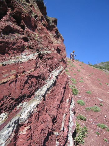
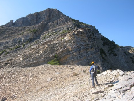
Typical terrain near the north ridge
Same as above
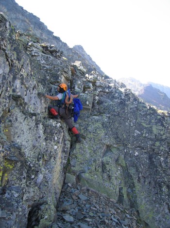
Steeper terrain on the ridge
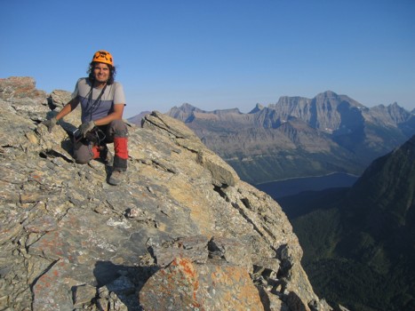
Mark takes a quick rest
Mark stops at one of many scenic highpoints along the ridge
Same as above
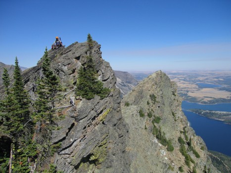
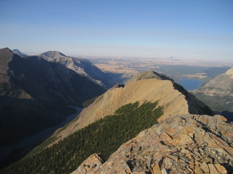
More of the long ridge, with the Waterton Lakes and Vimy Peak behind
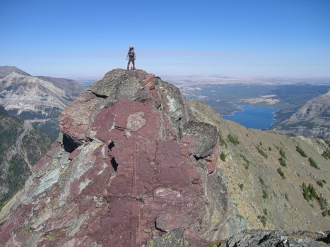
The great colours of Waterton
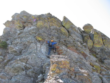
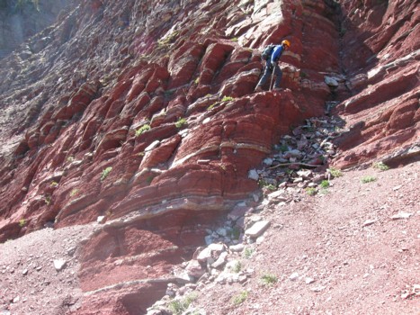
One of the steeper rockbands

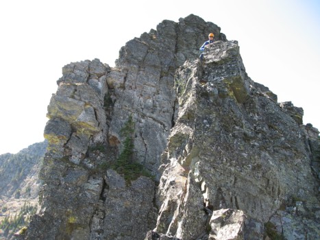
Almost at the top
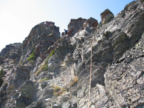
More exposed scrambling
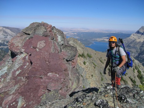
Approaching the major red argillite band
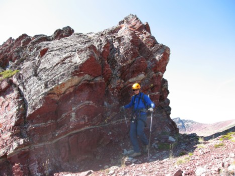
Starting the traverse around the east side
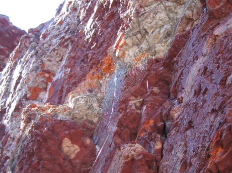
Colourful rock and a spider web
More great rock
Same as above
Looking east to Mount Boswell
Exploring the ridge near the false summit
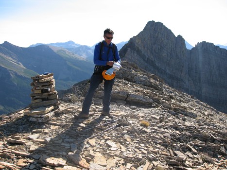
Checking the map at the false summit, with the true summit behind
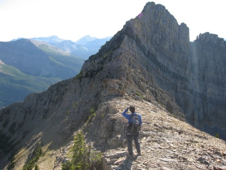
Trying to find a route around to the summit
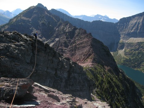
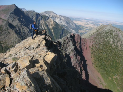
On the southeast ridge
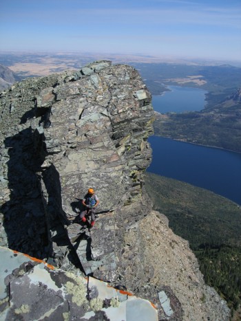
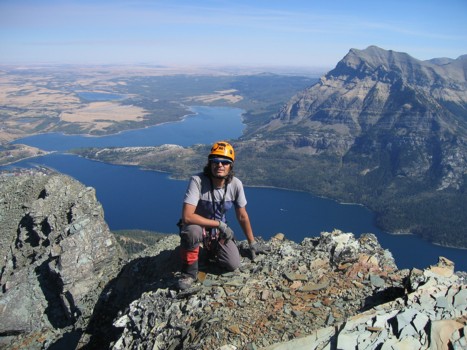
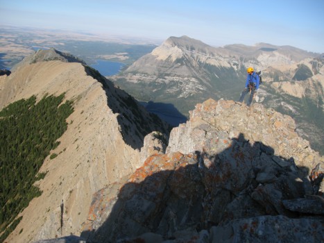
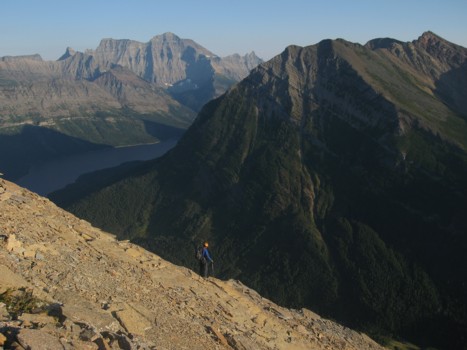
Ascending the ridge, with lengthy Upper Waterton Lake and Mount Cleveland behind
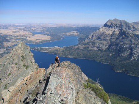
Almost at the summit
Taking the last few steps to the top
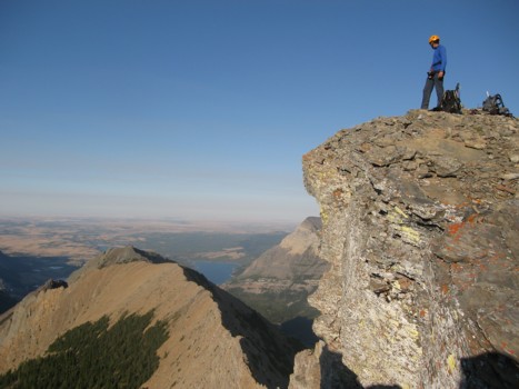
At the summit, looking northeast
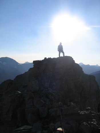
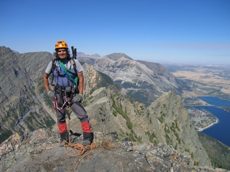
Mark at the summit
Same as above
The view to the north
On descent; Mount Campbell to the right and Cleveland at the left