Mount
Mountain height:
2492 m
Elevation gain: 1000 m
Ascent time:
6:20
Descent time:
3:40
Scrambling with Mark.
Besides the lacklustre weather, this was a great scramble, with tons of hands-on scrambling, interesting route-finding, and great scenery throughout. Unfortunately, much of the rock was covered in lichen and this made it very Slippery When Wet (a great Bon Jovi release in 1986!).
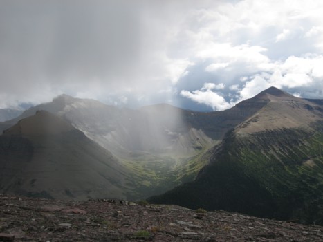
Loosely following Bob Spirko’s website description (for Spread Eagle Mountain), the day began with an easy, but wet hike to the far east end of the mountain. We then hiked up and over a couple of bumps in very interesting weather. Low-lying clouds covered everything above 2000 m and clouds would form in the valleys below, rise up quickly and then disappear. It was one of those meteorological phenomena that you marvel at for about ten minutes and then wish would just go away! And then, of course, then it rained on us for a good 45 minutes.
Soon we arrived at the start of the scrambling, though visibility was reduced to the point where we really couldn’t see what was above. The rain had stopped, but the rock was still very wet and we proceeded with much caution. Upon arrived at the first significant rockband we ascended through one of the 5 weaknesses as pointed out by Bob. As he mentions, the chimney at the south end of the ridge would have been the best route, however, with the rock in its present condition, we picked the shortest one, a little further north.
The crux of the trip came shortly after – a huge, vertical band of rock circling the mountain. This band seems to be a staple of all the surrounding mountains – Glendowan, Dungarvan, Loaf, Drywood, etc. Losing some elevation and traversing alongside the band, we eventually found a weakness and ascended it with care. Above that, the remainder of the ascent was a pleasant combination of colourful rock scenery and lots of hands-on scrambling. Though much of the terrain appeared too steep from below, there were always weaknesses to seek out and staying near edge of the ridge was very gratifying.
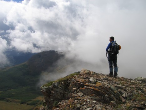
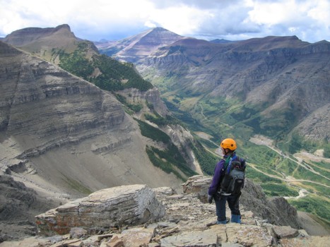
At the summit, we packed on every last item of clothing we had to battle the cold temperatures and waited for better weather. There appeared to be a break in the clouds and we wanted to see the terrific summit panorama in at least a slither of sunlight. Unfortunately, the gap between the clouds to the east and the ones to the west suddenly closed and it appeared we would be caught in a downpour. We therefore left the summit, in search of an alternate descent. Of course, it could have been way worse, as Dungarvan and many of the mountains in Waterton appeared to be getting a continual pounding from relentless storms.
We were successful in finding an easy way off the mountain, but not without a huge amount of route finding, getting cliffed-out several times, and the frustrating elevation regains that followed. Had the weather been better, I would have classified this as a perfect day of scrambling. As it stands, we’ll give the day an A-.
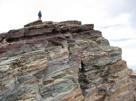
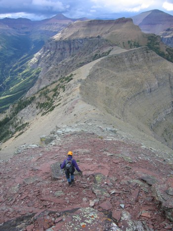
Even low on the mountain (far east end), the colourful rock layers are visible
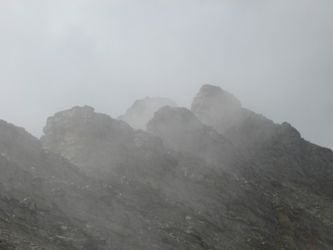
Typical weather of the day
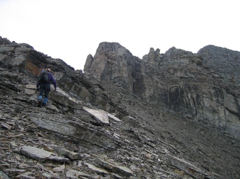
Heading to the second "hill"
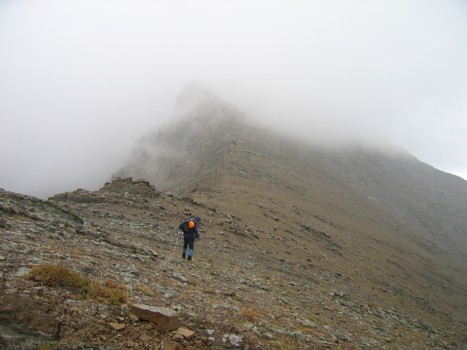
The scrambling starts somewhere up into the clouds
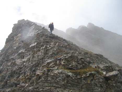
The start of the scrambling
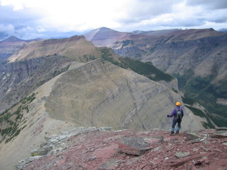
The lower section of the ridge
More of the same
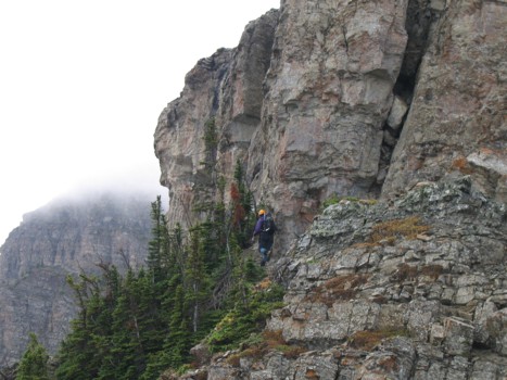
Reduced visibility, low on the mountain
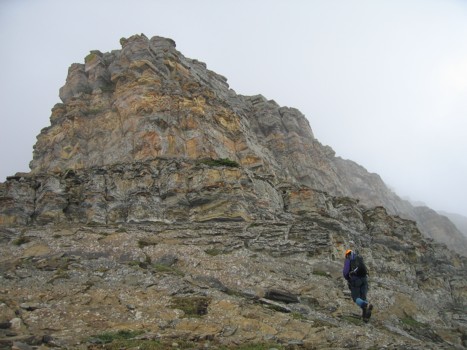
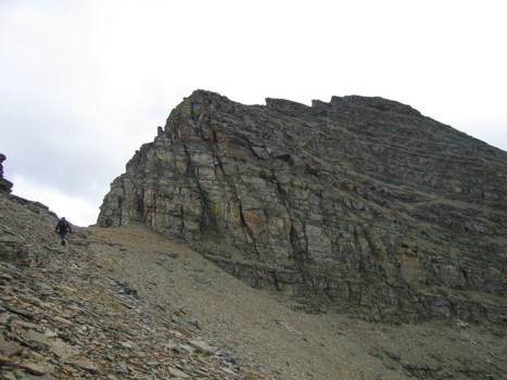
Approaching the first steep rockband
Same as above
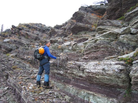
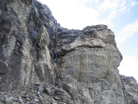
Trying to find a weakness in the band
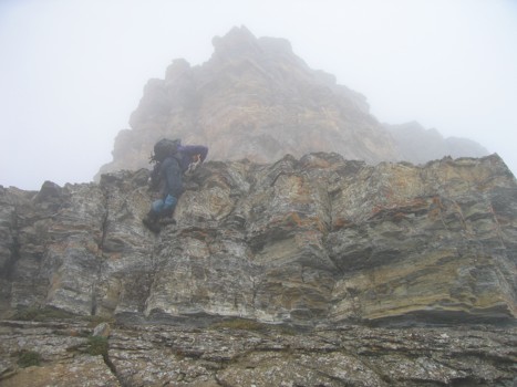
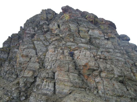
Mark approaches another steep rockband
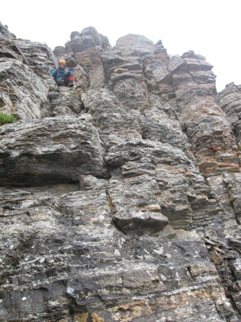
Mark waits for me halfway up the band
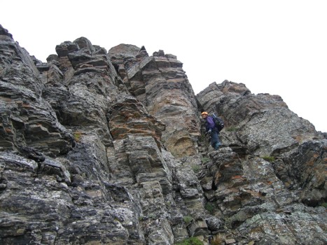
More typical scrambling of the east ridge
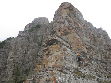
Approaching the crux rockband
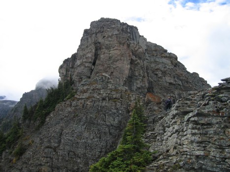
Same as above
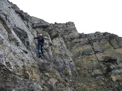
Trying to find a weakness on the left side; had to turn around here and try the right
Ascending the weakness
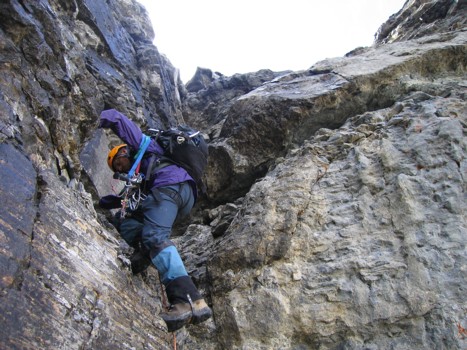
Same as above. Yes... again I'm armed with a ton of climbing paraphernalia, but you can't be overly cautious when on unknown routes
Above the crux, looking to the west; Loaf Mountain in the centre
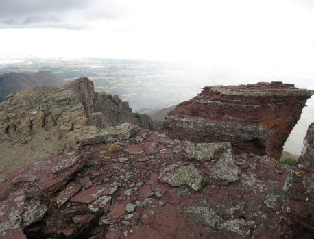
More colourful rock, too bad about the stark, white background
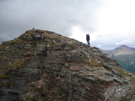
Me on the ridge
Mark on the ridge
The upper slopes
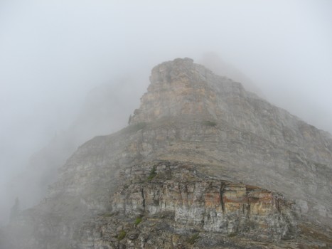
The last rockband
Ascending the last rockband
More colourful scenery near the summit
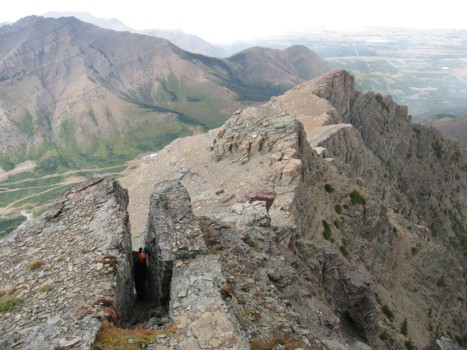
Mark squeezes through a gap in the rock; east end of Loaf at the left
The last few steps to the top
Dark clouds to the south
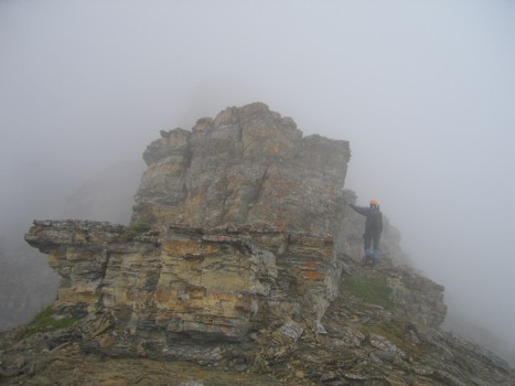
Mark takes a small diversion before the summit
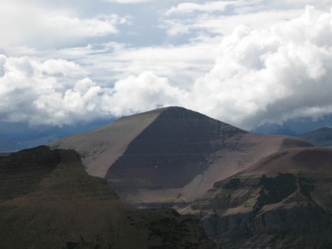
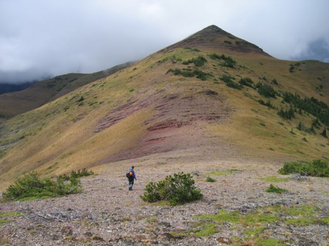
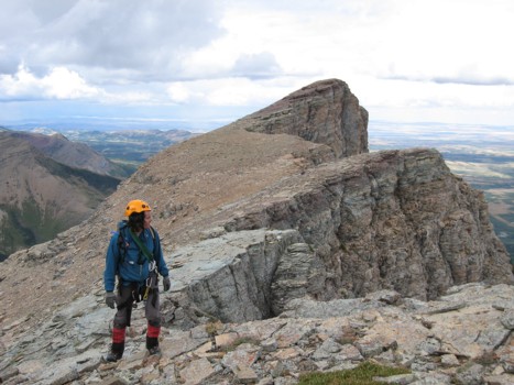
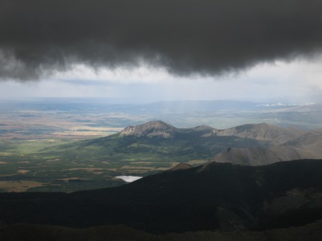
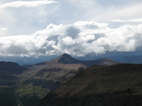
Loaf Mountain
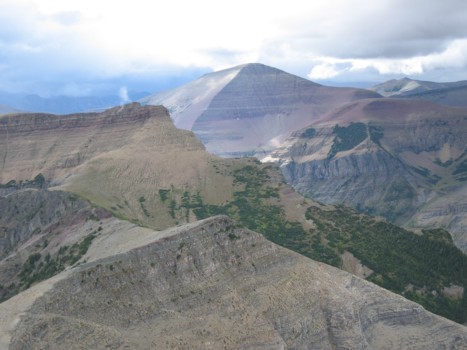
Glendowan (left) gets some rain (and sun); the peak to the right is an outlier of Newman Peak
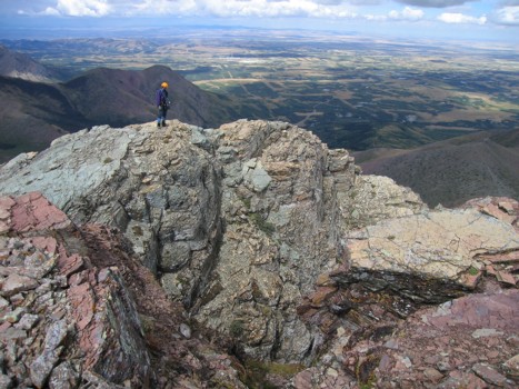
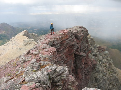
The highest point of Spionkop Ridge at 2576 m
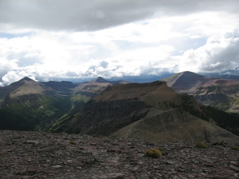
The view to the west
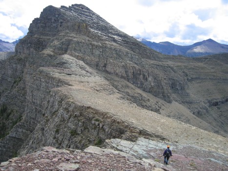
Another look at Loaf and the east section of Spionkop Ridge
On descent, looking for an easy way down
A last look at the ridge and Loaf Mountain