Mount Shanks attempt
February
5, 2012
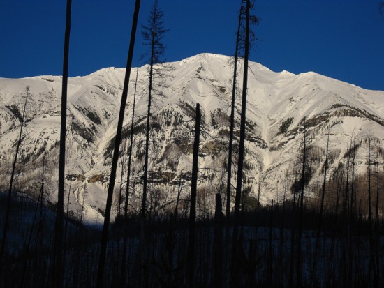
Mountain
height: 2850
m (we
made it to 1550 m!)
Elevation gain: 1600
m (we
came up 1300 m short!)
Roundtrip time: 8:20
Snowshoeing
with Raff (skiing).
Pretty
crazy stats for an 8+ hour trip!
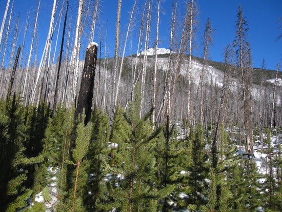
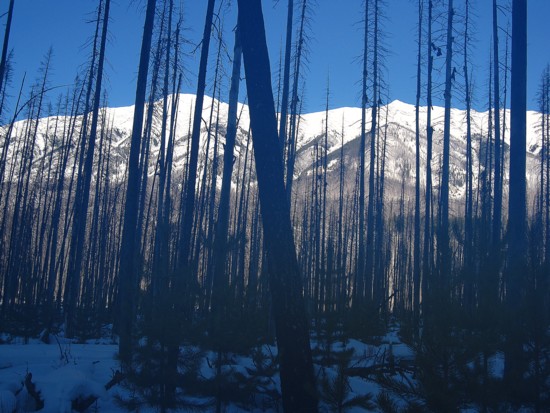
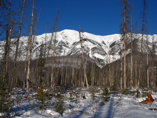
 As
one of the most statuesque peaks in the area, Raff and I surmised the
view from
the summit of Mount Shanks would be spectacular, especially in winter.
The only
thing standing between us and that view was 6 horizontal km of travel,
1600 m
of elevation gain, and a tree or two….well maybe a few more than two!
As
one of the most statuesque peaks in the area, Raff and I surmised the
view from
the summit of Mount Shanks would be spectacular, especially in winter.
The only
thing standing between us and that view was 6 horizontal km of travel,
1600 m
of elevation gain, and a tree or two….well maybe a few more than two!
We
arrived at the trailhead to the disillusioning view of nothing – ie. we
couldn’t
see the objective at all due to low clouds caused by a weather
inversion.
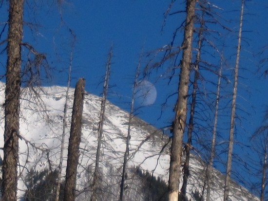
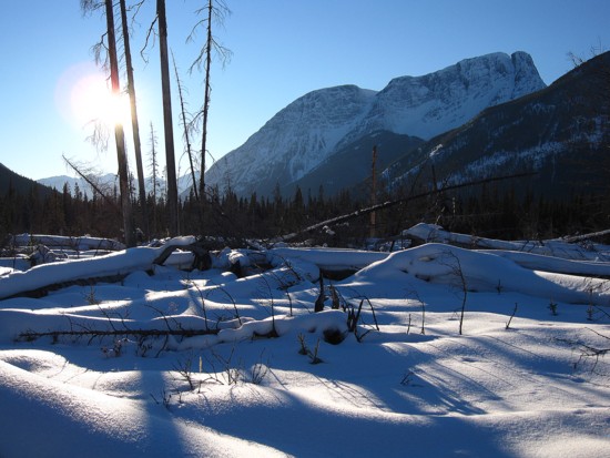
 Weather-wise this was hardly an issue, as we knew
that completely clear skies
were sitting above the clouds. Being on the summit right then and there
would
have being utterly surreal. But we were still at the parking lot, 1600
vertical
metres below that apex – bummer!
Weather-wise this was hardly an issue, as we knew
that completely clear skies
were sitting above the clouds. Being on the summit right then and there
would
have being utterly surreal. But we were still at the parking lot, 1600
vertical
metres below that apex – bummer!
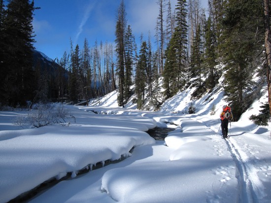
Since
we couldn’t see what kind of snow conditions we would be dealing with
above
treeline, a direct route to the summit, up west facing slopes, was out
of the
question. Instead we would take a very long, but gentler route via the
south
ridge. That entailed a roundtrip horizontal distance of approximately
32 km.
Combined with significant elevation gain along the 16 km one way
distance, a
daunting task was suddenly upon us. Admittedly, this change of plans
had my
“Spider-sense” tingling already, recalling a brutally exhausting attempt of Cone
Mountain,
several years ago that required less horizontal and
vertical gain.
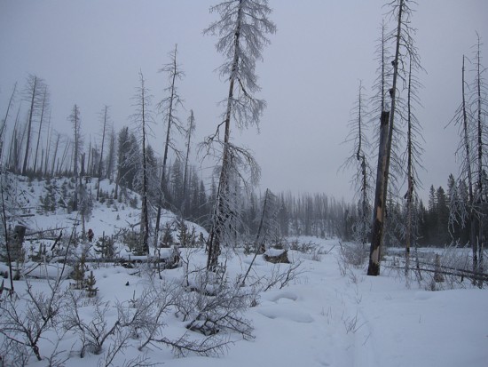
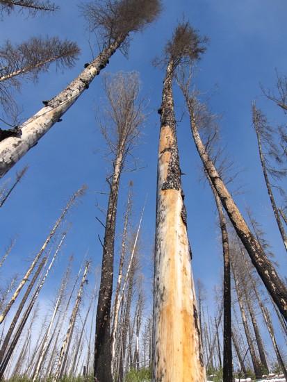
In
retrospect, perhaps the most unfavourable turn of events occurred as we
left
the trailhead to discover the trail leading to the south end of the
mountain had
been well-broken. Had it been unbroken I’m sure the strenuous effort of
forging
a new trail would have turned us around within 30 minutes and we would
be found
something quite a bit shorter. Instead, we embarked on an easy, but
long (10
km) trek around the south end of the mountain.
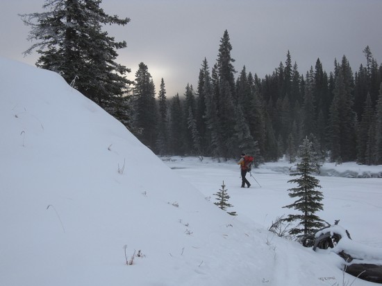
 About
3 hours in, we arrived at the far end of the south ridge and considered
ascent
options. The trees and deadfall looked pretty horrendous from every
angle and
so our only real option was to take a direct route to the nearest
tree-free
slope. That slope looked relatively close from our vantage point. As
such,
we started up with a glimmer of hope about making the summit.
About
3 hours in, we arrived at the far end of the south ridge and considered
ascent
options. The trees and deadfall looked pretty horrendous from every
angle and
so our only real option was to take a direct route to the nearest
tree-free
slope. That slope looked relatively close from our vantage point. As
such,
we started up with a glimmer of hope about making the summit.
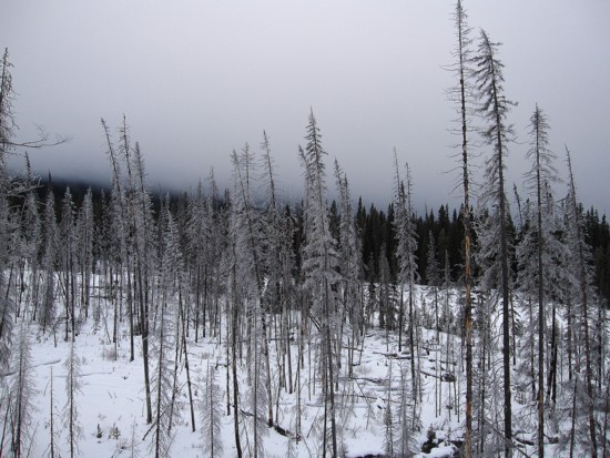
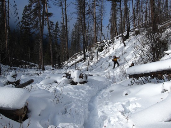
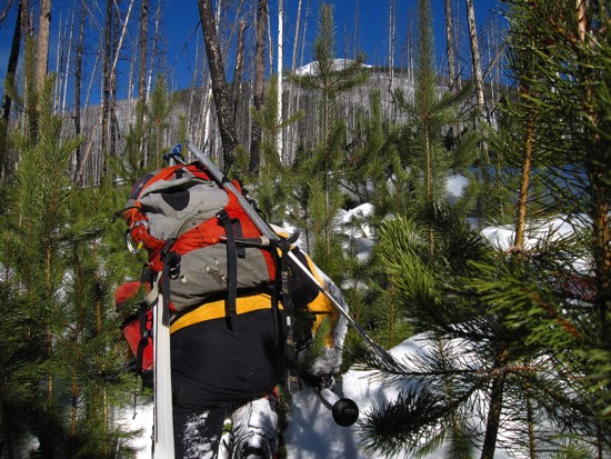
That
glimmer quickly turned into a black hole of complete and utter
hopelessness!
Negotiating the diabolical deadfall, covered in deep, unconsolidated
snow was
beyond futile. We tried every possible route and strategy to make any
kind of
progress towards the summit and each attempt was met with an
unqualified
“DENIED”!
About
1.5 hours after leaving the trail, I checked my GPS to see how much
actual
progress we had made. The good news was that we had made progress; the
bad news
– that progress amounted to 300 m of horizontal gain and about 100
vertical.
300 m in an hour and a half – the hair on my knuckles grows faster than
that!
A
rough calculation revealed that at our present rate we would reach the
summit at
9:30 am, the next day – a total ascent time of 26 hours – no thanks!!
We
stopped, had a little chuckle about our present situation, and then
mercifully turned
around.
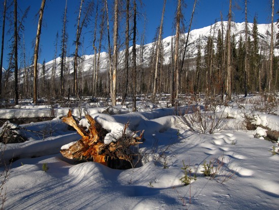
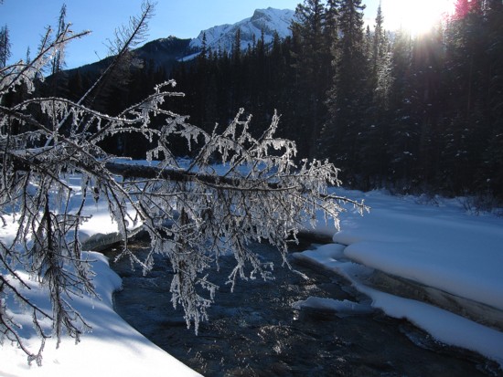
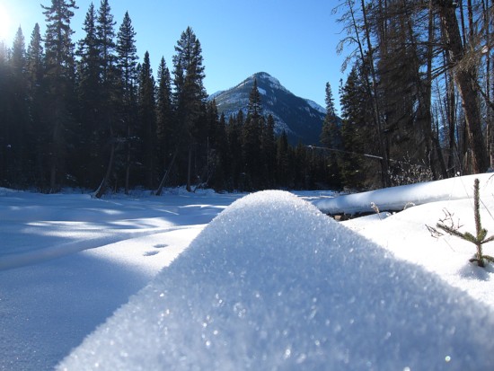
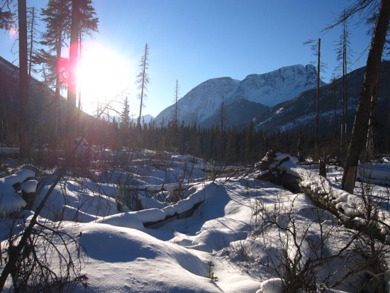
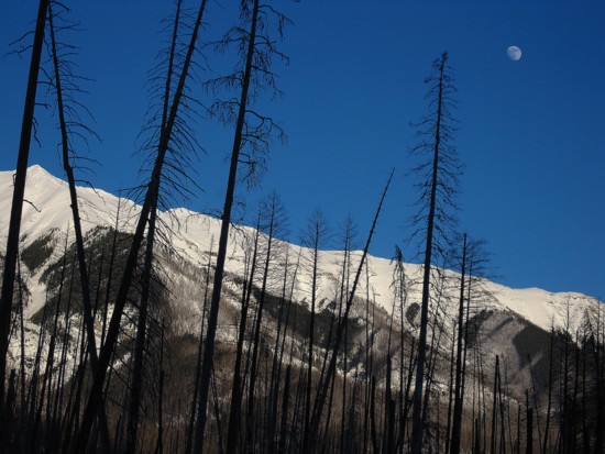
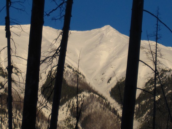
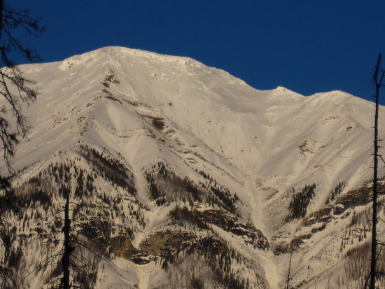
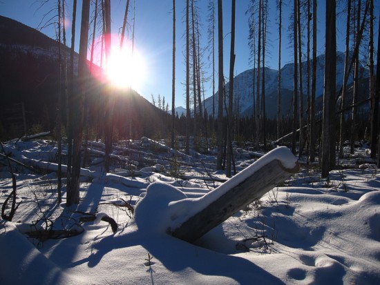
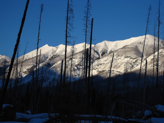
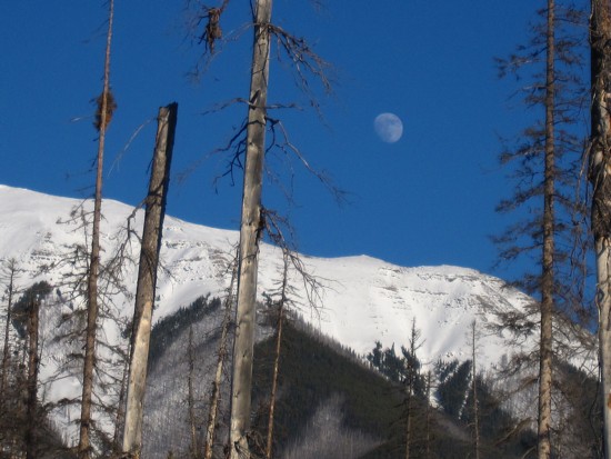
Due
to clear skies, the return trip was far more scenic than I thought it
would be and
made our defeat bitter a tad more palatable (but just a tad!).
On
many of my failures, I’ve experienced a strong urge to try again within
a day
or two of the trip. The same, unfortunately, cannot be said of Shanks –
certainly
a winter ascent is out of the question. Perhaps I’ll return to Shanks
in my
next life!