Syncline
Mountain III
– September 23, 2006
Mountain height:
2500 m
Elevation gain:
approx. 1500 m
Roundtrip time: 13:05
Scrambling with Mark.
More unfinished business here.
I had completed ascents of the true (?) summit and southern summit of
Just as we were preparing to leave the car, Bob and Dinah pulled up. Surprisingly, they were going to attempt the same peak. We agreed to go separately and perhaps hook up at the summit. Getting to the first summit, though easy, was wonderfully scenic – blue sky, fresh snow, and yellow larches provided unbeatable colour combinations - a far more enjoyable trip than my miserable ascent of December, 2005.
From the top, the traverse to the next summit didn’t look good. There was far more snow on the mountain than we anticipated and making it to the col between the 1st and 2nd summits required getting down some fairly steep terrain. We descended to a col and then up to the minor highpoint, with impressive drops on all sides. Returning to the col, we decided to rope up here. The snow made the terrain a little more dangerous and although there were only a couple of exposed steps, the security of the rope and a belay felt good.
We then traversed around the vertical cliffs of the highpoint we had just ascended, arriving at another col. Continuing along the ridge, we soon arrived at another precipitous drop and had to backtrack. This time we decided to look for a route around the south side of the mountain. With unexpected deteriorating weather conditions we plodded on starting to lose not only motivation, but a huge amount of elevation to get around cliff bands. Thankfully, the south side was stunning. Traversing under the colourful cliff bands was fantastic and arriving back at the ridge to see what was behind us, even more so.
A short slog later, and we
arrived at the south summit, which measured 40 vertical higher than the official
summit. The view from this summit was terrific, especially looking back to the
first summit and the route in between. Eloi, Haig, and
Now at the late hour of 4:30 pm, time was going to be an issue and we hoped we could make it to the final summit before 6 pm. We continued along the ridge for a short distance before coming to yet another drop-off. With snow-free conditions, it might have been possible to downclimb the left side of the ridge to easier terrain, however, the slopes were plastered and the snow was not stable. We, therefore set up a belay and Mark downclimbed to try to find a route. One did not appear and so we started traversing below the rockbands of the ridge back towards the south summit, hoping that a route would appear. Again, it didn’t and soon we were back near the second summit and at the top of the gully that I had used to gain the south summit on my trip with Linda to St. Eloi, earlier this year.
This was a small stroke of luck, as having done the route already, I knew we could get down to easier terrain. We did and then easily traversed back to the ridge and past most of the difficulties. The ridgewalk that followed was great, as the high pressure system we were expecting finally settled in, giving us clear skies and awesome scenery. Right before the summit several significant rockbands reared up. There was an easy route around all of them and at the late hour of the day, I was pretty much resigned to circumventing the bands. Mark wasn’t however, and decided to scramble up the steep and exposed terrain. This took us to another band, which again Mark scrambled up. I took the lead for the final rockband and shortly after, we arrived at the third, final, and sweetest summit of the day.
A GPS reading revealed that this summit was, in fact the highest of the three, at 2500 m. We took a few minutes to enjoy the summit panorama, but now at 7 pm, getting down fast was of the utmost importance. As planned we opted to try an alternate descent route, down to the valley in the middle of the three summits and then out via Suicide Creek. Initially, the route was great. We lost elevation quickly, on relatively easy terrain and then started along the valley bottom. With some daylight remaining, we were able to pick the least bushy line, but soon, the only light available was that from our headlamps, and staying near the creek was the only option. The bushwhacking here was terrible and seemed to go on forever. Of course, we could have been not more than 10 m from a good trail, but never realized it in the dark. Thankfully we did eventually find an ATV trail and followed it out to the road. A 13 hour day of incredible scenery, route-finding challenges, enjoyable scrambling, and terrific summit views – well worth a third visit to the mountain.
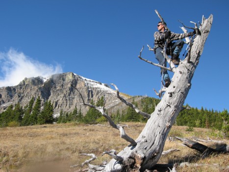
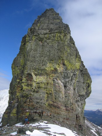
Having a little fun, low on the mountain; the 1st summit of Syncline to the left
Bob and Dinah also found this scene to be of interest
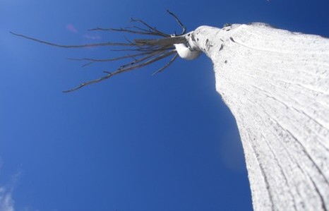
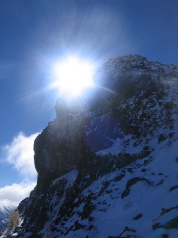
Looking skywards at a dead tree
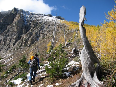
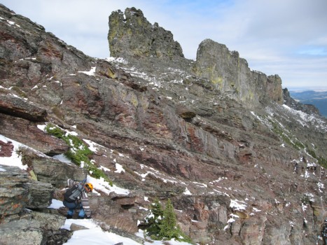
More beautiful colours half way up.
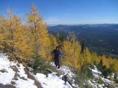
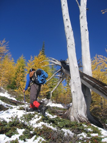
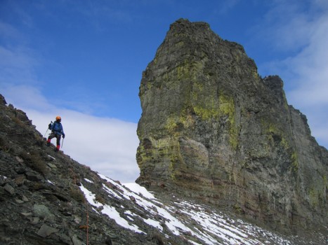
Mark hikes through the larches
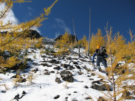
More colours
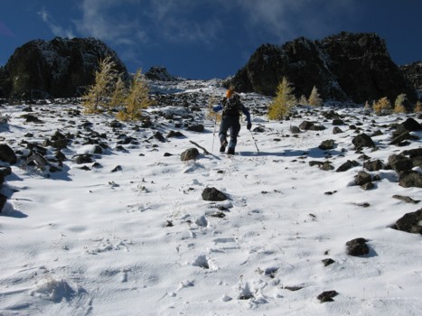
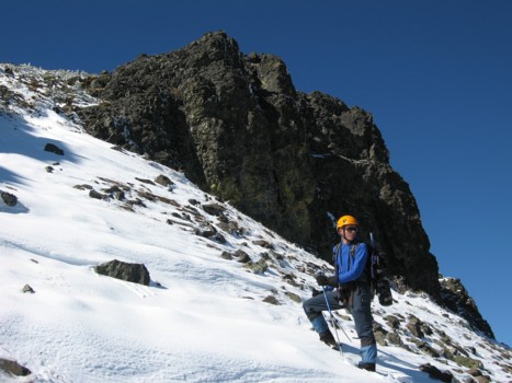
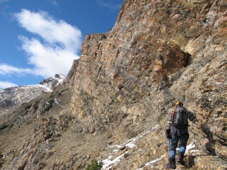
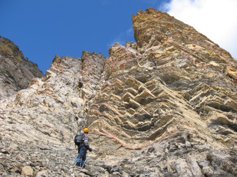
Nearing the weakness that allows easy access to the summit
A rockband before the summit
The other rockband
Mark hikes through the weakness
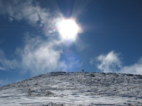
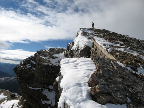
Nearing the summit
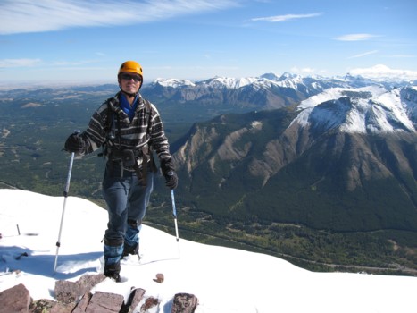
At the summit looking east
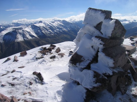
The summit cairn
Gravenstafel Ridge and Mount Haig
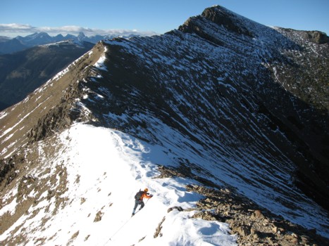
Starting the journey to the 2nd summit (right)
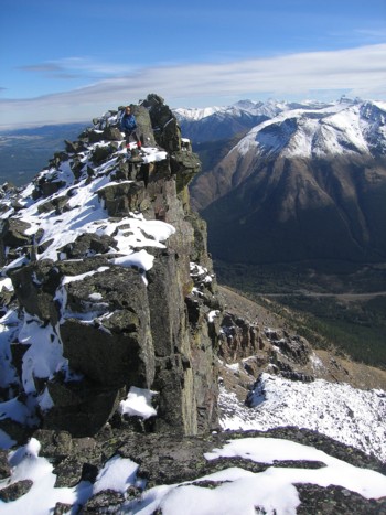
Mark above the vertical rock of the highpoint
Mark on the other side of the highpoint
Same as above
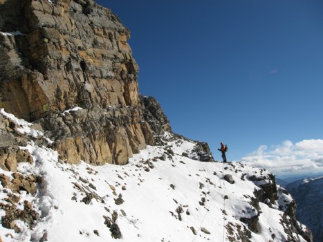
Losing elevation around the southeast side
Traversing below the cliff bands
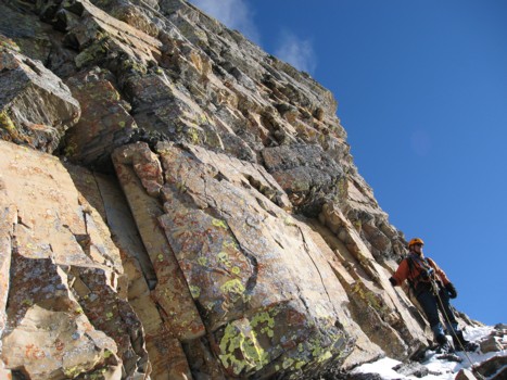
Checking out the magnificent rock and colours
Gaining the ridge again
Back on the ridge with the rockband we circumvented behind
Same as above
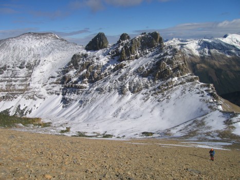
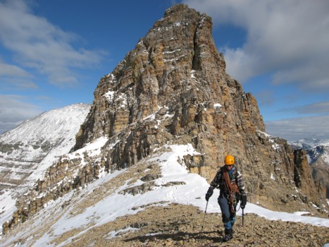
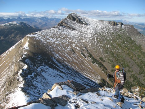
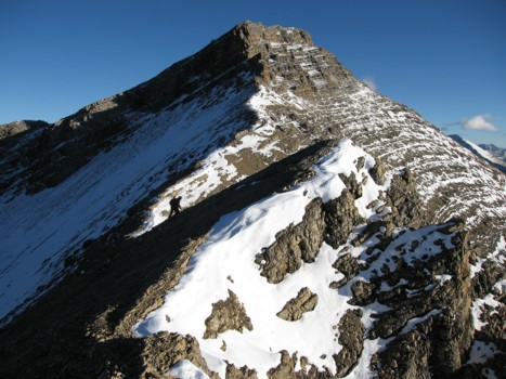
Mark slogs up to the 2nd summit, with the 1st behind
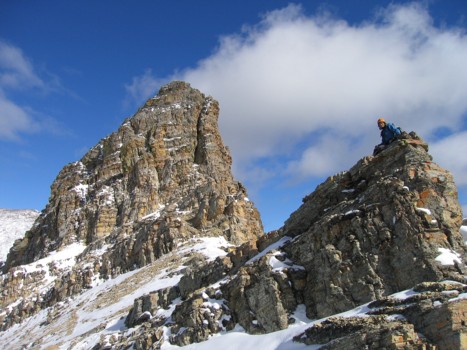
At the 2nd
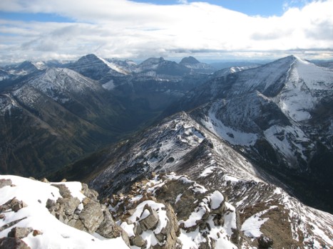
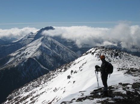
Looking north towards Eloi (right); Haig and Tombstone are also prominent
Looking back to the 1st
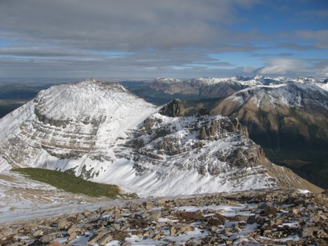
The 3rd and highest summit
Searching for a route below the cliff bands of the 2nd
Traversing back towards the 2nd
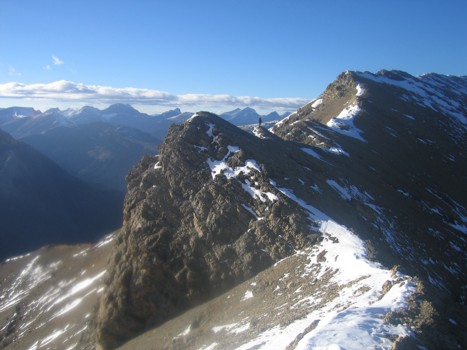
Traversing back towards the ridge and the 3rd
Regaining the ridge
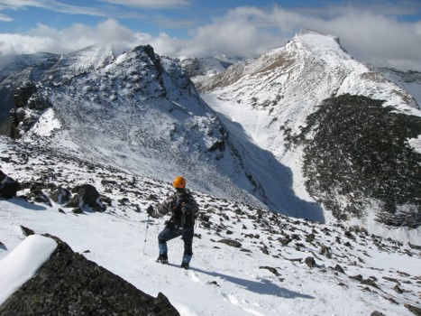
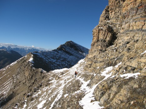
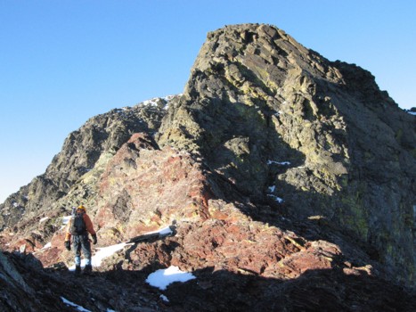
Hiking the connecting ridge, with the 2nd behind
Mark far ahead of the ridge
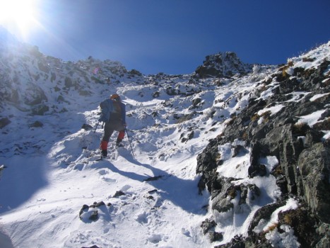
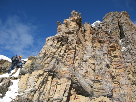
Approaching the rockbands before the 3rd
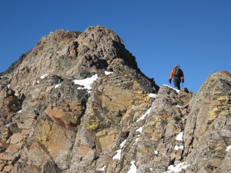
Above the first band and approaching the second
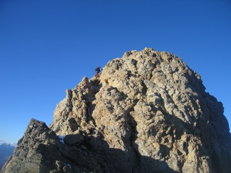
Mark scrambles up the second rockband
Approaching the third and final band
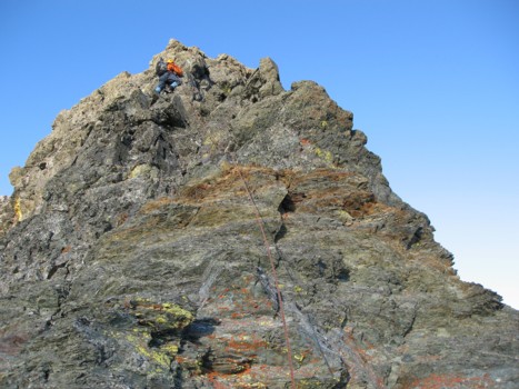
Scrambling up the band
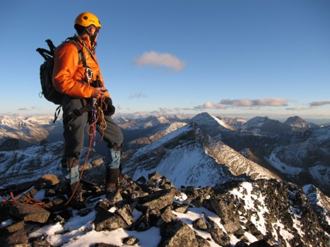
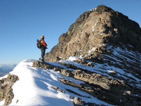
At the 3rd summit, looking north
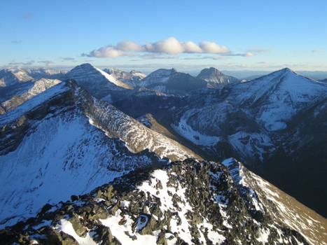
The same view without me