Mountain height: 2,209 m (7,245 ft)
Elevation gain: 880 m
Ascent time: 3:30
Descent time: 2:25
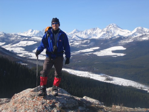
Scrambling with Mark,
We set out shortly after
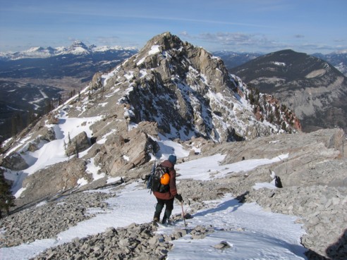
Mark and I quickly made our way up to the ridge, where we
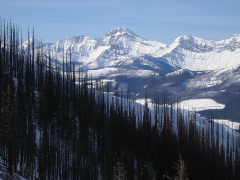
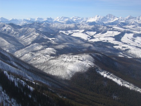
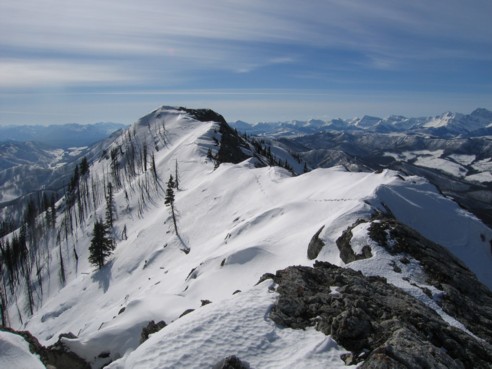
enjoyed terrific views of
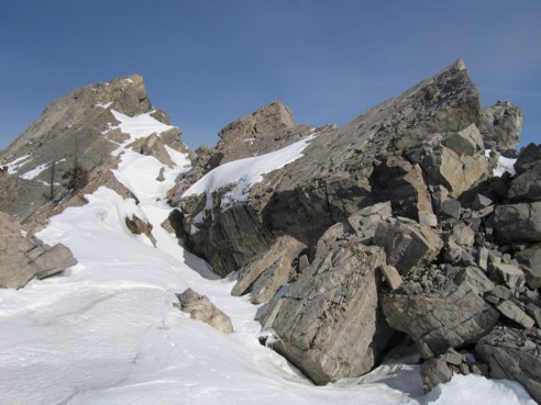
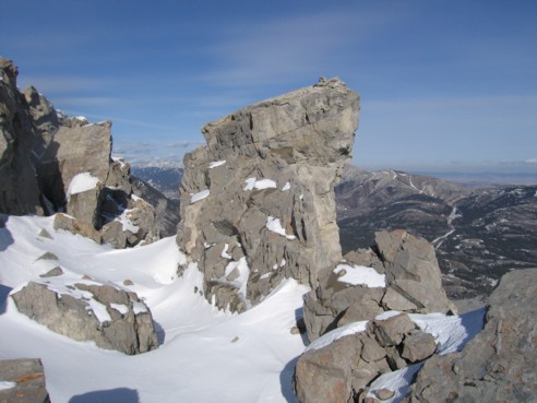
The really interesting scenery started when we reached the false summit. From that point, the long and wide notch between the false and true summit, revealed the absolutely enormous size of the section of rock that was no longer part of the mountain. A short descent and we were amongst some of the most astounding rock scenery we’ve ever seen: huge pinnacles, gaping fissures, large overhanging outcroppings – add a good dose of snow and you have some absolutely stunning scenery. Needless to say, however, the snow, often covering and hiding deep fissures in the rock, made the terrain quite treacherous. We were very careful to avoid stepping on snow-covered sections, as it was sometimes impossible to ascertain what was underneath. Some of the fissures were well over 10 metres deep and falling into one would have been most unpleasant! We spent quite a while exploring the fascinating features of the notch, although we were limited to certain sections – snow cover made others inaccessible. Certainly, we will return in the summer to explore more of the incredible terrain.
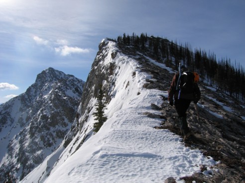
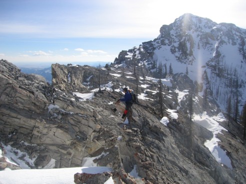
A short, easy scramble followed and brought us quickly to
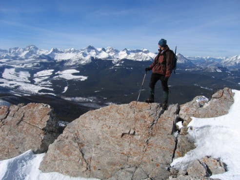
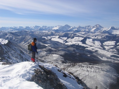
the summit and a splendid panorama. Again, the peaks and landscape to the south
and southeast really stole the show, although a very tall peak to the left of
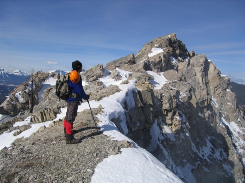
On the ridge, looking to the south
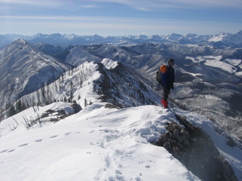
Almost at the false summit, with the summit block and ascent route to the left
Again, looking south at beautiful peaks
Mark at the false summit; true summit to the left
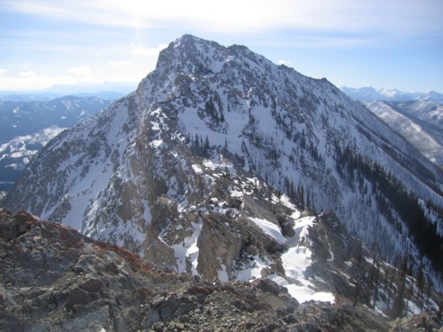
The notch, ascent route, and first summit
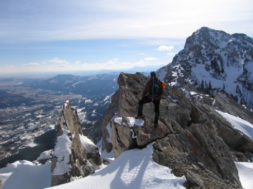
The cool rock scenery begins
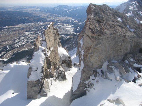
A huge flake of rock; you may recognize the outcrop at the right from a photo at the front of Alan Kane's book
Looking back at some of the debris and snow-filled fissures
Mark sits atop an outcrop of rock
Looking to the southwest; Sentry Mountain is small peak just right of me
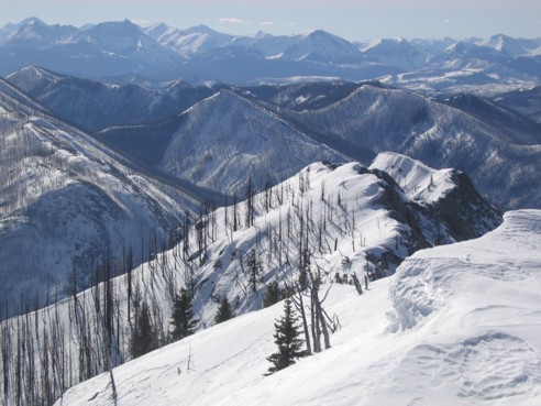
More great scenery on the upper ridge; Crowsnest Mountain is at the far left
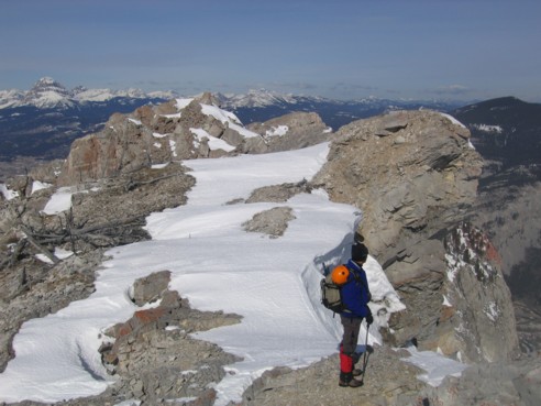
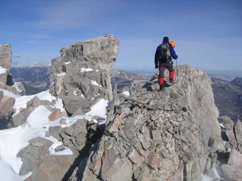
At the first summit, looking towards the second and slightly higher summit
Mark at the second summit
Same as above; the view in that direction was breath-taking
The south ridge; a potential alternate descent route
Heading back; the false summit in the middle, Crowsnest Mountain to the left
Nearing the false summit on return; imagine that before the slide, Mark would have probably been several hundred vertical metres higher at this point

A large fissure before the false summit
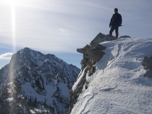
An overhanging rock formation with a cairn on top
The same as above