Unnamed
Peak attempt (between
Mountain height: 3,155
m (10,348 feet)
Roundtrip time: 11:00
Climbing with
Mark.
Looks like are
technical climbing aspirations are hanging by a very, very, thin thread right
now. I could never see myself leading a 5.8 climb, nor ever being a skilled rock
climber, but I imagined that easy 5th class would by within my
grasp…apparently I was wrong about even that, as yet another failure on a
grade II, 5.4 route now testifies. Nevertheless, the
This was our
first time on the Plain of Six Glaciers trail and it’s certainly a worthwhile
trip on a clear day. As luck would have it, we got a clear day …that is a
cloud free day, however, clouds were replaced by thick smoke from forest fires
in B.C., completely obscuring much of the view. Looks like we might be in for a
repeat of last year’s “smoke-fest”!
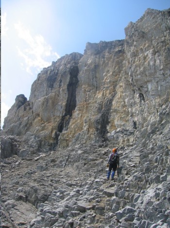
After an easy
5.5 km hike to the teahouse, we started up a somewhat labourious talus slope in
between the
The main part
of the ascent started with a couple of rockbands that were in fact quite
avoidable by going around them to the left (which we did on descent). Once past
the glacier we started scrambling up the
Eventually, we
came to the first major rockband and here’s where as progress would end. We
searched ever single nook and cranny of that rock face, looking for the easiest
way up, but each time we started an ascent, it became quite apparent that it was
more than 5.4 climbing (or maybe just more than our technical abilities
warrant), and we ended up backing down. In total, we spent over 5 hours at that
one place, traversing back and forth below the face, looking for a weakness.
Once again, we came to the point where we had no choice but to retreat and
started down in disappointment. The smoke had begun to clear by then and at
least we got to enjoy some of the phenomenal scenery around us.
This failure
was not as disappointing as Pinnacle, last week (mainly because of the great
scenery) and we still had a great day regardless.
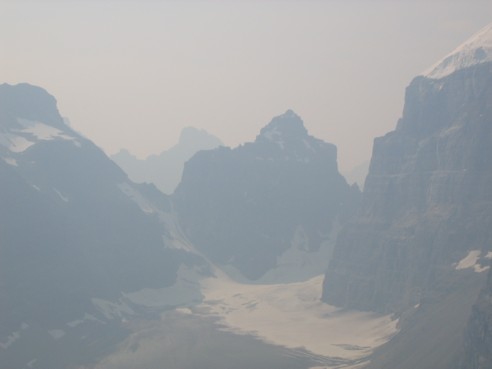
A very hazy (smokey) view of Mounts Lefroy (centre) and Victoria (right), as seen from the Plain of Six Glaciers trail
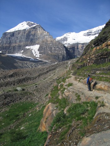
Heading up the gully just beyond the teahouse; the Unnamed Peak is at the left
Another hazy view of The Mitre
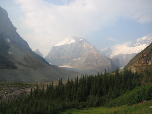
Unnamed Peak, it's small glacier, and a great deal of water spewing from it
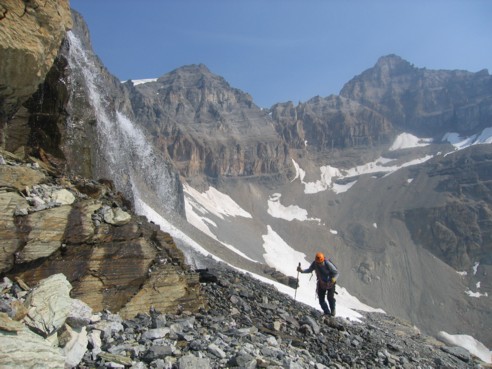
Mark, heading passed the glacial waterfalls; the peak at the right is Mount Whyte
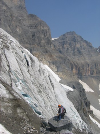
Mark, alongside the glacier
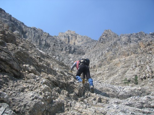
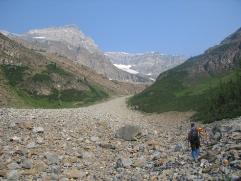
Mark, leading the way up the ascent gully
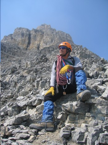
Mark, taking a well-deserved rest; the first rockband is behind
Trying to find a way around or up the rockband
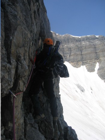
The same as above; from a distance, the terrain didn't look too steep, but up close, it was often vertical
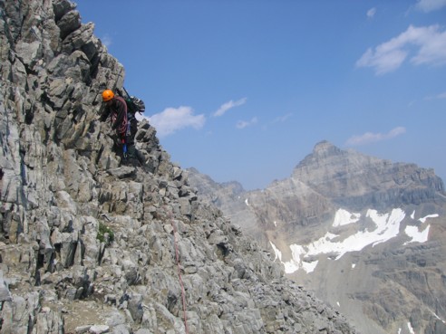
More searching...
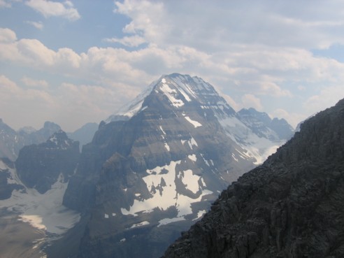
Mount Lefroy
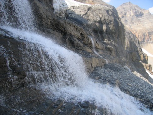
Water gushing from the glacier
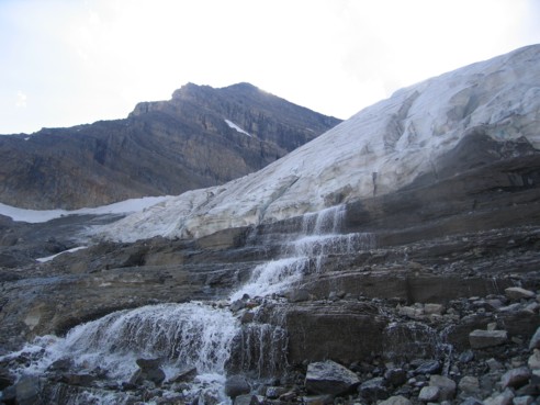
Looking back at the glacier, the waterfalls, and the mountain