Victoria
Mountain height: 2,587
m (8,484 ft)
Elevation gain:
approx. 1,100 m
Ascent time:
4:15
Descent time:
Scrambling with Linda Breton.
After seeing a posting on the RM Webboard by Rod Plasman,
regarding this peak, adventurous Linda suggested we attempt to summit. Having
recently completed a string of the Kane scrambles, I was quite happy to go on a
trip I knew nothing about, without any specific route information.
Finding the trip's starting point proved to be the crux. Fortunately, after
driving up and down the 505 (west) a couple of times, Linda was able to navigate
to a point that seemed a likely starting point (had we walked 1 minute further
down the road, we would have came to a huge sign and map that would have
confirmed this!). We quickly discovered that the approach trail (road) was
very well-suited for mountain bikes and would definitely take one for future
trips. Although the approach was only about 3.5 km and very easy, the bike would
have saved a little time and would have been great for a long, coasting ride
back to the car.
Upon finding the correct ascent gully, we decided to ascend to the left of the
gully along a relatively easy and barren ridge, as opposed to staying in the
gully, where it appeared there might be a fair amount of bushwhacking. This
turned out to be a great route, with tons of great scenery along the way.
Especially interesting was the "tree graveyard" slope (obviously,
where only the leafless remains of hundreds of dead trees remained). Up higher
the ridge narrowed and several times, the route looked to be blocked by
rockbands and downclimbs. Fortunately, such was not the case, and we were able
to easily negotiate our way through the bands and up to the final ascent slope.
Again, the scenery was fantastic, highlighted by the stunning yellows of
changing larches against the blue sky.
The final push to the summit, again seemed to be blocked by several steep
rockbands and we considered a traverse far to the left to approach the summit
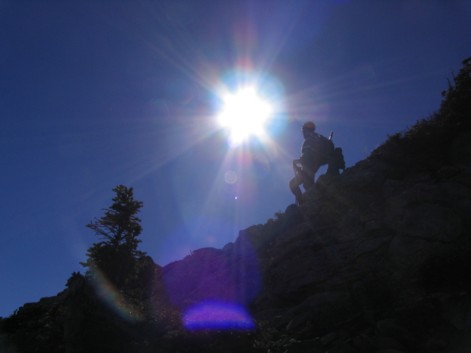
from the west. Attacking the bands head-on, however, was certainly worth a try
and we were quite happy to find a relatively easy way up, enjoying some loose
but interesting moderate scrambling. Bands of red and green argillite, yellow
lichen, and fascinating rock formations kept the cameras out of their cases.
Linda was very much under the weather for most of the ascent, but persevered
through the hot and windy conditions and we both summitted, after just over 4
hours of very enjoyable hiking and scrambling. The summit panorama was
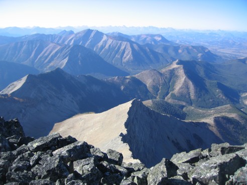
exponentially better than I was expecting: the red hills of Prairie Bluffs to the
east, scenic and shapely Pincher Ridge and numerous peaks of the Waterton area
scrambles (Alderson, Carthew, Bertha, to name a few) to the southeast, 10,000
foot+ Mount Cleveland and other snow-covered peaks in the U.S. also to the
southeast, a sea of interesting peaks to the west (especially the striking form
of Castle Peak, that Linda quaintly named "Rabbit Ears"!), and the
Crowsnest region to the northwest, including good views of isolated
Crowsnest Mountain and Allison Peak.
Our descent was very easy, as I spotted an easy route that bypassed all the
rockbands, on the northeast side of the ascent slope. After that, some decent
sections of scree surfing took us quickly down into the initial gully. We
attempted to stay in the gully, but eventually ran into some fairly heavy and
annoying bushwhacking and decided to cut to the right, up a treed slope and back
onto our ascent route. The remainder of the return trip was very easy and
stress-free. As we drove back to Highway 6, we were rewarded one last for the
day, with some terrific views of the full moon and great blues and pinks in the
sky, as the sun set. Overall, a truly fantastic day: perfect weather, stunning
scenery and colours, interesting scrambling, the challenge of finding your own
route, and great company - a highly
recommended trip!
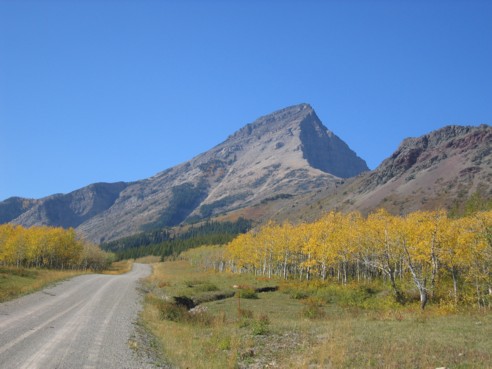
Victoria Peak, as seen from near the beginning of the trail
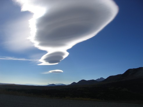
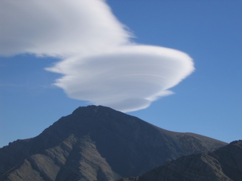
This very interesting looking cloud, with the sun behind it, kept us entertained for quite awhile
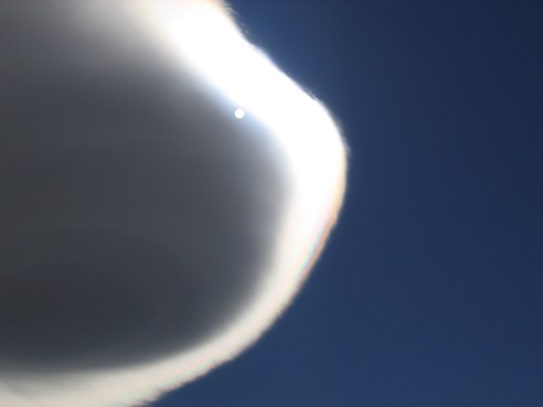
The same cloud, with the sun emerging from behind
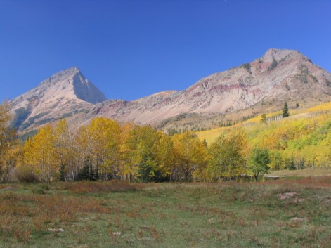
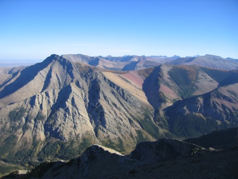
A colourful photo of Victoria Peak (left) and Prairie Bluff (right) (photo by Linda)
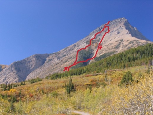
Our ascent and descent routes
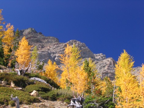
More fantastic colours, as the larches change; the summit can be seen to the left (photo by Linda)
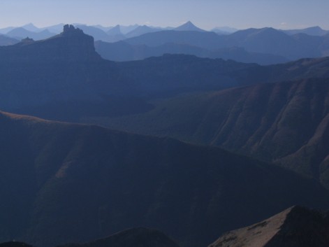
Several hours later, the same swirling cloud over Pincher Ridge
A great photo taken by Linda
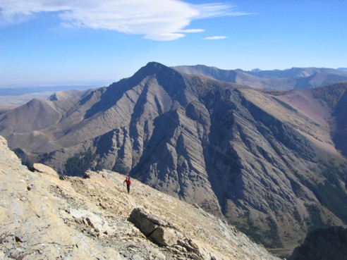
Linda, coming up the ridge, with Pincher Ridge behind
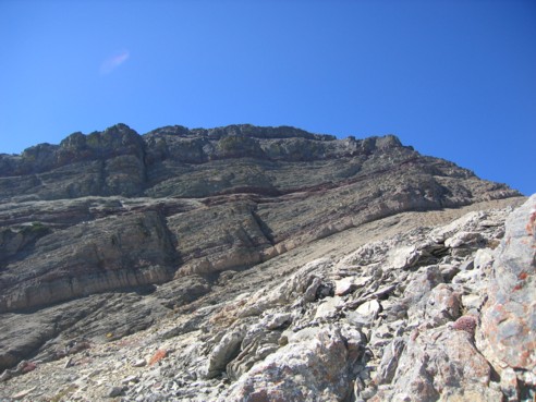
The upper slopes and rockbands; the route we took went straight up, just right of centre; an easier route lies to the right
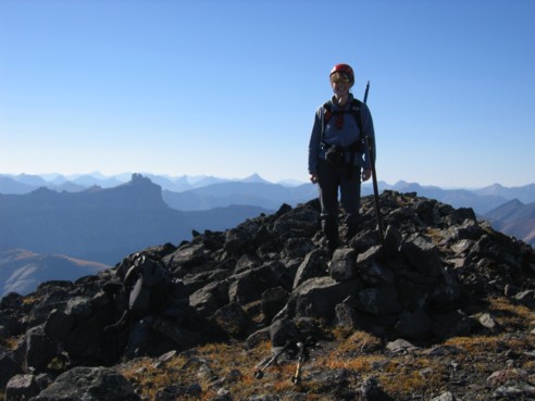
Linda at the summit
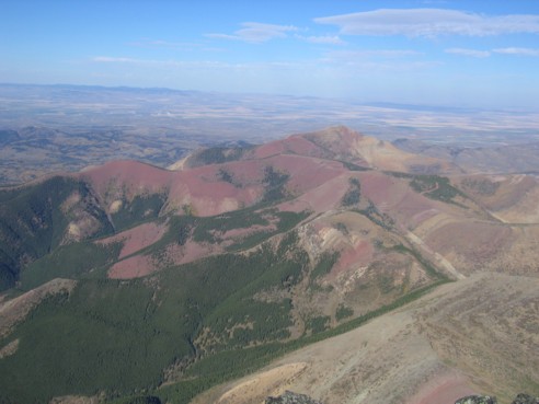
More colourful scenery to the east
The summit view to the northwest
A sea of mountains to the west; the striking peak at the left is Castle Peak (photo by Linda)
The view to the south
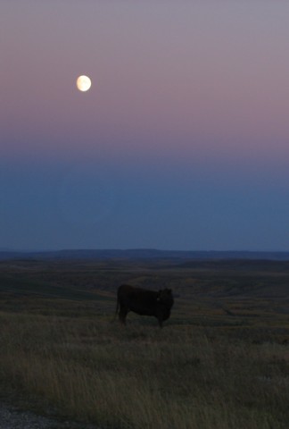
The Cow that didn't jump over the Moon