Victoria
Ridge
– May 21,
2006
Mountain height: approx.
2,300 m (7,544 ft)
Elevation gain: approx. 850 m
Roundtrip time:
8:50
Scrambling with Linda.
This could very well be the best ridgewalk I’ve ever done
(and I’m sure Linda would agree): astounding colours and breath-taking scenery
throughout, that were second to none.
The day got off to a decidedly bizarre and frustrating
start. We left
Calgary
at 7 am and drove into the West
Castle
area, with the intention of trying Southfork
Mountain. It seemed the only obstacle was fording the West
Castle
River, about 5 minutes into the trip. Unfortunately, the river may have been
swimmable, but it was far from fordable. We retreated immediately and decide to
try Cloudy Ridge via its east ridge. Again, we started along a trail but soon turned around as an easier route
became clear. That route was blocked by a gate and a “No Trespassing” sign
and so again, we abandoned the attempt.
Our last options were Prairie Bluffs or Whistler
Mountain. When we arrived at the Prairie Bluffs trailhead, however, a sign outlined a
route up Victoria
Ridge. Given that the trip was only 12 km roundtrip, with a mere 550 m of elevation
gain, we opted to cut our losses and give it a go. We finally got under way at
the depressingly late start time of 1:45 pm, almost 7 hours after leaving Calgary.
In truth, my expectations for the trip were not very high,
having ascended much higher peaks in the surroundings area -
Victoria
Peak, Drywood Mountain
and Pincher Ridge (almost!). I should know better than to underestimate any
trip in the beautiful Castle area.
After 5 km of easy and pleasant hiking, highlighted by
great views of Pincher Ridge to our left and Victoria
Peak
to our right, the well-worn trail curved right and we started to gain
elevation. Higher up, deep snow covered the trail and it became difficult to
follow. We lost it (and our bearings) a couple of times, but with some searching
and a bit of good luck, found the trail, as it crossed underneath the steep
walls of a very prominent outlier of Victoria Peak. When the trail disappeared
under a thick blanket of snow, out came the ice axes. The slope was somewhat
steep here, and a slip would have resulted in a rather long involuntary
glissade. Linda was particularly excited to try out her new lightweight, Black
Diamond axe. The snow slope was easily traversed, getting us back onto the
pleasant, snow-free trail.
At this point, we both became a little confused to where Victoria
Ridge
was actually located. We had far surpassed the 6 km mark (one way distance) and
the end of the trail or a highpoint was nowhere in sight. We continued on the
trail for a while, but soon, it seemed prudent to turn right and gain the ridge
above us, via a steep slope. Again, the axes were needed, though the slope was
quite short. This was a good decision – the view that awaited us atop the
ridge was spectacular: a mind-boggling array of colours on shapely Pincher
Ridge, the most striking forms of Windsor Mountain and Castle Peak, Victoria
Ridge extending in graceful lines to the south and sharp, jagged ones to the
north, and a host of other long, colourful ridges and beautiful peaks. We took a
long break, enjoying the phenomenal panorama.
It now became clear that although we were on Victoria
Ridge, the trail led to a low pass, a little further south. A very prominent peak
stood above the pass and seemed like a worthwhile objective, however, it was
quite far away and the ridge to the north, towards Victoria
Peak, looked equally inviting (and much shorter!).
This ridgewalk was by far the highlight of the day. The
colourful views of Pincher Ridge continued to mesmerize us and the almost
alarming variety on rock Victoria
Ridge itself was unbelievable. Of course, lingering snow patches and beautifully
clear skies added further to the astounding scenery. We reached the first
highpoint, where yet another amazing view was revealed - this time, it was the
west side of Victoria
Peak, that, like Pincher Ridge, boasted graceful contours and vibrant colours. The
jagged intervening ridge between the highpoint and the Peak was also
breathtaking - a precipitous drop on the right side contrasted beautifully with
the gentle and colourful slopes of the left. Traversing this ridge was one
incredible scene after another. It was one of the most gratifying ridgewalks
I’d ever experienced.
Unfortunately, it had to end, because that was what the day
was doing. We started the descent at 8 pm, expecting to complete the trip in the
dark. Thankfully, we were able to find a fast and easy escape off the mountain
and made good time on the easy trail (complete with old grizzly diggings), back
to the car. We finished the day at 10:35 pm. A thoroughly outstanding trip that
we will both not soon forget.
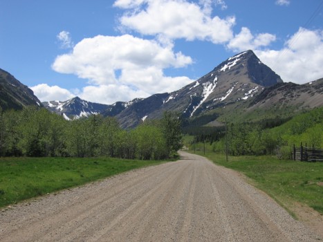
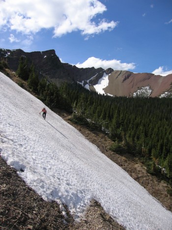
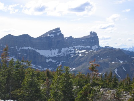
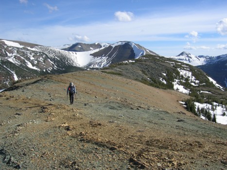
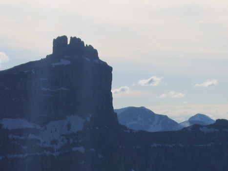
At the start of the hike; Victoria
Peak on the right; one of the main highpoints of Victoria
Ridge in the distant left
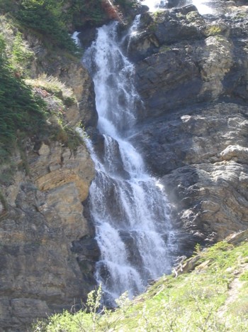
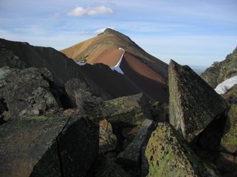
A waterfall coming off Victoria
Peak
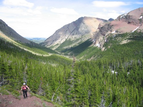
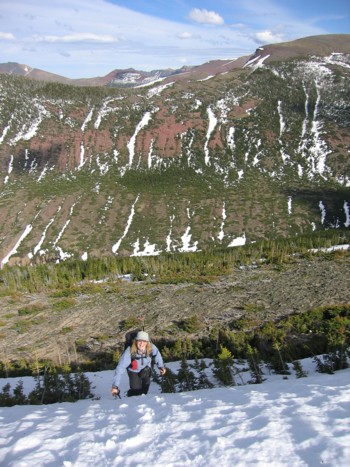
Linda comes up the trail; a
portion of Pincher Ridge on the right
Colourful Pincher
Ridge
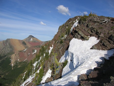
Linda traverses the first snow
slope
Same as above; the angle of the
trees on the slope indicates what kind of slope it is! Victoria
Peak behind
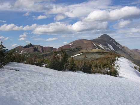
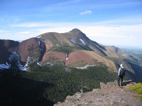
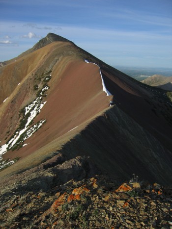
On Victoria
Ridge, with Victoria Peak
to the north
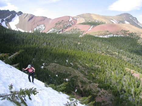
Linda ascends the second snow
slope
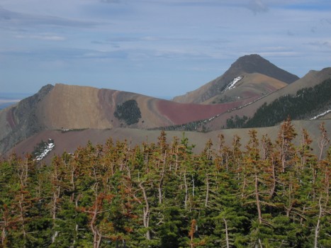
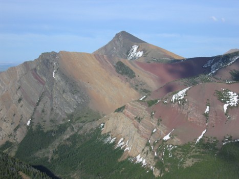
Windsor
Mountain (left) and Castle
Peak
Looking over to Pincher
Ridge
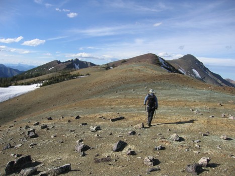
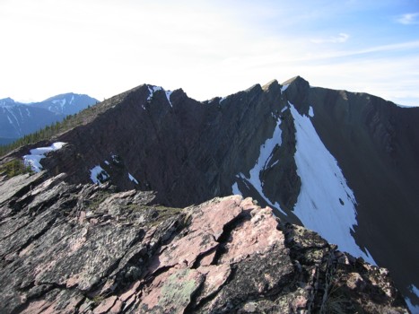
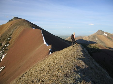
Heading north on the ridge
Pincher
Ridge again
Looking south
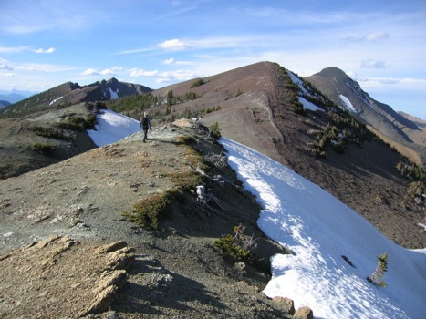
More of the north section of Victoria
Ridge
Lingering snow on the ridge
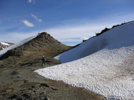
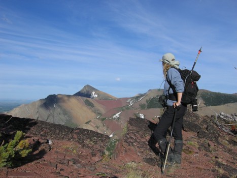
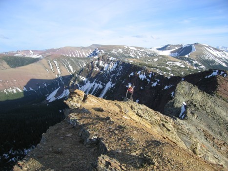
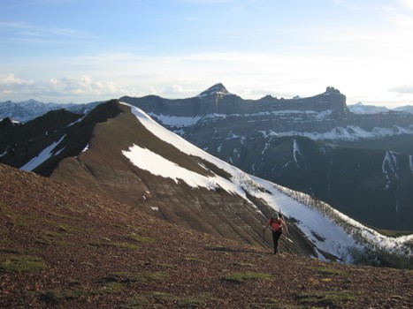
At the first of several
highpoints on the ridge
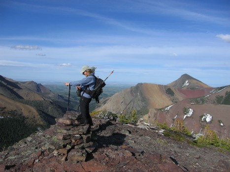
Linda points out where we are
going
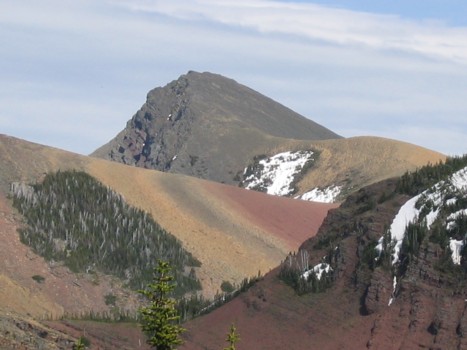
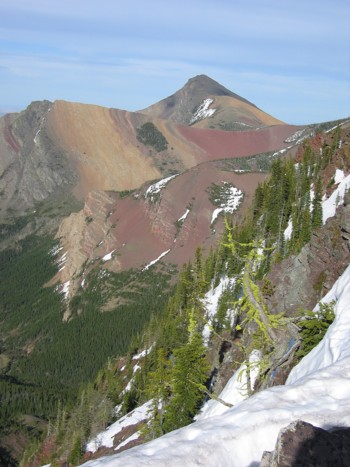
Victoria
Peak from the first highpoint
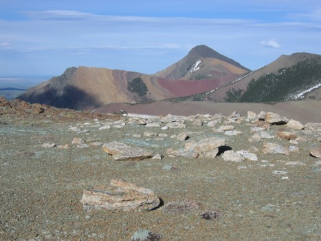
Pincher
Ridge, yet again....
.......and again.....
......and again.....
....and again!
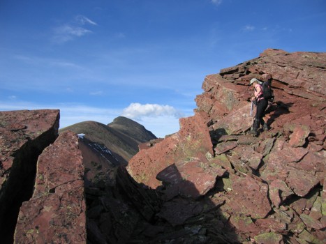
Linda checks out Pincher
Ridge
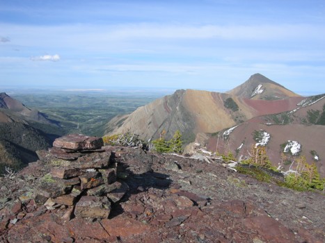
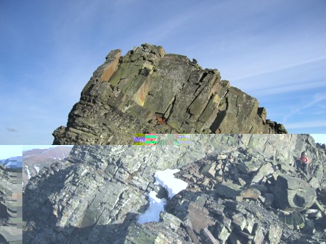
Part of the ridge
Castle Peak
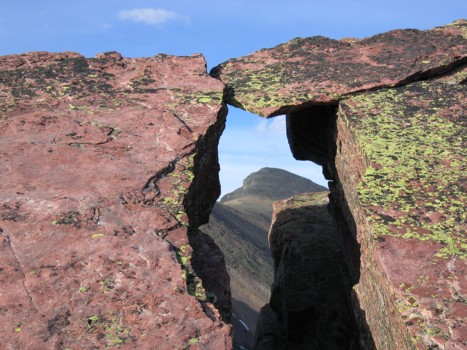
Looking through a small fissure
at Victoria Peak
Linda descends colourful
terrain into a small fissure
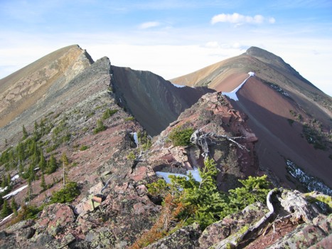
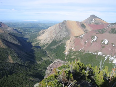
More of the ridge and Victoria
Peak in the distance
Victoria
Peak and more interesting rock
Linda circumvents a steep
rockband on the ridge
Linda ascends a short slightly
exposed section of the ridge
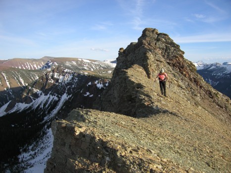
More ridge
On descent, looking at Victoria
Peak
Same as above
On the way home
Click HERE
to see Linda's report
LOG