Elevation gain from
Traverse time to Mount
Descent time from Cordonnier to car:
Roundtrip distance:
approx. 32
km
Scrambling and a little mountaineering with Mark.
If you are considering doing Warrior Mountain and Mount Cordonnier as a day trip from the Upper Kananaskis Lake parking lot, leave very early, take a headlamp, lots of food, water, and sunscreen, and then reconsider the whole idea and do an easier trip, because this one is guaranteed to kick the livin’ #@$% out of you! Having said that, this was a simply outstanding trip in a superb environment, with unbelievable views and perfect weather and I’d do it again in a second.
We abandoned our plans to attempt
either
Enjoying the terrific scenery of
Ascending Warrior was very enjoyable and easy. Although probably unnecessary, we decided to rope-up for the short glacier crossing. I wouldn’t want to be the first guy to discover a crevasse on the glacier by falling into it unroped (talk about avoidable accidents!). Unfortunately, I would later find out, while rereading Kane’s description, that we actually roped-up when we were almost all the way across the glacier – so much for avoiding the potential accident. Crampons were also quite useful on the hardened snow.
Once on the Warrior ridge, the hike to the summit was relatively short and highlighted by increasingly amazing views of Joffre and the Mangin Glacier. The best view of the trip, however, waited for us right at the summit. We were not at all prepared for the thoroughly breath-taking view of mighty King George and the Royal Group to the northwest, Waka Nambe right below us, Assiniboine further north, and “scary” Mount Northover immediately north, just to mention a few. The stunning scenery in every direction prompted about five straight minutes of gasps and “holy $%@”s!
The ascent of Warrior may have been
easy, but the traverse over to
Travel, up and along the ridge, was slow due to the snowy conditions and by this time, we were beginning to tire. The hot sun reflecting off the snow onto our sunscreenless faces further exacerbated the situation and I, for one, felt the strains of exhaustion creeping up on me. Nevertheless, we were so close and the phenomenal view of Joffre kept the feet moving. Two hours after leaving Warrior, we stumbled onto Cordonnier’s summit for yet another fantastic view.
Descending the ridge was far easier than the ascent, as we simply followed our footsteps in the snow. Kane’s alternate descent route offered an easy and fast escape off the ridge and down to the moraines. Unfortunately, I began to “bonk” at this point (severe headache, nausea, and exhaustion), and the remainder of the return to the car was sheer misery for me, and extremely exhausting for Mark. We made it back to the parking lot at 9:15 pm to find a couple who were completely lost after hiking along the lake from the north parking lot - good timing, as getting back to their car in the pitch black night would have been next to impossible - they were very grateful to receive a ride.
This trip goes immediately to the “Favourites” section – unbeatable scenery, unbeatable views, great weather – this is truly what the mountains are all about!
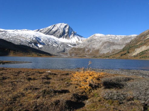
Aster Lake, backdropped by shapely Warrior Mountain
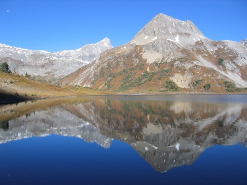
An unnamed peak reflected in the waters of Aster Lake; the peak to the left is Mount Northover and the faint, white dot in the left corner is the moon
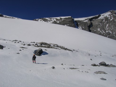
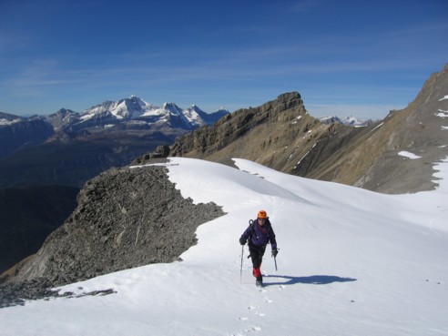
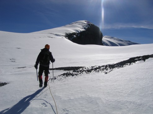
Mark, looking up at the glacier and the ridge of Warrior Mountain
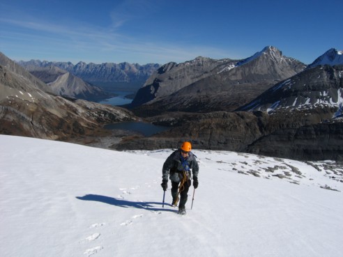
On the glacier, heading towards Warrior Mountain's ridge; behind are Aster Lake, the Upper and Lower Kananaskis Lakes, with the mountains of the Opal Range far in the distance; Mount Sarrail is the peak second from the right
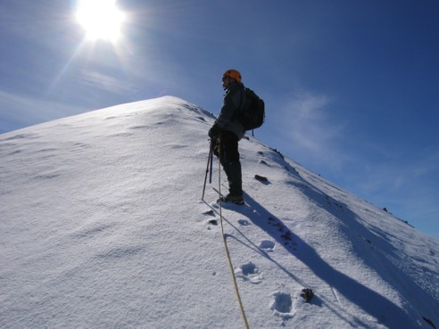
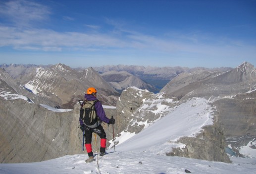
Mark, on the ridge
The magnificent view of Mount Joffre to the south
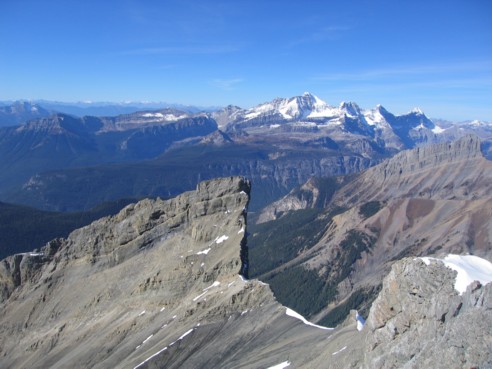
Mark coming up the final few metres of Warrior; Mount Cordonnier and the connecting ridge are to the right
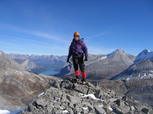
At the summit, with Mount King George to the left
Waka Nambe (front left) and King George and the Royal Group
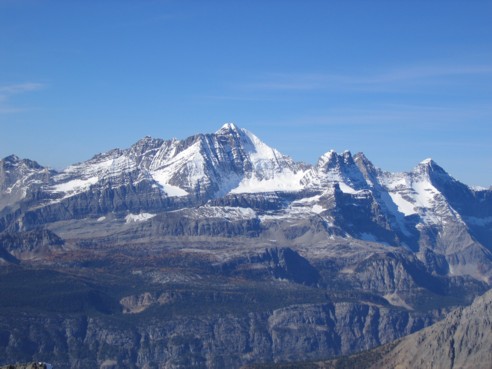
A closer look at beautiful Mount King George (3,422 m)
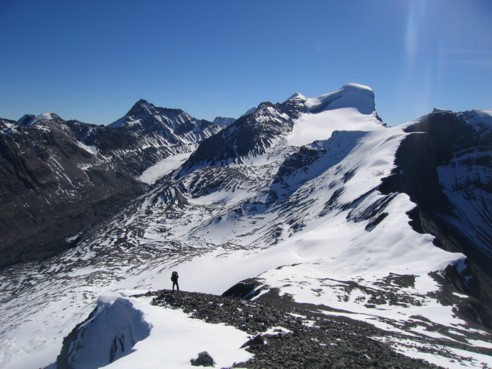
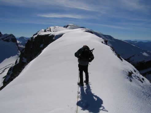
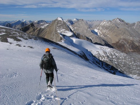
Mark on the ridge heading towards Cordonnier
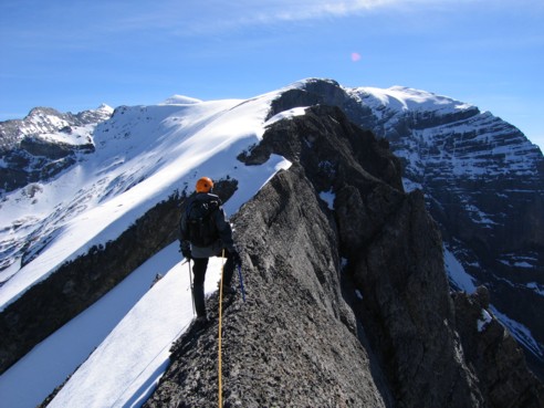
The ridge narrows; just ahead was a short knife-edge section; the drop-off down the west side was heart-stopping! The summit can be seen to the right, in the distance.
More of the snow covered-ridge; again, the summit in far in the distance
Taking a much needed rest, with the hot sun beating down on us
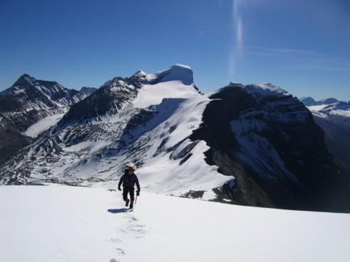
The final long, stretch of the ridge, with the summit in the centre

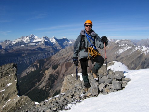
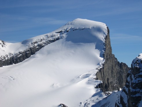
Mark at Cordonnier's summit; with Mount Joffre behind; the peak to the right is Mount Mangin
A closer look at the upper slopes and summit of breath-taking Joffre
Mark, surveying the area before the long trip back
Heading home, down the alternate descent route; Warrior Mountain is just left of centre, with Mount Northover to Warrior's right; Assiniboine can be seen faintly at the left