Watermelon Peak
August 7, 2019
Mountain height: 3094 m
Elevation gain: approximately 1680 m
Ascent time: 7:10
Descent time: 5:45
Scrambling (mountaineering) with Raff.
One
of the best (but most exhausting) day trips I’ve ever done – period!
I
was super excited when Raff suggested we try Watermelon Peak together, as this
trip had been near the top of my “to do” list and I was planning on just going solo.
Excellent reports from Josée and Fabrice, and Vern provided plenty of
motivation and the suggested route up.
A
quick email exchange with Vern prompted us to start the trip from the Helen
Lake trailhead, as opposed to the shorter route from the Dolomite Peak
trailhead. We were certainly happy to be on a well-trodden trail to start the
long day.
I
had forgotten how amazing the Helen Lake hike is in itself, having not visited
the area in summer since 2002. It’s simply a beautiful hike, with stunning
mountain scenery once you are above treeline.
The
next part of the trip would be new for me and I simply can’t rave enough about it.
Too many highlights to outline in full sentences so here’s my lazy point form
summary:
·
The
fascinating rock folding and colours of Cirque Peak’s southeast face
·
Katherine
Lake below awesome Dolomite Peak
·
Various
colourful tarns and some pretty sweet reflections
·
Wonderful
Dolomite Creek and the stunning view back to Dolomite Peak and OXO Peak
·
Ascending
alongside an amazing watercourse from Dolomite Creek to Lake Alice
·
Lake
Alice - unreal!!!!
We
took a break at Lake Alice. The trip up to that point had exceeded my
expectations a hundredfold and in retrospect was my favourite part of the day.
I could have easily just explored the area around Alice Lake, called it a day,
and went home – the scenery was that good!
 Nevertheless,
Watermelon Peak was at hand and so up we went. We ended up taking a slightly
different route than Josée and Vern, trying to avoid any glacier travel and the
need for crampons. This turned out well, although I can’t say for sure that we
were never on the glacier. We did manage to keep the crampons in our backpacks.
Nevertheless,
Watermelon Peak was at hand and so up we went. We ended up taking a slightly
different route than Josée and Vern, trying to avoid any glacier travel and the
need for crampons. This turned out well, although I can’t say for sure that we
were never on the glacier. We did manage to keep the crampons in our backpacks.
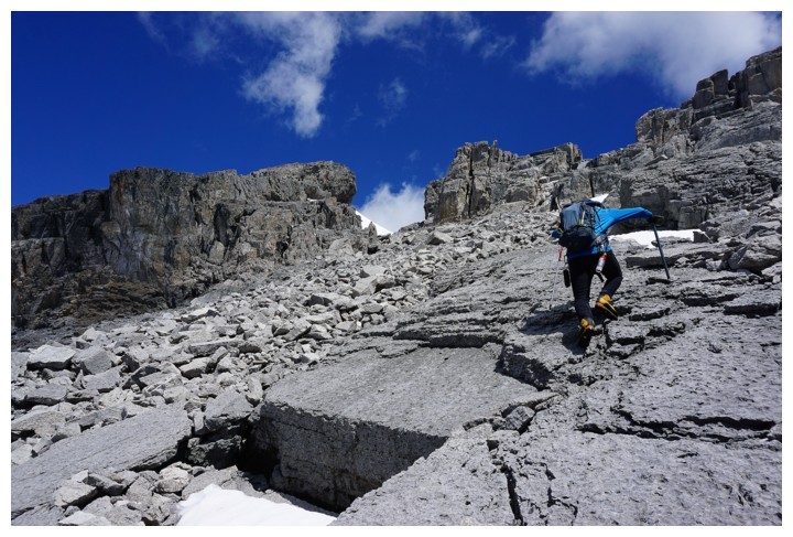
The
upper section was quite tedious, on steep, unstable rubble and boulders, but
once above that, an easy ridgewalk led to the summit. Much like nearby OXO, the summit view was insanely good, a combination of the impressive
glaciated peaks of the Wapta and Waputik icefields to the west and a sea of
colourful unnamed peaks and tarns to the east. Surprisingly, I always seem to
enjoy the non-glaciated stuff a wee bit more. We took a long summit break to
take it all in.
Admittedly,
I was not looking forward to the descent. My feet were already aching from the
long trip up and there was a decent amount of elevation to be regained en route
back to Helen Lake. The elevation gain was not that bad at all, but hiking the
final 6 km (of a 34 km day) seemed to go on forever, my feet complaining in
egregious ways the entire way - next time I will wear approach shoes for the approach!
Besides the very tiring return trip, one of my
favourite days yet in the mountains and hopefully not an isolated visit to the
Lake Alice area.
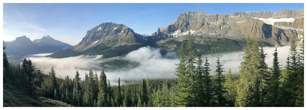
Clouds dissipating in the valley in the early morning. Andromache,
Little Hector, Mount Hector, Bow Peak, and Crowfoot Mountain are all
visible.
The Helen Creek valley is simply superb
Almost at Helen Lake. Cirque Peak in the background.
Helen Lake and Cirque Peak
Hiking by Helen Lake with one of the highpoints of Crystal Ridge (III) behind (photo by Raff)
Couldn't get enough of the lake and Cirque
...or the lake and Crystal Ridge (IV)
Yes, there is a Crystal Ridge II!
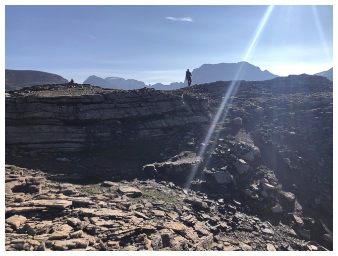
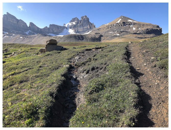
Raff gains the ridge above Helen Lake
Looking back to the lake and Crystal I. I must REALLY like that ridge!
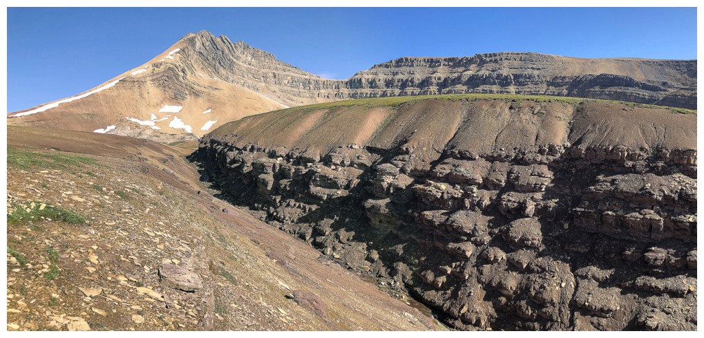
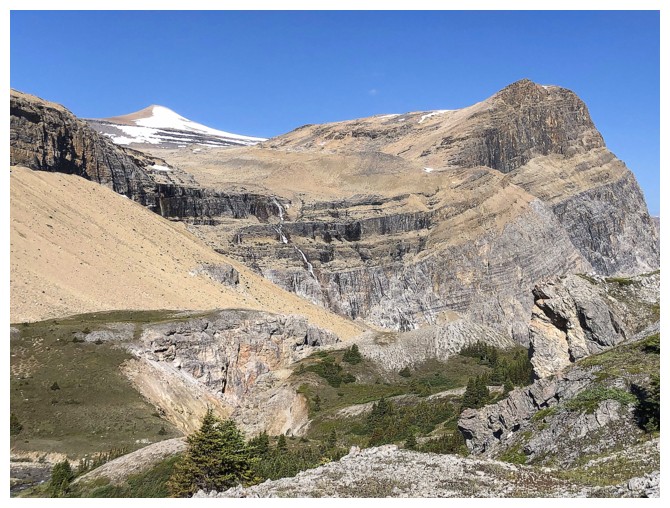
The southeast side of Cirque Peak provides a stunning example of rock folding
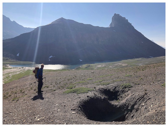
Raff and some unusual crevasse-like holes in the ground
Didn't expect to see this kind of amazing scenery only a few hundred metes from the ridge
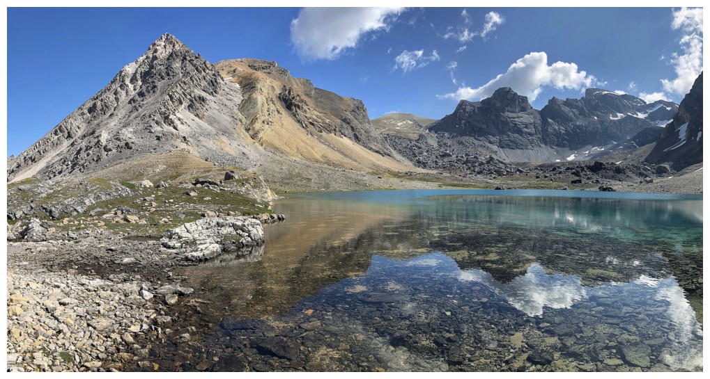
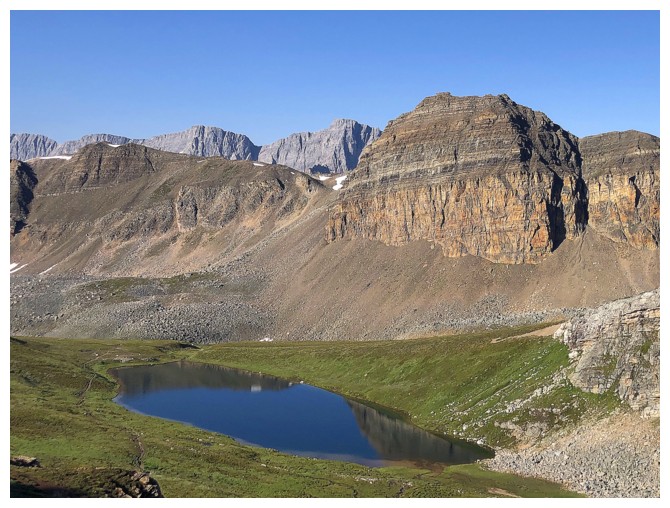
Striking Dolomite Peak over Katherine Lake
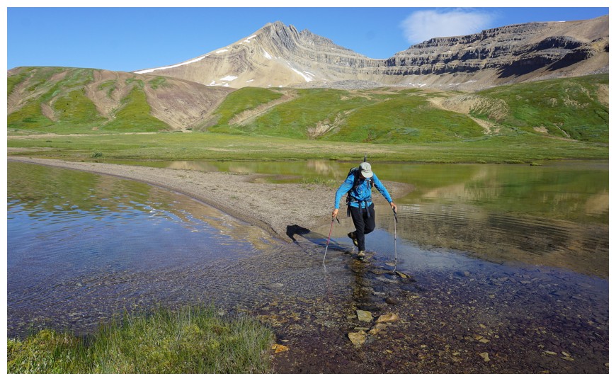
A very small land bridge gets you past Katherine Lake
Cirque and its eastern outlier
There's the dicey section of the land bridge (photo by Raff)
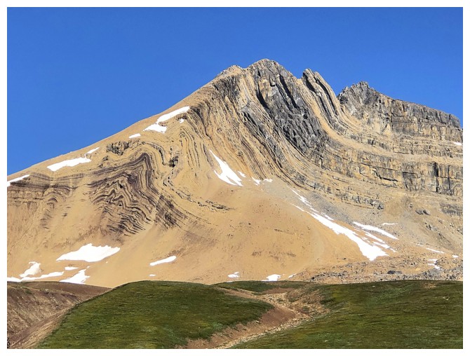
And there's some of the rock folding
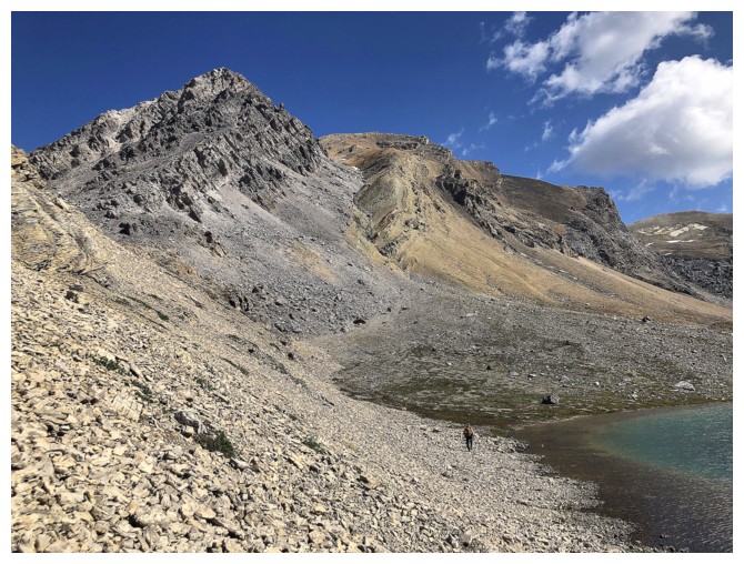
Equally impressive is the north end of Dolomite Peak
At Dolomite Pass and getting ready to lose more elevation into the Dolomite Creek valley
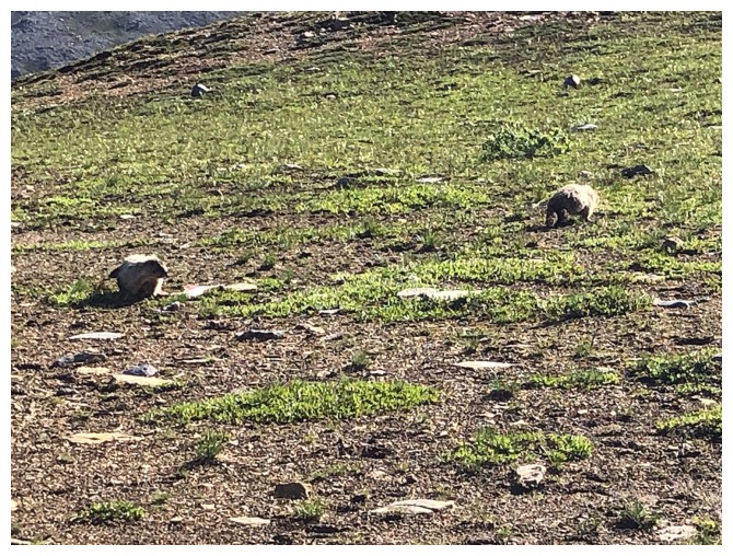
These two marmots had a vicious fight......
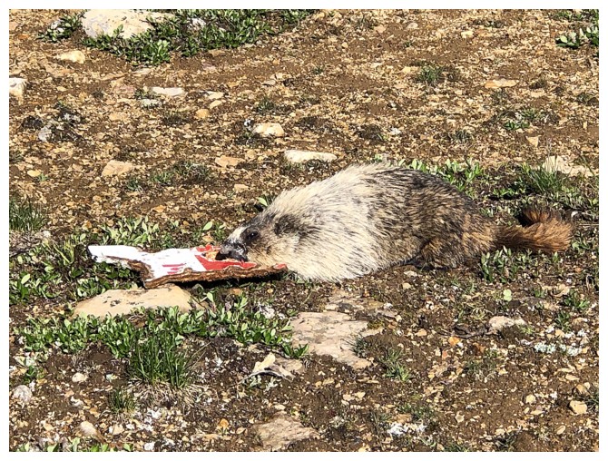
...over a piece of wood that was once a sign
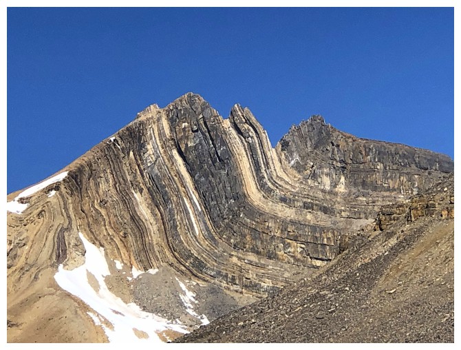
The folding on Cirque is mesmerizing
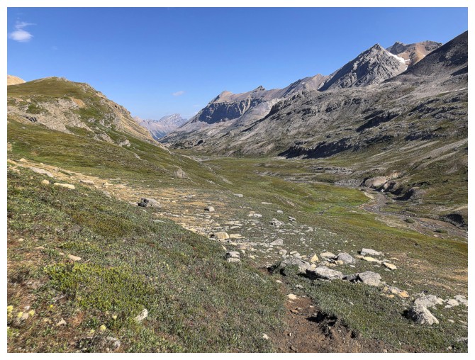
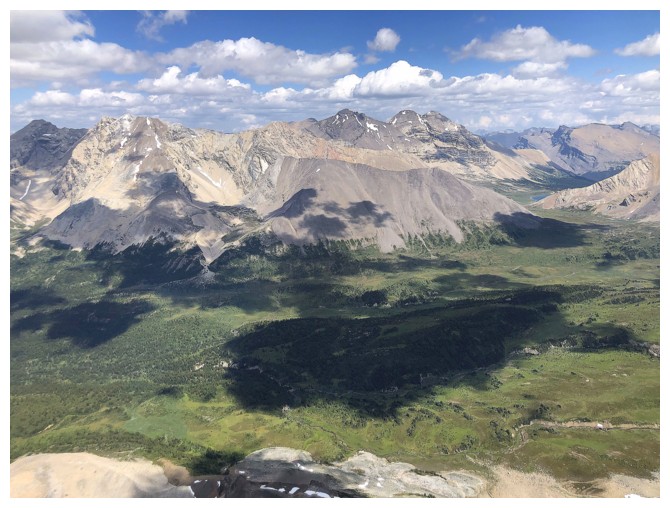
Dolomite Creek valley
Looking back to Dolomite Peak
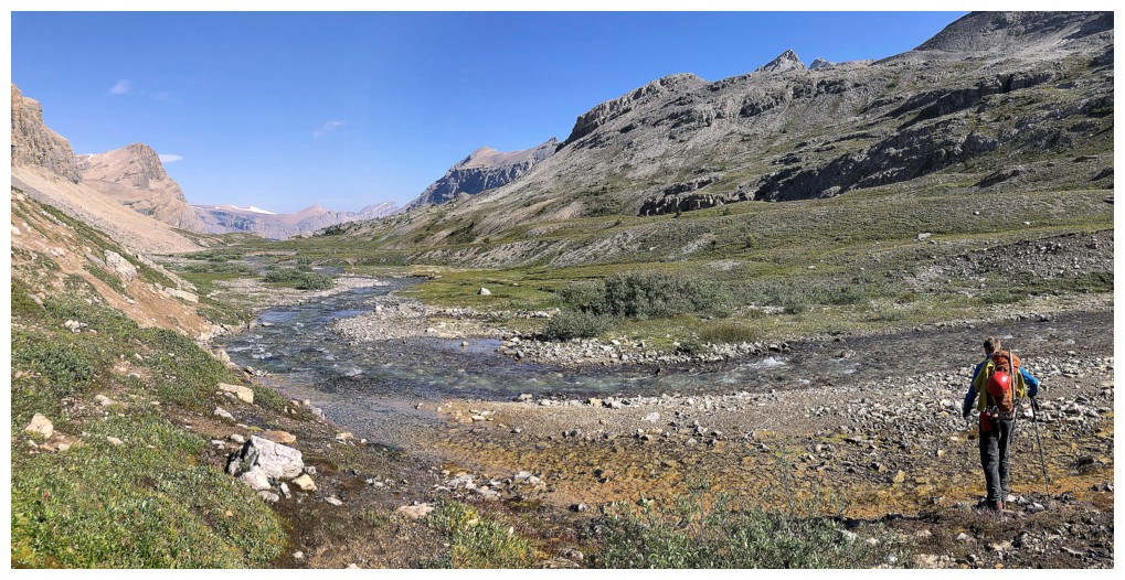
Raff leads the way along Dolomite Creek
On the other side of the creek (photo by Raff)
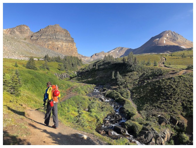
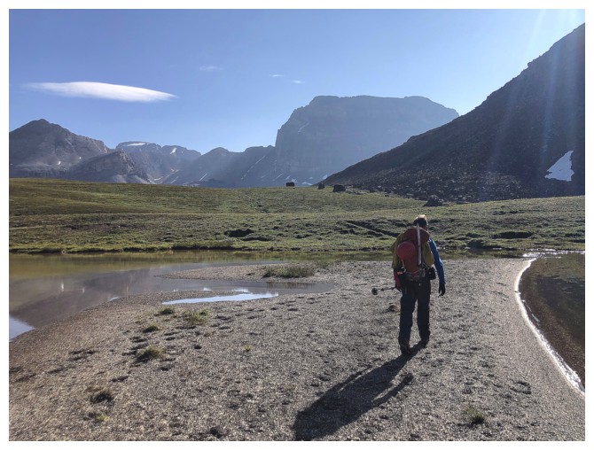
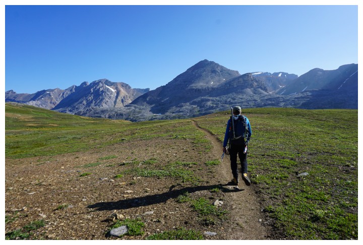
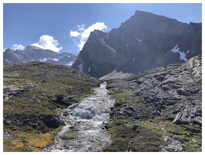
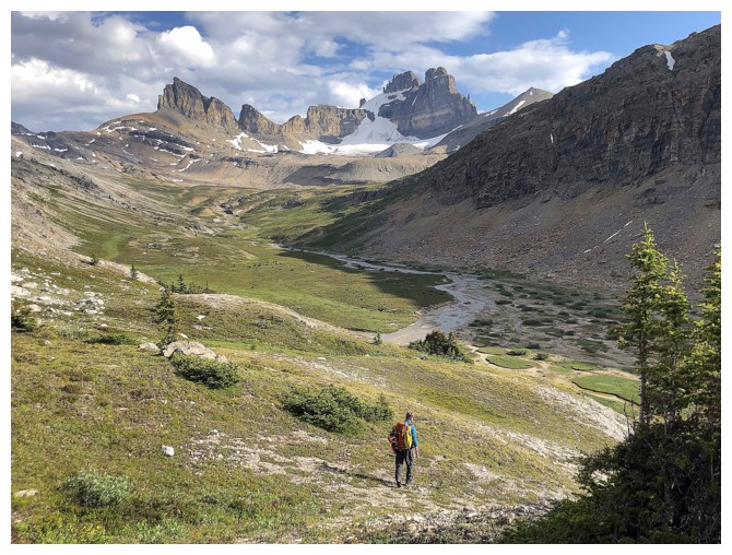
Leaving the valley and heading up towards Lake Alice
Sub-peak of Observation at the left
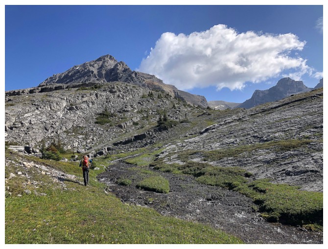
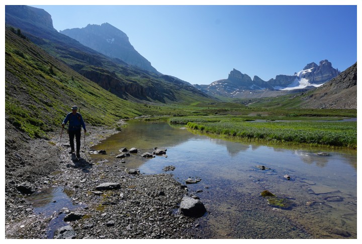
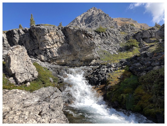
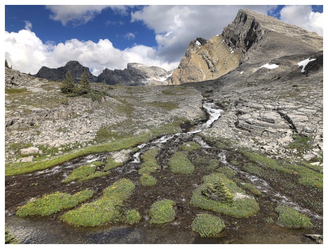
Following the creek that drains Lake Alice was a super scenic way to get to the lake
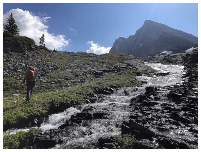
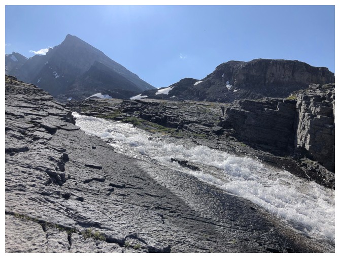
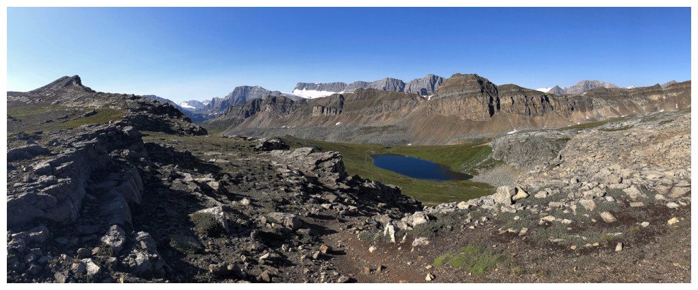
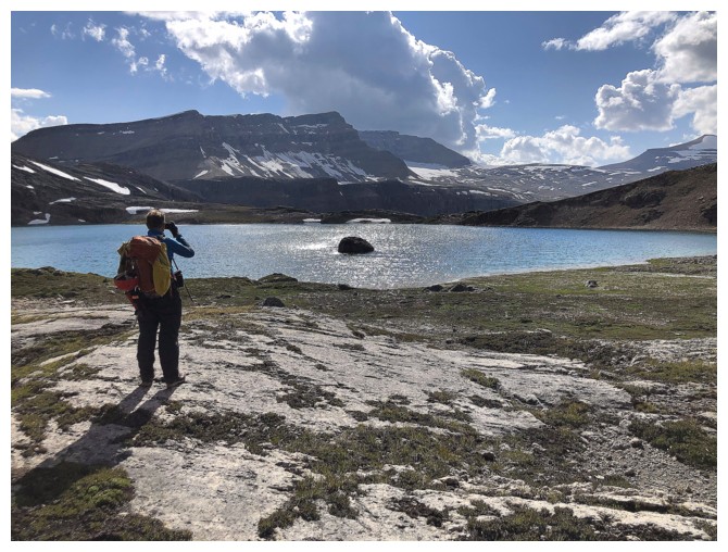
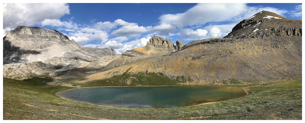
First little glimpse of the lake
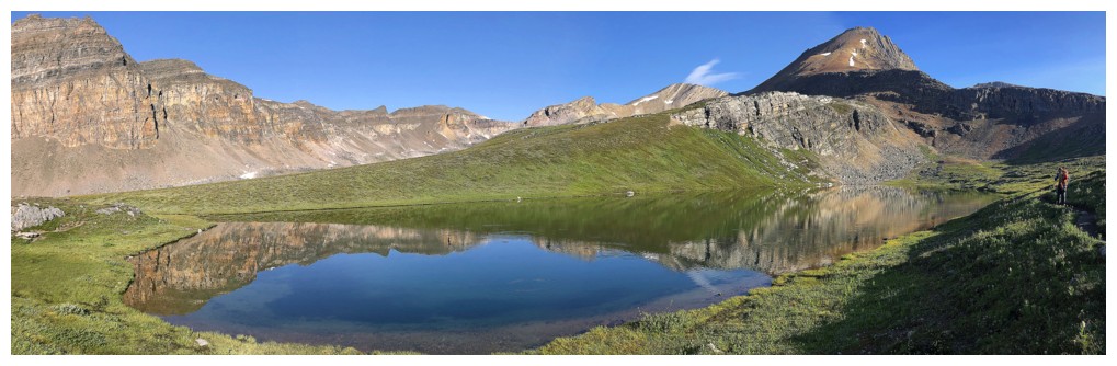
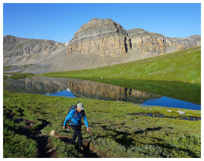
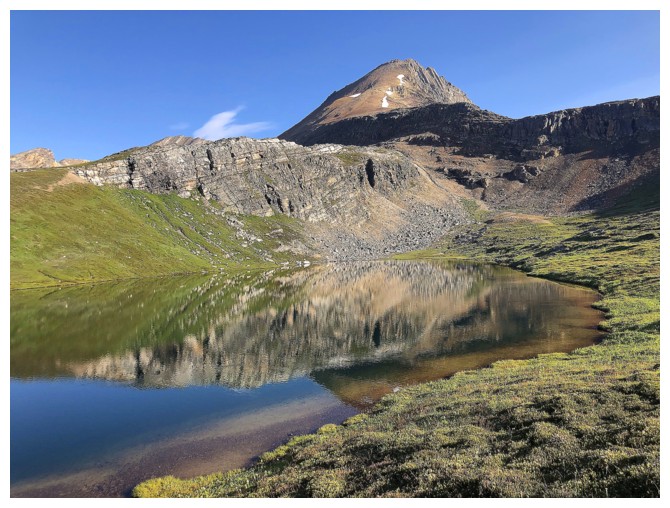
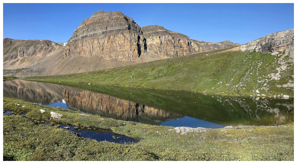
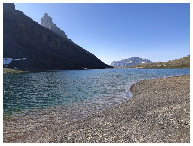
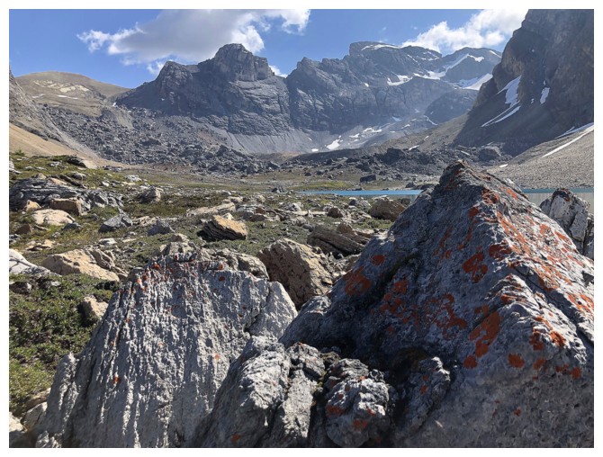
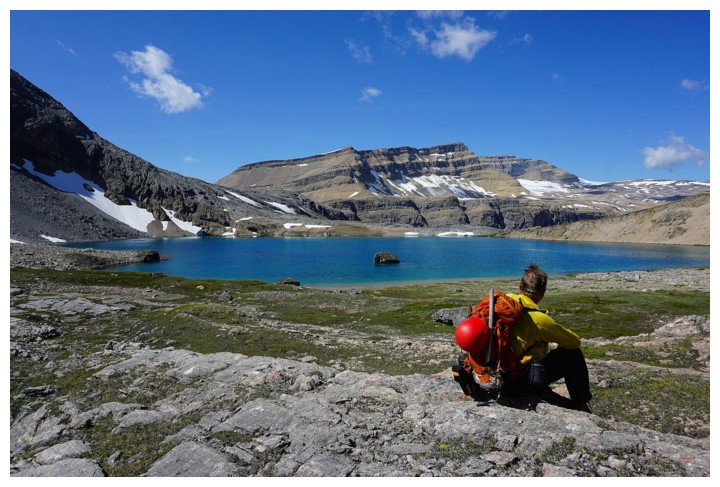
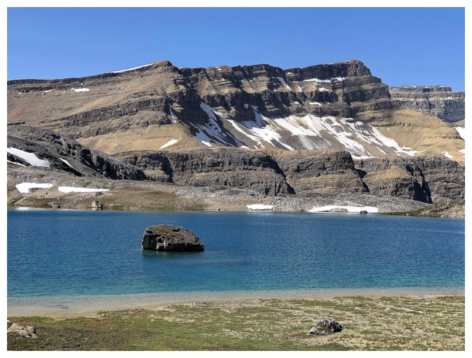
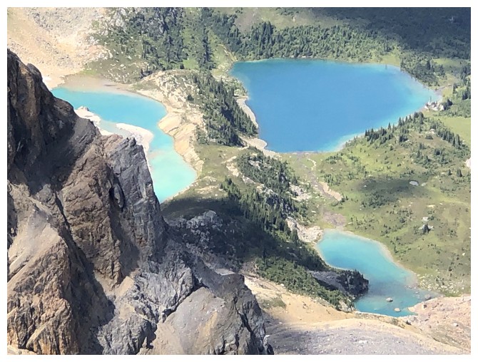
Wow! The view of Lake Alice was a best surprise of the day.
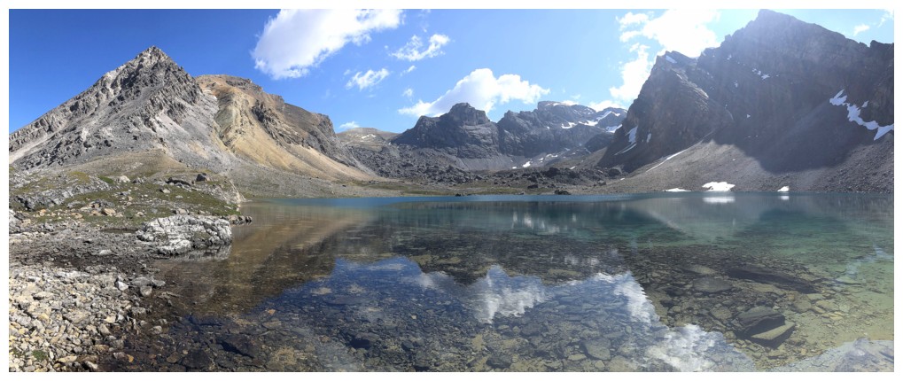
And therefore I had to take multiple photos!
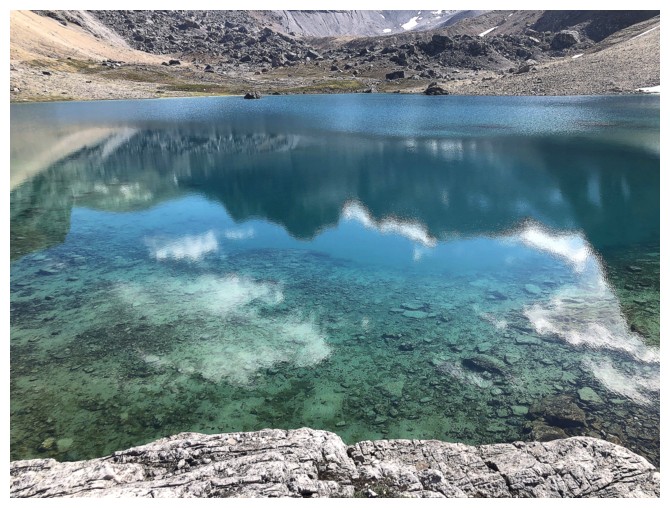
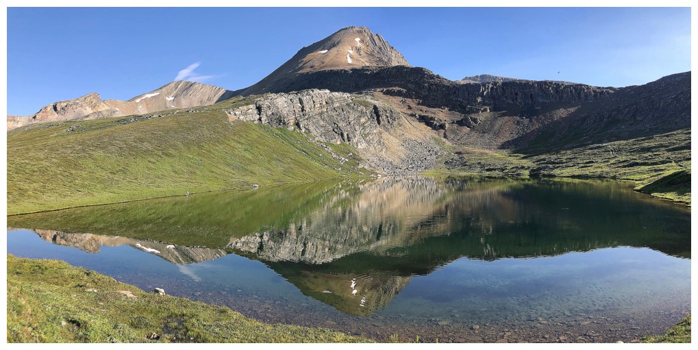
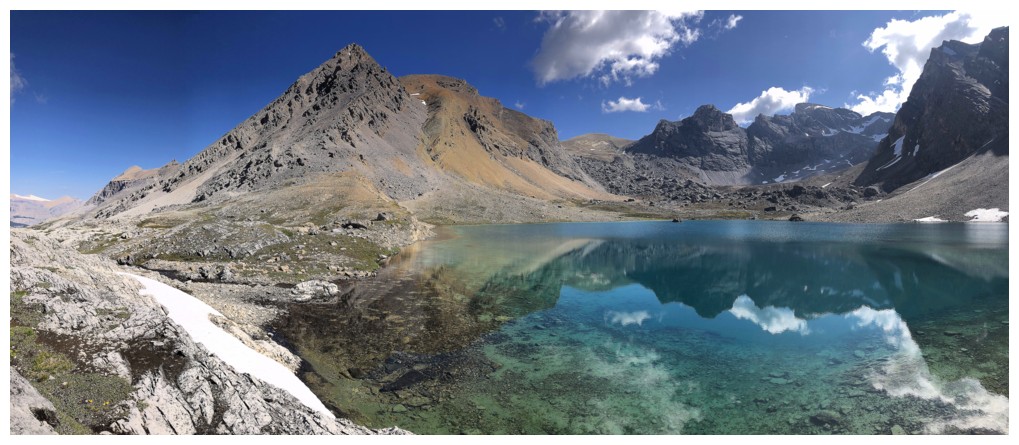
Speaking of Crystal Ridge, how about the crystal-clear water of the lake?
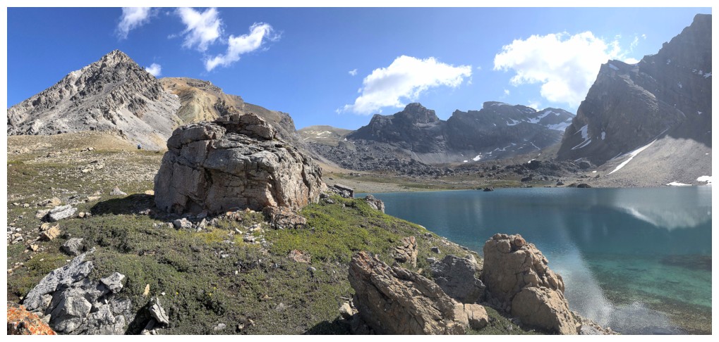
The ridge above the lake is a wonderful place to take a break
Raff leads us around the lake
The other side of the lake is also great for a rest and a sweet view
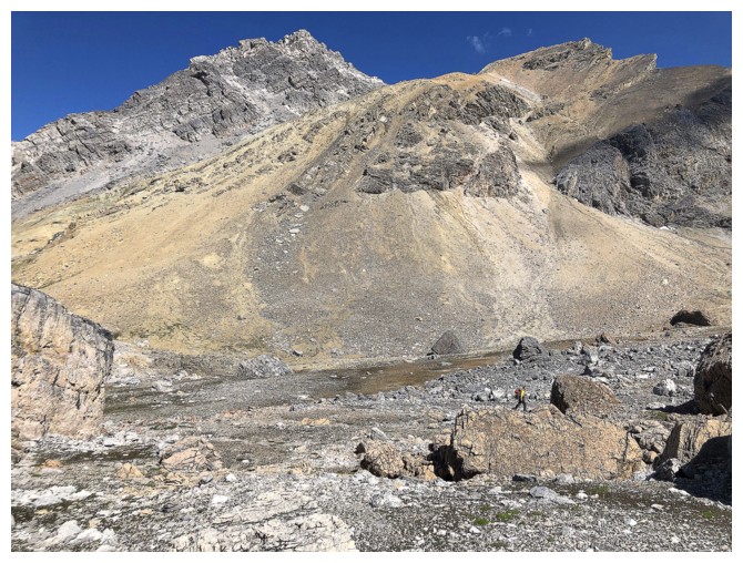
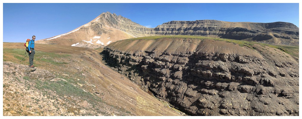
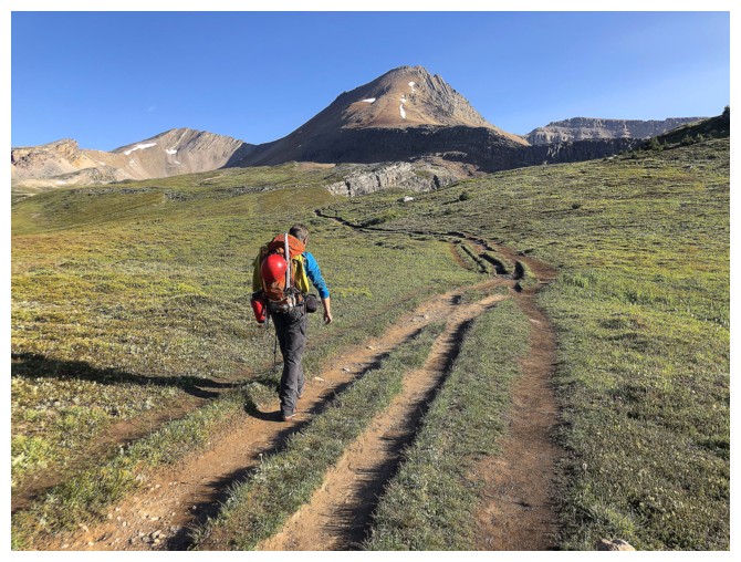
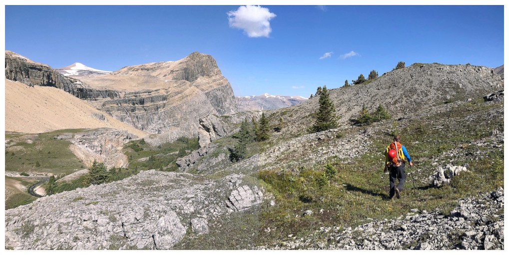
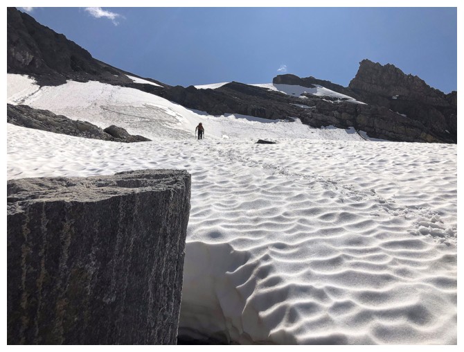
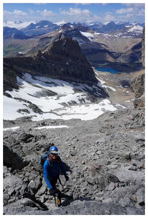
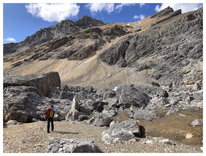
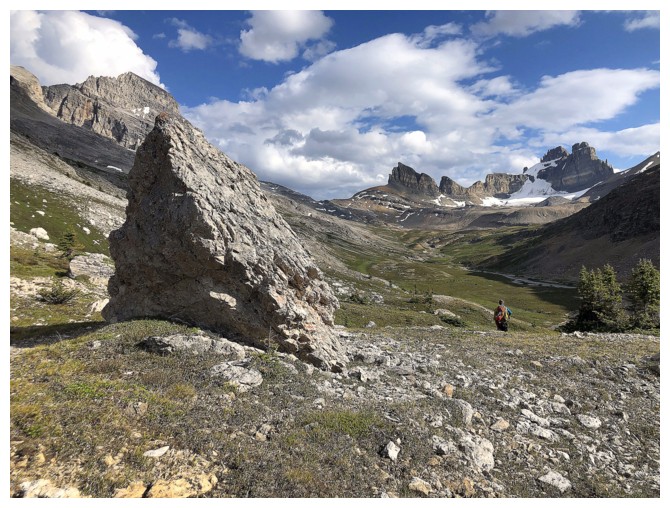
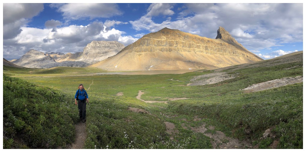
Raff (barely visible) hikes towards the boulder field that you must go through to get to Watermelon
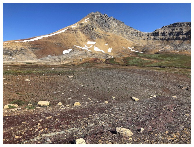
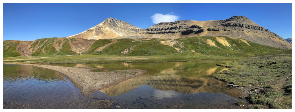
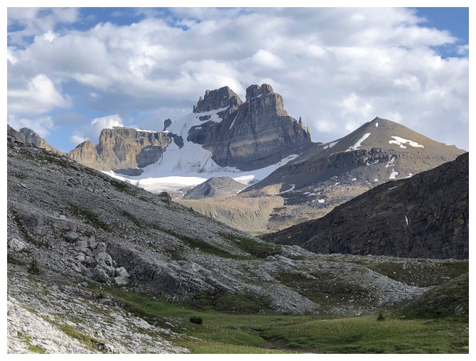
The colourful and interesting south end of Bobac Peak was another of the many highlights of the trip
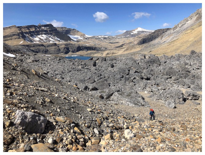
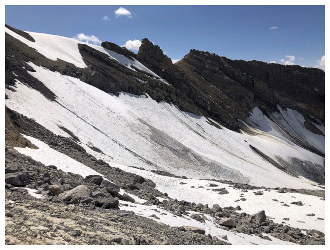
The boulder field is behind Raff
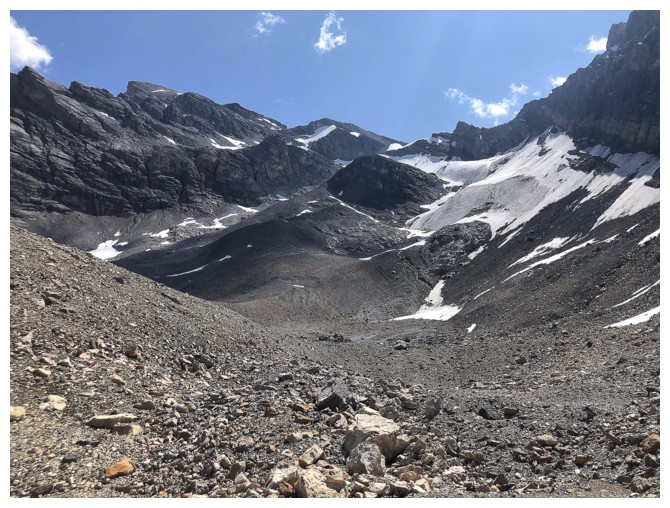
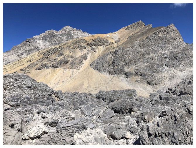
Ahead is route up Watermelon. Some parties went around the right side of the dark hump in the middle; we went to the left.
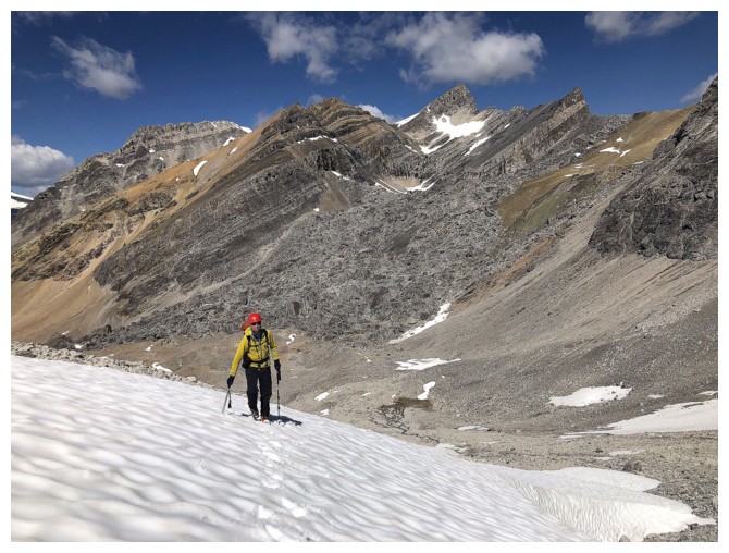
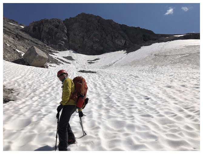
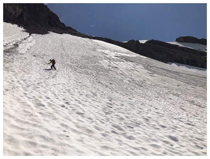
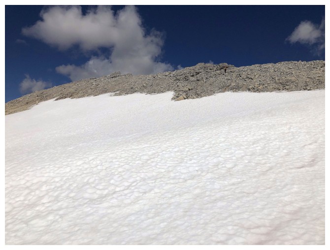
Firm snow made easy work of the ascent
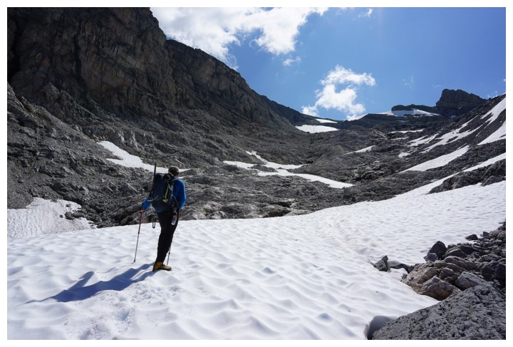
Unfortunately the snow eventually gave way to loose rubble (photo by Raff)
And then back to snow
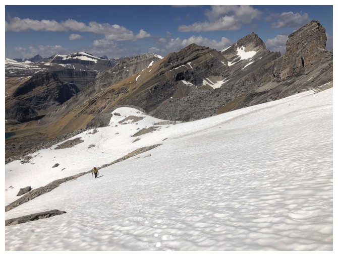
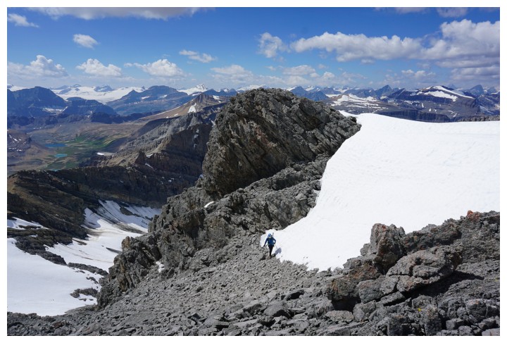
Raff is going to go to the right
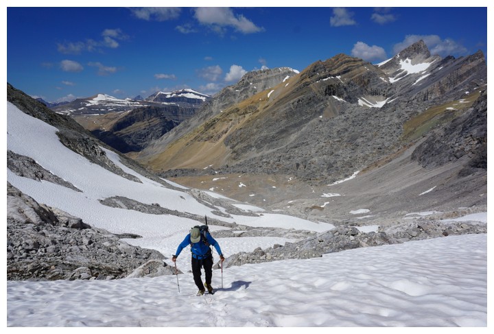
I follow. Now the summit of Bobac is visible at the right.
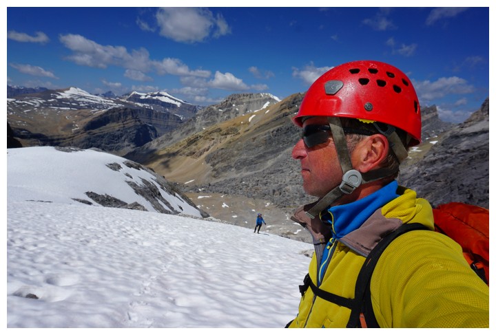
Interesting selfie by Raff
After encountering some sketchy terrain, Raff traverses left. Good
decision - the new route avoided anything that might have been glacial.
Looking back at the slopes we turned around on
Back onto good snow
And then steep, loose and somewhat annoying rubble (photo by Raff)
Almost onto easier terrain (photo by Raff)
Yeah! (photo by Raff)
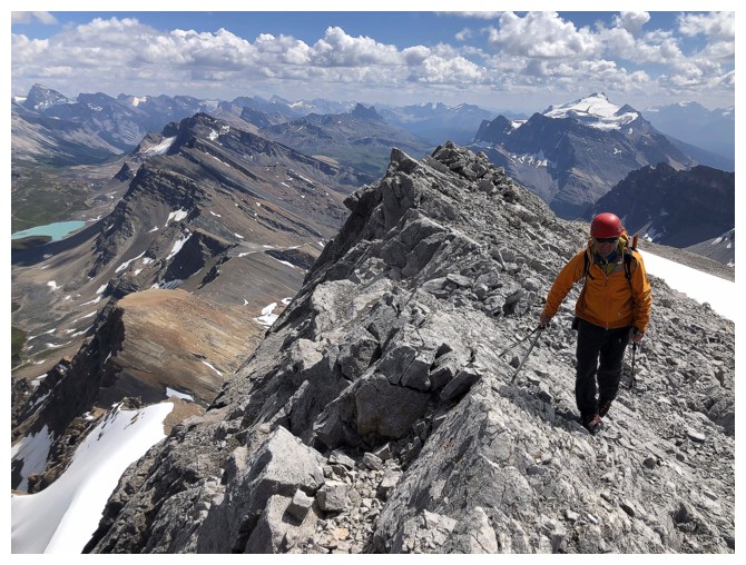
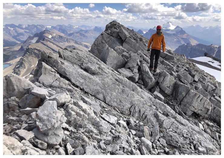
Looking up to Raff and the summit ridge
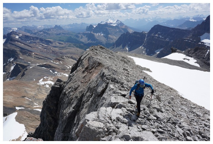
My final few steps to the top (photo by Raff)
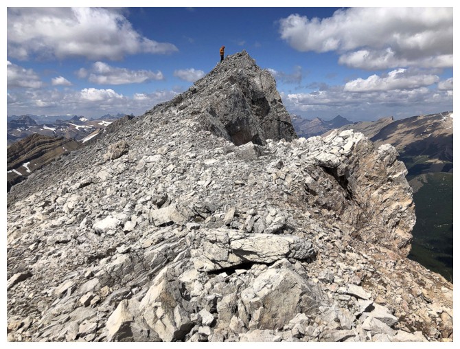
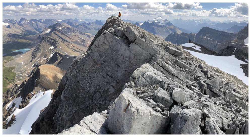
Raff is already at the summit
Looking southeast down the Pipestone Valley (photo by Raff)
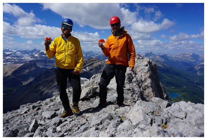
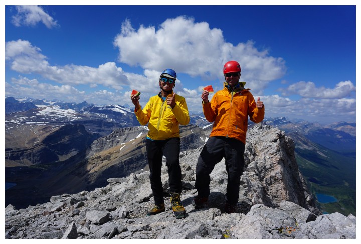
Guess who actually brought watermelon to the summit of Watermelon Peak? Way to go Raff! (photo by Raff)
Clearly the watermelon was invigorating!
The Willingdon trio
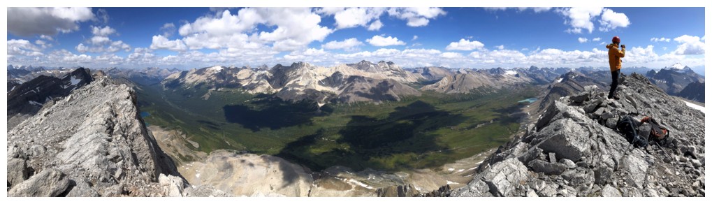
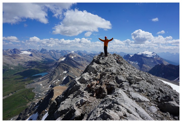
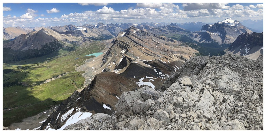
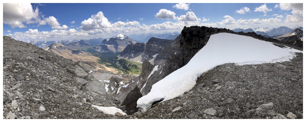
Summit pano
After enjoying the true summit, we made our way a short distance north along the ridge
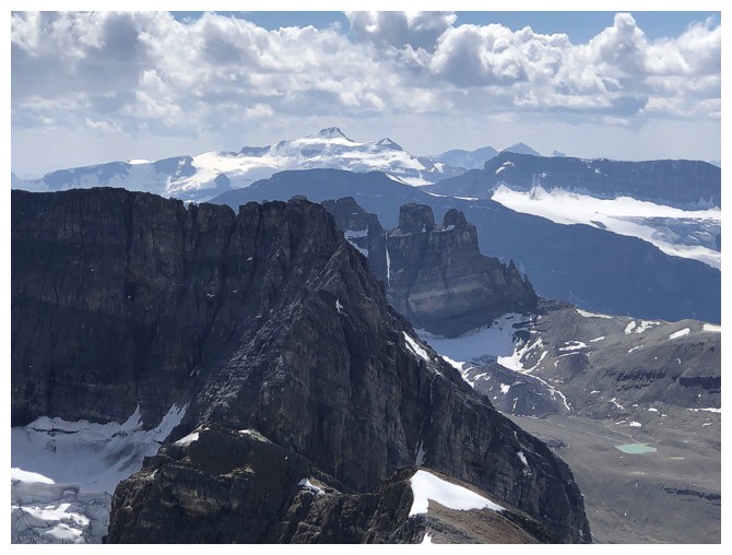
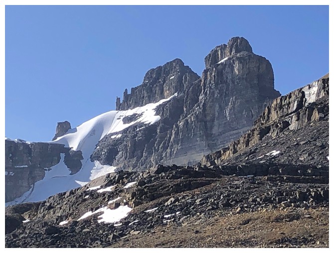
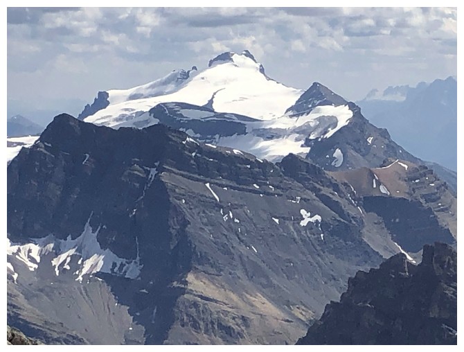
Balfour in the distance and the infamous OXO (Vern's report) in the foreground
View to the north
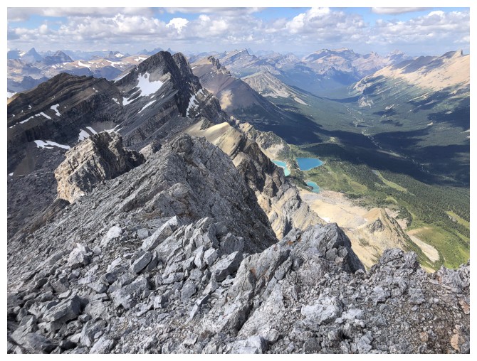
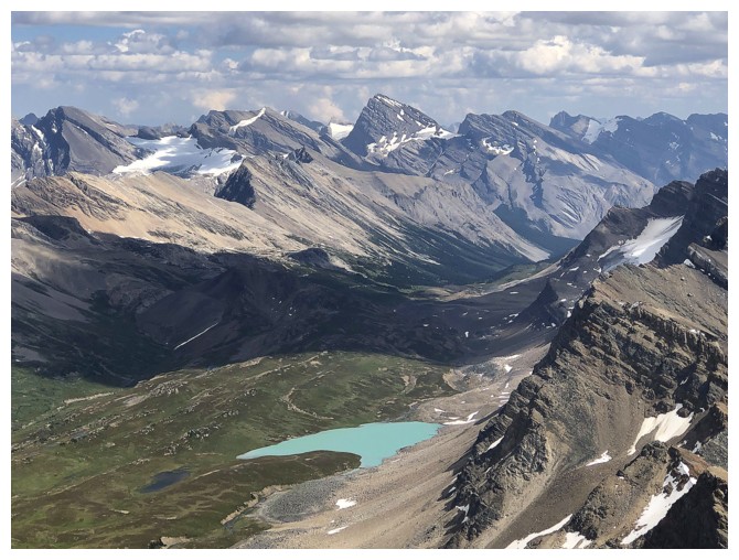
Three colourful tarns in the valley
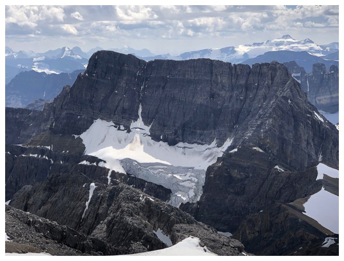
OXO again
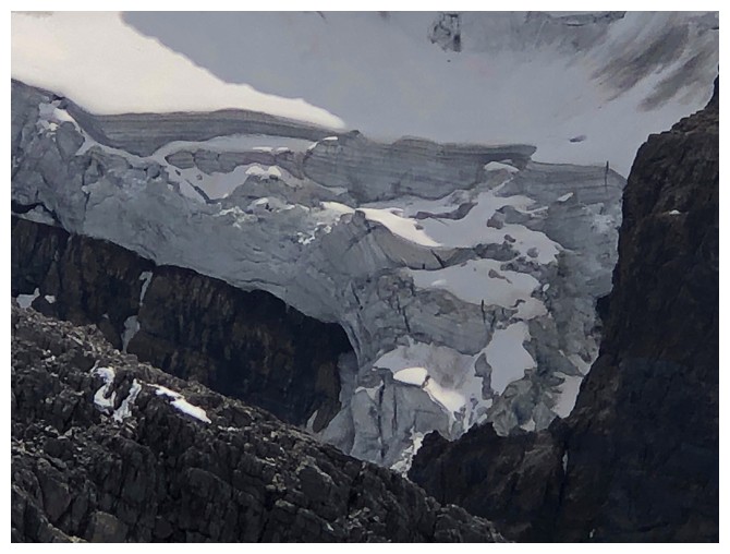
The glacier on OXO
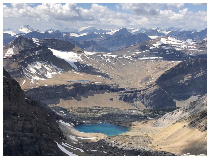
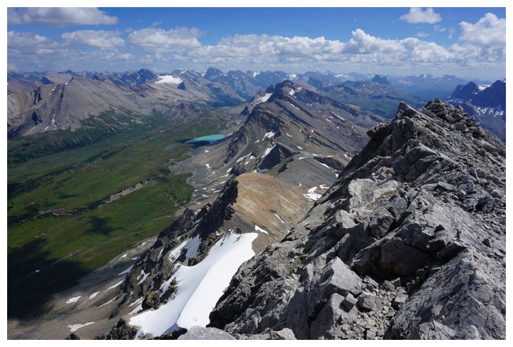
View to the west, with Lake Alice below
Taking in the magnificent view to the southeast one last time
Mount Hector
The big peak in the centre is Cataract Peak
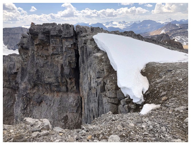
Tenacious snow and a big drop down the left side of the mountain
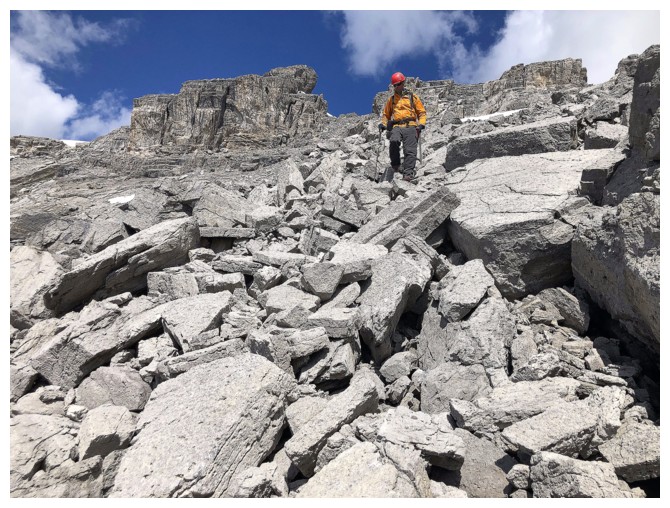
Descending the rubble
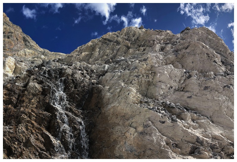
Great water source when we both needed more water
Raff gets ready to go back through the boulder field
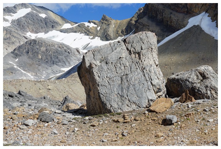
HUGE boulder! (photo by Raff)
Back at Lake Alice
And back down the beautiful creek draining Alice
Good thing the awesome sight of Dolomite Peak gave me something to take my mind off my super achy feet!
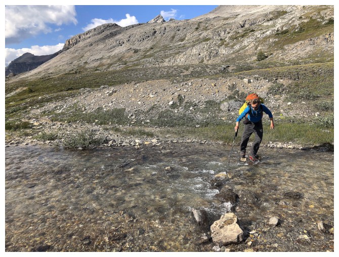
Back across Dolomite Creek
Back up to Katherine Lake
And almost back to the ridge above Helen Lake. I was too exhausted to take any more photos from this point on.
The End