Mount Alcantara
August
25, 2011
Mountain
height: 3020 m
Elevation gain:
1680 m
Ascent time:
5:50
Descent
time:
3:15
Scrambling
with Raff.
One
of the millions of aspects I love about going to the mountains with my
brother,
Mark, is that we are both very flexible and will change plans on a whim. Sometimes
we will drive to mountains without an objective in mind, choosing
something
when we arrive. Fortunately, this is also a quality that I admire about
Raff.
 An
attempt of Mount Alcantara was as unplanned as unplanned gets. I just
happened
to mention the peak in passing as we drove back to Invermere after an
incredible day on Mount Nelson. Raff said, “Do you want to try it?”, I
said,
“Okay”, and less than 12 hours later we were gearing up near a creek,
due west
of the mountain. Fortunately, in the interim I had managed to get my
hands on
Rick Collier’s route description on Bivouac and so we wouldn’t be
attacking the
peak blindly.
An
attempt of Mount Alcantara was as unplanned as unplanned gets. I just
happened
to mention the peak in passing as we drove back to Invermere after an
incredible day on Mount Nelson. Raff said, “Do you want to try it?”, I
said,
“Okay”, and less than 12 hours later we were gearing up near a creek,
due west
of the mountain. Fortunately, in the interim I had managed to get my
hands on
Rick Collier’s route description on Bivouac and so we wouldn’t be
attacking the
peak blindly.
The
route starts with a healthy stint of what Collier describes as
“moderately
nasty” bushwhacking and his chosen adjectives are bang-on! Not knowing if the north or
south side of the
creek would offer at least amount of resistance, we picked the south
side and
in retrospect chose incorrectly. The bush was VERY nasty and
route-finding
around rockbands and other obstacles (i.e. even denser bush than what
we were
tackling) time-consuming and circuitous. Several
hours in, we conceded our error and
crossed to the other side. Travel from then on was far easier.
Since
we were not going to bivy at the unnamed lake, as Rick and company did
in order
to ascend Brussilof in addition to Alcantara, we took a more direct
line up the
southwest face. This route (probably slightly west of Collier’s) put us
in a
terrific dry, water-worn drainage that was heaps of fun to ascend –
solid,
step-like rock with minimal scree. 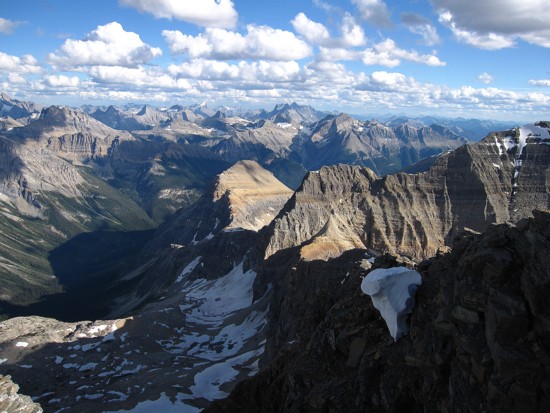 I
was also very pleasantly surprised to
discover that Alcantara is quite a colourful mountain in its own right
– lots
of reds, oranges, and beiges to complement the more common, gray
limestone.
I
was also very pleasantly surprised to
discover that Alcantara is quite a colourful mountain in its own right
– lots
of reds, oranges, and beiges to complement the more common, gray
limestone.
Nearing
the advertised summit elevation of 2840 m, we were surprised to
discover the
mountain offered at least another 100 m of gain to the top. We crossed
over to
the ridge to find another gully (the one described by Collier) leading
more
directly to the summit. Instead of going into the gully, we stayed on
the ridge
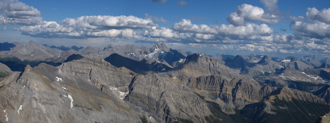
enjoying terrific views of the Eon, Aye, Assiniboine trio. The
full extent of
the view, however, was not realized until we reached the summit – a summit that Raff and I
both confirmed to
be around 3020 m – 180 m higher than described. Though perhaps slightly
inferior to the view from nearby Eon, Alcantara’s panorama was still
absolutely
magnificent and worth every second of the bushwhacking tribulations. Of course, the giants
Assiniboine, Sir
Douglas, Joffre, and King George commanded much of our attention, but
closer
peaks like Red Man Mountain, Aurora, Byng, King Albert, Back, Craddock,
and a ton of unnamed outliers were
equally interesting. The
sea of peaks to
the northeast, east and southeast was simply phenomenal.
After
a wonderfully long summit stay we descended most of Collier’s route,
enjoying
more colourful rock scenery and terrific views of Brussilof. Lower
down,
traversing over to our ascent route seemed like a good idea, in light
of the
disappearing light – it was and clear skies granted us more amazing
views of
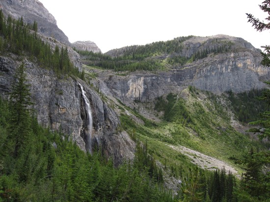
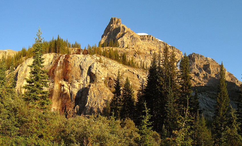
Brussilof and an impressive waterfall cascading down the headwall. We
finished
the descent by headlamp, crashing down through the thick brush on the
north
side of the creek with somewhat reckless abandon.
A
totally awesome mountain and trip!
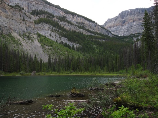 The first unnamed lake
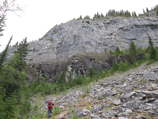
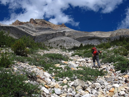
Raff approaches one of innumerable obstacles on the south side of the creek
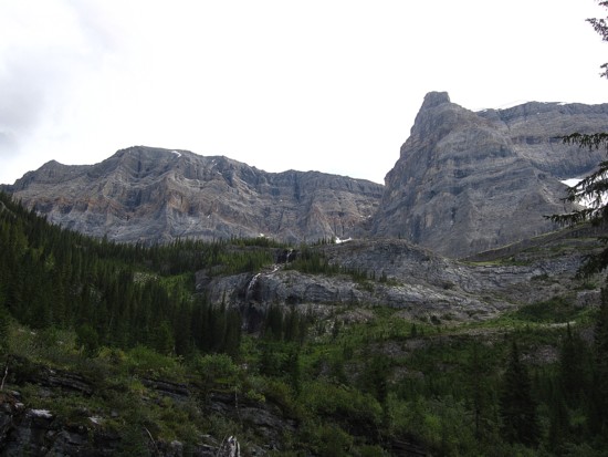
Pleasant views of Mount Brussilof, but clear skies would have been nice
Same as above
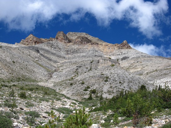
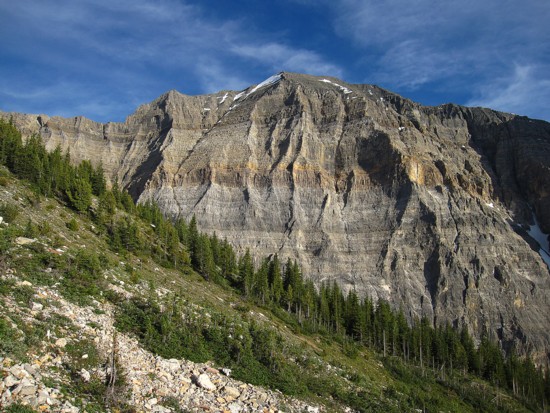
The ascent gullies of Alcantara
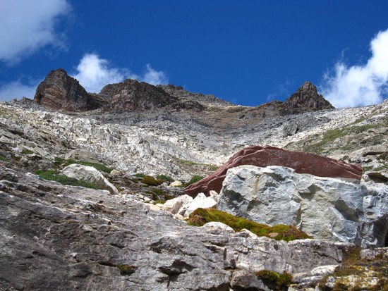
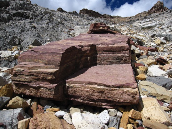
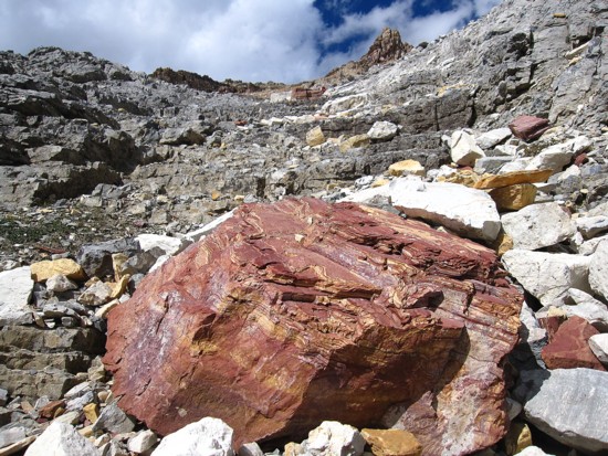
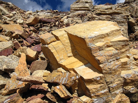
A random red argillite boulder shows up
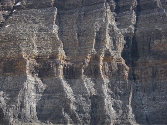
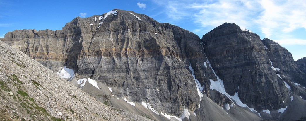
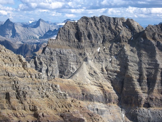
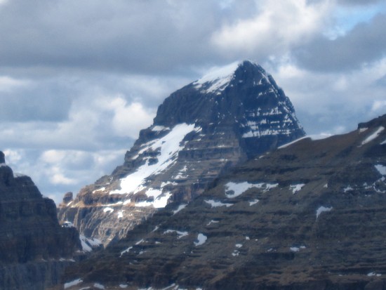
The distnictive layers of Brussilof
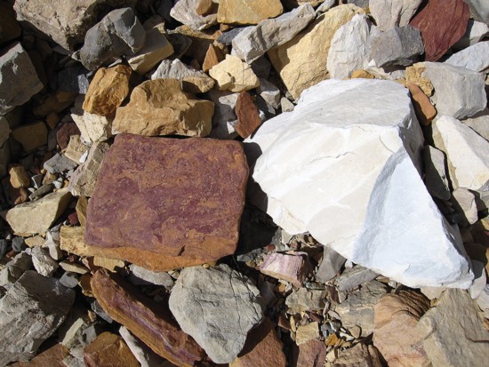
Argillite and limestone living together in perfect harmony
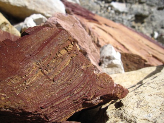
More cool argillite
More random, cool, red argilllite
Same as above
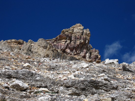
An interesting outcrop of rock
A closer look
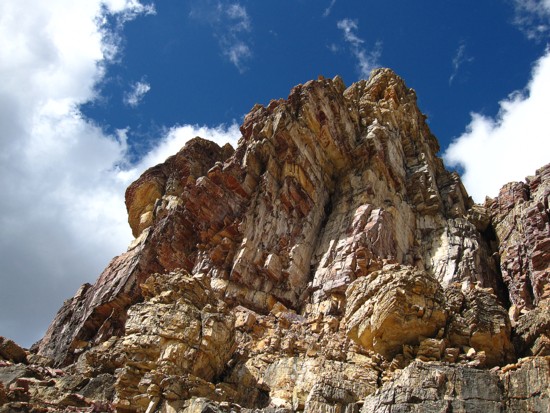
More vibrant colours
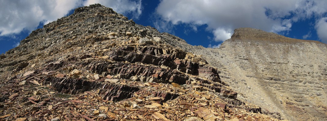
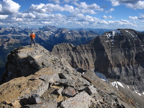
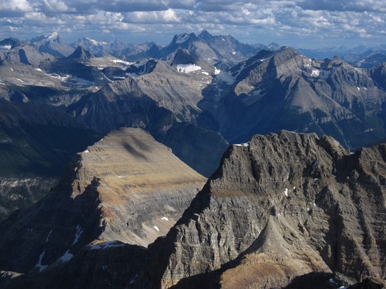
The ridge we went up (left) and the summit (right)
Looking south towards Brussilof
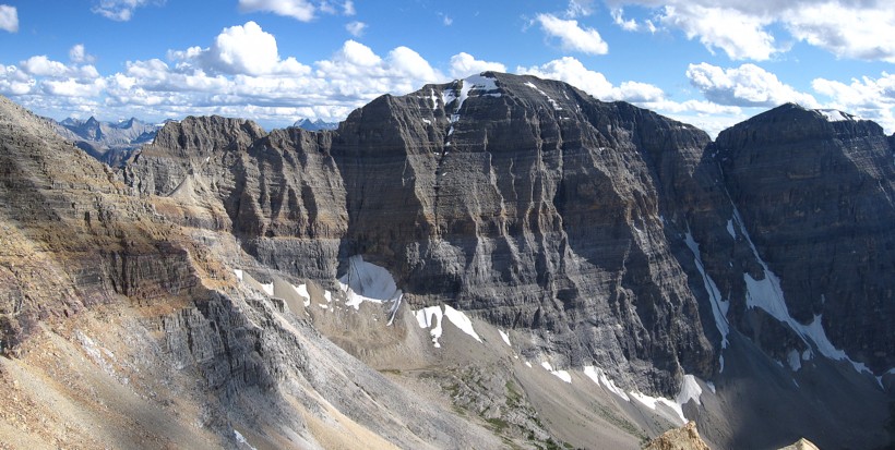
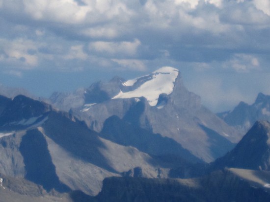
Mount Brussilof
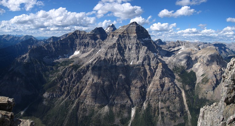
The Aye, Assiniboine, Eon trio; obviously Eon dominates in the foreground
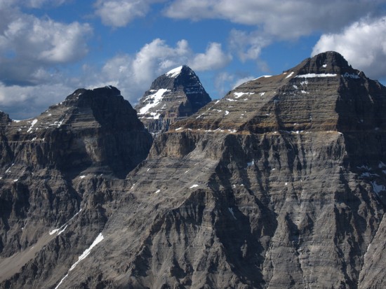
A closer look
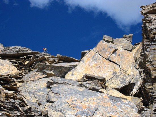
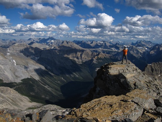
Raff takes the final few steps to the summit
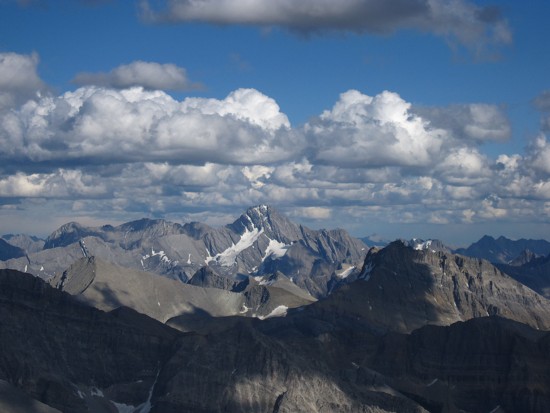
The west face of Sir Douglas
Joffre and Abruzzi at the right
A close-up of Sir Douglas
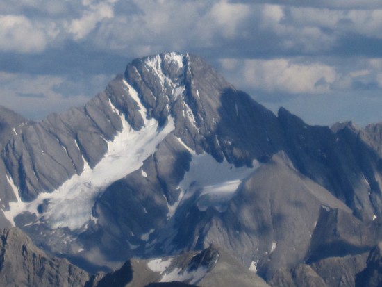
A close-up of Joffre
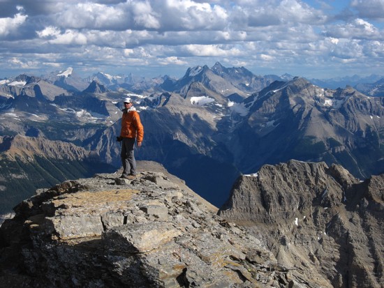
Raff and the summit view to the southeast; the big peak in the distant centre is King George
Same as above
Probably not a good time to be ascending the southwest face of Assiniboine
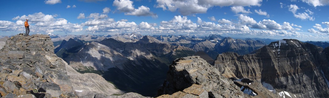
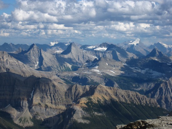
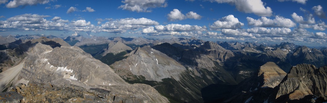
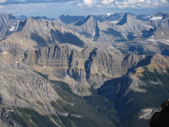
A partial summit panorama, looking east
Tons of cool outliers
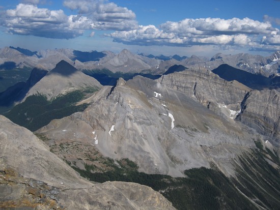
Another view to the east; Mount Birdwood in the distant centre
Looking down the descent route
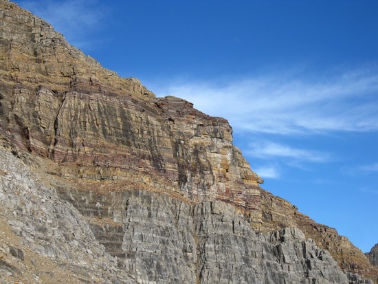
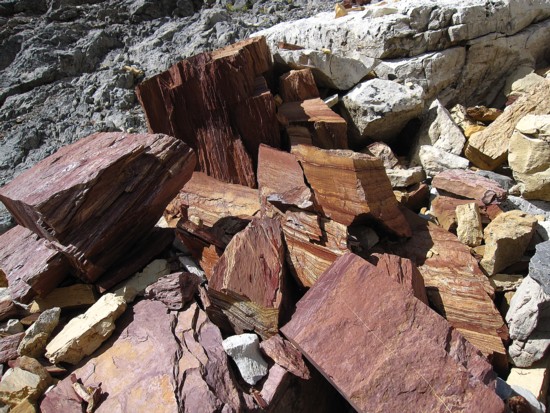
Colourful rock layers on Alcantara
Brussilof in better light and clearer skies
Same as above