Black Brett
July 10, 2021
Mountain height: 2900 m
Elevation gain: 1500
m
Round-trip time: 10 hours
Solo scramble.
Definitive proof that I need to do more trips
that involve visiting a lake or two.
Although
reaching the summit of Black Brett
was very interesting and rewarding, it paled in comparison to seeing
the Harvey Lakes from afar and up close. Granted, that sentiment may
have been
heavily influenced by the less than stellar weather at the summit and
the
improving weather when seeing the lakes, but increasingly I’m finding
water-related scenery to be as interesting as summit views and other
mountain
scenery.
To the trip…..
 The relative obscurity of this peak is
probably because it sits between two slightly higher mountains: Bourgeau and
Brett, both described in Kane’s Scrambles in the Canadian Rockies. Nevertheless,
mountain extraordinaire John Martin had ascended Black Brett via the southwest
side in 1967, the route is well-described in Mike Potter’s Ridgewalks
in the Canadian Rockies, and the mountain had seen a few ascents in recent
years, including one by Vern, which takes a more direct route to the summit
than Potter’s route.
The relative obscurity of this peak is
probably because it sits between two slightly higher mountains: Bourgeau and
Brett, both described in Kane’s Scrambles in the Canadian Rockies. Nevertheless,
mountain extraordinaire John Martin had ascended Black Brett via the southwest
side in 1967, the route is well-described in Mike Potter’s Ridgewalks
in the Canadian Rockies, and the mountain had seen a few ascents in recent
years, including one by Vern, which takes a more direct route to the summit
than Potter’s route.
The trip starts with a 7.5 km hike to
Bourgeau Lake. I was hoping that I would find the hike more interesting than my
first visit to the area, back in the early 2000’s, but such was not the case.
It’s still a long and mundane hike with limited views throughout. The situation
improves a little upon reaching Bourgeau Lake, but even that is a little
anti-climatic, the body of water often in shade and again offering limited
views, due to the bulk of Mount Bourgeau above.
Thankfully, the next section of the trip more
than compensates for the lacklustre beginning. There are three small lakes
above Bourgeau Lake, each granting better views than the larger, lower lake. Above
the first lake a left turn takes you to Harvey Pass and Mike Potter’s route, a right
turn goes more directly to the summit of Black Brett. I chose the steeper,
direct route, giving me the option to take the gentler Potter route on return.
The actual ascent had its pros and cons,
outstanding scenery and views fitting into the former category and tedious and
occasionally precarious terrain underfoot into the latter. As stated, the
summit view was fantastic but marred by an unexpected build-up of clouds. My
long stay summit did nothing to change that.
However, the descent was a different story.
Hoping that time would eventually grant clearer skies to the area, I took the
more circuitous route via the southwest/south ridge. A complete clearing never
materialized, but as soon as the Sun hit the lakes below, the views turned from
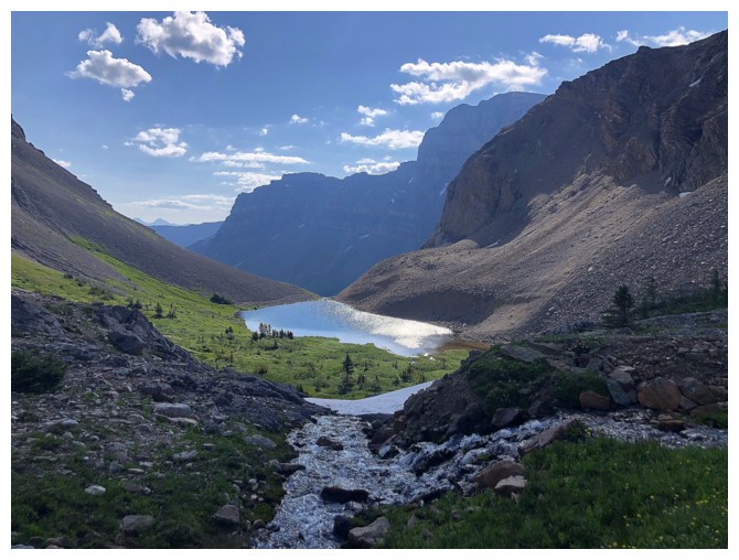
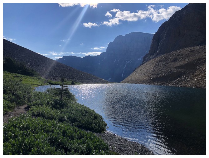
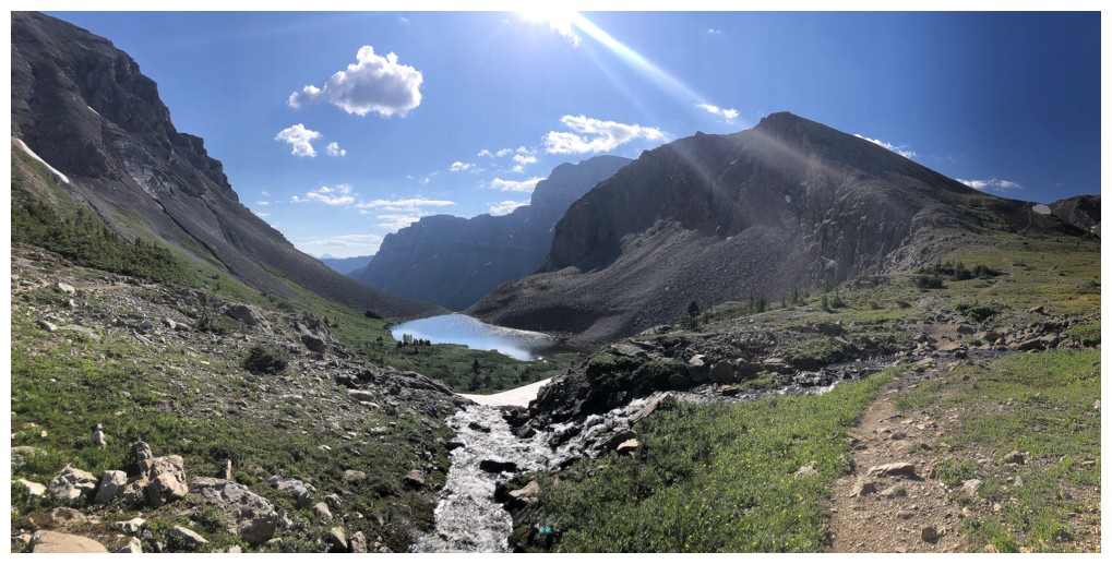
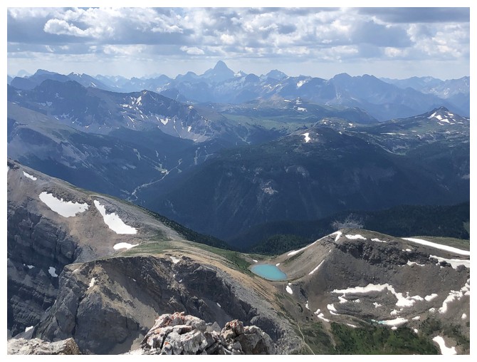
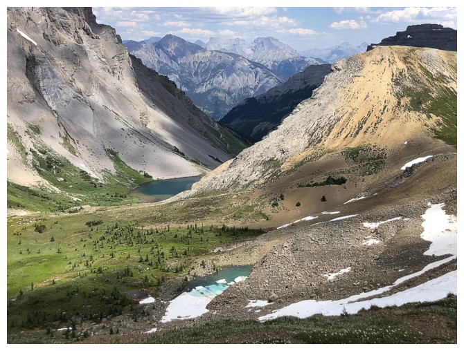
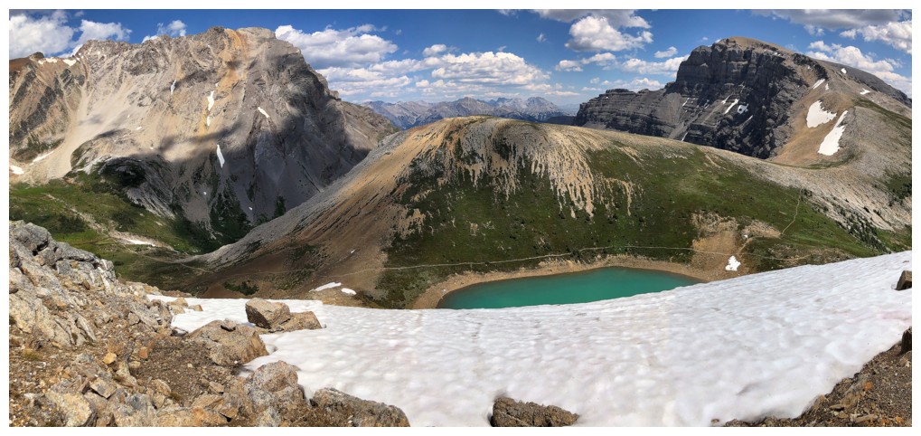
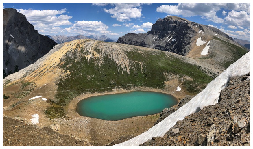
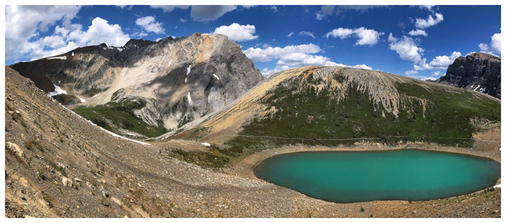
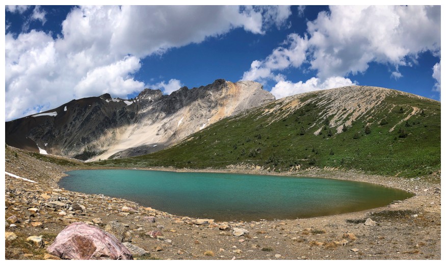
great to magnificent. This was especially true for the shockingly turquoise
upper lake, which quickly asserted itself as the highlight of the entire trip.
After a gratifying stint of exploration, I
hit the main trail to finish the trip. Even riding a high from the scenery
around the lakes, the 8 km Bourgeau Lake Trail still felt excessively long!!
Besides the drudgery of the approach an
extremely rewarding day out.
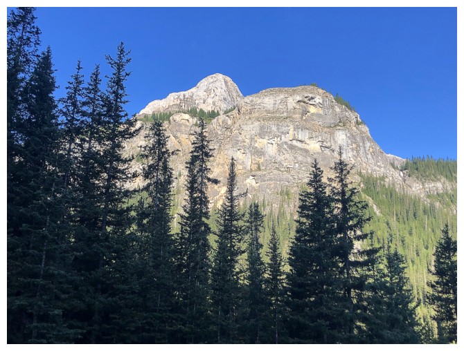
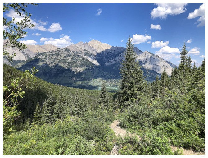
The first decent view after almost 2 hours of forest hiking
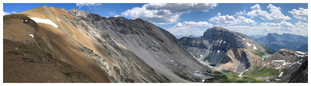
The west side of Mount Bourgeau at the left and the east side of Black Brett at the right
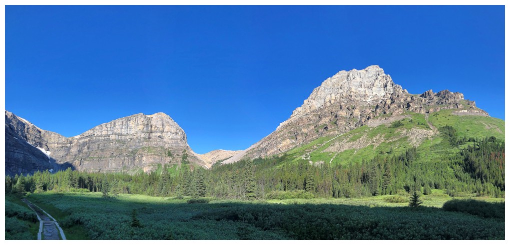
Bourgeau Lake - nice lake, but it's often in shade and offers limited views
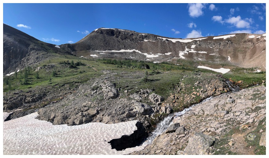
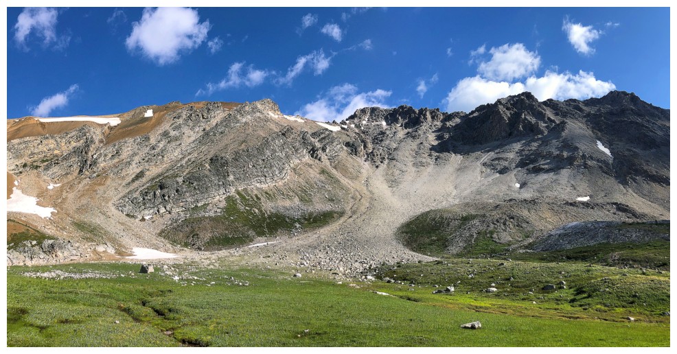
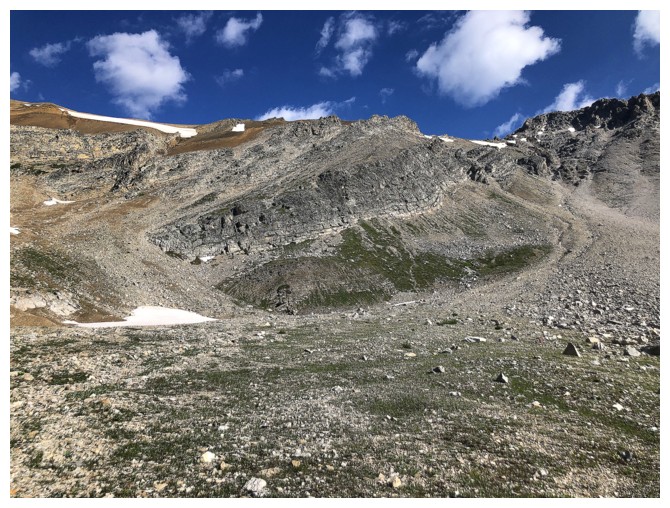
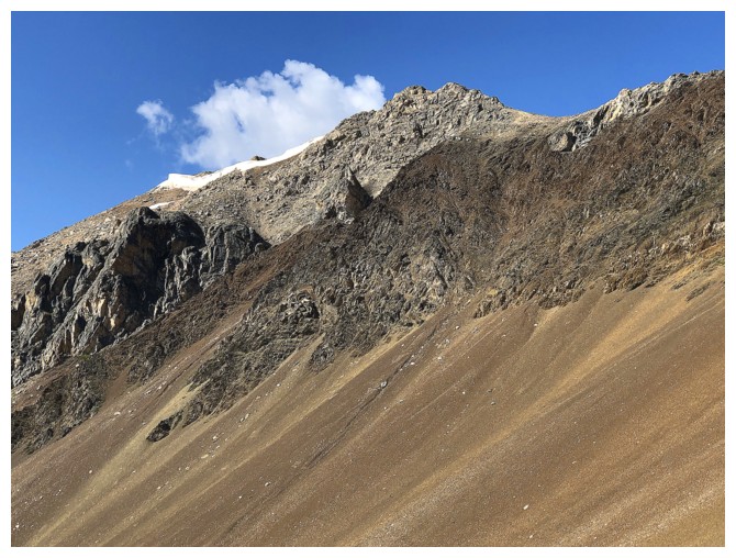
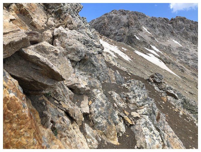
The east side of Black Brett has many interesting rock bands
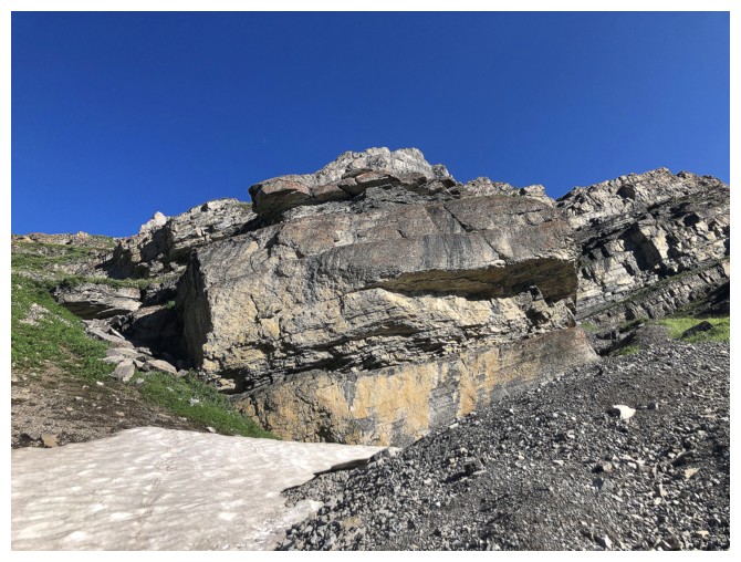
Same as above
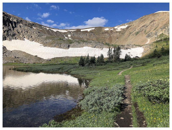
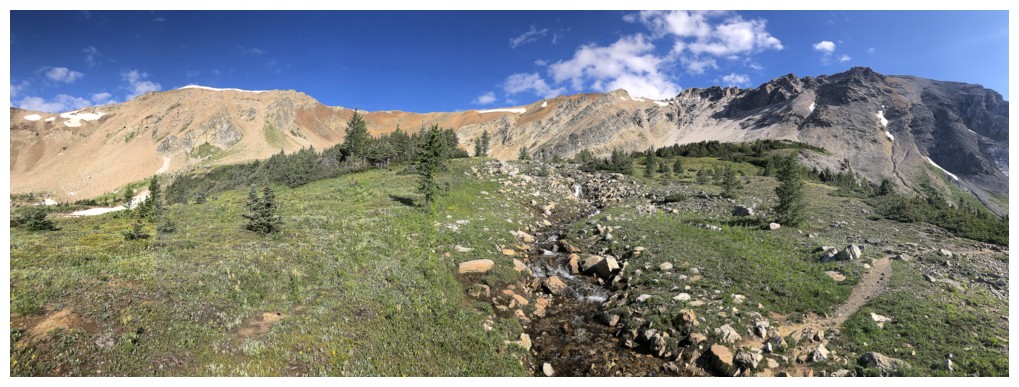
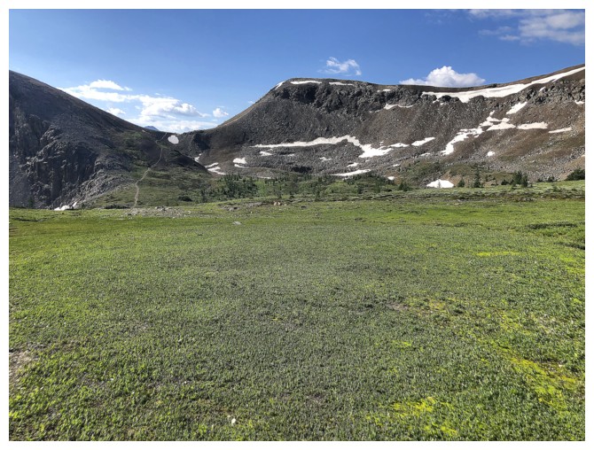
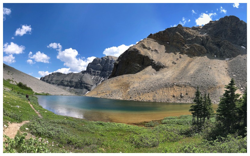
The terrific hiking trail continues up towards the Harvey Lakes and Harvey Pass
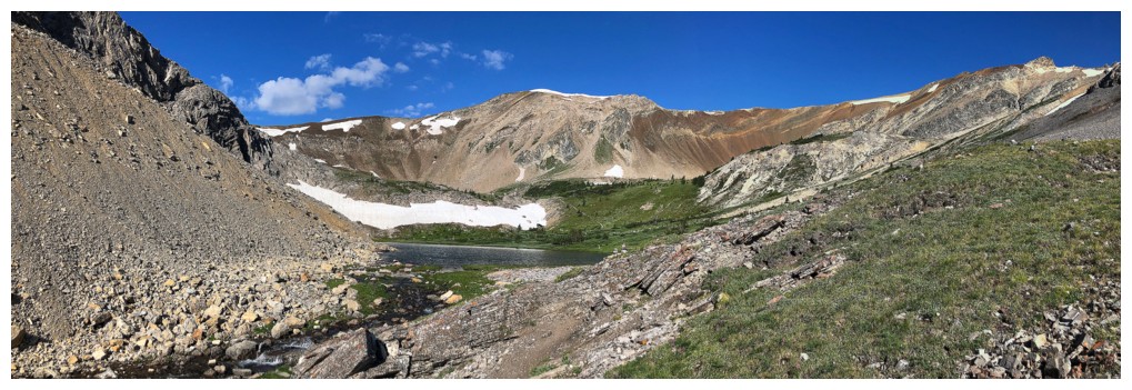
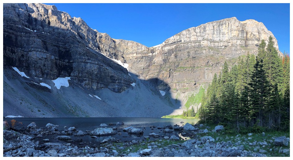
Approaching the first lake, with much of Black Brett stretched out in front
Passing the first lake
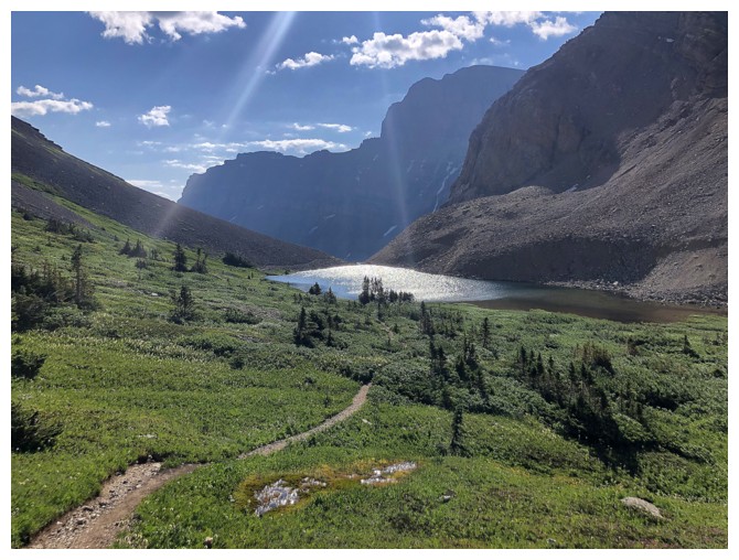
Looking back at the lake
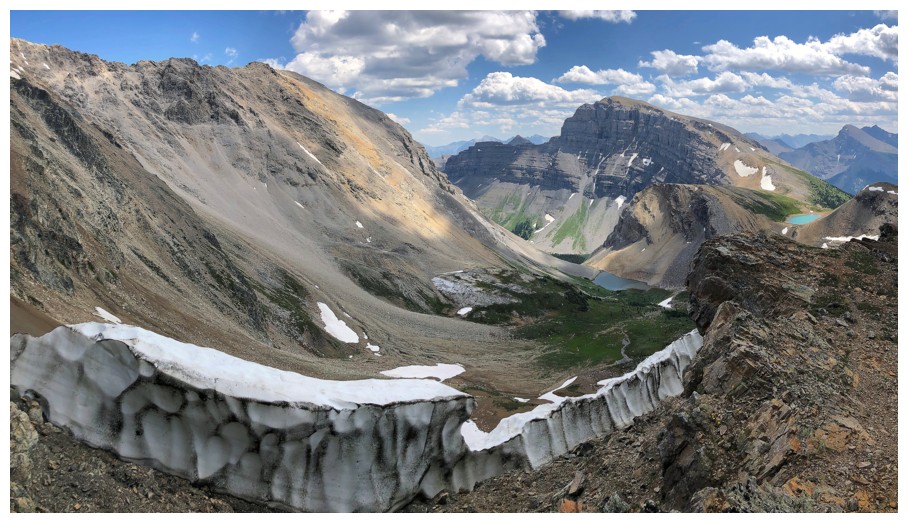
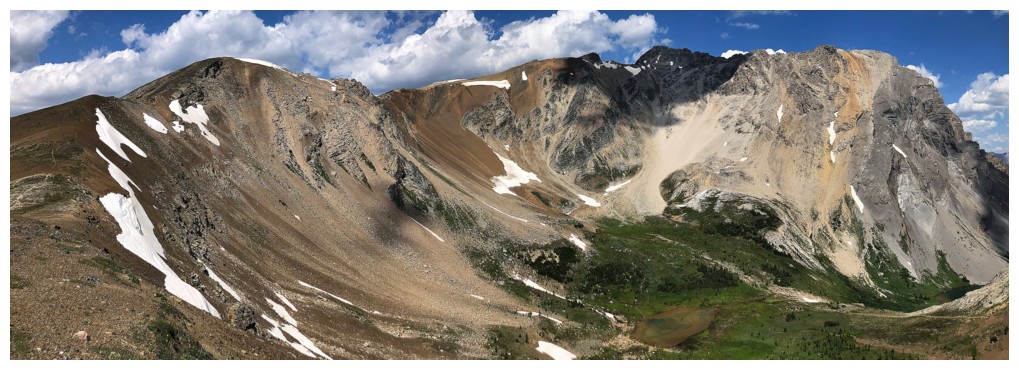
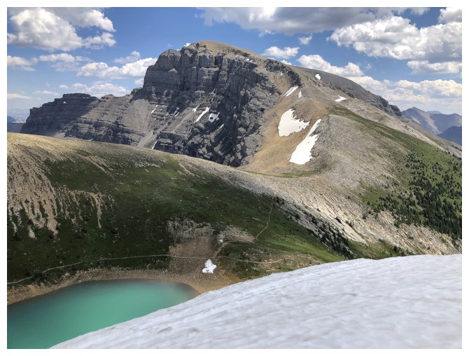
Harvey Pass at the left and the south ridge of Black Brett trending right
Still enjoying views back to the first lake
Turning right towards Black Brett. The summit is near the right side.
I took a short detour here to check out some of the other water features of the trip
A shallow tarn
Resuming travel towards the objective
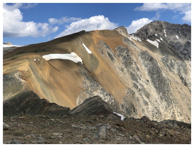
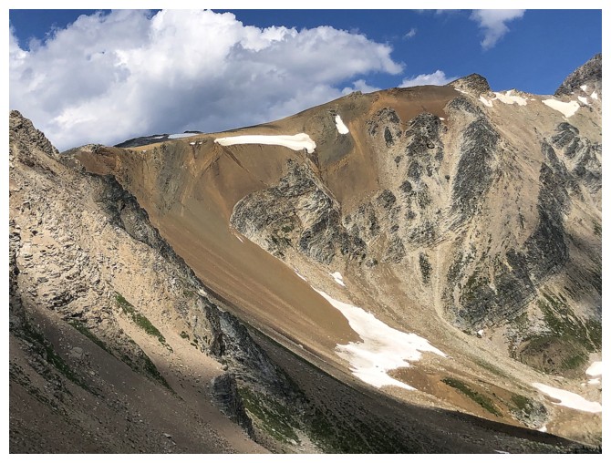
In addition to the water related highlights of the trip, an ascent of
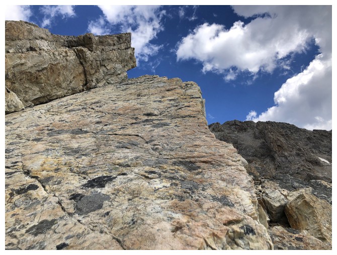
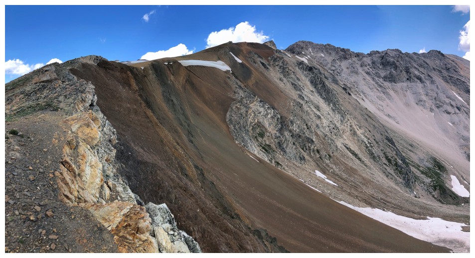
Black Brett features a fascinating variety of rock types and colours
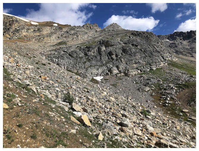
Harvey Pass
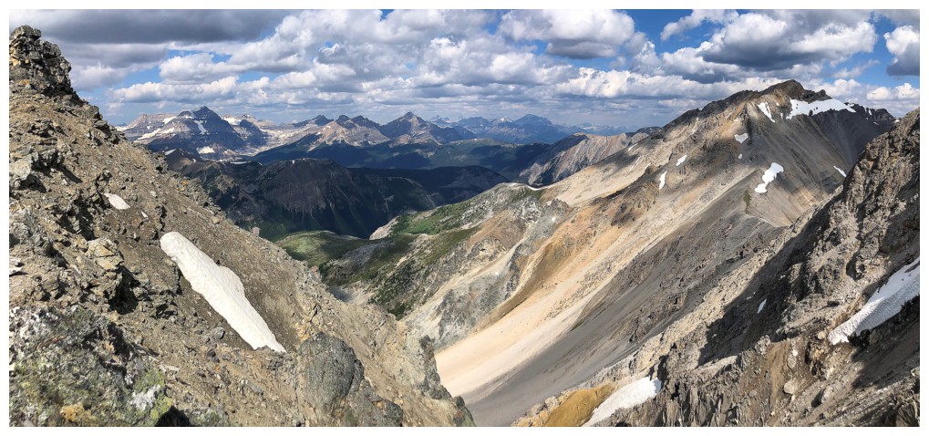
There are several routes up from here. I took the right trending ramp up to the lowpoint near the right.
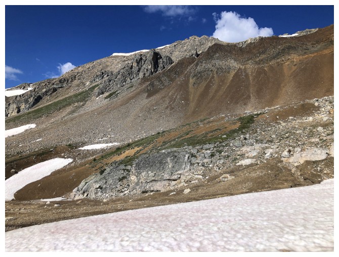
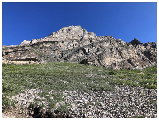
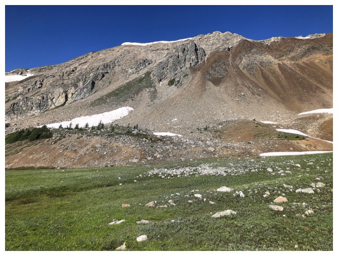
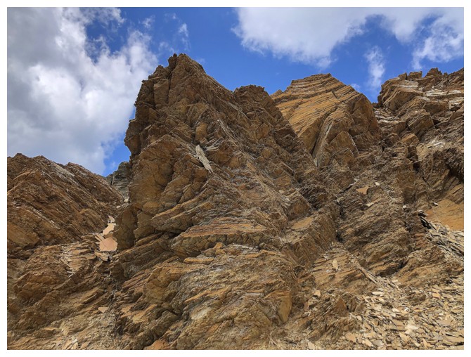
Wonderful colours on the south side of the mountain
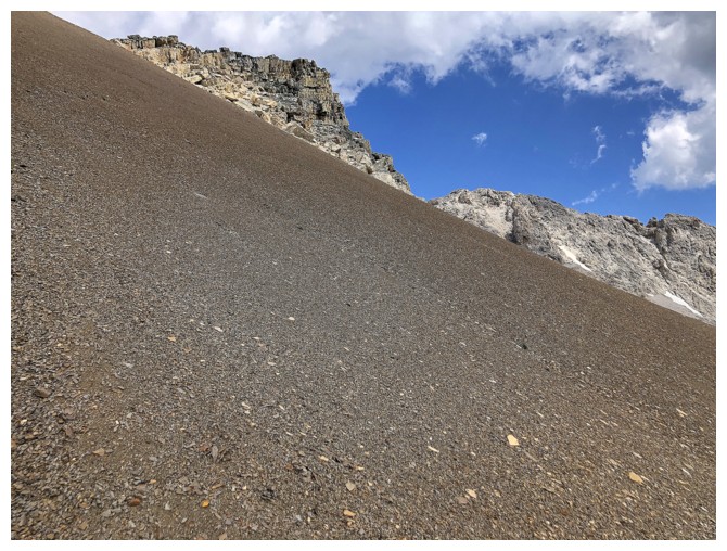
Looks easy but the ascent to the col was steep and tedious
At least, the colourful layers of rock kept me entertained
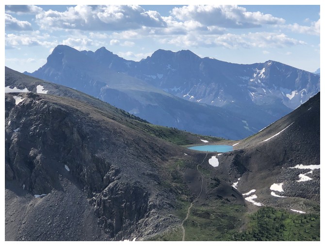
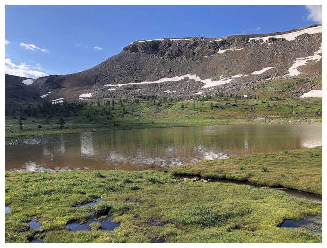
Upper Harvey Lake and a blast from the past - Mount Howard Douglas
Still impressed with the rock and colours
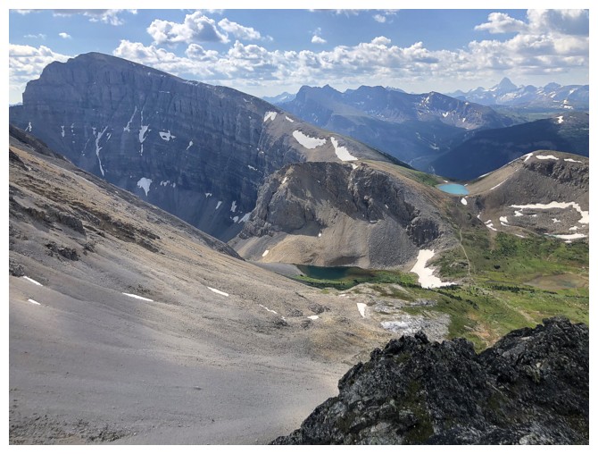
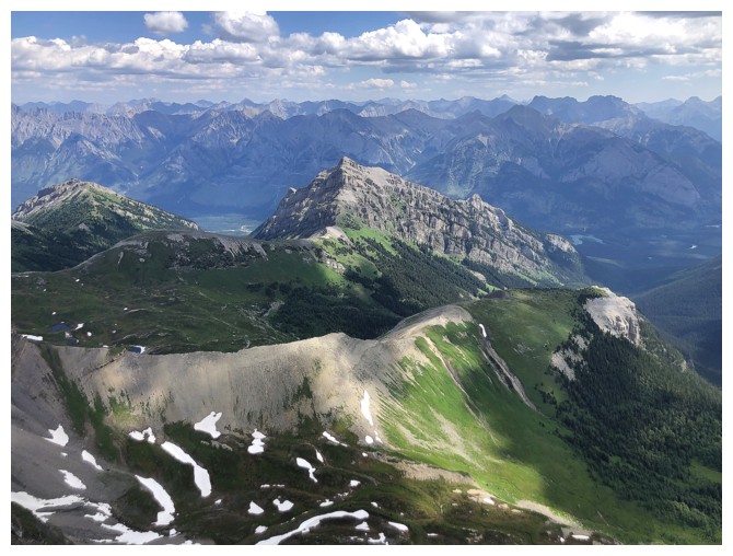
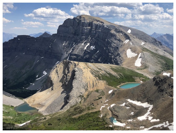
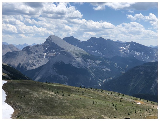
Mount Bourgeau to the left
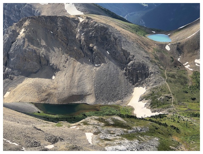
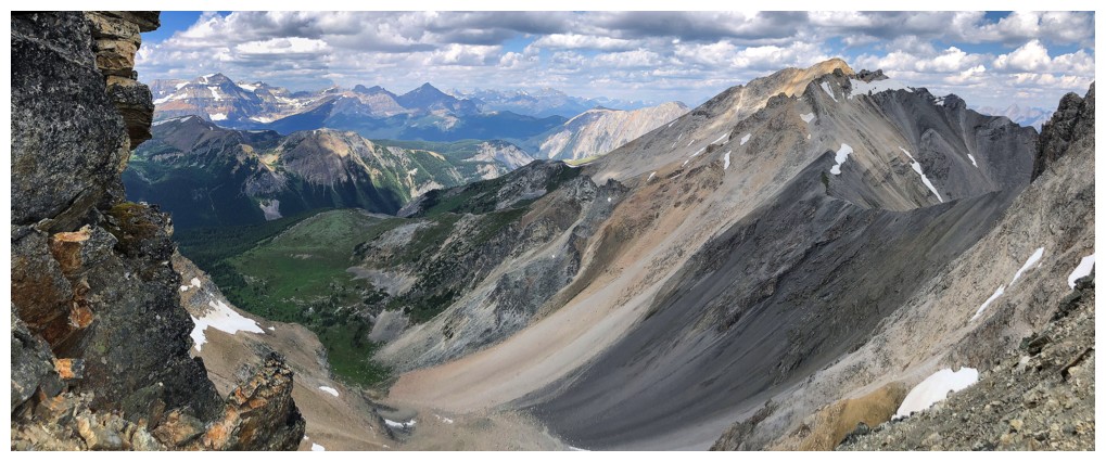
Closer look at the Harvey Lakes and the hiking trail
At the col and looking southwest to the descent route
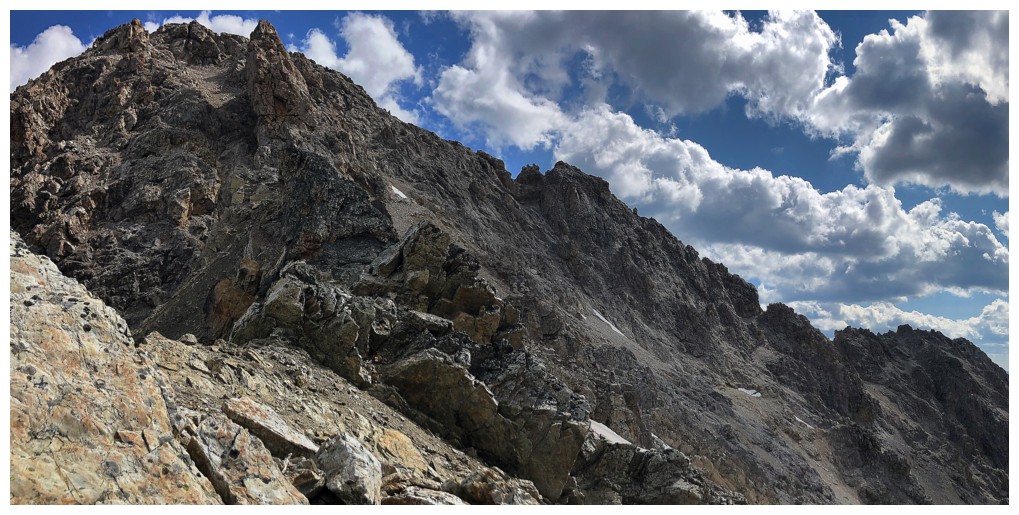
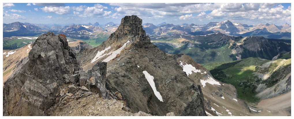
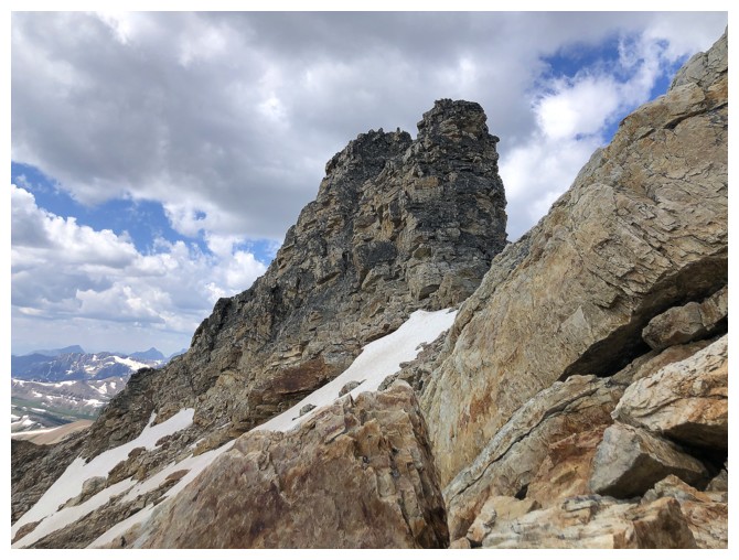
Looking northeast to the summit. The route up goes to the small notch in the centre and then left to the summit
The view to the north, over the other side of the col
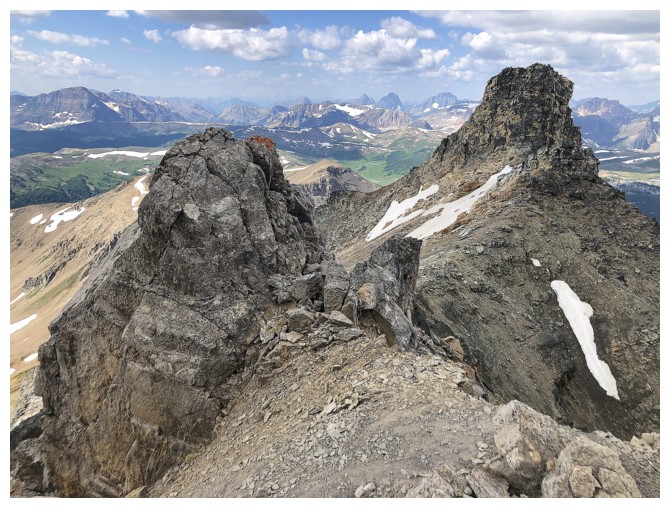
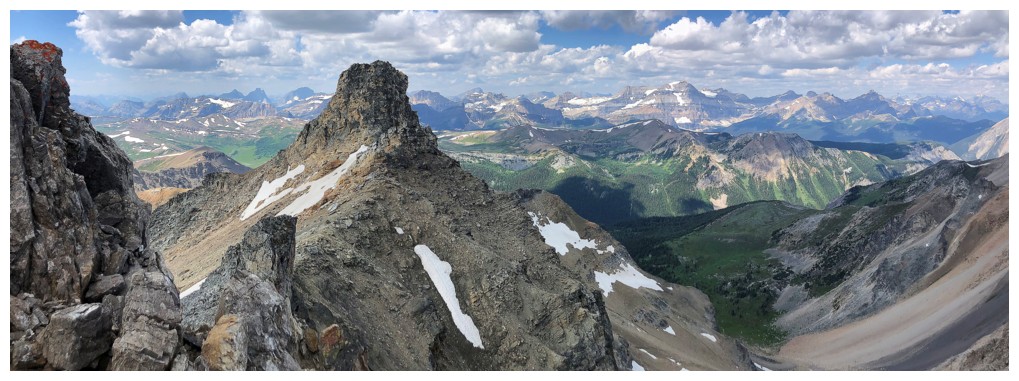
Two massive pinnacles on the southwest ridge were quite striking
The view to the west features mountains in the Egypt Lakes area
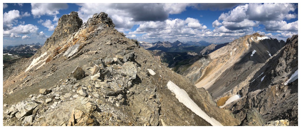
On the summit ridge
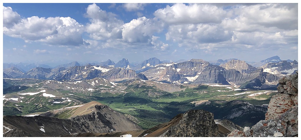
Summit view to the northwest
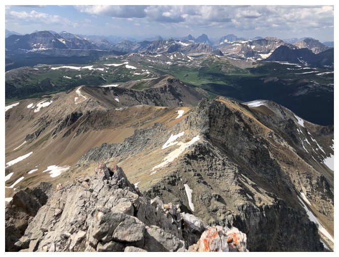
Looking down the southwest/south ridges of Black Brett
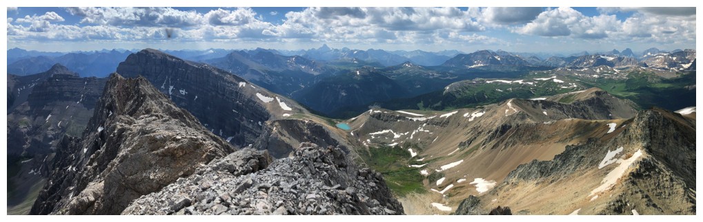
Summit view to the southeast
Distant Mount Assiniboine in the centre
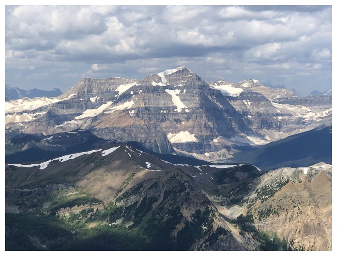
Mount Ball
The lush, green valley below the northeast side of the mountain
Heading down
The big pinnacles again
Awesome rock, but tricky to negotiate
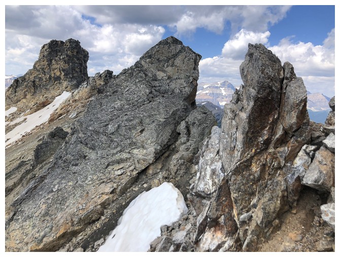
Same as above
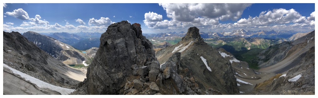
Heading towards the second pinnacle, circumvented on the left
Yet again, fascinating rock to look at
Mount Brett and Pilot Mountain to the right
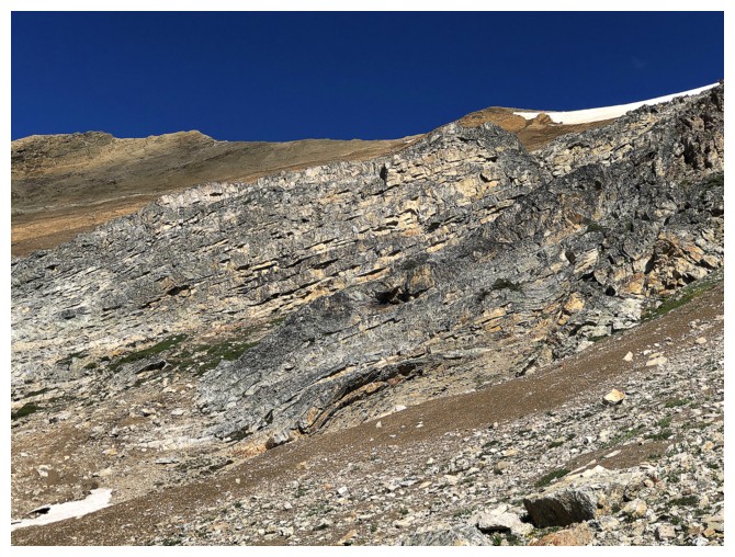
There's some good quartzite on this peak
...and a heck of a lot of scree!!
One more rock band to get around before regaining the ridge
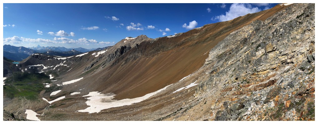
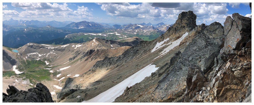
On the easy but gratifying southwest/south ridge
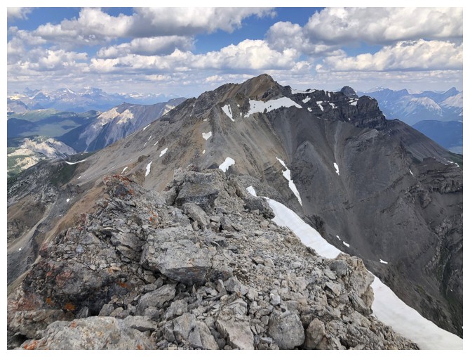
Looking back to the summit
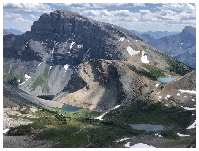
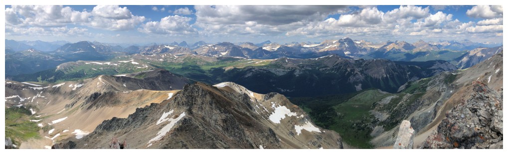
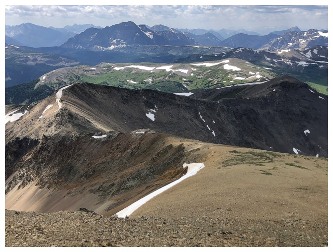
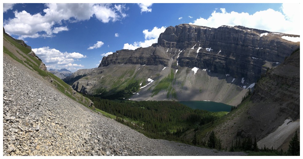
Mount Bourgeau and the four lakes around it
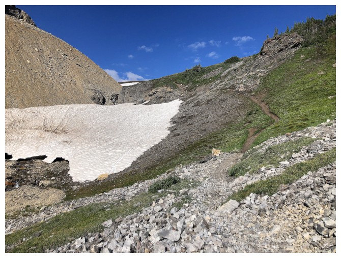
The last of the season's snow
Colours muted by cloud cover
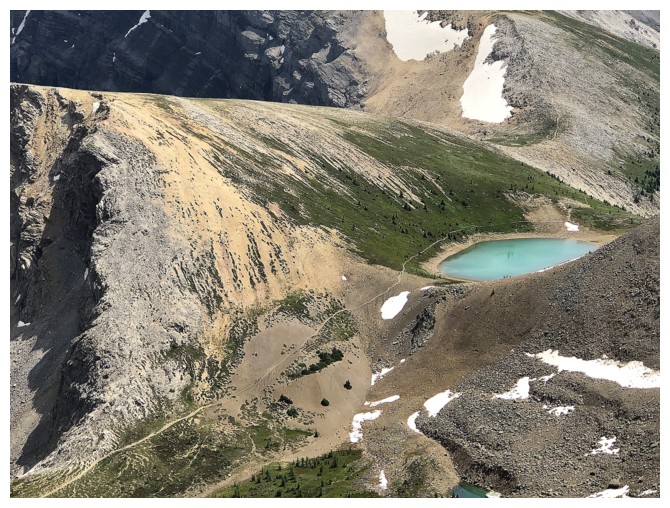
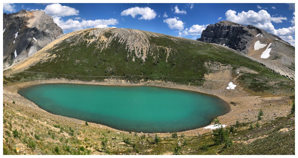
Pronounced trail to the turquoise Harvey Lake
Not muted here
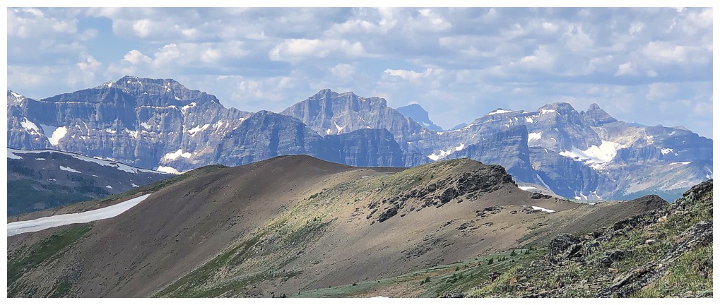
Closer look of the peaks around the Egypt Lakes, including Scarab, Haiduk, and the three Pharaoh Peaks
Eagle Mountain to the left - one of the easier ascents in the area (although our winter ascent was far from a pushover!)
Again, looking back at the wonderful southwest ridge
I was tempted to descend to checkout that small, ice-filled tarn, but
decided that staying high on the ridge would provide better views
Like this one
...and this one
Here comes the barage of photos of the highlight of the day - the turquoise Harvey Lake
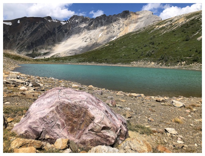
A random, pink boulder
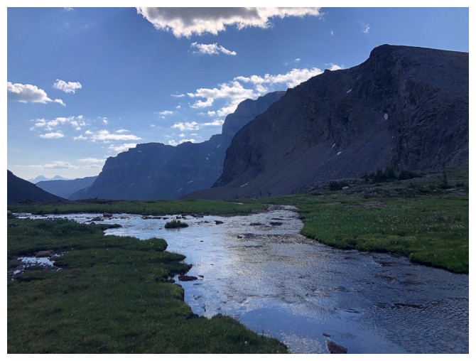
Back at the lower Harvey Lake
Looking down to Bourgeau Lake
Back on the Bourgeau Lake Trail and (not so) excited for the long hike out
The End
LOG