Black Rock Mountain II
November 21, 2020
Mountain height: 2462 m
Elevation gain: 920
m
Ascent time:
3:30
Descent time: 1:55
Scramble with Mark.
Couldn’t have asked for a more entertaining
return to this little front-range gem!
Having spent an inordinate amount of time
over the past year in the outrageously colourful Southern Alberta Rockies,
admittedly my interest in the more northern (and less colourful) Rockies was at
a lower than normal level. Mark and I had first ascended Black Rock in 2006 and
we both recalled it to be a very enjoyable trip. Perhaps a repeat ascent would rejuvenate that interest.
 As usual, this objective was a last-minute
decision, Mark pulling the idea out of his hat (helmet) as we fueled up on
Timmy’s coffee at 6 am in Calgary. The drive to the trailhead was a pleasant
surprise. Recalling a long, unpleasantly bumpy drive from our trip 14 years
ago, we were both grateful to find the road a much smoother ride. As well, we
were able, not only to drive down “The Big Hill”, but also several kilometres
up the valley to a point very close to the trailhead.
As usual, this objective was a last-minute
decision, Mark pulling the idea out of his hat (helmet) as we fueled up on
Timmy’s coffee at 6 am in Calgary. The drive to the trailhead was a pleasant
surprise. Recalling a long, unpleasantly bumpy drive from our trip 14 years
ago, we were both grateful to find the road a much smoother ride. As well, we
were able, not only to drive down “The Big Hill”, but also several kilometres
up the valley to a point very close to the trailhead.
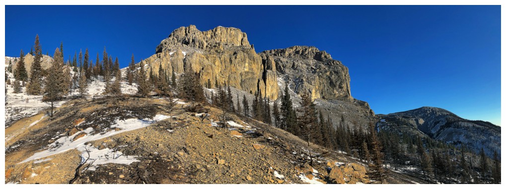
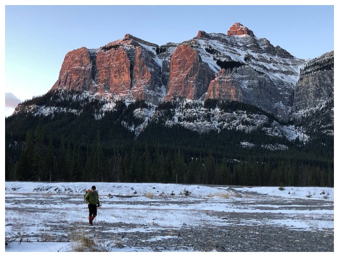
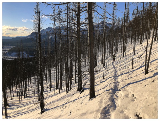
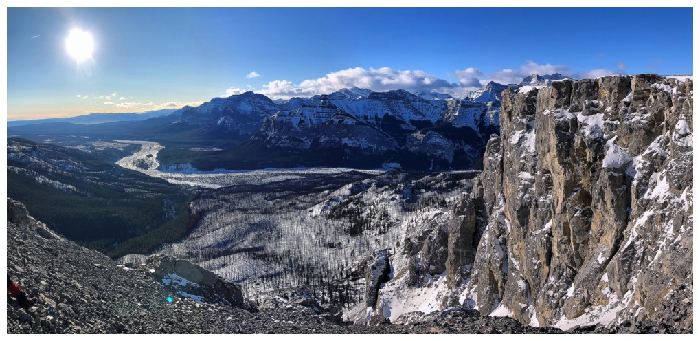
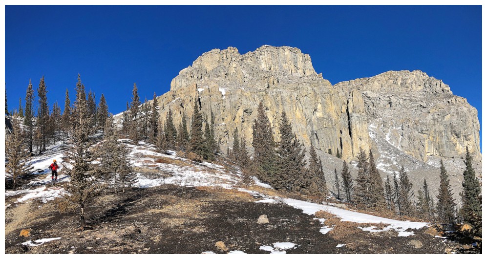
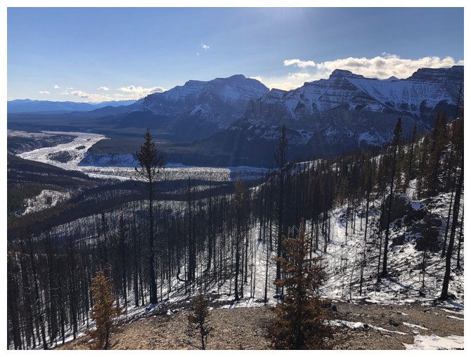
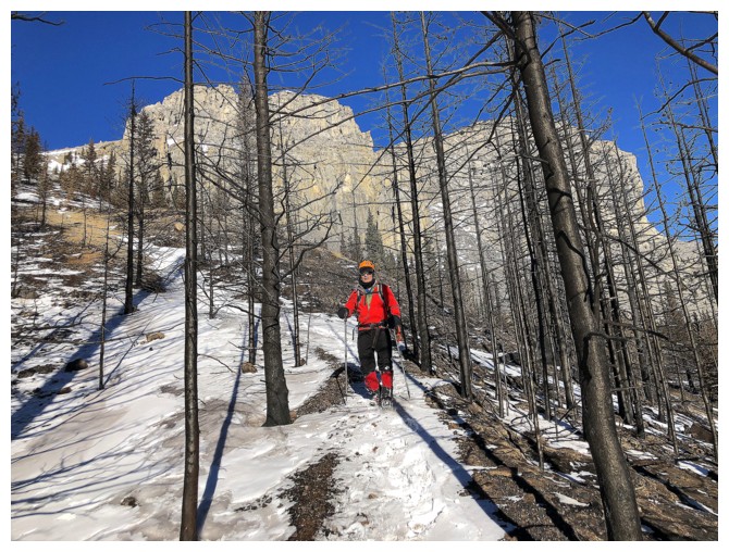
The hike to the base of the mountain was
stunning, courtesy of a very recent fire that ripped through the area. Unlike
the Waterton Kenow fire, where we waited three years to see its amazing results
(ie regrowth), this fire occurred only a few months prior. On this day, the
newly blackened trees and scorched ground below provided a stark but beautiful
contrast to the new snow and clear blue skies – very cool!
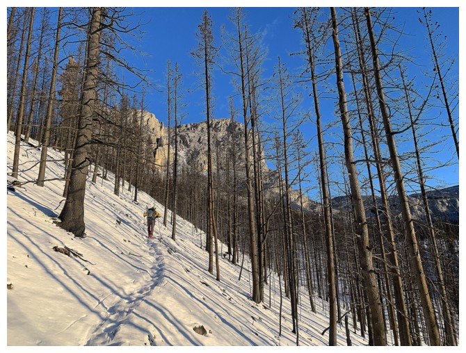
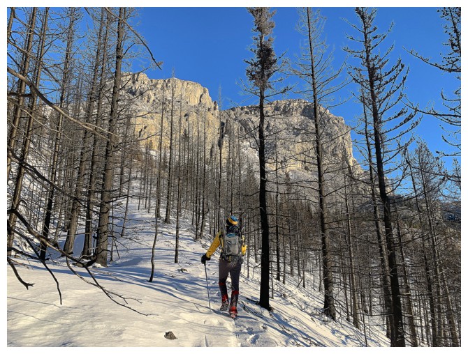
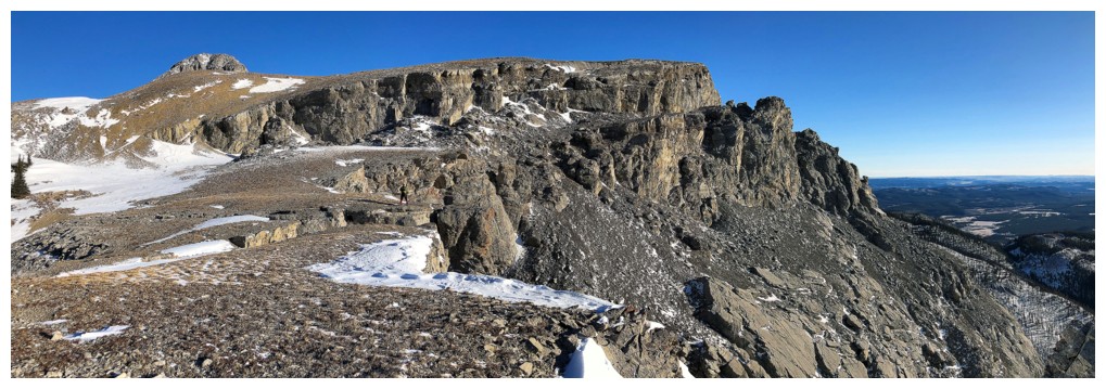
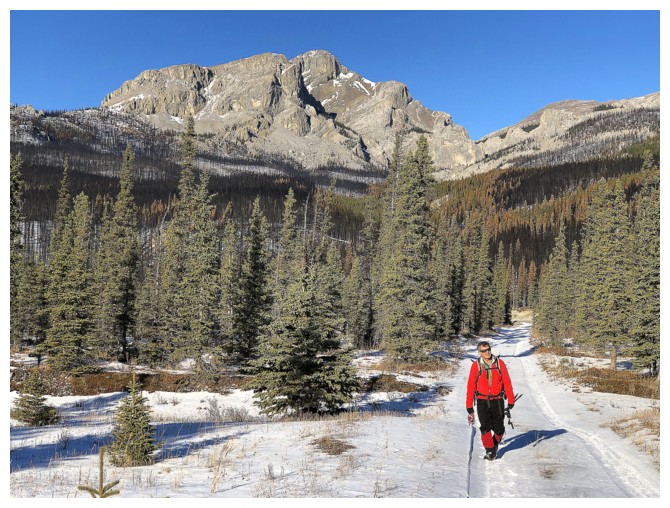
 Eventually we cleared treeline, with the
super impressive bulk of Black Rock Mountain before us. After a long stretch of
“oohing” and “aahing” at this magnificent scene, we decided to leave the hiking trail in
search of a route through the immense walls of stunning rock. One was found and
it was incredible!
Eventually we cleared treeline, with the
super impressive bulk of Black Rock Mountain before us. After a long stretch of
“oohing” and “aahing” at this magnificent scene, we decided to leave the hiking trail in
search of a route through the immense walls of stunning rock. One was found and
it was incredible!
Although, for me, rock scenery (specifically rock
colour) in other parts of the Canadian Rockies will never compare to that of
Waterton and The Castle, the rock of the east side of Black Rock measured up in
every way – no red or green argillites, but beautiful shades of gray, beige
limestone, pinnacles and other cool features; add a deep blue, November sky and
some fresh snow – the ultimate recipe for the most delicious scenery!!
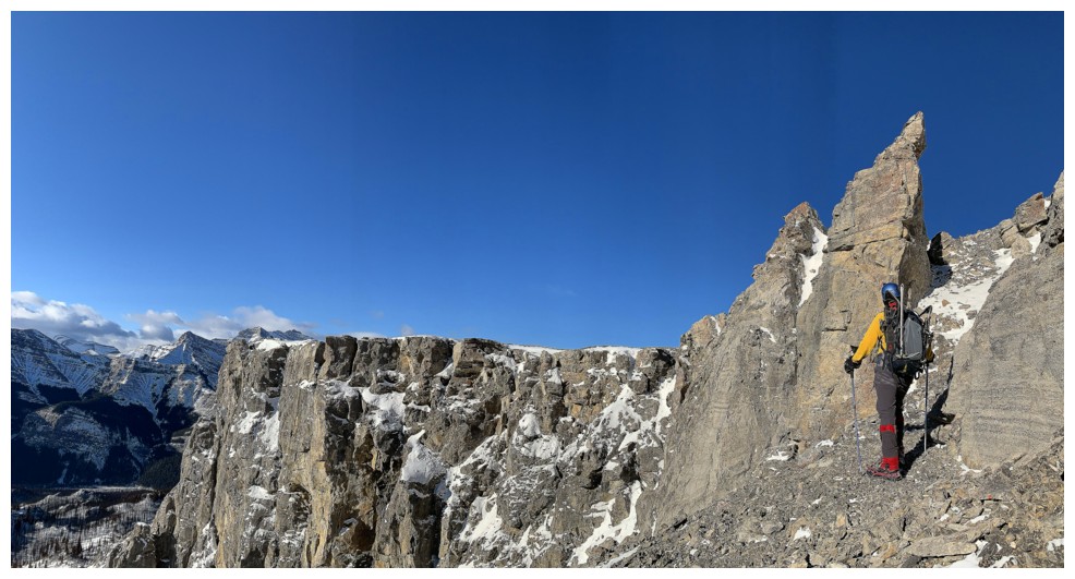
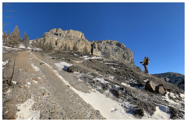
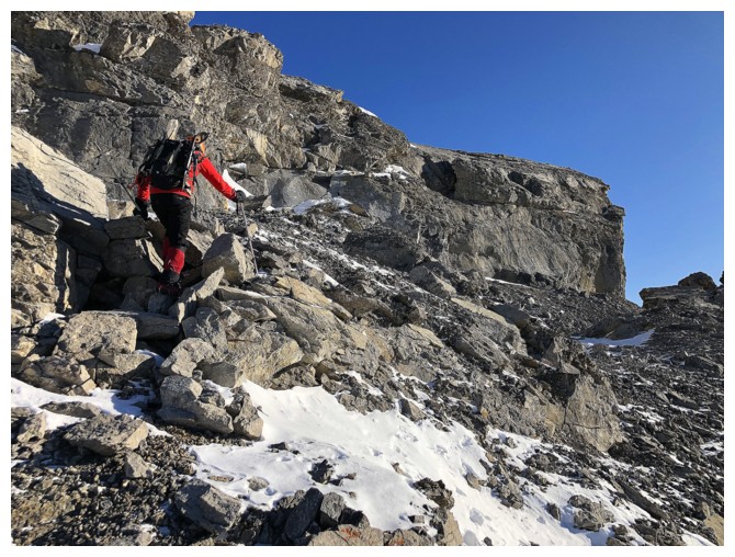
As scenic as the route was, it was also quite
steep, requiring either crampons, or at least microspikes, and a few careful
moves on unstable terrain. Mark led the way through a maze of outstanding rock.
We were delighted to find a weakness through the imposing rock, all the way to
the ridge, as retreating would have been slow, tedious, and time-consuming.
Aside from the outrageous rock scenery, the
route we used also had the advantage of keeping us sheltered from the cold. Of
course, that changed dramatically upon exiting the gully. Though initially a
minor inconvenience, the wind and accompanying bone-chilling temperatures
wreaked havoc on our hands and faces near the summit and throughout our
summit stay (the old lookout up there provided surprisingly little reprieve). We
had considered attempting an alternate descent route down the east and
southeast sides of the mountain but decided against it, warming our hands asserting
itself as a far more pressing issue!
Needless to say, we took the easy hiking
route for descent, as opposed to retracing our steps down through the weakness. The hiking
route itself is replete with fantastic rock scenery and so we were treated to
the best of both worlds by doing it as a small loop. And then, a surprise encounter
with a super friendly group of fellow hikers/scramblers. I immediately
recognized Mike Buenting and when he introduced us to the rest of his group I
was pleasantly surprised to meet Chris Conrad, who I had been in correspondence
with only a few days earlier, Luciana Kuamoto, a Seattle Seahawks fan, but as a
Los Angeles Rams I won’t hold that against her :), Luciana’s son Leandro (maybe
he’s a Rams fan?!), and Jenny Kennard – always great to meet fantastic people
on a fantastic mountain!
After a delightful visit with the group we
completed the easy descent, again enjoying tons of fantastic scenery.
As
alluded to, a thoroughly outstanding day.
And yes, the more northern Rockies are still offering some of the
finest scenery on the planet and my interest has been fully restored!
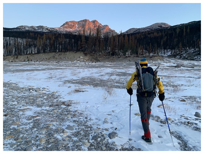
Off we go, as Black Rock Mountain gets the first rays of the morning Sun
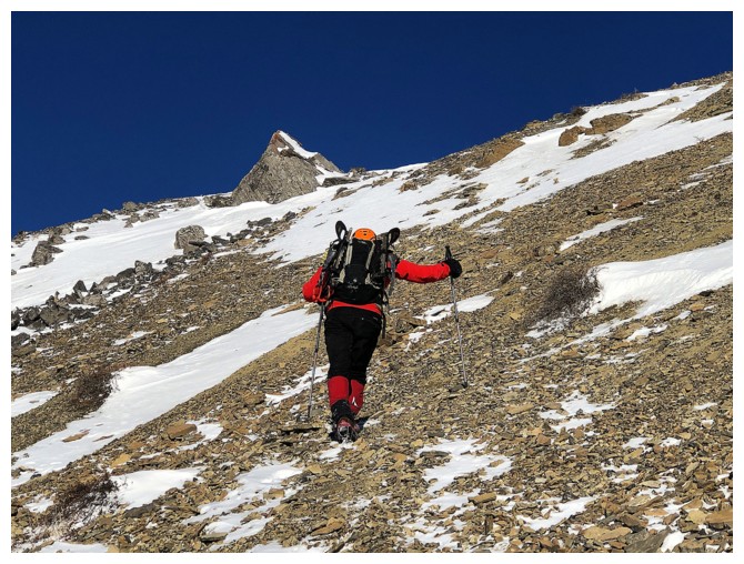
Looking back at Phantom Crag
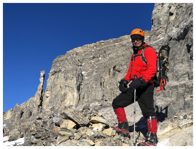
Although just an outlier of much bigger Mount Costigan, Phantom is an impressive and apparently worthwhile objective in itself
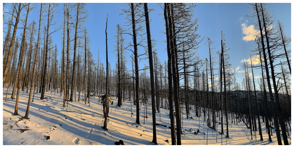
Easy hiking through a wild landscape of newly burned trees
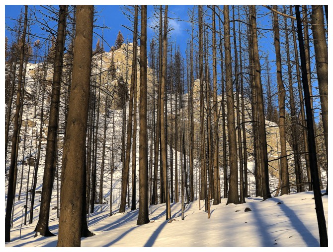
The bulk of Black Rock appears through the trees
A generous individual had broken trail for us
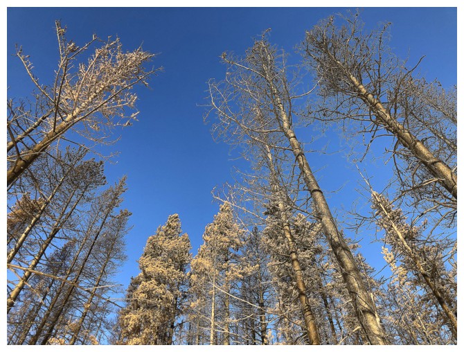
The vast majority of the trees were completely burned, but a few, surprisingly, had been spared
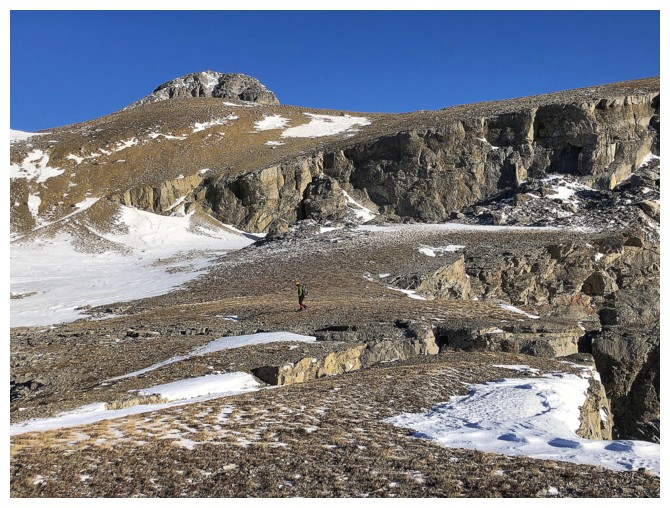
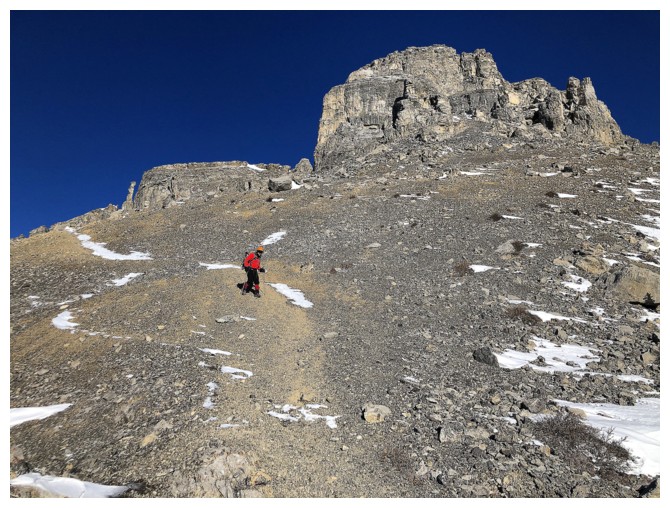
Getting closer!
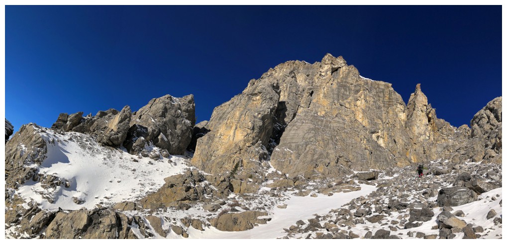
Black Rock Mountain - stunning!
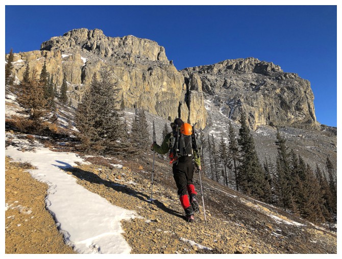
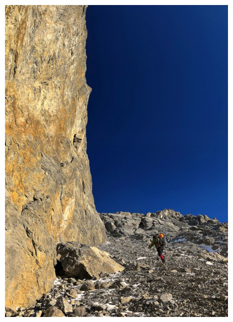
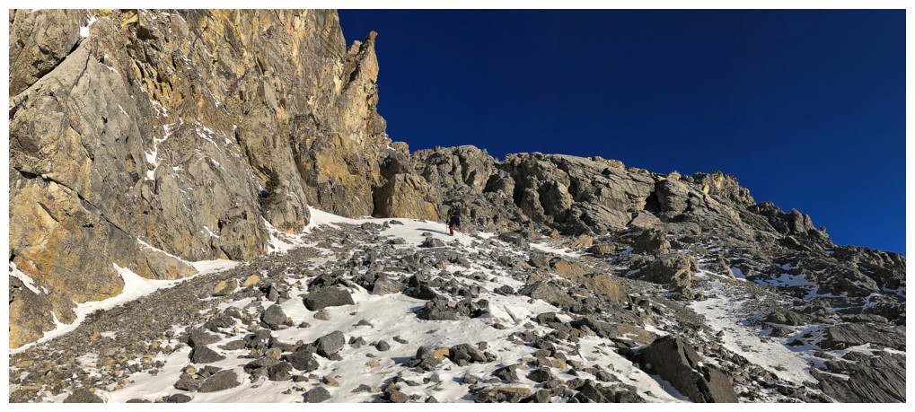
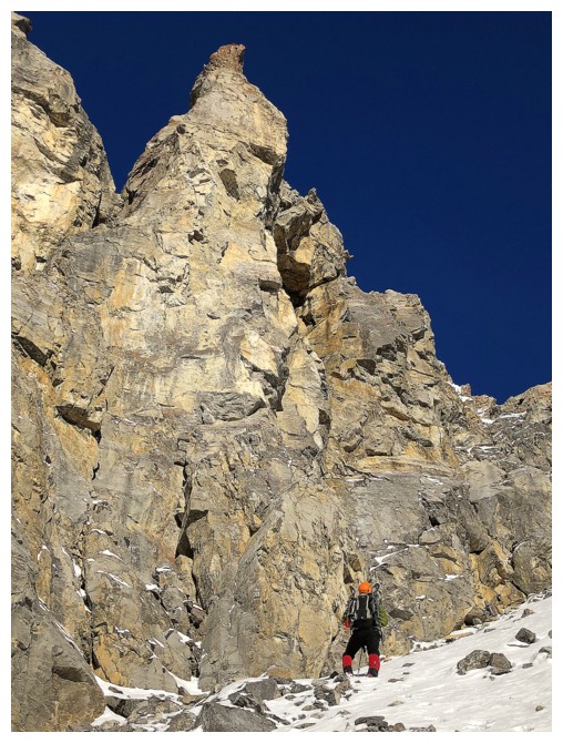
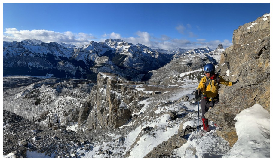
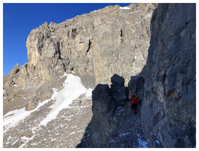
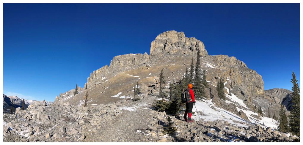
Leaving the hiking trail and heading towards the impressive rock face
A steep traverse across rubbly slopes is required to get to the awesome rock
The rubble sucks but the views are awe-inspiring
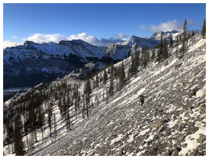
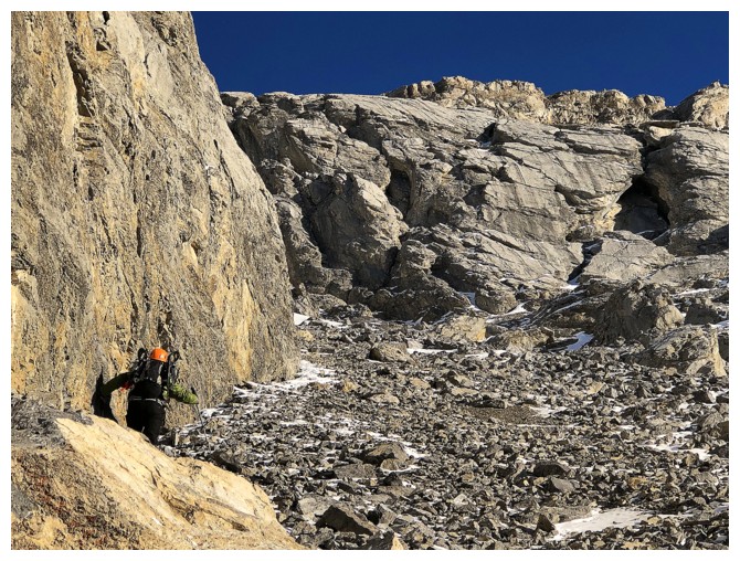
Mark is still traversing
Let the ogling begin!
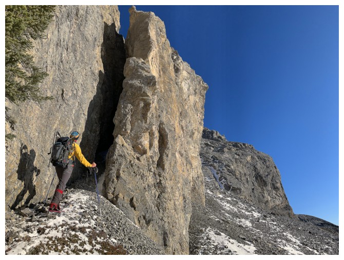
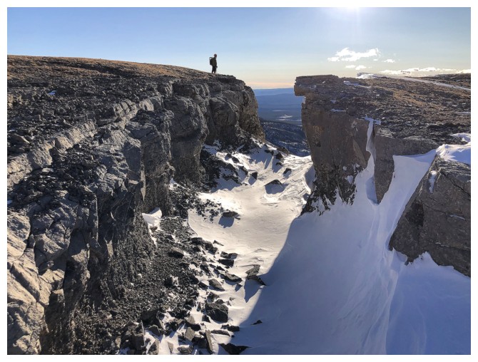
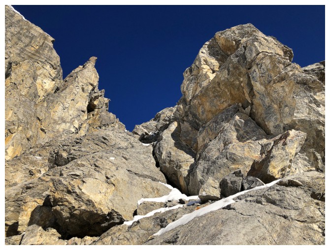
Quick detour to check out a cool gap in the rock wall
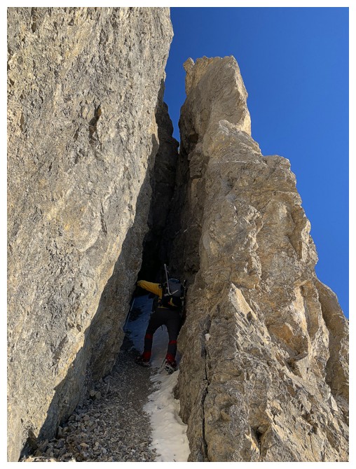
Entering the gap
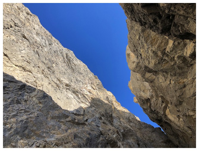
Looking up from inside. The Alex Honnold's of the world would be salivating here - I felt mildly nauseous!
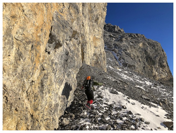
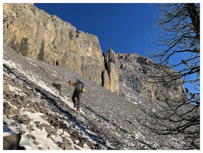
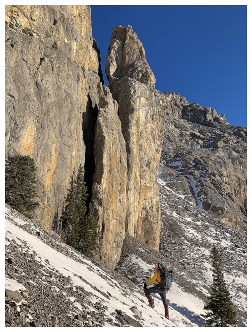
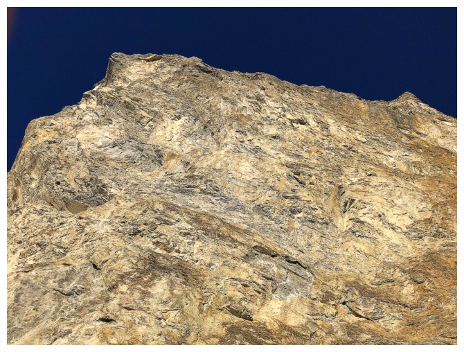
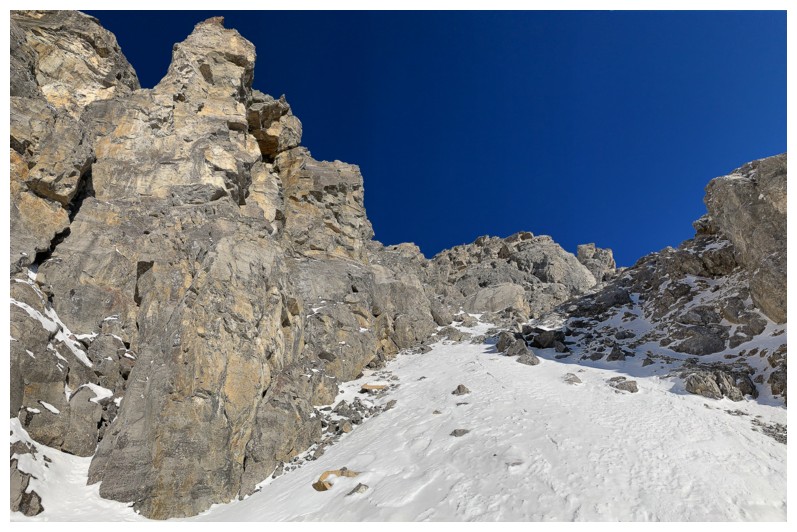
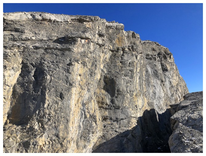
Continuing up, alongside the imposing wall of rock, hoping there's an easy route around the corner
Excessive neck strain was a real concern for this part of the trip!
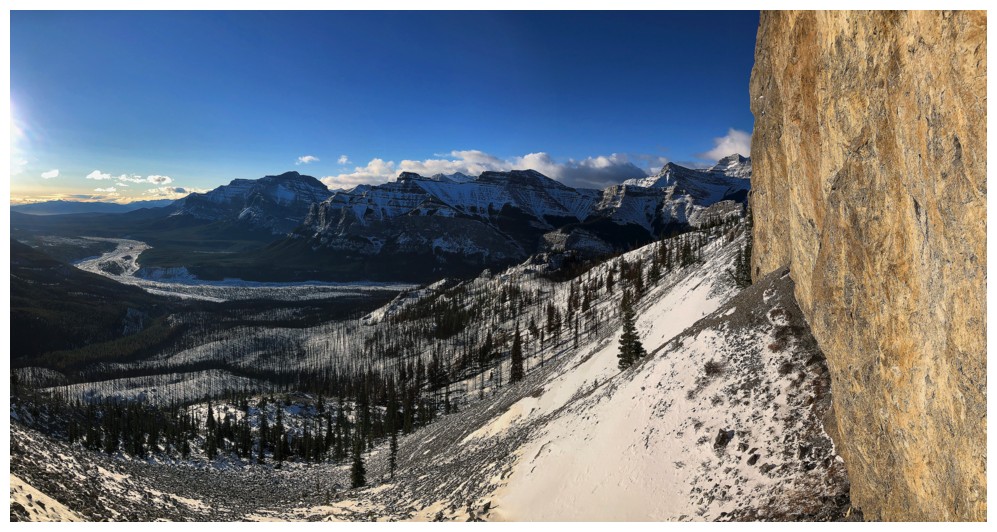
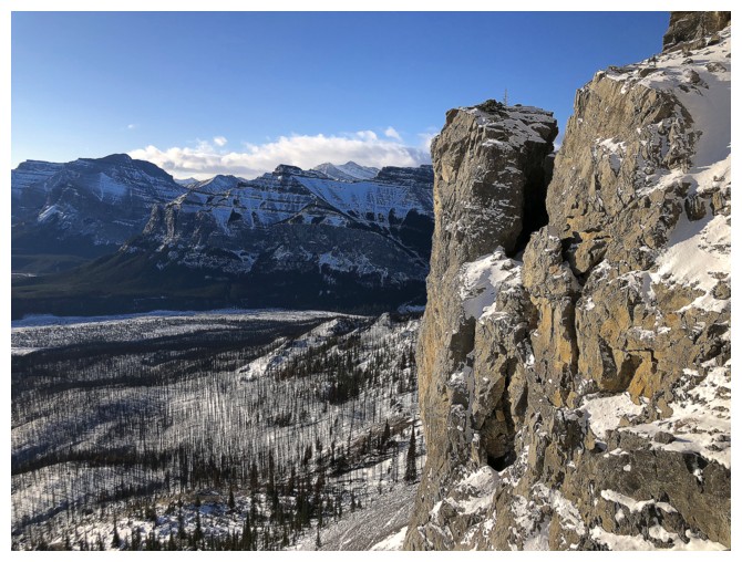
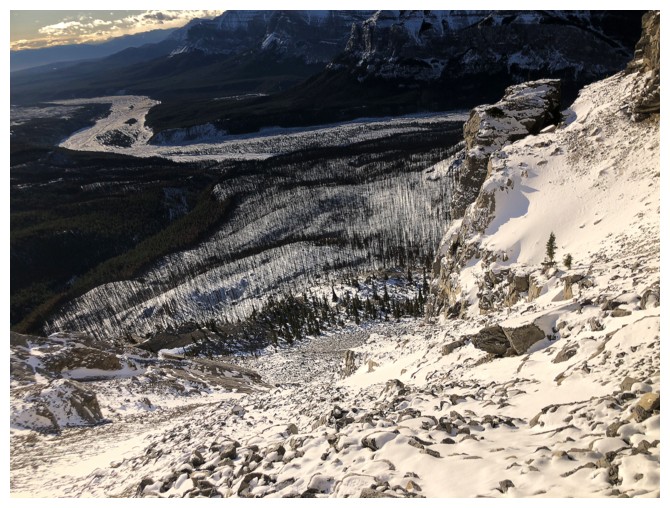
The wall and the Ghost valley
More neck strain
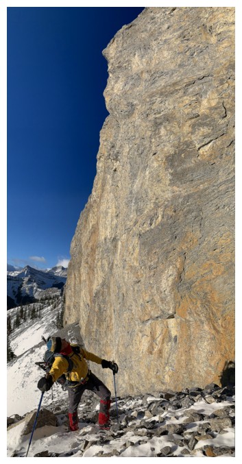
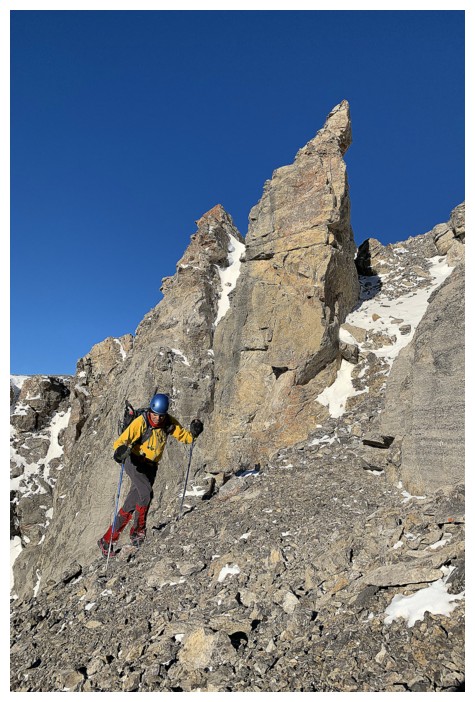
Mark leads the way, The rock in front had some potential, but it would have been a very steep, exposed scramble.
Love the colour of the sky at this time of the year. The rock ain't bad either!
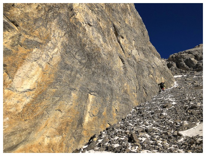
Love the geometry of the lines here
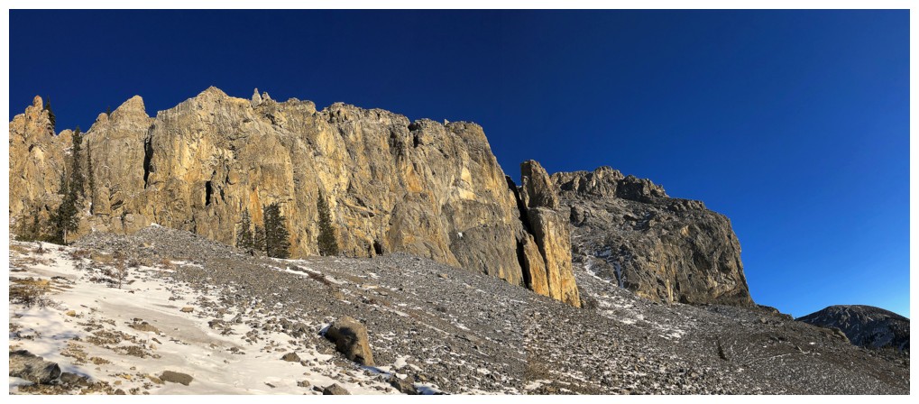
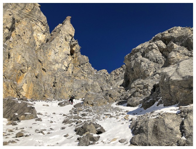
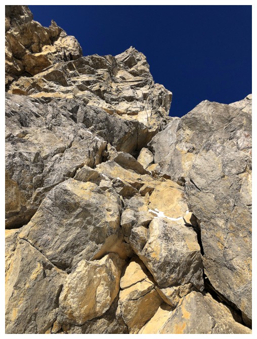
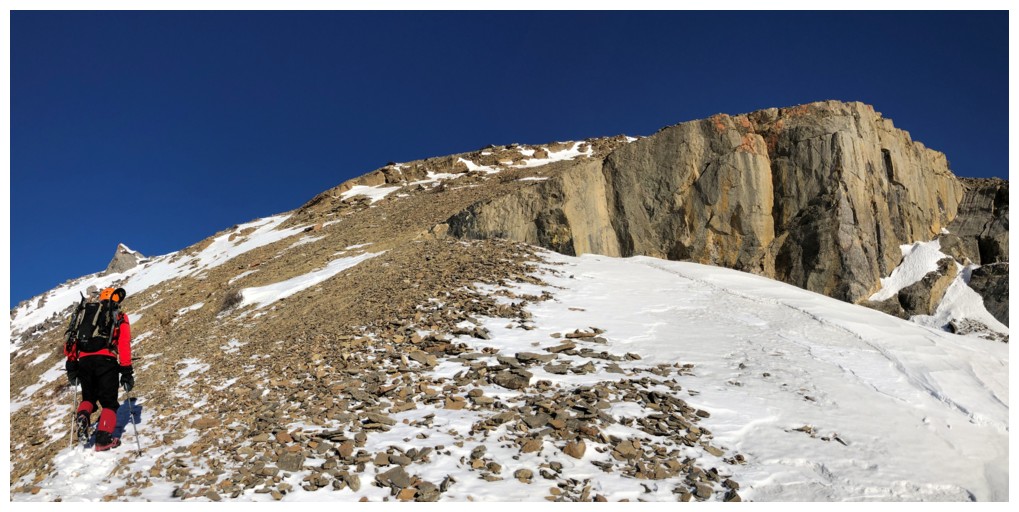
Around the corner and looking up at some fierce but awesome terrain
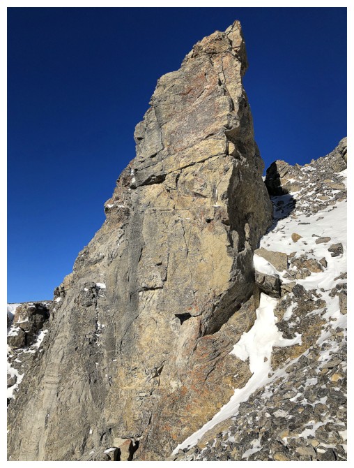
The rock pinnacle at the left garnered much photo attention
One reason why random exploration can be a very good thing
A similar reason
Passing the other side of the gap in the rock wall
Reason #3
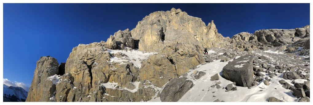
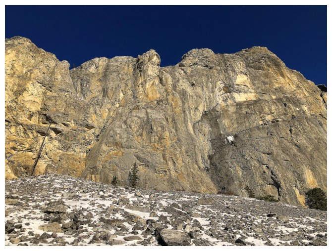
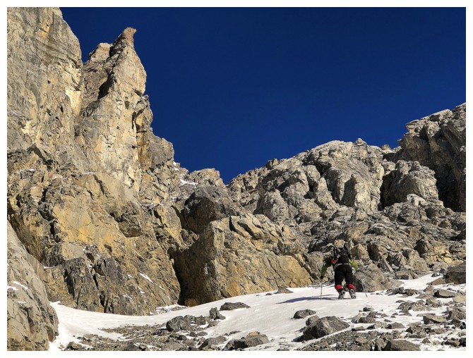
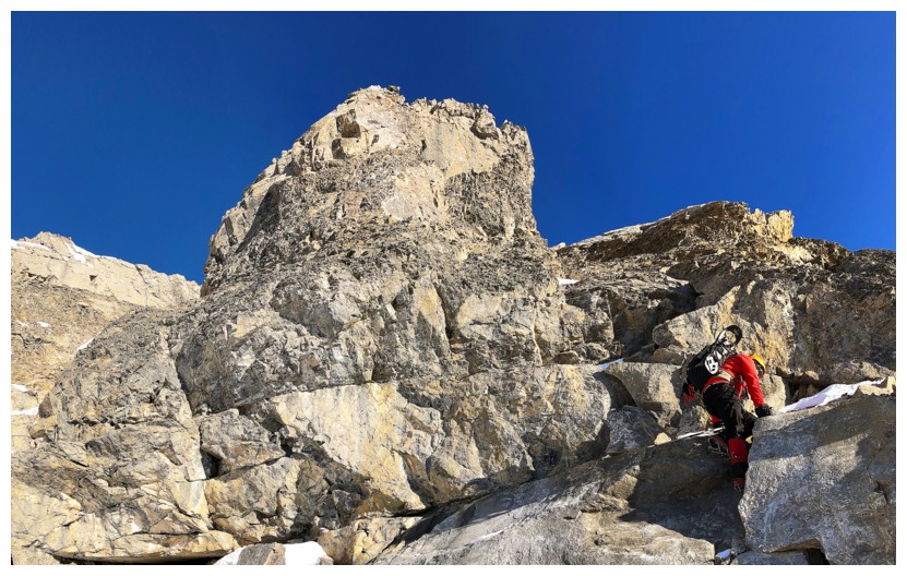
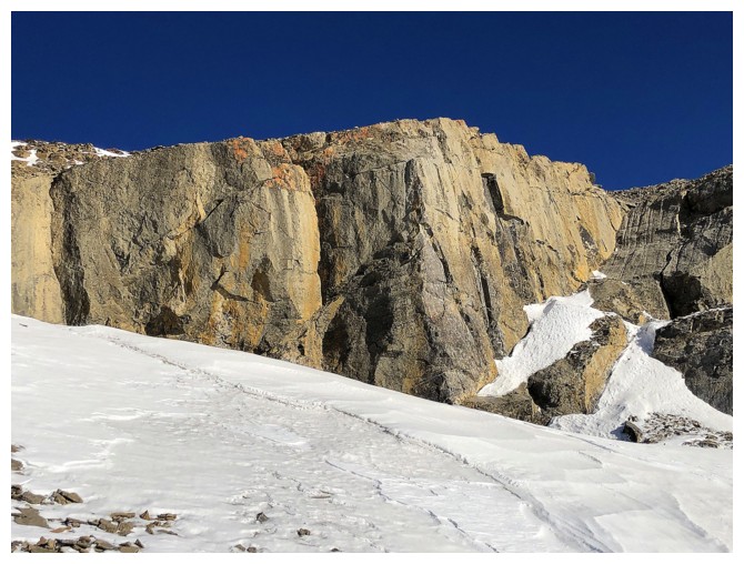
This part of the ascent boasted some of the finest rock scenery of the day
Mark continues to lead the way up
Looking down the route we just ascended
Mark stands under the coolest rock formation of the day
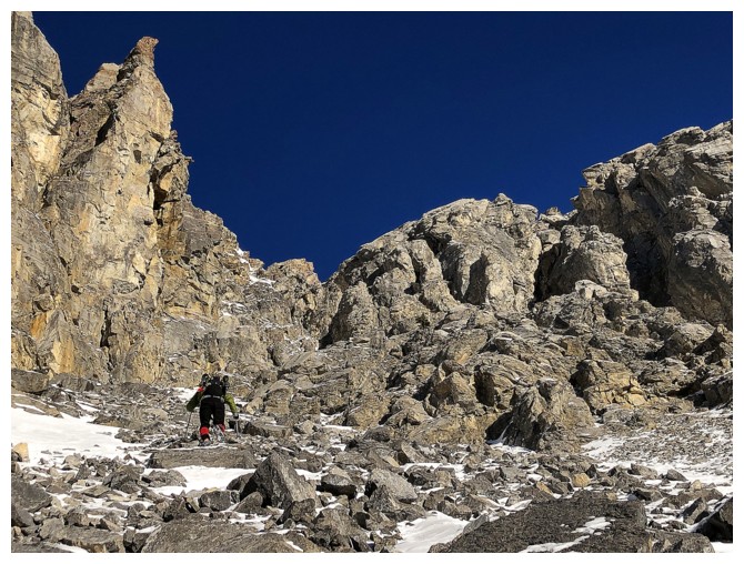
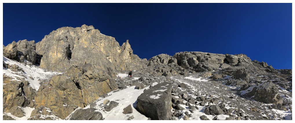
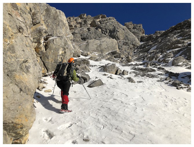
The route continues to unfold with relative ease
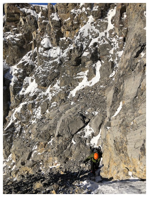
The snow made the ascent easier in places
The passage to the ridge and the crux of the ascent. It wasn't viciously steep, but care was required.
Cool rock and looking at Mark ascend one of the steeper sections
Cool rock and more cool rock
Almost at the ridge
Looking over the valley
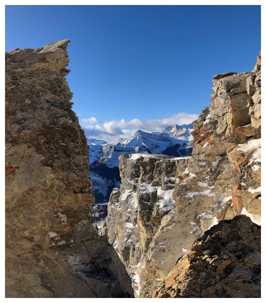
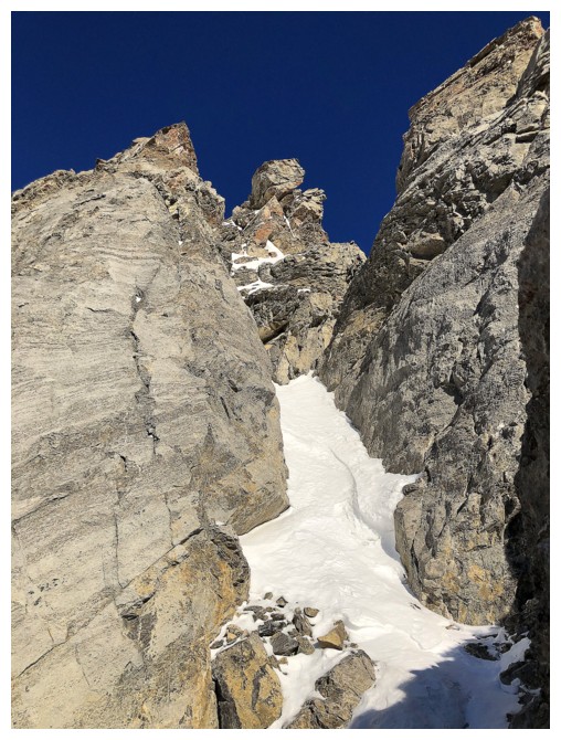
Another gap in the rock
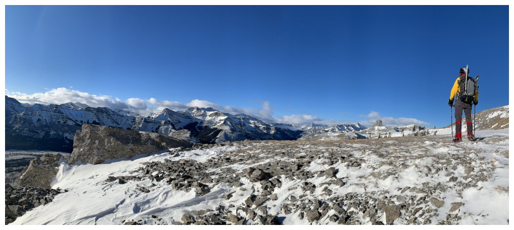
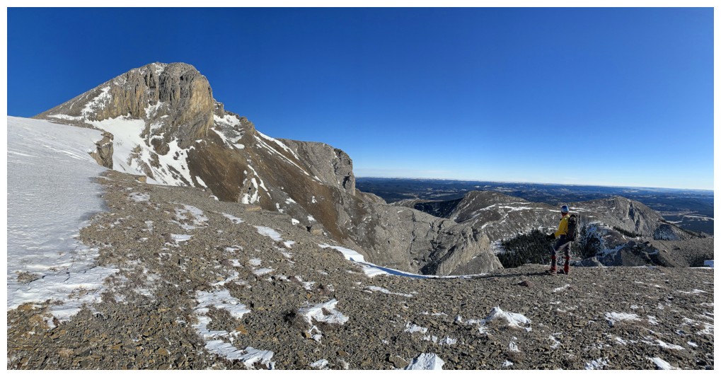
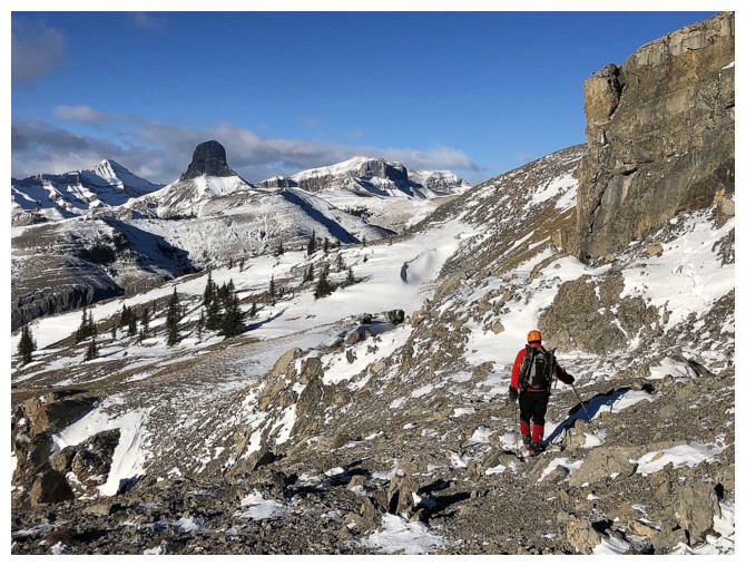
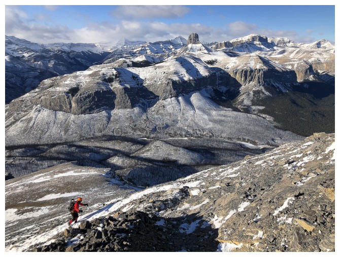
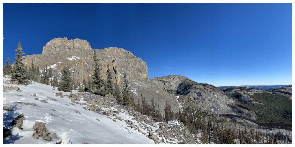
Atop the ridge and almost back to the hiking trail
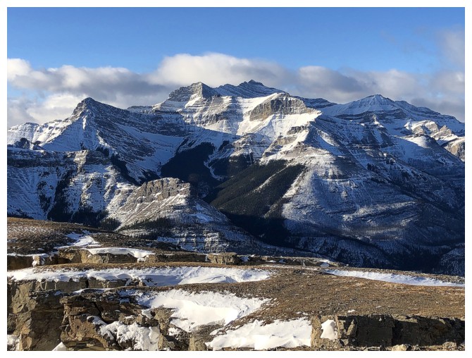
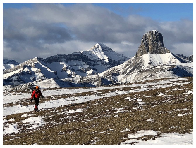
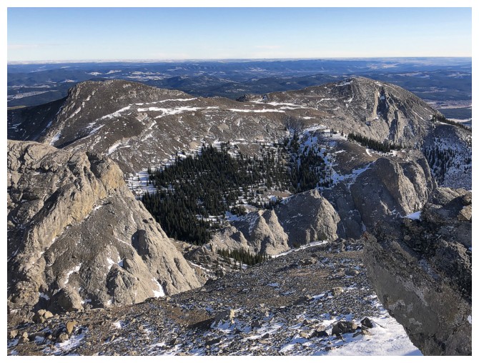
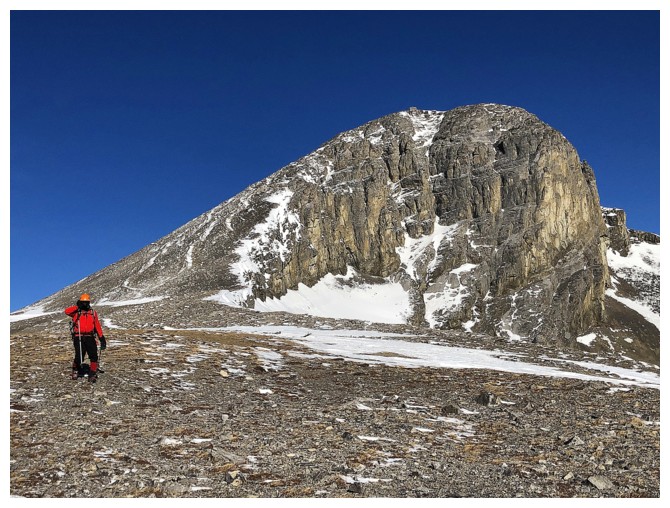
Massive Mount Costigan
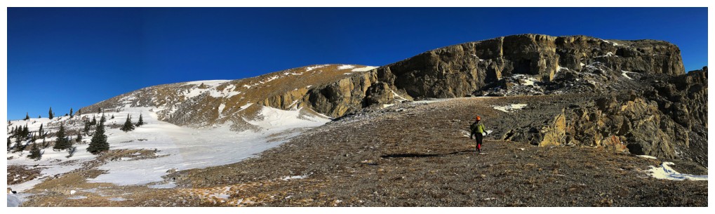
The hiking trail sits to the left, but we still have some exploring to do over to the right
Lots of fissures and interesting features to check out on this mountain
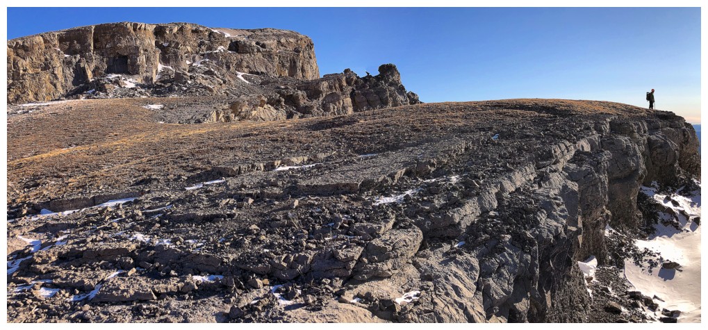
One of the more interesting features
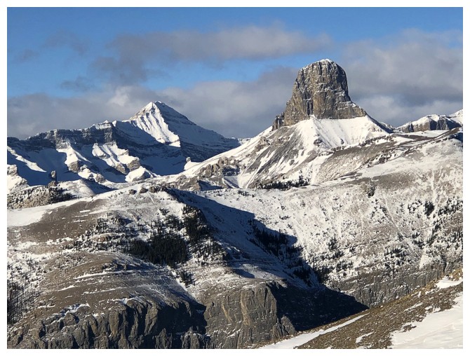
Mount Alymer (left) and Devil's Head (one of the coolest mountains in the area)
The rock at the left resembles a really BIG chair. I'm standing above it for scale.
Mark on the other side of the fissure and there's the summit of Black Rock
Still enthralled by this area
Mark leads us up another unexplored area, with the hope of gaining the ridge above
This route did not acquiesce. The terrain became very steep and exposed.
Still, a cool place to be
Continuing around the mountain was out of the question
Retreat. Heading back to the hiking trail.
The title "Black Rock Mountain" at times seems to be somewhat of a
misnomer. The peak is littered with glorious shades of beige, yellow,
and light gray limestone.
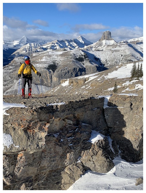
Finally on the hiking trail
Good thing we chose a front-range trip, as clouds filled the western skies
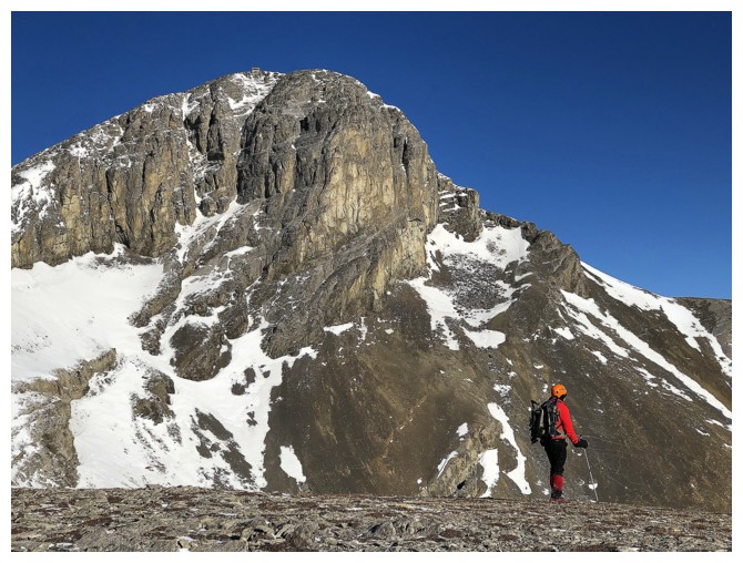
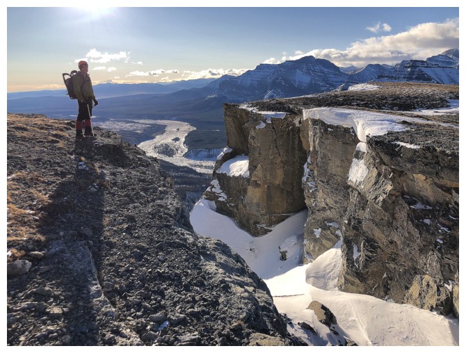
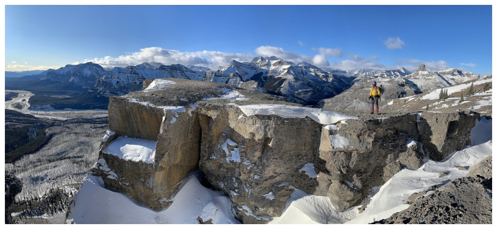
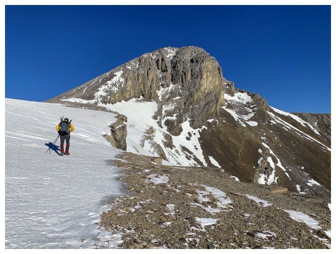
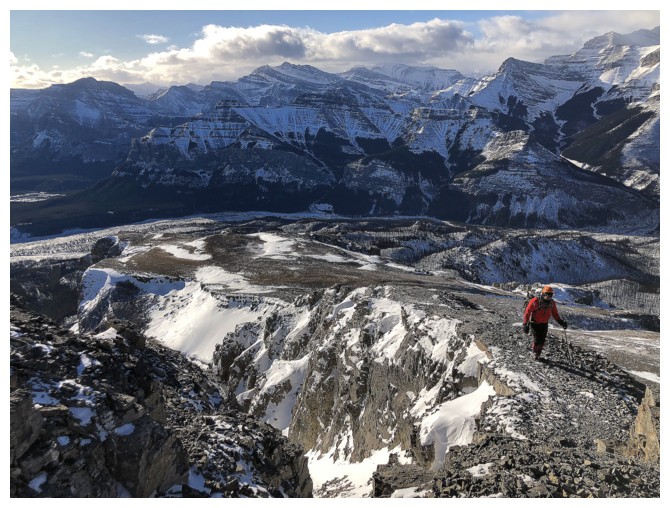
The summit block of Black Rock is pretty impressive itself
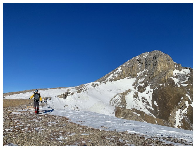
Easy hiking with great views, but the air temperature at this point was bone-chilling and just got worse higher up
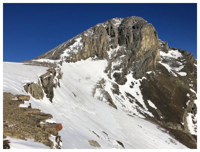
Still kinda' mesmerized by this view of the summit
Initially, we were hoping to find a way down to these lower summits to the southeast
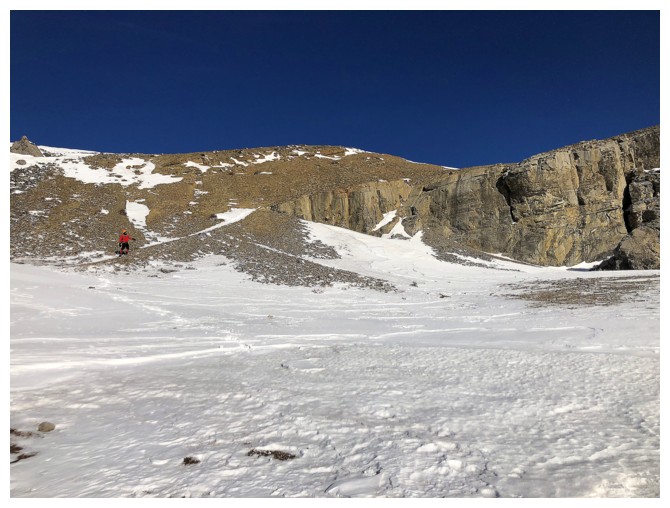
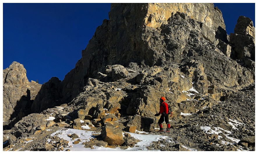
The trek continues
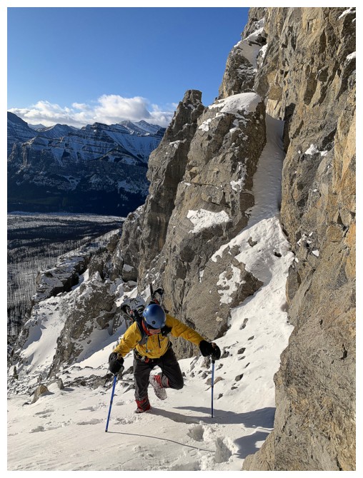
The trail does get steeper for some sections
The last section is pretty cool, as the trail narrows to a comfortably wide sidewalk, but with drop-offs on both sides
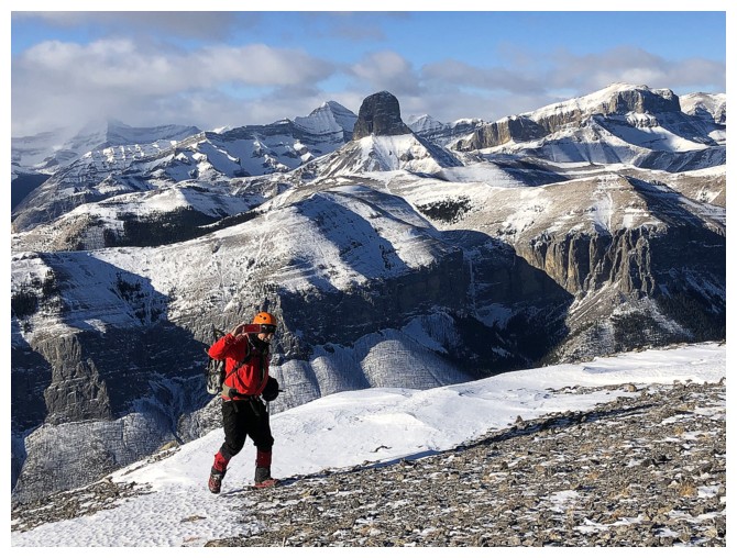
Mark records his summit movie, as he finishes the ascent
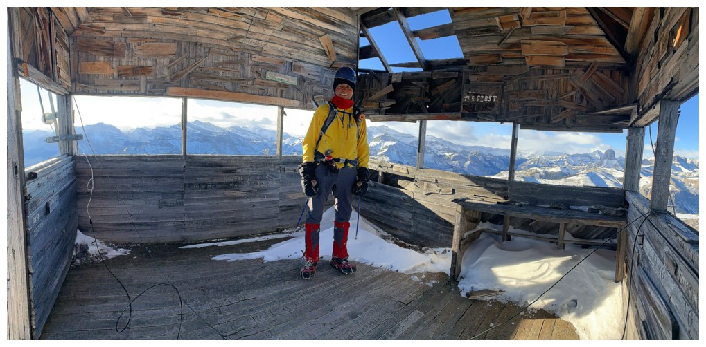
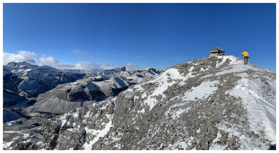
Pano from inside the abandoned lookout
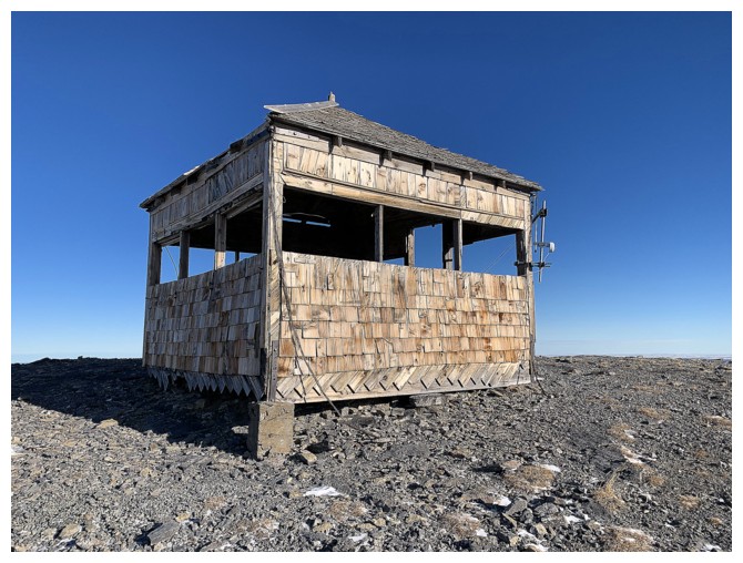
The lookout. Contrary to appearances, it doesn't provide much shelter.
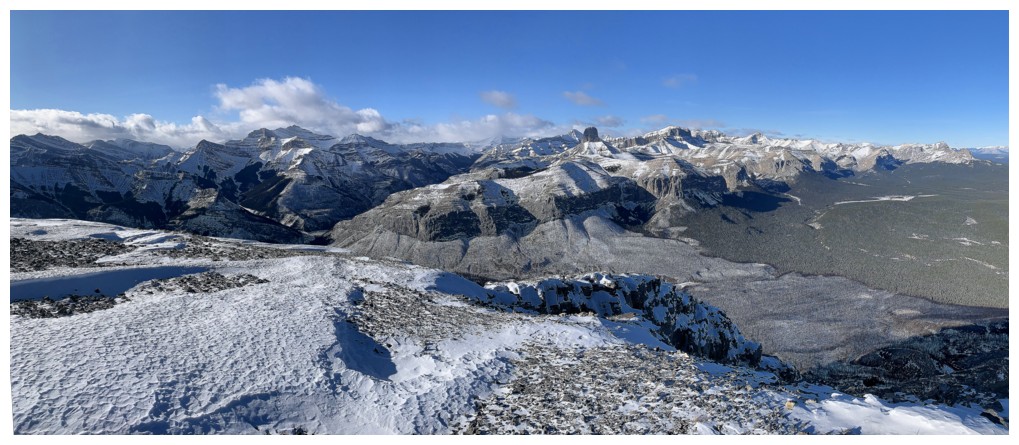
View to the north, northwest, and west
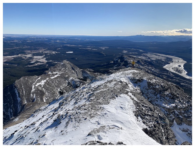
Wandering down the southeast ridge to see if a route down to the low
summits at the left was possible. There was a feasible route down, but
we would have liked warmer conditions to make the attempt, in case it
failed.
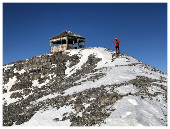
Returning to the lookout
Getting the heck outta Dodge, and fast! We were both freezing at this point, even with multiple layers of clothes
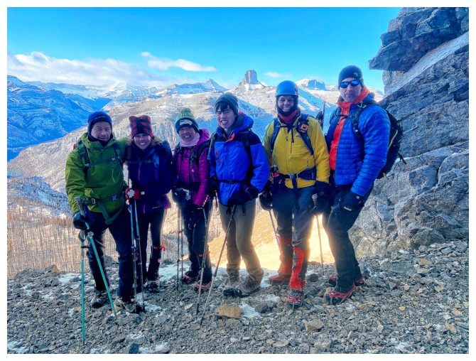
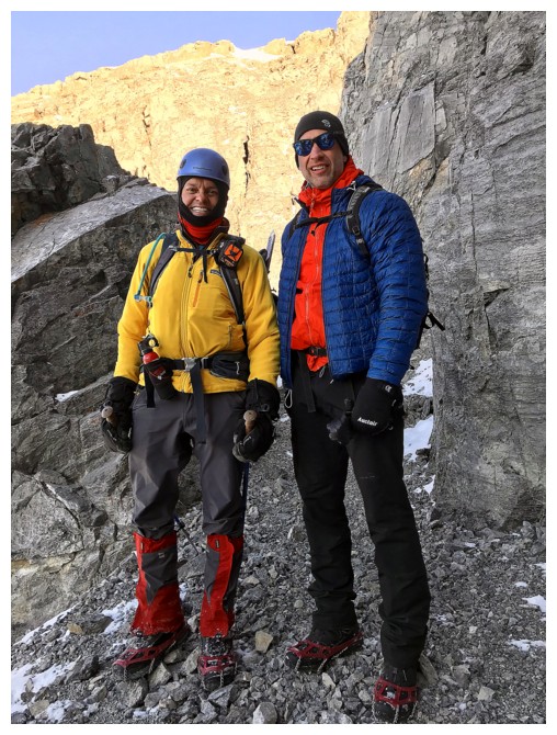
A serendipitous run-in with this terrific group of hikers/scrambles.
Left to right: Mike, Jenny, Luciana, Leandro, really old guy, Chris
(photo by Mark)
Really old guy and Chris (photo by Luciana)
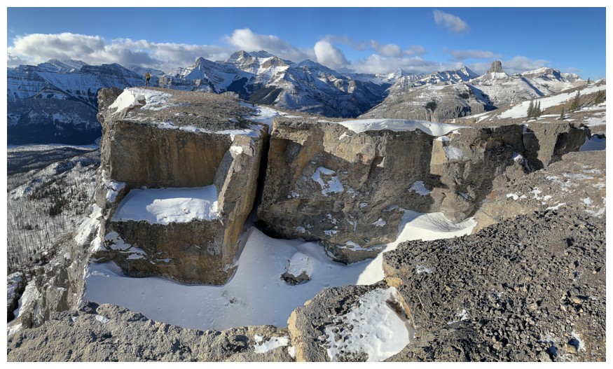
Descending the amazing trail that weaves through the seemingly impenetrable walls of rock
Hard to believe there is an easy route up through this rock
That beautiful sky!
Back to a point near where we left the trail
The other summit to the right of Black Rock
Last close-up look at this awesome scene
Looking forward to an easy and satisfying plod through the charred forest, back to the start
Start of the plod
And the last few steps of a most memorable day
The End
LOG