Mountain height: 2776
m – Cockscomb
2769
m – GR895751
2745
m –
Elevation gain: 1372 m to Cockscomb + approx. 1000 m for additional summits and descent
Ascent time: 4:45
to
3:00
from Cockscomb to
Descent time: 3:45
Solo scramble.
Unfortunately, I
missed the ascent
drainage described by Mr. Collier and ended up taking a longer route to
the
summit that required a decent elevation loss. There was little actual
scrambling throughout the ascent.
Surprisingly, I found the summit view to be rather anti-climatic. However, it was a perfect weather day and I took a 45 minute nap at the top, before starting the return trip.
Along the way, I decided to try
ascending the next highpoint
south on the ridge. This involved some decent hands-on scrambling and
route-finding challenges and was very worthwhile. From this summit
(GR895751),
the map I was using revealed  The ridge
to Fifi
was definitely the highlight of the day – lots of hands-on
scrambling, great
rock scenery, and a few exhilarating, exposed situations. I was very
happy to
arrive at the cairned summit, though at the late hour of 7 pm. It was a
little
odd, however, checking my GPS to reveal that I was more than 100
vertical
metres higher than
For descent, I was more or less forced to look for a faster and easier way down. I didn’t think I had the physical stamina to regain all the elevation required to make it back to the descent slope. There appeared to be an easier route following another drainage directly below the summit. This route started off very well and was scenic to boot! My luck ran out when the drainage narrowed and suddenly dropped off. Side-sloping steep terrain above the canyon got me past this first obstacle, but the next required an elevation gain to circumvent and the one after that even more elevation gain. In short, I had to gain almost 400 total vertical metres to escape the confines of the drainage. Needless to say, after more than 2 km of elevation gain and almost 13 hours of hiking and scrambling I was exhausted. So much for easing into the scrambling season!

Epilogue: checking the NRC map, later
that day, revealed
that
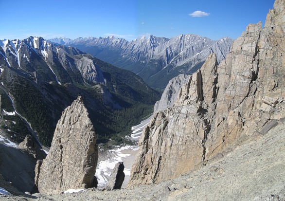
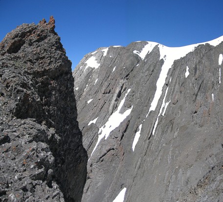
The interesting strata of the west side of Cockscomb
Avalanche debris
Looking up to one of the outliers

Looking across to alternate ascent gullies
On the ridge, looking at the summit of Cockscomb (far right)
A few cornices persist into the summer
Mount Rundle (skyline), Mounts Fifi and Louis are in the foreground
The summit view to the north

A partial panorama, looking north
A bird flys towards the camera
Looking south to the next highpoint along the ridge, GR895751
GR895751
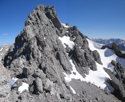
The upper section of GR895751
Looking back

The final summit block of GR895751; I circuvented it on the right side
Nice snow scenery
From the summit of GR895751, looking east towards Ficomb Peak
Part of the connecting ridge between GR895751 and Ficomb Peak
A pinnacle
Typical rock scenery on the traverse
Typical terrain on the traverse
Another cool slab of rock
Looking south towards Mount Cory
The real Mount Fifi