Mount Fisher
August
20, 2011
Mountain
height: 2843 m
Elevation gain:
1400 m
Ascent time:
3:30
Descent
time:
2:30
Scrambling
with Raff.
Raff
came up with the idea for Mount Fisher, perhaps after seeing Sonny Bou’s
report. I didn’t know much about the peak and even less about
the area, but was
open to checking it out. Admittedly, after an incredible day on Mount
Jackson
24 hours earlier, 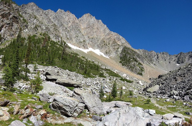 I
was pretty sceptical about this trip measuring up by any
degree – yet again I was dead wrong!
I
was pretty sceptical about this trip measuring up by any
degree – yet again I was dead wrong!
The
crux of the trip was skilfully negotiated by Raff before we even got to
the
trailhead – Mause Creek Road – although the word “road” assuredly
stretches the
definition. Good
thing we were in Raff’s
4x4, because my Honda Civic would have simply stopped dead in its
tracks,
refusing to have anything to do with the rocky pathway. 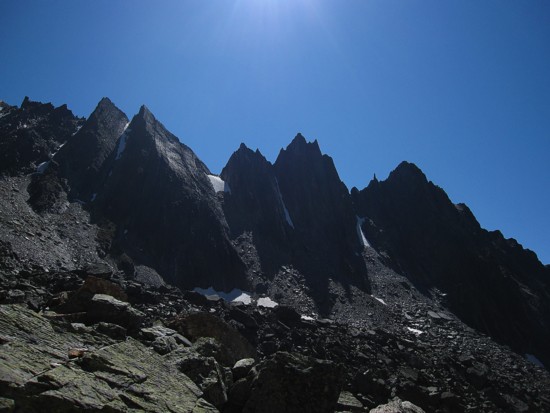 Surprisingly we arrived
at the trailhead to find nine other vehicles: seven big trucks, one
van, and
one small sedan – hats off to the individual who miraculously coaxed
that
vehicle up the road!
Surprisingly we arrived
at the trailhead to find nine other vehicles: seven big trucks, one
van, and
one small sedan – hats off to the individual who miraculously coaxed
that
vehicle up the road!
The
trail to the upper valley was great. It basically went straight up,
allowing
all to gain a big chunk of elevation in minimal time. And then the fun
began.
Though we lost the trail at one point, the upper valley was already
more scenic
than I was expecting. We finally ascended to a point where we could see
Mount
Fisher and it was gorgeous – an aesthetic spire of beautiful rock at
the head
of an equally beautiful valley. Striking peaks on the other side of the
valley
added to the spectacle.
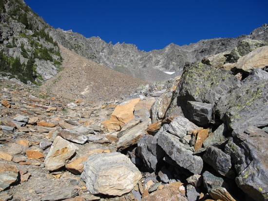
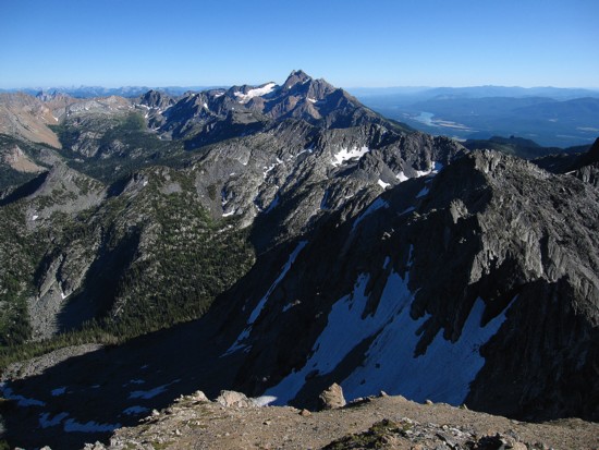
We
made our way up the beautiful valley to the start of the real work, a
well-worn
trail providing clear evidence of the popularity of the peak. The
ascent gully
going to the col, though bit of a slog, was strewn with wonderfully
colourful
rock. The colours and textures were totally unlike anything we saw on
Mount
Jackson, but every bit as vibrant and interesting.
At
the col, the view of the surrounding area started to open up, with The
Steeples
taking centre stage. It was obvious we were in for a treat at the
summit. We
followed a string of trails, cairns and a line of yellow and black
metal
markers led to the summit. Only a few scrambling moves were required,
although the
last one was fairly exposed.
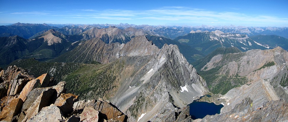
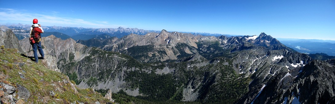
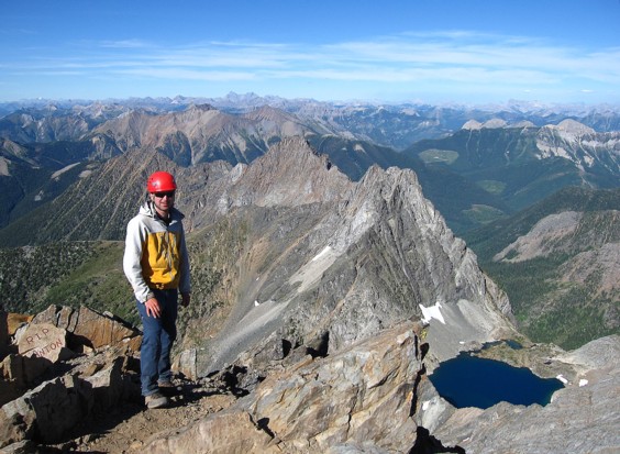
We
were right about the summit view, however it was not only a treat, it
was
astounding – exactly as advertised in Joey Ambrosi’s guidebook, Hiking
the Southern Rockies. The
peaks surroundings Fisher were absolutely beautiful, even though I
could not
identity a single one, and Nichols Lake below was stunning. We did
manage to
name a few distant peaks, but the main focus was definitely what was
directly
around us. Our summit stay was very long and very gratifying.
The
descent was as enjoyable as the ascent – just a heck of a lot easier! We managed to find the
correct trail,
providing us with even more beautiful terrain to take in.
A
totally, unexpectedly magnificent trip. Like Jackson, a must-do
mountain.
 Pleasant mountain scenery on the drive in; these may be part of The
Steeples
Pleasant mountain scenery on the drive in; these may be part of The
Steeples
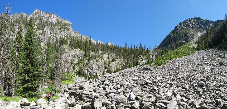
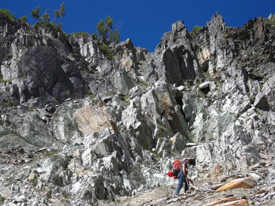
Raff (lower left) leads the way up the valley
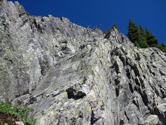
The rock scenery starts to improve; the rock in the Purcells is
noticeably different from that of our beloved Rockies
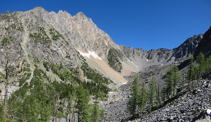
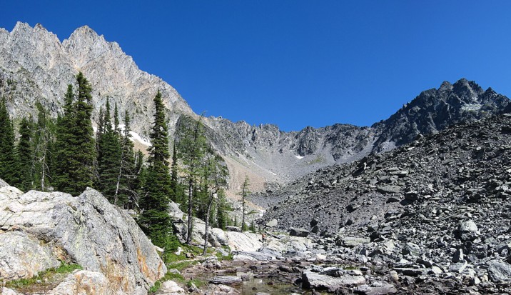
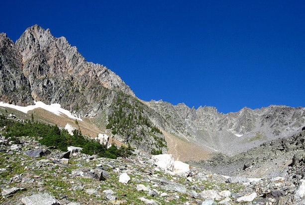
The first look at Mount Fisher and the gorgeous access valley
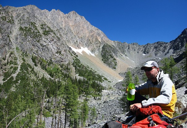
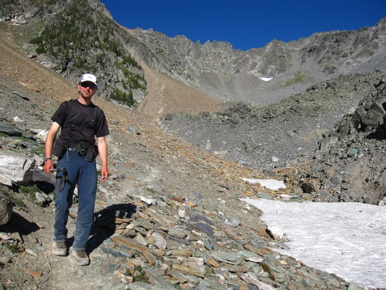
Raff hydrating and taking in the great views
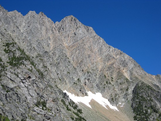
A closer look at Fisher
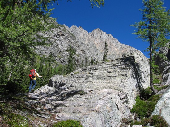
Raff works his way into the valley
Back onto the trail; there are two tarns here, however they were all
but dried up at this time of the year
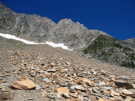
More great colours and scenery
Raff heading up to the col
The very impressive spires on the other side of the valley
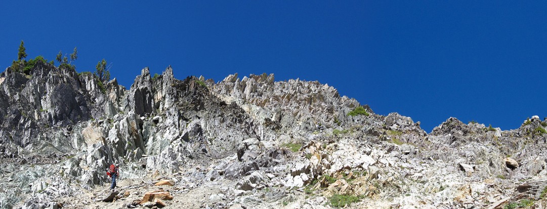
The rock on the left side of the ascent was absolutely beauttiful
The closer look at the rock
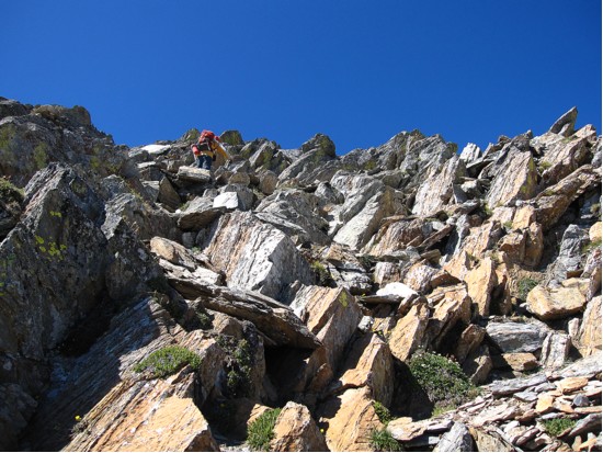
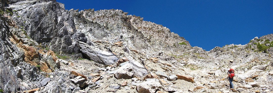
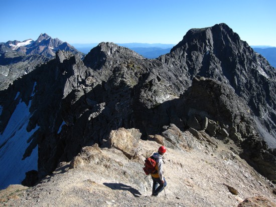
Raff tackles terrain above the col
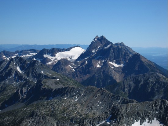
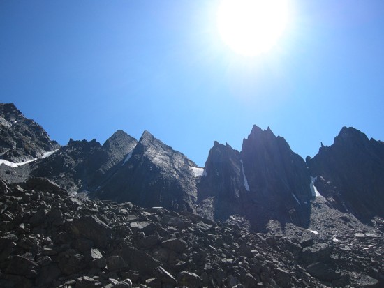
The Steeples
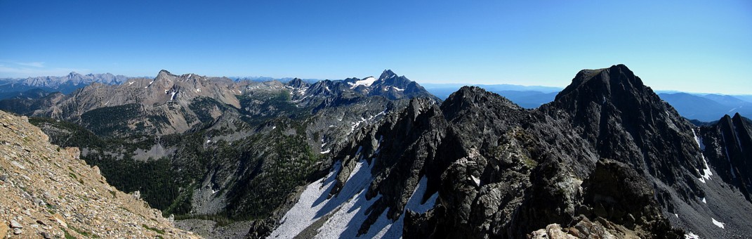
The Steeples and more
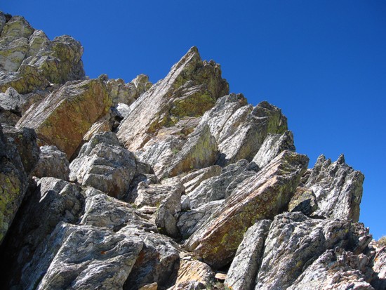
More great rock
More exciting views
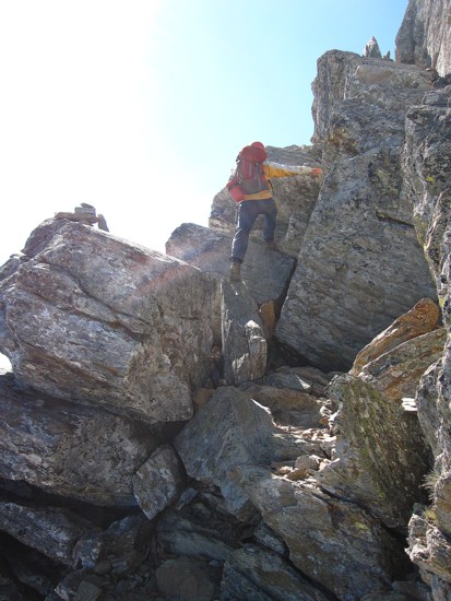
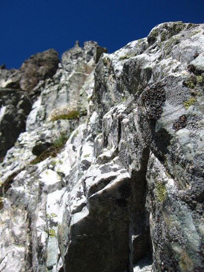
Raff appraoches the crux
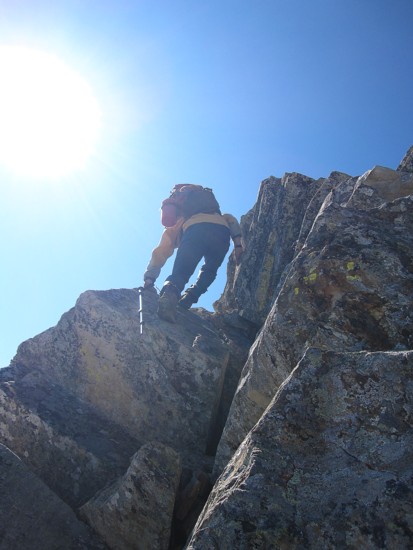
Raff ascends the crux
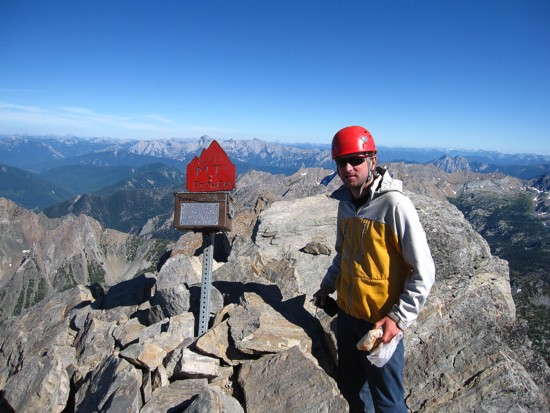
Raff at the summit
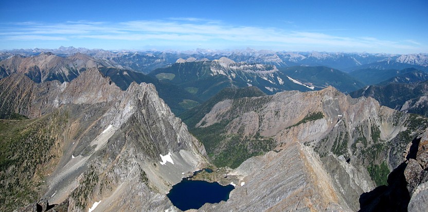
Tons of unnamed peaks and one breath-taking lake (Nichols Lake)
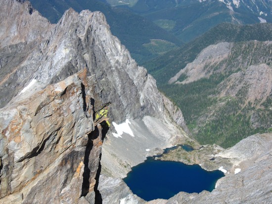
A closer look
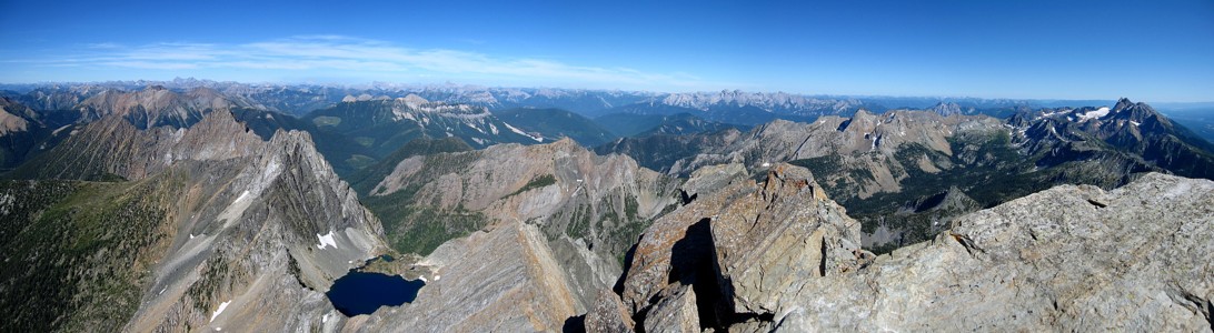
A further look
The amazing view AND Raff
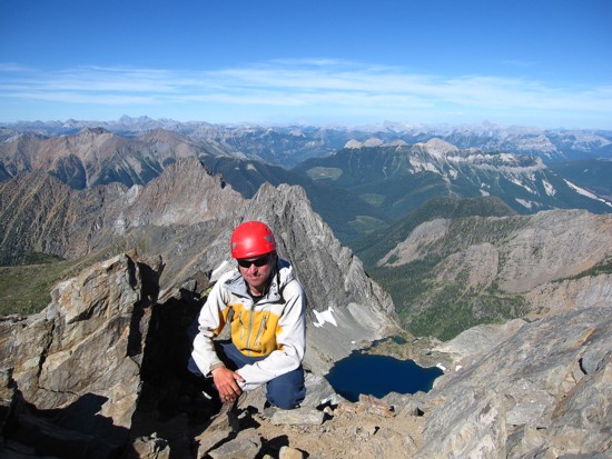
Same as above
The Steeples again
Raff heading down to the col
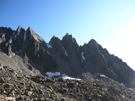
A last look at the spires
Raff enjoying the good trail back
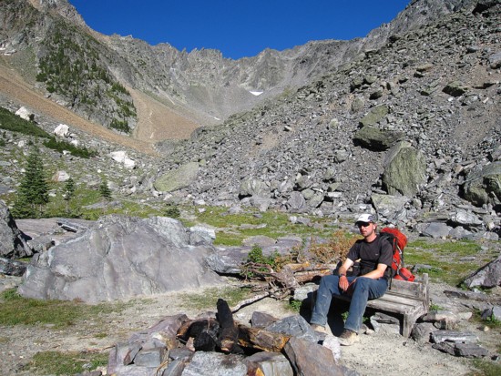
Raff enjoying a very nice bench on the trail
A last look at the Fisher valley
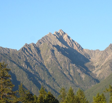
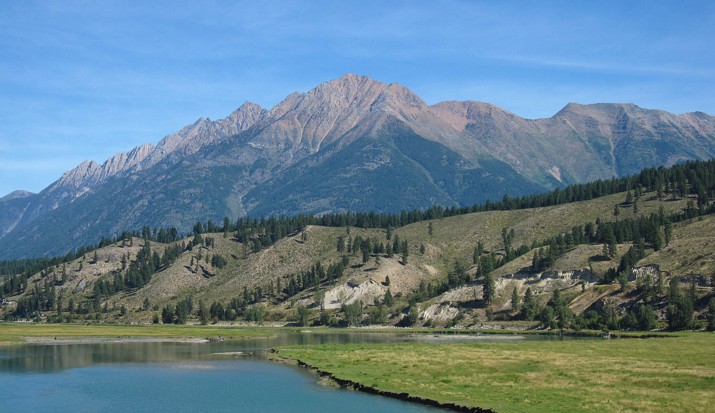
Mount Fisher from the near the highway