Forum Peak II
March 7,
2010
Mountain height:
2415
m
Elevation gain:
780
m
Ascent time:
5:45
Descent time:
3:00
Snowshoeing and mountaineering with Mark.
 This one definitely gives “Middle
Kootenay Mountain
II” a run for its money in terms of being my
favourite winter ascent to
date. After seeing the Forum Ridge ascent on Bob’s
site,
we decided to give it a go if we were in the area. In addition to
snowshoes, we
brought along some climbing gear in hopes we could continue on to the
summit of
This one definitely gives “Middle
Kootenay Mountain
II” a run for its money in terms of being my
favourite winter ascent to
date. After seeing the Forum Ridge ascent on Bob’s
site,
we decided to give it a go if we were in the area. In addition to
snowshoes, we
brought along some climbing gear in hopes we could continue on to the
summit of
The first part of the trip was very
easy, thanks to a very
well-used and packed down approach trail to 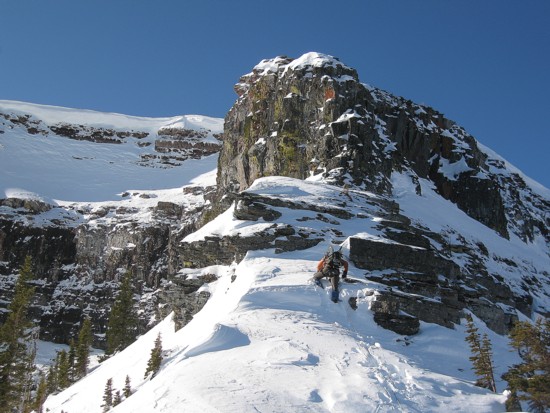 We then followed the cutline, as described in Alan Kane’s
book. This too had
seen a substantial amount of traffic. That was until we arrived at
“the big
hill”. The tracks abruptly stopped at the bottom of the hill.
After making it
to the top we discovered why. The hill is unusually steep, approaching
45
degrees for a few short sections.
We then followed the cutline, as described in Alan Kane’s
book. This too had
seen a substantial amount of traffic. That was until we arrived at
“the big
hill”. The tracks abruptly stopped at the bottom of the hill.
After making it
to the top we discovered why. The hill is unusually steep, approaching
45
degrees for a few short sections.
Travel at the top was much easier and
soon the trees started
to thin, revealing some pretty decent views. They were decent to begin,
but
quickly turned into magnificent as the east face of
As we followed the beautiful ridge
towards the north face of
After trading snowshoes for crampons
and some climbing gear,
we followed the slightly narrowing ridge to the rock face and then
began a
treacherous traverse around the right side of the rock, looking for the
weakness that Kane describes. I crossed two short, but steep slopes
that
definitely pushed my comfort level beyond comfort. 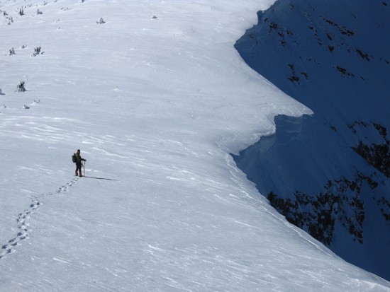 Upon starting across
the
third, we both agreed we had “pushed” too hard.
With only one good belay point,
a slip down the mountain or an avalanche would have resulted in a
significant
pendulum across the slope that would probably cause as much physical
damage as
a fall down the entire slope. Mark led us slowly and safely back to a
good
position at the foot of the rock face.
Upon starting across
the
third, we both agreed we had “pushed” too hard.
With only one good belay point,
a slip down the mountain or an avalanche would have resulted in a
significant
pendulum across the slope that would probably cause as much physical
damage as
a fall down the entire slope. Mark led us slowly and safely back to a
good
position at the foot of the rock face.
This was a little disillusioning as
we knew the view from
the summit of 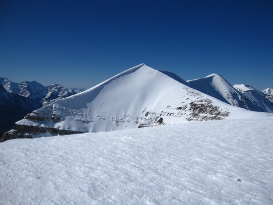 Thankfully, there were several great handholds along the way and a
couple of
good places for slings. The first step was the most difficult. After
that easy
terrain took us rather triumphantly to a large cairn, near the summit.
Thankfully, there were several great handholds along the way and a
couple of
good places for slings. The first step was the most difficult. After
that easy
terrain took us rather triumphantly to a large cairn, near the summit.
The view was not really good
– it was stupendously,
amazingly, outrageously magnificent! The striking forms of Custer,
After exploring the summit area,
marveling in one terrific
view after another, we headed west towards one of Akamina
Ridges’ several
highpoints. Returning the same way would have been reasonably fast, but
would have
also required a rappel – no point leaving webbing on the
mountain when a
slightly longer, but rappel-less descent is possible. This descent
route was
the same one Mark, Keri, and I had used on ascent in September
of 2005. It
turned out to be a straightforward affair, though crampons were useful
in
sections. Snowshoeing down untouched, pristine slopes west of
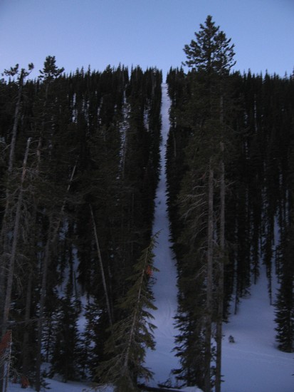
"The Big Hill"
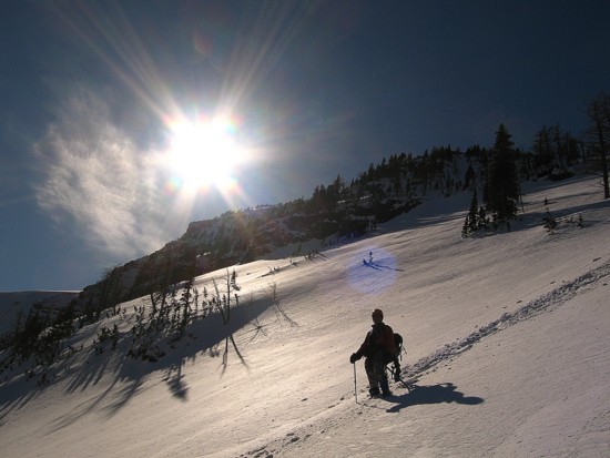
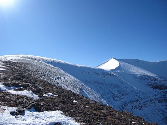
The terrain opens up
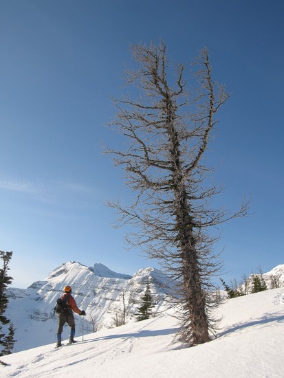
Me and a big tree
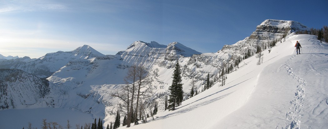
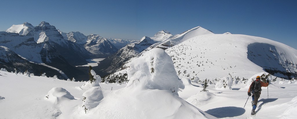
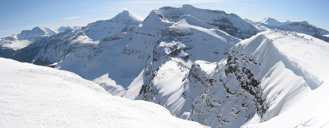
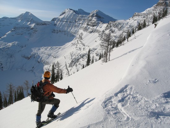
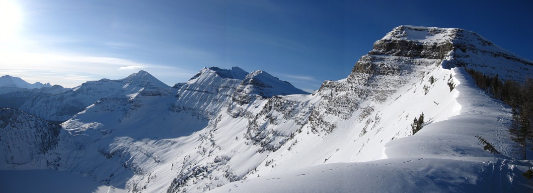
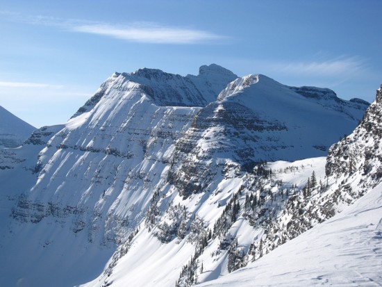
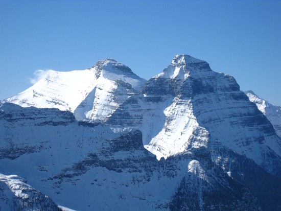
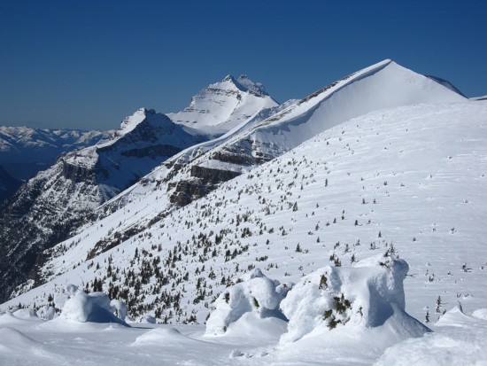
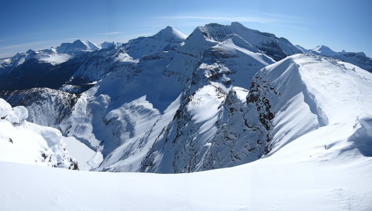
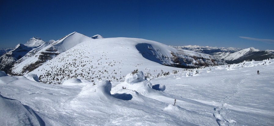
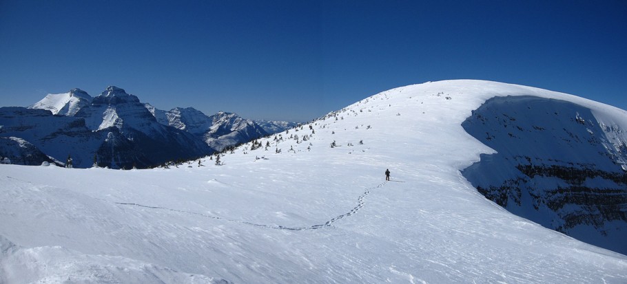
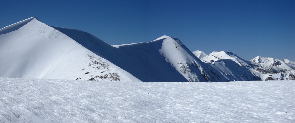
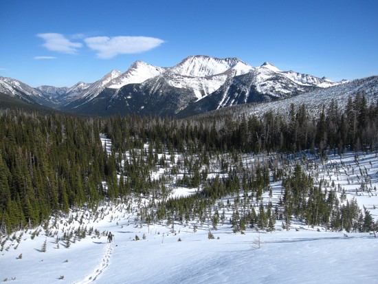
The terrain really opens up; Chapman Peak at the left, Mount Custer in the centre, and Forum Peak at the right
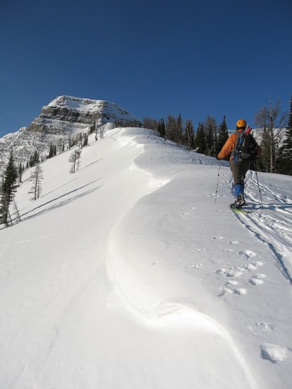
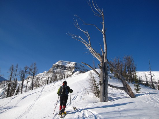
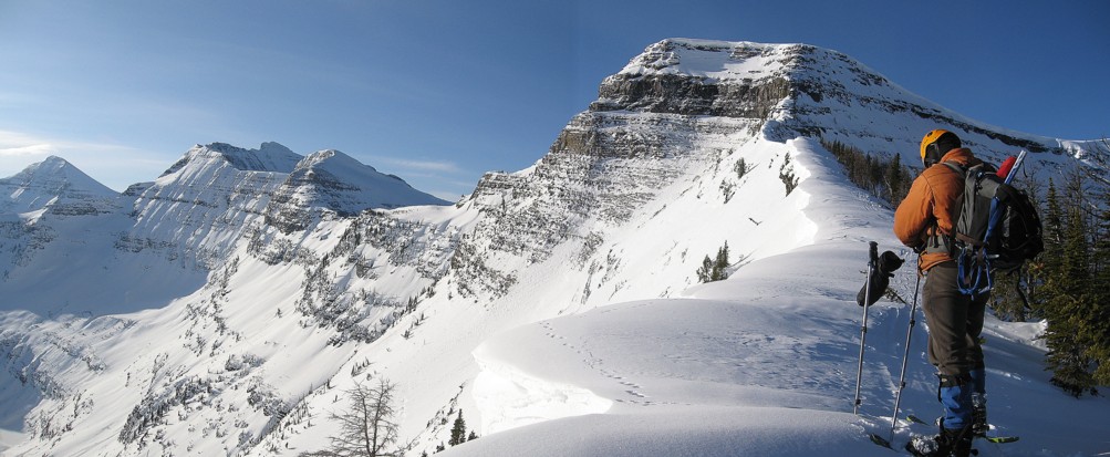
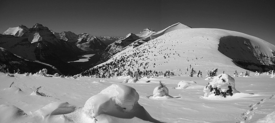
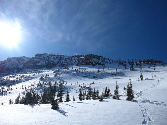
The very pleasant Forum Ridge
Same as above
Same as above
Mesmerized by Custer
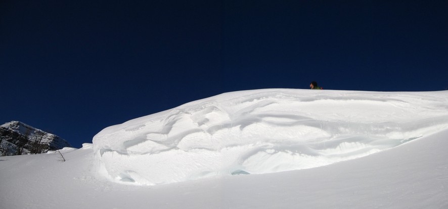
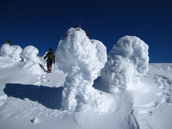
Mark above a scenic build-up of snow
Same as above
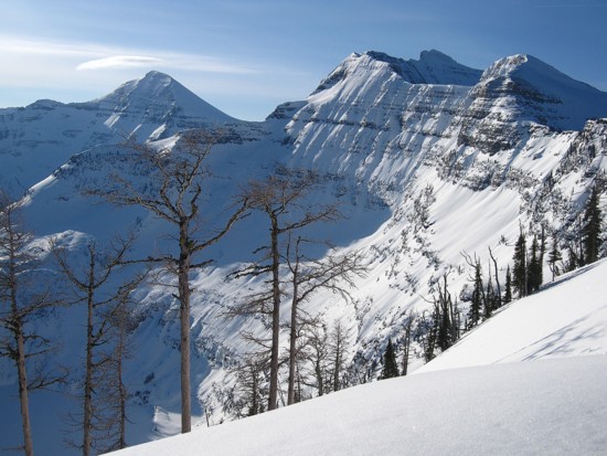
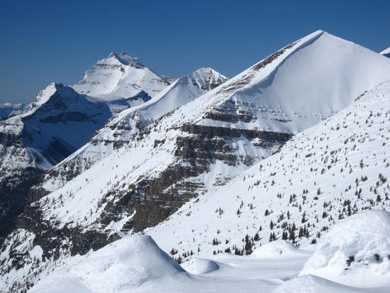
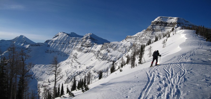
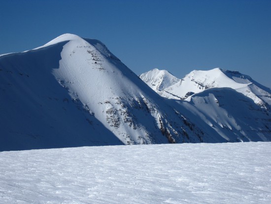
Chapman and Custer again
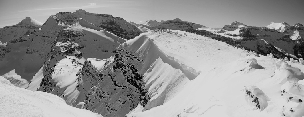
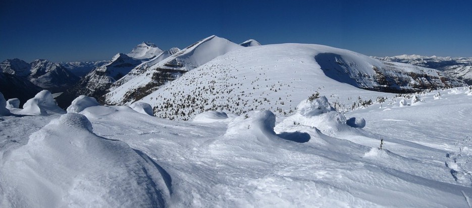
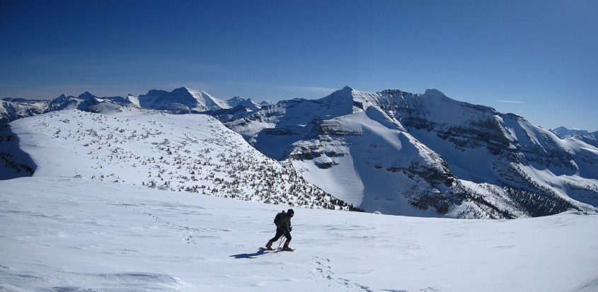
More ridge scenery
Same as above
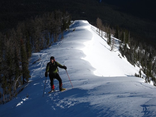
Looking back along the ridge
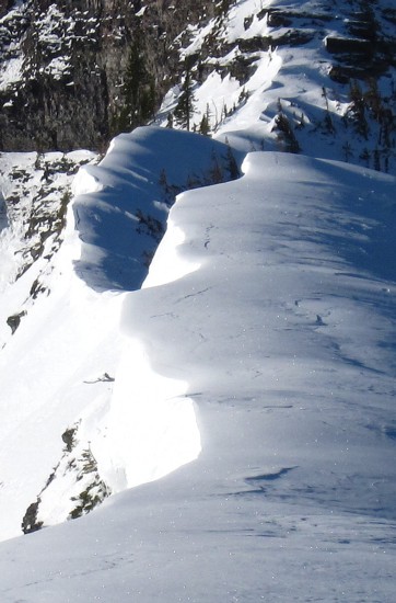
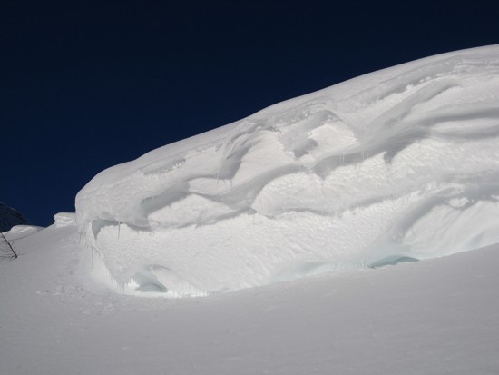
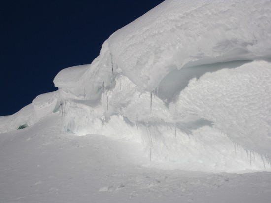
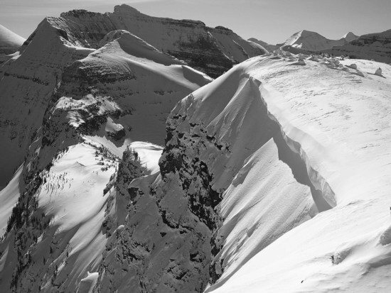
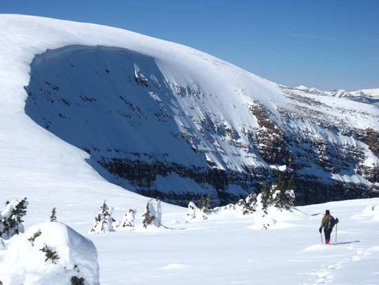
Cornices
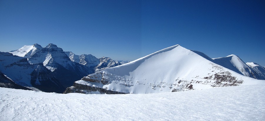
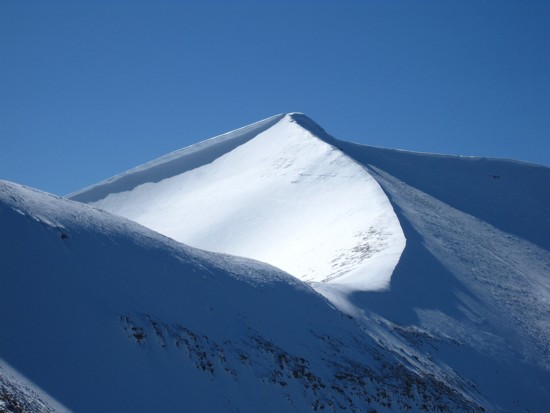
Another fantastic view of Custer
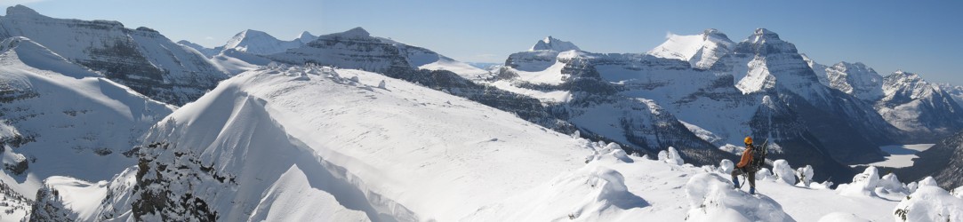
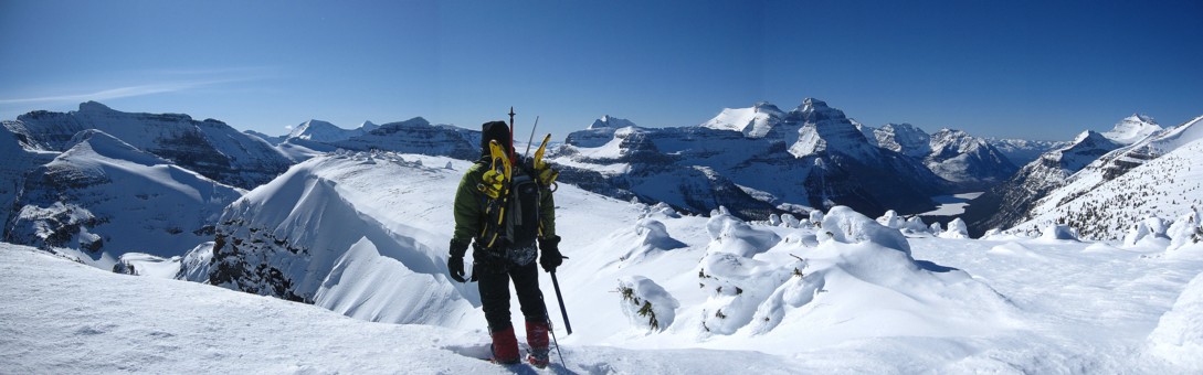
Mark (lower left), the ridge, Cameron Lake, Buchanan, Carthew, and Alderson
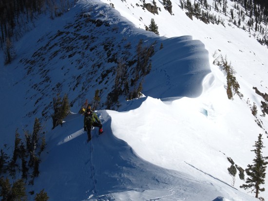
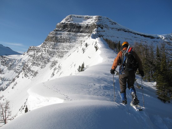
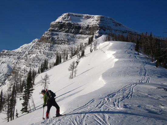
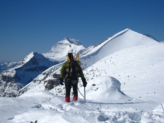
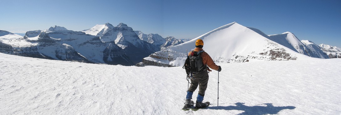
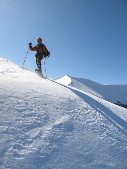
Mark on the ridge
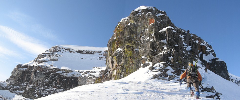
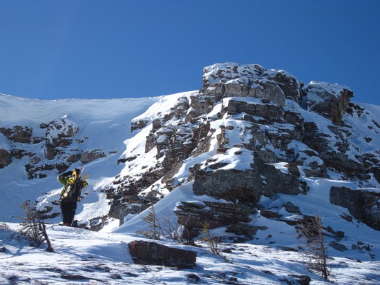
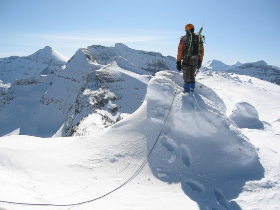
Approaching the rock face
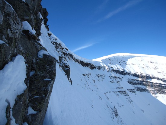
Looking back at the slopes we tried to traverse on right side of the ridge
Clearing snow away from the second route we tried - failed on that one too
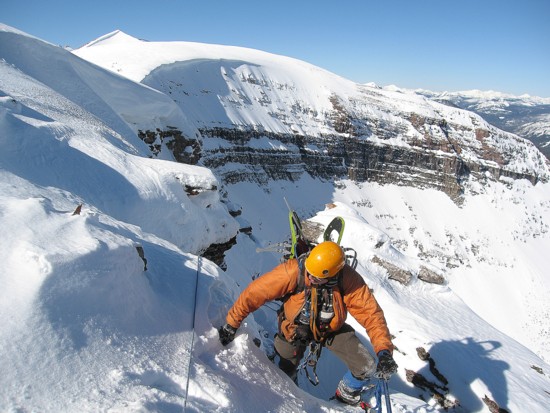
Above the difficult step, with easier terrain to the summit

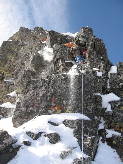
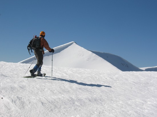
Mark leads the route to the summit

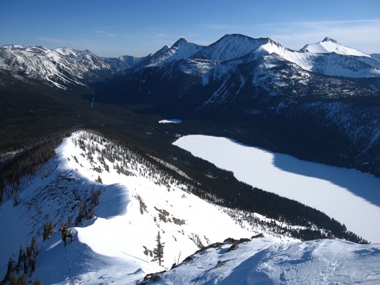
Looking down on Cameron Lake
The last few steps to the summit; Akamina Ridge behind
The first thing you see upon reaching the cairn; Kintla (left) and Kinnerly
Long Knife Peak (above Mark's head) and part of Akamina Ridge
Standing on top of the trees, while admiring more incredible views

Same as above
Same as above
The blistering view towards Mount Custer!

Starting the descent

Long Knife Peak
More snow-encased trees
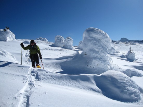


Heading down the descent ridge
Mark leads us down
Looking back at the descent route