Mount
Galwey Loop –
Mountain height:
2,348 m (7,703 feet)
Elevation gain:
960 m
Ascent time:
2:40
Traverse time to north summit:
1:10
Descent time (ridge, west of Coppermine Creek): 2:55
Scrambling
with Mark.
Trying to
avoid the predicted afternoon thunderstorms and a large and nasty system heading
in from the west, we left
The
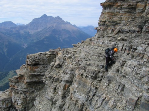
scrambling, on sometimes loose, but horizontal and step-like strata was very
pleasant and never difficult to ascend (I would definitely classify this as one
of the easiest “difficult” rated scrambles – it sure ain’t no Smuts!).
After being completely spoiled on the outstanding, solid rock of the East Ridge
of Edith Cavell last week, I thought I would be forever cursing the loose rock
that comprises the rest of the “Rotten Rockies”, but it looks like I’ve
experienced enough of it to be fully indoctrinated and very much enjoyed the
more loose (?) scrambling on Galwey.
The crux was
not at all what we were expecting and was easily traversed on relatively large
ledges – I wish the ledges on the crux of
The summit
view was fairly good, even though the skies remained generally overcast. Most
noticeable were Mount Blakiston (the highest mountain in Waterton at 2,910 m),
Ruby Ridge, Mount Crandell, Vimy Peak, and obviously the impressive Waterton
Lakes. Of even greater interest, however, was the striking connecting ridge on
Our first
attempt took us around the east side of the summit block. Quickly we arrived at
a long, steep section that we couldn’t downclimb and so we backtracked to try
the west side. Initially, we thought we could get around the summit block
without losing too much elevation, but once again we came to an impasse and were
forced to go back and descend the original route a little. Finally, we worked
our way to the north side of the block and the start along the fairly lengthy
ridge. We stayed on the ridge for awhile, but found out it was much easier to
traverse on the right side. After an enjoyable traverse of the very interesting
ridge, we made it to another summit block, where an easy scramble around the
left side brought us to the second summit. The trip over was fun, easy, and
definitely worth the effort.
As mentioned,
the third summit looked to be unattainable without climbing gear and so, after
enjoying the scenery under clearing skies, we started down the west ridge,
directly below the summit. Although scree slopes to the left would have been
faster and easier, we choose to downclimb the ridge as much as possible. Again
the horizontal strata and good ledges made for an enjoyable descent. Twice we
came to sections that were too steep (almost vertical), but they were easily
bypassed on the left side. The scenery via this route was fantastic and stopping
every couple minutes to admire it and take pictures certainly contributed to our
length descent time. We continued down the ridge, on the west side of Coppermine
Creek, through scenic meadows and beautiful argillite scree, on the way coming
across a huge single antler. It was very impressive and must have belonged to a
very large animal. The remainder of the descent was easy and highlighted by a
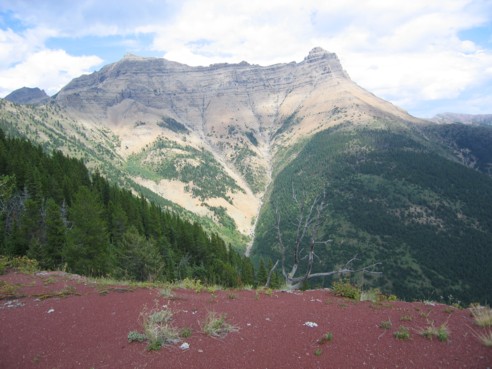
beautiful red rock outlining the creek. Overall, a terrific day on a terrific
mountain – I’m sure we’ll return someday to nab that third summit.
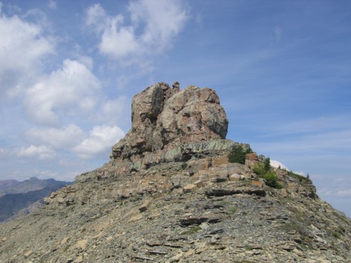
Mount Galwey
The upper section of the mountain; the "mushroom" can be seen faintly as the small dot just to the right of the summit
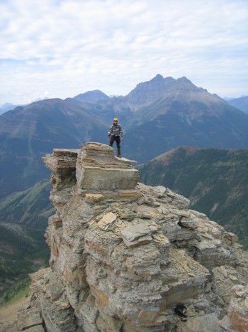
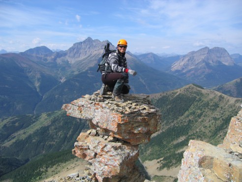
A little diversion atop a large rock pinnacle; Mount Blakiston behind, at the right
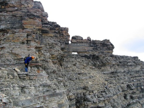
Mark, inspecting the crux, with the window in the centre
Me, traversing the ledges of the crux
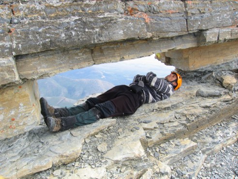
This
poor chap seems to have perished enroute to the summit – at least his friends
gave him something resembling a burial. Unfortunately, he was obstructing our
view and so we pushed him through the window and over the edge of the
mountain.
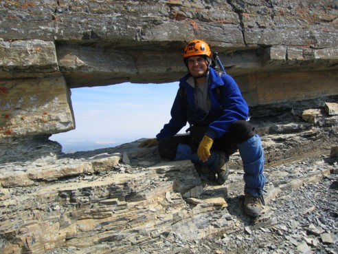
With the unsightly cadaver gone, Mark is free to enjoy the view
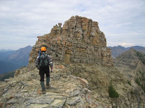
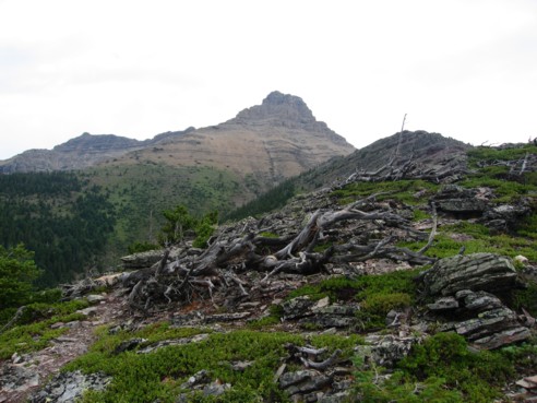
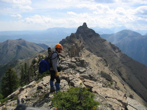
Heading towards the summit block; we tried ascending the right side, however, the left was much easier ("mushroom" to the left)
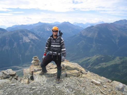
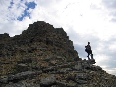
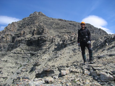
At the summit
Mark, at the summit, with the two additional summits in front
Sitting atop the "mushroom"; again, Mount Blakiston is the dominant mountain in the panorama
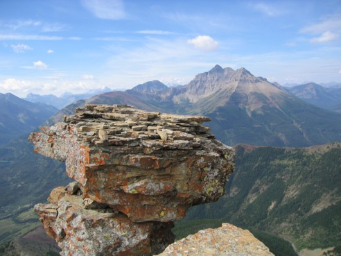
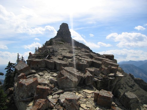
The "mushroom" without the eyesore on top
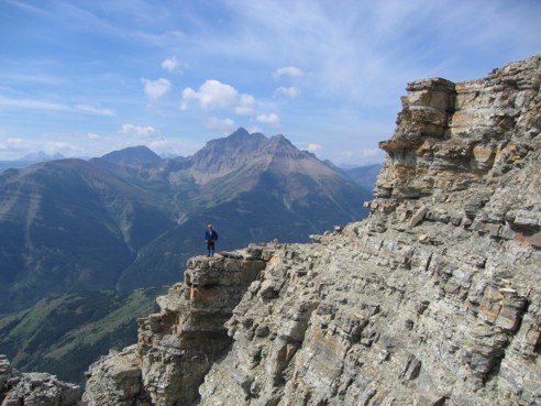
Mark, living on the edge
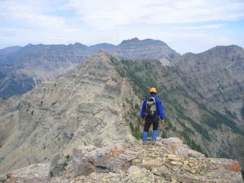
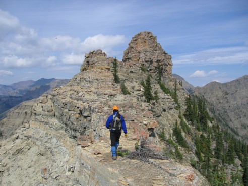
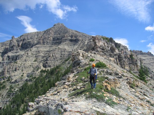
Traversing around the left side of the summit, heading towards the interesting connecting ridge and second summit
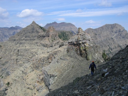
Looking back at the first summit from the ridge
Looking forward to the second summit, from the ridge
Again, looking back!
The summit block of the second summit; easily ascended on the left side
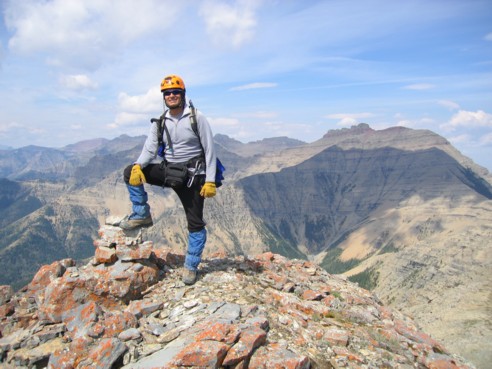
Mark at the second summit
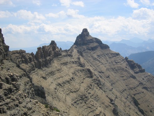
The first summit and connecting ridge again - getting bored yet!
The second summit and descent ridge
The same as above, but with some green and Mark thrown in for colour
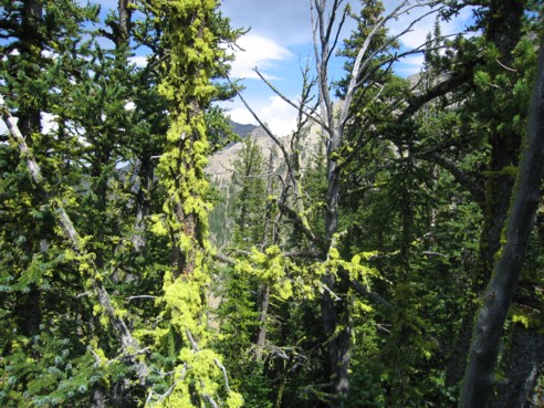
More greens; this tree was covered in beautiful light green moss
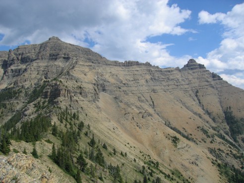
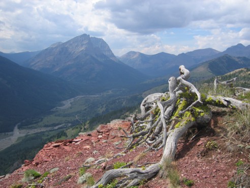
Looking back at most of the loop: the first summit (right) the second summit (left) and the descent ridge
The same as above, with some argillite scree thrown in
A weird-shaped dead tree, more light green moss, more red argillite scree, and some mountains
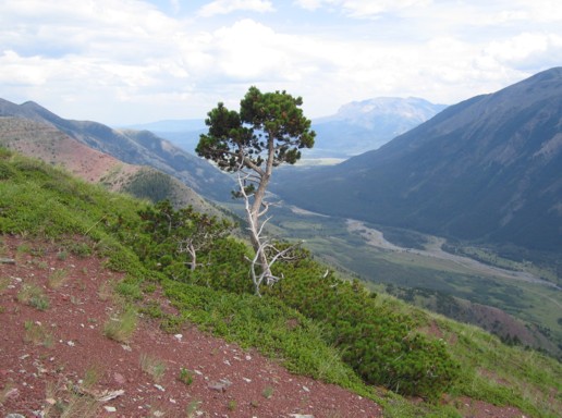
A tree
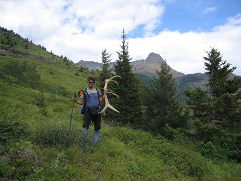
Mark finds a large antler
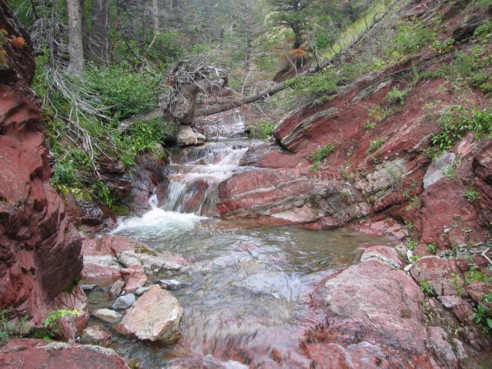
Beautiful
red rock and the Coppermine Creek - a perfect way to end the day
HOME
SCRAMBLES
MOUNTAINEERING
OTHER
TRIPS
PHOTO
GALLERY
LOG
FAVOURITES
LINKS