Mount Harrison
July 19, 2005
Mountain height: 3,359 m (11,018 ft)
Elevation gain: 1,341 m
Ascent time: approx. 8:00
Descent time: approx. 6:00
Mountaineering with Kevin Barton.
When Kevin suggested a five-day trip to
attempt two of the most southerly 11,000er’s of the Canadian Rockies, “no
thanks” was simply not an option. Not only is Kevin a terrific mountaineer, with
extensive knowledge and experience in all aspects of mountaineering, but he is
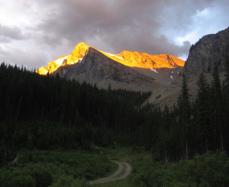
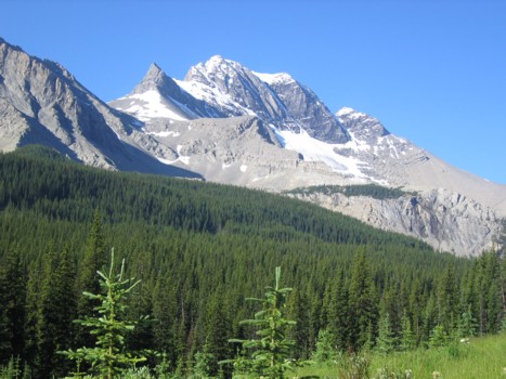
a great guy and easy to get along with. We arrived at the remote roadside camp
to a cloudy, but enticing view of the very unique looking mountain and set up
camp for the night.
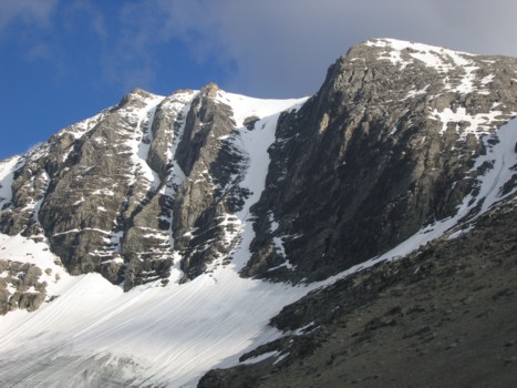
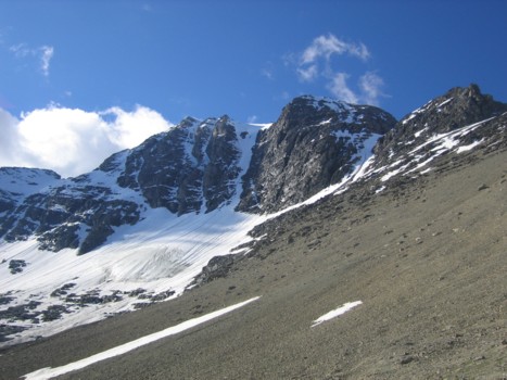
Although had we planned on attempting the
north coulior, the route looked to be too icy at the bottom and not snowy
enough in the middle, not too mention downright steep. We therefore opted for
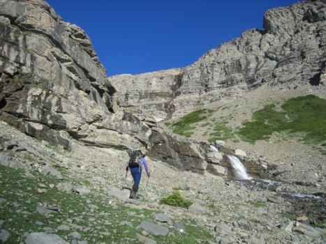
the easier and apparently shorter southwest route. As expected the route
started with some nasty B.C. bushwhacking (B.C. bush really is far worse than Alberta bush!). A pleasant
hike alongside a creek and then a scree slog up a very foreshortened slope,
brought us to the col between Harrison and Mount Folk.
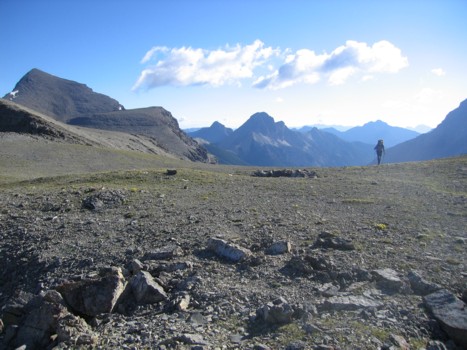
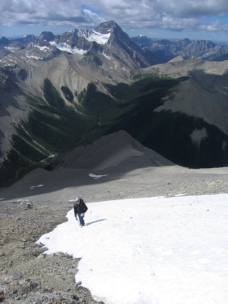
The view towards Mount
Mike (3,300 m) was
particularly stunning.
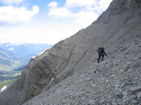
Traversing the three large scree basins,
comprising the west slopes, was quite tedious and time-consuming. At times the
terrain looked to be frightfully steep, however, the perception was thankfully
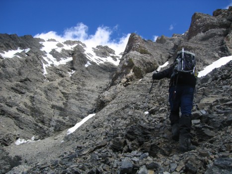
false, and the incline was manageable. From the southwest slopes, the remainder
of the accent looked to be nothing more than a scree slog, followed by some
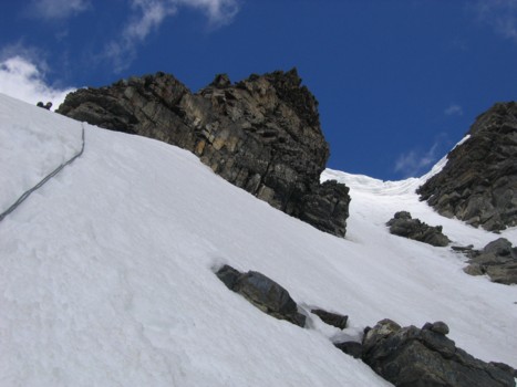
moderate/difficult scrambling. At first it was, however, the route was far
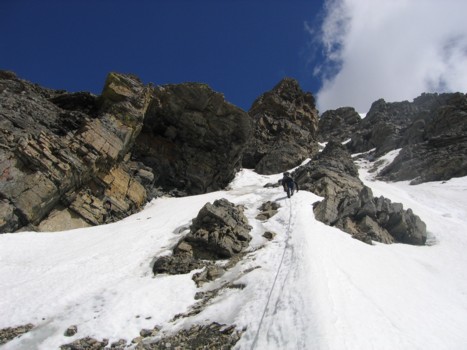
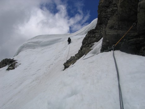
longer than it looked and higher up we encountered steep and snow-covered
terrain. We roped up here, took out ice axes and crampons, and Kevin led the
remainder of the ascent with a running belay. A large cornice at the summit
ridge provided the crux of the trip (other than the awful bushwhacking!), but
Kevin skillfully negotiated his way up and around it at its weakest point. From
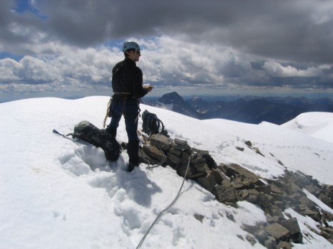
there, a short walk across the snowy west ridge and we were on the summit.
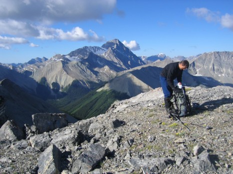
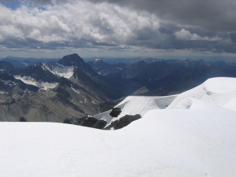
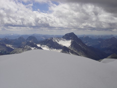
Though clouds had now formed all around, the
summit view was, nevertheless, fantastic, with a sea of shapely peaks in every
direction - it was quite an odd feeling not to be able to name any of those
peaks. We dared not explore too much of the summit, as a large cornice
persisted over the south face and after a handshake and 10 minutes, reveling in
the views, we returned the same way. Quite surprised that the ascent had taken a full
8 hours, we were a little dismayed to find the descent equally lengthy. The
west face scree traverse and the evil bushwhacking were thoroughly unenjoyable
on return. Given more time and energy, running up a scree slope to the summit
of adjoining Mount Folk would have been a great idea, however, we lacked both
(especially energy!) and chose to forgo that option. We were also too tired to
drive to the start of the approach of our next objective, Mount King George,
and settled for another night at the Mount
Harrison roadside camp.
As usual, I learned a terrific amount from watching Kevin setting up protection
and ascending tricky terrain. A terrific day of mountaineering, on a beautiful
mountain, with a great mountaineering partner.
.