Hector South Ridge
June 4, 2025
Mountain height: 2660 m
Elevation gain: 1030 m
Ascent time: 5:30
Descent time: 3:25
Solo hike.
Hector South
Ridge could very well become a yearly late May/early June ritual – the trip was
that good!
 Not
surprisingly, it was primarily some amazing cornice scenery that rendered the
day such a hit.
Not
surprisingly, it was primarily some amazing cornice scenery that rendered the
day such a hit.
I basically
followed Bob Spirko’s GPS track to the summit, with a minor detour en route.
That detour yielded some of that super cool snow scenery. Overcast conditions
to the south put a bit of a damper on the views, hence a return visit next year
is already in the making.
Back on track,
the summit was easily reached, though it was little further than I thought.
More amazing scenery and terrific views to the east along the way were more
than enough to keep me highly motivated. With improving weather to the north
and east I was in no hurry and took an extended and very satisfying summit
break.
And that
improving weather also prompted me to retrace my steps back across the stunning
ridge on return. I also intended to take a slightly different route back, via
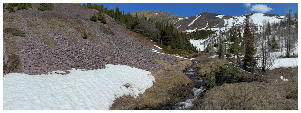
the col between the Hector South Ridge and Hector South Peak. That route worked
perfectly, featured very interesting terrain, a scenic creek to follow, and
generally very easy travel.
As stated, I’ll
be back!
Typical terrain on the lower slopes - treed, but not heavily
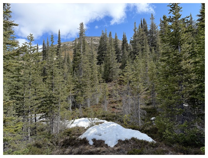
Almost at treeline
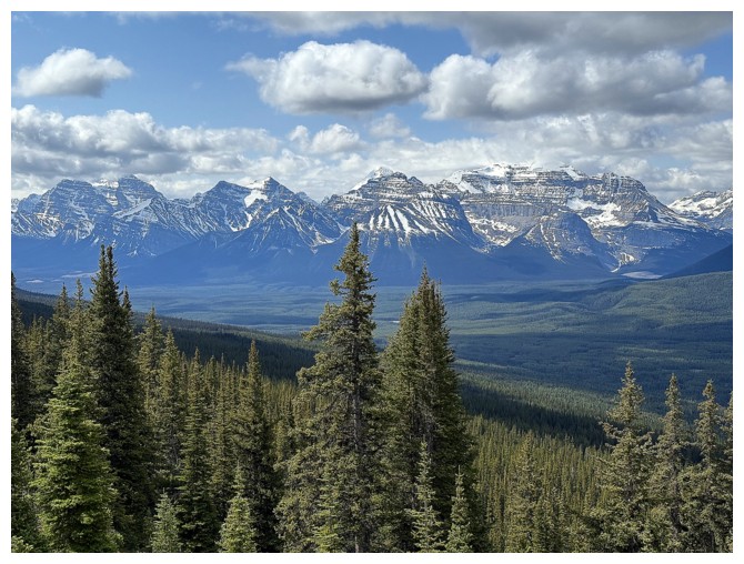
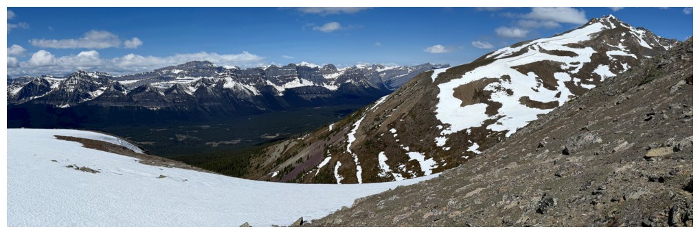
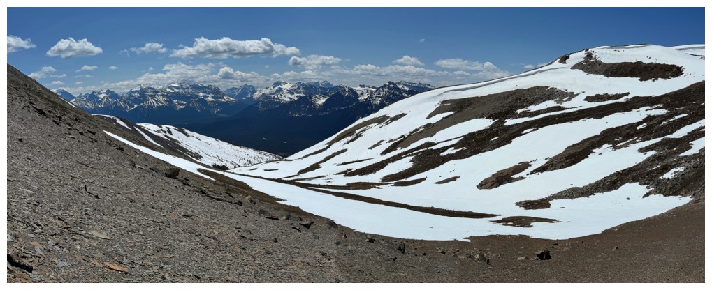
First view over to the Lake Louise and Lake O'Hara areas
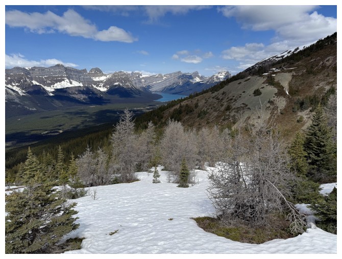
First glimpse of Hector Lake
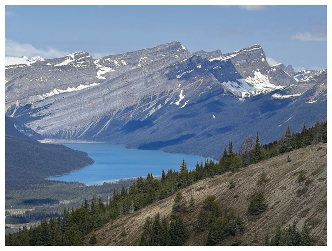
Close-up of the lake
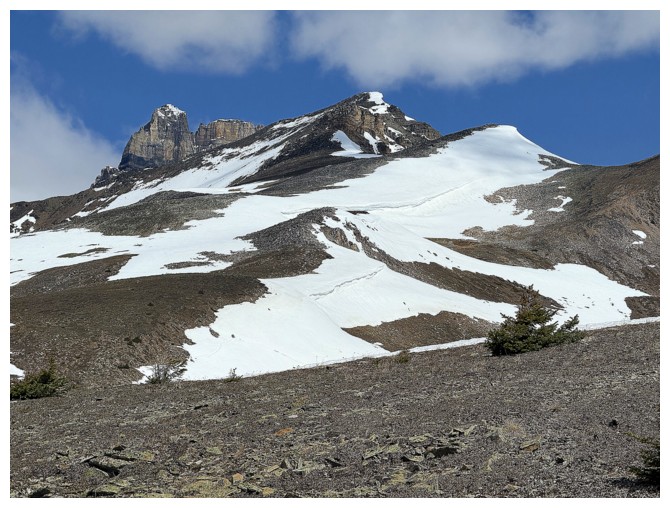
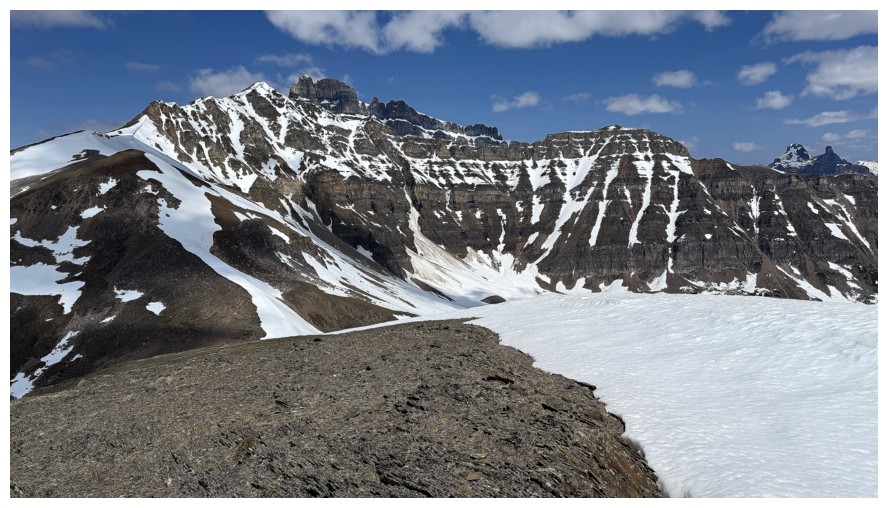
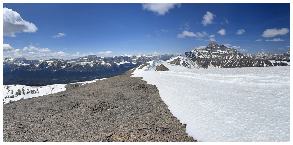
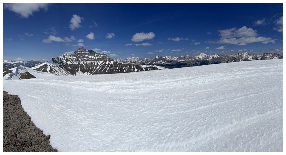
Cathedral Mountain
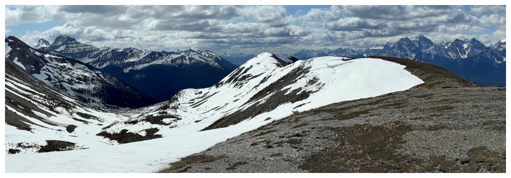
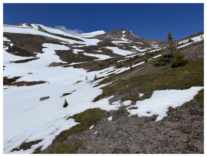
The route ahead looks straightforward
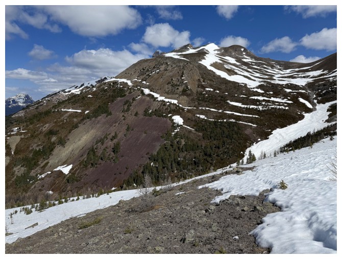
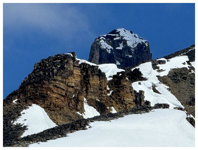
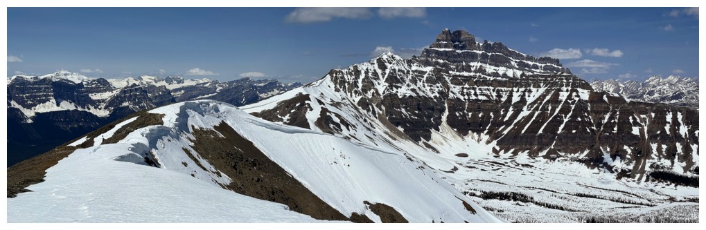
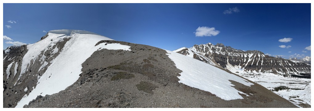
Hector South
Mount Hector (left) and Hector South
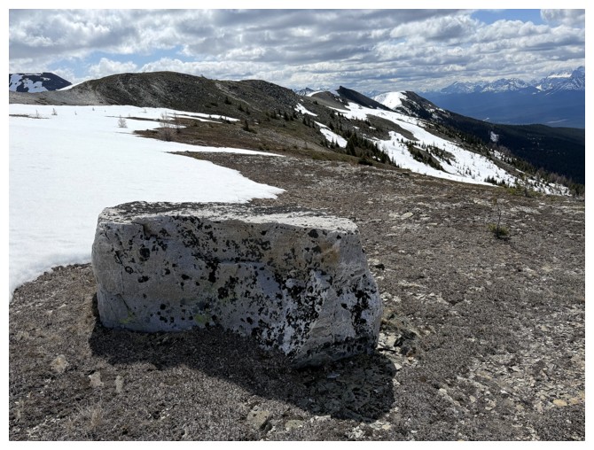
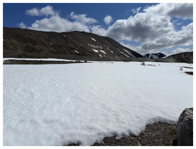
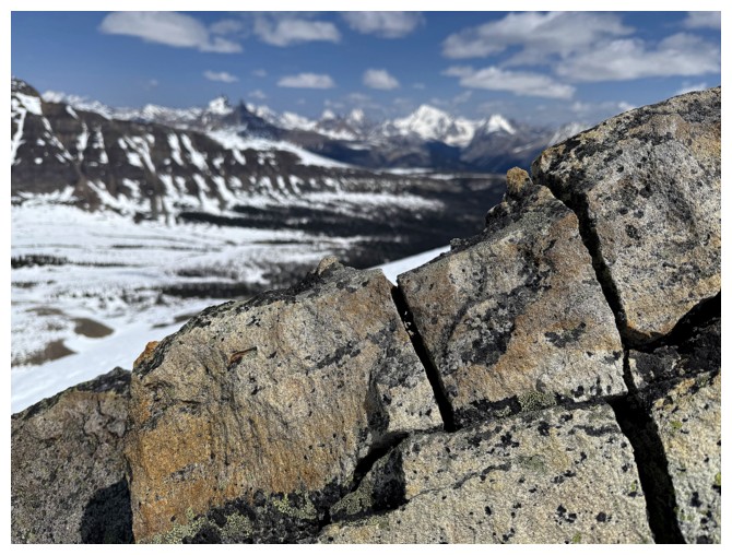
Random boulder
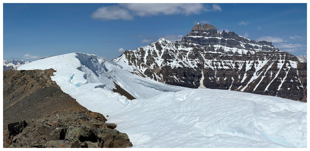
The summit of the objective
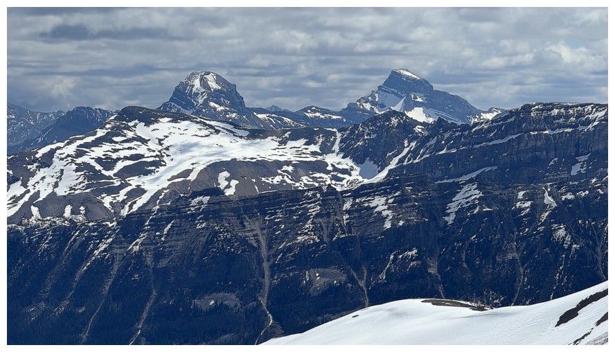
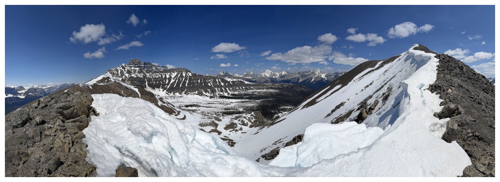
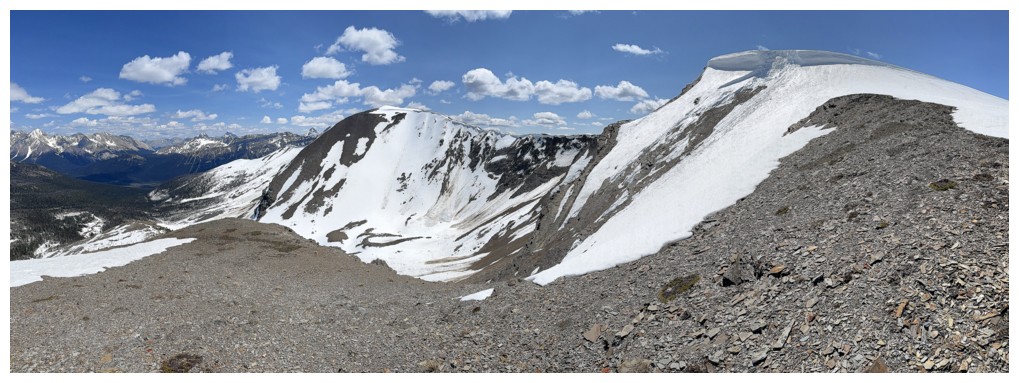
View to the south. The highpoint in the centre has been unofficially named "Hector Point"
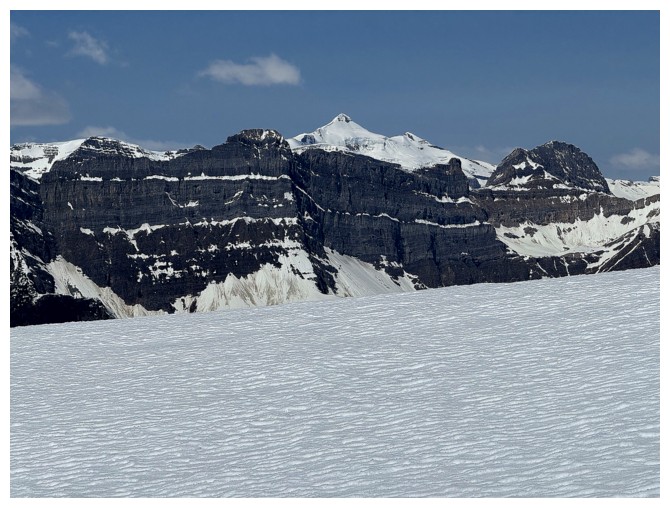
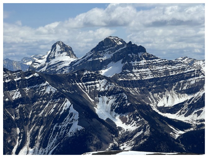
The Pulpit Peak massif in front, with Mount Balfour behind
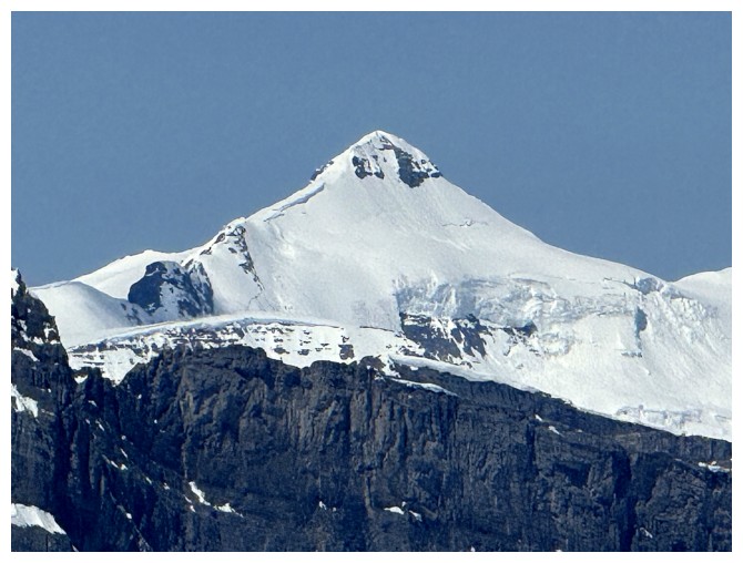
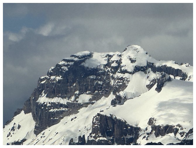
Close-up of Balfour
Close-up of Hector
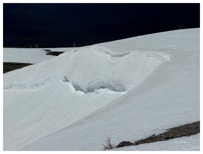
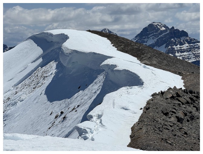
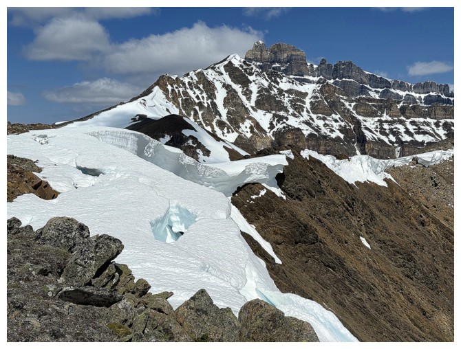
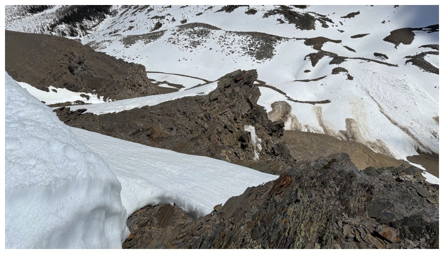
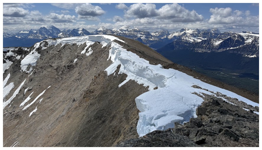
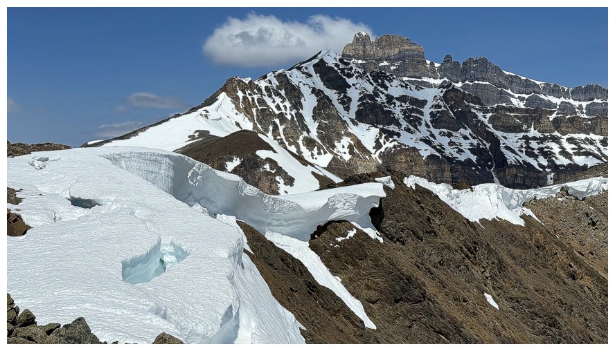
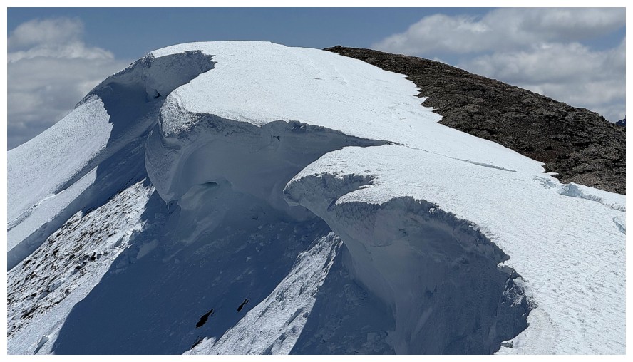
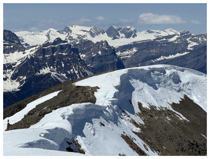
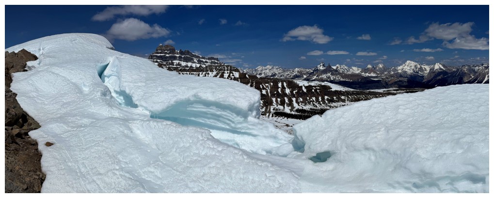
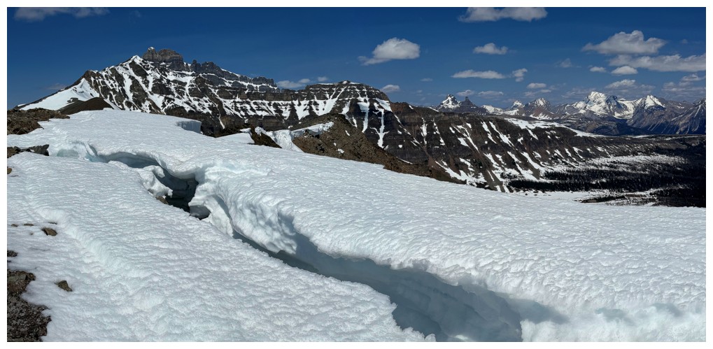
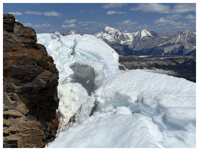
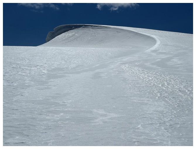
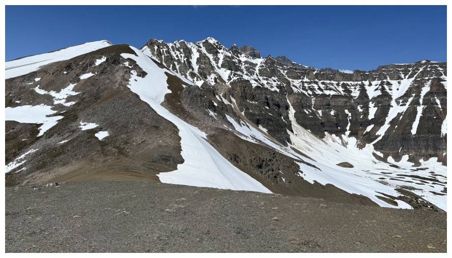
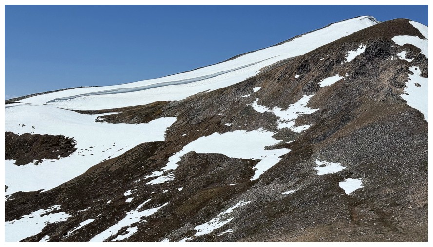
The first indication that big cornices are still present
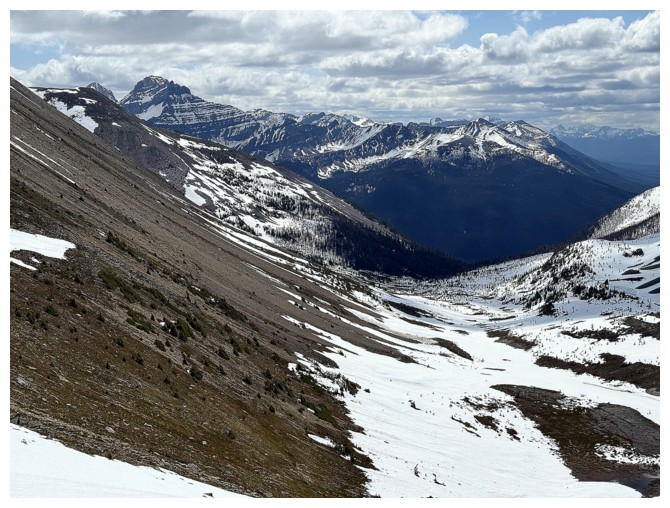
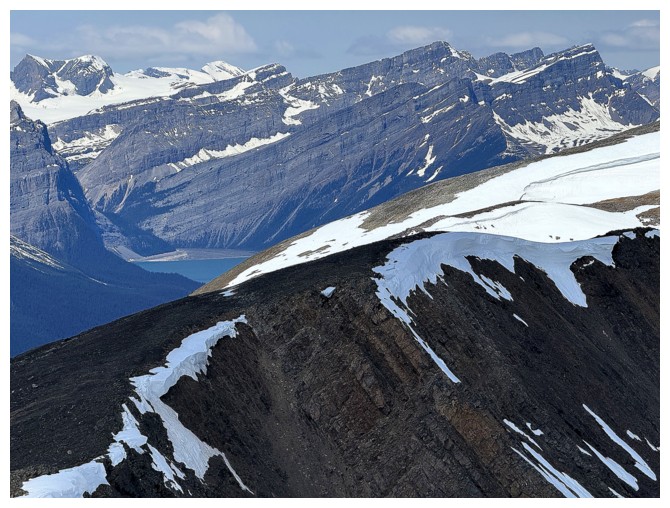
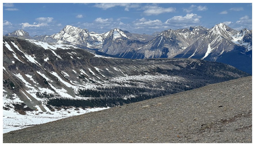
The valley between Hector South Ridge and Hector Point
The view to the north was captivating throughout
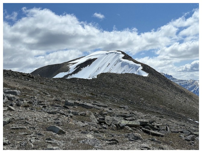
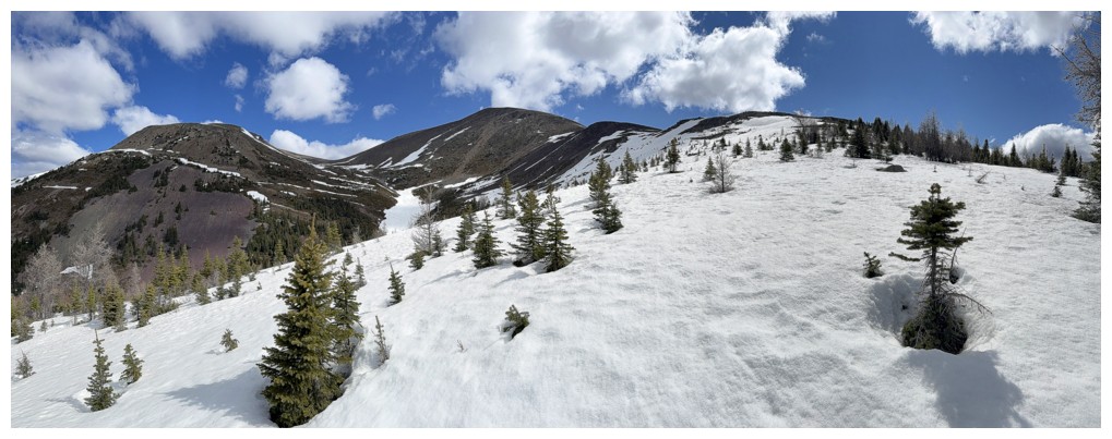
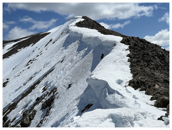
Approaching the ridge. The summit appears close but is farther than it looks.
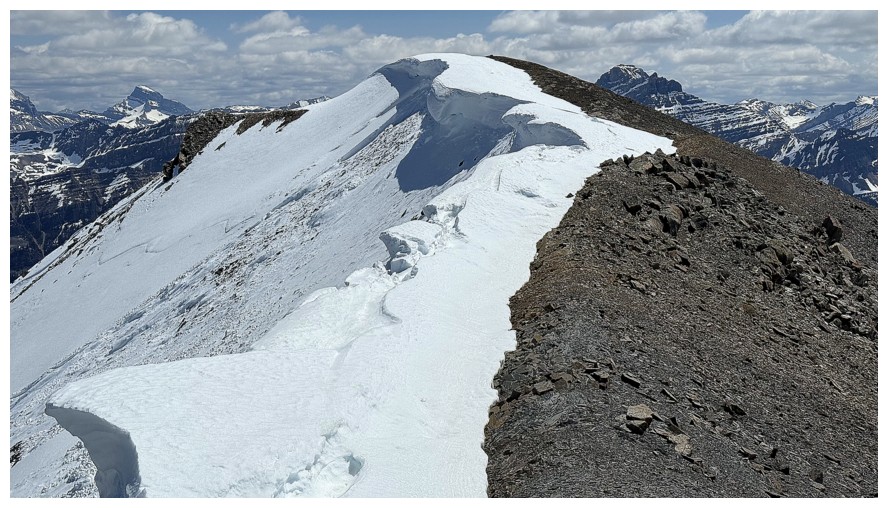
On the ridge
Same as above, but I'm going the wrong way
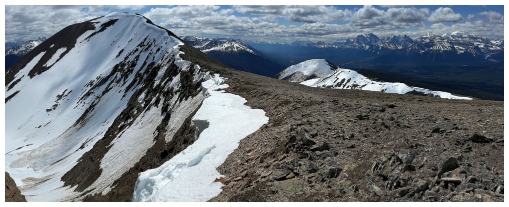
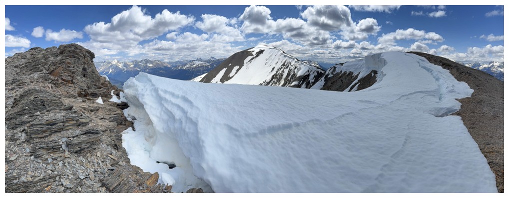
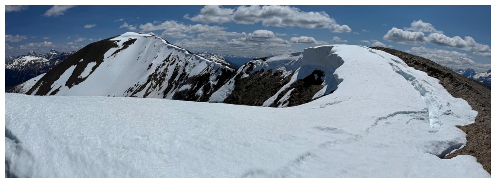
Mount Hector and a taste of the cornice scenery that will have me going every which way
Traveling away from the summit
Better look at Mount Hector
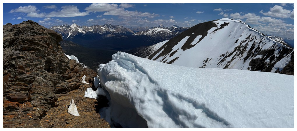
View down the northeast side of the ridge
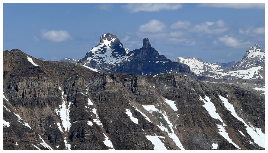
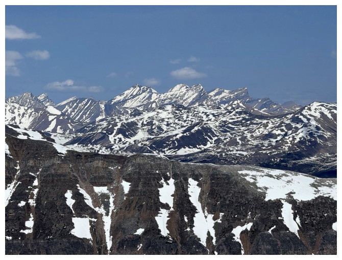
Molar Mountain and Molar Tower
Cataract Peak
Mount Douglas and Mount St. Bride
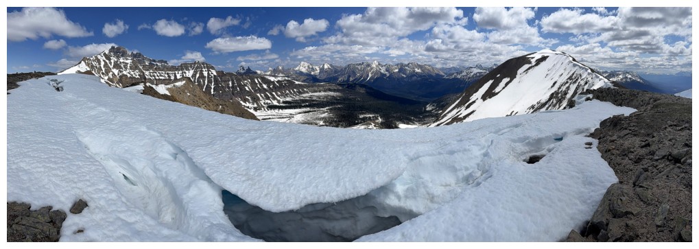
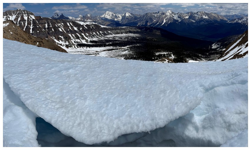
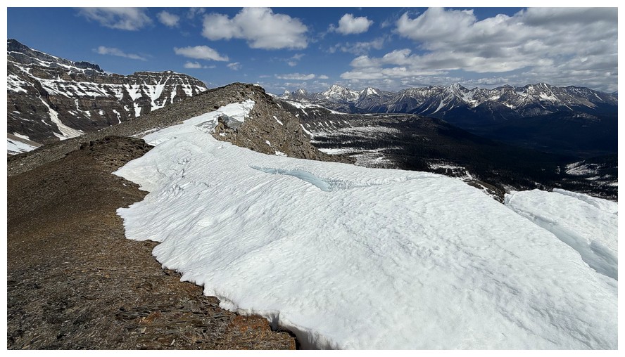
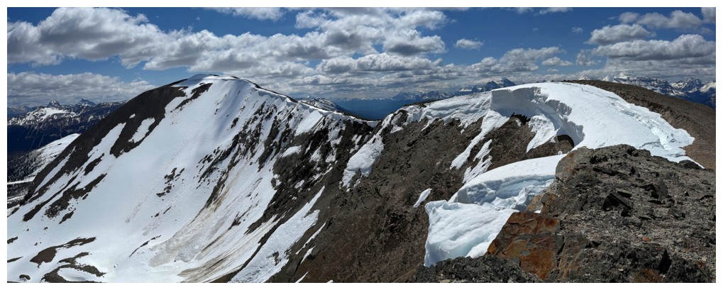
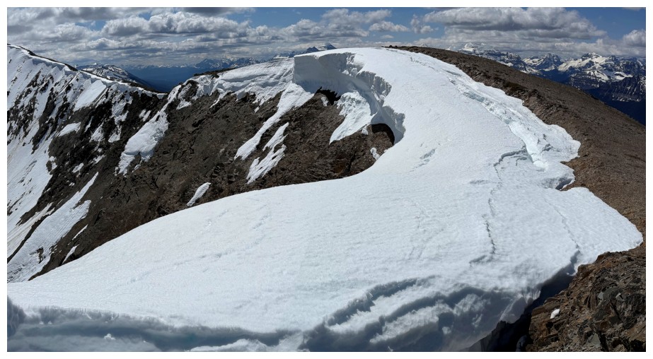
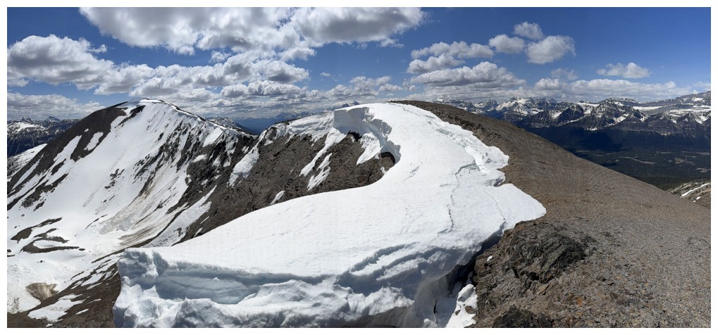
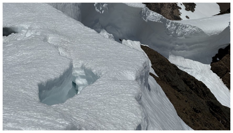
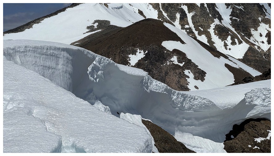
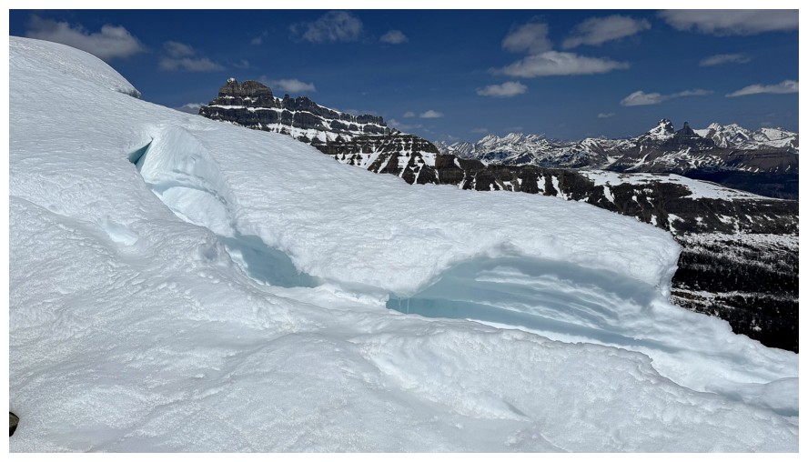
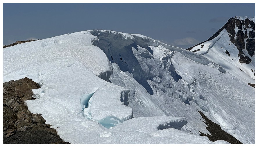
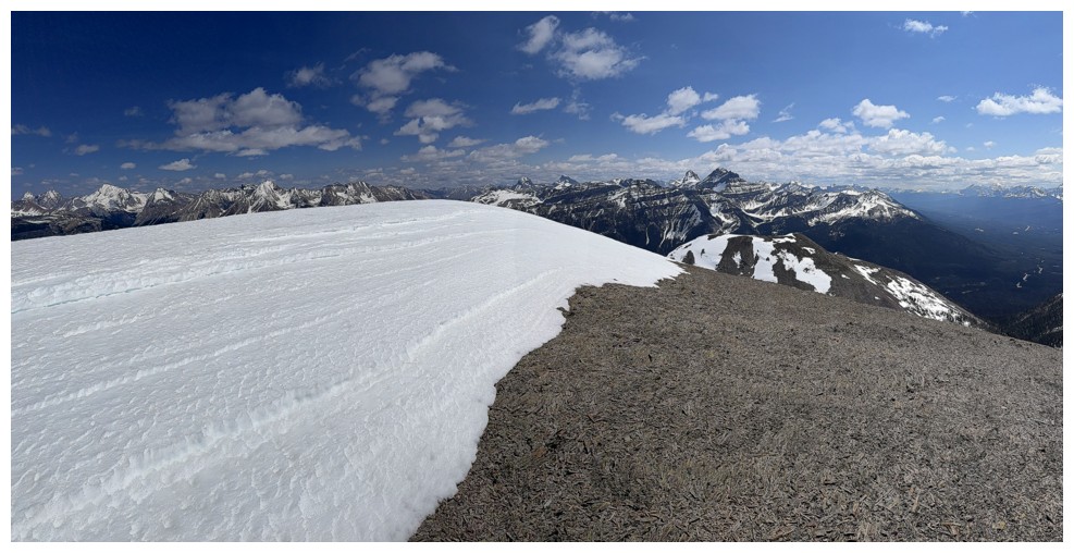
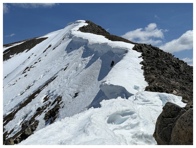
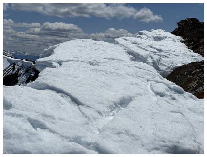
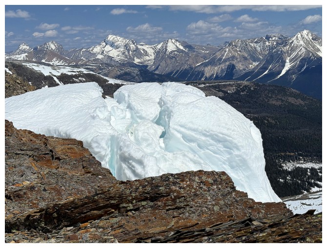
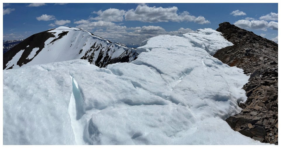
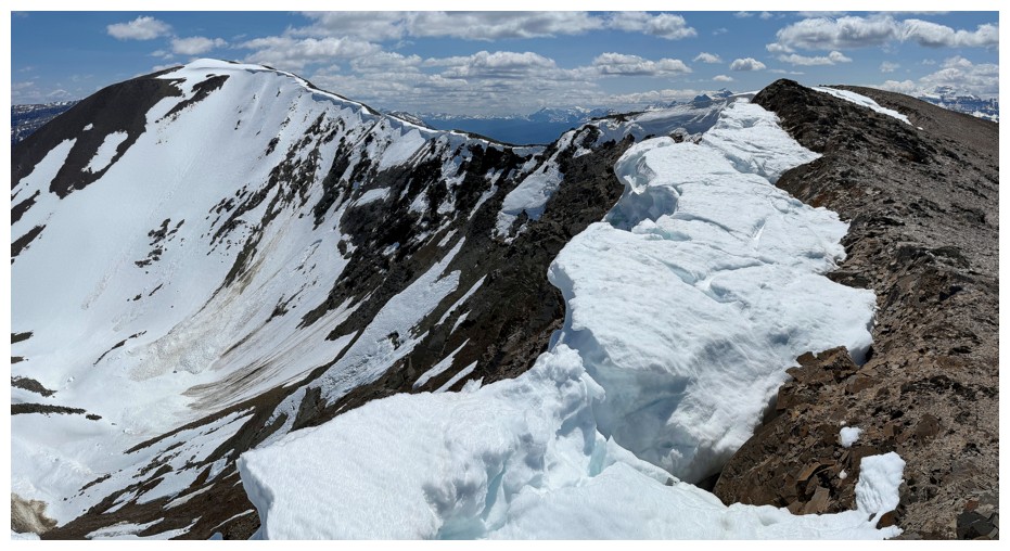
It's crazy cornice scenery for a while now, so no captions
Finally heading in the direction of the summit
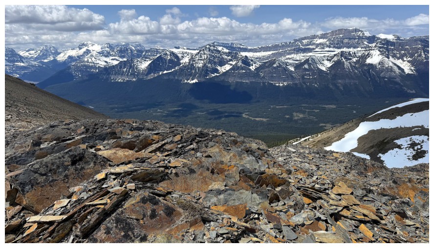
Lots of solid quartzite on this ridge
Over to Hector Lake again
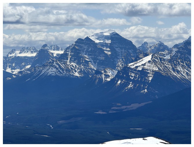
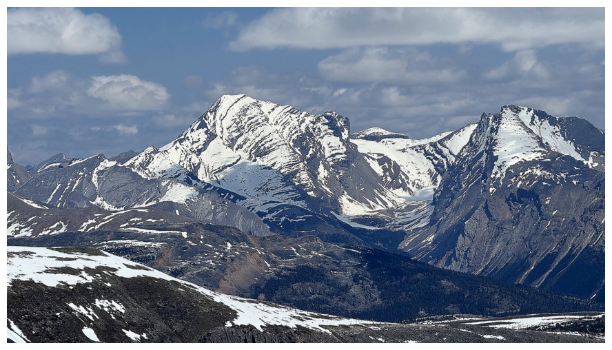
Mount Temple
Pika Peak and Mount Richardson
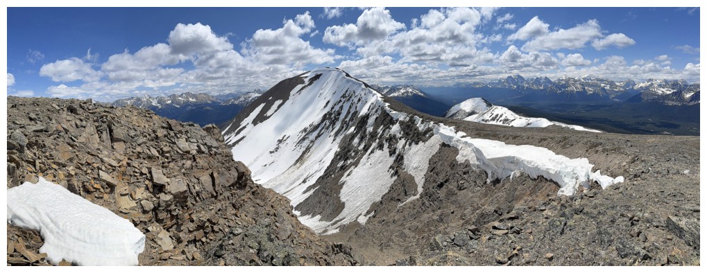
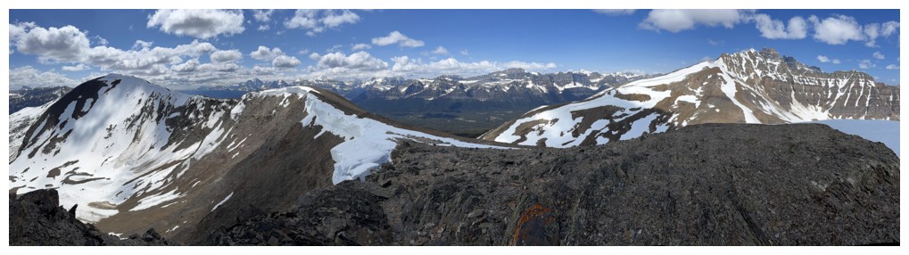
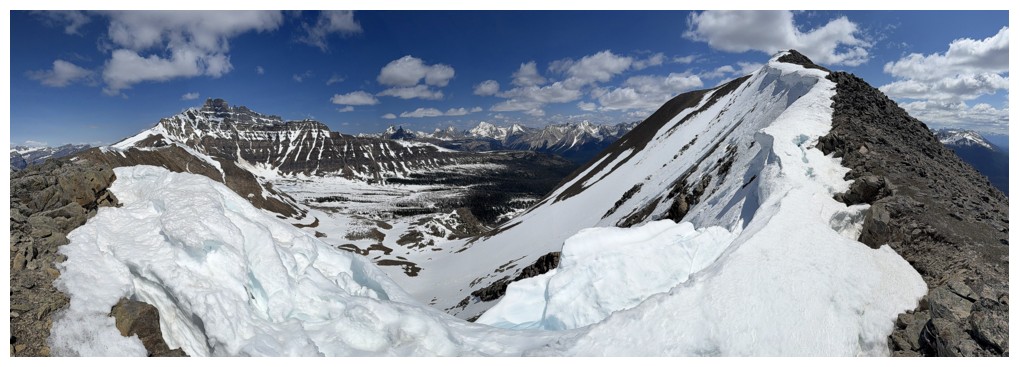
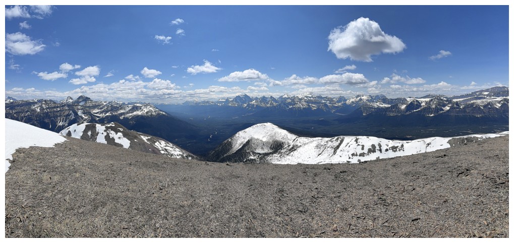
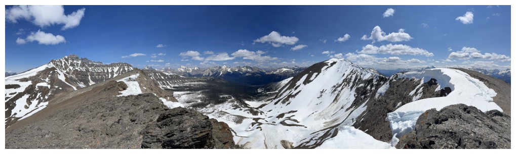
Summit panos
The large cornice at the summit prevented me from looking over the east edge
The Willingdons
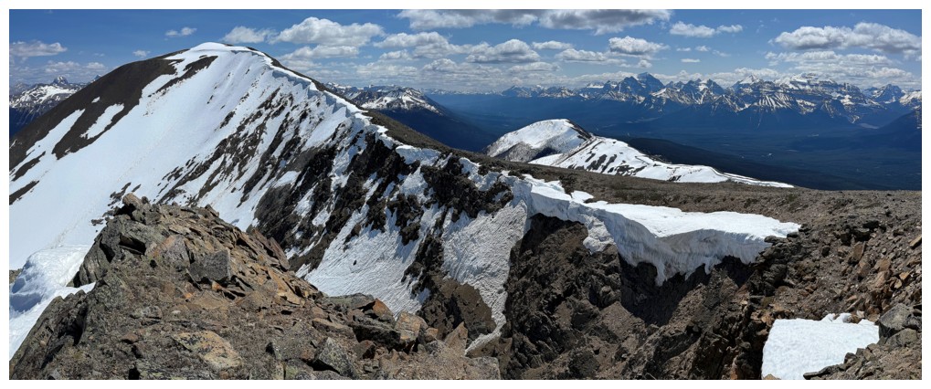
Returning along the ridge to take it all in again with slightly better weather
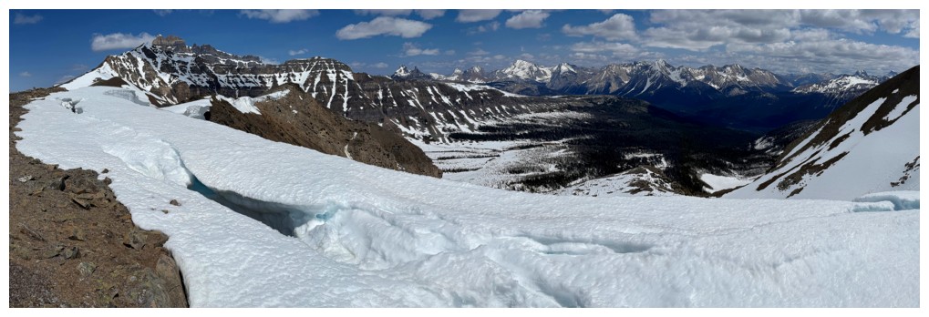
A little exploration down the northeast side
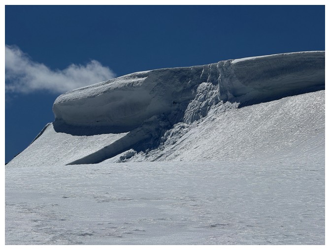
Minor cornice failure
Wrapping around the northeast side over the col
Approaching the col
The view to the northeast again
Continuing north towards Hector South was tempting but I chickened out
Ready for an easy but very scenic return via the col
Looking back up the first part of the route
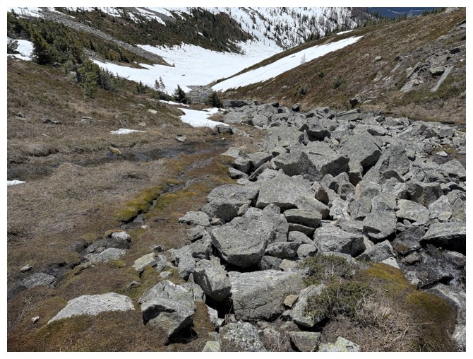
A boulder field running down the valley
Same as above
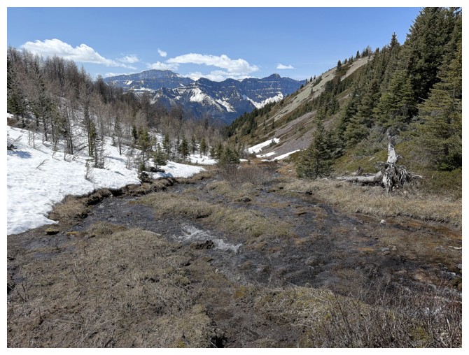
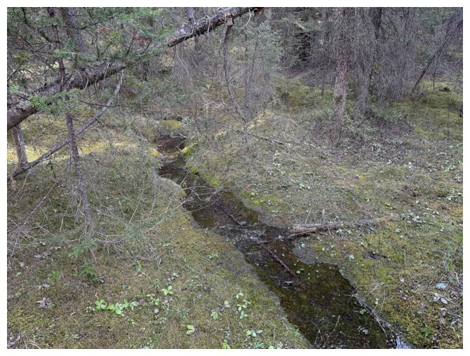
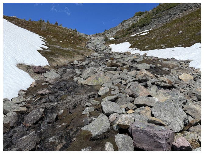
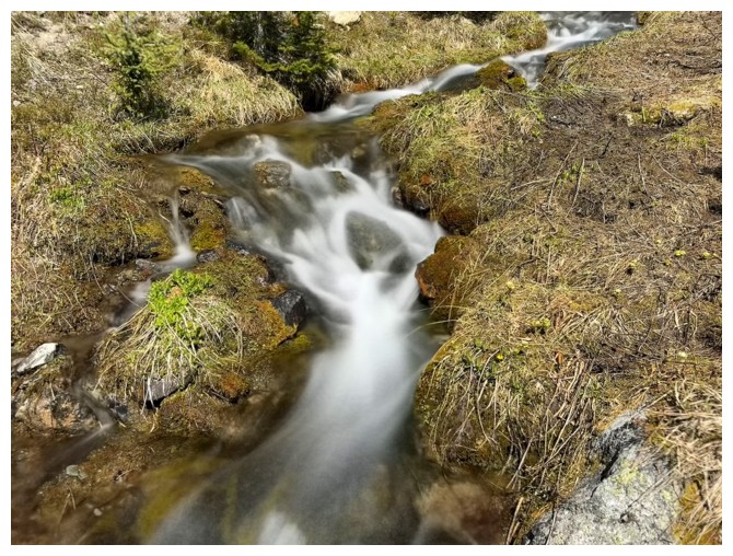
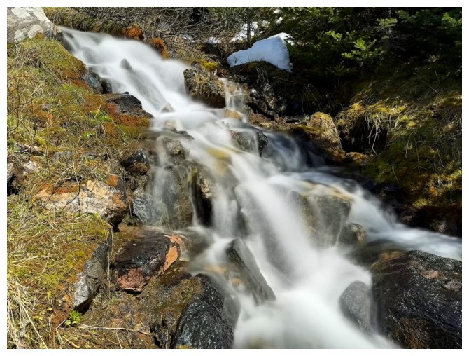
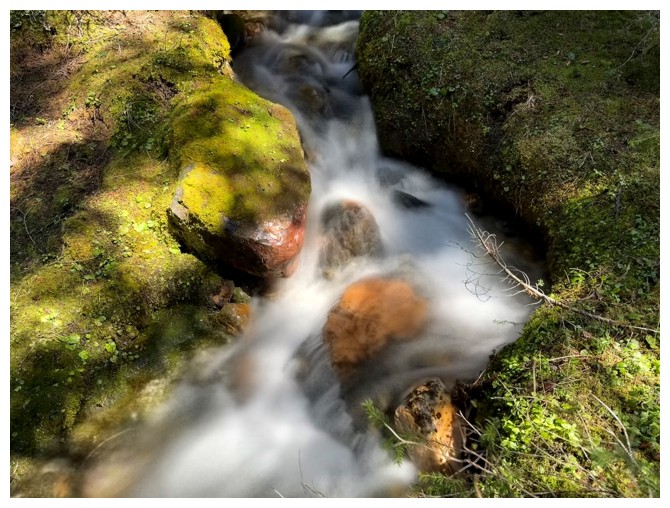
End of the boulders, but there's a nice stream to follow down
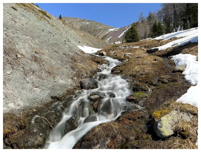
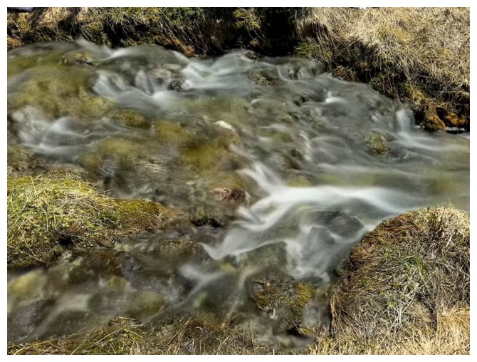
Happy to get a few long exposure shots of the stream
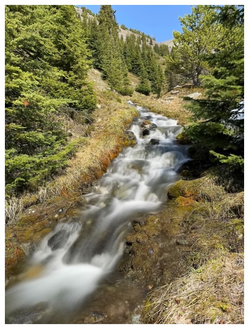
Last one. Easy, forested terrain to finish a very gratifying day.
The End
LOG