Mountain height: 2777 m
Elevation gain: approx.
1200 m
Ascent time: 5:05
Descent time: 3:45
Scrambling with Mark.
With a nasty looking satellite photo, contradicting the somewhat optimistic forecast for the day, we chose to pick an objective in the Front Ranges – a strategy that has paid off in the past, especially at this time of the year, when picking objectives is a major challenge in itself.
Kevin had put
It took us 1 hour, 20 minutes to hike approximately 5 km west along Canyon Creek, before we reached the start of the ridge. The sky was pleasantly clear where we were, but we could see nothing but dark clouds further west. As expected, the ridgewalk was long. Fortunately, it was also incredibly scenic - the new snow and clear skies adding immensely to the views.
The ridge twisted and turned and involved several elevation losses and regains. Though side-sloping would have shortened our ascent time and minimized the elevation gain, we chose to visit every highpoint along the way, to best enjoy the views. Unfortunately, the clouds did eventually start to move in and higher on the ridge we were hit by intensely strong winds. We slowed down the ascent at this point, hoping for clearer skies later in the day. The west remained cloudy, but we did get some sunny breaks at the summit, and a chance to enjoy a terrific summit view.
After a brief sojourn down the south ridge, looking for
potential extensions of the trip, we decided against it, due to the reduced
hours of daylight, and returned to the summit. We did take a variation on
descent by traversing the connecting ridge between Howard and Compression Ridge
and then descending a ridge between the two mountains. Not a terribly
challenging route up
Mount Howard (centre) and its north ridge, as seen from Mount Bryant
Hiking along Canyon Creek
Mark passes the impressive cliffs of Bryant's southeast face
One of numerous unnamed peaks west of Howard
Approaching the start of the north ridge
Slogging up snow slopes
Beautiful snow scenery
The wind picks up
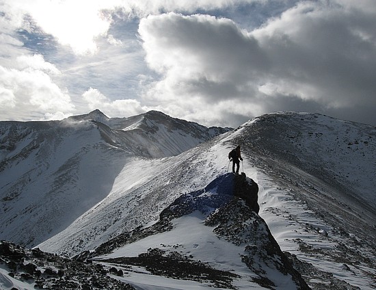
Mark comes up the ridge, with Bryant to the left
Mount Bryant
Part of Compression Ridge to the east
Mark checks out Compression Ridge
The entire north ridge, with the summit at the left
Heading up to the next highpoint
More blustery weather
...followed by calm weather (but only for a few seconds!)
Looking to the summit, a long way off

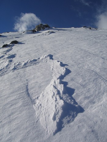
Interesting wind-blown snow
More ridge

A small rock outcrop on the ridge
More ridge
Heading down to the col of the second last highpoint; summit in the centre
The summit (left) and the last highpoint (right)
At the last highpoint, with the summit ahead
Mark, with the last highpoint behind
The final few metres to the summit; Romulus at the far right
At the summit, with Fullerton, Glasgow, Remus, and Romulus behind
Mark at the summit, with the view to the north behind
Mark starts down the south ridge; the long ridge of Nihahi in the background
Me, coming down the ridge
More of the south ridge
Mark sits near the edge of the precipitous east face of Howard
Me, doing the same
Mark returns to the summit
A last look at the view to the south
Mark looks back at Howard from the ridge that connects Howard to Compression Ridge
The full moon and wispy clouds from Canyon Creek, late in the day