Limestone
Mountain
–
Mountain height: 2,173 m (7,127 ft)
Elevation gain: 583 m
Ascent time: 1:50
Descent time: 1:30
(3 hours, if you count all the wrong
routes I took)
Solo scramble.
Looking up at the summit of
I started at Rocky Creek, immediately southwest of the peak, heading northeast to gain the ridge as quickly as possible. It also looked possible to follow the creek and then ascend the peak on its east side, but I thought the most direct route would be best for the ascent. The bushwhacking to get to the ridge was the least enjoyable part of the ascent, though the odd animal trail helped ease matters. As soon as I was out of the trees and on the ridge, the terrain and view improved dramatically. The Wedge was especially stunning from this unique angle.
Ascending the spine of the ridge provided some very enjoyable and easy hands-on scrambling. Unfortunately, the already dicey weather soon began to quickly deteriorate and suddenly it was snowing fairly hard and visibility was reduced to the ascent ridge alone. I slowed my ascent, hoping that the system would pass and not deposit too much snow on the route. It did and I continued up the ridge to the summit.
The dreary weather hid most everything to the west, but the
east was relatively clear, and again, the view of The Wedge was fantastic. Also,
of special interest, was a horizontal ridge, emanating from The Wedge, that
looked to be fairly easily achieved. The big challenge was going to be
descending down to the col from
After a short and very satisfying summit stay, I started down the east side of the mountain, looking for weaknesses in the rockbands. Once again, without warning, a weather system rapidly moved in and within minutes I was in the middle of a blizzard. I descended south, at this point in search of an escape route, not necessarily a route to the col. The conditions worsened and I was forced to stop and wait out the storm. Descending had become too dangerous and unnerving on the steep and snowy terrain.
When the system passed, I decided to not push my luck and find an alternate route down, saving the upper ridge for another day. Getting down to the easy east slopes proved to be more difficult than I thought and eventually I was forced to return to the summit. This turned out to be a good thing, as there was now a little clearing to the west, revealing good views of North and South Kidd, The Fortress and Mount James Walker. For my second attempt, I chose to descend alongside a prominent rockband clearly visible from the summit. It was a little steep, but I was fairly confident it granted an easier descent than the now very snowy ascent route. For the first little while it did. The route was, however, longer and more challenging than expected and about halfway, I looked down to see the route steepen even more and then disappear around a corner. It may have been very easy, or it may have been impassable. I wasn’t willing to take the chance that the section would be easy and once again started up to the summit - three summits in one day (too bad it was the same summit!)
There was now only one option left - return the way I came,
which is 9 times of the 10 is the best way. I wasn’t crazy about downclimbing
some sections of the ridge now that they were covered in snow, however,
negotiating the terrain wasn’t too bad at all and soon, I was down to easier
terrain. I did eventually make it to the east slopes, where I descended to the
bottom and returned via Rocky Creek. The alternate return was no easier than the
ascent route and actually added time to the descent. A very enjoyable day on a
surprisingly interesting mountain.
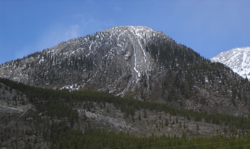
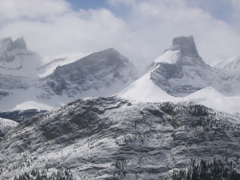
Limestone Mountain, as seen from the road; The best ascent route follows the right-hand skyline; I tried to take an alternate descent down the centre, but turned around
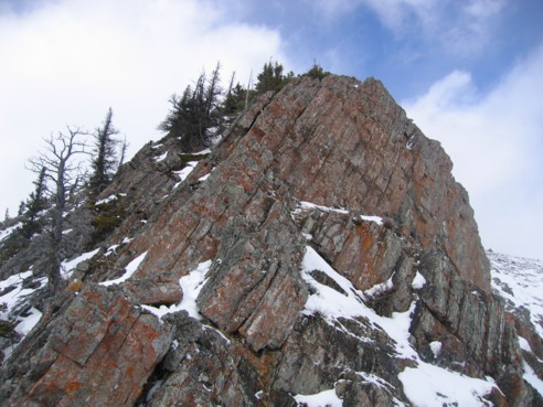
Typical terrain along the ridge; for the best scrambling, stay on the ridge
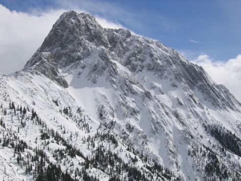
A summit view of The Wedge
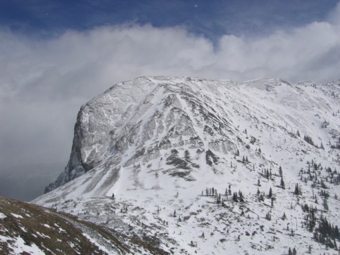
The ridge emanating from The Wedge; I tried to make it down to the col, but failed
Part of James Walker (left) and The Fortress (right)
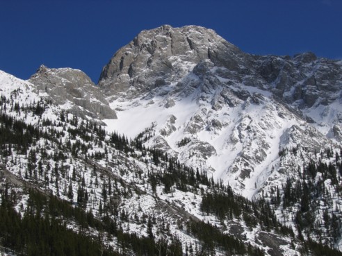
The Wedge, as seen from near the bottom of the descent slope