Limestone
Mountain Loop
–
Limestone
height: 2,173 m (7,127 ft)
Elevation
gain: 583 m
Ascent
time:
Ridge height:
2,347 m ( ft)
Elevation gain from Limestone:
approx. 100 m loss + 275
m gain
Ascent
time from Limestone
to
highpoint at GR308353: 3:20
Descent time:
2:40
Scrambling with Mark and Dan Cote.
More bad weather…more experimental routes. Having
completed an ascent of
As before, we used the southeast ridge to ascend Limestone - a route that
features some very pleasant and enjoyable hands-on scrambling, although it is
far too short-lived. A brief summit stay and we were on our way down to find a
scramble route down to the col between Limestone and the ridge. I thought that
this would be the crux of the trip and so we had brought along a 60 m rope, in
case we were forced to rappel down the cliffband, barring the way. Fortunately,
such was not the case and after a short scramble down the first band, just below
the summit, we were able to find a gully that split the second and steeper
rockband, providing an easy route down and through it.
Surprisingly, the weather had held up to that point, however, at the col, the
skies opened up and down came the rain. By the time we had reached the north end
of the ridge, the rain stopped, although the sky remained cloudy throughout the
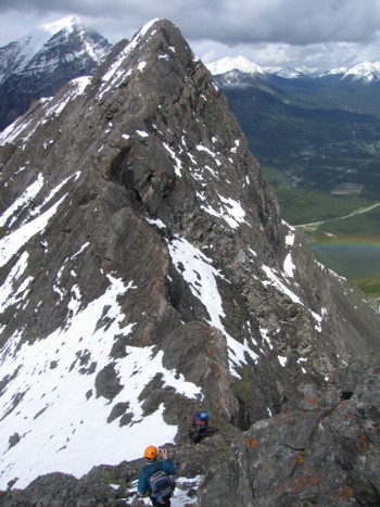
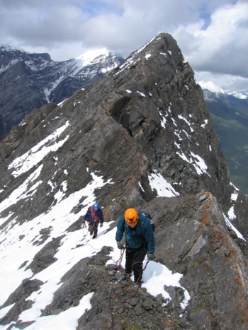
ascent. The ridge traverse was definitely the highlight of the trip. Starting
off as a fairly wide ridge, it soon narrowed and became more exposed and
we decided to short-rope and set up the occasional belay. Although some sections
could have been easily circumvented on the right side, we chose to stay on the
ridge, enjoying a thrilling ridgewalk and stunning views down the northeast side
of the ridge. At one point, a beautiful rainbow appeared, a considerable
distance below us. It was quite an unusual experience to be looking down to see
a rainbow.
Dan was great. This is certainly not a beginner scramble, due to some narrow and exposed sections on the ridge, and he negotiated the tricky terrain with ease. Soon we came to the end of the line, where a steeper rockband blocked the route ahead. I continued on, a little ways up the rockband, but was soon on pretty steep terrain that could be ascended without too much difficulty, but may have required a rappel to get down (for me, anyway!).
Our summit stay was eventually cut short, as a
nasty-looking weather front stormed over the
Surprisingly, the crux of the trip came when we arrived at
Rocky Creek. The creek was no longer the shallow and gentle flowing stream that
I had boulder-hopped over several times earlier this year. The recent heavy rain
had turned it into the torrent of deep and raging water, that was completely
impassable. We stayed on the right side of the creek, but were soon stopped by
vertical cliffbands blocking the route. For a minute, it looked like we might
have to go all the way back up to circumvent the steep rockbands of the lower
section of
A similar situation occurred a short time later, but this time there was no way we were going to be able to get above the rockface. Luckily, Dan spotted a large tree that had fortuitously fallen across the creek, providing an escape route to the other side. Mark went over first, breaking off numerous branches that hindered his progress and Dan and I followed. I couldn’t believe the enormous volume of water rushing passed us, as we bum-shuffled across the tree. Falling into the creek could have been the end of it all.
Now on the left side Rocky Creek, we found the remainder of
the return trip to be straightforward. A great experimental route, with some
terrific hands-on scrambling and exposed ridgewalking. Mark and I are both
hoping that Dan will be joining us for more of the same!
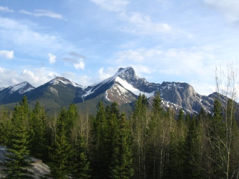
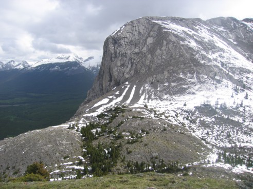
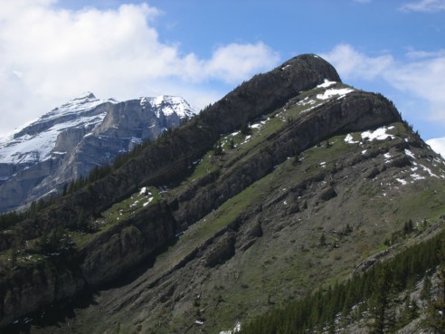
The Wedge (centre), Limestone Mountain (far right), and the ridge on between them (photo by Dan)
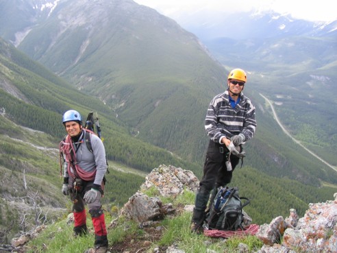
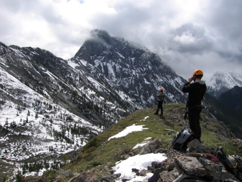
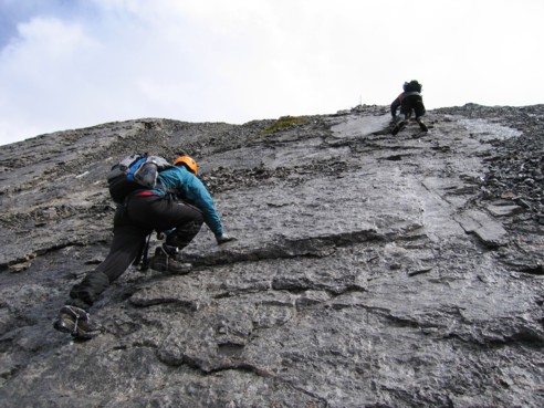
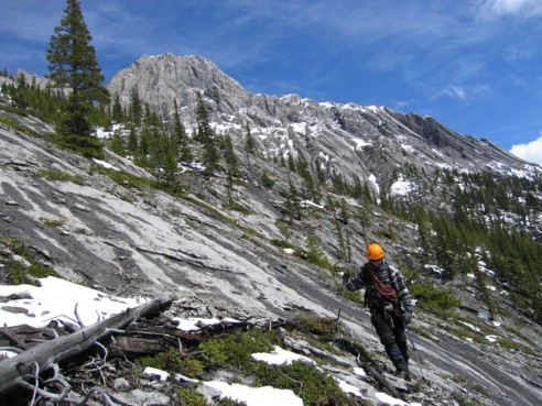
Mark and I preparing for the fun scrambling on Limestone Mountain (photo by Dan)
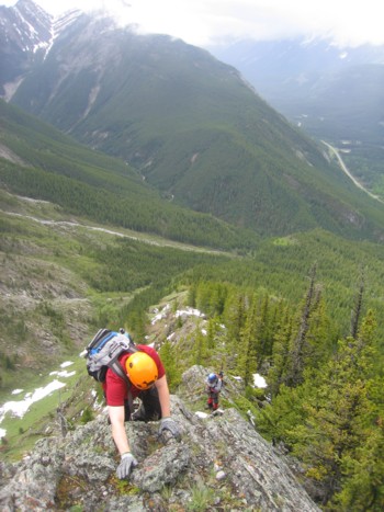
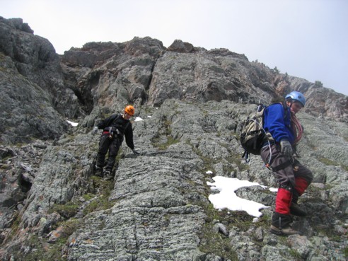
Dan and Mark coming up the ridge
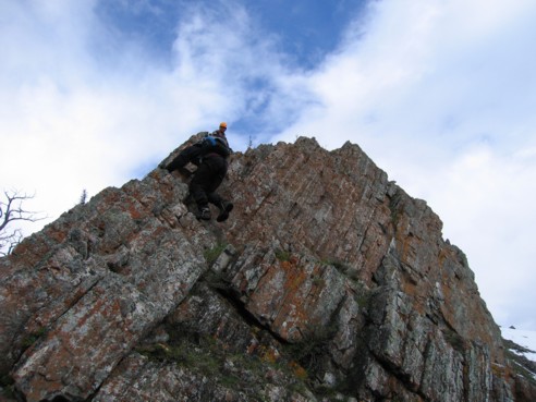
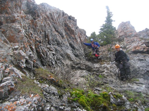
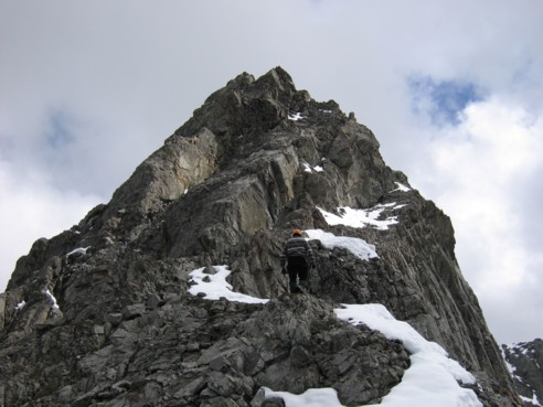
Dan tackles a fun scrambling section
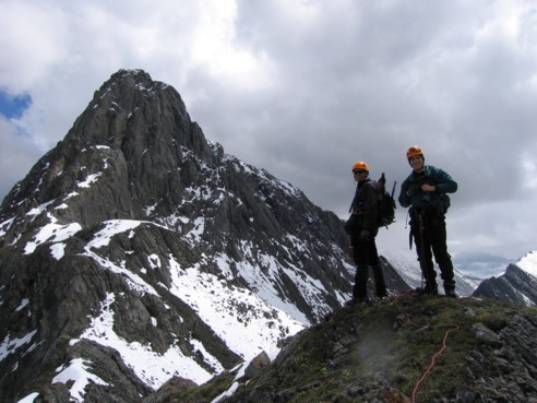
Dan and I at the summit of Limestone Mountain, looking towards the ridge and The Wedge
Looking at the south end of the ridge, from Limestone summit
Dan and Mark, after scrambling down the rockband above
Mark and Dan coming down through the second rockband
Some interesting slab scrambling en route to the south end of the ridge
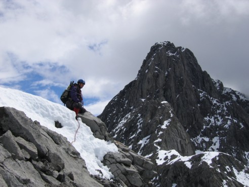
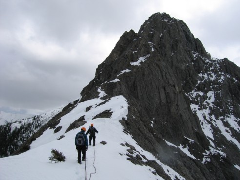
At the south south, starting up towards The Wedge, in the background
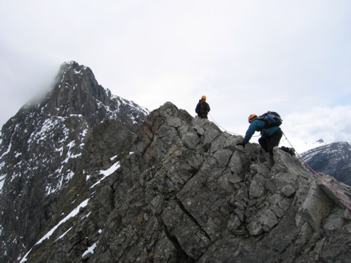
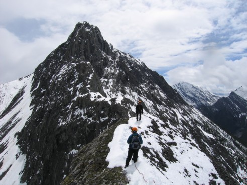
Dan negotiates exposed terrain on the ridge
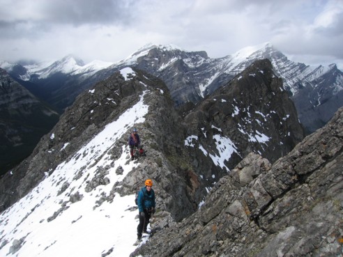
More interesting scrambling along the ridge; North Kidd hides behind the clouds to the left
Taking a short break on the ridge
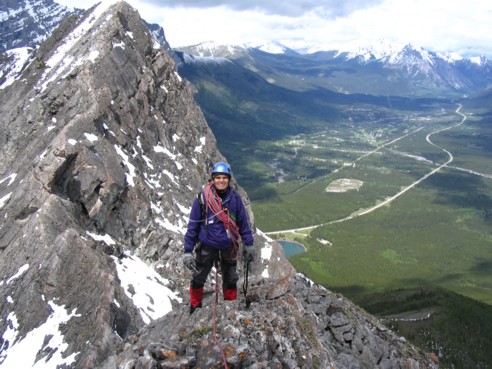
Mark on the ridge (photo by Dan)
Mark's turn to take a break
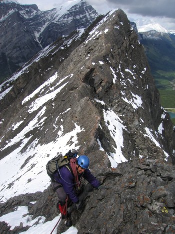
Mark, scrambling up the ridge
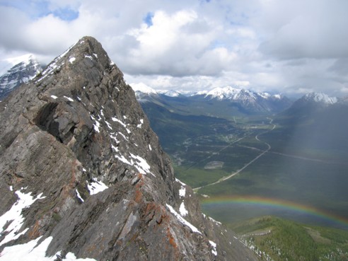
A rainbow appears below us
Looking back at the interesting ridge and the rainbow; North Kidd at the far left
Dan and Mark, with the ridge behind
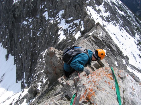
Dan carefully scrambles down a very exposed section
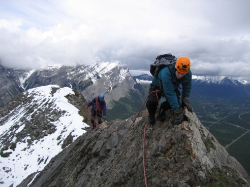
Dan and I stop at a nice, safe place on the ridge
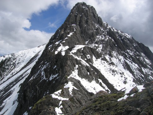
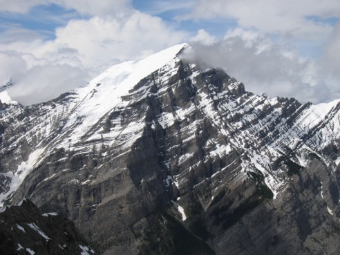
More terrific views of The Wedge
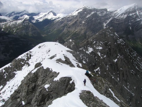
More ridge
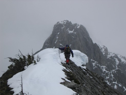
Almost at the end of the line; we stopped where the snow thins out
A little further exploration up a steep rockband just before The Wedge; I didn't make it too far up this section
Looking back at Mark and Dan; North and South Kidd at the right
A closer look at the summit of North Kidd
Clear skies behind the summit block of The Wedge, as we descend slabby terrain
A view of Limestone Mountain (right) and South Kidd (left) from the descent route
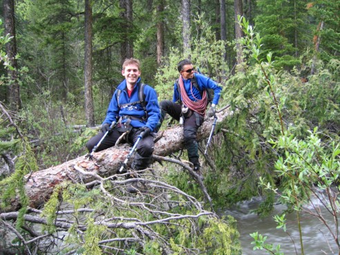
Dan and I negotiate the crux of the trip - getting across raging Rocky Creek