Lone
Mountain
August
9, 2011
Mountain
height: 2420 m
Elevation gain:
1000 m
Ascent time:
4:15
Descent
time:
4:00
Solo
scramble.
Like
Kishinena Peak, Lone Mountain was one of those peaks I had little
interest in.
Upon reflection, however, when putting the question to myself, “Which
Waterton
mountains were not worth the effort?”, the answer came back as a
definitive “none,
they were ALL terrific in at least one way”. And my recent ascent of
Kishinena
itself was one of my most enjoyable trips in the park. I could
therefore simply
not pass up on this isolated, little peak.
 The
other characteristic common to both Kishinena and Lone is that they are
both
fairly lengthy trips; 26 km and 32 km roundtrip respectively. While 16
of the
Kishinena kilometres are bikeable, the Lone trip must be completed
entirely on
foot (definitely another factor that prevented me from making an
attempt
earlier!)
The
other characteristic common to both Kishinena and Lone is that they are
both
fairly lengthy trips; 26 km and 32 km roundtrip respectively. While 16
of the
Kishinena kilometres are bikeable, the Lone trip must be completed
entirely on
foot (definitely another factor that prevented me from making an
attempt
earlier!)
I
left the parking lot at 7:30 am with the intention of hiking about 8 km
along
the Blakiston Creek Trail, ascending the north face and then descending
the recommended
(by Rick Collier) south ridge. All started off as planned, but in
retrospect I
should have worn a wet suit, not hiking attire! Even with water-treated
boots and
gaiters I was completely soaked from mid-thigh down within an hour of
leaving –
unusual in that travel is along a good trail all the way. The cause was
precipitation, from the previous night’s awesome storm, clinging to the
vegetation lining the trail. It was unavoidable and I spent most of the
remainder of the ascent “squelching” my way to the top.
Upon
reaching the 8 km mark, although several feasible routes appeared, they
all
required extensive stints through bush that would have been far worse
than what
I had encountered up to this point. 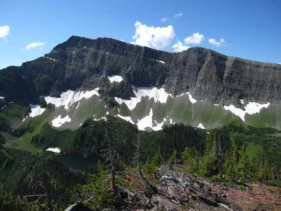 Being soaked from mid-thigh down is
one
thing, but doing the ascent drenched from head to toe is quite another
– I opted
to stay on the trail and ascend the south ridge.
Being soaked from mid-thigh down is
one
thing, but doing the ascent drenched from head to toe is quite another
– I opted
to stay on the trail and ascend the south ridge.
As
Collier states this route is really the only sensible way to get up and
down
Lone Mountain. The scenery on approach to Lone Lake was very pleasant
and the
ascent a total pushover. Although the grade at the bottom of the ridge
was steepish
in places, by the time I reached the summit I hardly realized I still
going
uphill!
I
didn’t have the same “WOW!” reaction, upon arriving at the top, as I
did for
Kishinena Peak, but still the views were much better than expected.
Especially
noteworthy were the unique forms of rarely ascended King Edward,
Starvation,
and Miskwasini Peaks and Kenow Mountain.
A
long summit stay was in order so that I could attempt to dry out my
footwear.
Fortunately I had brought with me a pair of MEC neoprene socks for the
Blakiston Creek ford – a great recommendation by Raff. They worked
magnificently in place of my hiking socks and although my boots
remainder
soaked throughout the rest of trip, the neoprene provided a much better
level
of comfort than soaking wet hiking socks.
I
would have stayed at the summit much longer, but the thunderstorms
predicted
for the afternoon made a premature appearance, just before noon. While
I basked
in beautiful sunshine, rainclouds were forming all around. The bigger
peaks in
the vicinity (Blakiston and Anderson) seemed to be creating their own
storms.
It was time to go!
But
first…I at least had to look down the north face, just to see things
for myself
– famous last words! It only took a glance down the face to immediately
set in
motion my usual rationalization process for attempting unknown,
alternate
descent routes:
1. It
was a fast way to lose elevation quickly in light of the incoming
storms.
2. It
would shave 6 horizontal kilometres off the descent.
3. It
looked easy from the bottom and from my present vantage point.
4. Descending
through the bush is far easier than ascending through it.
5. The
bush would probably be dry by now.
6. It
was part of the adventure!
There
was a cliffband about midway down, but I had spotted a potential
weakness
through from the bottom and thought I could find that weakness.
Alternate route
– on!
Not
surprisingly, the route began well and ended horribly! I lost elevation
quickly
and expected to be reunited with the Blakiston Creek Trail in short
order. Not
so. Finding the weakness in the cliffband was a nightmare. The top of
the band
was guarded by thick alders and even getting close to the edge to find
the
weakness was fraught with difficulty. After fighting my way across the
top for
a good half hour, breaking my sunglasses and losing half a hiking pole
in the
process, I did find the weakness, only to discover it was not much of a
weakness. In fact it was vertical and I was forced to take out my rock
shoes to
get down the short step.
Breathing
a sigh of relief I put my hiking boots back on and continued down.
Within
minutes another rockband, unseen from below because of the thick
vegetation,
was encountered. Fortunately this one was not vertical and I was able
to squirm
my way down using alder branches as handholds.
That
was the end of the rockbands, but getting back to the trail was a bush
battle
of Biblical proportions. Arriving at Blakiston Creek, I simply walked
through
the knee deep waters instead of trying to find a place to cross where
my feet
would be spared of getting wet – I couldn’t get any more drenched than
I
already was!
Two
hours was easy hiking ended a somewhat adventurous and (yes!) very
rewarding
day. Another Waterton peak gets the thumbs up!
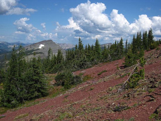
The colourful slopes of Mount Anderson
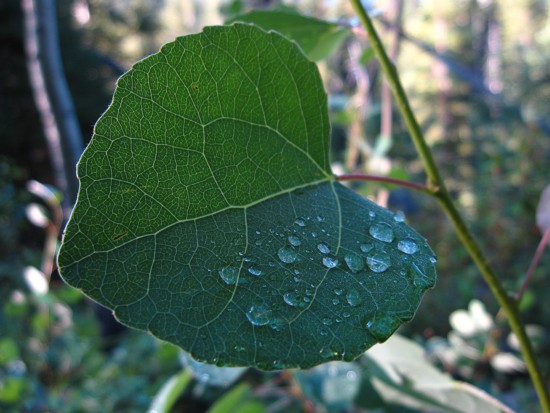
A tiny sample of the precipatation that ended up in my boots
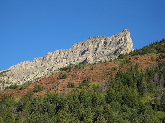
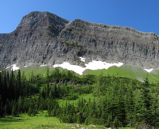
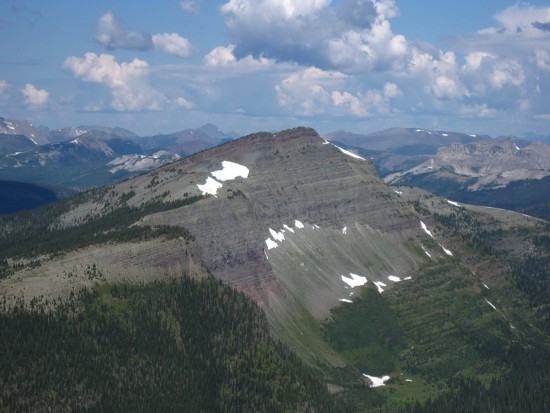
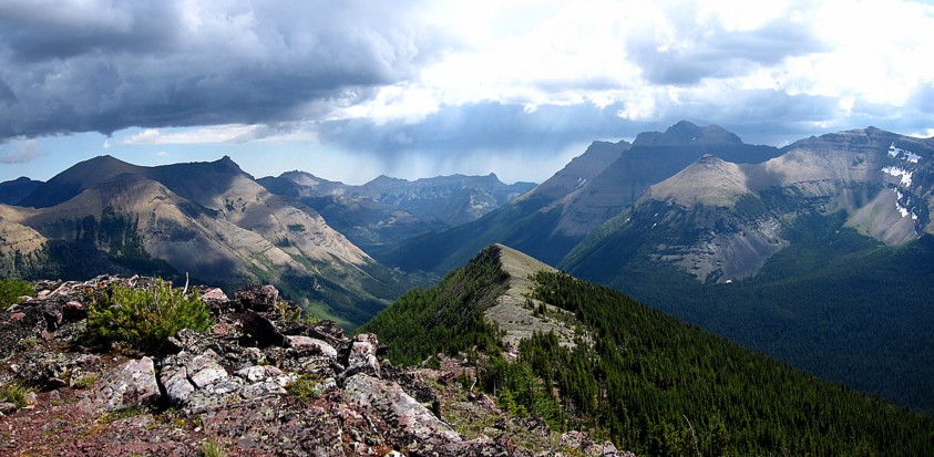
The east side of Lone Mountain
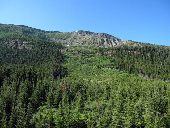
The north face of Lone and the intended route up
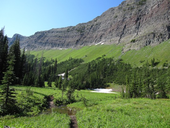
Pleasant meadows near Lone Lake
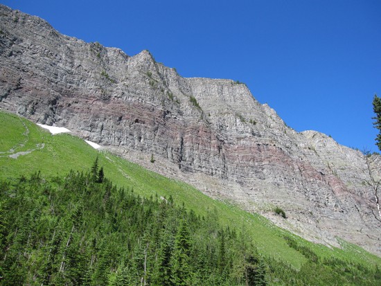
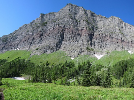
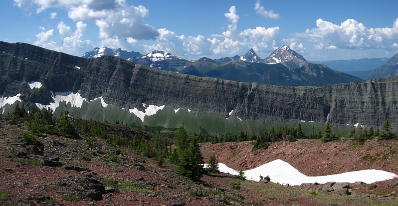
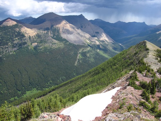
The impressive wall of rock that separates the beautiful provinces of Alberta and British Columbia
Same as above
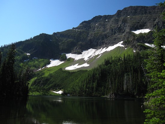
Lone Lake
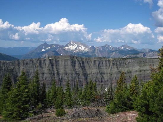
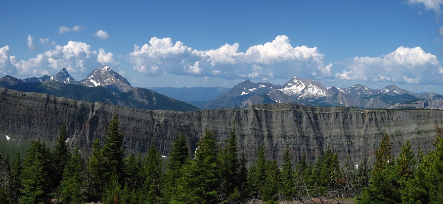
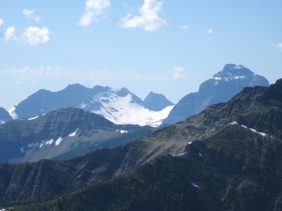
The wall, with Miskwasini and Kenow to the left
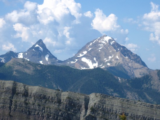
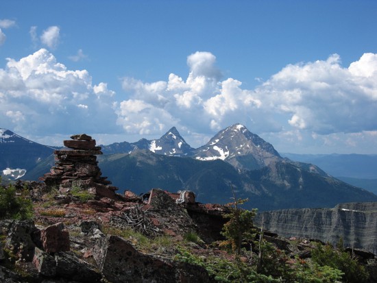
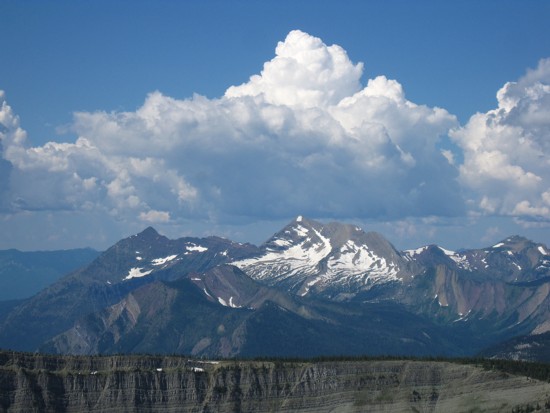
King Edward (left) and Starvation
Mount Kinnerly in GNP at the right
Kishinena Peak
The summit of Lone is comrprised of red argillite; Long Knife Peak to the left
Clouds build above Kenow
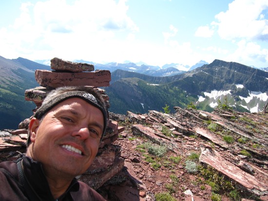
Don't do the self-photo often, but decided to make an exception in this case
Clouds also build up to the east; Blakiston to the right
Looking down the awful, alternate descent route
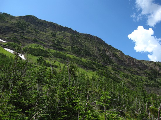
The lush green slopes of the north face; the cursing and swearing started shortly after this photo was taken!
LOG