Pincher Ridge III – June 17, 2006
Mountain height:
2431
m
Elevation gain: 880 m
Ascent time:
5:25
Descent time: 2:00
Scrambling and a little climbing with Mark.
After a typically restless night of sleep at the Crandell
Campground, following our Cloudy Ridge ascent, we got an early start to make
attempt number 3 at Pincher Ridge. Attempt number 1, in February of the same
year, turned into a minor epic, in the form of a headlamp descent in blizzard
conditions and attempt number 2, later in May, had simply failed because we
severely underestimated the steepness and seriousness of the mountain’s
One of the best decisions of the day came right near the
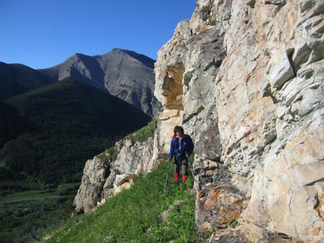
beginning, where we opted to traverse alongside the rock outcrops below the
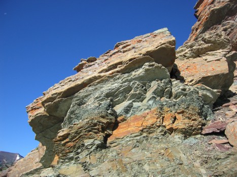
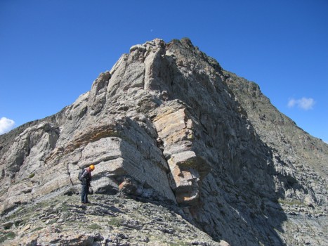
Previously, we had attempted to avoid the vertical rockbands by circumventing them on the northeast side of the mountain – this time we went to the southeast. Again, the mountain was home to innumerable scenes of fascinating rock and colours, including a beautifully pronounced example of rock folding. Though we had planned on traversing a long distance across the southeast side, before heading up, the lure of the ridge was too much and when a weakness appeared, we scrambled up a water worn gully and then up a steeper gully to gain the ridge. The scrambling here was steep and a little exposed, but the rock was solid, with plenty of good holds.
That was the second good decision of the day. The ridge was definitely the best place to be in terms of great scenery, great views, and fun scrambling. We continued up the ridge, at times tackling rockbands head-on and at other times, circumventing them on either side of the ridge. We were both very surprised at how much progress we were making up the ridge that we previously believed to be too steep. That is, until we pulled up to within 40 vertical metres of the summit. Here, the final rockband was definitely too steep to scramble up and the right side of the ridge ended in drop-offs. We had no choice but to go left onto the northeast side – specifically what we were trying to avoid.
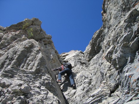
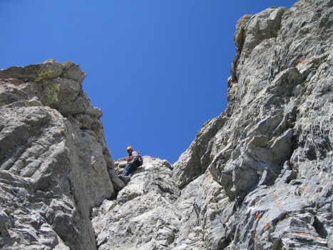
This is where the fun was replaced by a healthy dose of nervous exhilaration and a little trepidation. We ascended increasingly steep slopes via a series of grassy ledges, growing concerned that we might have to set up some rappel stations if we couldn’t reach the ridge from this side. Eventually, we made our way to within striking distance of the summit ridge, but it was guarded by a small vertical rockband with a narrow ledge below it. This terrain was considerably more exposed and any slip would have been very serious. We, therefore, pulled all the climbing gear out and I started up. After placing a couple of cams for protection I was just about to try and haul myself up the rockband, when Mark noticed another route further along the ledge. This route had a couple of exposed steps but was considerably easier than the one I was planning on taking. The ridge was only a few more steps beyond and we both breathed a sigh of relief when all four feet were firmly planted on the wide ridge. The summit was only minutes away - a most enjoyable and “thrilling” ascent.
After a relaxing summit stay, enjoying the gorgeous panorama, we descended via Linda Breton’s southwest route. The colours were yet again magnificent and scree surfing down the gently-angled slopes was a godsend, after the challenging ascent. A short stint of bush-bashing, followed by an easy 4 km walk back to the car ended a terrific day out.
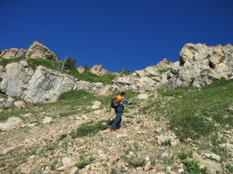
On the lower slopes
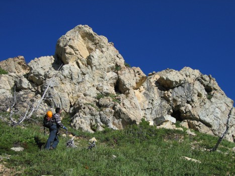
The beautiful rockbands of the lower slopes
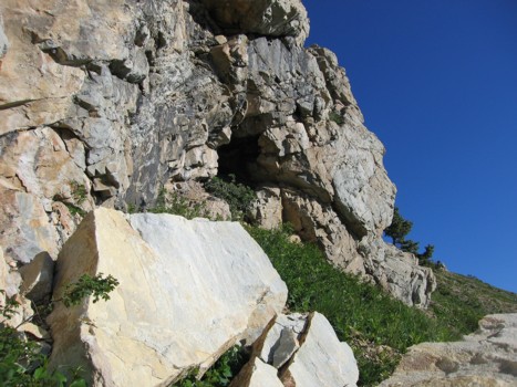
A small cave along the way
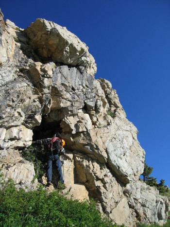
Checking out the cave
More great colours; Drywood Mountain behind
More interesting rock
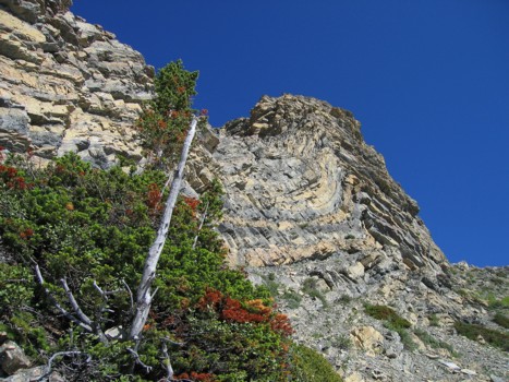
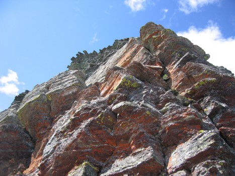
Some of the most beautifully coloured and layered rock we've seen
Same as above
Same as above
On the east ridge
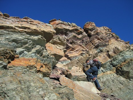
Approaching the steepest and biggest of the rockbands on the east ridge
At the rockband
A striking and colourful example of rock folding
Looking back on the folded rock
Scrambling up the first gully to the ridge
Approaching the top of the gully
Back on the east ridge
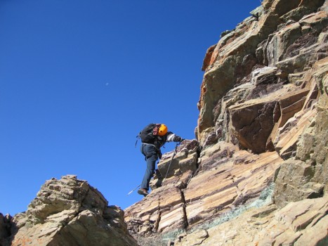
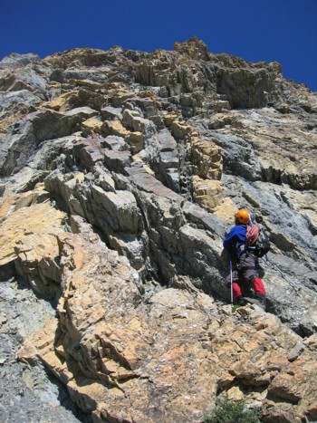
Scrambling up the second gully
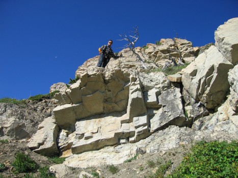
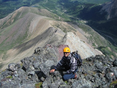
At the top
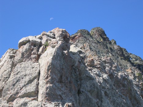
More cool rock on the ridge and the faint moon
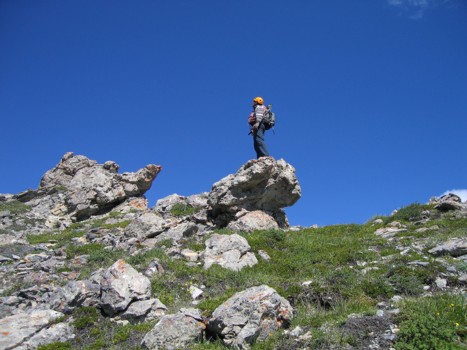
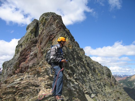
Mark atop more unique rock formations
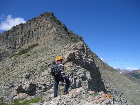
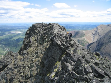
Looking towards the summit
The remainder of the ascent
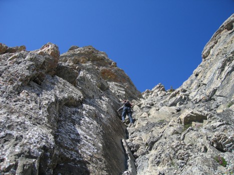
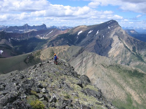
Interesting scrambling on the ridge
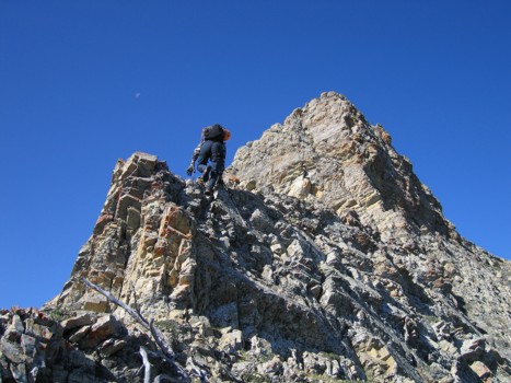
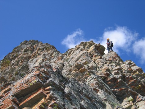
The ridge steepens near the top
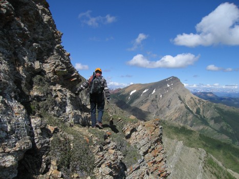
Traversing around a rockband on the northeast side of the mountain; Victoria Peak behind
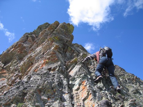
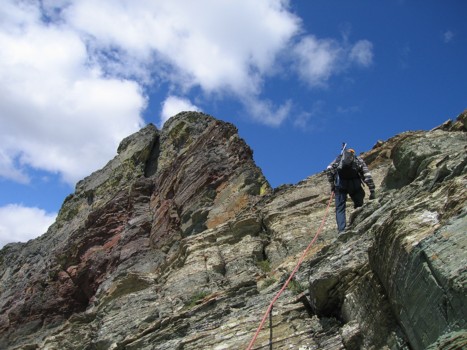
Tons of great hands-on scrambling on this route
Same as above
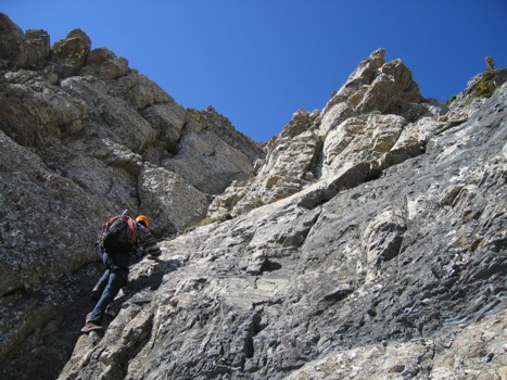
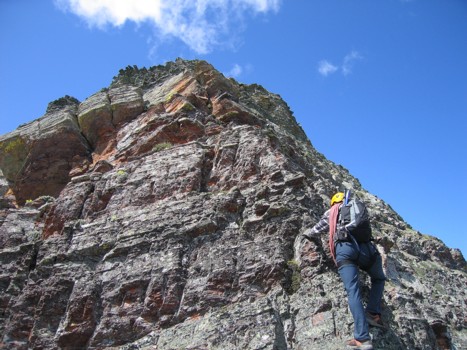
Approaching the final rockband
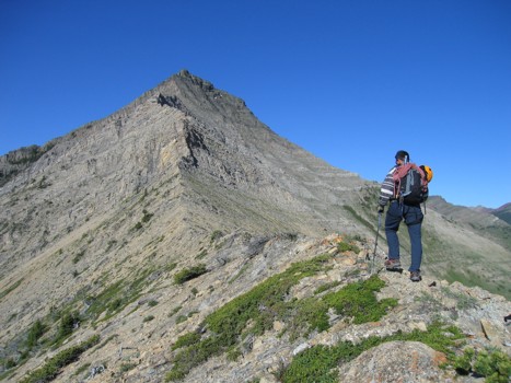
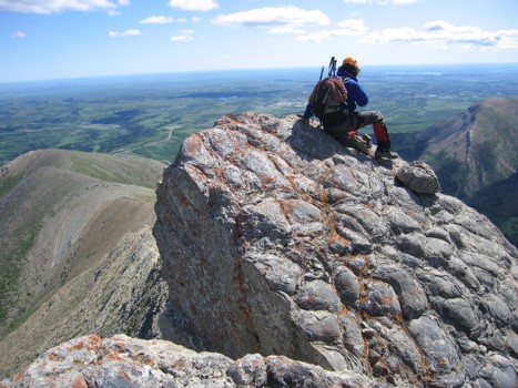
Checking our altitude; summit behind; here, we traversed around to the northeast side
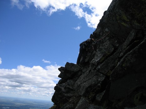
Setting up protection for the final push to the summit
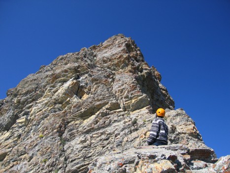
Easy scrambling on the summit ridge
Looking down the colourful southeast side of the mountain, from near the summit
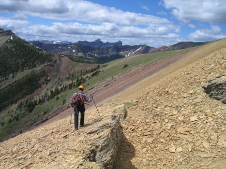
Starting the descent
More great colours on descent; Windsor Mountain and Castle Peak in the distant centre
LOG