Pincher
Ridge
Centre and South Peaks
October
1, 2011
Mountain
heights: 2290 m, 2450 m
Elevation gain:
approximately 1000 m
Ascent time:
4:50
Descent
time:
3:00
Solo
scramble.
These
days, with limitations on weekend mountain trips I’ll take what I can
get.
Although Saturday was supposed to be a work day, I was unexpectedly
granted a
labour reprieve and therefore set out to do something. The weather was
looking
to be pretty iffy, but as said I’ll take what I get can.
 Inspired
by Bob Spirko’s trip to the centre peak of Pincher Ridge, I set out to
do the
same. If the weather took a turn for the better I could continue the
trip south
along the ridge. There even existed the possibility of going all the
way to the
summit of Victoria Ridge and back via one of the most scenic ridgewalks
in the
Rockies – Victoria Ridge/Peak. Unfortunately a late start and lack of a
bike
rendered that an unlikely possibility.
Inspired
by Bob Spirko’s trip to the centre peak of Pincher Ridge, I set out to
do the
same. If the weather took a turn for the better I could continue the
trip south
along the ridge. There even existed the possibility of going all the
way to the
summit of Victoria Ridge and back via one of the most scenic ridgewalks
in the
Rockies – Victoria Ridge/Peak. Unfortunately a late start and lack of a
bike
rendered that an unlikely possibility.
As
Bob did, I used the Pincher Ridge descent route to gain the col between
the
true summit and the centre peak, but decided to forgo an ascent to the
true
summit, since I had been there previously. 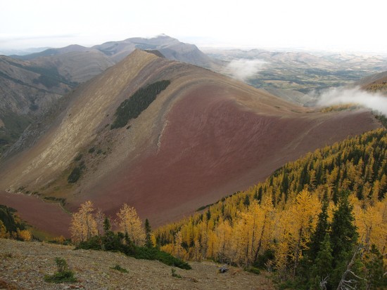 With completely overcast
skies and a
very low cloud ceiling, the scenery and views were respectable, but not
mind-blowing,
as I’ve come to expect from trips in this area.
With completely overcast
skies and a
very low cloud ceiling, the scenery and views were respectable, but not
mind-blowing,
as I’ve come to expect from trips in this area.
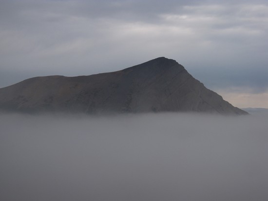
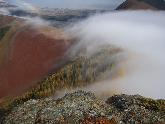
At
the col, things took a general turn for the better. The weather didn’t
improve,
however, I was to discover the low cloud ceiling was not actually a low
cloud
ceiling – it was the phenomena of clouds forming in the valley, rising
up and
dissipating. At the col this was pretty cool – higher up it was
mind-blowing, as the clouds crept over the col like a living entity. It
very
much reminded me an old, but awesome Marillion lyric from the album
Misplaced
Childhood: “The mist crawled from the canal, like some primordial
phantom of
romance, ….” Fish (Derek Dick). Yellow larches lining the col, the
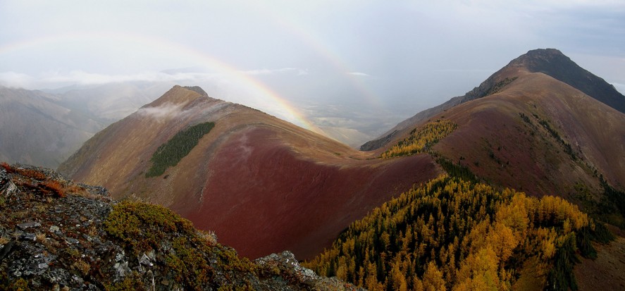
awesome red
argillite bowl to the north, and a double rainbow added tremendously to
an
already breath-taking view. Had the sky been a clear blue to the east,
I’m sure
the scene would have leapt instantly into the number one position of my
All-time Favourite Mountain Scenes.
I
then scrambled up to the summit of the Centre Peak, took a few photos
and continued
along the ridge, heading south. The scenery along the way never dipped
below
the “amazing” level, even though the weather couldn’t quite reach that
“perfect” status that I’ve become addicted to over the years. Yellow
larches
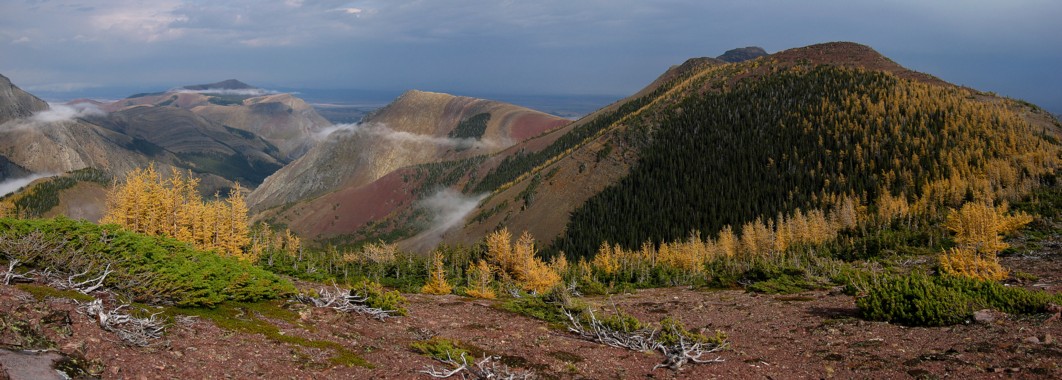
and the green pines combined with the extraordinary shades of red and
light
browns of rock on Pincher Ridge, Victoria Ridge, and Victoria Peak was
striking
to say the least and again would have been unbelievable in conjunction
with a
clear sky.
Like
Pocaterra Ridge, a week earlier, the ridgewalk on Pincher Ridge was
delightful
– an hour of easy walking and fantastic and constantly changing
scenery. Upon
reaching the summit of the South Peak I quickly dismissed the idea of
continuing on to Victoria Ridge. Though tempting, time, energy, and
perfectly
clear skies were not in abundance at this point. Instead I took a long,
relaxing summit break and then retraced most of the ascent route back
to the
car.
An
amazingly scenic day out.
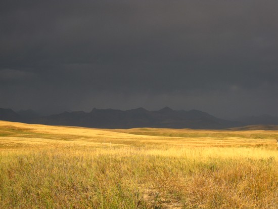 Ominous weather on the drive in
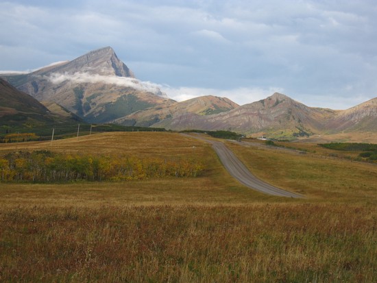
Looking better, approaching the trailhead; Victoria Peak to the left
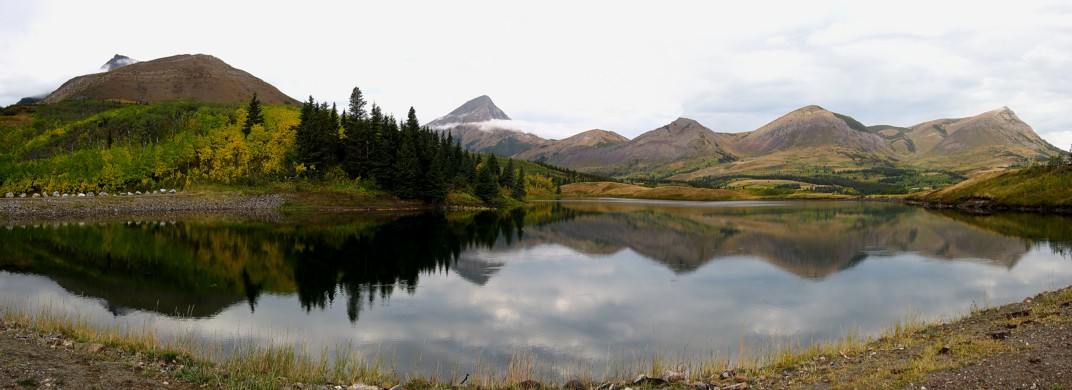
Butcher Lake, Pincher Ridge (left), Victoria Peak, and the multiple peaks of Prairie Bluff
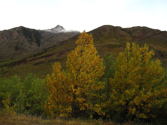
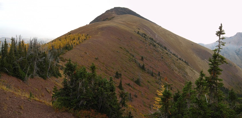
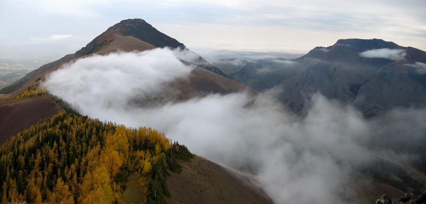
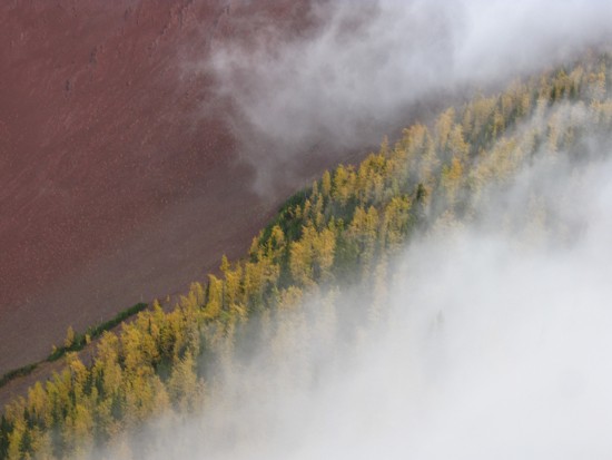
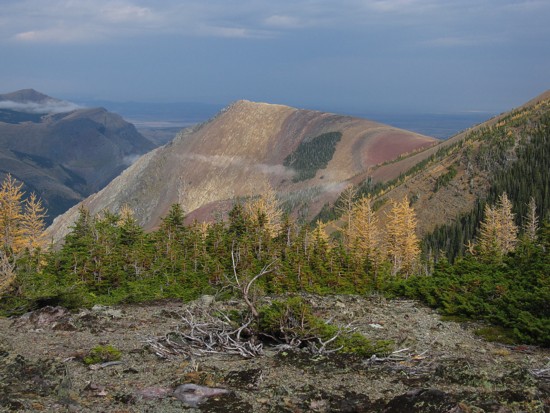
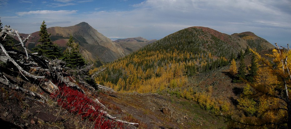
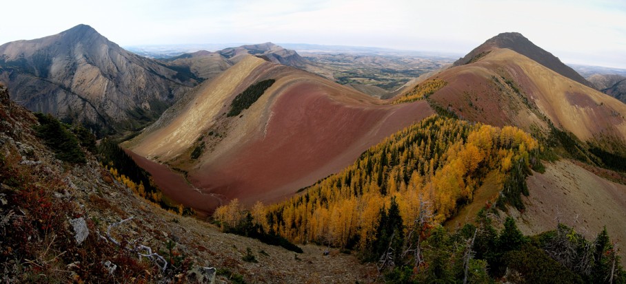
Autumn colours and the summit of Pincher Ridge
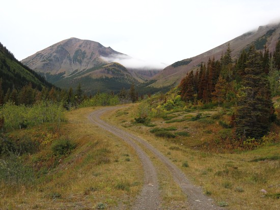
The gravel approach road (great for bikes), with the South Peak of Pincher Ridge at the left
The ascent slopes to the col
Same as above
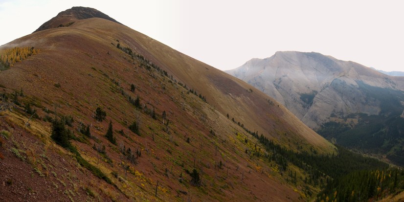
Looking back across the ascent slopes; Pincher Ridge at the left and Drywood Mountain to the right
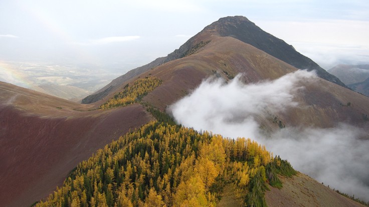
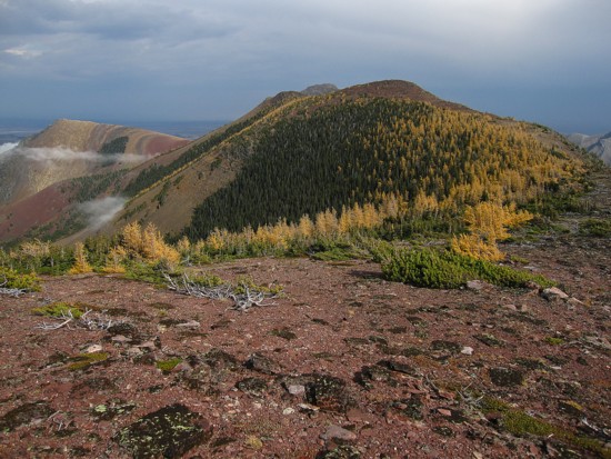
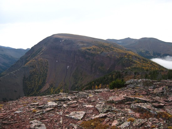
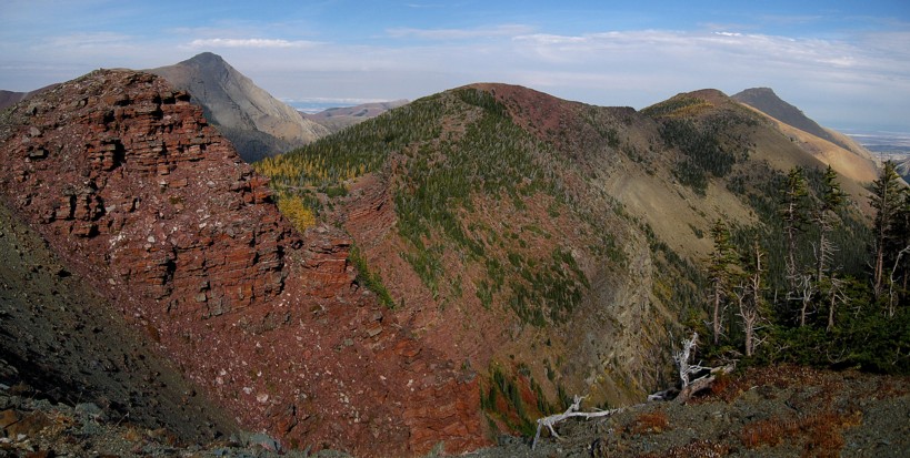
Pincher Ridge
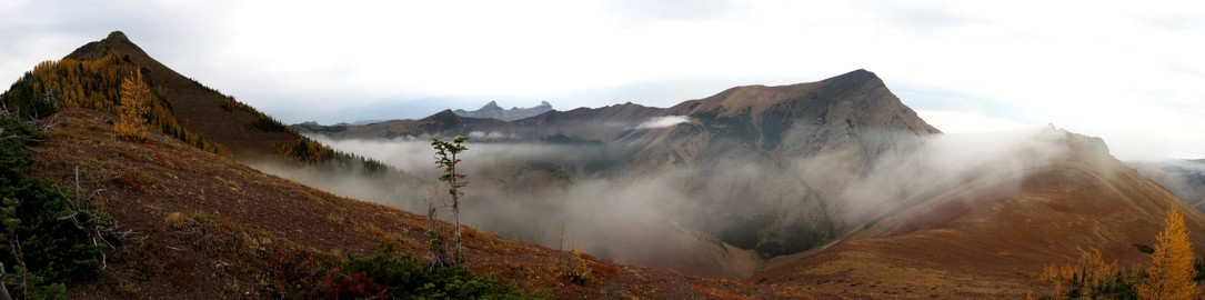
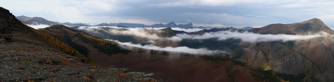
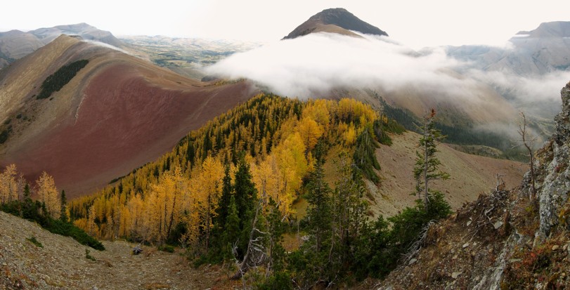
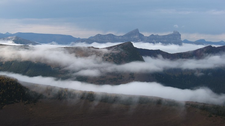
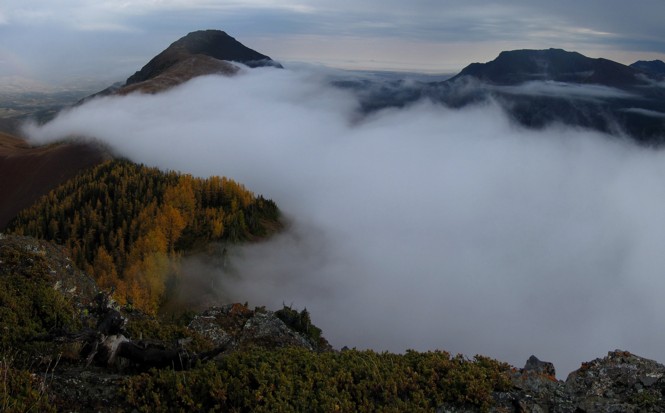
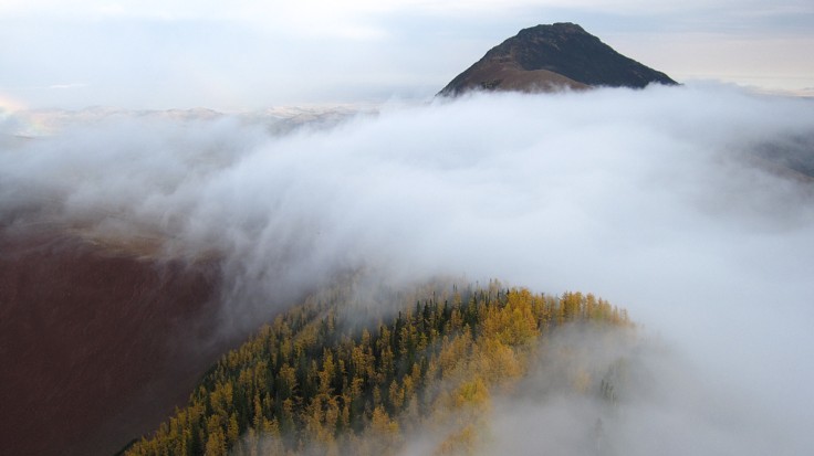
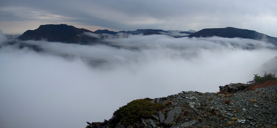
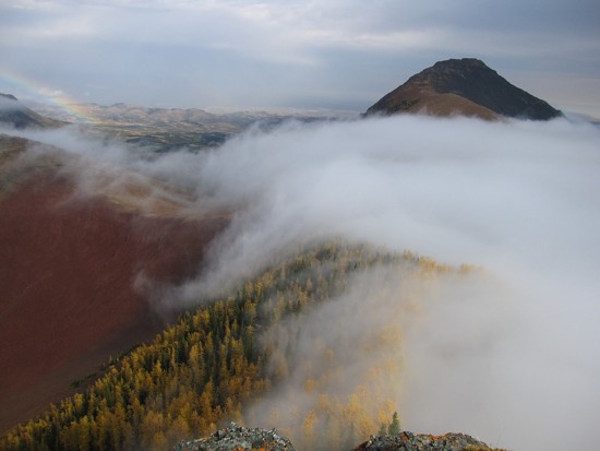
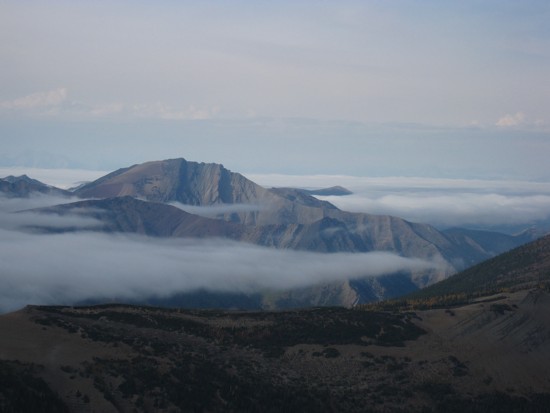
Clouds forming to the north; the Centre Peak is at the far left
Victoria Peak and an outlier I ascended in last year
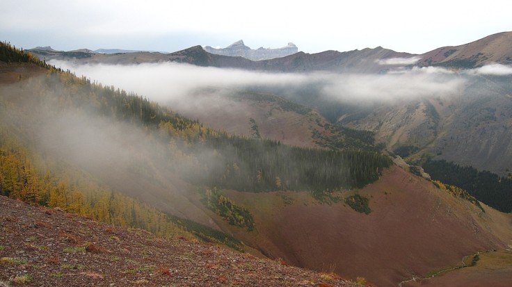
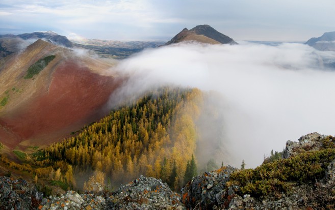
More clouds form above the red argillite basin
Same as above; Windsor Mountain at the right
More clouds, this time below Victoria Peak
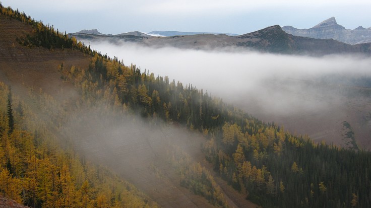
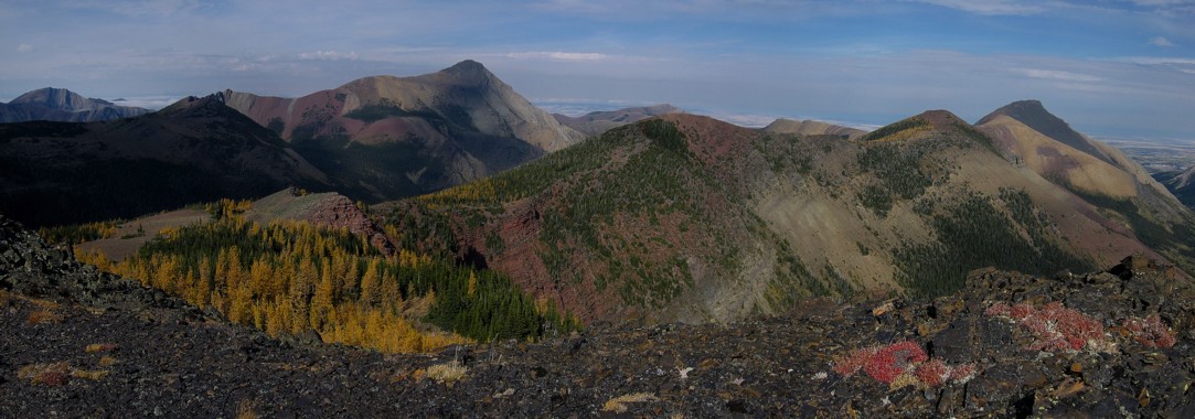
The larches on the ridge
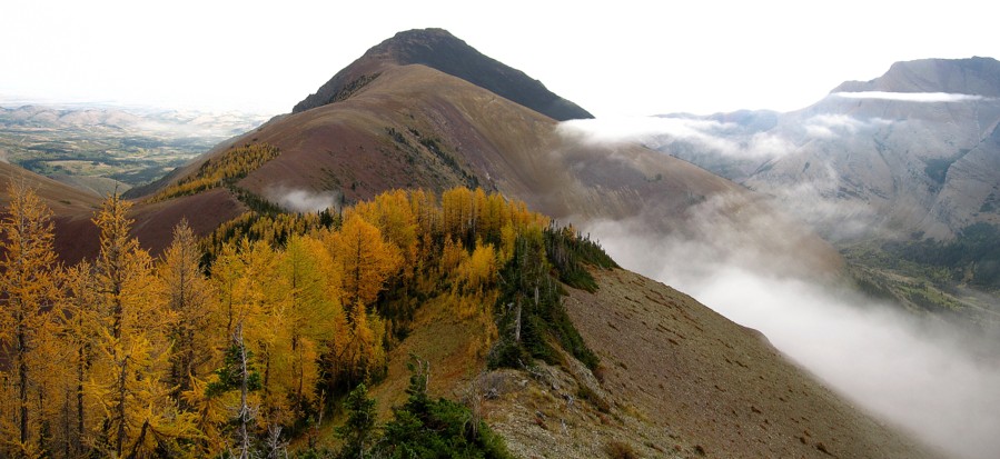
Looking back to Pincher Ridge
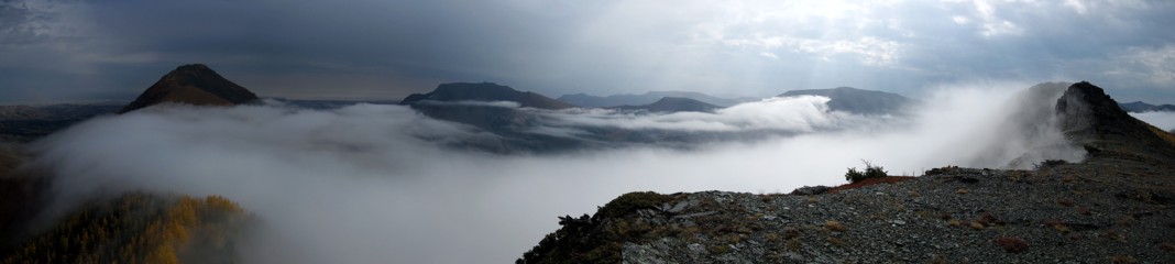
Here comes the first wave of clouds
Same as above
Clear again
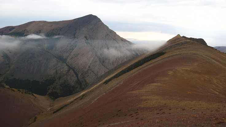
The cloud layer around Windsor Mountain and Castle Peak
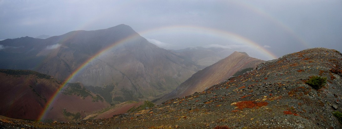
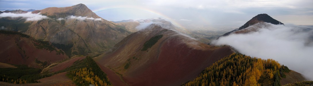
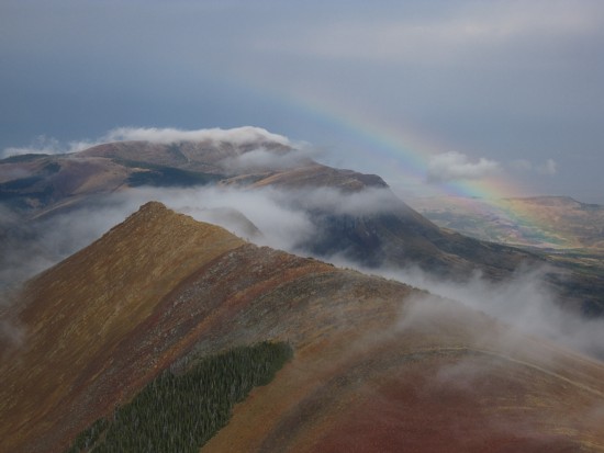
A double rainbow
Same as above
The second wave
Windsor and Castle again
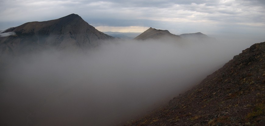
The third wave was the most dramatic
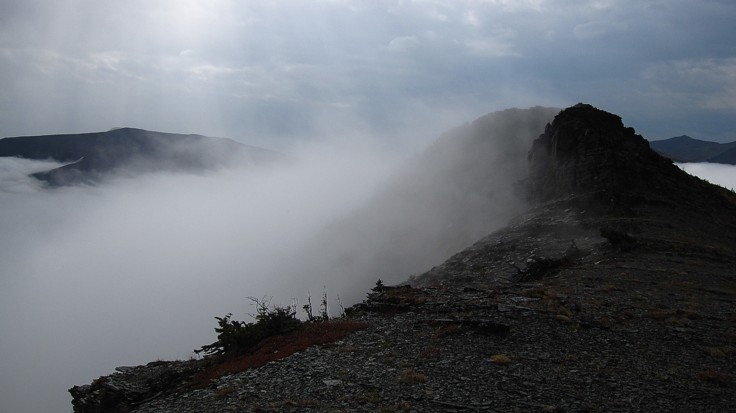
It enveloped the entire valley below
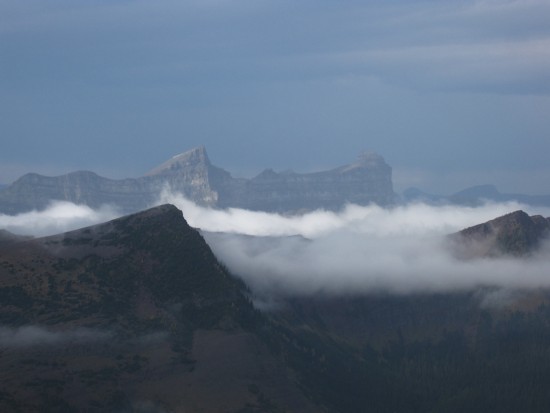
The cloud layer separates the east and west summits of Drywood Mountain
A more comprehensive photo of the above
On the other side of the ridge most of the cloud has dissipated
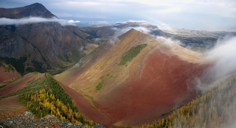
The Sun momentarily lights up the beautiful, red basin
The Marillion lyric
Same as above
Same as above
A close-up
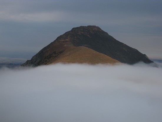
The top of Pincher Ridge stays visible
The rainbow again
Victoria Peak again
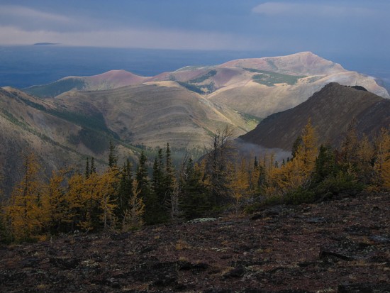
Prairie Bluff takes on different hues in the sunlight
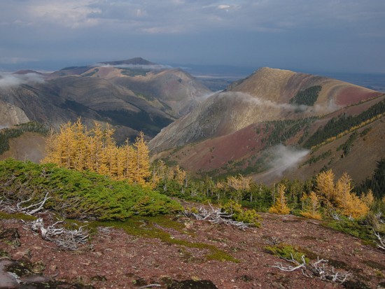
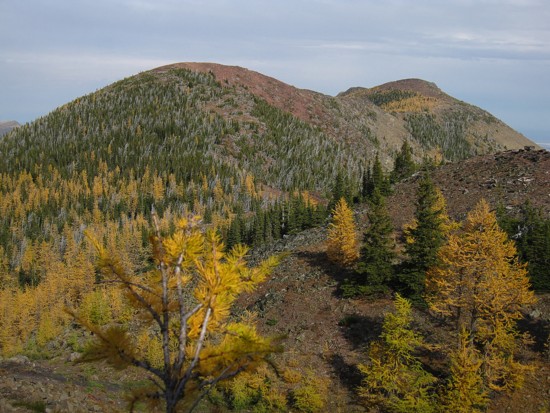
Prairie Bluff (left) and the colourful, northern outlier of Pincher Ridge
The outlier
Looking back along the ridge
Same as above
The outlier again!
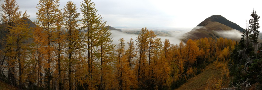
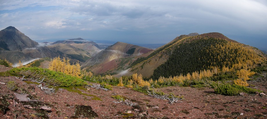
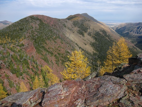
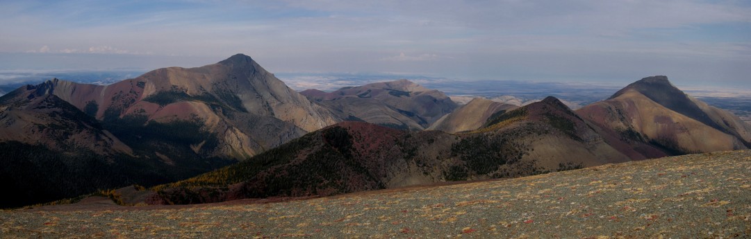
The South Peak of Pincher Ridge (left) and the summit of Victoria Ridge (distant right of centre)
More Autumn colours
Same as above
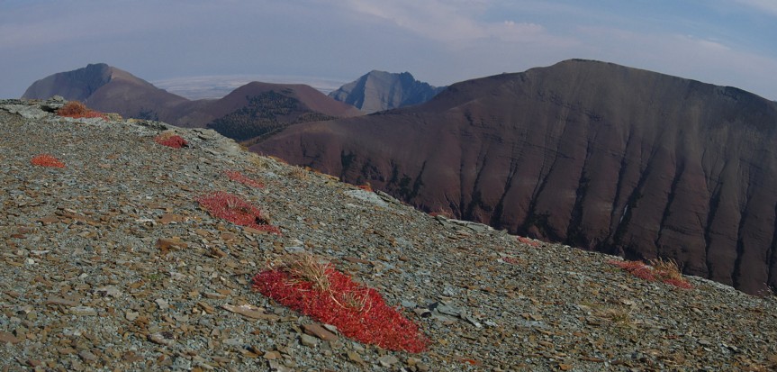
The band was red argillite at the left was very impressive
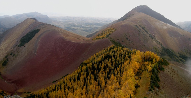
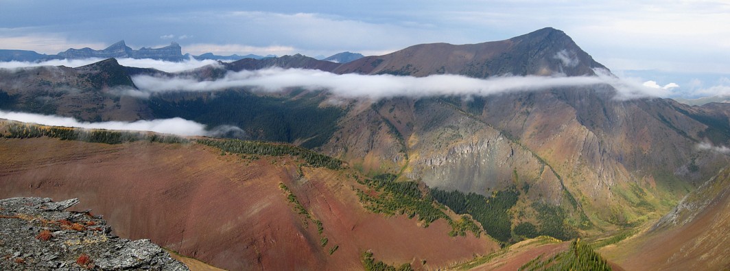
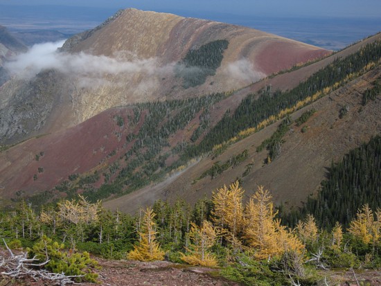
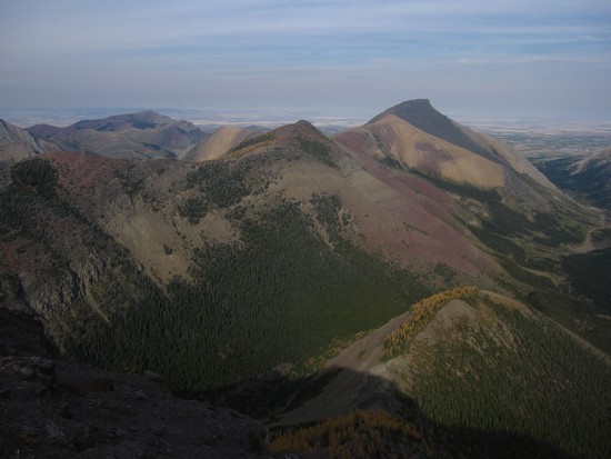
A
comprehensive view of Pincher Ridge in its entirety and a large part of
Victoria Peak/Ridge; Mount Gladstone at the distant left
Same as above, from near the summit of the South Peak
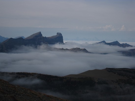
Windsor Mountain, Castle Peak and other mountains to the northwest remain surrounded by low-lying clouds
Gladstone
Interesting colours near the summit
The length of Drywood Mountain and the east End of Loaf in the centre
Looking back to the summit of Pincher Ridge
On return, a last look at the remarkable colours of the mountain