November
11, 2011
Mountain
height: 2850 m
Elevation gain: approximately 1000 m
Ascent time: 6:00
Descent
time: 3:15
 Scrambling
with Kevin.
Scrambling
with Kevin.
The
jury is still out on this trip and they may be out awhile – better send out for
DQ (best double cheeseburger on record!) While every trip cannot possibly be on
a bluebird day, I still have issues with the “whiteout at the summit” trips.
Mount Schlee joins the ranks of Cline, our first attempt at Jimmy Simpson, and
Goat Mountain where we experienced a summit view of a “whole lotta’ nothin’”.
Given the view on Goat was secondary to the climbing, Mark and I still really enjoyed
that trip. However, Cline and Jimmy Simpson were exceedingly disappointing. Schlee,
for now, will reside with Cline and Jimmy – “for now”, because I will DEFINITELY
return someday to see the view on a clear day.
Kevin
and I did know, when leaving the city, we wouldn’t be enjoying the same kind of
phenomenal scenery characteristic of our Tombstone North excursion in August of
this year. However, we hoped the cloud ceiling would be high and therefore we
would still be able to see the surrounding mountains.
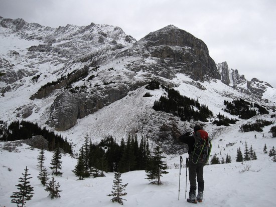
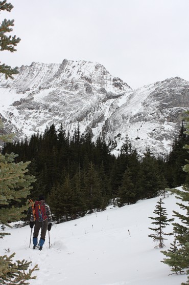
Using
a relatively, recent route description from the Ramblers, we left the
Elbow Pass
parking lot around 8 am, hiking first to Elbow Lake and then down
towards Piper
Valley. Hoping to avoid an icy dip into Piper Creek, we left the
Big Elbow Trail relatively early, easily crossing the trickle of
water (Elbow
River) that, much further downstream, provides a million plus people
with their
drinking water. Kevin then led us up and over a few hills, across Piper
Creek
(where it too is but a trickle of water) and up to the terrific trail
on the
southeast side of Tombstone Mountain South. Further up the trail, views
of
Schlee and Cat's Ears were okay, but noticeably lacklustre when compared
to our
August look.
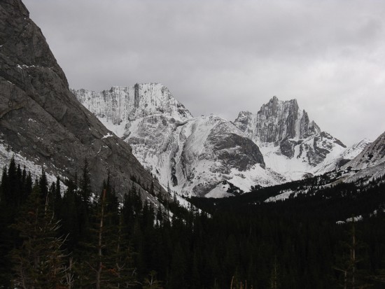
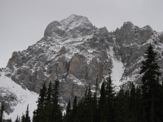
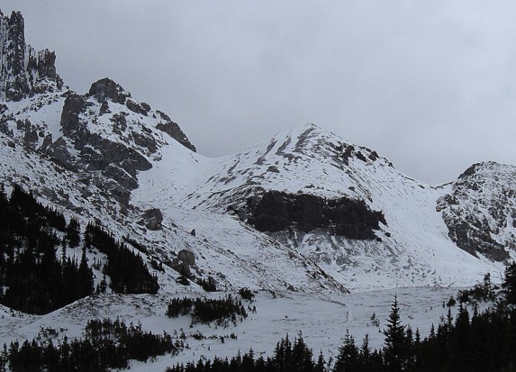
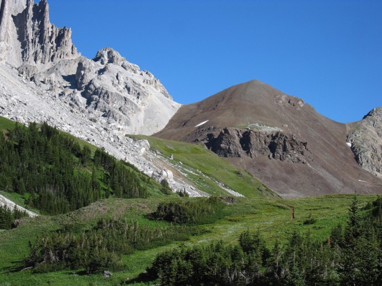
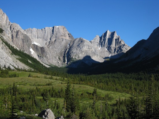 (A Tale of Two Trips - Schlee and Cat's Ears as seen on November 11 (left) and August 7 (right))
The
actual ascent of Schlee was fairly straightforward, although the snow did make
it a little more challenging than it probably would be without snow. Gaining
some elevation, we were soon able to see the entire north section of Tombstone
Mountain. To our chagrin it appeared that the summit south of the one me,
Kevin, and Raff had attained in August, was clearly higher than what we had stood upon.
Of course that really doesn’t mean much, given the fallibility of human
perception and the array of variables that make the determination of height
from a distance a more complicated task than it would seem. Nevertheless, both
Kevin and I agreed that we would have to check it out firsthand someday – but not any day soon!
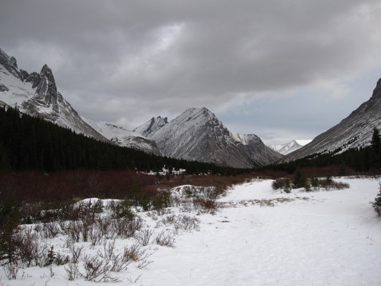
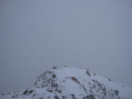
The
other bit of bad news was a rapid deterioration of the weather as we ascended. It
started to snow, the wind picked up considerably, the cloud ceiling dropped
below 2800 m and everything except those objects within a 200 metre radius disappeared
– major bummer!! And as has often been the case, when the weather goes, my
motivation to reach the summit goes with it. At that point, since we were
within 200 vertical metres of the top, we chose to continue and slogged our way
up to a completely viewless summit. Even though I had been atop several nearby
peaks of more impressive stature (Elpoca and Tombstone North in particular), I’m
sure the Schlee view would have been quite unique.
Due
to the lack of any view whatsoever, continuing bad weather conditions, and the
shortness of the day, we only stayed at the summit for a couple of minutes and
then embarked on a pretty easy and fast descent. However, the Big Elbow Trail seemed to drag on
forever, perhaps because it’s slightly uphill most of the way. We made it back
to the car just before complete darkness set in.
Thankfully,
Kevin’s terrific company made the trip worthwhile, but I’ll be back – for sure!
P.S.
After checking out a YouTube video taken from the Rambler's trip, it appears that
the true summit of Tombstone is in fact the one me, Kevin, and Raff reached –
phew!
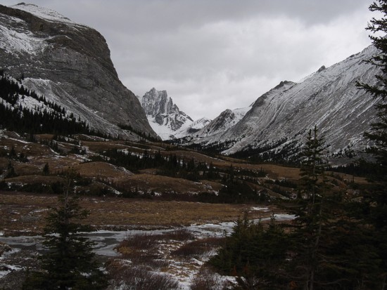
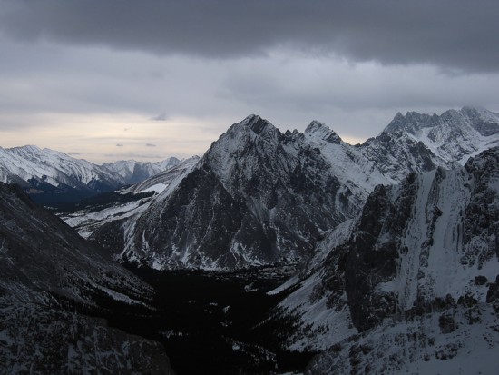
 Tombstone Mountain South (centre); Elpoca Tower at the left
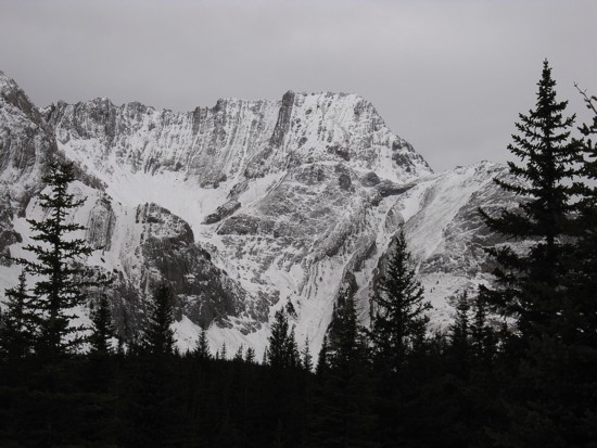
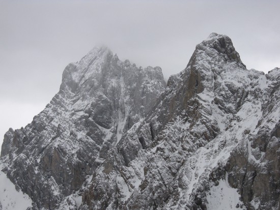
Cat's Ears
Unnamed outliers of Banded Peak
The east side of Elpoca Mountain
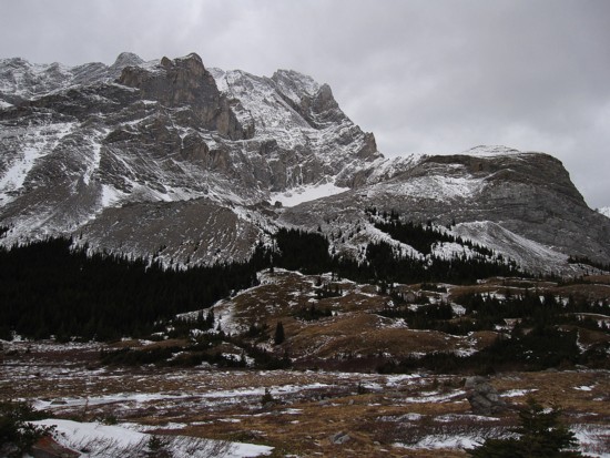
Mount Schlee
Me and Schlee (photo by Kevin)
The northeast side of Elpoca
Another comparison of our two trips into Piper Valley
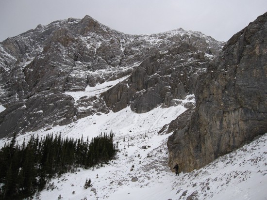
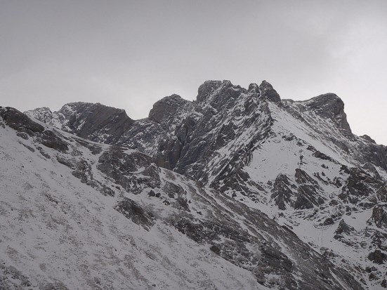
Kevin goes around a big butress; the peak above has been unoffically named by Kevin as "South Schlee"
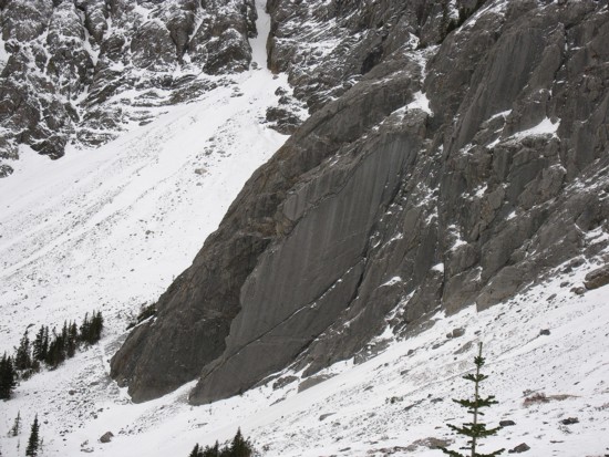
An interesting slab on South Schlee
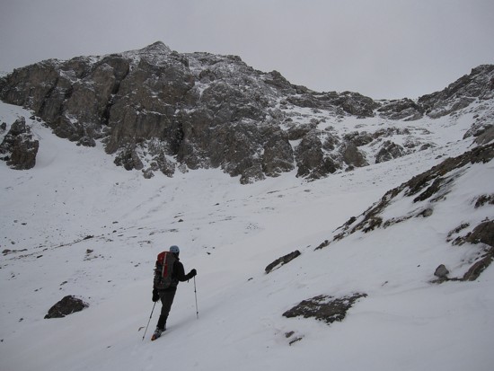
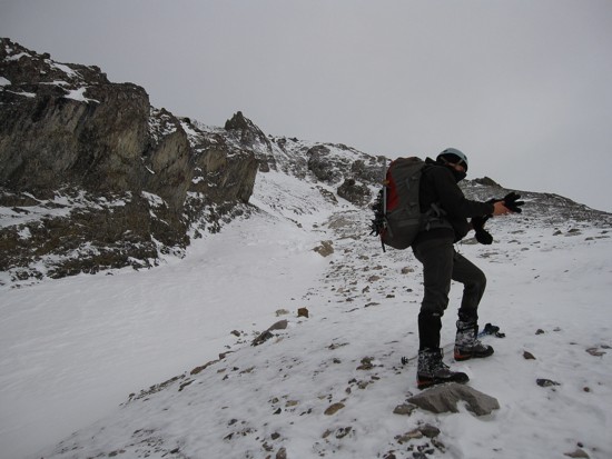
Kevin leads us up the lower slopes
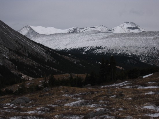
Looking back to the northern outliers of Mount Rae
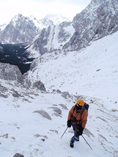
Mid-slope (photo by Kevin)
Change of gloves
The complex summit ridge of Tombstone Mountain;
we made it to the second highpoint from the left (photo by Kevin);
at this point, we were convinced we had NOT made the true summit in August
The summit of Elpoca starts to disappear in the clouds; South Schlee (right) is next to go
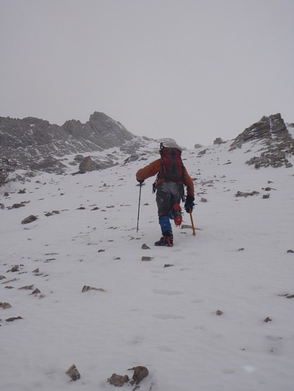
Slogging up the upper slopes (photo by Kevin)
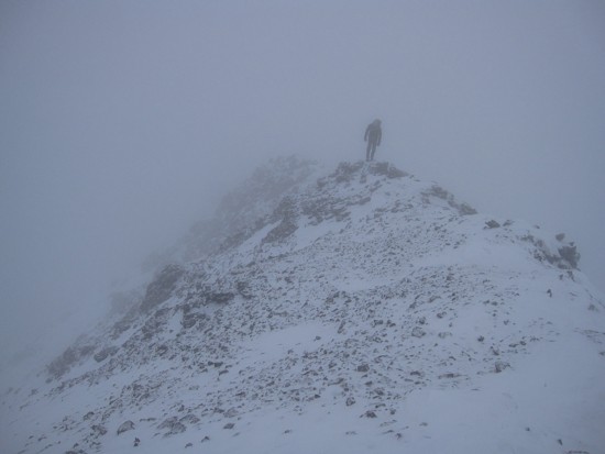
Kevin takes the final few steps to the summit
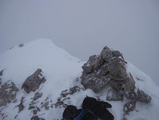
The summit cairn
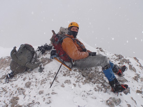
Enjoying the weather (photo by Kevin)
The stellar summit view!