East
Mountain height:
2,394 m (7,852
feet)
Elevation gain:
1,200 m
Ascent time:
5:05
Descent time:
2:50
Scrambling
with Mark.
Stealing
another trip idea from Bob Spirko and Dinah Kruze, we set off to attempt either
the true summit of
Like
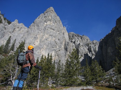
Bob and Dinah, we wanted to explore those cliffs a little and so we took a
direct route to the east side of the mountain, even though the ascent route uses
the west side. Once we arrived at the base of the cliffs, I thought to myself,
“There goes the summit of Wendell!” The rock scenery was simply phenomenal
and there was no way we were going to be rushing off to a summit, without first
exploring and enjoying this wonderful area. As well as the stunning cliff
scenery, there were several large, free-standing pinnacles that likewise
warranted some attention.
Eventually,
we did arrive at the west end of the peak, where we decided to go for the lower
east summit as opposed to trying the true summit of Wendell – at least we knew
there was a feasible route to this summit and it was heck of a lot closer. Most
of the ascent was a scree-slog, though occasional slabby sections did provide
some relief. Again, the rock scenery on and around the mountain was great.
Higher up, it looked as though we might become “cliffed-out”, as rockbands
seemed to be guarding the summit ridge and we were both sure that at the ridge we
would be looking down the enormous vertical cliffs of the mountain’s south
face. Such was not the case, and we were delighted to arrive at a wide ridge,
where an enjoyable 20-30 minute hike brought us to the summit. The view was
terrific. The north faces of Yamnuska and
Of
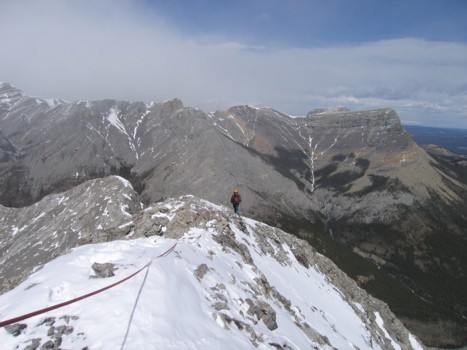
most interest was the potential to scramble over to the true summit of Wendell,
some distance away, via a narrow connecting ridge. Unfortunately, much of the
ridge and the summit of Wendell were covered in snow and looked pretty
dangerous. We had no illusions of making it to the summit, however, there
appeared to be an easy descent route off the
After
a short break, in very cold and windy conditions, we took out the rope and Mark
belayed me across a short, but very narrow section of the ridge to see if a
route to the col would reveal itself. It did (I think? – I couldn’t see the
entirety of the route), but covered in snow, it was far too dangerous. We
didn’t have enough rope for Mark to belay me all the way down, it was brutally
cold, and any slip while downclimbing without a rope would have been fatal, no
matter which side of the ridge you fell down. We opted to call it a day and
return the same way.
The
return trip was quite fast, due to a long section of terrific scree-surfing.
Arriving at a meadow just below the peak, we were struck by the awe-inspiring
beauty of the area and remarked what a great bivy site it would be – meadows
and beautiful greenery, surrounded by craggy mountains with enormous cliff
faces. It had that secluded, remote feel, even though the highway was only a
couple of hours walk away.
Instead
of traversing back along the beautiful south face of the
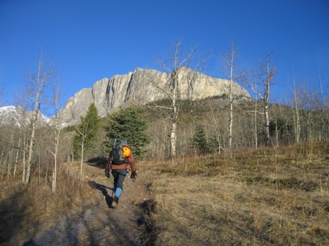
Near the beginning of the trail to Mount Yamnuska
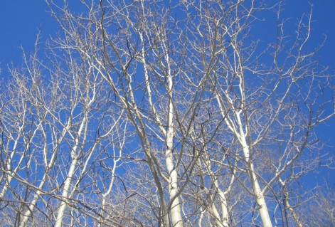
Aspens and the blue sky
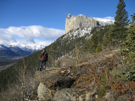
Approaching the east side of Yamnuska
Mount Yamnuska from the east ridge
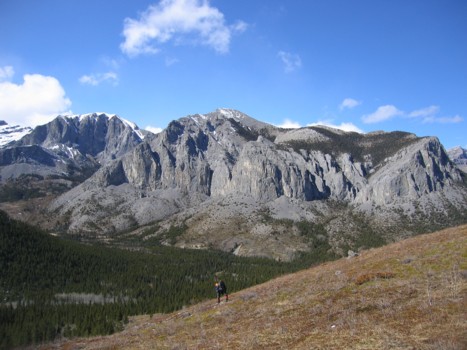
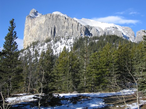
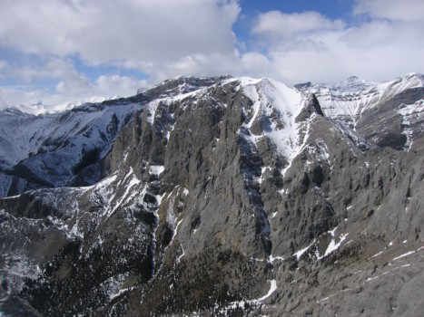
Mount Wendell (far left) and the East Peak (centre); taken on the way back
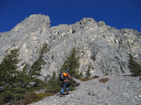
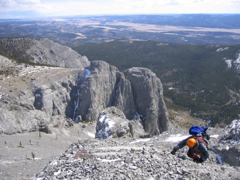
Approaching the south face of the East Peak, at the east end of the mountain
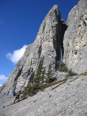
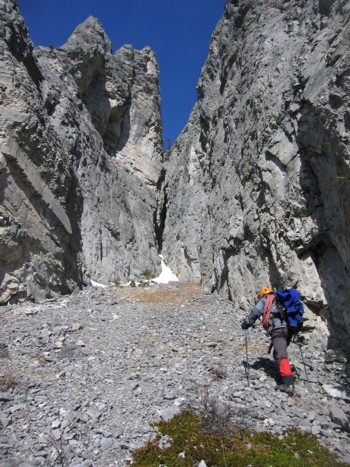
The first canyon
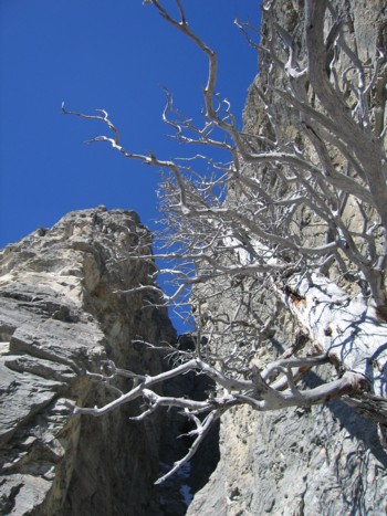
The canyon and a dead tree
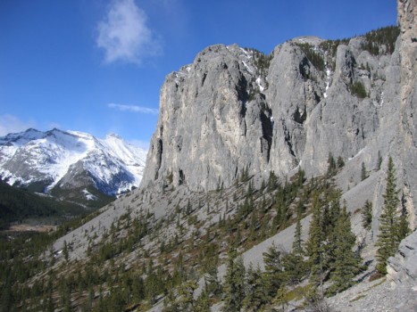
Looking west along the cliffs of the East Peak
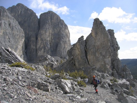
More great rock scenery
Mark explores another canyon
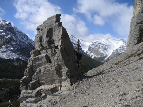
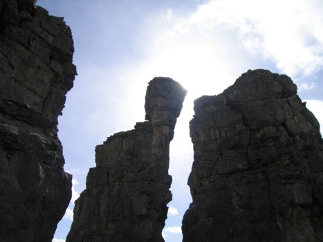
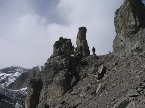
The first pinnacle; that was as high as I made it!
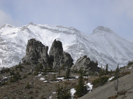
The second group of striking pinnacles
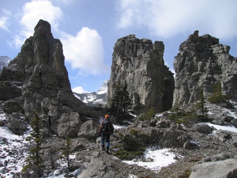
Approaching the second group
A closer look at the second group
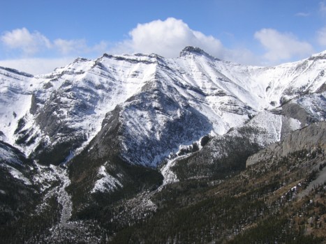
Looking back along the south face
The ascent slopes, with the north side of Yamnuska behind
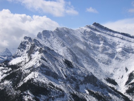
The north side of Goat Mountain
Another striking peak to the north of Goat Mountain
More interesting rock on the ascent slopes
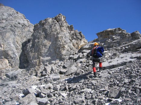
Same as above
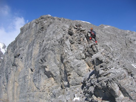
On the upper ridge
Same as above, looking down to the cliffs of the south face
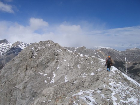
More of the upper ridge
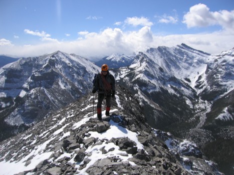
...and more
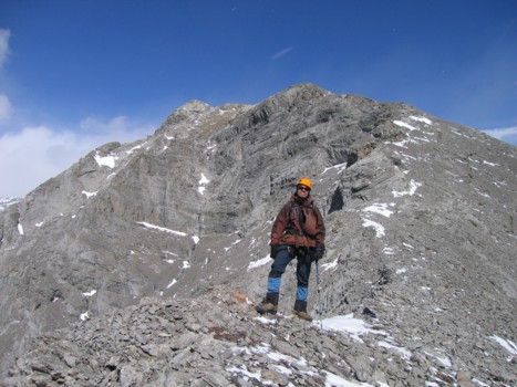
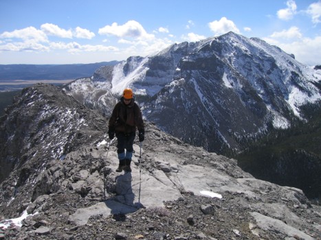
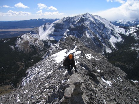
The long stretch to the summit (just left of centre)
Almost at the summit (centre)
The final few metres
The true summit of Wendell Mountain
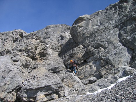
Mark belays me over to look for an alternate descent route
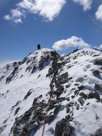
Looking back at Mark
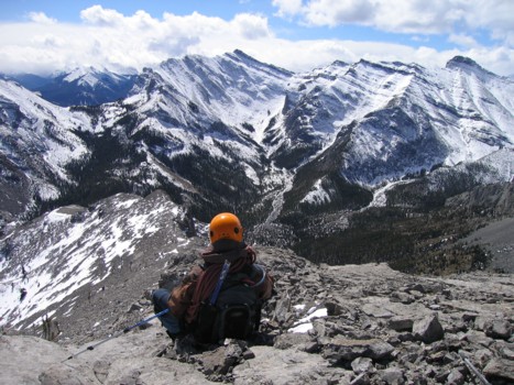
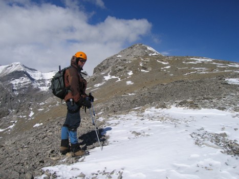
Back at the summit, with Goat Mountain behind
More pinnacle scenery, seen on descent
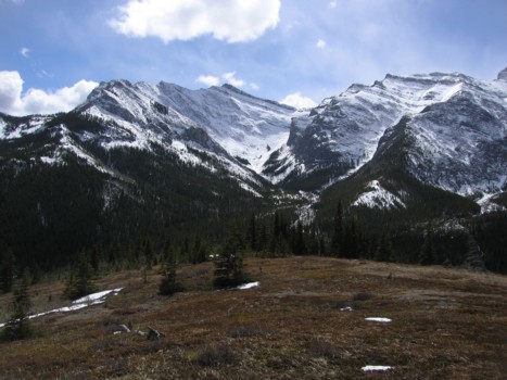
The beautiful meadow below the East Peak