Mountain height:
3108 m
Elevation gain:
1630 m
Ascent time:
8:05
Descent time:
4:35
Scrambling and a little climbing with Mark and James.
On the drive up, James commented, “I’ve never had a short, easy day with you guys!”. I thought he might me wrong on this one – I should know better!
Ever since Kevin
Barton and I completed the first three peaks of
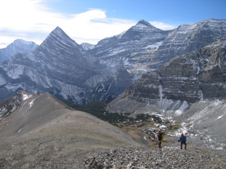
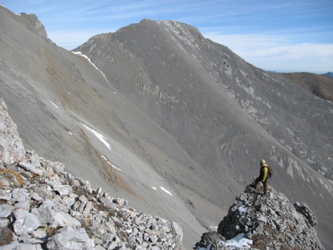
Gaining the south ridge as soon as possible paid off immediately, affording us terrific views of Sparrowhawk’s imposing east face, Mount Bogart, striking Ribbon Peak, Mount Allan, and the beautiful, slabby ridge and summit of Wind’s outlier, immediately east of us. We then began scrambling the ridge, enjoying several sections of interesting scrambling and wonderful scenery along the ridge. Shortly, we arrived at the first major obstacle of the day – a large, vertical rockband. Initially, it appeared we would now have to traverse left onto the southwest slopes, but a quick search around the right side of the band revealed a steep and exposed, but feasible route up.
The second obstacle was not as forgiving. After another brief search on the right, which ended up on narrow, snow-covered ledges, with some intense exposure down the east side, we had to concede that our ridge ascent was over. We lost elevation down slabs and scree and started looking for an alternate route. This is where things got interesting –perhaps a little too interesting.
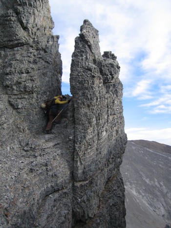
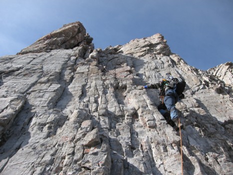
The initial part of the route looked fairly straightforward and there appeared to be several weaknesses to ascend the first of innumerable rockbands on the face. We got up that one okay, but were struck by how the easy-looking terrain was actually far steeper and challenging than expected. This was to become the theme of the day. One of us would ascend a rock-step, and say to the others, “it’s easy from here”; several minutes later we would all find ourselves on steep exposed slabs, with tiny (if any) handholds. There were 5 or 6 very intense and nail-biting moments and at one point of the ascent, each of us had to be rescued by the other two, with the rope.
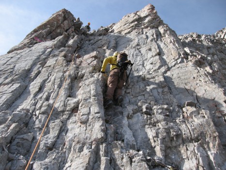
James, who we have come to know as a skilled and fearless climber, led most of the ascent and Mark and I were again impressed by his enthusiasm at tackling very challenging terrain and his ability to get up it. But even James admitted that he was freaked out on a couple of sections. His comment, later in the day, “I’m glad I didn’t die!” pretty much summed up the lower part of the ascent for all of us.
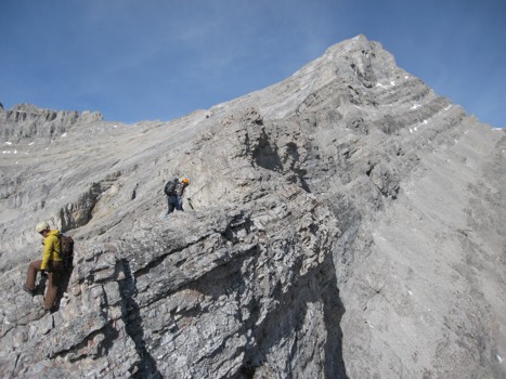
After several hours of nerve-wracking scrambling, climbing, and routefinding our way up the southwest face, we were all done, both physically and mentally. We decided to try to traverse over to the west ridge and complete the ascent from there. This turned out to be a decent decision, but even the traverse to get over there was tense, due to the steepness of the slabby terrain. This was by far the most consistently deceiving mountain we had ever been on and we were immensely relieved to finally gain the west ridge and complete the ascent.
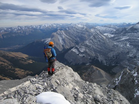
Surprisingly, the weather held for most of the ascent and even though it was cloudy at the summit, the panorama was stunning in all directions. The mountain also decided to earn its name, at this point, as we were blasted by a cold and bone-chilling wind. It was a little surprising to find that we actually appeared to be lower than the summit of Sparrowhawk (3125 m) - the height of Wind was listed at 3153 m. GPS confirmed that the actual elevation of Wind Mountain is around 3108 m.
After a short but very gratifying summit stay, we started down, obviously looking for an easier route than the one we came up. There was one, mostly down easy scree slopes, with a couple of moderate rockbands to downclimb for fun. We wanted to descend all the way to the valley floor and out, but a group of big horn sheep waiting at the bottom prompted us to traverse rubble slopes back to the ridge and then down the same way we came from there. Though tedious, this route did highlight a few spectacular, freestanding pinnacles and other great rock scenery. We competed the last hour of hiking and the bike ride out by headlamp. In retrospect, an outstanding day, even with the unexpected challenges – perhaps they are what made it so worthwhile.
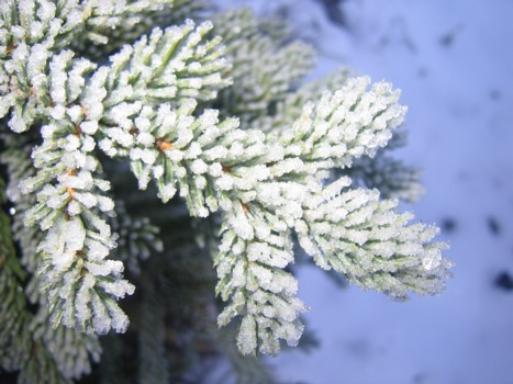
Ice on an evergreen
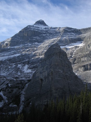
Bogart Tower (foreground) and Mount Bogart behind

Same as above, with Ribbon Peak at the left
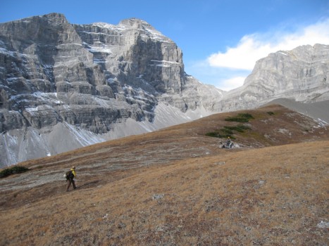
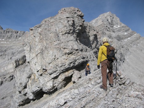
On the south ridge on Wind; Sparrowhawk at the left

Wind Mountain
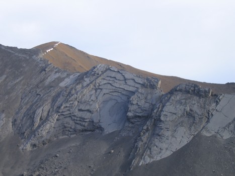
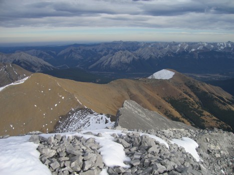
The ridge to the east of Wind; the summit of Allan at the left
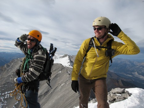
James and me, with Sparrowhawk and its col with Wind
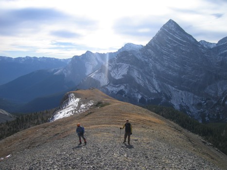
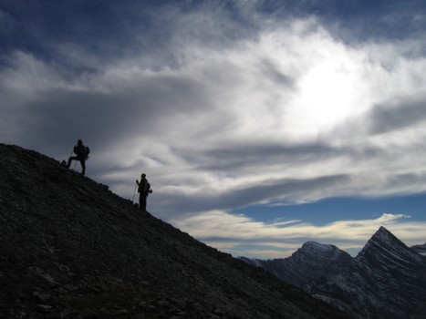
Looking back along the ridge
The imposing east face of Sparrowhawk and James and me looking very unnatural!
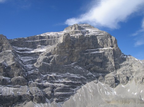
A close-up of Sparrowhawk
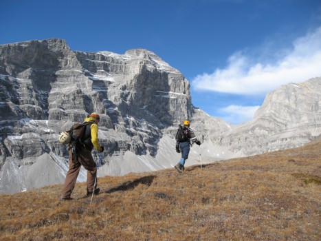
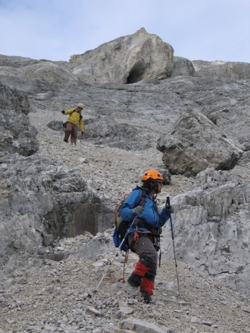
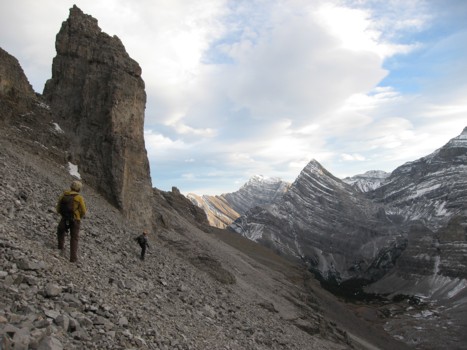
James and Mark approach the start of the scrambling
Same as above
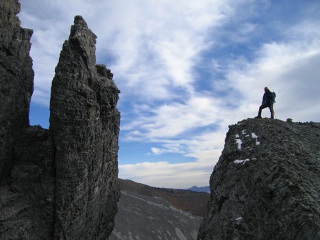
Mark and a pinnacle along the ridge
James checks out the pinnacle
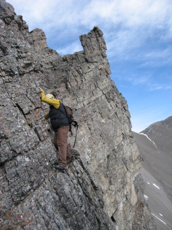
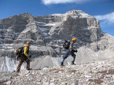
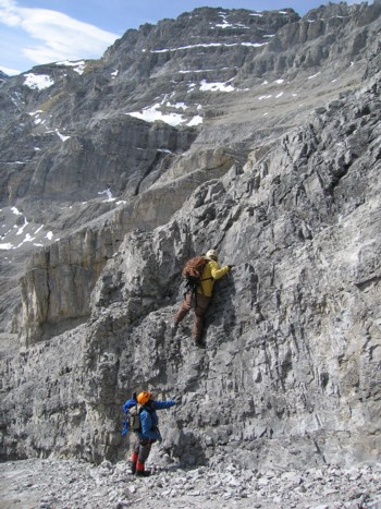
James tries a steep and exposed route on the east face
An easier route
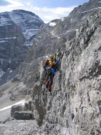
Looking back along the ridge and drop-offs on the east side of Wind
More fun scrambling
James checks out the eastern outlier of Wind
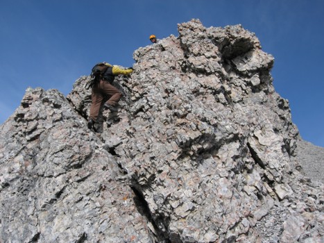
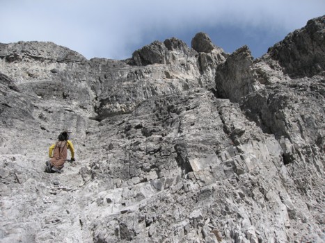
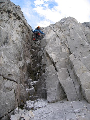
Starting up the first difficult section of scrambling
James heads up
More ridge and the summit of Wind
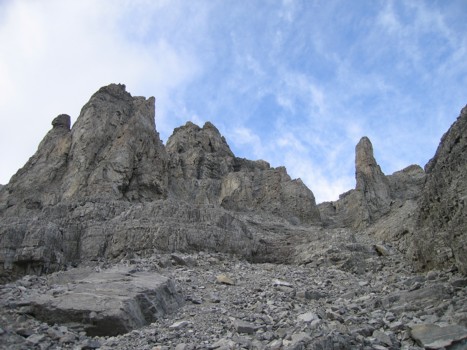
The rockband that marked the end of our ridge ascent

Mark descends slabs to circumvent the above rockband

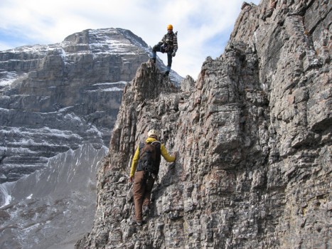
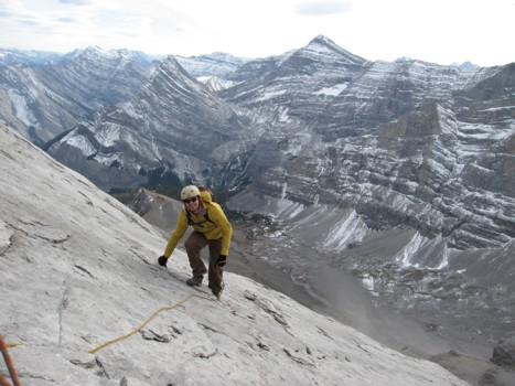
The start of several hours of difficult, exposed scrambling up the southwest face; I'm just visible at the left
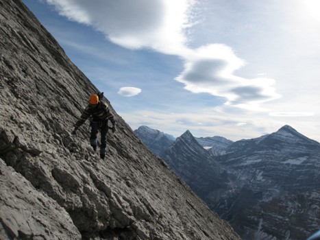
Traversing slabs; the angle of the slabs was typical of much of the terrain
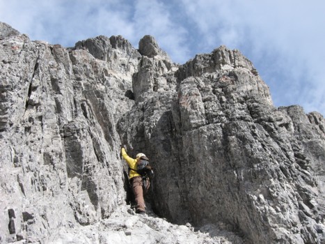
James starts up another difficult section
More fun scrambling and good rock scenery
James leads up a small step
The definition of simu-climbing!
James is still smiling after a close encounter with The Reaper on a steep rockband

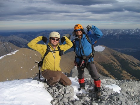
James and Mark complete the final few metres of the ascent
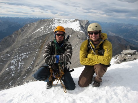
Me and James at the summit
James and Mark
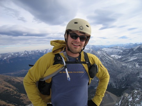
James is all smiles - mouse-over to find out why
James has me acting like a pre-pubescent teenager too!
The long ridge of Mount Allan
Mark checks out the view to the south
Mark and James on descent, with one of several caves on the face
Mark descends an interesting step
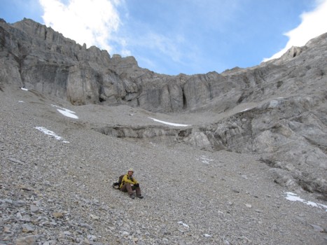
James rests below the major rockbands of the descent route
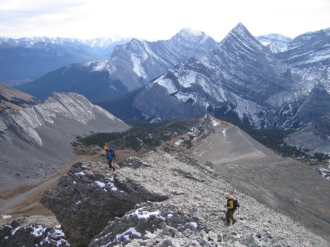
Traversing back to the south ridge
More pinnacles near the ridge
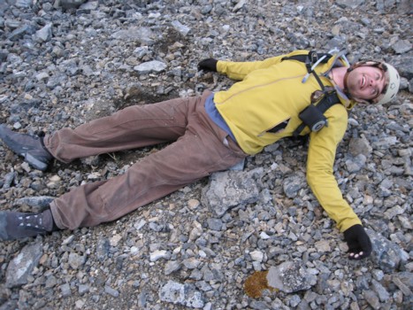
James is still smiling even as he nears death, lying on the rocks on the south ridge

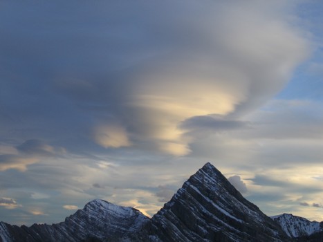
Interesting clouds in the dying light
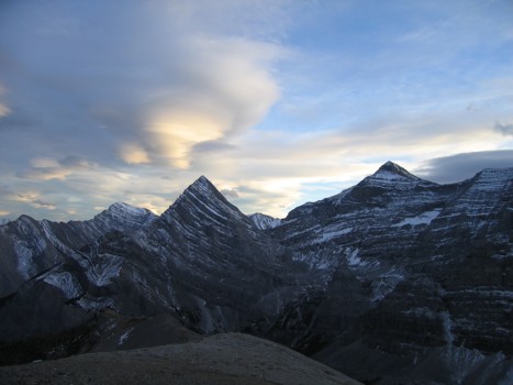
Same as above
A closer look at the cloud above Ribbon Peak