Mount Alderson II
July 26, 2020
Mountain height: 2692 m
Elevation gain: 1400
m
Roundtrip time: 11:30
Scrambling with Mark.
Long overdue was a nostalgic return to the mountain that started
it all. Started what? Answer: a profound love and admiration
for the mountain environments of Waterton, The Castle, and Glacier National
Park, Montana. On July 12, 2004 I had ventured into Waterton for the first
time and chose Mount Alderson for my first Kane scramble. The outrageous colours
of the area were startling when compared to areas farther north and I
knew immediately this was a game-changer in regard to where I would want to
spend the majority of my mountain time in the future.
 16 years and 14 days later, Mark and I set out
to ascend Alderson via Alderson and Carthew lakes. Though normally one would
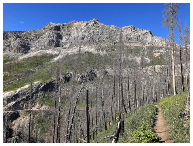
reach Mount Alderson from Cameron Lake, the entire area remained closed because
of the 2017 Kenow fire. The route starting from Cameron Falls requires about 10
km of additional distance (about 30 km return in total) and 300 m of extra
elevation gain (1400 m in total), but we were both game I was keen to hike the
stretch of the trail I had never seen before, between Alderson Lake and The
Carthew Lakes.
16 years and 14 days later, Mark and I set out
to ascend Alderson via Alderson and Carthew lakes. Though normally one would
reach Mount Alderson from Cameron Lake, the entire area remained closed because
of the 2017 Kenow fire. The route starting from Cameron Falls requires about 10
km of additional distance (about 30 km return in total) and 300 m of extra
elevation gain (1400 m in total), but we were both game I was keen to hike the
stretch of the trail I had never seen before, between Alderson Lake and The
Carthew Lakes.
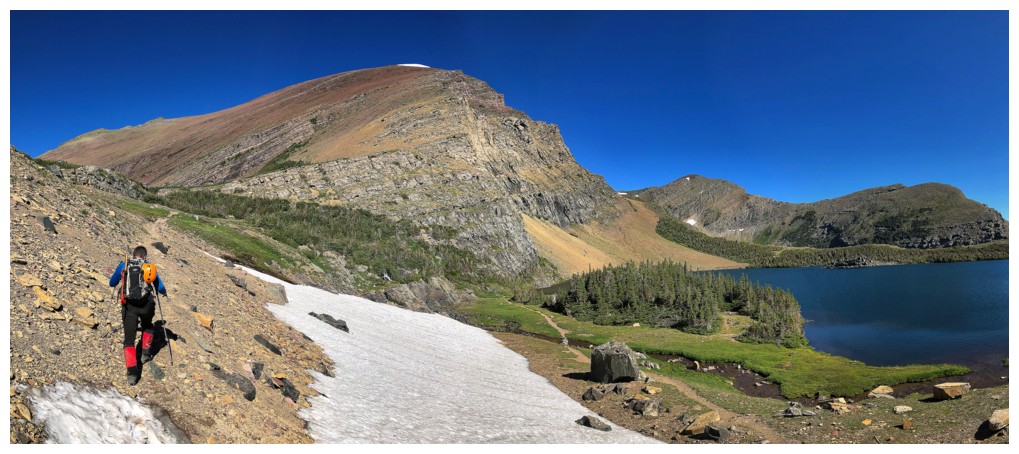
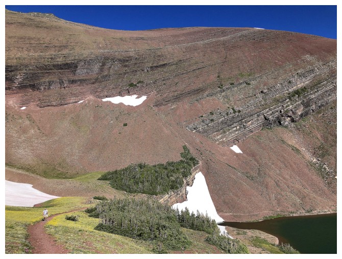
The first 6.8 km of the trail were relatively
dull, though straightforward, with easy travel. From the first junction its
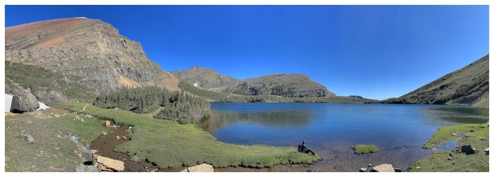
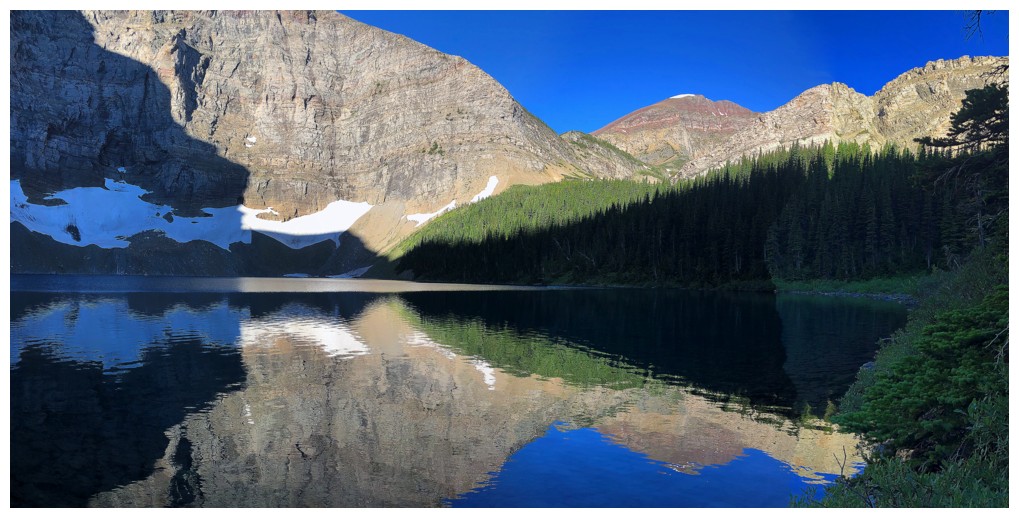
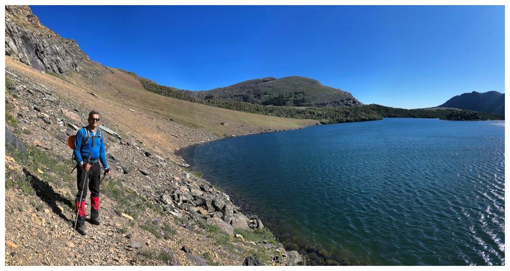
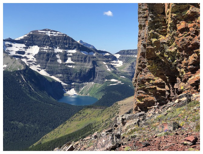
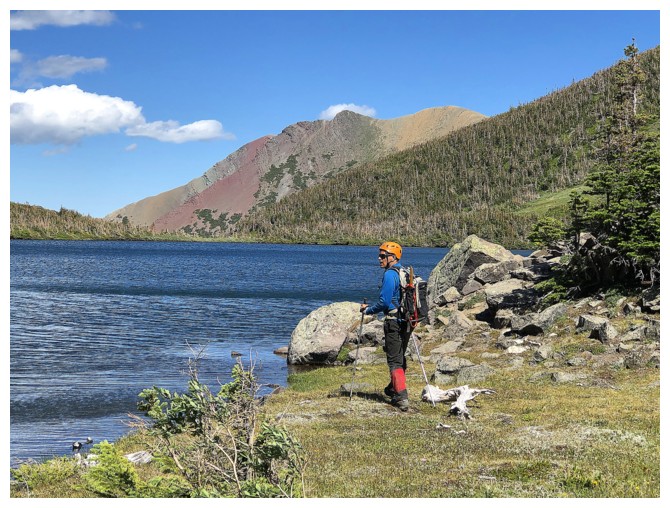
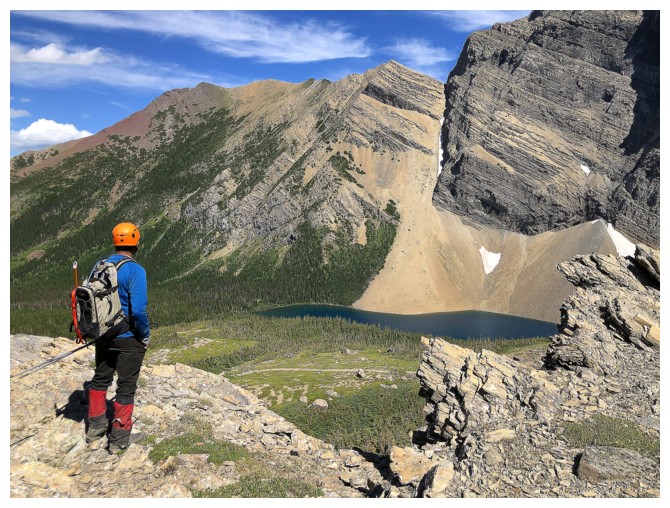
only 200 m to Alderson Lake and the short side trip did not disappoint – the
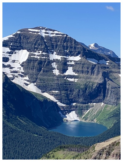
blue-tinged placid waters of the lake a pleasant contrast to the awesome north
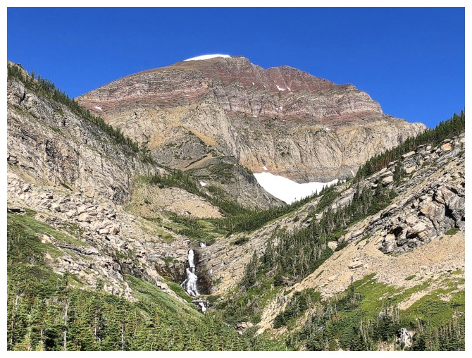
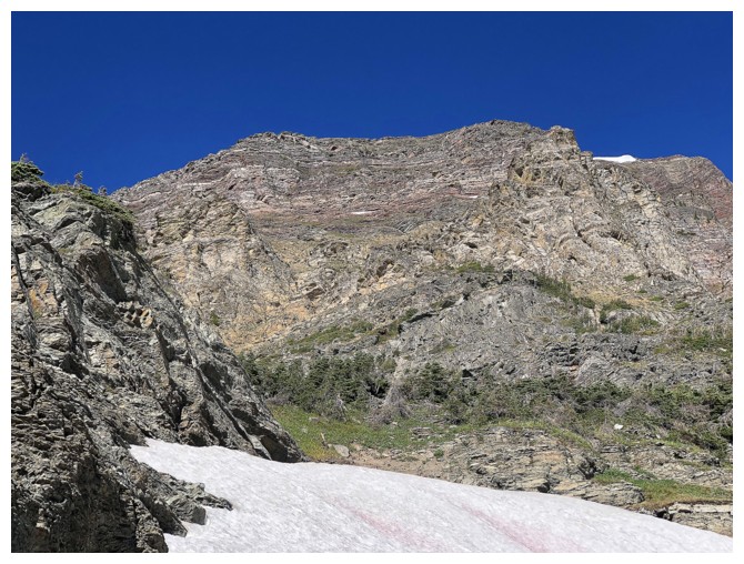
face of Mount Alderson towering above the lake.
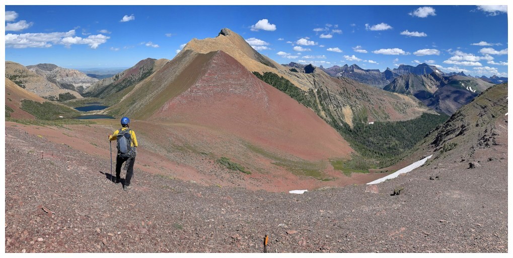
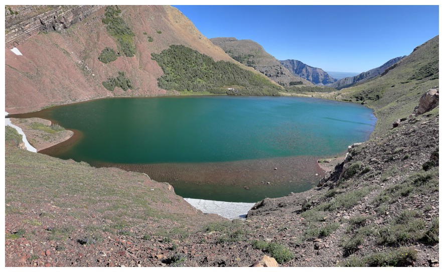
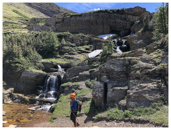
 The next section of the trail, between Alderson
Lake and Carthew Lakes, I can only describe as spellbinding! My expectations
for scenery in Waterton are very high and so when those expectations are
greatly exceeded, I know I’ve experienced something special. Mark’s reaction to
this part of the trip was one of equal amazement. A stunning waterfall, the
eye-catching red form of Mount Carthew, all three Carthew Lakes, idyllic
streams and smaller waterfalls joining the lakes, and tenacious banks of snow
conspired to render this one of the most enjoyable and gratifying ascents
either of us had experienced to date.
The next section of the trail, between Alderson
Lake and Carthew Lakes, I can only describe as spellbinding! My expectations
for scenery in Waterton are very high and so when those expectations are
greatly exceeded, I know I’ve experienced something special. Mark’s reaction to
this part of the trip was one of equal amazement. A stunning waterfall, the
eye-catching red form of Mount Carthew, all three Carthew Lakes, idyllic
streams and smaller waterfalls joining the lakes, and tenacious banks of snow
conspired to render this one of the most enjoyable and gratifying ascents
either of us had experienced to date.
We both conjectured the ascent of Alderson
might be anti-climactic after what had preceded it, but thankfully we were both
wrong. 16 years had somewhat dulled my memory and I forgot how colourful and
intensely scenic this mountain is. Not only are you treated to the wonderful
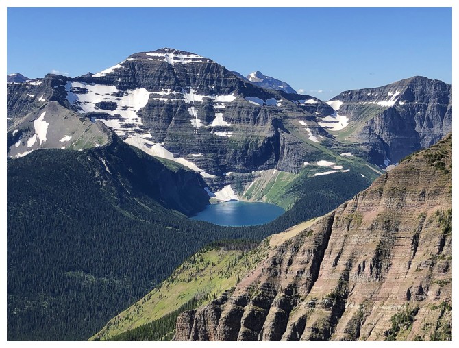
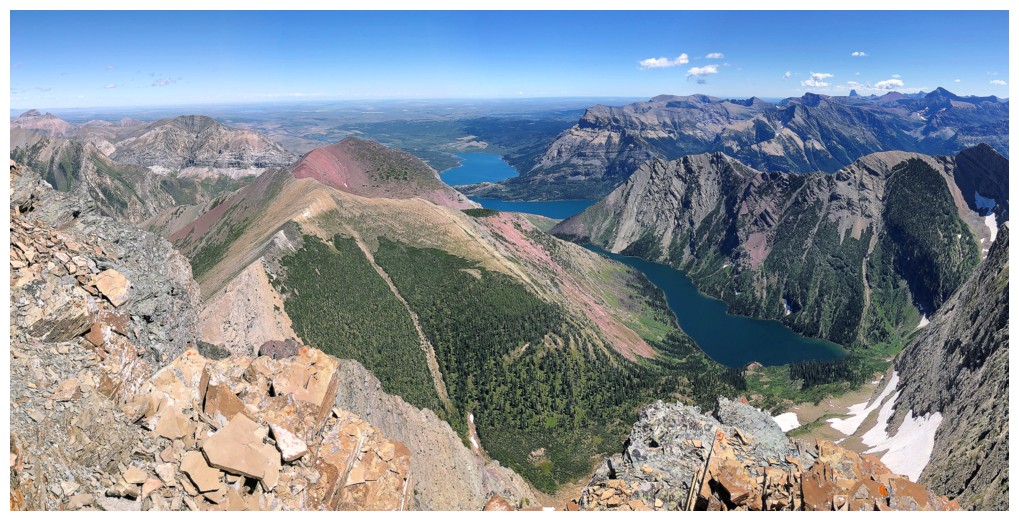
colours of the mountain itself, but as you gain elevation, three beautiful lakes
in Glacier National Park appear (Nooney, Wurdeman, and Carcajou), below an
array of stunning peaks that form the north border of the U.S.
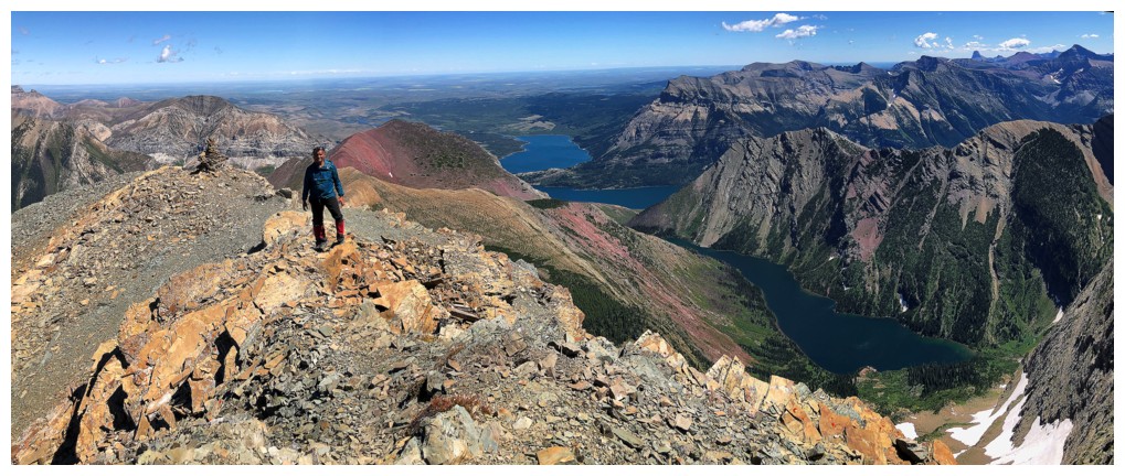
Needless to say, as the 6th highest mountain in
Waterton and highest in the general area, the summit view was stupendous,
featuring Bertha Lake, some of Upper Waterton Lake, and basically everything
else. After a very long and satisfying summit stay, we lost some elevation
towards Mount Richards, just to see some different angles of Bertha Lake. To
our surprise the traverse all the way over to Mount Richards appeared to be
fairly straightforward from this vantage point. There were a few unseen
drop-offs, but it looked like each could be circumvented. A loop route from
Alderson to Richards and then out via Bertha Lake had enormous appeal, probably
being one of the most scenic traverses in the area. However, after much
discussion, we decided against it for a few reasons: 1. Neither of us felt like
an “epic” if in fact the unseen drop-offs did not yield with ease; 2. The more
logical route would be to start at Richards and then traverse to Alderson
(difficult up, easy down); 3. I told Mark that you simply have to see the view of
Mount Alderson from Carthew Summit (not the summit of Mount Carthew, but the
oddly named col south of the mountain); 4. Experiencing the scenery we had
seen on ascent again was never going to be a bad thing! As such, we left
the summit, returning almost exactly the way we came, at least for the first section.
As expected, the view from Carthew Summit was surreal. We were also surprised to see many people on the trail, at this
point. The ascent to Carthew Summit from the townsite is about 12.2 km one-way
with 1000 m of gain elevation – hardly a trivial hike. The descent did not disappoint either, although
the final 6.8 km were somewhat mind and foot-numbing.
I would have to rate this as one of our best
and most enjoyable trips to date – three cheers for the re-opening of Waterton!
Epilogue: several weeks after our trip and upon
my suggestion, Doug Lutz completed the Richards to Alderson traverse. Unfortunately,
it was not the smooth easy ride we predicted. Doug was forced to lose a huge
amount of elevation to get around unseen obstacles. As Doug is one of the most
competent scramblers I know, it is clear that this traverse is very challenging.
If it is on your radar, expect lots of route-finding, lots of elevation losses
and lots of challenging terrain (probably just easier to do them separately!).
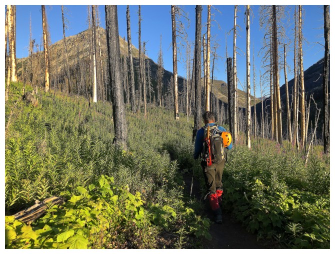
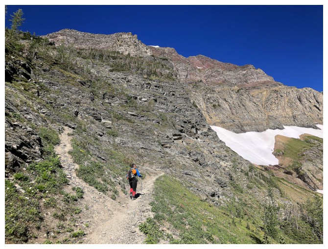
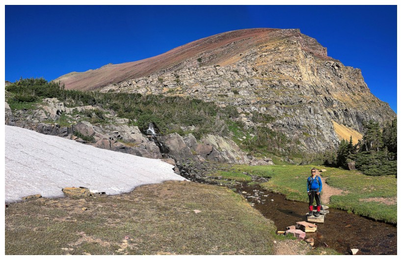
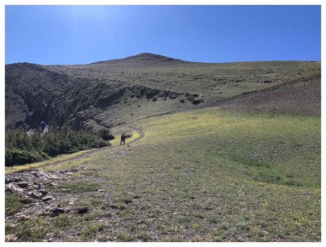
Occasional views for the first 6.8 km to Alderson Lake, but nothing to write home about.
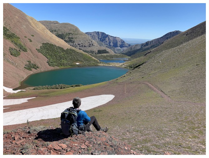
Alderson Lake - that's something to write home about!
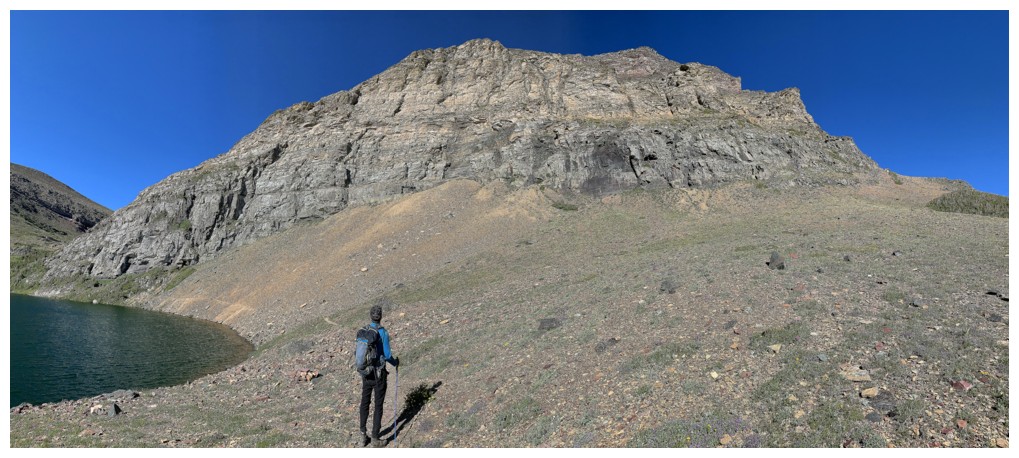
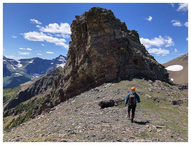
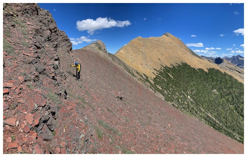
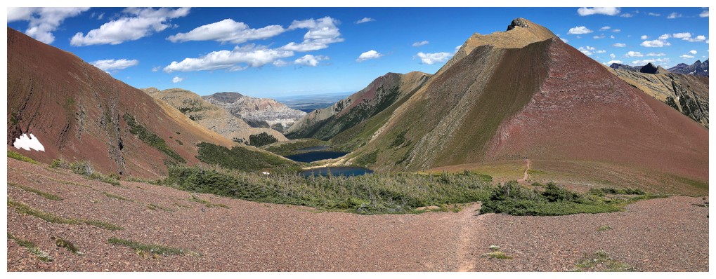
The trail goes around the northwest side of Mount Alderson
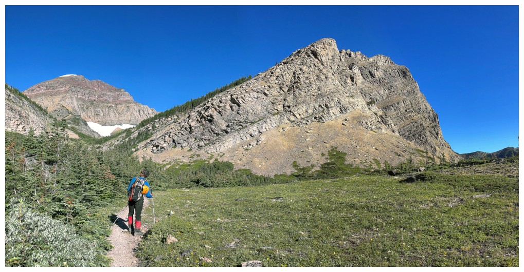
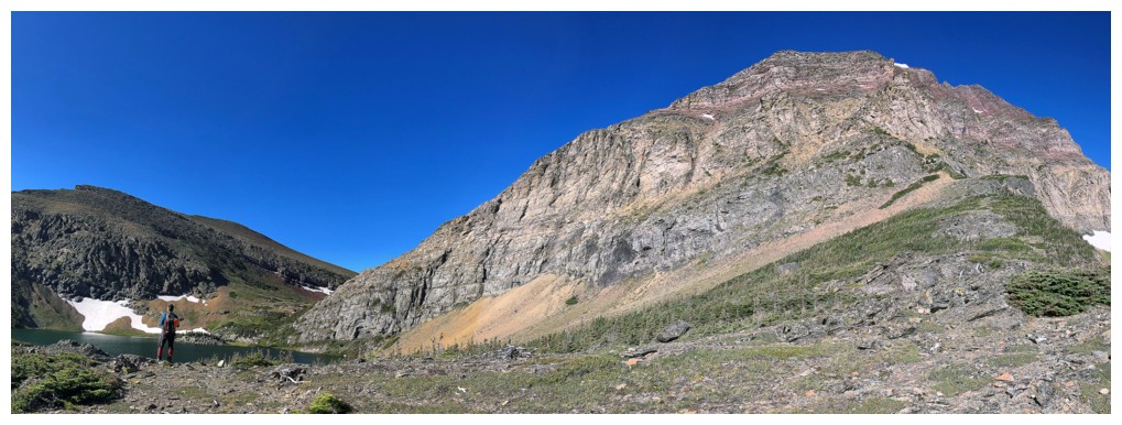
Buchanan Peak (right) and Mount Carthew (left)
Carthew and Mark
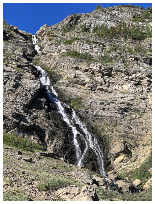
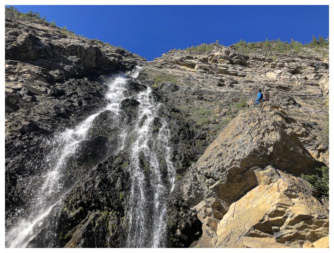
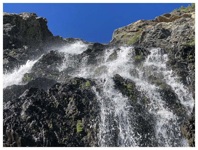
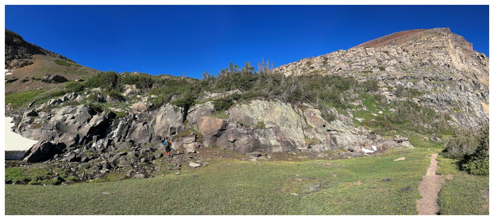
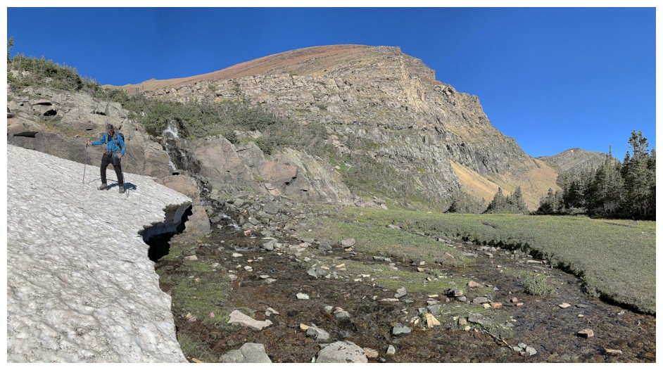
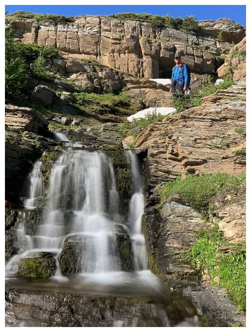
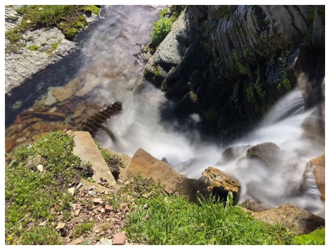
Add in a waterfall for some extra flavour
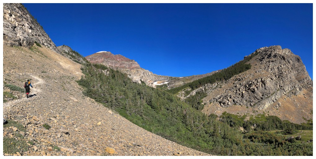
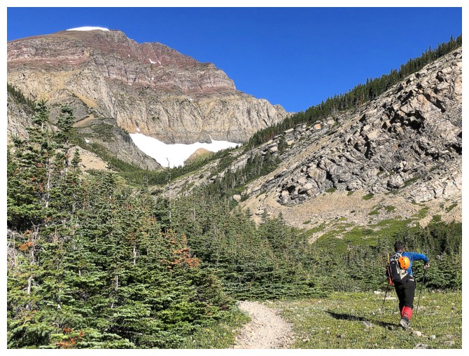
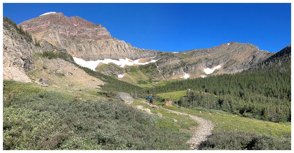
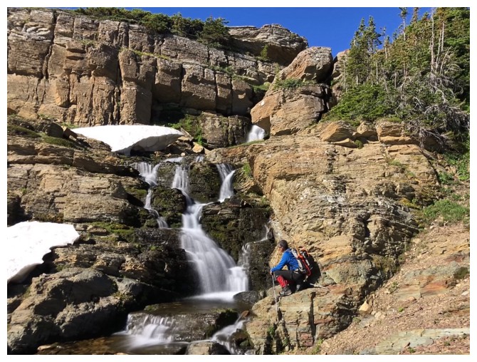
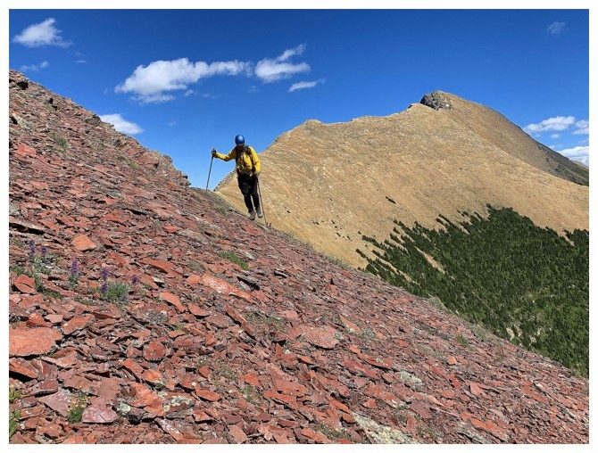
Gaining elevation on the excellent trail
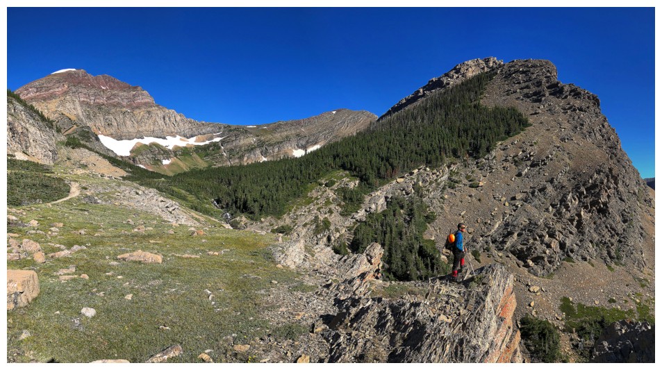
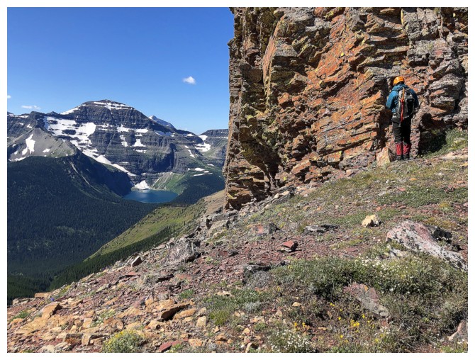
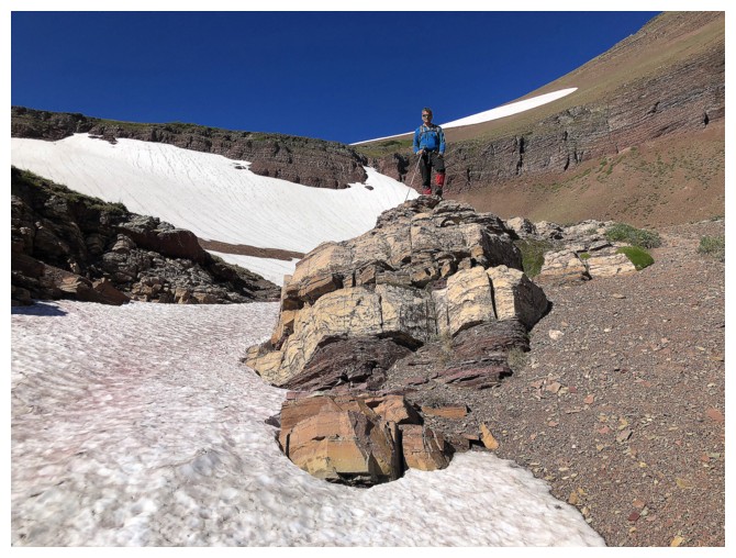
Mark finds an outcrop of rock to take in the view
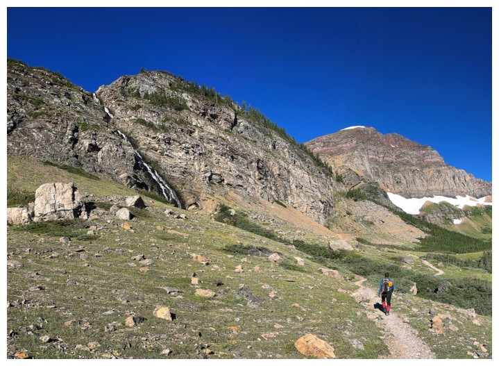
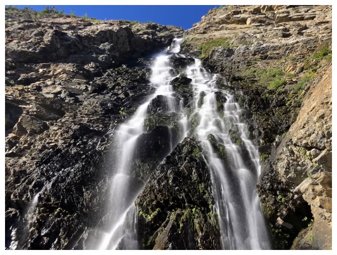
Approaching a significant waterfall
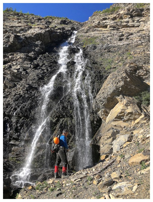
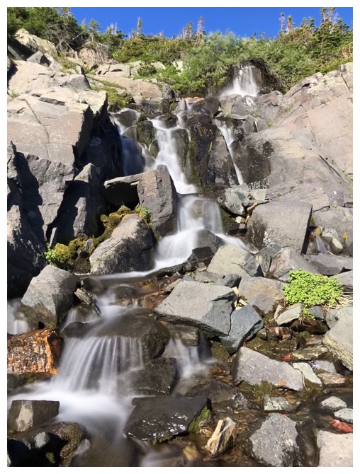
Having recently learned how to take long exposure photos with my phone, I've gone a little nutty with the practice!
Mark finds another strategic viewpoint
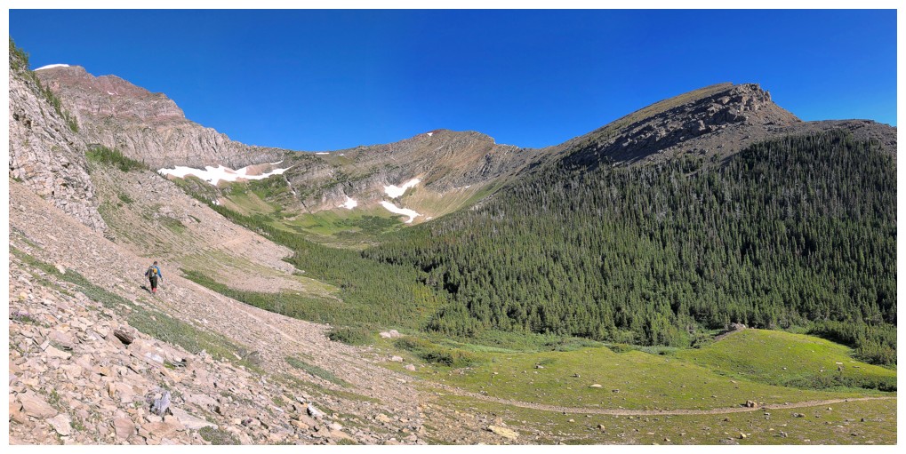
Continuing on
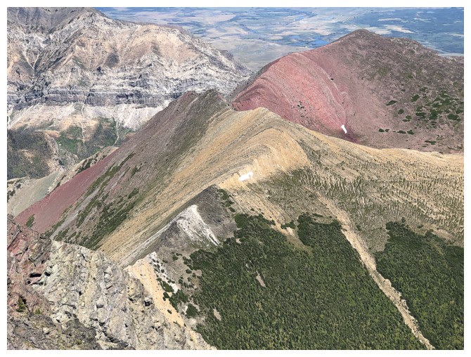
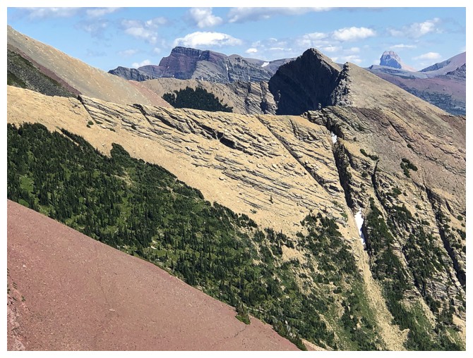
Buchanan Ridge between Carthew and Buchanan Peak. The Ridge is higher than the Peak.
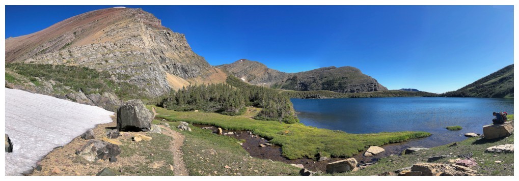
The trail takes a spectacular route up the headwall below the lowest of the Carthew Lakes
Speaking of spectacular, how about everything related to Mount Carthew
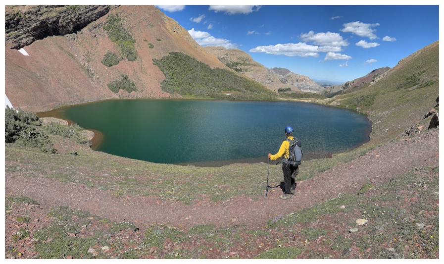
Mark crests the headwall to see the first Carthew Lake
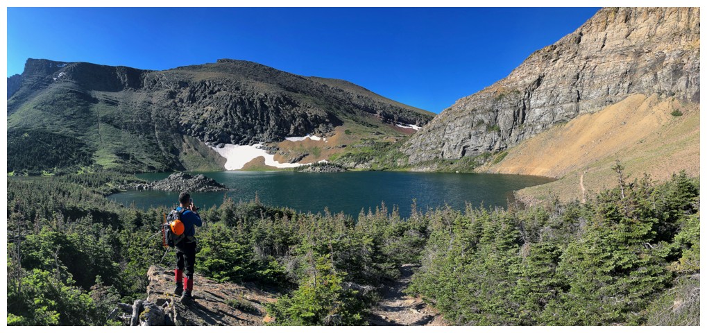
It's a beaut!
 \
\
Mesmerized by Carthew - the mountain and the lake
Mark is liking it too
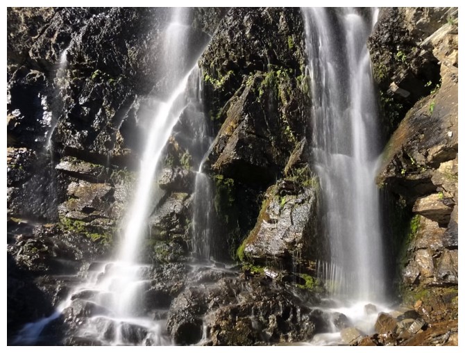
Mark makes his way over to another waterfall, but much smaller
More of a cascade than a fall, but equally beautiful
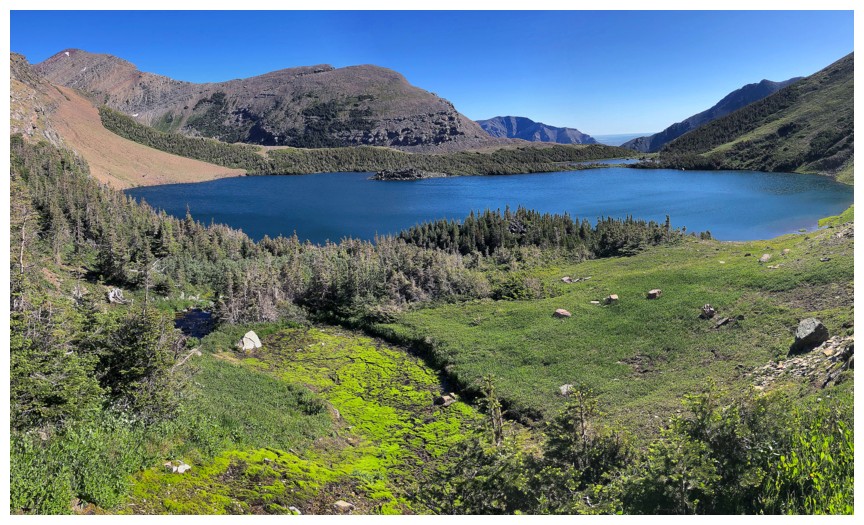
Perhaps one of the most idyllic mountains scenes we've ever
experienced: A stream running into a beautiful lake and surrounded by
colourful mountains. We stayed here for quite a while, marveling in the
awe-inspiring beauty. Mark on the rock at the right.
The same scene but from a different angle. Mark is now at the left.
Wish I could live here!!!
Speaking of idyllic - perfect placed steeping stones to get across the
stream!! Thank you Nature (or a very strong Parks Canada employee!)
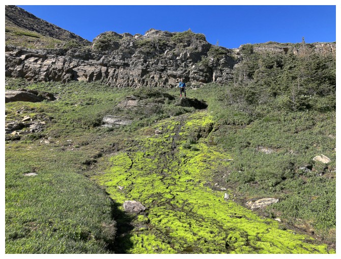
Why not add some bright green moss to make this area even better than unbelievable!
Looking back at the first Carthew Lake
The stream that drains the second lake to the first
Addicted to long exposure photos
The long exposure photos seem a little incongruous when there a human subject also in the photo
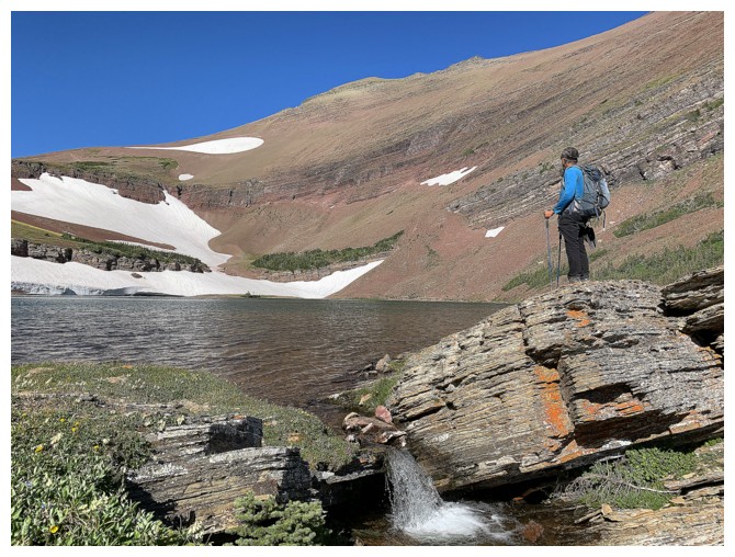
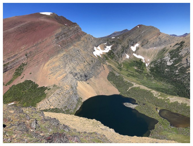
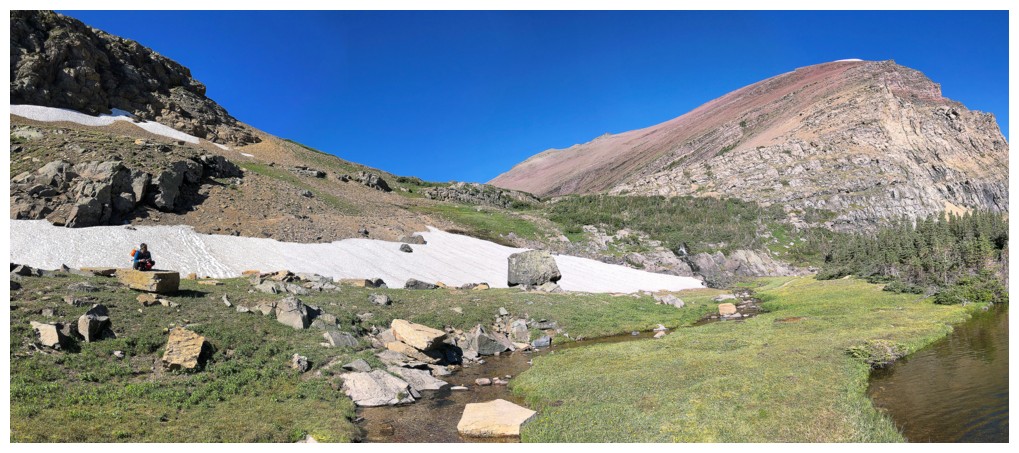
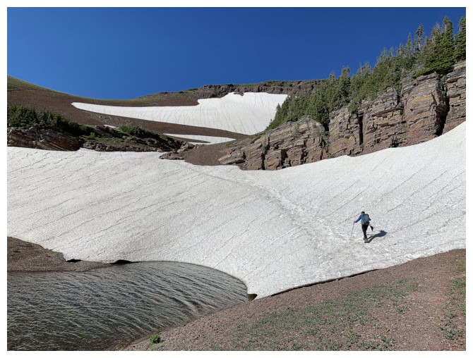
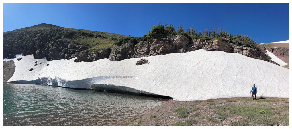
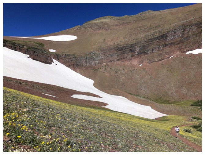
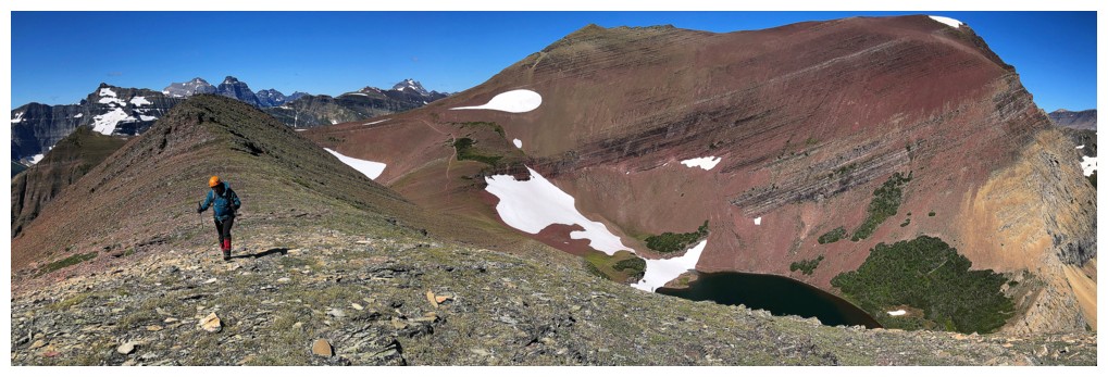
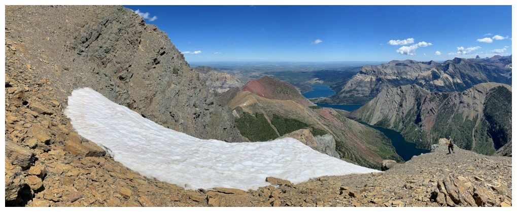
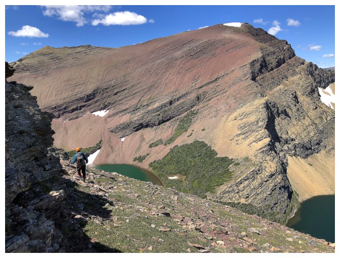
The second lake
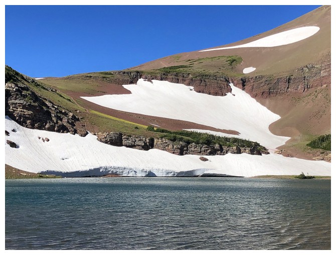
Huge bank of snow still hanging onto life at the far end of the lake
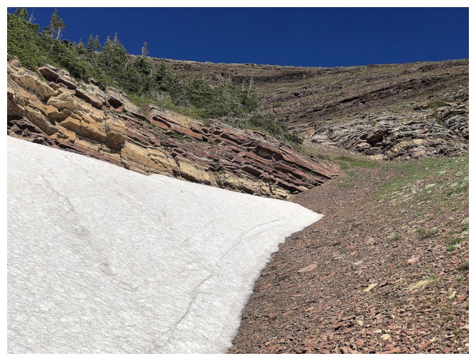
Snow, red argillite and blue skies - this is my kinda scenery!
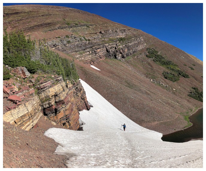
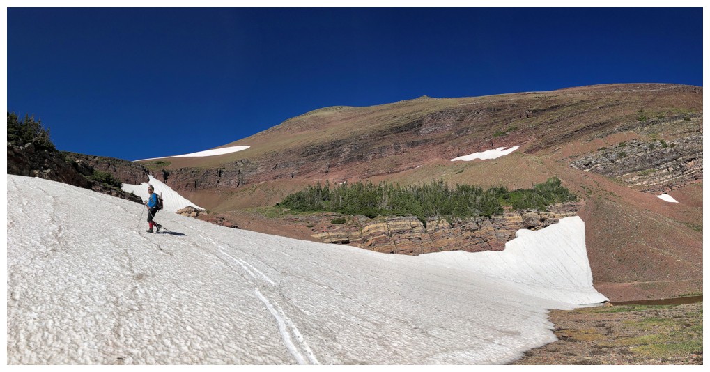
As stated, the bank of snow was huge for the end of July
Leaving the snow behind for the rest of the day
A
fellow hiker (lower left) catches up with us. He was moving at a
phenomenal pace and was loving the scenery as much as we were.
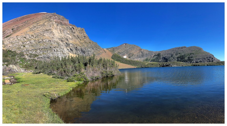
Looking back at the third lake
The carpet of yellow flowers was a pleasant surprise to us and the hiker (now at the lower right)
Enjoying the sweet view of two of the Carthew Lakes
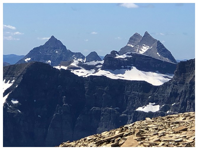
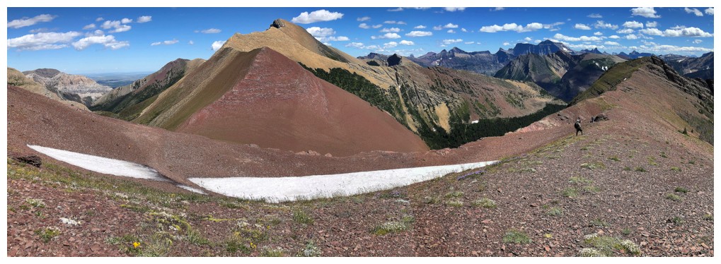
Mount Carthew is a red argillite beast! No wonder I've made 6 trips up to its summit or that of Carthew Minor
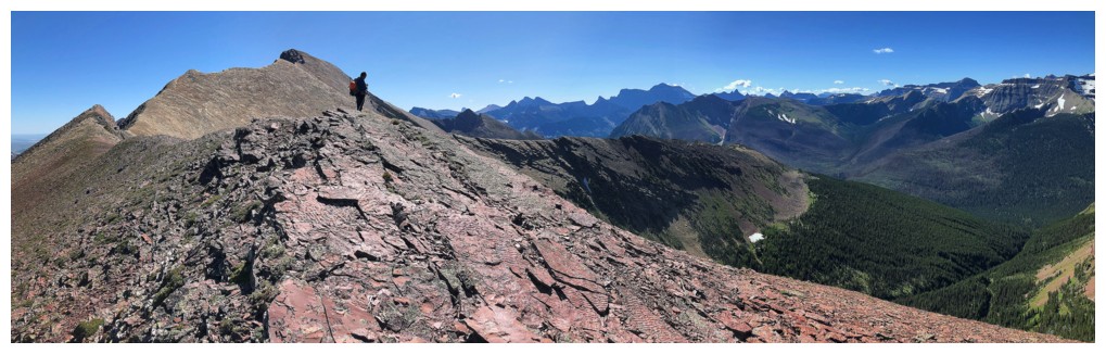
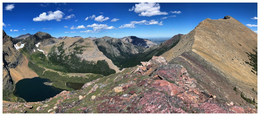
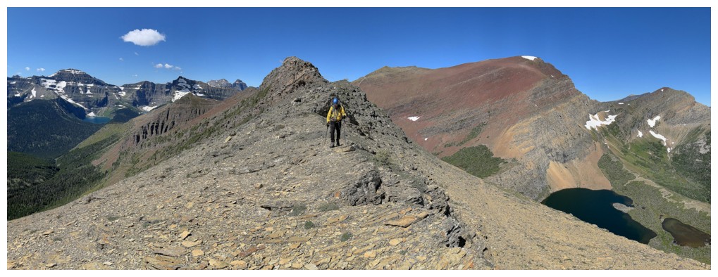
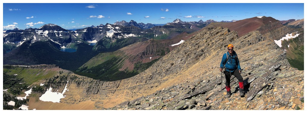
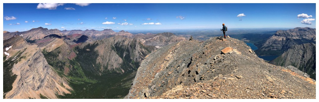
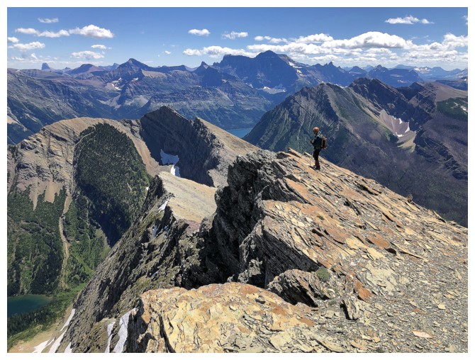
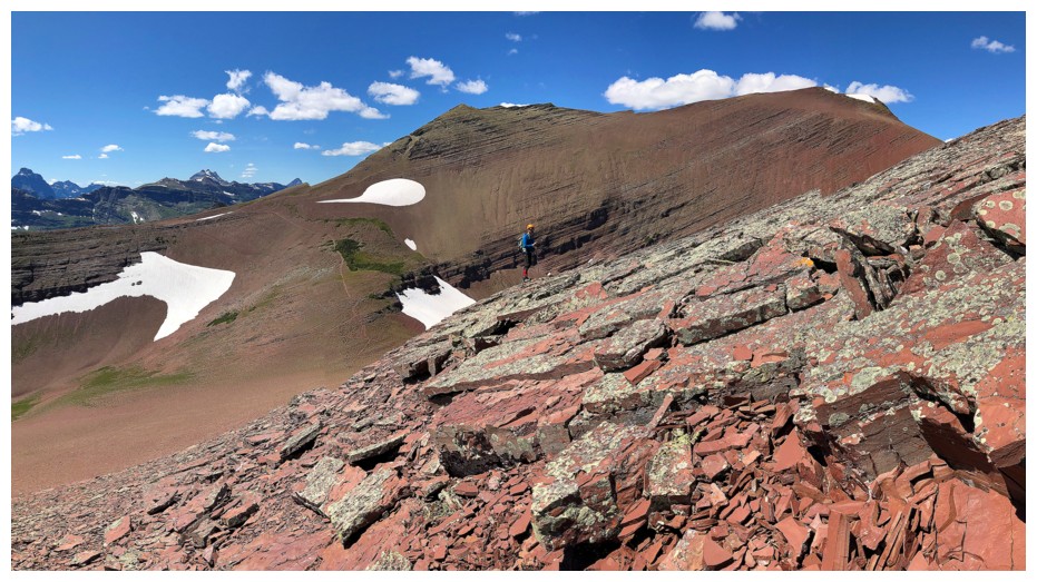
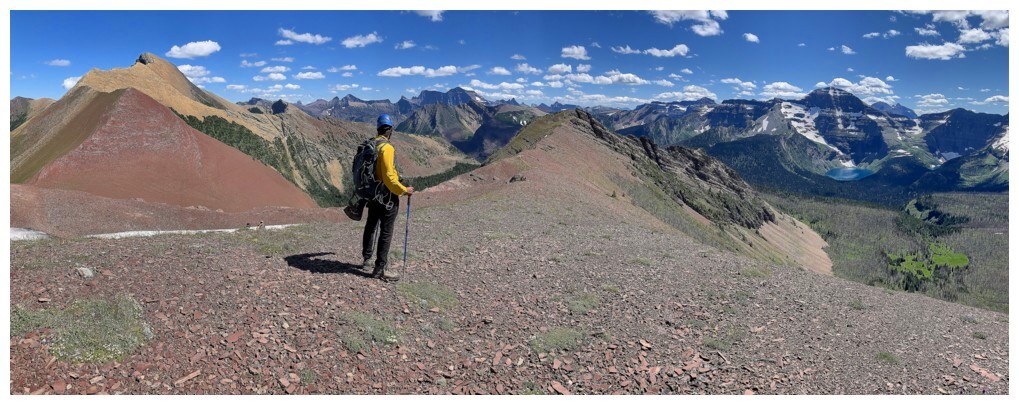
On the ridge with the summit on Alderson at the left
The peaks of Glacier National Park (left) start to appear
Mount Chapman towering above Lake Wurdeman
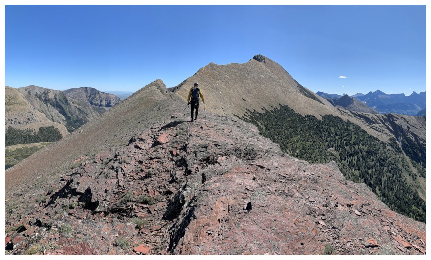
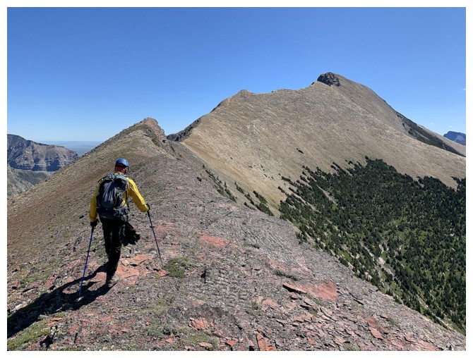
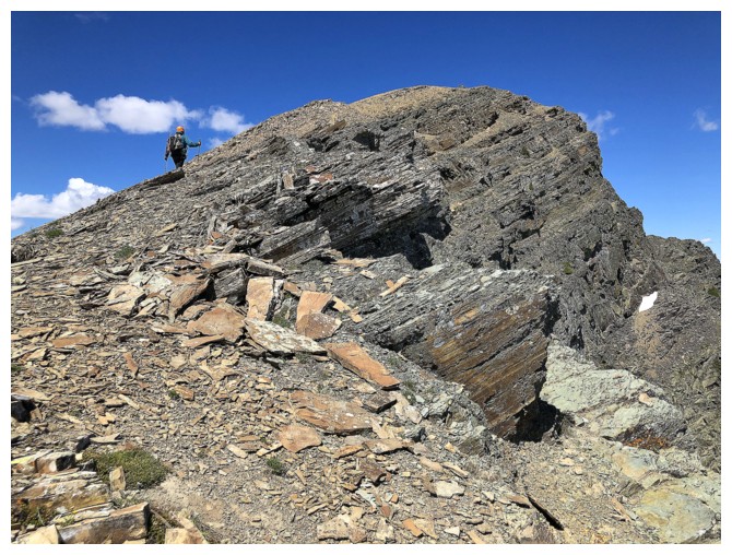
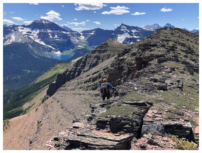
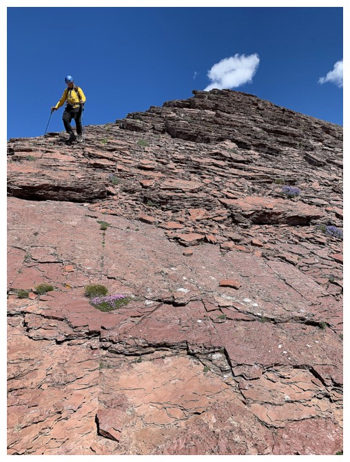
Easy and super scenic ridgewalking for most of the ascent
Chapman again
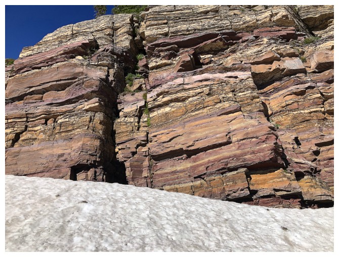
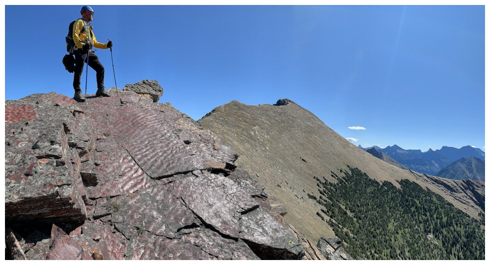
Red argillite again!
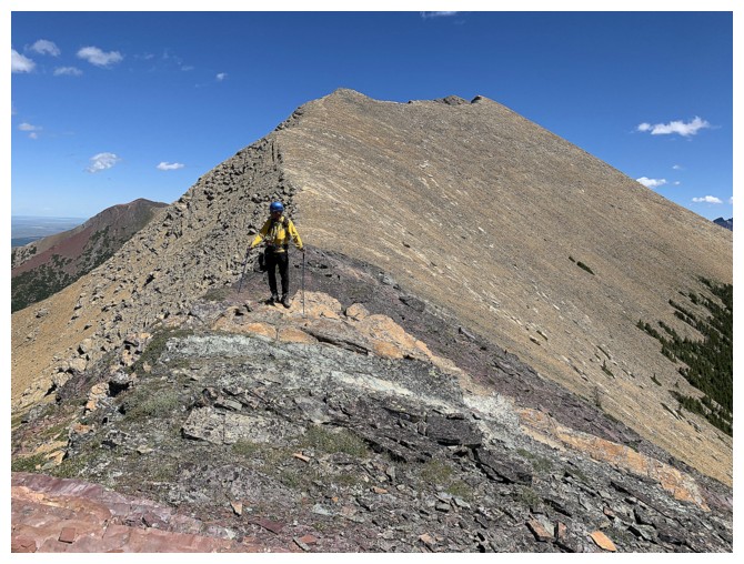
The summit looks close, but it is still a long ways off.....
....but that's not a bad thing when views like this one abound
A section of ripple rock
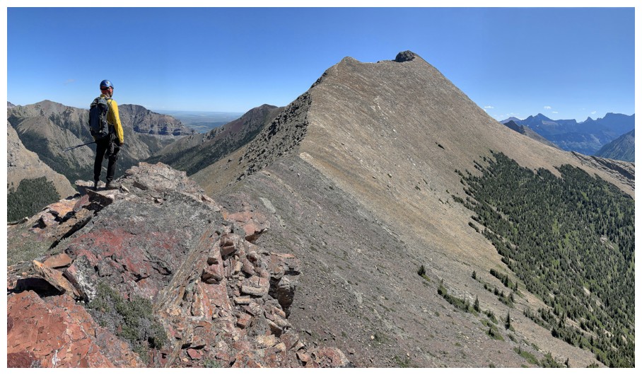
It's still far off
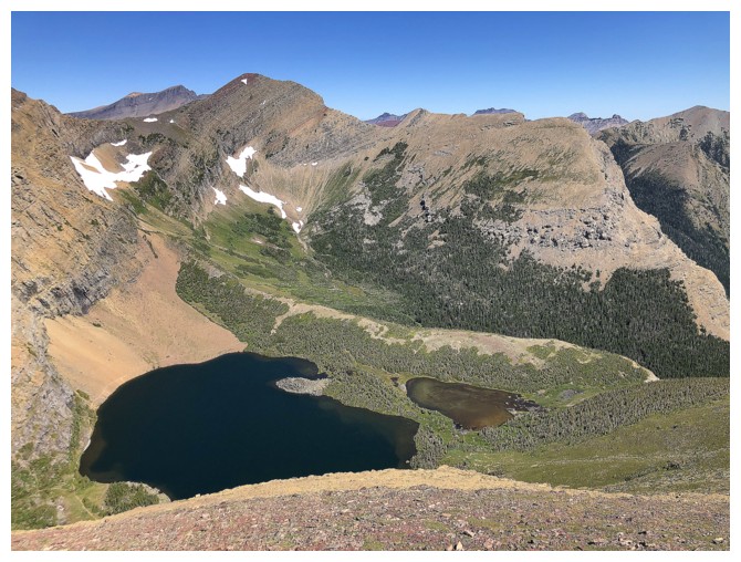
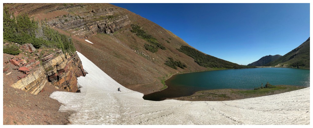
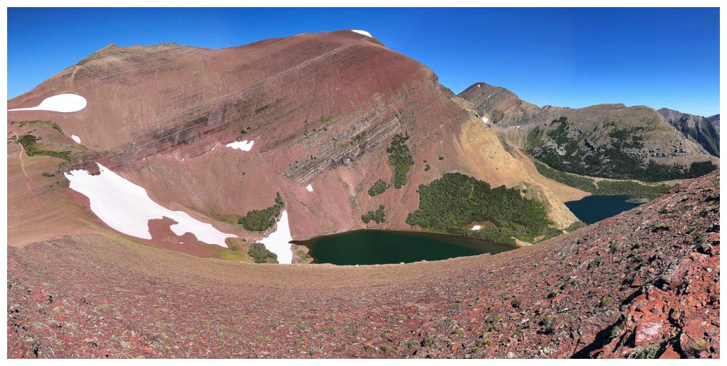
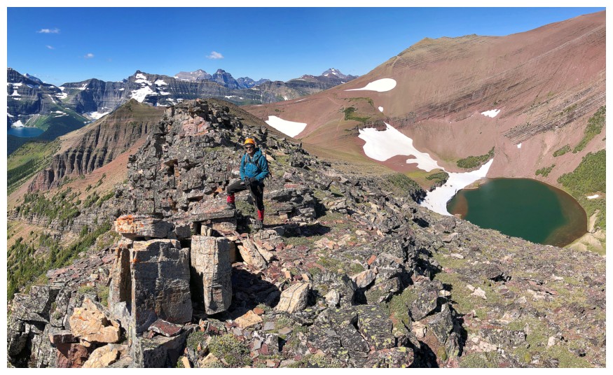
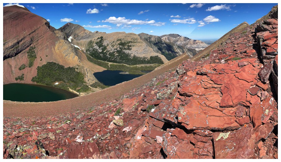
Two of the Carthew Lakes
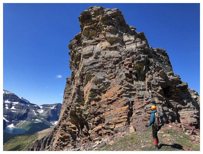
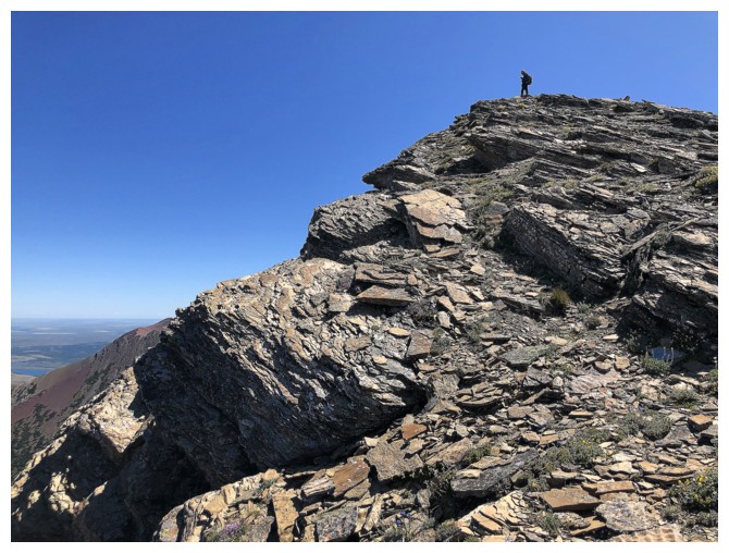
An outrageously cool rock band that is easily circumvented
Getting closer, but there is still a lot of cool ridge to walk
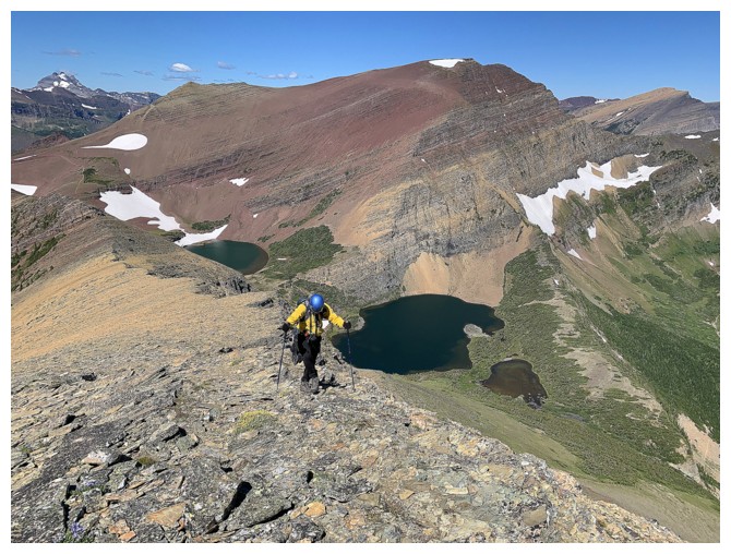
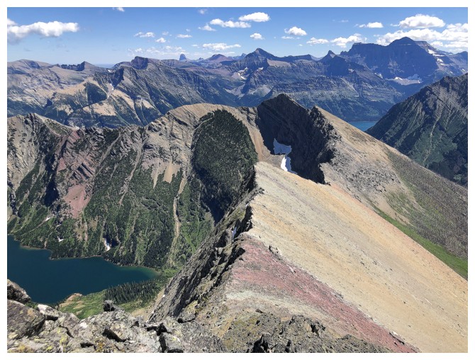
2.5 of The Carthew Lakes now visible
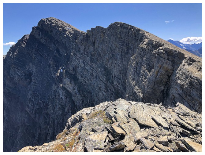
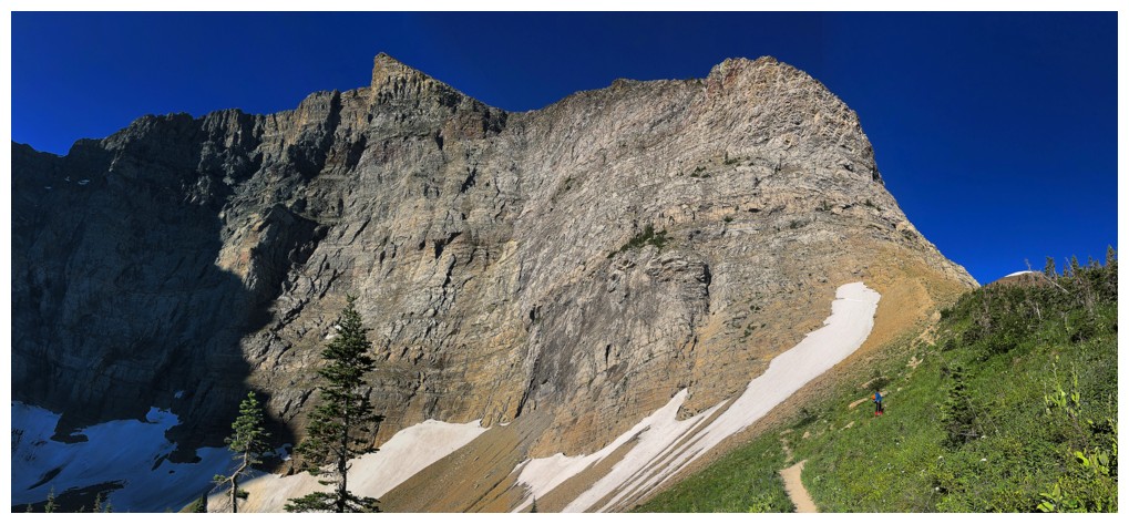
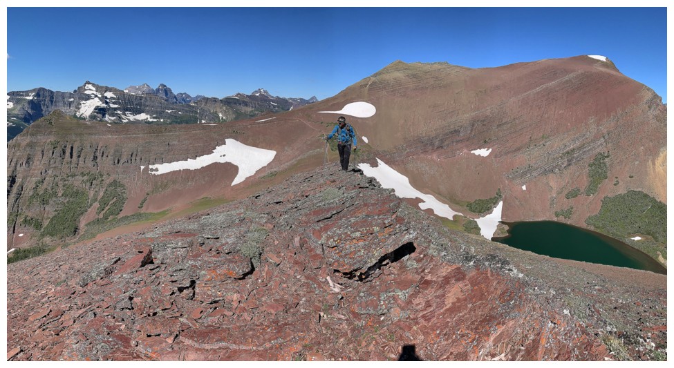
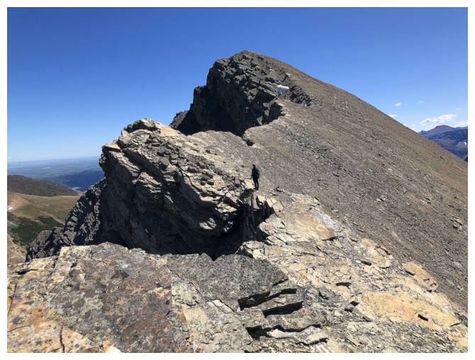
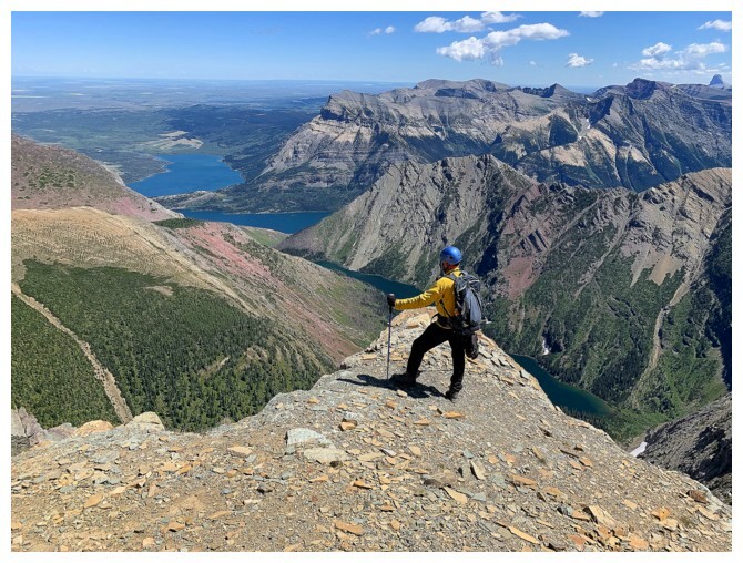
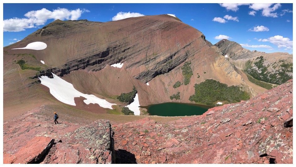
The wickedly steep northwest face of Alderson
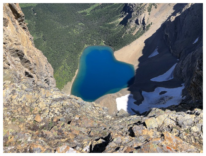
Looking down the wickedly steep northeast face of Mount Alderson to the serene blue of Alderson Lake
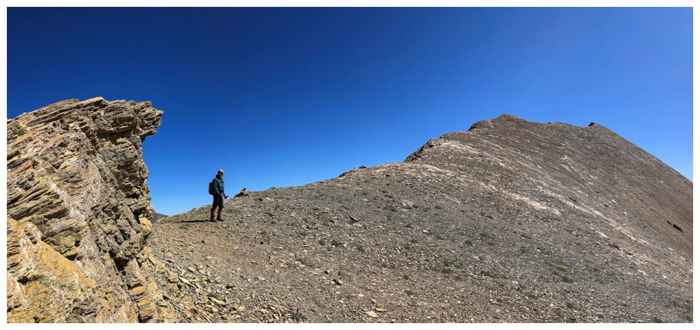
The trail traverses some distance below the ridge, but it's far more interesting to stay near the edge
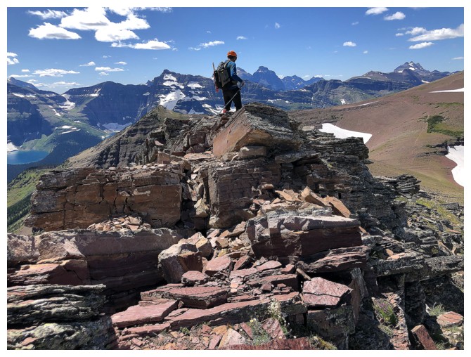
The summit is finally visible
One of the happy campers on the final push to the top (obviously the other is taking the photo!)
Staying near the edge does mean some extra elevation loss and gain, but who cares when the scenery is this good
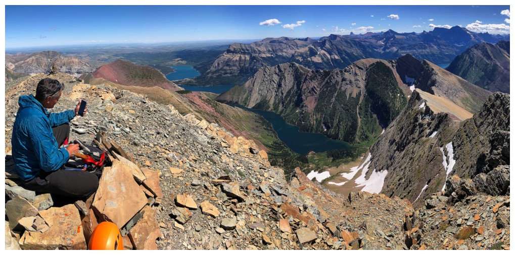
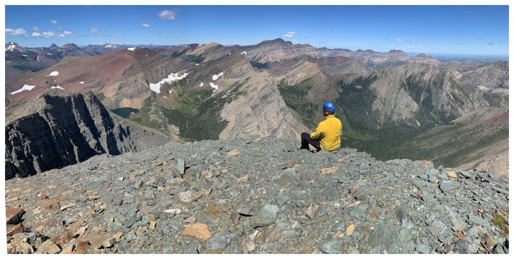
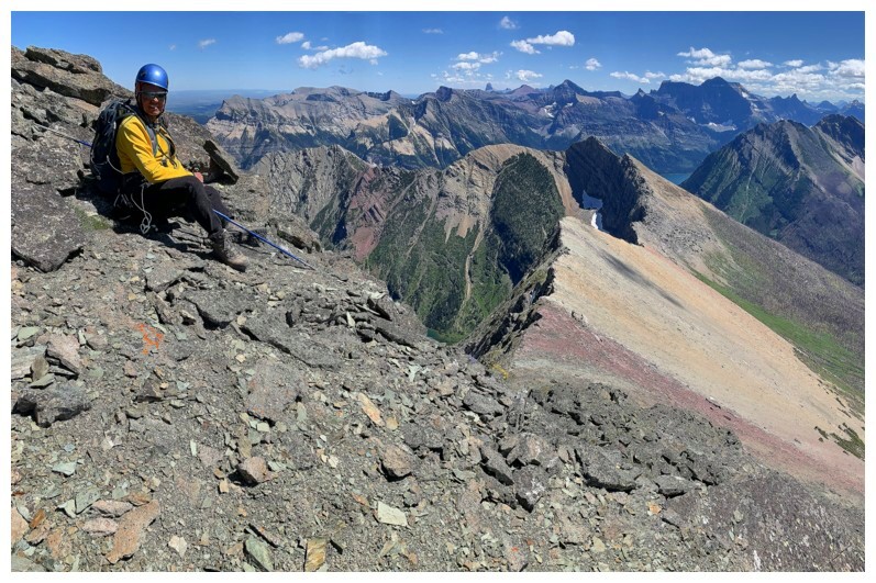
Mark Facetimes his kids from the summit
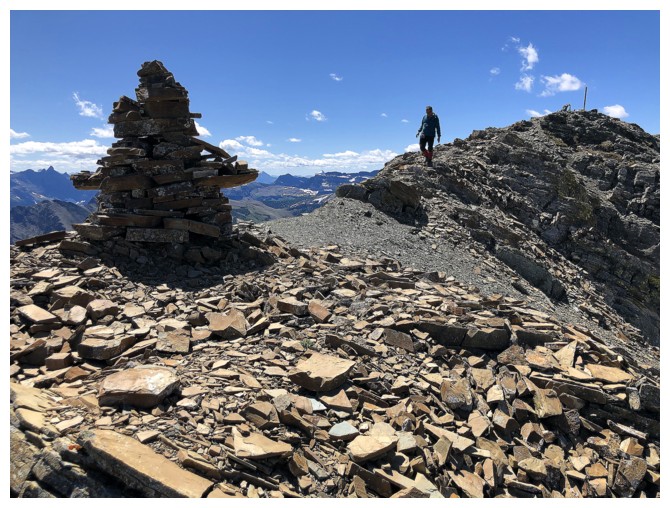
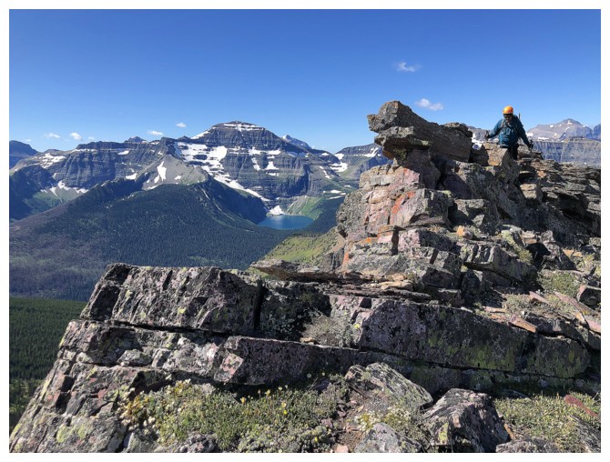
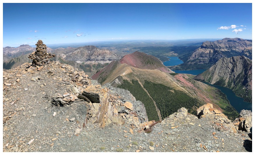
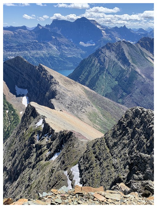
Walking down the ridge to a slightly lower point with a huge cairn
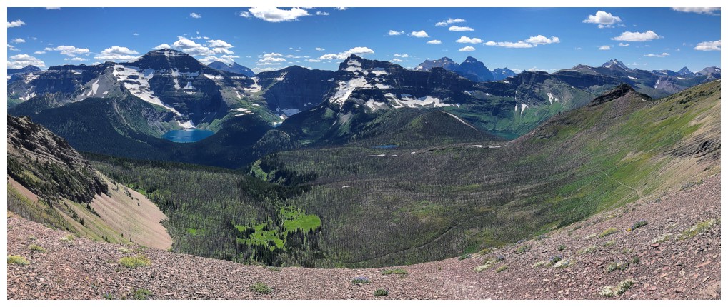
That point sports a magnificent view of the Waterton area
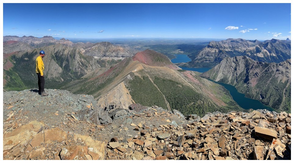
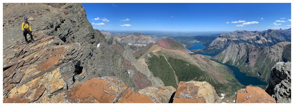
Why so stiff???? The view to the north, northwest, west and southwest, from Galwey near the right to
Long Knife Peak at the far left. Waterton's highest, Mount Blakiston in the centre
Bertha Lake looks fantastic from here
The red form of Bertha Peak (just left of centre) helps to make this one of the best views in Waterton
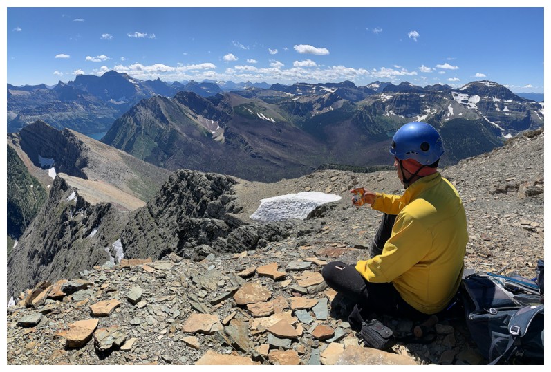
Enjoying a spectacular Orange Crush to compliment the spectacular views
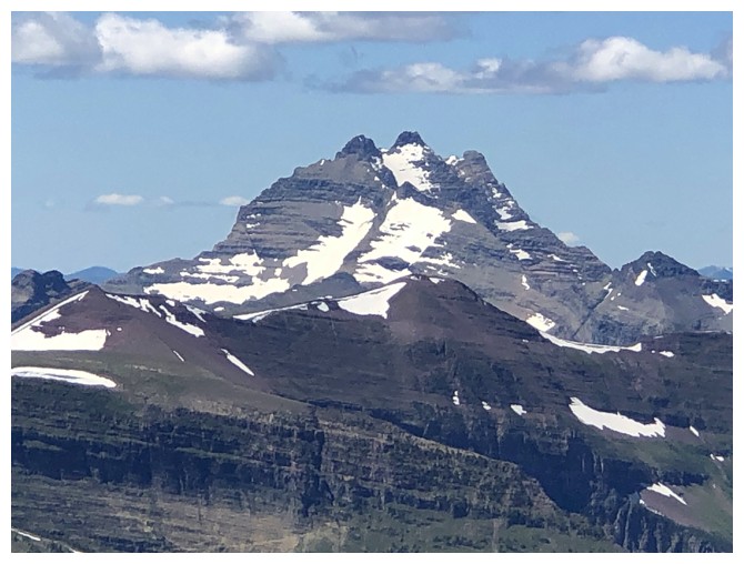
Some Glacier classics: Long Knife Peak,
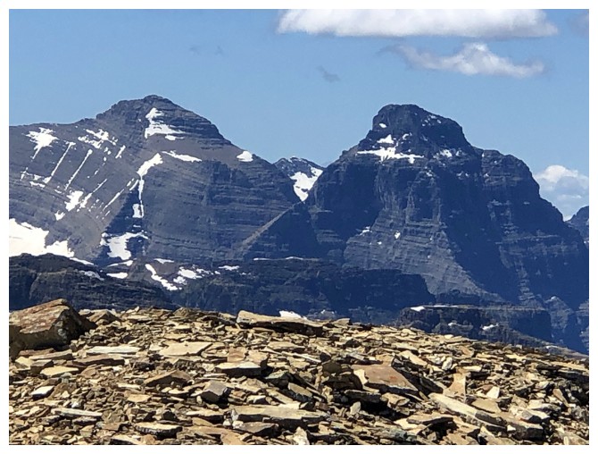
Kintla and Kinnerly,
not sure, but talk about stunning mountains!
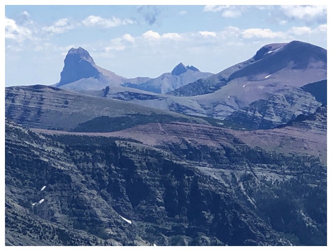
Chief Mountain at the left,
Mount Cleveland
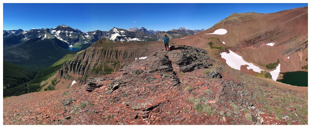
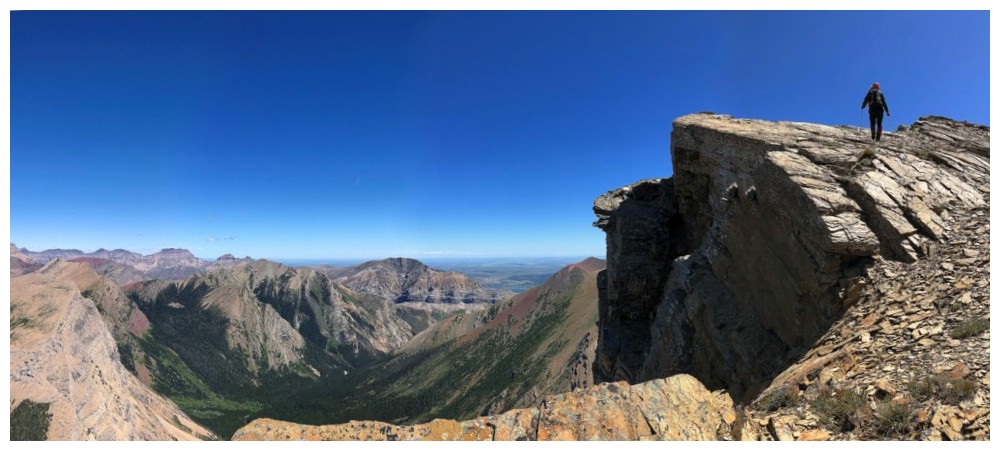
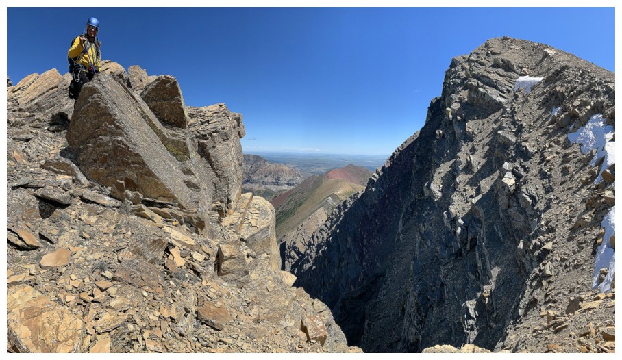
Last pano before checking out the traverse to Richards
Heading to an outcrop of rock that overlooks Bertha Lake
Closer look at red Bertha Peak and the connecting ridge to Mount Alderson.
Blair Piggot and Dave Stephens climbed that challenging route, grading it at a solid 5.8.
Checking out the traverse over to Mount Richards
As far as we got, but sweet view
The colourful ridge to Richards had us salivating, but in the end we decided against the attempt
Nice rest spot before the return trip
Heading back
The super colourful rock band is not as impressive in shade
But Mount Carthew is always impressive!
Ridgewalking in Waterton is a real treat due to the blocky and mostly stable terrain
We took a little detour here onto the left side of the ridge where all the red argillite was on display
This red argillite
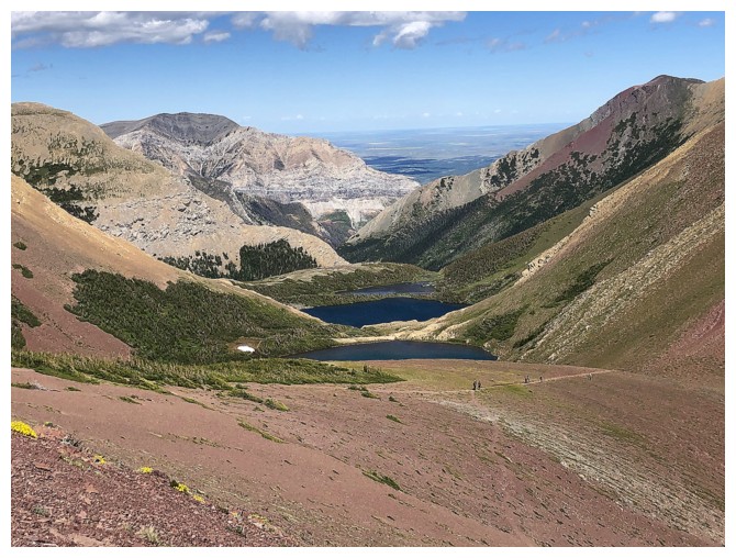
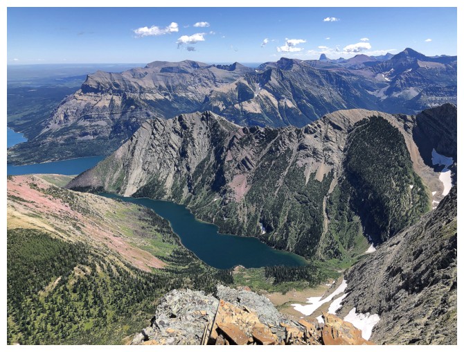
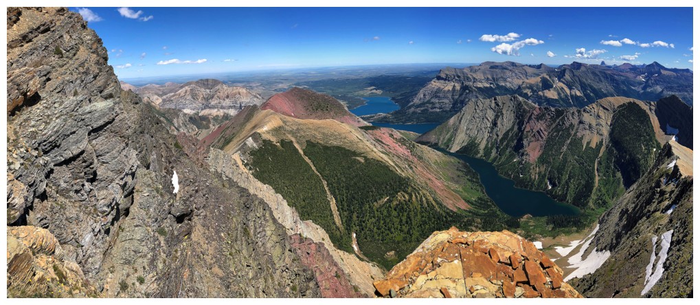
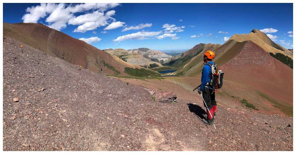
The Carthew Lakes from near Carthew Summit
The mountains and lakes of Glacier National Park are stunning from Carthew Summit
The view of Alderson that I told Mark he had to see
Some of the traverse to Richards
Leaving Carthew Summit
View to Alderson Lake
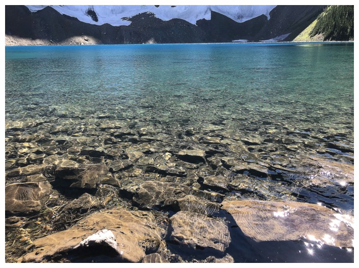
Back at Alderson Lake, with its crystal clear waters
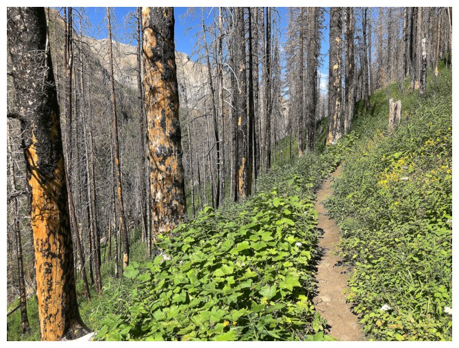
Lots of green on the Alderson Lake Trail
The impressive southeast face of Mount Crandell
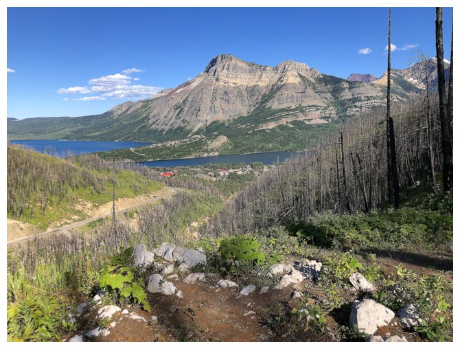
Vimy Peak overlooks the Waterton Lakes and the town of Waterton
The End
LOG