Mount Glendowan
Mountain height: 2,677
m (8,781 ft)
Elevation gain:
1,175 m
Ascent time:
Descent time:
Scrambling with Mark and Jodi.
We were hoping that the south ridge of Mount Glendowan would provide the same great hands-on scrambling and outstanding scenery its neighbour, Dungarvan had done for us two weeks earlier…and it did. Not surprisingly, the ascents and geology of the two mountains (both via their south ridges) are remarkably similar – definitely brothers if not twins.
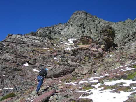
The good stuff was preceded by a 2 km hike along Snowshoe Trail and then an hour of sometimes tedious bushwhacking and climbing over deadfall. Once above the treeline, it was Déjà vu for the next three hours, as we scrambled up numerous pinnacles and rockbands lining the south ridge. Though not quite as stunning and demanding as Dungarvan, the ascent was, nevertheless, thoroughly enjoyable.
Higher up, we had to circumvent some of the rockbands, on the left side, as time was becoming a concern. Mark and I were also quite tired (the residual effects of the previous evening’s Judas Priest concert) and opted for the quickest route towards the summit block. The upper section of the mountain was characterized by the same band of black, lichen-covered rock, atop a band of burgundy argillite, as was Dungarvan – the only differences being that on Glendowan the black band was more broken and less steep and atop that, was an additional band of light brown shale (accounting for the slightly higher elevation of Glendowan than his little brother).
Where the black band of Dungarvan was a significant challenge that required a rappel to get down, Glendowan involved only moderate scrambling. Regaining the ridge above revealed not only the stunning and imposing-looking, shale summit block, but a fantastic view of the long ridge towards Dungarvan and other shapely Waterton peaks. Although the east wall of the summit block would have required a significant compliment of climbing gear to ascend, the south side granted easy access to the summit via a weakness in the band. A scree slope followed and then a short and pleasant traverse led us easily to the summit. The summit panorama was outstanding in every direction, but I found the view towards the Castle Crown area especially breath-taking – the distinctively coloured layers of rock and beautiful contours of the mountains were absolutely unique – there is nowhere else in the Canadian Rockies where such a variety of amazing colours of rock exist.
Although it was extremely tempting to investigate an
alternate descent route by heading west along the undulating ridge towards
Except for the miserable final couple of hours and the lost
camera, a thoroughly enjoyable and satisfying ascent – definitely worth a
repeat visit.
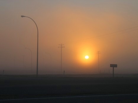
Early morning, driving south on Highway 2
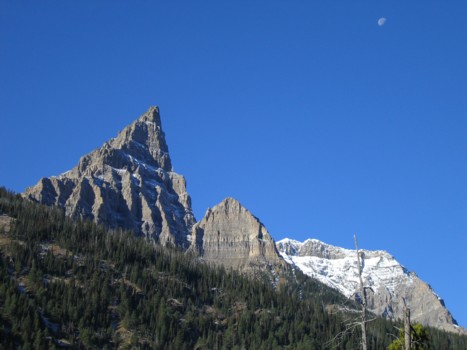
Anderson Peak and the moon
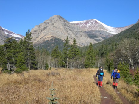
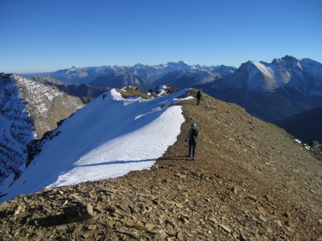
Jodi and Mark hike the Snowshoe trail
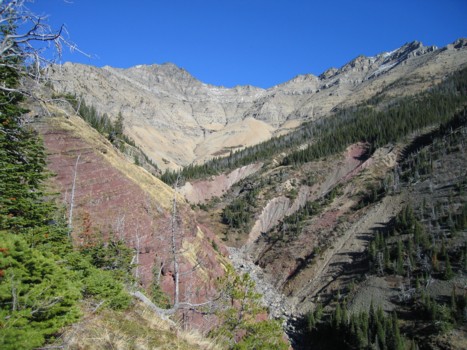
A lower section of the south ridge; the ascent route follows the left skyline
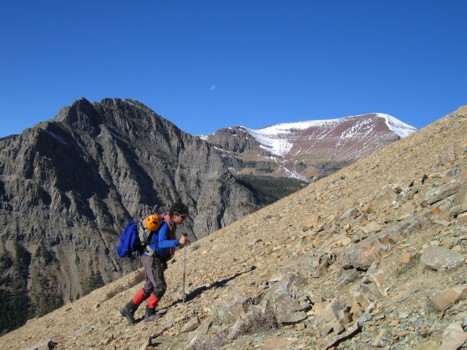
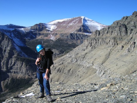
Mark on the lower slopes
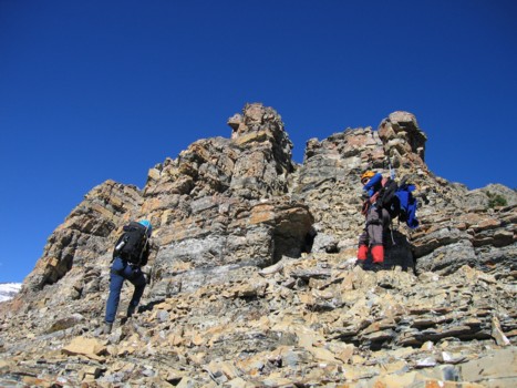
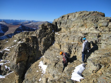
The scrambling begins
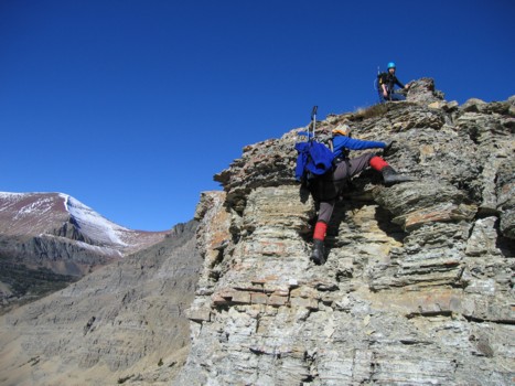
Mark ascends a rockband
Mark approaches another rockband
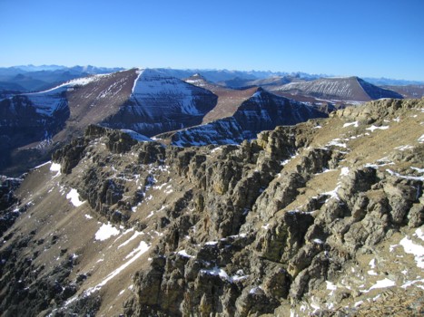
Mark surveys some of the terrific scenery; Blakiston (left) and Anderson (right)
Jodi, with part of the connecting ridge to Newman Peak behind
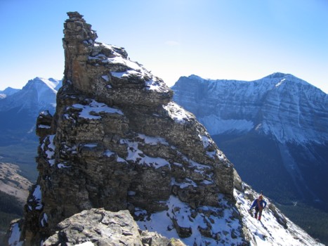
Mark circumvents an interesting pinnacle
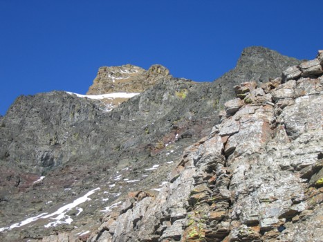
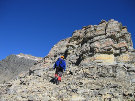
The upper slopes
Jodi easily ascends the burgundy band and heads up to the black band
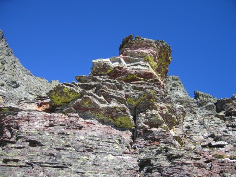
Typical rock of the upper slopes
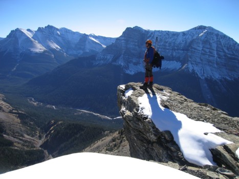
Mark, back on the ridge; the connecting ridge to Dungarvan to the left
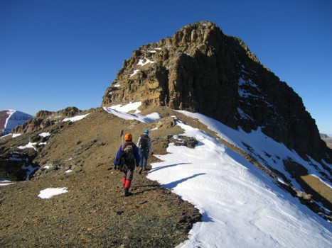
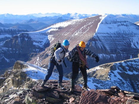
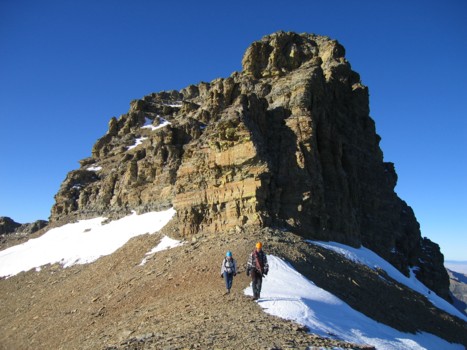
Mark and Jodi approach the summit block
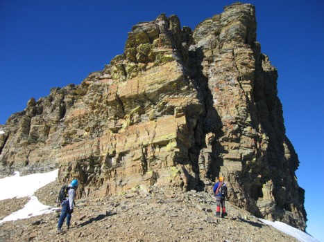
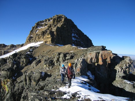
Jodi and Mark inspect the steep, east side of the summit block
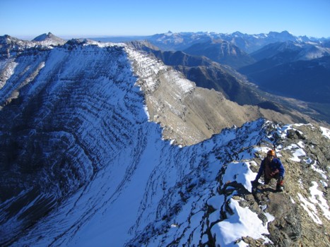
Mark, back on the ridge
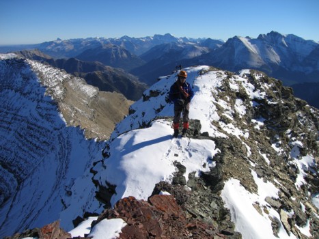
Mark takes the final few steps to the summit
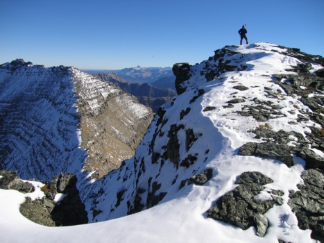
At the summit, looking north
Jodi and I take a page from the Dan and James book of summit poses
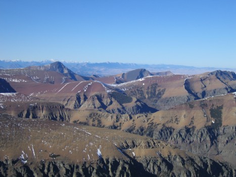
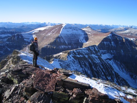
Beautiful hues of the Castle Crown area; Victoria Peak, Pincher Ridge, and Drywood Mountain are visible
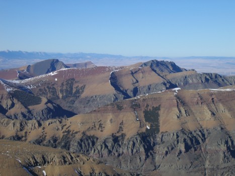
Same as above
Me and Jodi descend the summit block
Another view to the north
On descent
The striking the summit block
A last look at upper ridge and summit block
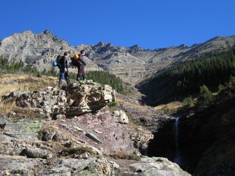
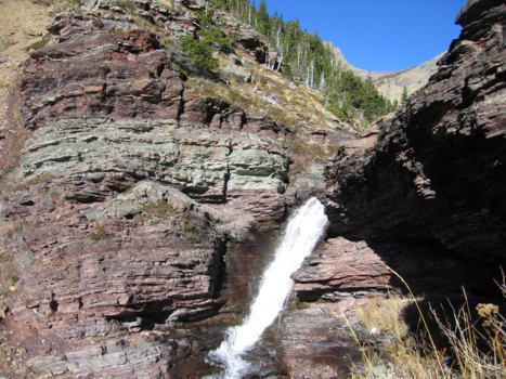
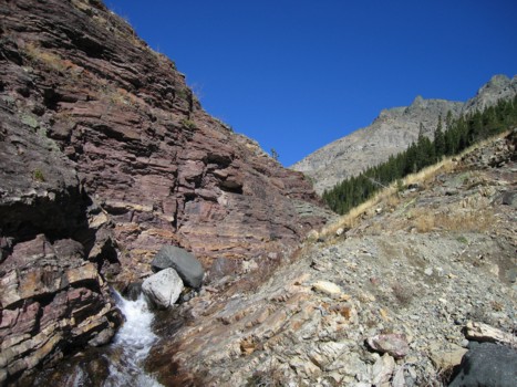
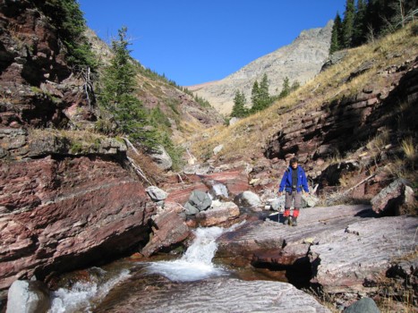
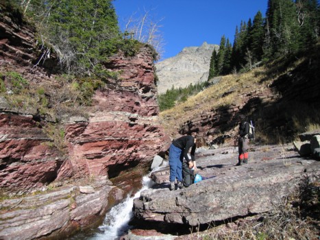
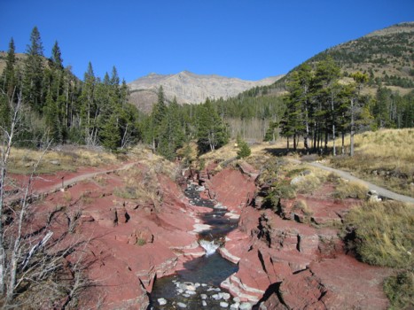
Epilogue: We stayed at Pincher Creek overnight, and returned to see if by some miracle we could find the camera. Six hours the searching turned up nothing, however, we were able to see the fantastic waterfall and creek scenery in much better light.
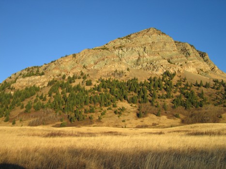
Bellevue Hill from the Red Rock Parkway
The next few pictures are of the terrific scenery of the creek
Back at the parking lot