Unnamed
summit at GR333458
(Wasootch Peak)
November
15, 2003
Mountain height: approx. 2,300
m (7,544 ft)
Elevation gain: approx. 850
m
Ascent time: 5:25
Descent time: 2:55
Mountaineering
with Mark.
What started as a straightforward hike and scramble, turned into a
full day expedition of some exciting mountaineering. Given the miserable
weather forecast (cloudy with snow flurries in the afternoon), our initial plan
was a practice climbing at Wasootch Slabs. When we arrived at Wasootch Creek
parking lot, however, the sky was still generally clear, and so we decided to attempt
the unnamed summit to the west of the parking lot (actually the northernmost
summit of a long ridge that includes Old Baldy Mountain and Mount McDougall,
further south). It looked to be a relatively straightforward scramble with some
bushwhacking at the beginning, followed by the ascent of an avalanche gully, and
then a steep hike to the summit. A long ridgewalk to several higher points was
also visible, but we didn’t plan on doing much of it.
Although the
deep snow made the ascent lengthy (about 2 hours), it was easy and we chose to
stay in the tress throughout, avoiding the avalanche gully. At the first
summit, we were given terrific views of Wasootch Tower,
Mount Allan, Mount Lougheed,
Mount Lorette, and last week’s Mount Collembola.
From there, a short, easy, and enjoyable scramble took us to a second, slightly
higher summit.
The next
section of the ridge looked considerably more difficult and it was! At first,
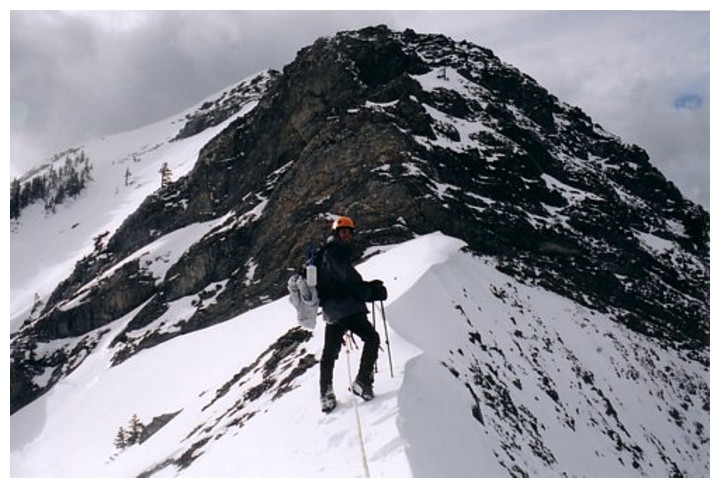
the ridge was wide and easy to negotiate, but quickly it became quite narrow,
with significant drop-offs on both sides. A fair amount of snow didn’t make
things easier. We eventually came to a section with a short downclimb followed
by a very steep wall that might have been possible to ascent, but would have
required climbing gear to descend. Unfortunately, because of the snow, we
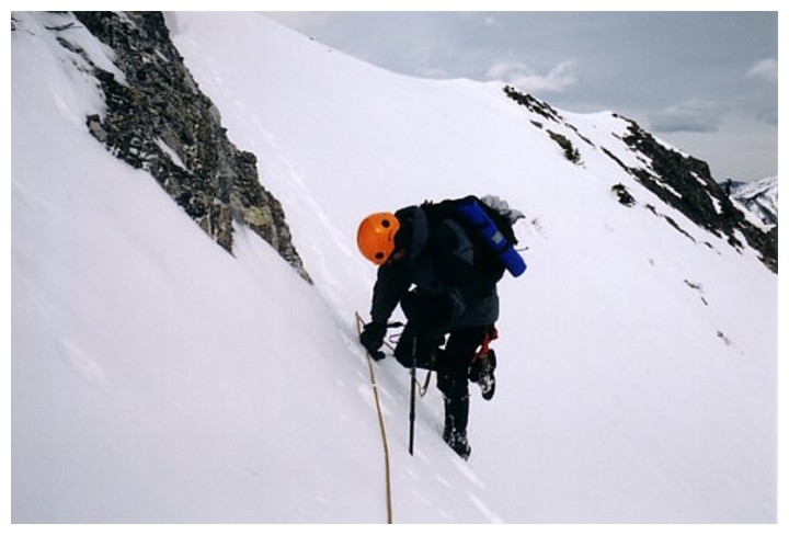
couldn’t even get passed the downclimb. Luckily, we had brought with us a 25m
length of rope and after backtracking a little, we found a steep snow-filled
gully that would take us down and around the difficult section. A tree at the
top provided a great anchor and we set up a rappel, with the intention of
leaving the rope there so that we could use it to ascend the gully on
return.
After
rappelling down, we tried to stay on steep avalanche slopes to shorten the
ascent, but the extremely deep snow made travel excruciatingly slow and we were
forced back onto the ridge. Up higher we did actually cut across the slope – a
big mistake! We came to an impasse and had to ascend a very steep and dangerous
rock band to regain the ridge.
Now, we were
confronted with another near vertical rock band that we would have to circumvent
on either side. Neither route looked promising and I thought that this would be
the end of the line. We decided to take a look at the left side. This involved
traversing a very steep snow slope, where a slip would have sent you on an
involuntary glissade hundred of metres down the mountain. The longer rope would
have been nice, but we were forced to use our short rope and ice axes. Mark
went first and I followed. We made it safely and then a found a good route back
onto the ridge.
The summit was
now in view and after another half hour of interesting travel across corniced
ridges and up short rock bands, we made it to the top. Aside from the increasing
cloud cover and a viciously cold west wind, the summit view was beautiful. Of
special interest were Old Baldy and the subsidiary peak of Mount McDougall
that we ascended almost two years ago.
Descending the more difficult sections was easier than I thought it
would be and the sun came out eventually, highlighting stunning surroundings.
Overall, a fantastic day! We got far more than we bargained for the were both
thrilled to make a summit that we didn’t even expect to get close.
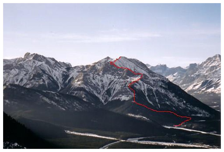
Approximate route up, as seen from Mount Baldy
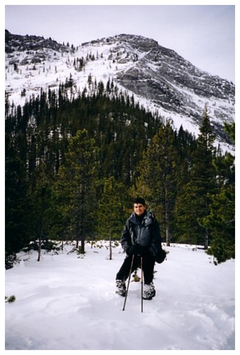
Light forest up to the ridge
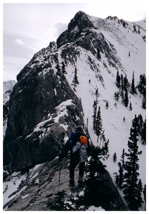
On the ridge, looking for a potential route up
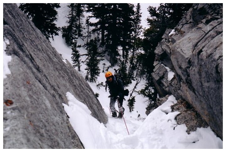
Leaving the ridge (rappell required) for easier terrain
Back on the ridge
Looking down on Wasootch Tower
Good view from a minor highpoint along the way
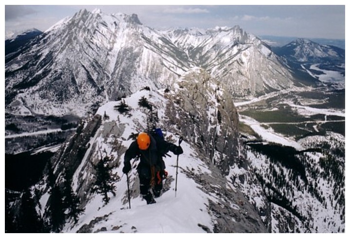
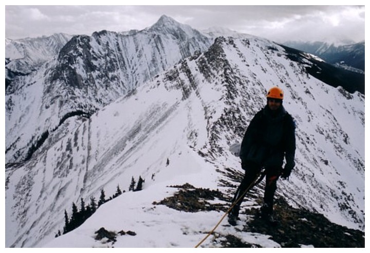
Challenging terrain ahead
At the rock band we had to circumvent the rock band on steep snow slopes
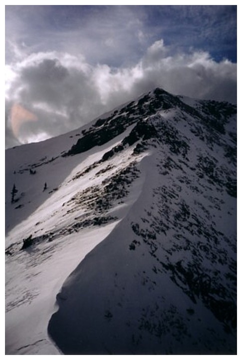
Steep, snow slopes
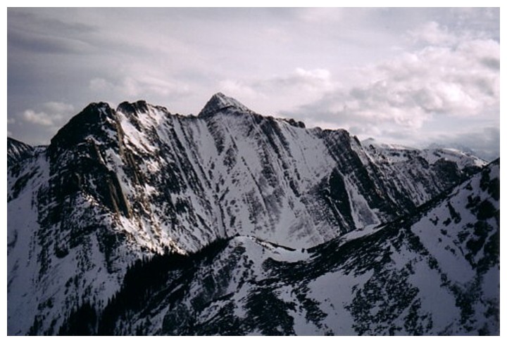
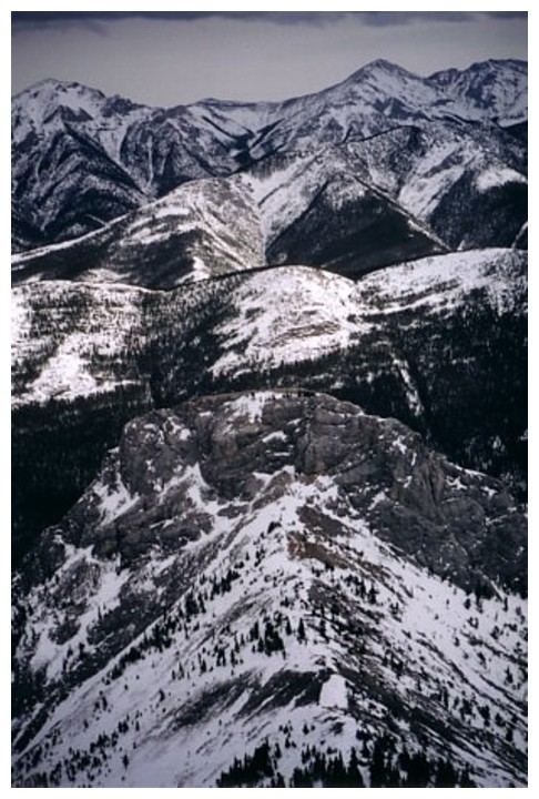
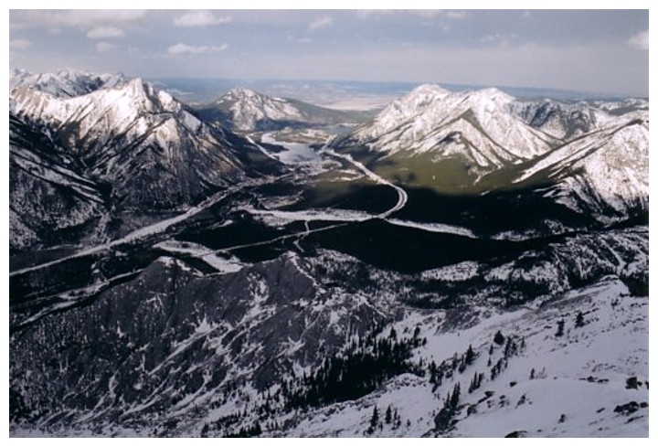
The ridge to the south continues on to several unnamed summits and Old Baldy Mountain
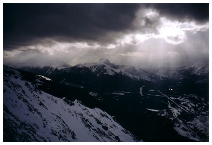
Not the greatest weather day. The Wedge in the centre.
Better weather and views to the north
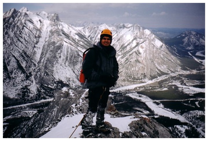
Summit to the south
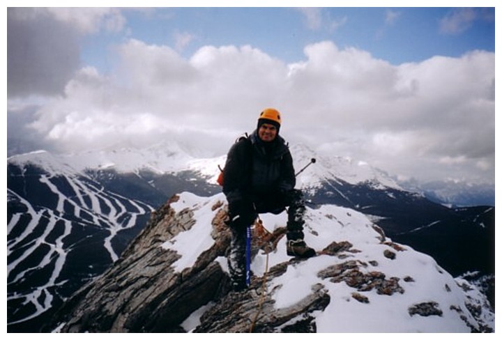
Summit view to the west. Nakiska Ski Hill at the left.