GR344442
–
Mountain height: 2,419 m (8,157 ft)
Elevation gain: 830 m
Ascent time: 5:35
Descent time: 2:50
Scrambling with Mark.
This seemed to be a good opportunity to see if we could
connect two routes on the north end of the
On March 31, I made to GR338442, before turning back because of winter-like
conditions and the simple fact that the easterly traverse to the next highpoint
seemed to be blocked by near vertical bands of rock and tall pinnacles. With all
the snow gone, the ascent was much easier, however, far less scenic. We did
deviate from the obvious route up, to do some easy climbing, but that was all
too short-lived, and soon we were back on the scree gully. Higher up, I was
amazed at how easy the crux(?) was without any snow (easy scrambling, if that!).
I was also surprised to find that the short sling I had left around a tree, to
assist me in the descent, was no longer there. Throughout, the rock scenery was,
once again, impressive, but didn’t really compare visually to my “blue sky,
white snow, gray rock, green tree” ascent at the end of March.
By the time we arrived at my previous highpoint (GR338442), Mark was suffering
miserably and confessed to almost passing out four times. I suggested that we
retreat, but he was as curious as I about a potential route to GR345555 and so
he insisted we continue. Although I initially thought that the traverse would
require some roped climbing, we were both happy to find that all the rockbands
could be circumvented on either side or scrambled up directly (easy to moderate
scrambling).
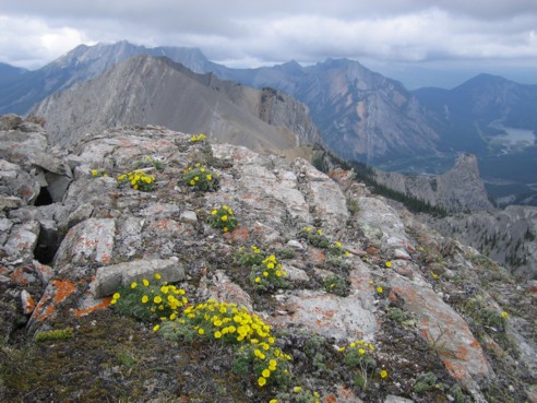
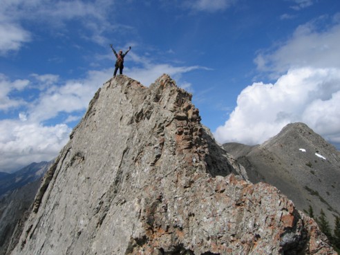
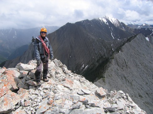
Arriving at GR344442 (2,421 m), it was simply too much to resist extending the
trip to the next highpoint, that could be easily reached by heading south
towards the unnamed and highest and point of the range at GR356418, a good
distance away (this peak is labeled Old Baldy Mountain on the older version of
the Gem-Trek, but is unnamed on the newer one). Being the next logical extension
of the trip, getting a closer look at the route was definitely in order, and
since it didn’t involve any significant elevation losses and gains, Mark was
up for the traverse.
The short ridgewalk to GR343438 (2,401 m) was probably the best part of the
trip. Although quite innocuous-looking from the start, at two points the terrain
suddenly dropped off completely on the right side and the ridge narrowed to the
point where caution was needed. Looking back at the tremendous vertical slabs
that created these drop-offs was quite spectacular. At the highpoint, we
surveyed the long ridge towards GR356418. Although the visible parts looked to
be quite straightforward, the upper section was difficult to see because of the
gloomy weather and the sheer distance. Attaining that summit using this ascent
route would certainly be a long and grueling day.
After admiring the good view (great if it was a clear day), and an interesting
double rainbow that suddenly appeared to the east of us, we decided that a
further traverse was pointless for today and headed back. Instead of using the
same route for descent, we chose the easy northwest scree gully that served us
well on the April 9 descent. Before that, however, I quickly ran up to GR345444
again (our highpoint of April 9) to take another look, and yet again, without
the snow the summit and intervening ridge was not half as eye-catching as when
covered in the white stuff!
The scree gully provided a fast and entertaining descent, but from the bottom of
the gully to the road, alongside a creek, was long and very tedious. In
retrospect, returning exactly the way we came would have been faster and more
pleasant, which I guess brings us back to the point of the trip – a loop route
is possible, best done in a north to south direction - a great trip with plenty
of stunning rock scenery and interesting scrambling to keep you entertained.
Click HERE
to see the first route to GR338442
Click HERE
to see the second route to GR345444
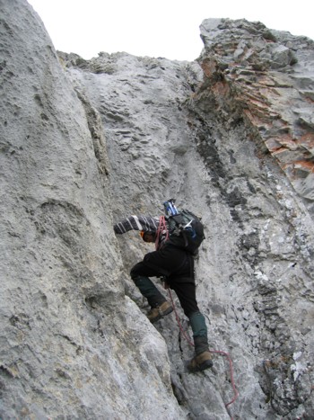
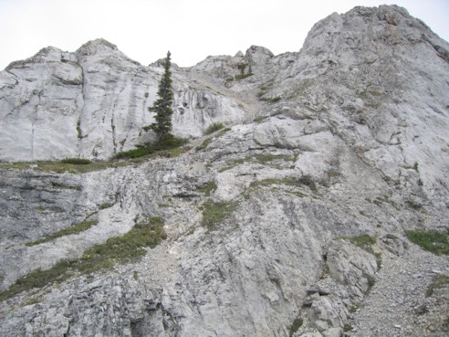
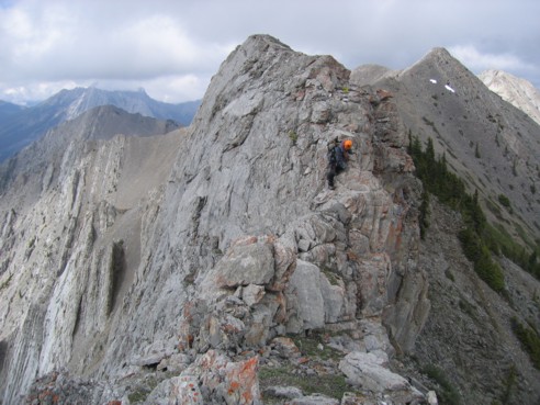
A very short climbing section after clearing the tree line
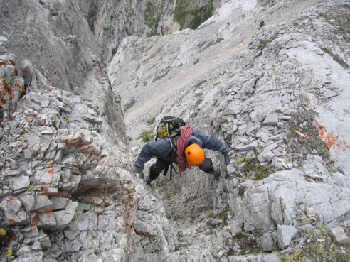
Mark comes up the small chimney
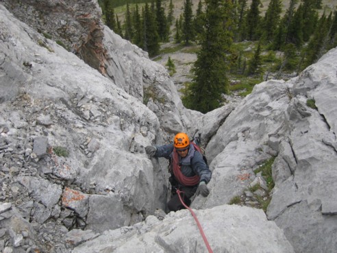
Heading up the scenic gully
Exploring more interesting sections
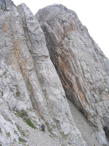
Some of the enormous and impressive vertically-tilted slabs alongside the ascent gully; Mark stands at the bottom for a size comparison
Mark demonstrates his "stemming" technique
Looking down one of many huge drop-offs; Wasootch Peak to the right
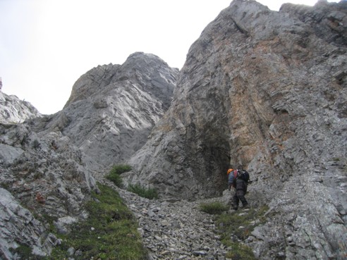
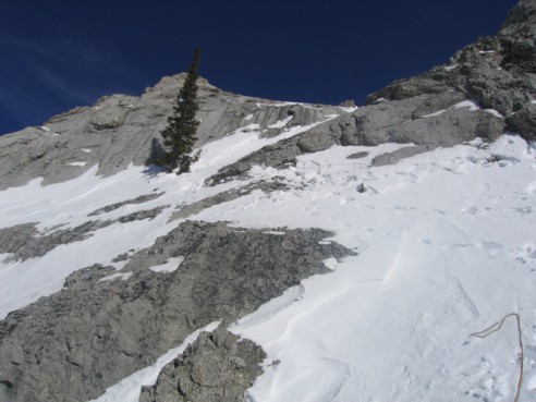
More cool scenery, but....
...not as beautiful as the first time I was there, with blue sky and snow
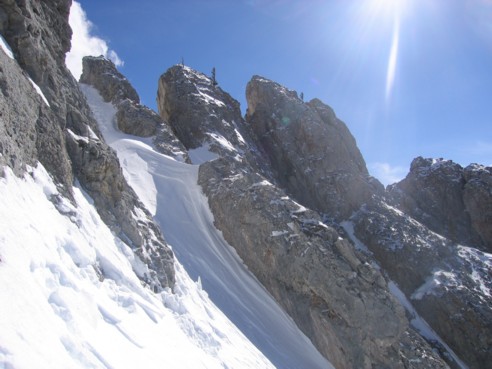
The crux, not looking like a crux any more
The crux, seen the first time I did the route
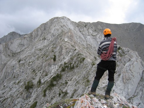
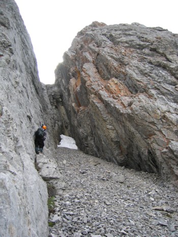
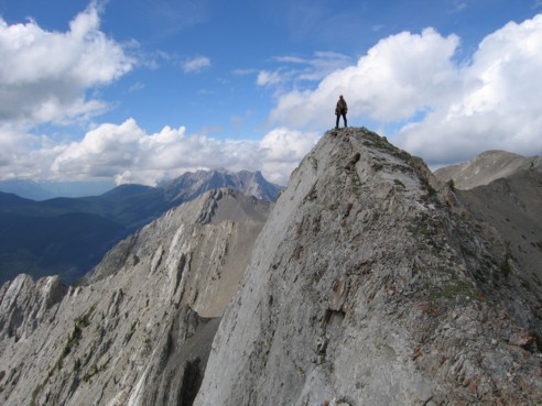
At GR338442, looking towards GR344442
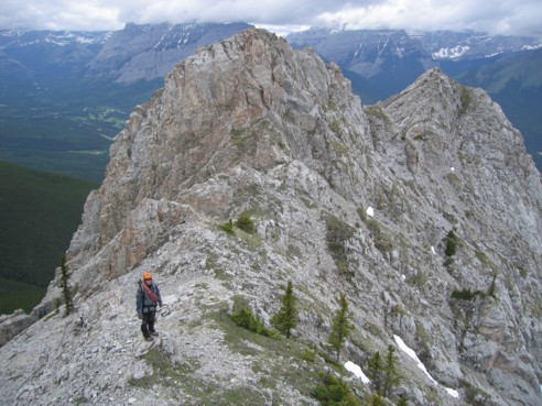
Looking back at part of the traverse
A view to the north from a highpoint on the traverse; Wasootch Tower is lower down, at the far right
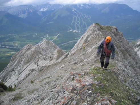
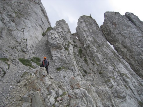
Almost at GR344442
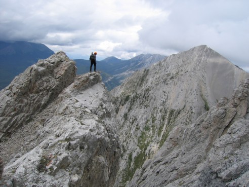
Continuing the trip south towards the highpoint of the entire range at GR356418, seen in the centre
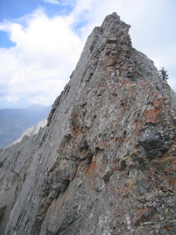
One of the impressive slabs
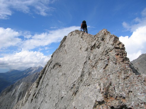
Scrambling up the ridge of the above slab
At the top of the slab
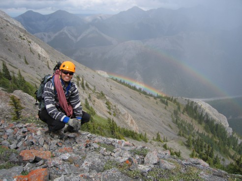
A double rainbow
The second and even more impressive drop-off; the ridge here wasn't "Lady MacDonald" narrow, but caution was definitely needed
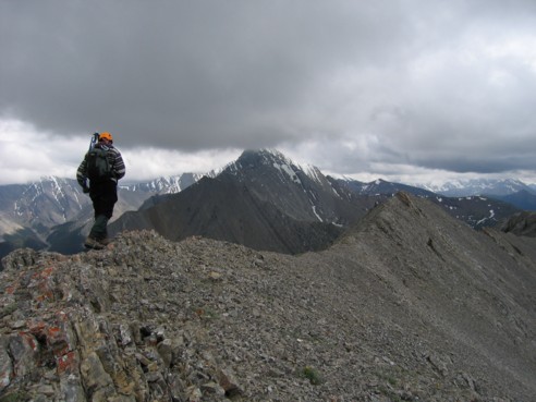
Mark carefully scrambles down towards the next highpoint
The end of the line for us; continuing on from here would have required a great deal more time and energy than we had
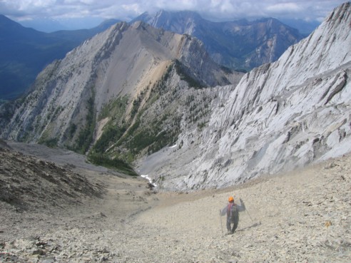
Heading down the mercifully easy and long scree slope