Gunnery height: 2,089 m (6,852 ft)
Elevation gain:
570 m
Holy Cross height:
2,766
Elevation gain from Gunnery: 677 m (plus approx. 400 m because of required elevation losses)
Ascent time (to Holy Cross):
Descent time: 2:30
Scrambling with Mark.
No point in doing something big when the forecast calls for never-ending rain, so we set out to try and finish what I had started last month, in a bid to ascend Holy Cross Mountain via the southeast ridge.
Since Mark hadn’t done
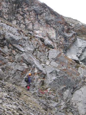
Soon, we reached upper ridge, characterized a series of striking and extensive cliffbands that add considerable challenge and excitement to the route. When we arrived at the steep rockband that had halted my progress three weeks earlier, we took out a rope and up I went. As expected, it was fairly straightforward (difficult scrambling) and we continued to the second rockband. It didn’t take long to realize we wouldn’t be getting up this one. It was vertical, wet, and the rock was as rank and loose as anything I’ve ever been on. We had protection, but there didn’t appear to be anywhere to safely place it. This rockband would have to be circumvented on either side. Both looked to be feasible, so I chose the right – wrong choice! Actually, the right side was fine, however, it required about 100 m of elevation loss on treacherously loose rubble, some difficult scrambling to regain the ridge and way too much time and effort (now we have to go all the way back to see if the left side is easier!).
By the time we did make it back to the ridge, we were tired, soaking wet, and still a long, long, way from the summit. The next rockband was as equally daunting as the previous and, looking for the quickest possible ascent route, we cut to the left to traverse around the very impressive band. Again, this required some elevation loss and we were both quite disheartened to see that, at one point, we had lost so much elevation overall, that we were only a few metres higher than Gunnery Mountain – a peak that we had summitted three hours ago! Nevertheless, the interesting rock scenery continued to impress, even in the dismal weather conditions.
Another slog up horrible rubble followed and finally we arrived at the south peak, still a good distance from the true summit. To our complete surprise, the sky over the summit and to west was relatively clear. Having spent the last three hours in rain and surrounded by low-lying clouds, the clear view of the magnificent connecting ridge to the true summit was a reward in itself and absolutely made the day. The immense vertical walls to the right of the narrow and undulating ridge was spectacular. With more time and energy, we would have liked to stay on the ridge as much as possible, however, it was quite narrow and exposed in places and would have required a slow and very cautious pace. Given the lateness of the day and our waning levels of energy, we again had to opt for the quickest route, which, for the most part, traversed below the ridge. More terrific rock scenery added to the enjoyment of the traverse. After one, last, tedious slog up rubble slopes, followed by a very pleasant ridgewalk, we finally we topped out at the summit. A wet and grueling 7.5 hour ascent, but worth every minute of it.
Within a minute of arriving at the top, we were battered by storms approaching from both the west and the northeast - rain and then hail. Needless to say, the view was extremely limited and our summit stay short. For descent, we took the same route (east facing slopes) as we had on our harrowing winter descent of this past December. That time, we were forced to belay each other off small rocks protruding from the snow. This time the descent was a mercifully easy hike, though the terrain still consisted of annoying rubble. The remainder of the descent was nothing but mindless hiking – which was exactly what we needed at that point of the long day.
I can’t see this long, circuitous, and physically
strenuous route via the southeast ridge, becoming a popular ascent route, but it
was, nevertheless, a very satisfying and interesting, and rewarding day.
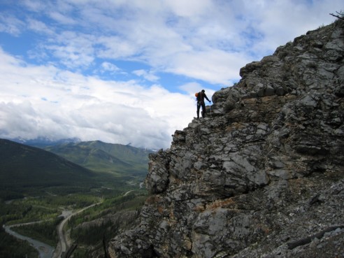
Exploring the interesting south side of Gunnery Mountain
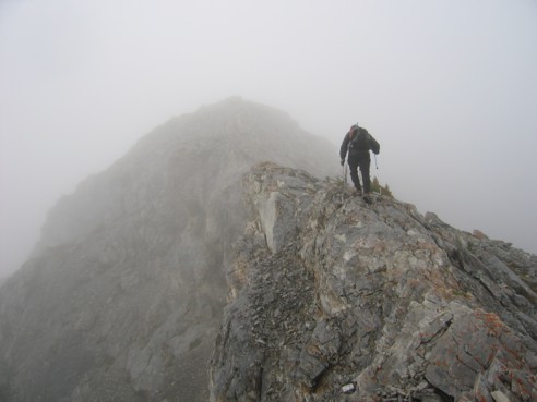
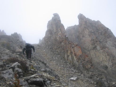
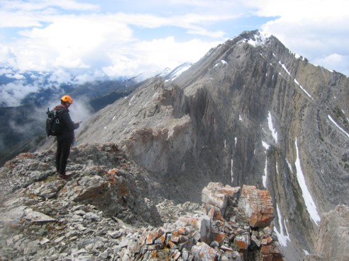
The clouds come in, as we head towards the first highpoint of the southeast ridge of Holy Cross
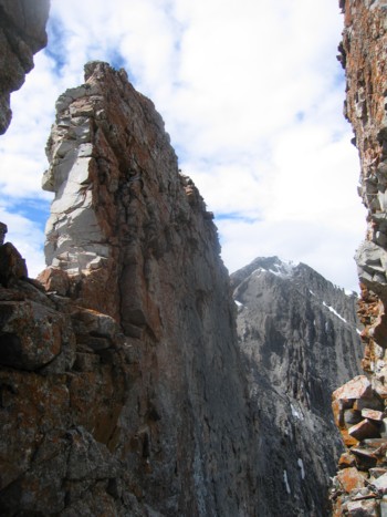
The second rockband; we went around it on the right side - a long and tiring detour
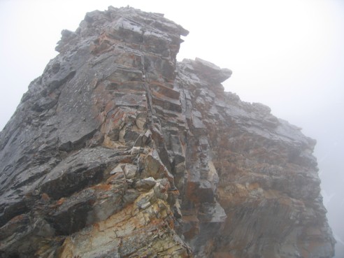
A closer look at the above rockband
We had to scramble up this rockband to regain the ridge; it's actually much easy than it appears here
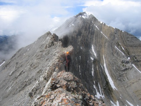
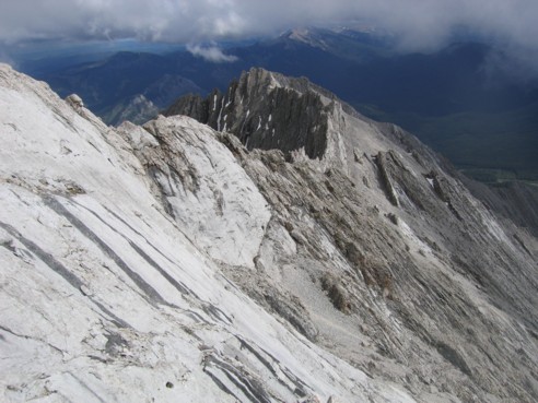
Back on the ridge, looking towards the true summit of Holy Cross - still a long way to go.
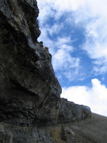
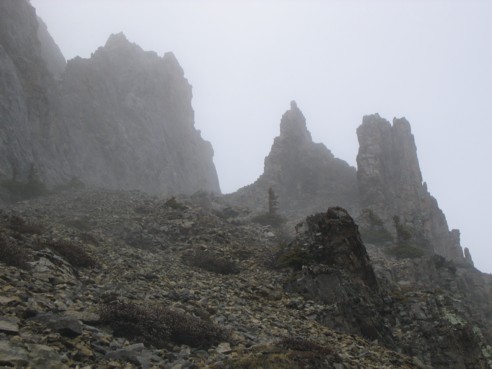
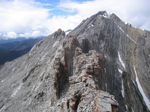
One of the more impressive cliffbands
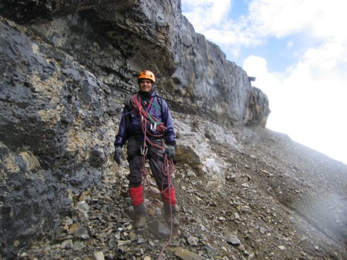
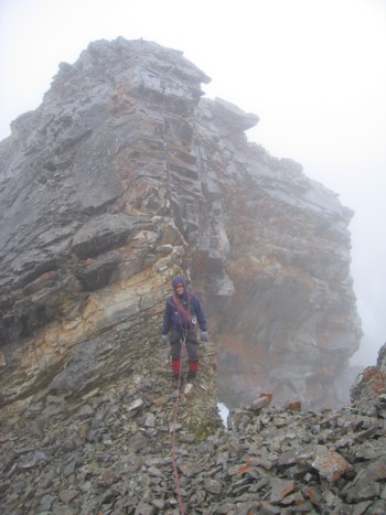
Mark below the cliffband
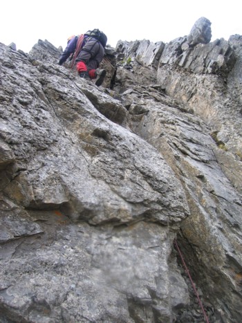
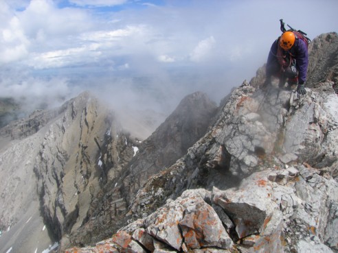
Mark scrambles up steep terrain, en route to the ridge
Great rock scenery on the south side of Holy Cross
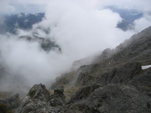
Looking down the mountain, where fog and mist would form and creep up the slopes
More cool rock scenery
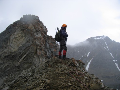
Finally at the south summit, with the true summit and connecting ridge ahead
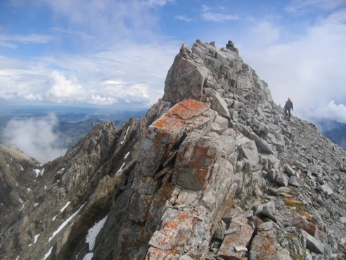
Mark carefully scrambles along the exposed ridge
More of the great ridge
The ridge would often end in drop-offs; given the looseness of the rock, we descended to the easier left side of the ridge
Looking at the summit, with more interesting rock formations
More of the ridge
Looking back at the ridge
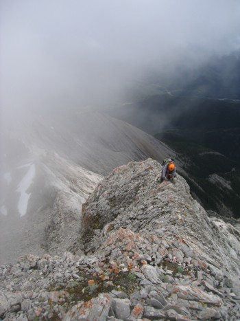
Mark scrambles up the final few metres of the route; heavy clouds approaching from the northeast
Click HERE to see our first attempt