La Coulotte Peak
July 19, 2022
Mountain height: 2420 m
Total elevation gain: approximately 1630 m
Round-trip time: 9:15
Solo scramble.
Still feeling very inspired by Cornelius Rott’s trip into south
Castle in 2020, I hit the road with the intention of attempting Jutland
Mountain via his suggested route. The attempt didn’t last long – in fact I
didn’t even get to the trailhead. Following a night of heavy rain, the approach road was
a muddy mess with huge puddles. I could have biked the extra distance but that still
would have involved riding through the water or around it for up to 15 km – no
thanks!
The alternate plan was La Coulotte Peak from the Castle Mountain Ski
Resort. The ascent route would utilize the GDT (Great Divide Trail) throughout,
so I reasoned it would be easy and straightforward. And in fact, the route was
straightforward – but easy it was not!
Neither
was it short, at 40+ km. However, I hoped a big chunk was bikeable. I
did manage to bike about 13.5 km, but when I finally gave up, I had
reached an unprecedented level of water-logged! Several kilometres of
the GDT
along this route are heavily overgrown with head-high brush. Of course,
that
brush was soaking wet from the heavy rain, and it was happy to share
that
moisture with me. When I stepped off the bike, my pants were plastered
onto the
legs, my arm sleeves were dripping as though I had just got out of a
swimming
pool, and my backpack was soaked through. Fortunately, I had stopped
and put
all my electronic devices in waterproof bags after a few minutes of the
ordeal
and all were functioning.
Actually relieved to be on foot, I proceeded to ford a small but
deep creek (easiest ford ever, since I was already drenched from head to toe) and continue along
the now brush-free trail. Eventually, I reached the Sunkist/La Coulotte Ridge
and took a break to dry out – clear skies and a brisk wind helped immensely. This
was also my first opportunity to check out the surroundings. Unique views of familiar
favourites like King Edward, Starvation, Kenow, Miskwasini, and Scarpe were
cause for a few oohs and aahs.
I mistakenly thought the summit of La Coulotte would yield with ease
from this point and I might even have time to explore farther down the ridge. I
was already at an elevation of 2150 m and La Coulotte rose up to about 2400 m.
However, there are big several ups and downs along the way, and that 250 m
difference actually required about 560 m of elevation gain. I wasn’t ready for
that!
Nevertheless, travel was generally easy, the views all around
continued to impress, and the summit boasted a fine panorama. After refueling
and having a nice chat with a GDT hiker, I started back, already dreading the
approximately 320 m of elevation gain necessary on return. This trip was
turning into Font Mountain all over again and I certainly wasn’t expecting a
total elevation gain almost equivalent to that of 3450 m Mount Temple on lowly
2420 m La Coulotte!
(Excruciatingly) slow and steady won the race for the elevation
gains and quelled any need to whine, weep, sob, and/or ball! Of course, the
downs were a breeze. With dry brush, the return bike ride was also mercifully
easy, though, unless someone goes in there with the mother of all weed-whackers,
I’m not sure I would ever repeat at least the upper part of this trail on bike.
An unexpectedly challenging day, but a great one, nonetheless!
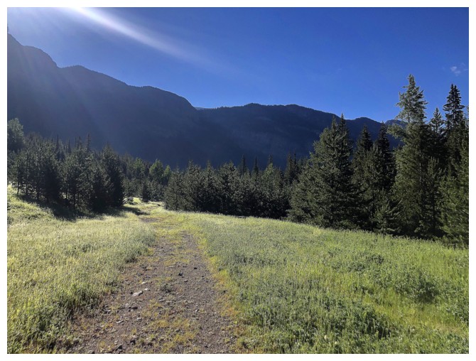
A very brief section of easy bike riding in open terrain along the GDT.
I didn't take my camera out for a very long time after passing this!
Several hours later and finally out in the open again, but I'm still drenched from head to toe
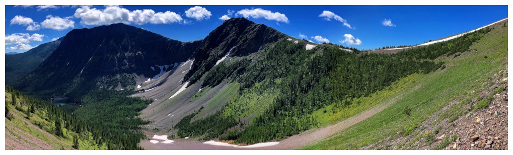
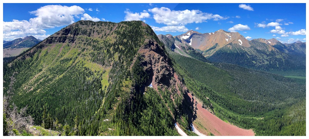
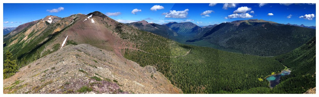
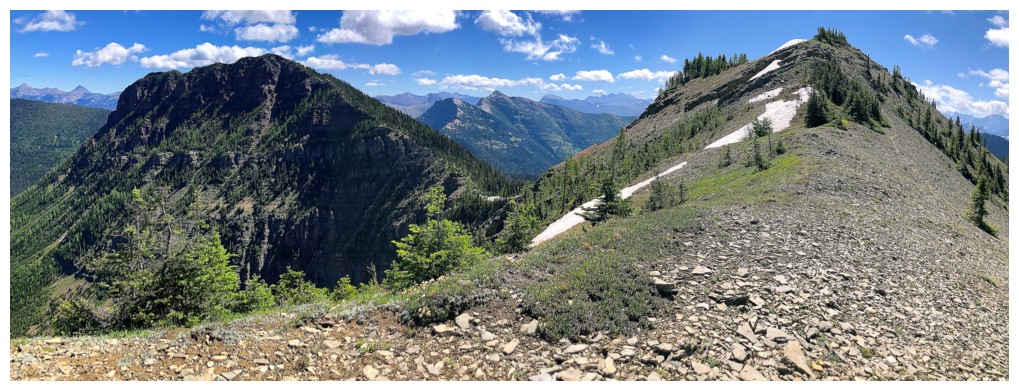
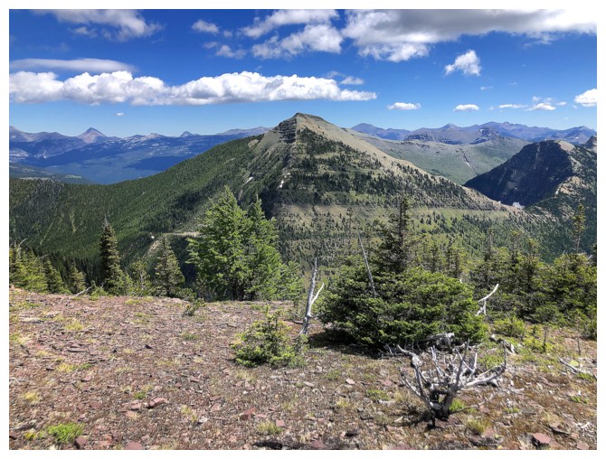
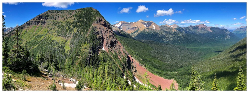
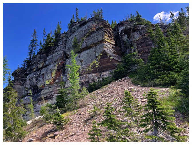
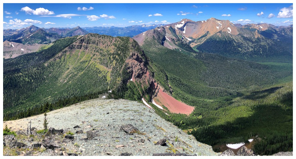
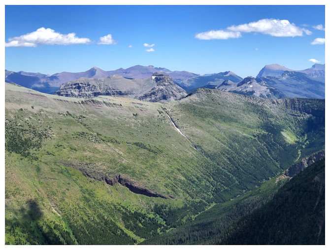
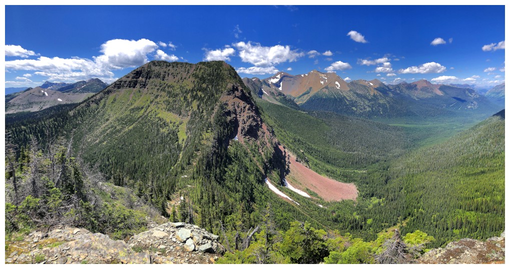
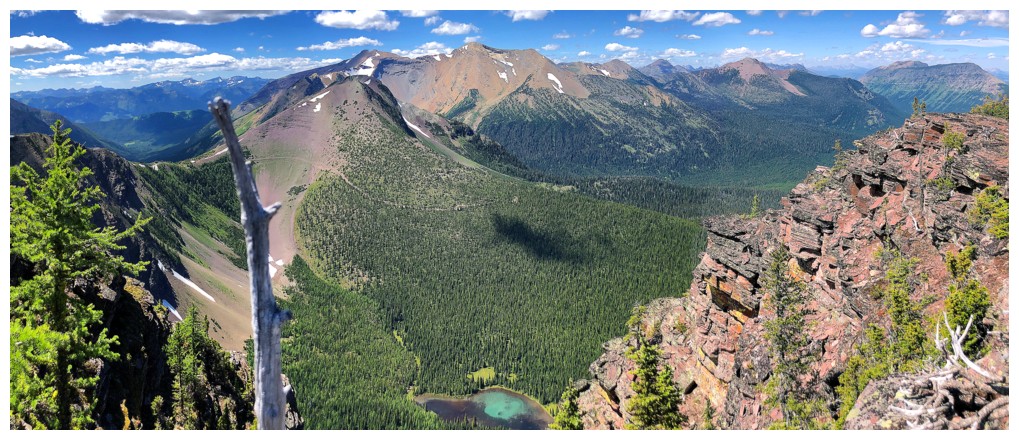
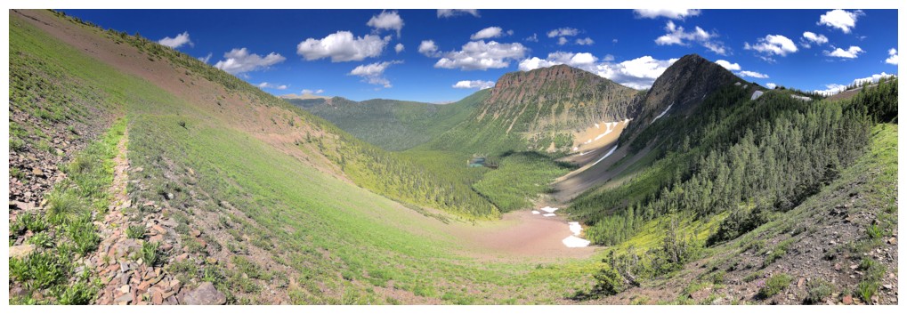
Part of the La Coulotte ridge. The route goes right to left, over both
bumps, then down again and up to the summit (not visible).
On the ridge and taking a long break to dry out
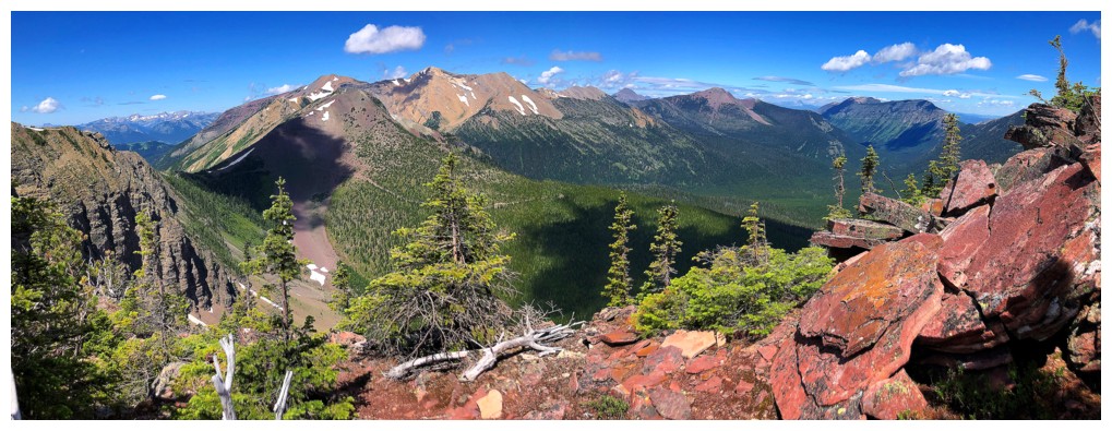
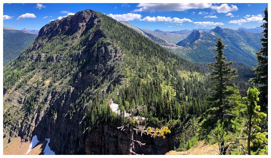
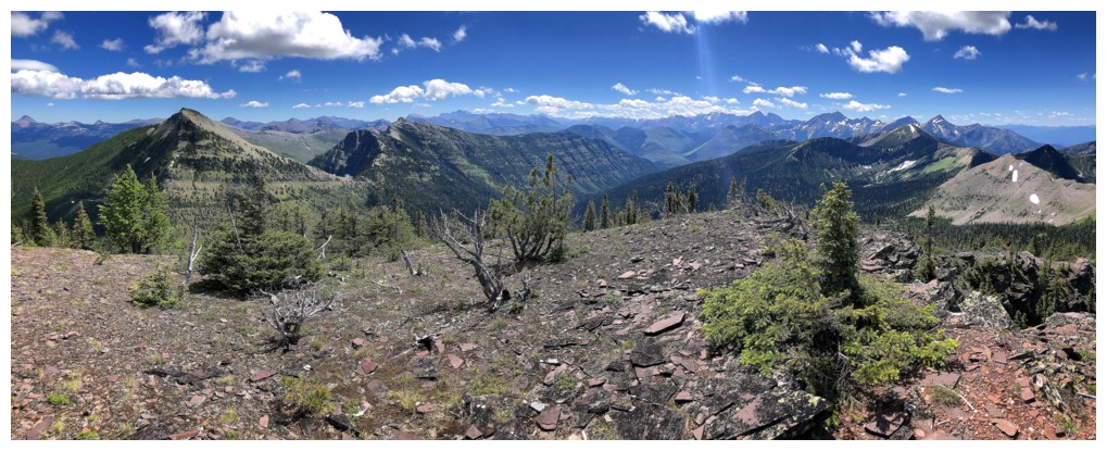
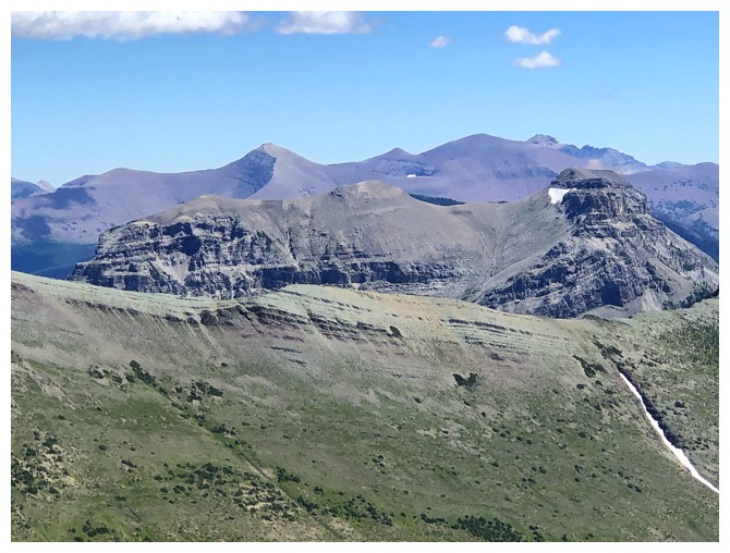
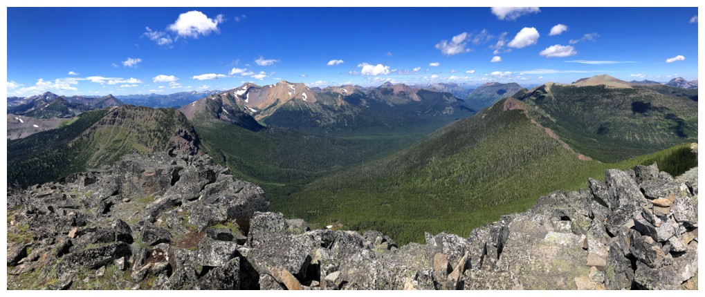
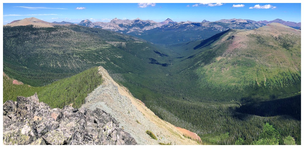
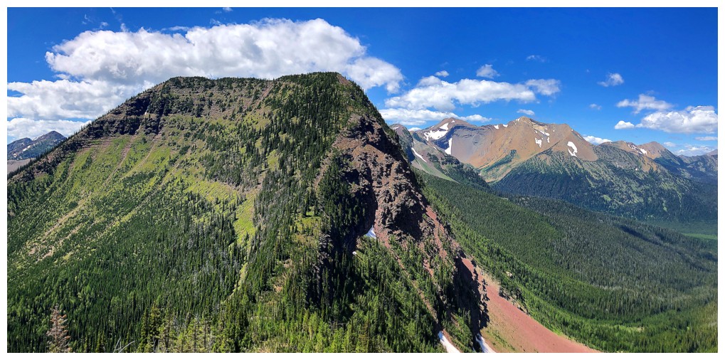
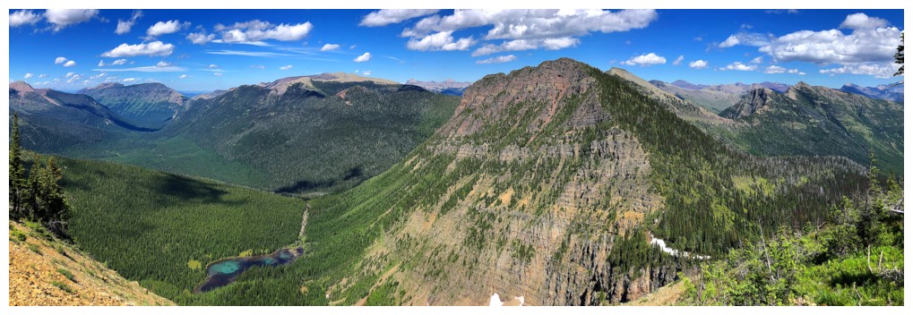
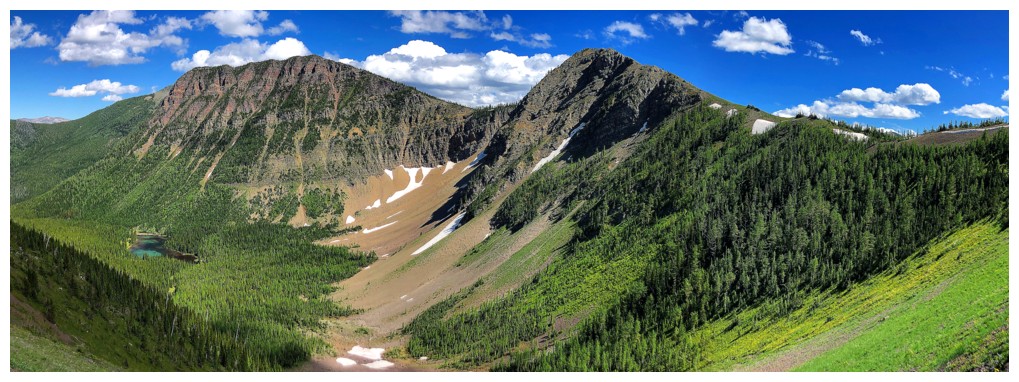
The west ridge (left) goes to Scarpe Mountain and the second highest mountain in The Castle, Jake Smith Peak. The highest is Loaf Mountain.
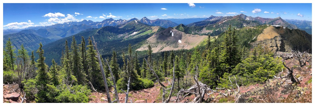
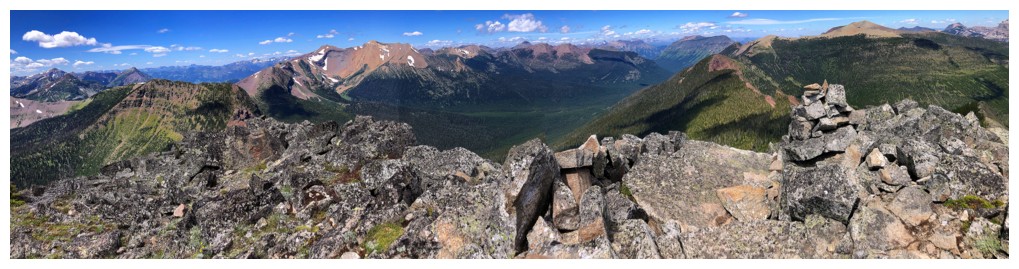
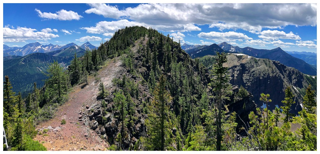
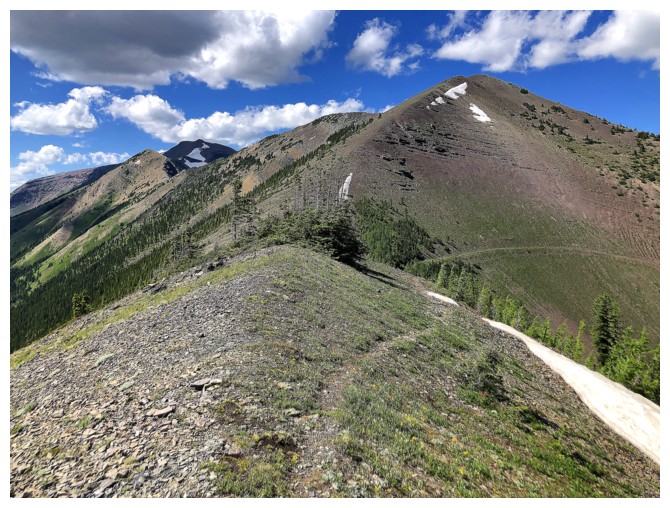
The ridge ahead. Easy ridgewalking, but at stated, several significant ups and downs
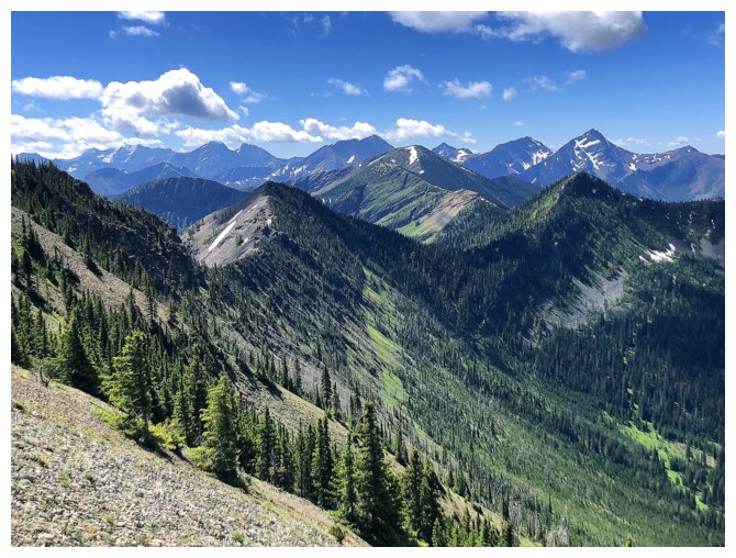
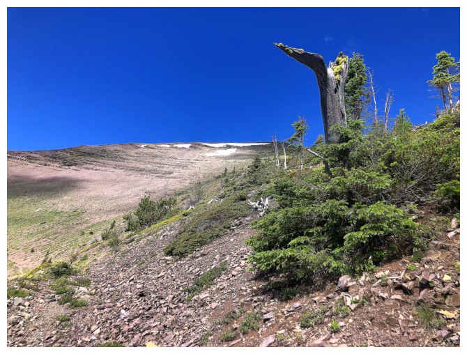
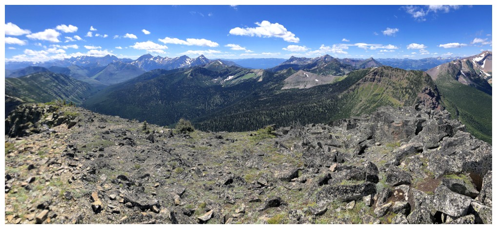
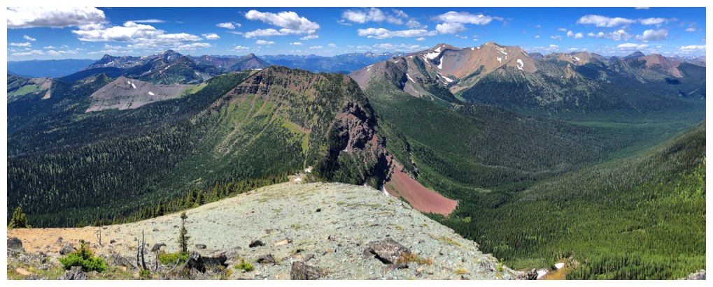
Lots of interesting unnamed peaks to the southwest
Looking west again. The GDT trail is the obvious line going across the slope.
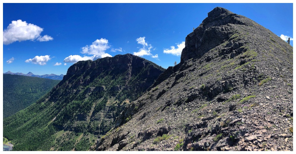
Nearing the first highpoint, with the second to the left
The second highpoint
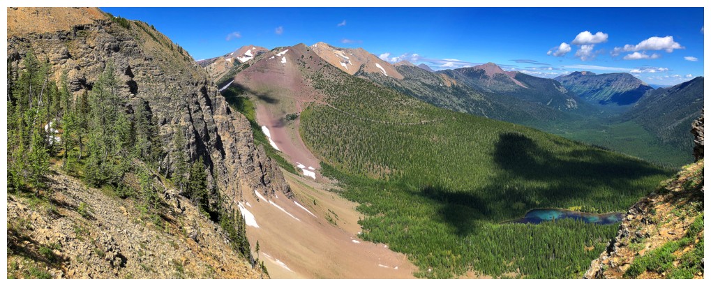
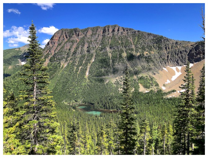
The tarn at the lower right was a source of interest now and then
Brief stop to enjoy the view to the southwest and west
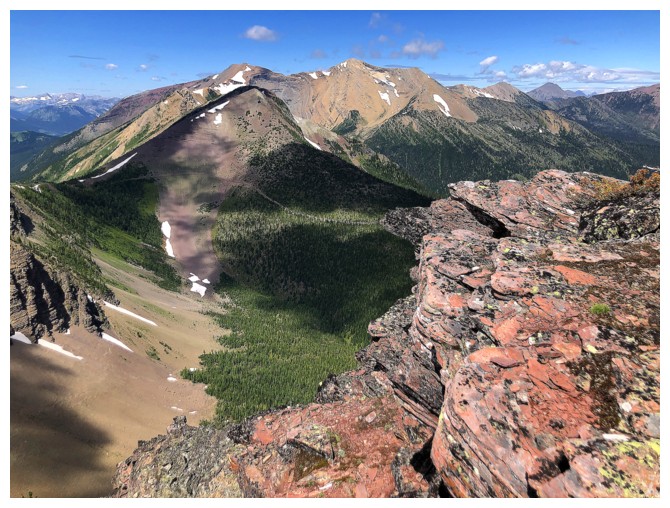
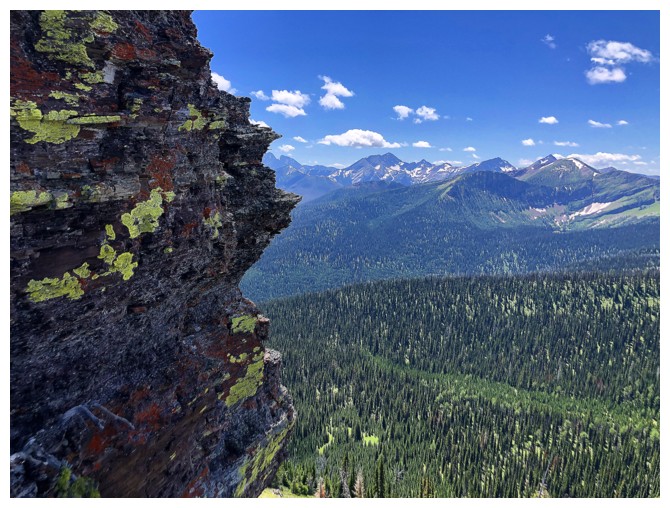
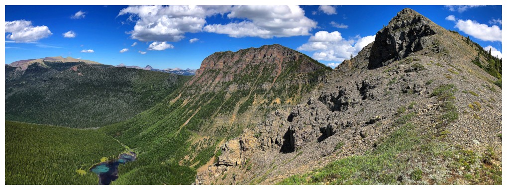
The second highpoint is has some excellent red argillite
And it's really steep on the north side
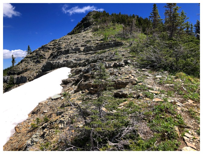
Almost there
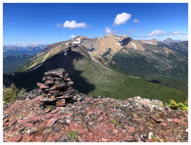
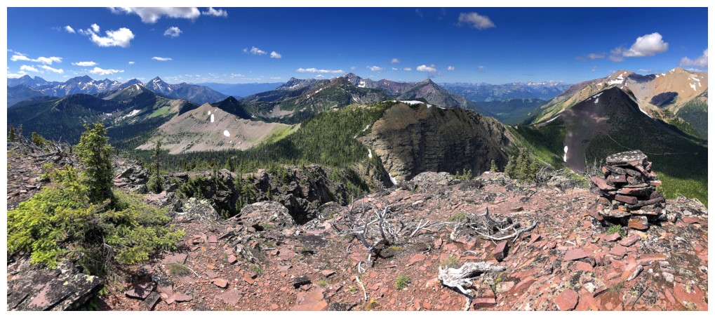
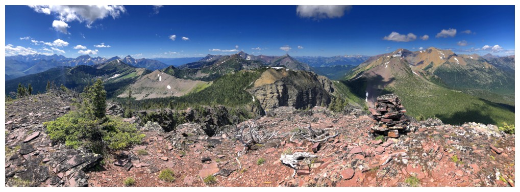
Big cairn on the second highpoint
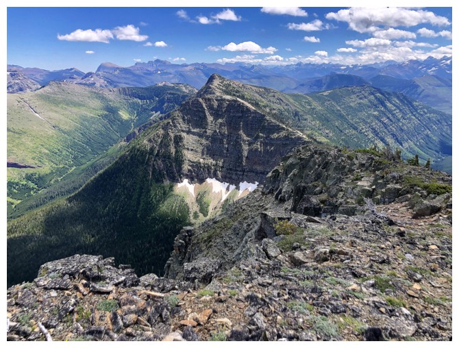
The true summit to the east
View to the northeast
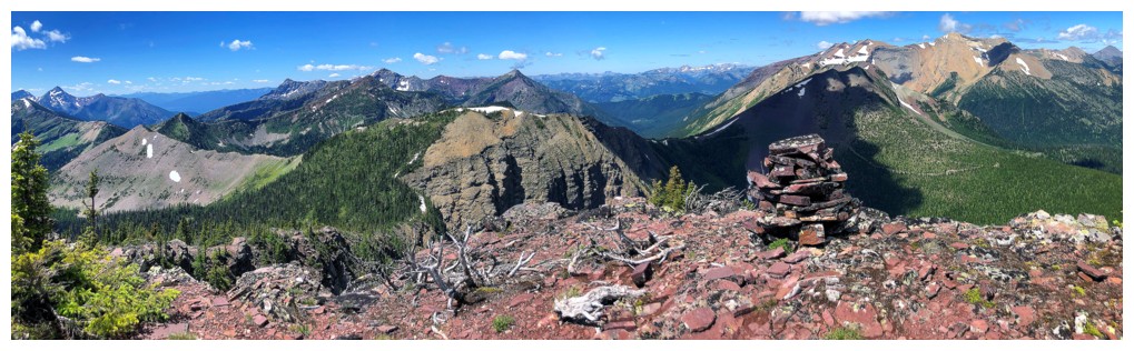
View to the west
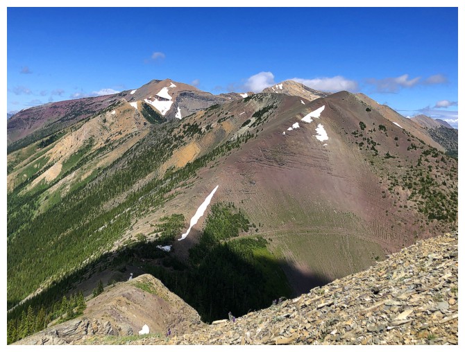
Northeast again. The continuation of La Coulotte Ridge looks very cool, but again, lots of ups and downs.
Still basking in the views from the highpoint because the next section
involves a big elevation loss and I'm in procrastination mode!
Heading to the col between the second highpoint and the true summit
At the col
Looking back to the second highpoint
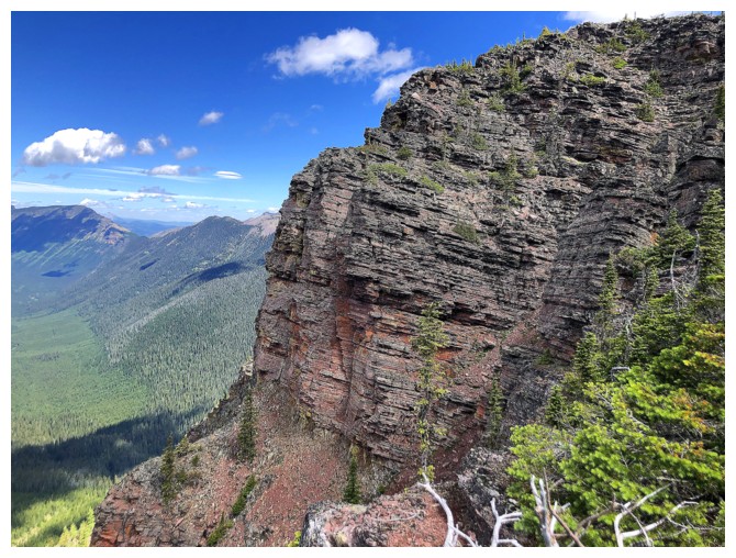
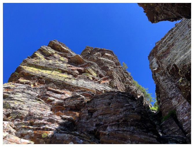
The easy ascent is interrupted by a significant rock band that appears
to barre the way, but there is a nice scramble route right up the
narrow gully in the middle
View from the gully
Back to easy terrain
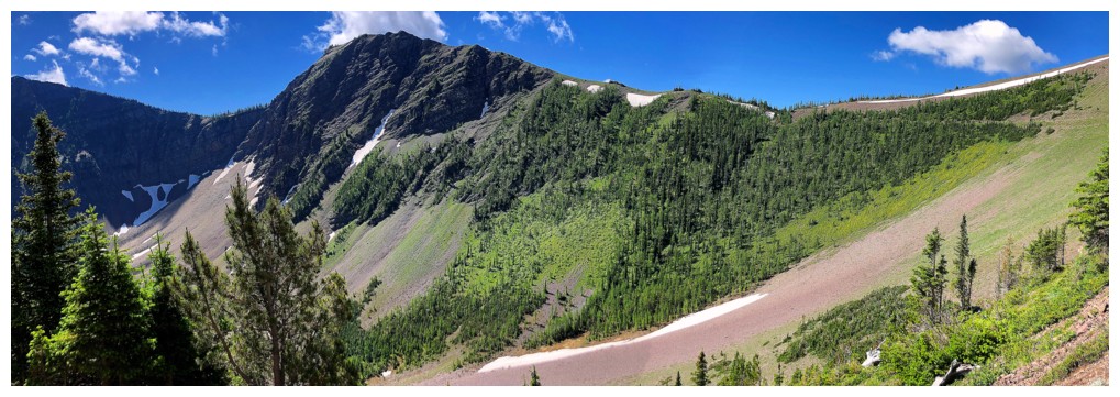
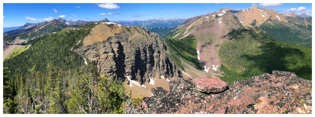
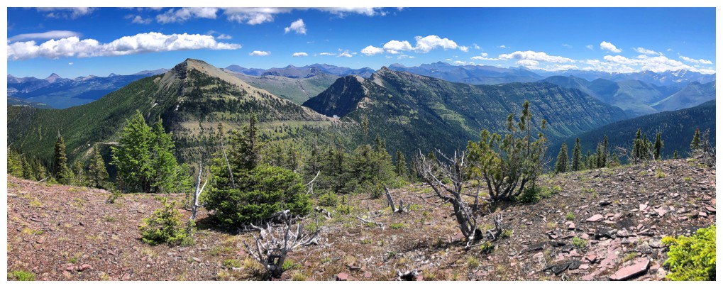
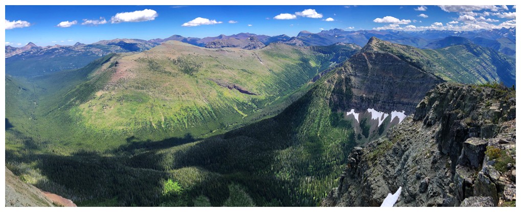
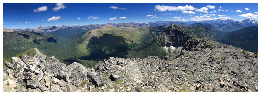
Part of Windsor Ridge, with Castle Peak at the far left and Windsor Mountain at the far right
Looking back to the second highpoint
Summit
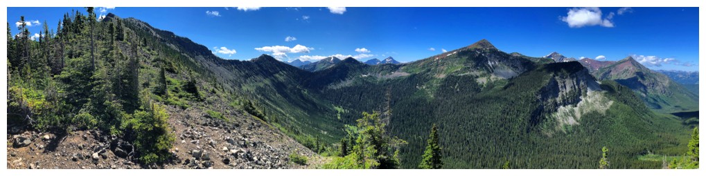
The next section of the ridge to the southeast. I was so tired at
the this point that the temptation to continue was nonexistent.
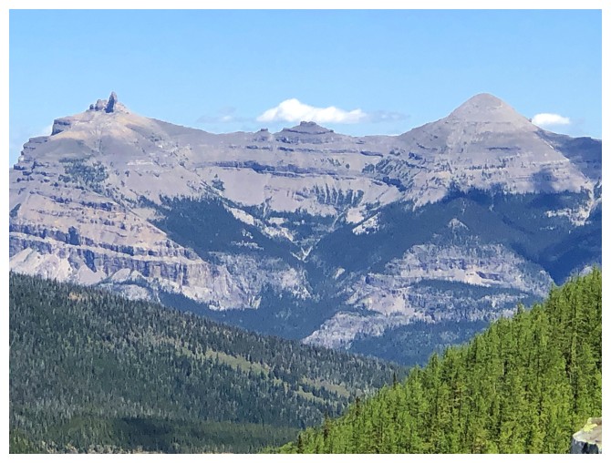
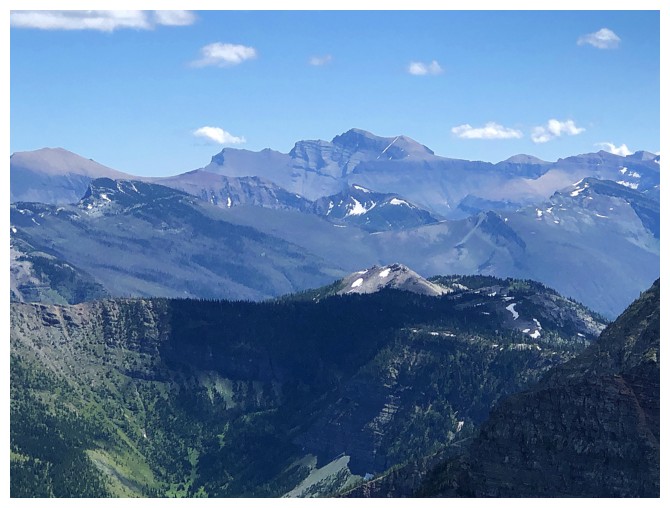
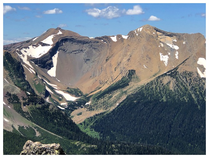
The original objective to the left - Jutland Mountain
Beyond the long south ridge of Jutland lie Mount Matkin (just left of
centre) and Font Mountain (just right of centre). The bigger peaks in
the background are all in Waterton.
Closer look at Matkin. It looks to be a very cool ascent.
Font Mountain looks so small compared to Anderson Peak (far right).
That's because it is, rising only 2353m above sea level, compared to
Anderson's 2698 m.
Mount Blakiston in the distance
View to the northwest
View to the west
View to the east
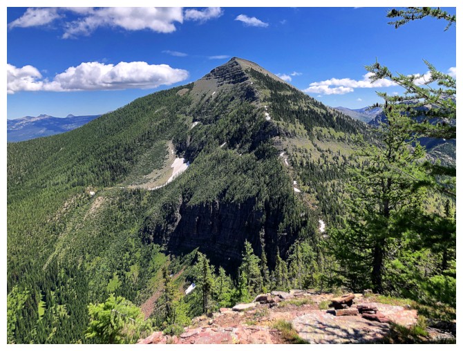
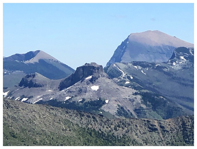
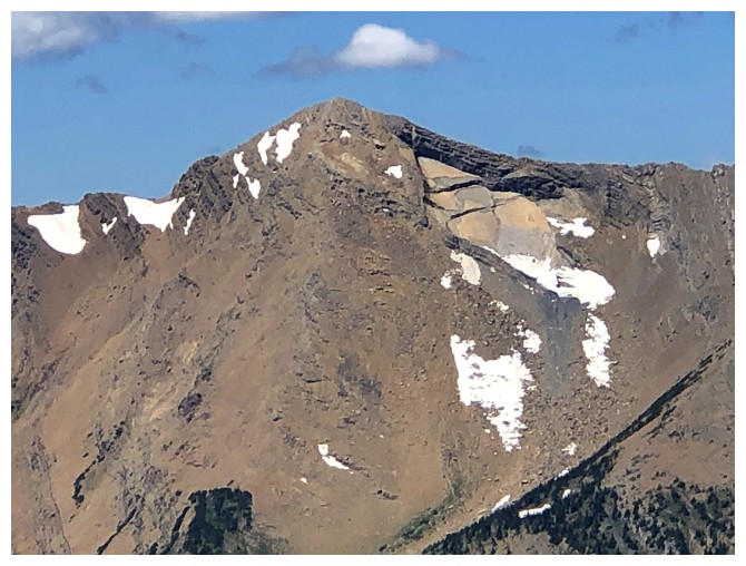
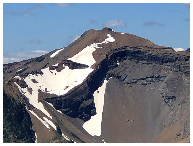
Scarpe (left) and Jake Smith Peak
The massive chunks of rock missing from the southeast side of Jake Smith are always a source of interest. Mount Ishbel in Banff has a similar feature.
Closer look at Scarpe Mountain
Last view before embarking on the descent that has a lot of ascent!
Heading down
The big swath of red argillite on the north side of second highpoint helped to keep my mind off the big elevation gain ahead
Descending the narrow gully
Scarpe and Jake Smith at the right were also a great distraction
Almost back up to the second highpoint
The tarn is small but colourful from this angle
Finally done all the necessary elevation gains, and enjoying the view before the long but easy descent
Descending
The pronounced GDT is a sight for sore eyes at this point of the day
One more peek at the tarn
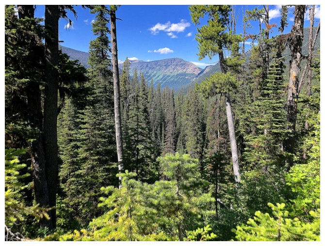
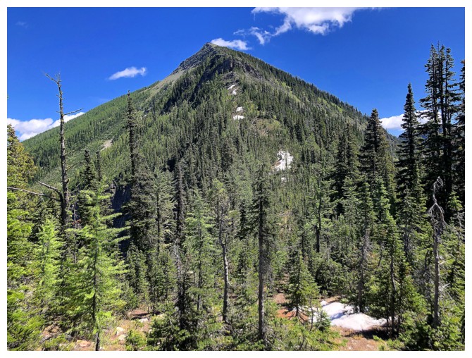
Last view before entering the generally viewless forest
The End
LOG