Minnow Peak
August 25, 2022
Mountain height: 2920 m
Elevation gain: 1600 m
Ascent time: 5:40
Descent time: 4:30
Solo scramble.
This trip had been on my to-do list ever
since seeing Vern’s excellent trip report from 2019. It was not, however, the
original objective for the day. My intention was to attempt Michael Peak using
the Class 3 route described in David Jones’ Rockies West. Michael Peak is
merely a minor outlier on the southeast side of popular mountaineering
objectives The President and The Vice President and hardly seems worthy of
ascent. However, a recent trip by mountaineering extraordinaire Devan Peterson
ignited my interest. 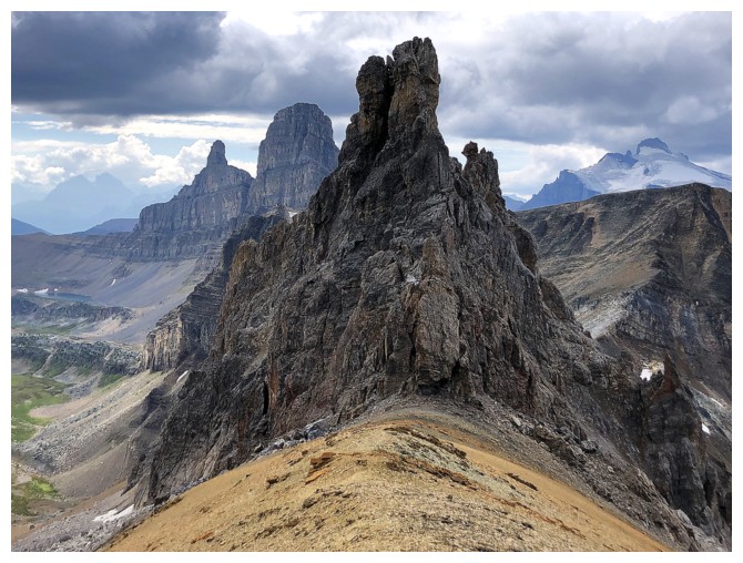 Devan had completed yet another Herculean trip, ascending
The President, The Vice President, Angle Peak, and Michael Peak in a single
push. Given he had enjoyed the summit view from Michael Peak more than the others
(all significantly superior in height) I thought I’d take a look.
Devan had completed yet another Herculean trip, ascending
The President, The Vice President, Angle Peak, and Michael Peak in a single
push. Given he had enjoyed the summit view from Michael Peak more than the others
(all significantly superior in height) I thought I’d take a look.
That was not meant to be. Getting a
glimpse of the snowy southwest side of Michael from the Trans-Canada, I decided
that an easier objective might be better for the day. 30 minutes later I was in
the Mosquito Creek parking lot. With four potential trips starting here {Ramp
Peak, Quartzite Peak, “OX Peak” (the lower outlier of OXO Peak), and Minnow
Peak}, I would have the option to choose one en route.
The skies were both cloud and generally
haze free, as I hiked past the turn-offs to OX, then Quartzite, then Ramp. Apparently,
my mind was made up and Minnow it would be. The weather was forecast to break
down around 3 pm, but I was confident I would be on my way down at that time.
Why it took me so long to return to the
valley below Molarstone Mountain is a complete mystery! This is one of the most
beautiful valleys I’ve ever visited, and the return was every bit as
enthralling as the initial visit, highlighted by the shallow tarn that
sometimes provides stunning reflections of Noseeum Peak, Mosquito Mountain and
many others. My sense of urgency to beat the incoming cloud cover took a real
hit here. However, not staying to enjoy the tarn and surroundings was simply not an
option!
Nevertheless, even with the extended
stay at the tarn, I was able to make to make it to North Molar Pass in about 3
hours, where the objective immediately moved into full view. An easy and scenic
descent down the other side of the pass followed. Things became infinitely more
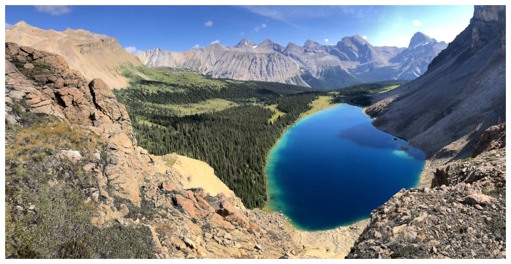
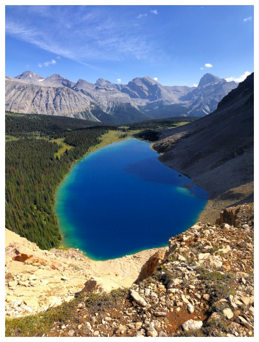
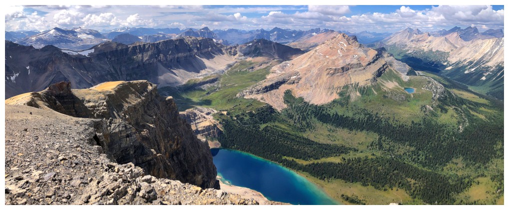
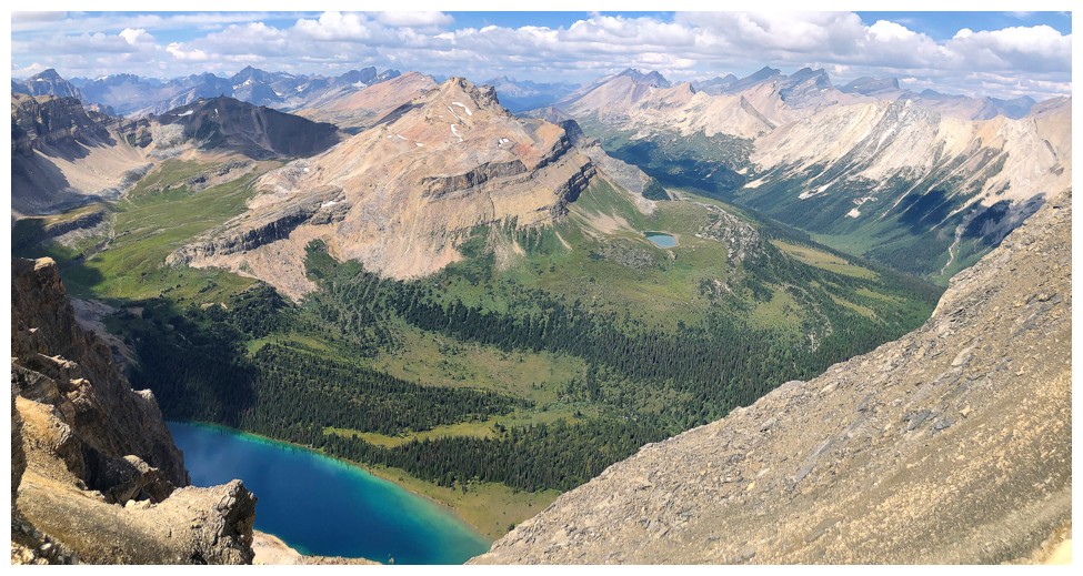
scenic when the largest of the Fish Lakes also popped into view. What a
stunning blue lake, very similar in colour and beauty to Carnarvon Lake in
Kananaskis.
As much as I would have loved to
descend all the way to the shores of this very inviting body of water, time
wouldn’t allow that – another time. Leaving the trail and heading towards the
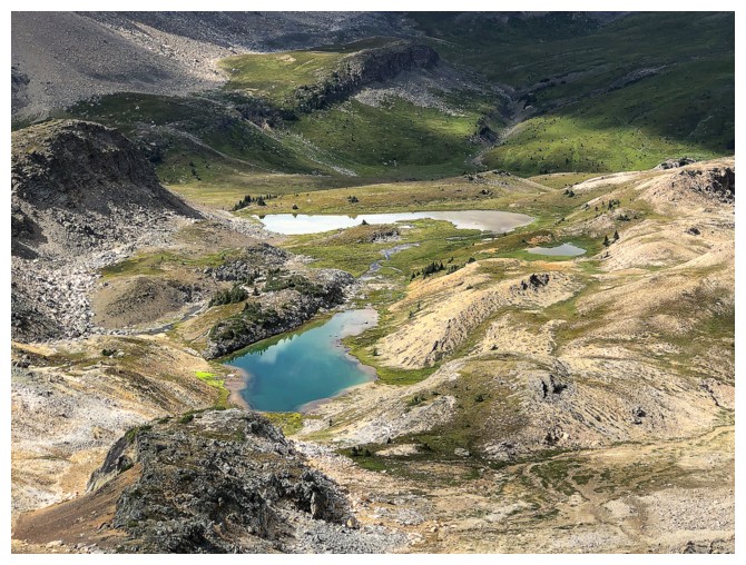
main ascent slopes of Minnow, 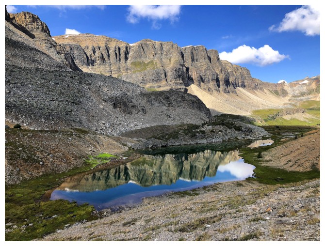 I soon encountered a few small but very scenic
tarns – more than enough to satiate my need for up-close water scenery. At this
point I should have followed Vern’s route that goes directly to the summit.
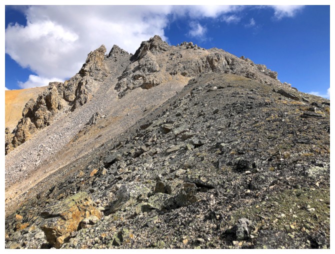
However, the ridge immediately southwest looked very interesting and I
was curious to see if it would allow access to the summit – it did not, and in
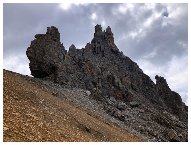
a big way! I reached the ridge to find the route blocked by multiple pinnacles
of towering, near-vertical rock. As impressive as the pinnacles were, losing a
huge amount of elevation to circumvent them was not! And unfortunately, this
coincided with a clear skies turning into somewhat cloudy ones, several hours
ahead of schedule. Nevertheless, I arrived at the summit to a wonderful and
unique view in every direction, clouds and all.
I soon encountered a few small but very scenic
tarns – more than enough to satiate my need for up-close water scenery. At this
point I should have followed Vern’s route that goes directly to the summit.
However, the ridge immediately southwest looked very interesting and I
was curious to see if it would allow access to the summit – it did not, and in
a big way! I reached the ridge to find the route blocked by multiple pinnacles
of towering, near-vertical rock. As impressive as the pinnacles were, losing a
huge amount of elevation to circumvent them was not! And unfortunately, this
coincided with a clear skies turning into somewhat cloudy ones, several hours
ahead of schedule. Nevertheless, I arrived at the summit to a wonderful and
unique view in every direction, clouds and all.
The first part of the descent went
quickly and slogging back up to North Molar Pass not the tribulation I was
expecting - being distracted (and tempted) by several alternate lines up to the
ridge on the west side of the valley helped. I decided to leave those potential
routes for another day when I had more time. The hike from North Molar Pass to
the road felt long but was easy and very scenically rewarding up to
the campground. En route I did manage to scare a couple of bears, way in the
distance, with all my yelling. Upon hearing me they bounded across a meadow and
into the trees at an incredible speed.
An incredibly rewarding day out. I
won’t make the mistake of neglecting the stunning environs of this area again!
O Peak - the lowest outlier of an unofficial outlier (OX Peak) of an unofficial mountain (OXO Peak)
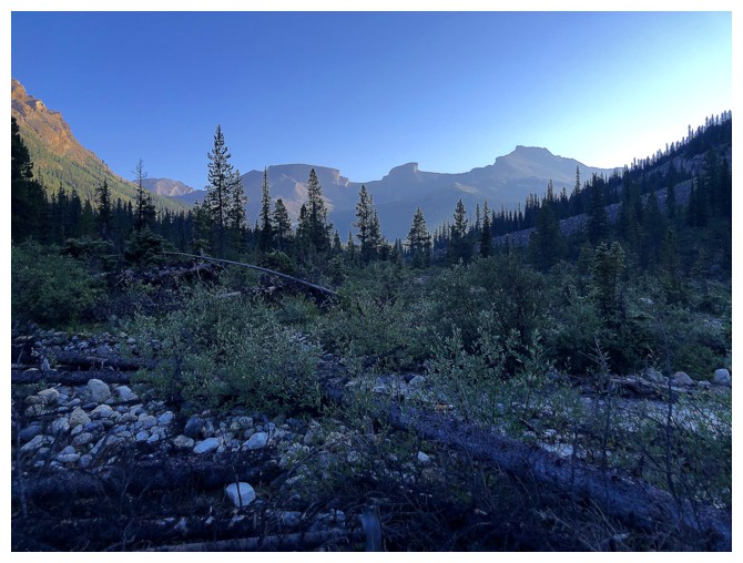
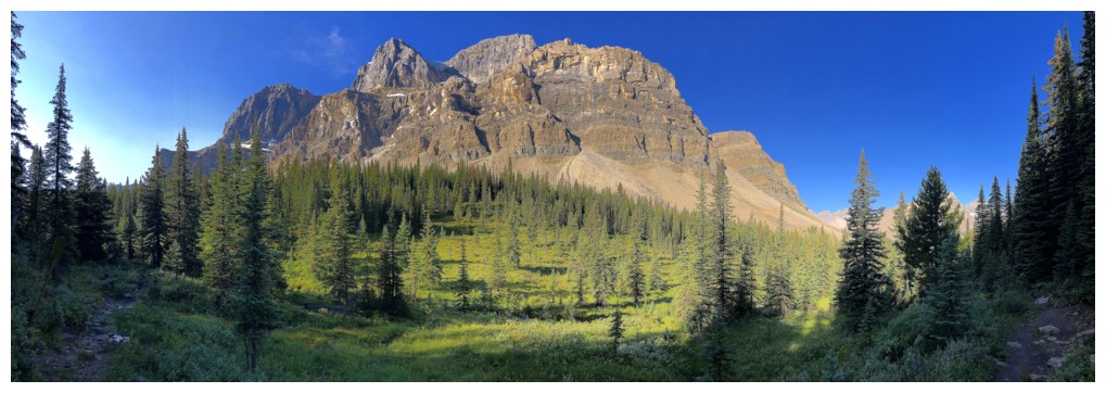
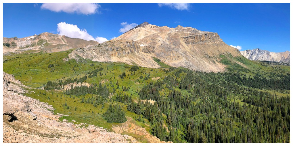
The Quartzite, Ramp, Mosquito trio
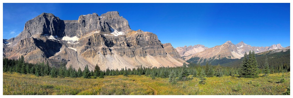
The impressive northeast side of Noseeum Peak
Same as above but farther along the North Molar Pass Trail
Looking back to Dolomite Peak, O, OX, and OXO peaks
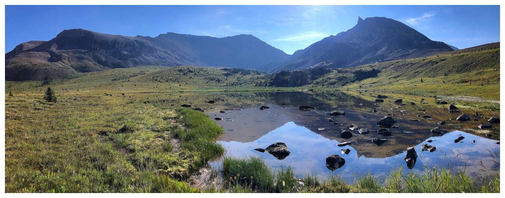
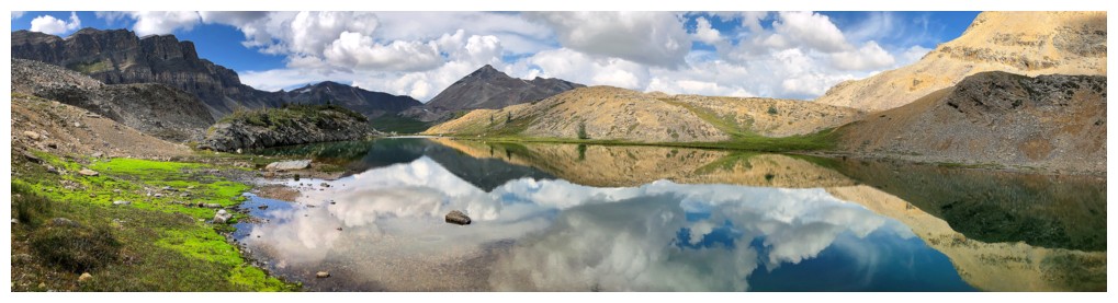
Arriving at the shallow but stunning tarn
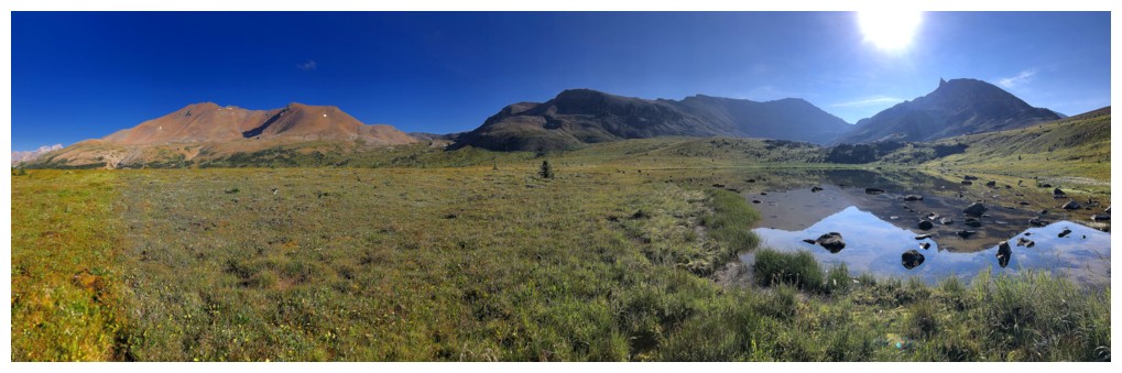
Mosquito, Molarstone, the tarn, and The Fang
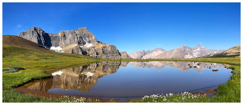
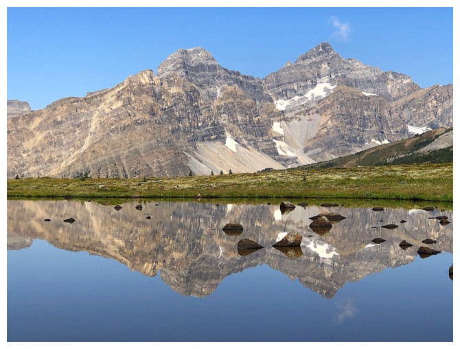
Noseeum reflected in the tarn
Same as above
.....and again! A scene that was very difficult to leave behind
The OXO massif again
Mosquito again
Back on track and heading to North Molar Pass, near the right
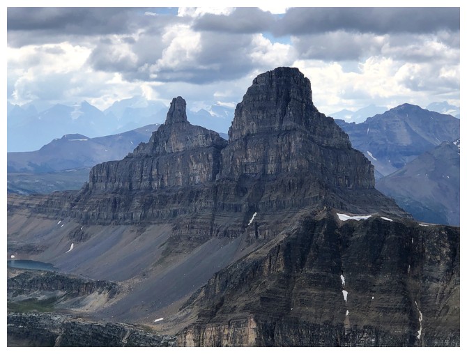
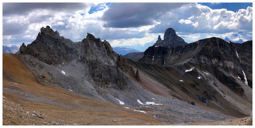
The Fang and Noseeum
Got a little obessed with Noseeum - perhaps because of the minor obsession Mark and I had with the peak in 2008 and 2009
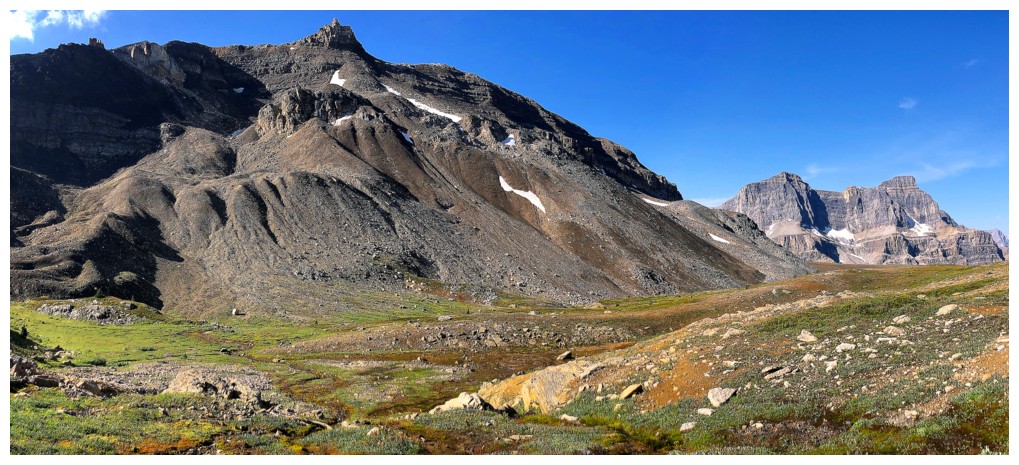
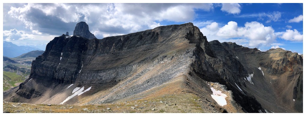
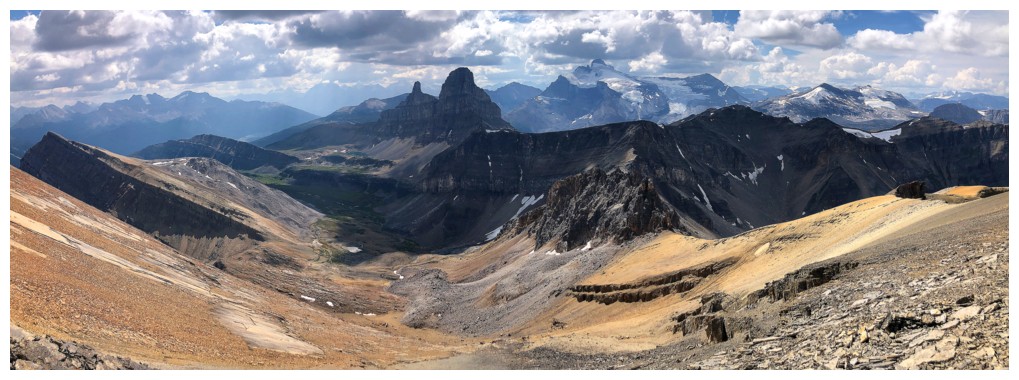
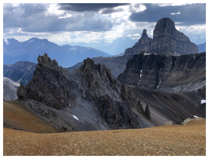
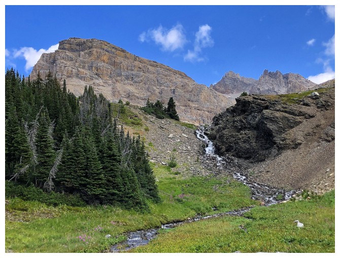
At North Molar Pass, looking up the start of the route to The Fang
The unbelievable colourful rock band on the way to The Fang
Looking back to the pass
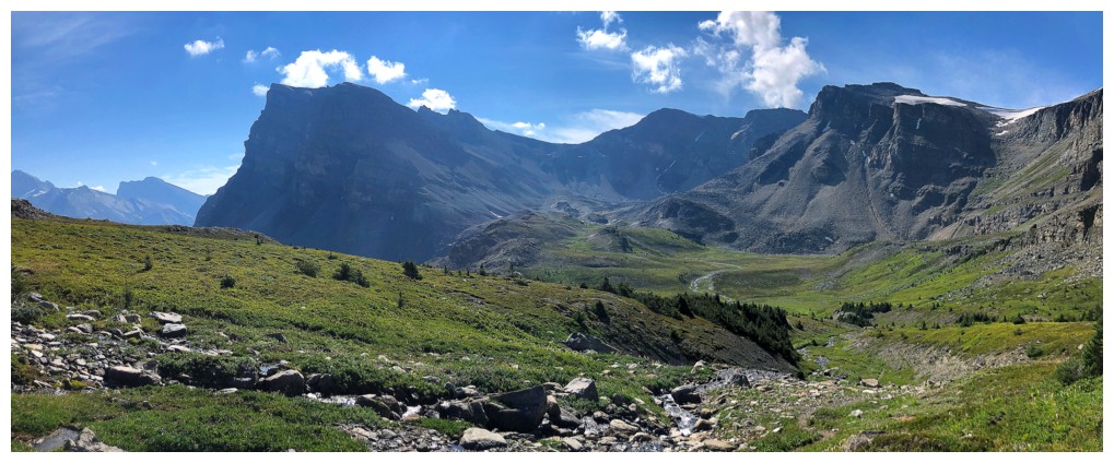
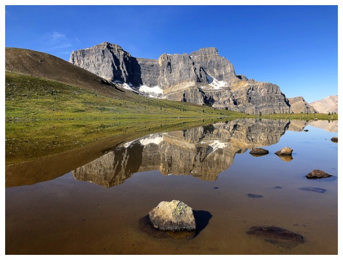
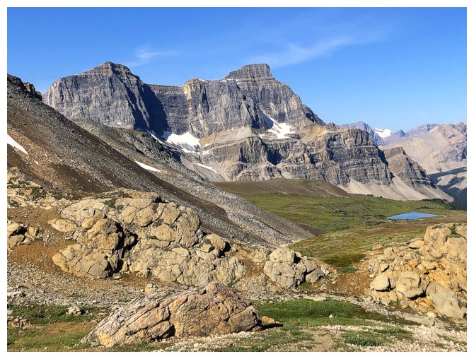
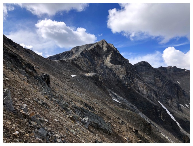
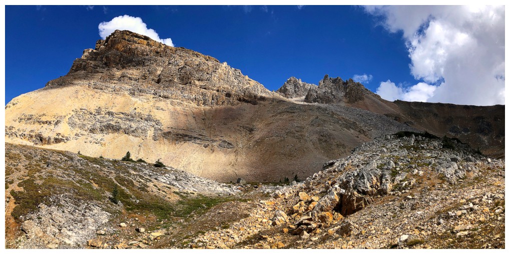
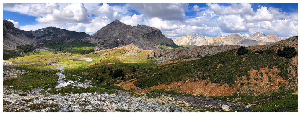
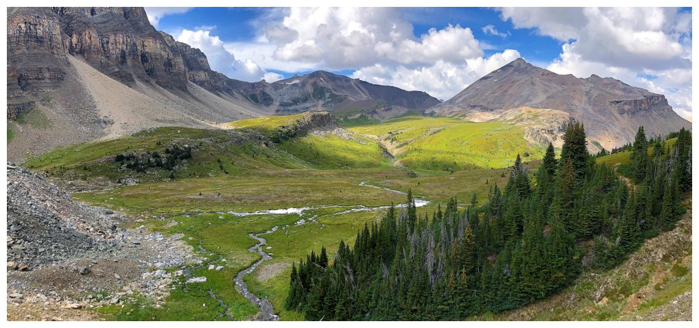
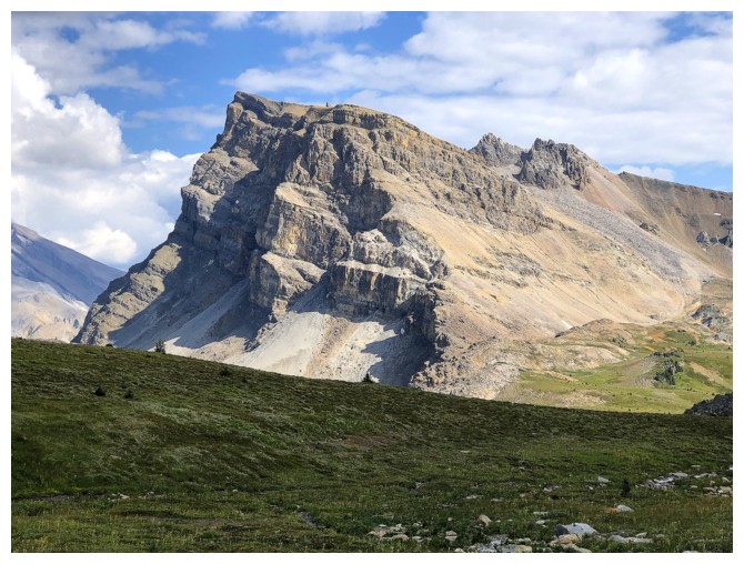
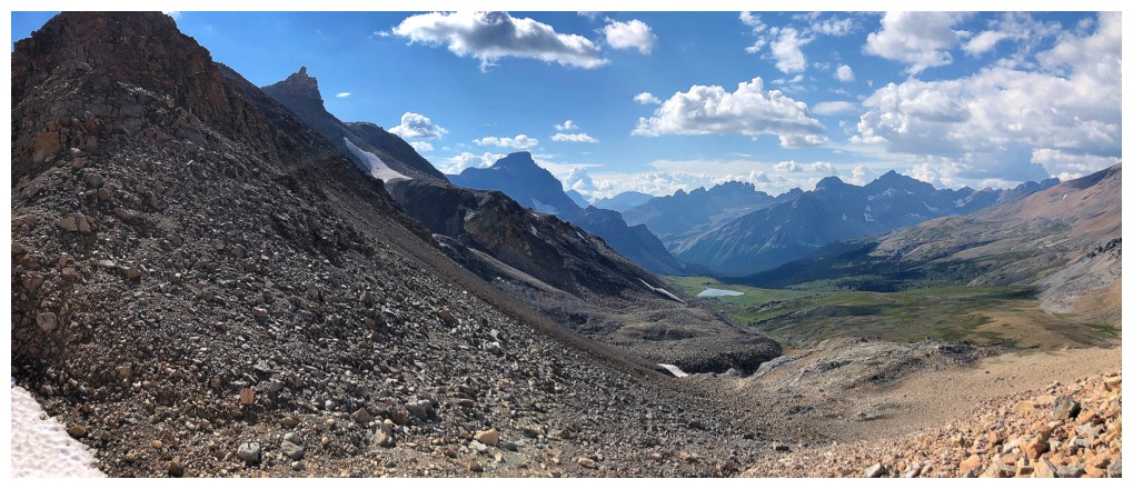
Minnow Peak at the left
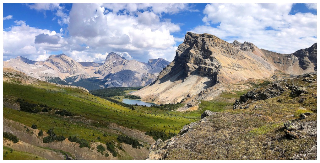
Minnow and the wonderful environs south of North Molar Pass
Very cool ridge to the west that eventually leads south to Molar Mountain
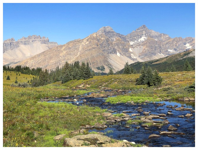
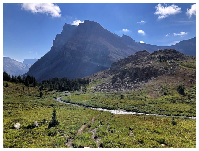
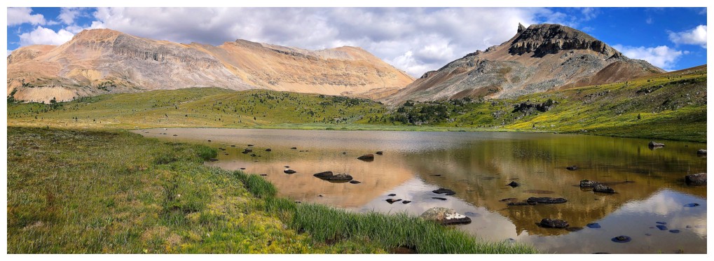
Crossing the stream that feeds the largest of the Fish Lakes
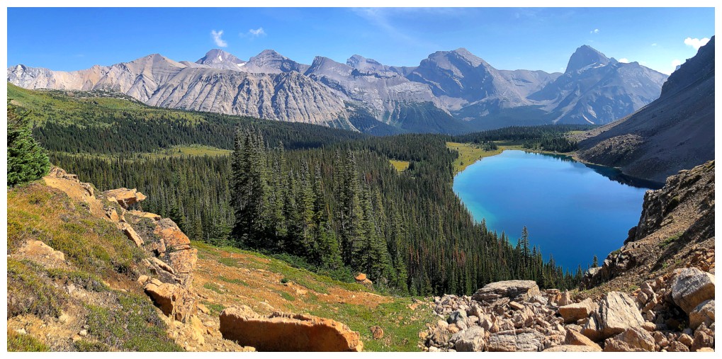
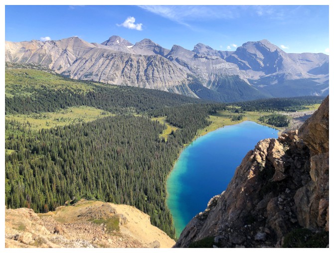
And there is one of the most beautiful lakes I've ever seen in the Canadian Rockies
There is going to be MORE THAN one photo of this beaut!
The blue colour of the lake reminded me of Carnarvon Lake
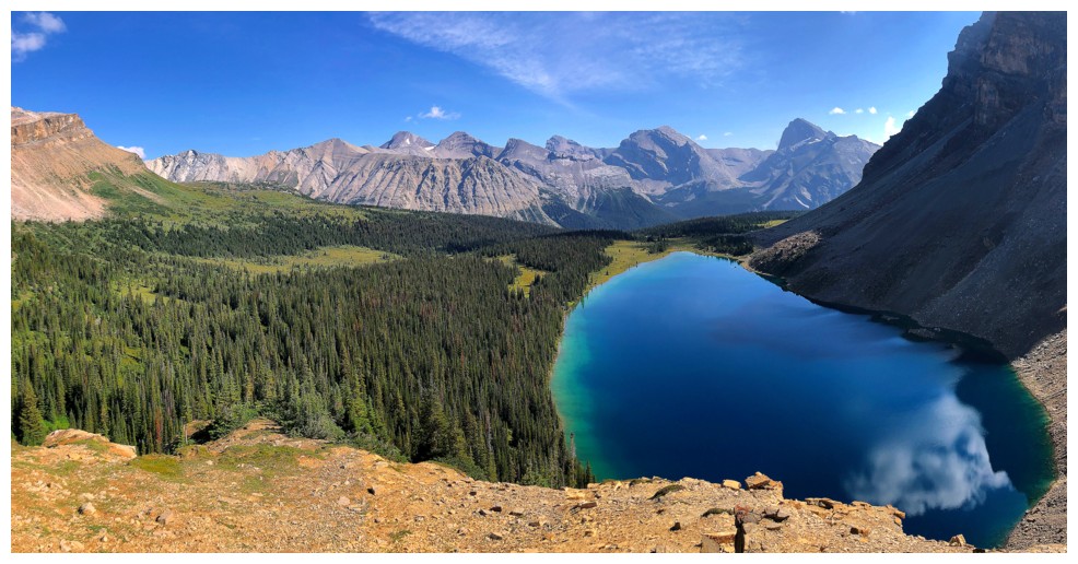
The south end of Molarstone
The lake disappears behind a rock band
But reappeared shortly after....phew!
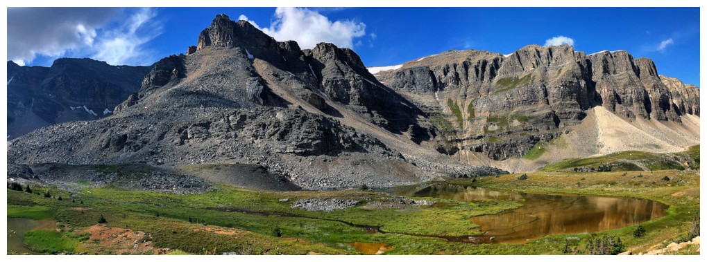
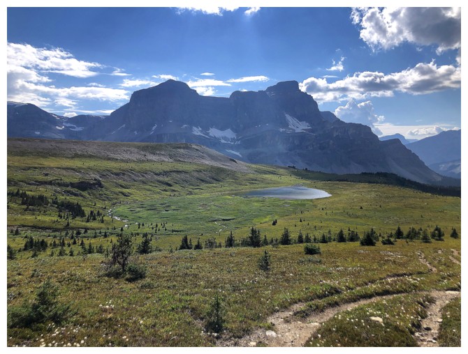
The first of several tarns in the Minnow Peak valley
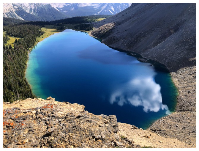
Fish Lake is still giving me chills!
So is the terrain to the west
Last look at Fish Lake for awhile
But the tarns take over
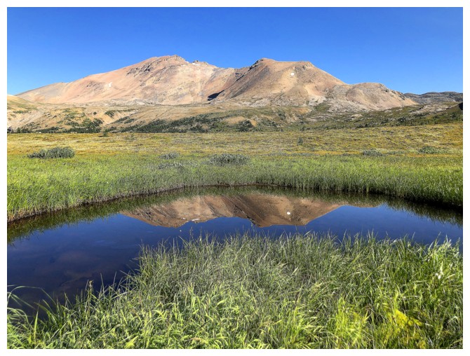
Terrific green hues and reflections in this tarn
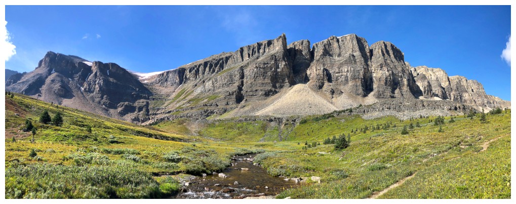
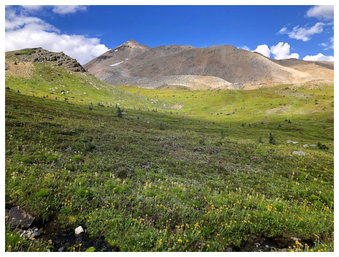
Minnow is dead ahead
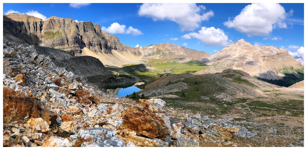
Looking back to the tarns
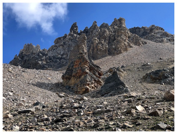
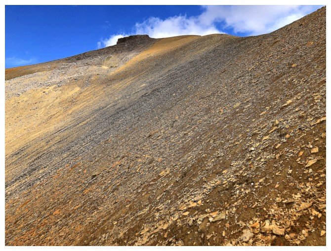
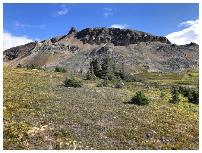
Interesting rock formations near the bottom of the main ascent slope. Here is where I went right instead of left.
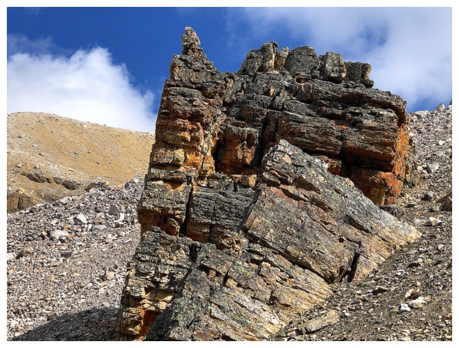
The same formation
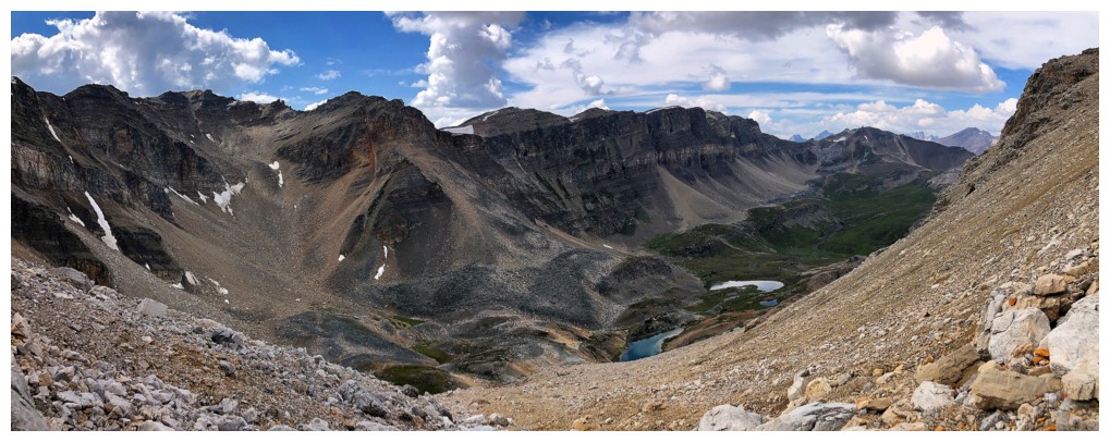
Approaching the ridge southwest of Minnow's summit
Looking to the northeast and cautiously optimistic the route will go
Southwest sits Molar Mountain (left)
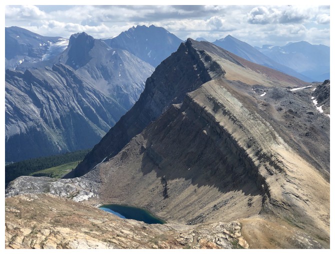
An unnamed peak and tarn south-southeast of Minnow
A little less optimistic
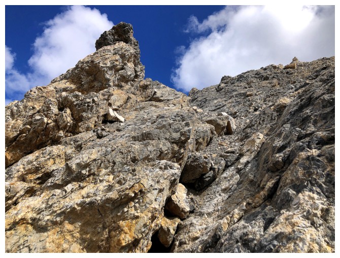
The summit of Minnow near the left. Unfortunately, there was no route on the right side of the ridge. Maybe the left?
...that's a hard no! Here is where my optimism vapourized.
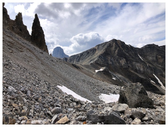
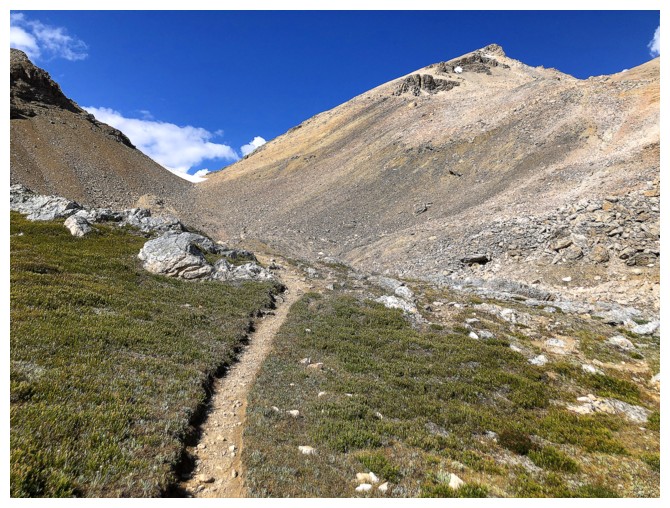
Back to ascent slope I should have been on in the first place. Still, exploring is never a bad thing.
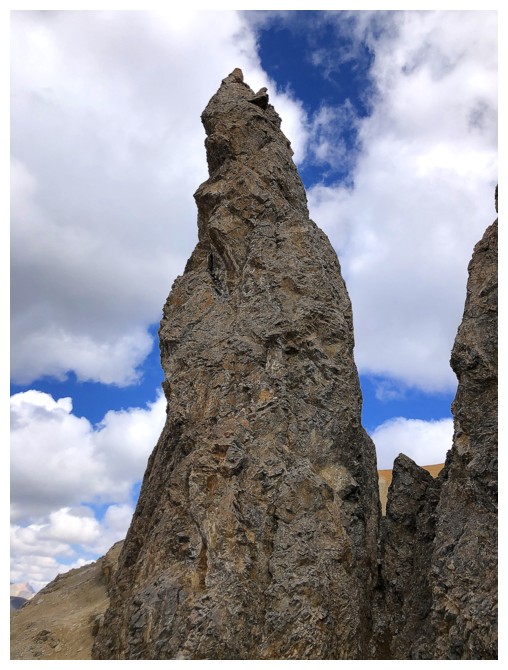
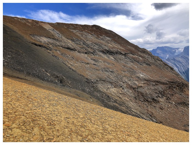
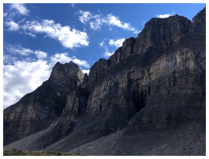
Looking back at the reason the southwest ridge is not a scramble
That's more like it
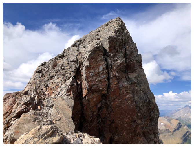
The south end of the summit block
Might be a scramble for Alex Honnold, but not for his cowboy!
View to the west continues to improve, even though the clouds have rolled in
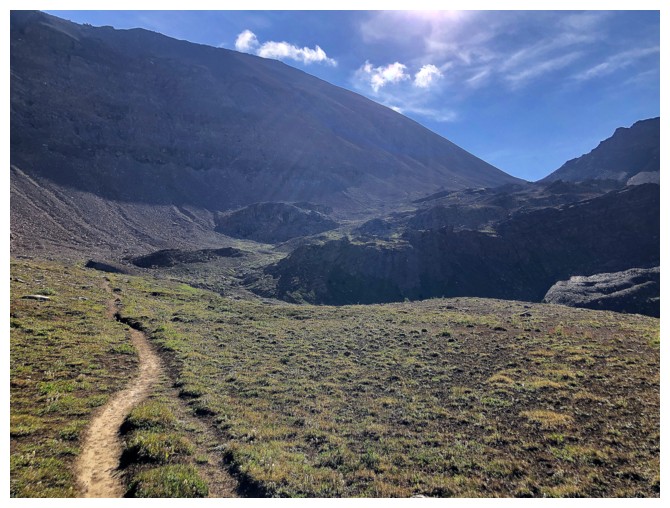
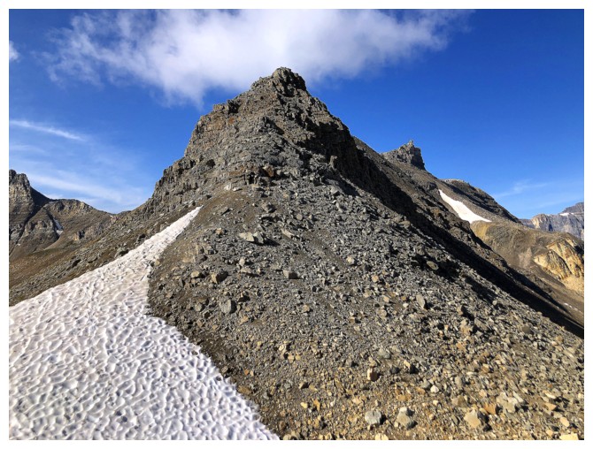
Easy terrain to the summit
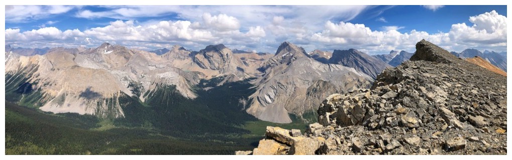
The view to the north is nothing to sneeze at
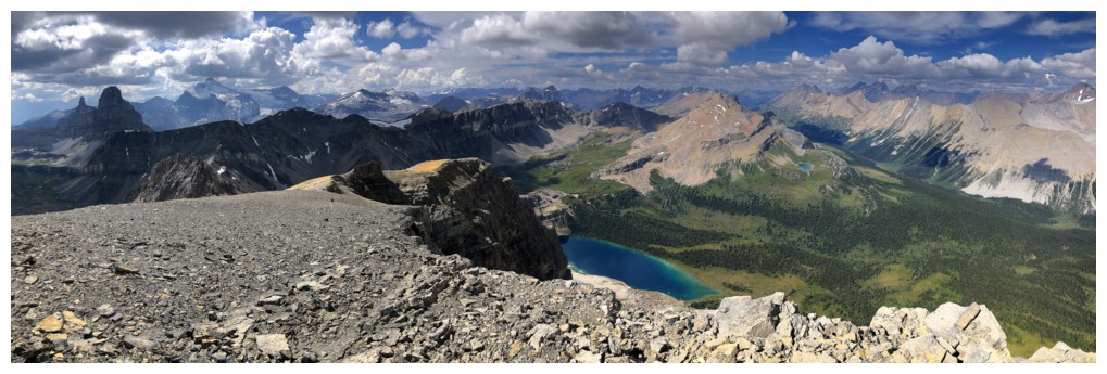
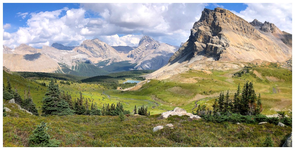
Some of the main Fish Lake is visible again
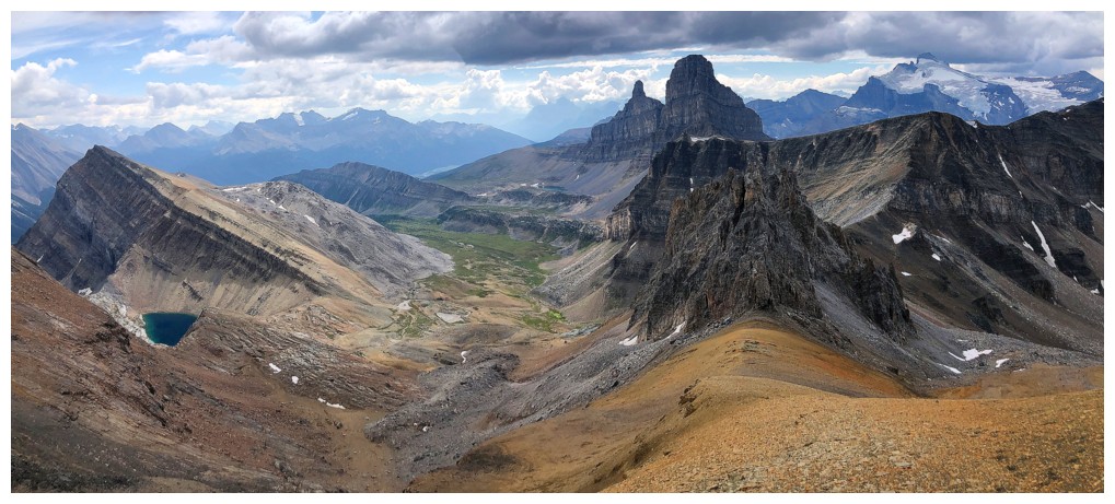
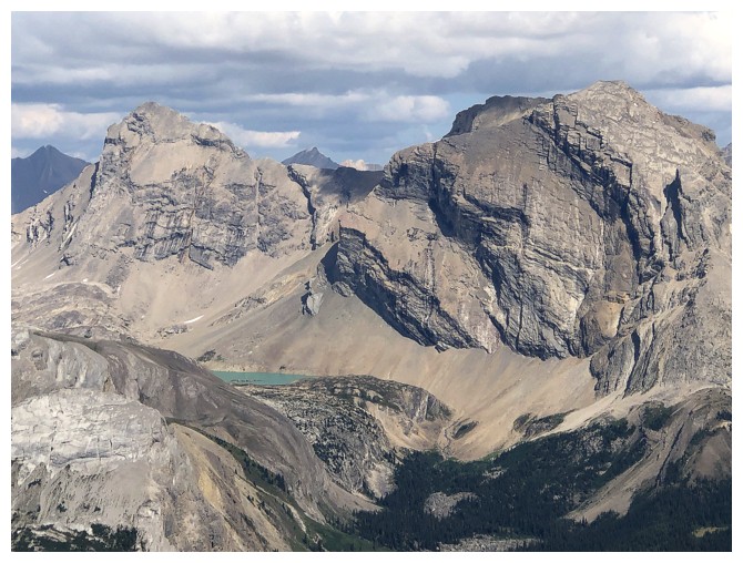
Molar Mountain and Molar Tower are quite striking from the east
So is Mount Hector
All of the above and more
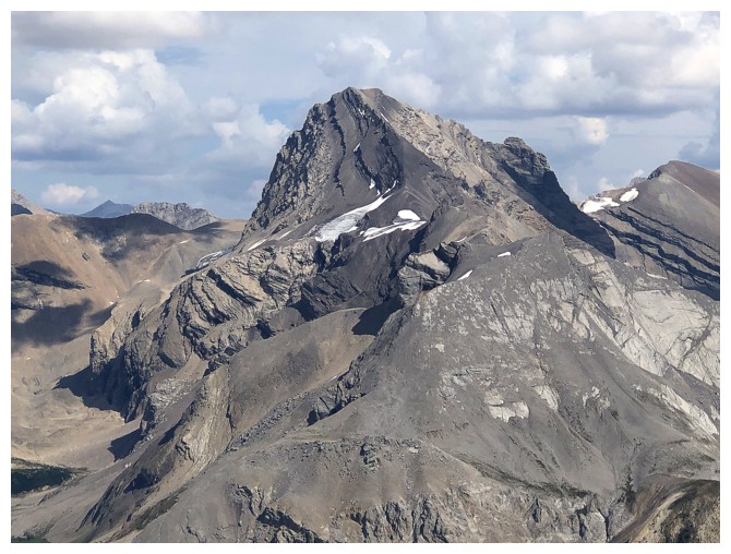
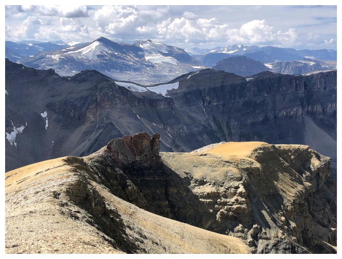
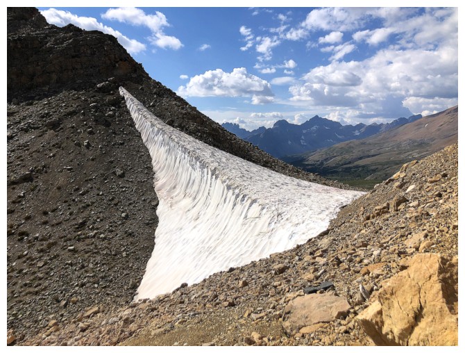
Cataract Peak
Unnamed peaks north of Cataract Peak
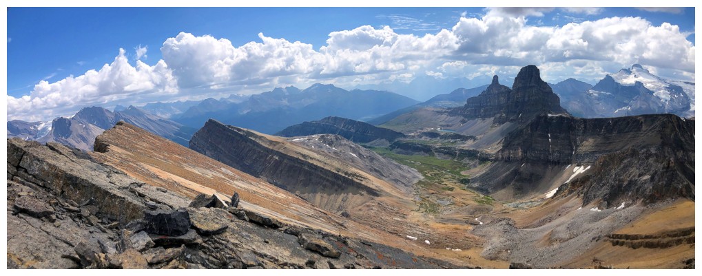
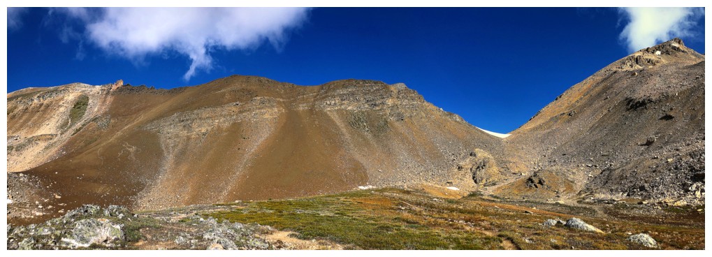
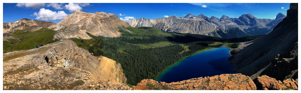
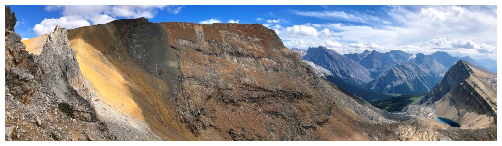
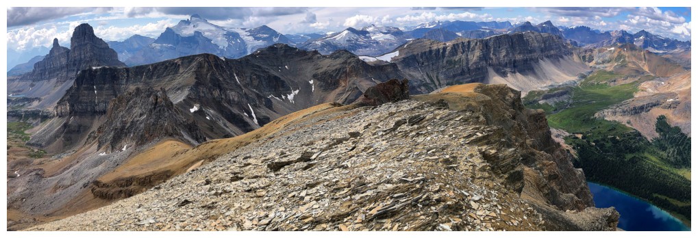
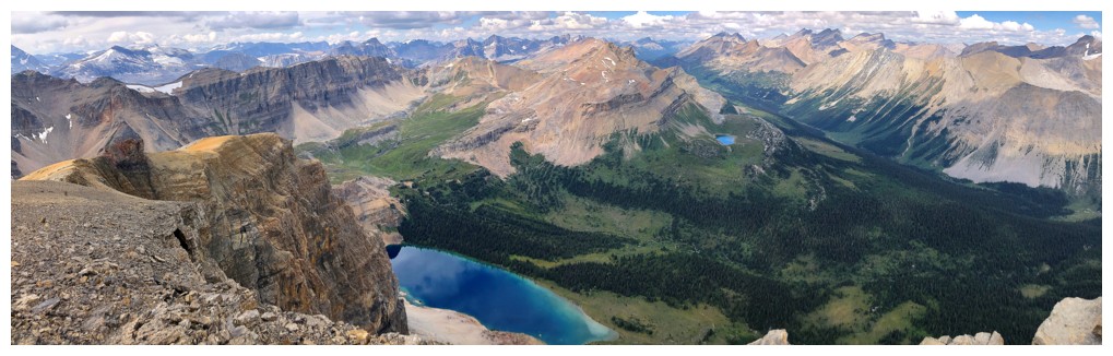
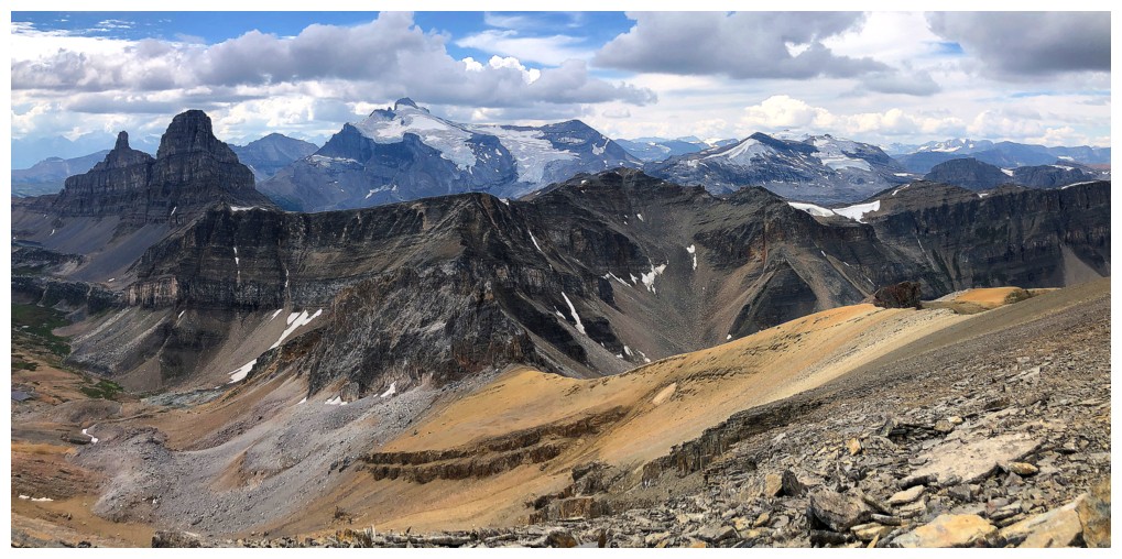
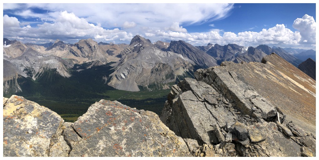
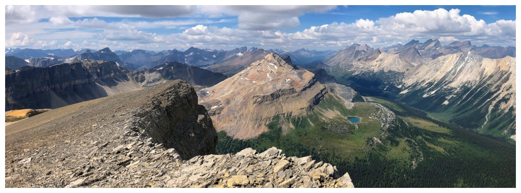
Summit panos
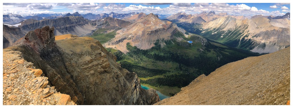
Heading down the west ridge
Staying close to the edge to get partial views of the main Fish Lake
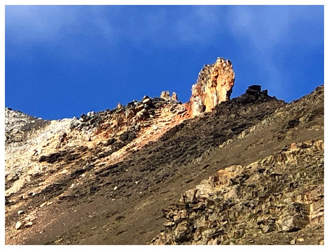
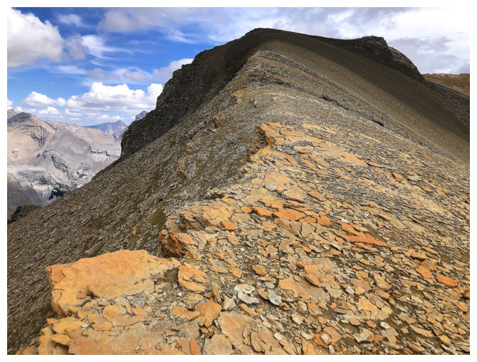
Some striking colourful rock along the way
Small obstacle to circumvent
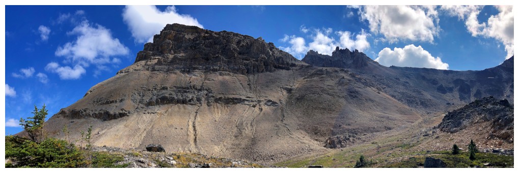
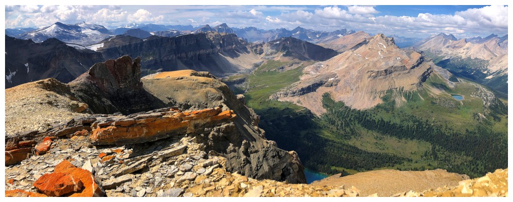
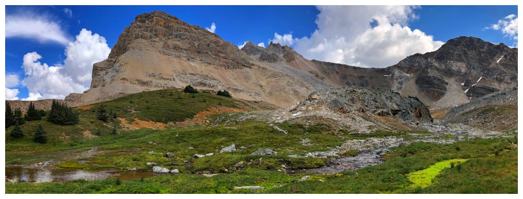
Looking back to the summit
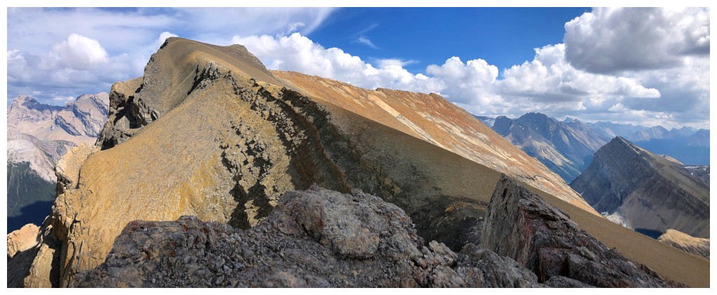
Molar and the serrated southwest ridge of Minnow continue to impress
Yes they do
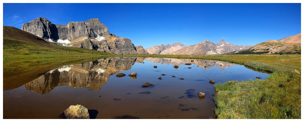
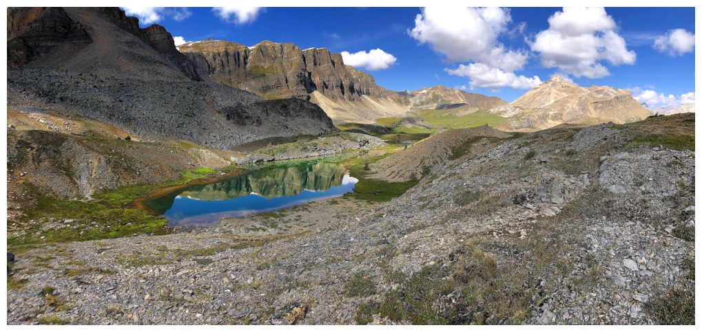
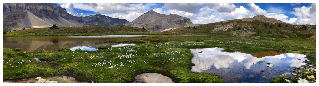
Back onto the main descent slopes and looking forward to visiting the tarns again
There they are
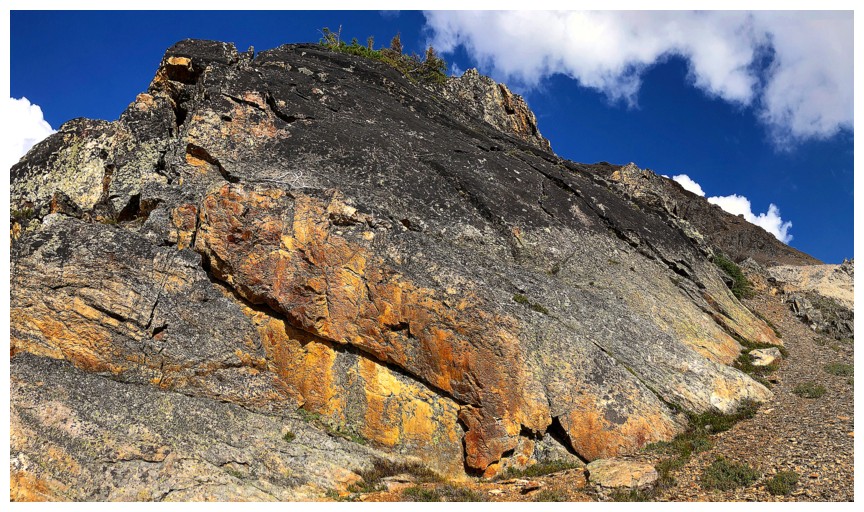
Some more colourful rock
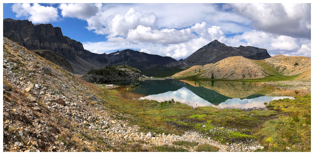
Approaching the first tarn
Looking back to the southwest ridge (right) and the west ridge of Minnow
Good opportunity to see the tarns from the other sides
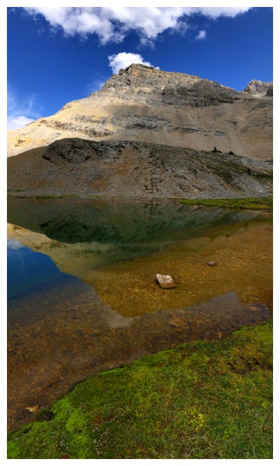
Minnow reflected in the tarn
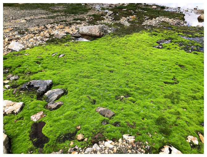
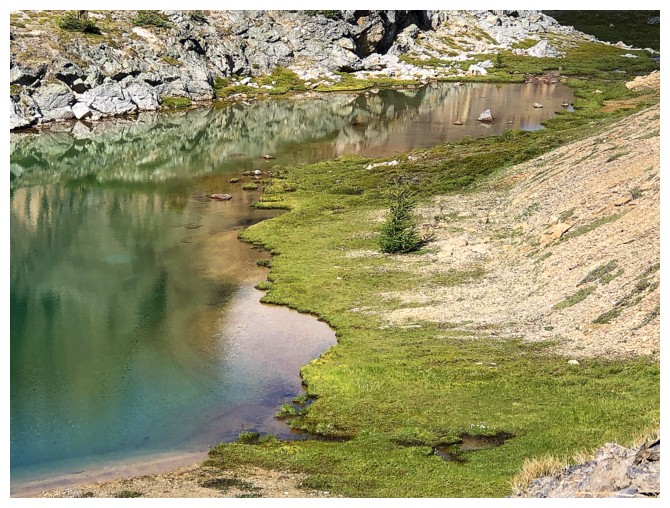
A particularly vibrant section of mossy terrain
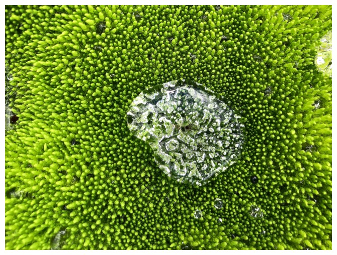
Bizarre formations of water in the moss
Moving on. Molarstone Mountain is present throughout
So is Minnow
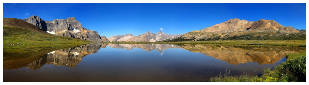
At the next tarn
Leaving and ready to trek back to North Molar Pass
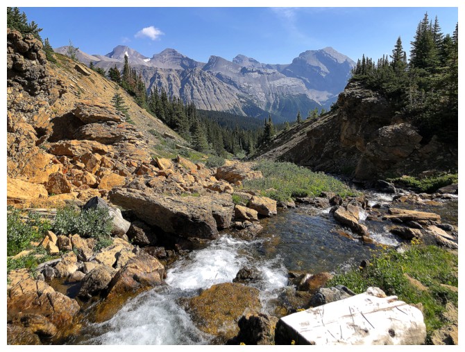
Following a stream out
Looking back to Minnow (right) and more distant peaks to the east
The steep wall of rock to the west
Minnow
Molarstone
Closing in on North Molar Pass
Back at the Pass
View down the other side and the super scenic hike out
Reunited with views of Noseeum
And The Fang
Round 2 at the shallow tarn
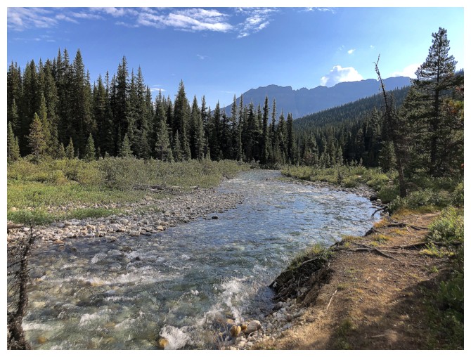
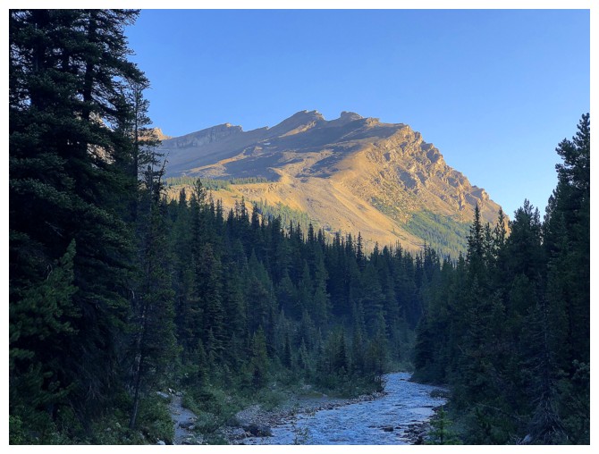
Last look at Mosquito Creek, before finishing the hike out through the forest
The End
LOG