Middle Kootenay Mountain II
January 17, 2009
 Mountain height: 2512
m
Mountain height: 2512
m
Elevation gain: 1200
m
Ascent time: 6:00
Descent time: 3:50
Biking, snowmobiling, hiking, and Crazy Carpeting with Mark.
If Mark and I part this world having achieved
nothing of
greater significance, our “claim to fame” shall be
that we were probably the
first individuals to reach the summit of “
 We chose this mountain as the day’s
objective for two
reasons: 1. having reached the summit in whiteout conditions, a month
and half
earlier, we had vowed to return when a high pressure system rolled in
and here it
was; 2. avalanche conditions were less severe in the area than up north
and we
thought the south/southwest slopes would be wind-blown and therefore
generally free
of snow.
We chose this mountain as the day’s
objective for two
reasons: 1. having reached the summit in whiteout conditions, a month
and half
earlier, we had vowed to return when a high pressure system rolled in
and here it
was; 2. avalanche conditions were less severe in the area than up north
and we
thought the south/southwest slopes would be wind-blown and therefore
generally free
of snow.
Reaching the summit was going to require some creativity, due to a fairly long approach, so we hauled our bikes down to the Castle Mountain Ski Resort and brought snowshoes and Crazy Carpets. Cycling the flat, snow-packed snowmobile trail was relatively easy in the morning cold, but we both feared the day’s warm temperatures would soften the snow to the point where riding a bike on it would be difficult, if not impossible. En route we passed a large group of army personnel, practicing “snow maneuvers”. They were very friendly and seemed impressed by the fact that we were biking on snow-covered trails in January. We abandoned the bikes as soon as the trail started gaining elevation – it was simply too difficult to pedal uphill through the snow.
As luck would have it, one of the army guys then
pulled up
beside us on his snowmobile. He graciously offered us a lift partway up
the
trail that goes to Middle Kootenay Pass. The ride (me on the back of the
snowmobile and
Mark in a sled attached at the rear) was a blast and saved us a good 45
minutes
of boring plodding. 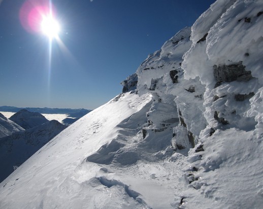 After vehemently thanking him, we continued up on
foot.
Snowshoes were not necessary, the trail being well packed down.
After vehemently thanking him, we continued up on
foot.
Snowshoes were not necessary, the trail being well packed down.
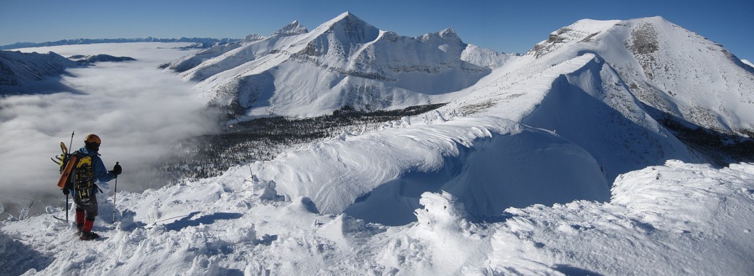
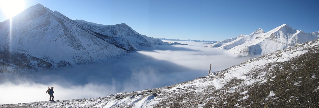
The scenery at the Pass was terrific. Low clouds rushing over the peaks of Rainy Ridge were cause for a few photos. Thankfully, the wind exposed ascent slopes were fairly clear of snow and the avalanche danger non-existent. Gaining a little elevation, we were suddenly treated to a repeat performance of our favourite failure (Mount Loomis), as low clouds blanketed the valley to the southwest – always a breath-taking scene.
The remainder of the ascent to the false summit was relatively easy, though strenuous in parts. It was also stunningly scenic, thanks to the curvaceous contours of the ridge, several fairly large cornices, the pleasant contrast of shapely peaks with more pointed ones in the surrounding area, the aforementioned cloud cover below, an incredible abundance of rime on dead trees, live trees, and rock, and of course, perfect weather. I’d classify this part of the trip as being one of the most rewarding and visually-mesmerizing of all our trips.
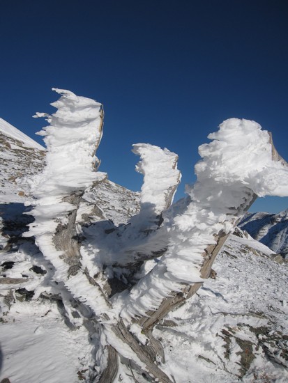
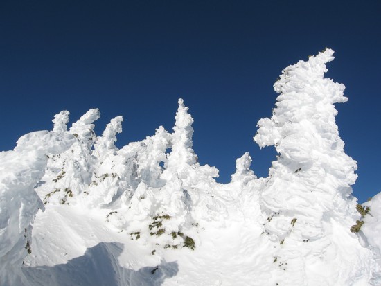
The snow combined with the notorious high winds of
southwestern  It took me a while to figure out why the scenery was so bizarre, but
finally
realized it was partly because the trees were not simply covered in
snow – they
were encased
in snow, that was then wind-blasted into amazing formations. Many were
not even
recognizable as trees and looked more like snow-covered, statues of
rock. The
summit view from the false summit was expectedly magnificent.
It took me a while to figure out why the scenery was so bizarre, but
finally
realized it was partly because the trees were not simply covered in
snow – they
were encased
in snow, that was then wind-blasted into amazing formations. Many were
not even
recognizable as trees and looked more like snow-covered, statues of
rock. The
summit view from the false summit was expectedly magnificent.
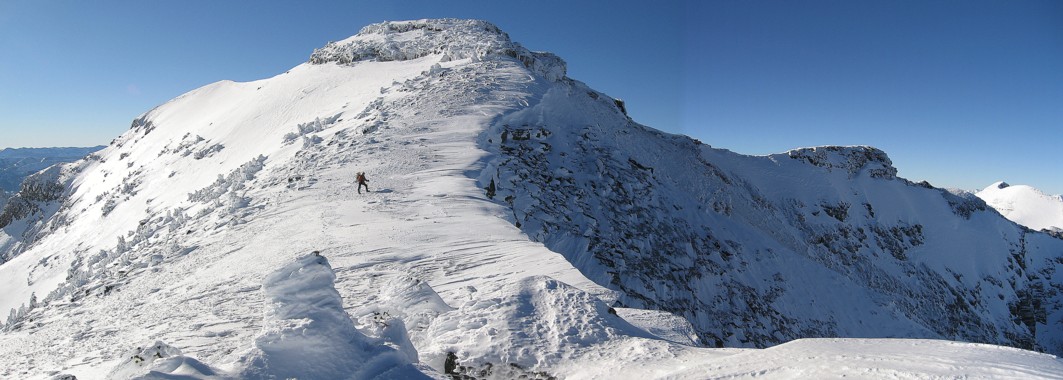
We thought that getting down to the col between the false and true summits might be too dangerous. On our previous trip, this descent required travel on slopes that were definitely potential for avalanches. Given that these slopes were now plastered in snow, an alternate route was needed. Sticking close to the ridge, we were able to avoid any dangerous slopes. Once at the col another remarkably scenic hike to the true summit followed.
The panorama from the true summit was really what
we had to
come to see and it did not disappoint in the least: the valley to the
southwest
remained shrouded in a blanket of clouds, with the summits of distant
peaks
piercing the white sheet; to the south stood Scarpe Mountain, Rainy
Ridge,
Three Lakes Ridge and several quite beautiful unnamed peaks; the more
familiar
peaks of the Castle area lay to the east; of course Mount Haig and
it’s
subsidiary peaks garnered most of the attention to the north; and to
the west
was the mountain I had really come to see – Tombstone
Mountain. Though its south slopes are more gentle in grade, the north face of
For descent we were able to side-slope a great to deal to avoid several elevation gains back to the three main highpoints of the ridge. Back at the Pass we traded crampons for Crazy Carpets and with varying degrees of success slid back to our bikes. That was the end of the good stuff. As feared, the snow on the trail had softened a great deal. Riding our bikes back was thoroughly exhausting and, at times, very frustrating. Even the downhill parts required exertion.
Besides the miserable last hour, definitely one of our most enjoyable and scenic trips ever.
(Just kidding about the wooden leg – they're both flesh and bone….mostly bone!)
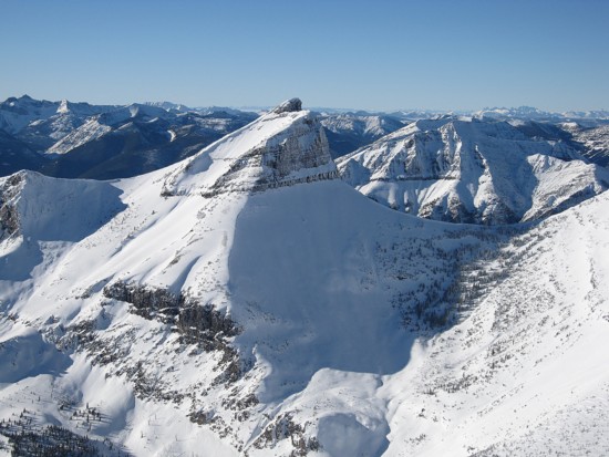
The east side of Haig Mountain
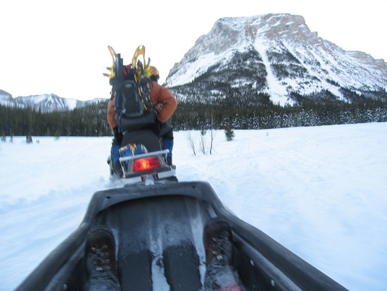
Our first time on a snowmobile; Mark's feet at the forefront
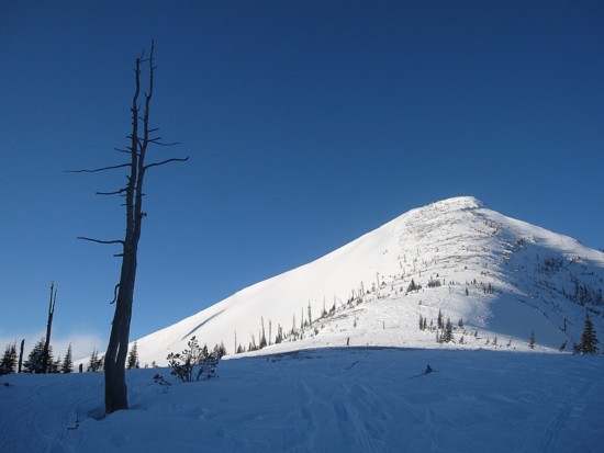
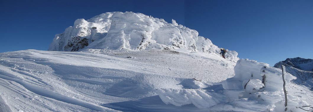
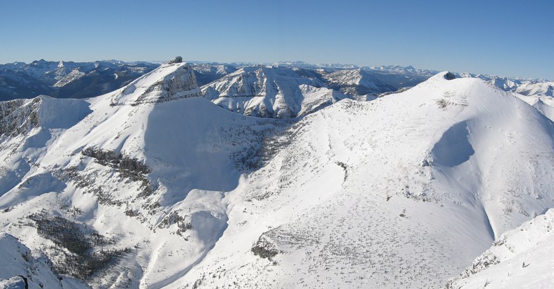
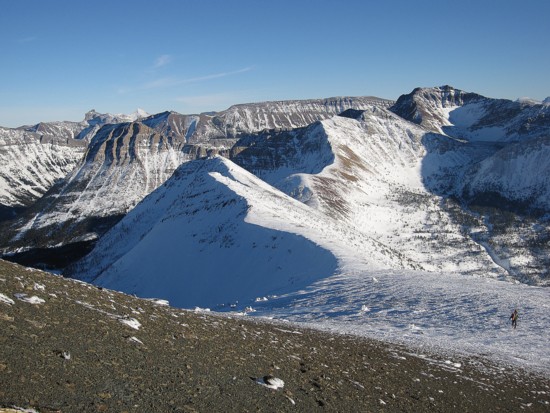
The northwest side of the first highpoint of Middle Kootenay Mountain
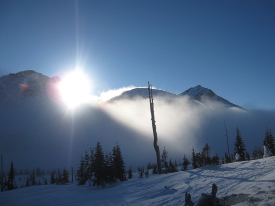
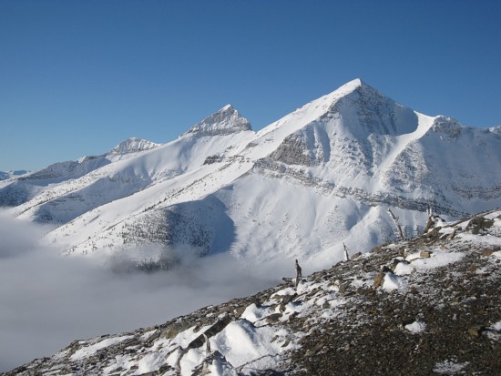
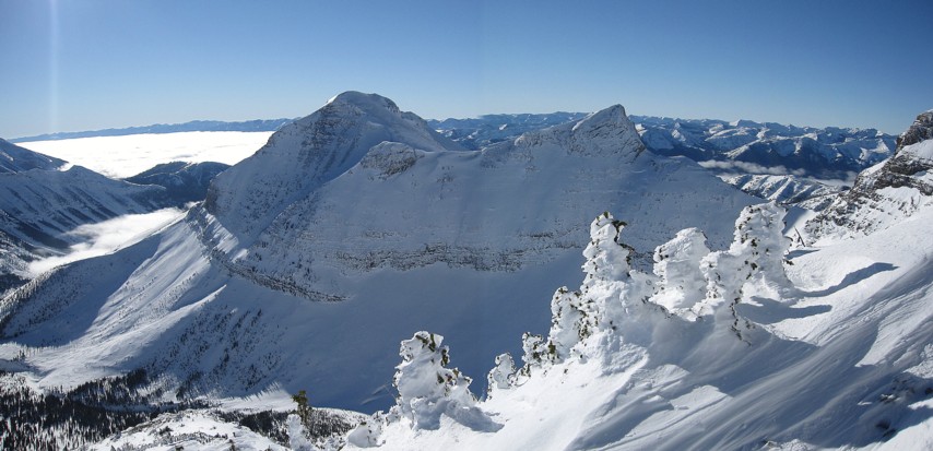
Low-lying clouds obscure Rainy Ridge
Same as above
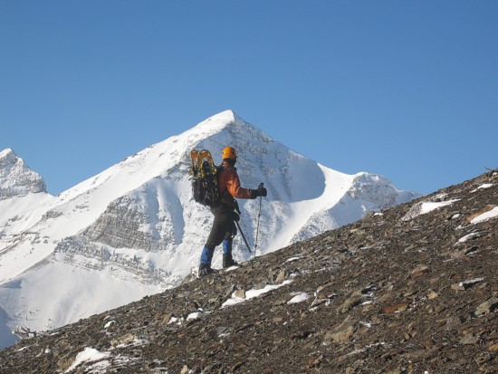
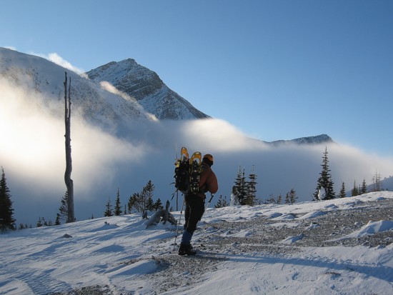
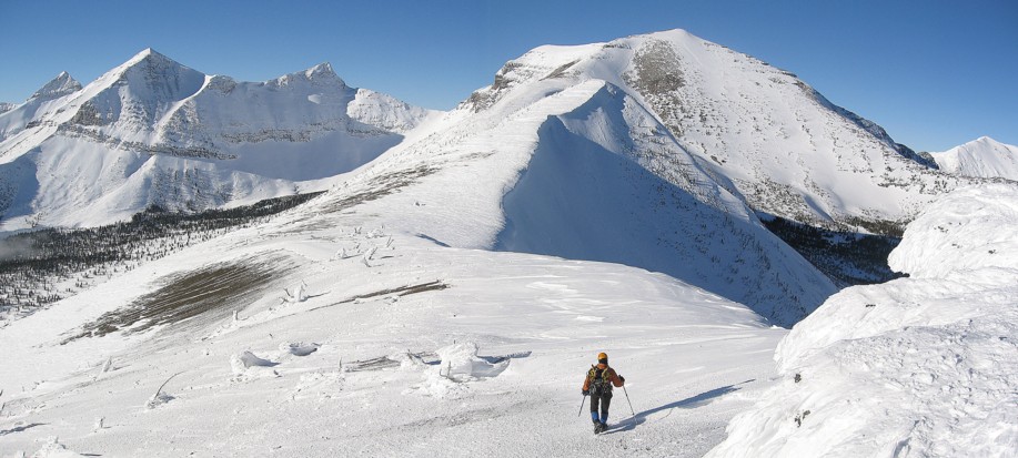
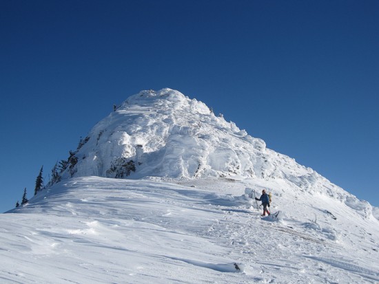
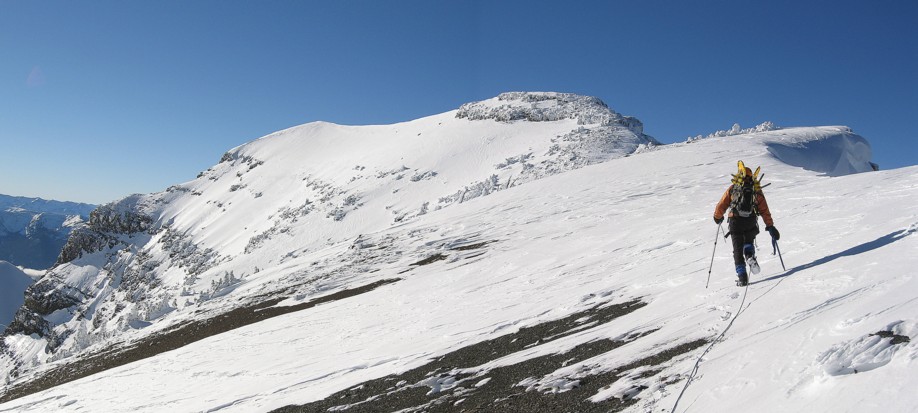
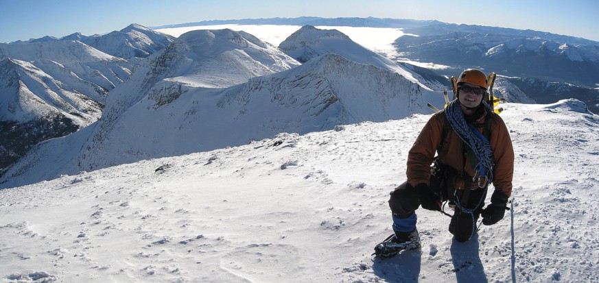
On the main ascent slope, with an unnamed peak, south of Middle Kootenay behind
Same as above, without me obscuring the view
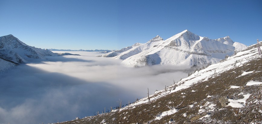
Same as above, with the low-lying clouds in the valley to the southwest
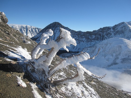
Rime
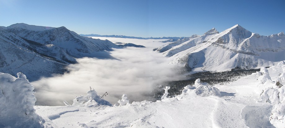
Another look at the cloud-filled valley
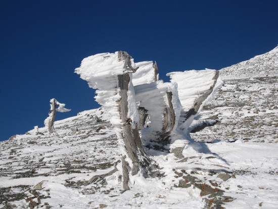
More rime
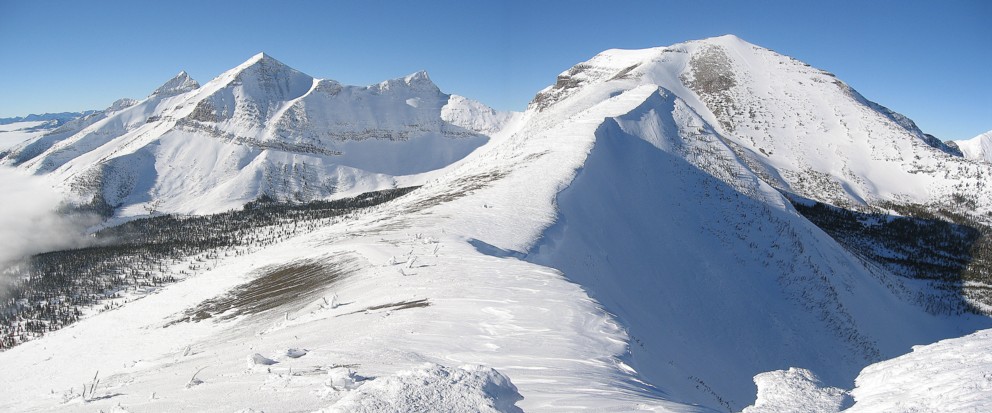
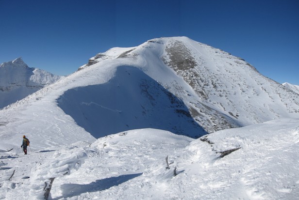
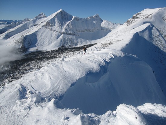
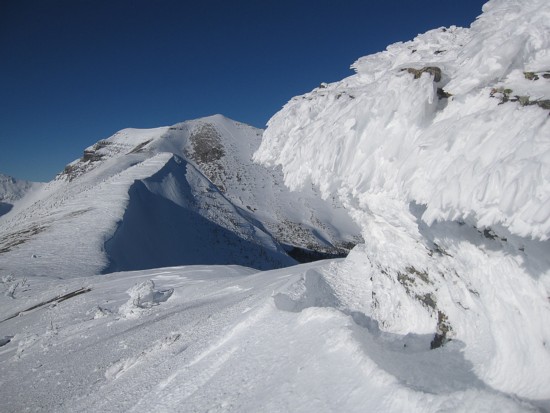
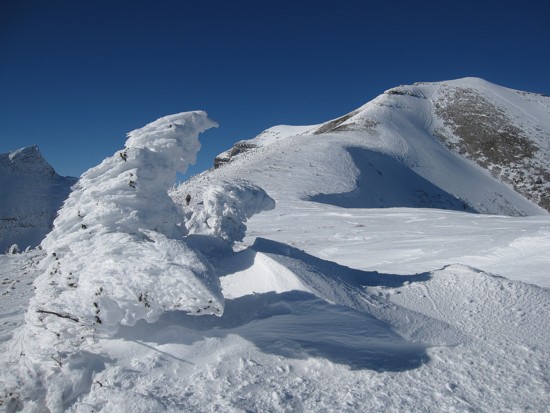
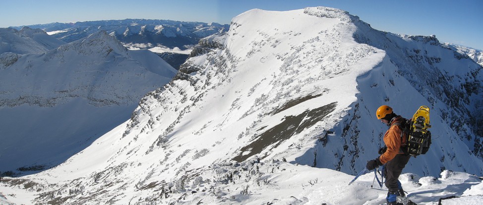
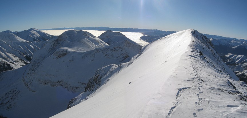
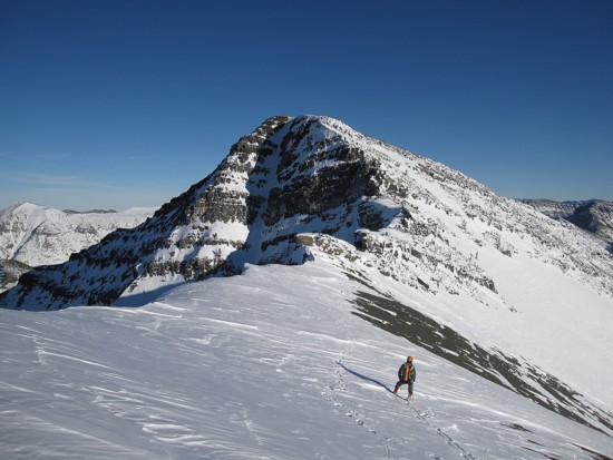
At the first highpoint, looking along the ridge to the false summit at the right;
the true summit is the lower-looking point to the left of the false summit
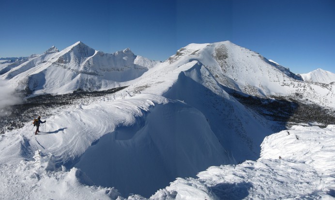
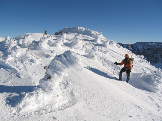
Mark leaves the first highpoint
Same as above; note the sizable cornice
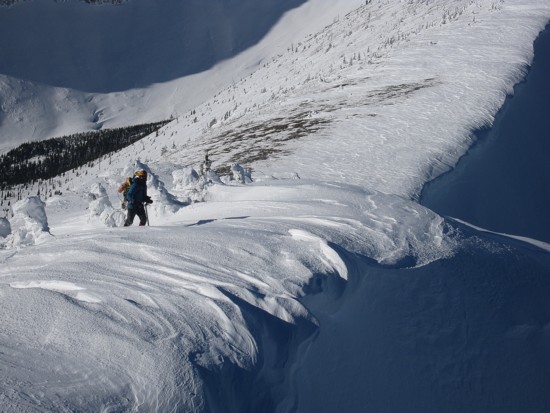
A closer look at the cornice
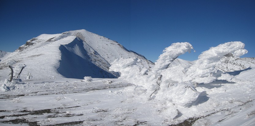
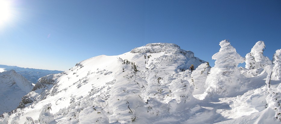
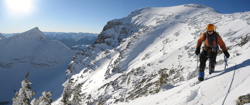
The ridge and more rime-covered trees
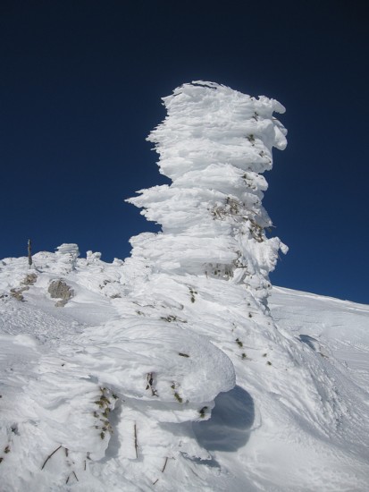
My favourite photo from the trip
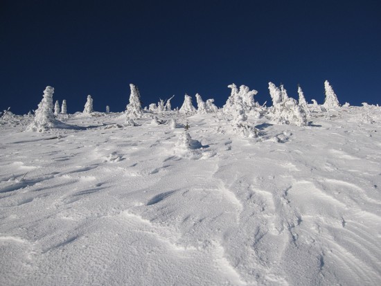
Interesting snow scenery
Same as above

Mark and lots of rime-covered rock
Starting to see a few small, snow-encased trees
Descending from the second highpoint
More rime-covered trees
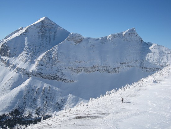
Mark, looking fairly small against the striking, unnamed peaks south of Middle Kootenay
A
lame attempt at a more artsy shot; Mark is the black dot between the
snow-covered trees
on the left, but he's too far away to even recognize
as a person
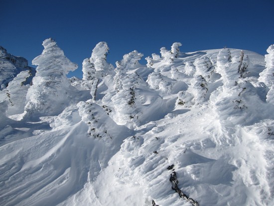
More snow encased trees
At the false summit, preparing to head over to the true summit (both high points at the centre and right)
Another look at the unnamed peaks and the sea of clouds to the left
Heading towards the summit
Passing through a maze of trees
The trees the photo above
The last section of the ascent
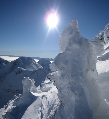
Yet more tree, snow, and sun scenery
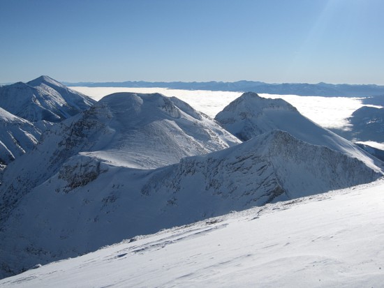
The striking unnamed peaks south of Middle Kootenay don't look so striking from this angle
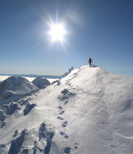
Almost at the north summit; the south summit is about 200 metres away; both summits are of comparable height
Almost at the south summit
The view to the west; Tombstone Mountain on the left and an unnamed peak on the right
Tombstone Mountain
The view to the south from the summit
Back at the col between the false and true summits
Side-sloping on descent
Looking up at the trees
Returning to Middle Kootenay Pass; Rainy Ridge to the right
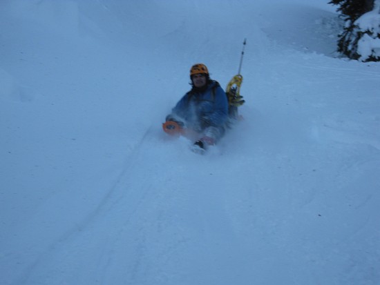
Mark on his brand new Crazy Carpet - the deluxe model at the whopping $4.99