Red Mountain
October 7, 2023
Mountain height: 2852 m
Elevation gain:
1276 m
Ascent time: 6:40
Descent time: 4:10
Scrambling with
Doug and Raff.
Day 2 in the
best national park in the United States of America and Red Mountain was on tap.
Obviously, the name of the mountain is a reference to the fact that a large
portion of the peak is comprised of red argillite rock. And even more
obviously, that fact was my primary motivation for an attempt!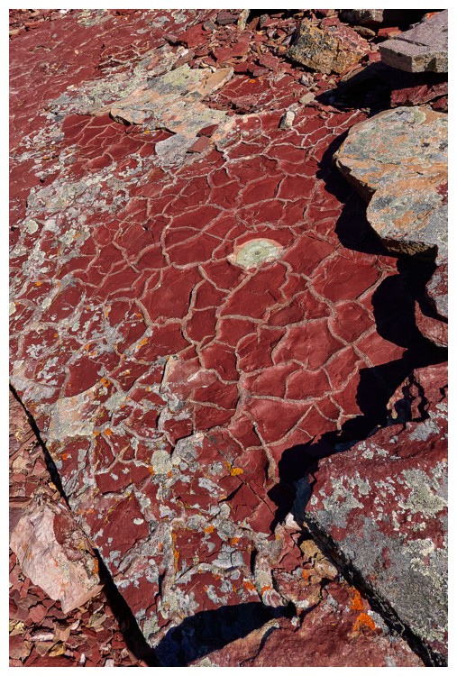 We had two GPS
tracks for this peak, one from Sonny Bou and the other from Keegan Seibenaler on Peakbagger. Another option involved ascending
Spot Mountain first and then traversing west to Red. However, that seemed to be
a very long route and would jeopardize any chance of exploring the area west of
Red. We decided to take the shortest route possible so that we would have
options to extend the day if we made the summit.
We had two GPS
tracks for this peak, one from Sonny Bou and the other from Keegan Seibenaler on Peakbagger. Another option involved ascending
Spot Mountain first and then traversing west to Red. However, that seemed to be
a very long route and would jeopardize any chance of exploring the area west of
Red. We decided to take the shortest route possible so that we would have
options to extend the day if we made the summit.
(Aside: while its in my head, a huge shout-out to Jake Bramante and his incredible website Hike 734.
I recently came across it online and the blog is a wealth of information and
inspiration, especially for trips in Glacier National Park, Montana. I
did watch Jake's video for his trip up Red, preceded by Spot Mountain. 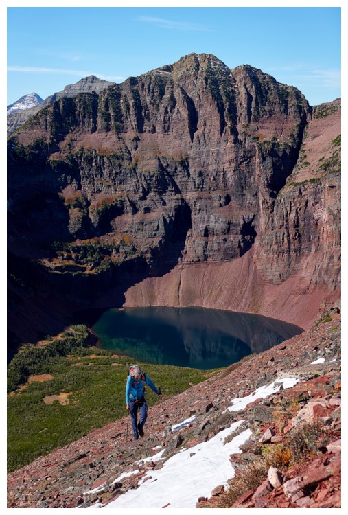 We decided against that
specific route because of the limited hours of daylight we would have,
but were I to repeat Red, I would definitely use Jake's route up both.)
We decided against that
specific route because of the limited hours of daylight we would have,
but were I to repeat Red, I would definitely use Jake's route up both.)
Back
to our day. Surprisingly,
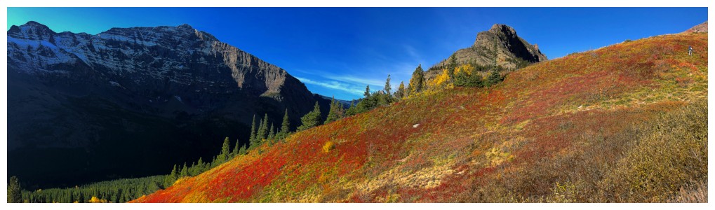
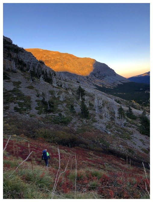
one of the scenic highlights of the day occurred quite early on. After
leaving
the main trail we soon encountered a vegetated slope covered in bright
red plants
and backdropped by a striking outlier of Red Mountain – multiple photos
were taken and the "oohs' and "aahs" came out in full force! A
drainage filled with broken red and green argillite slabs had the same effect,
sometime
later. The mountain had already more than lived up to its name and we were not even on the main ascent slope!
I’m glad we read
Sonny’s report upon starting up towards the ridge. He very accurately describes
this foreshortened slog up tedious rubble and that’s exactly what it was. At
least the unnamed lake below Red was now visible, giving us something to gawk
at between dejected bouts of, "Are we there yet?!" We deviated from Sonny’s route here
and went directly up to the ridge, intercepting Keegan’s track. 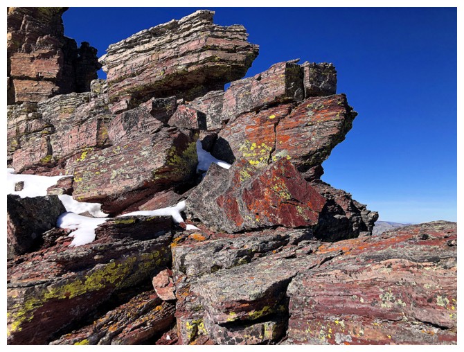 The views
atop the ridge were expectedly fantastic and the ridgewalk/scramble towards the
summit looked intriguing, to say the least.
The views
atop the ridge were expectedly fantastic and the ridgewalk/scramble towards the
summit looked intriguing, to say the least.
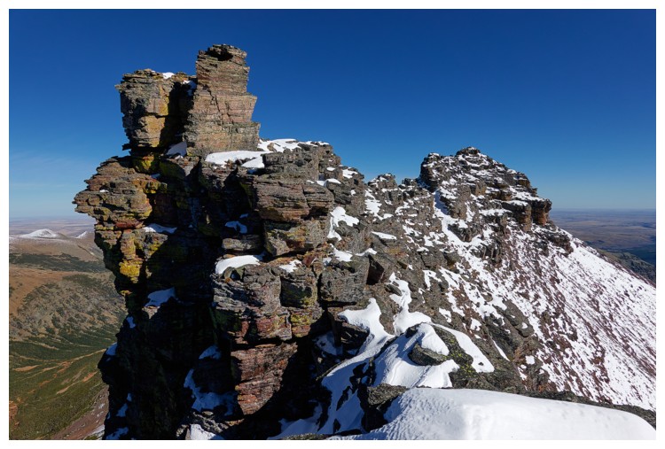
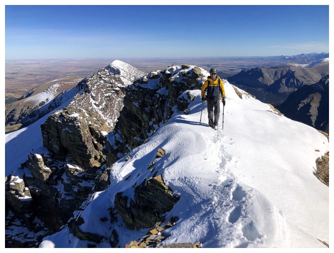
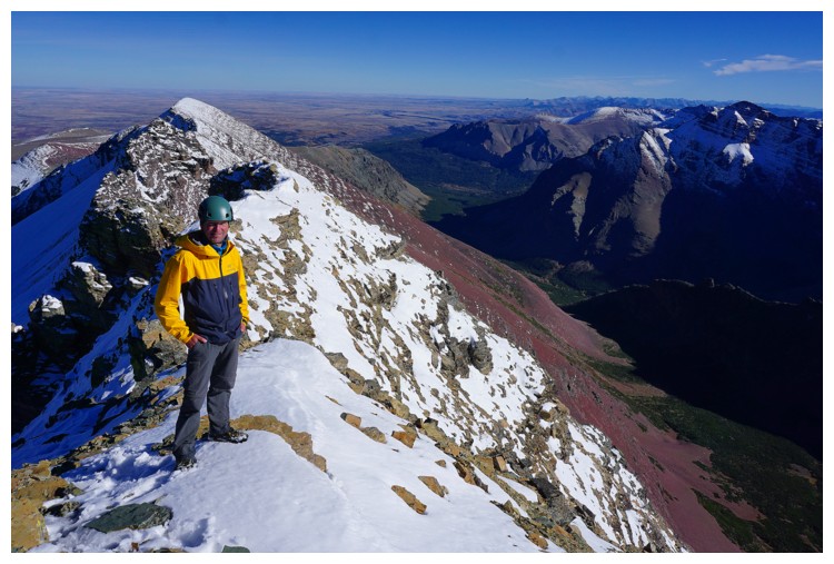
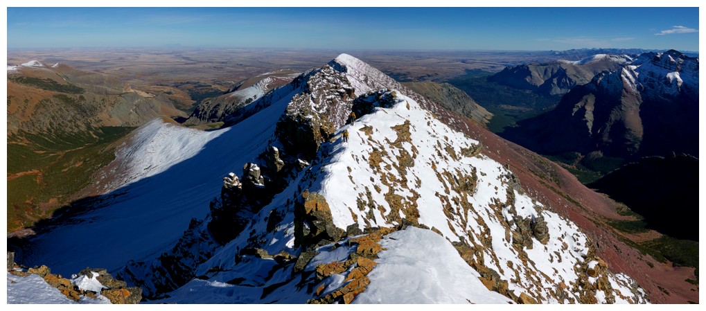
And intriguing
it was! After circumventing a huge rock band straddling the rdge, we were confronted with two
choices: traverse below the next section and lose elevation to intercept
Sonny’s route or stay high on the ridge, following Keegan’s route. Raff and I
decided to follow Sonny’s, while Doug went with Keegan’s. Both routes worked
very well and met each other on the ridge near the summit. From that point, a
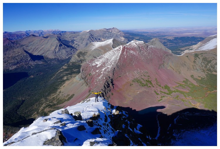
little “bobbing and weaving” brought us with relative ease to the top and the
magnificent view it affords.
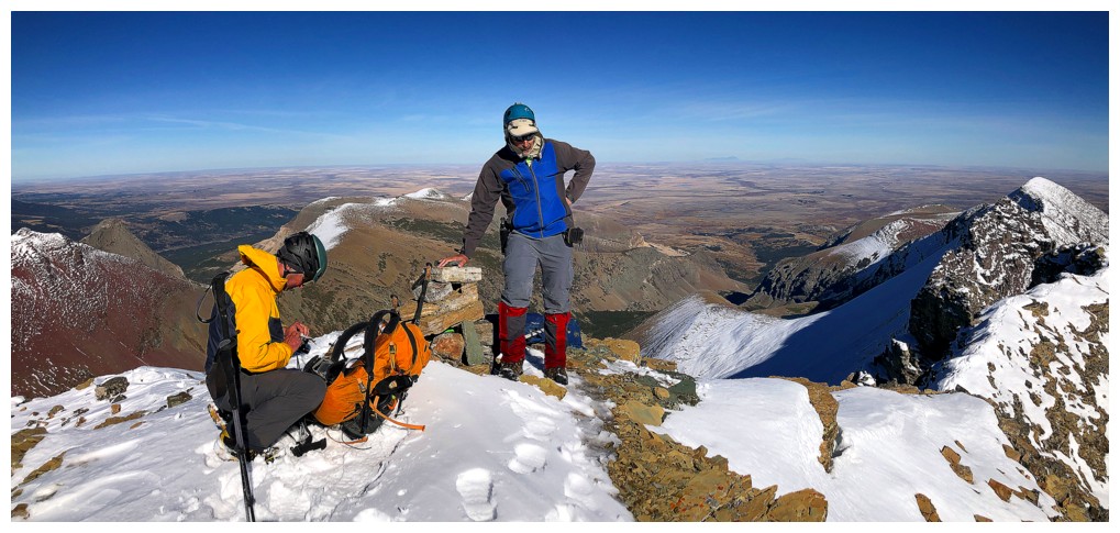
After
congratulations were extended and photos were taken, we quickly ran
over to the
nearby west summit to scope out possibilities for extending the trip,
as Jake and company did. Unfortunately,
the snowy conditions had us thinking, "That could go very wrong". To
avoid any chance of
an epic day (and possibly night), we wisely chose to just return via
our ascent route, with a few small modifications. Good decision,
as darkness fell and the headlamps came out for the final 30 minutes of
the trip.
A
superb day out in a wonderful area, on an awe-inspiring peak, with two amazing partners. And we all got our RED fill, in argillite and other forms!!!
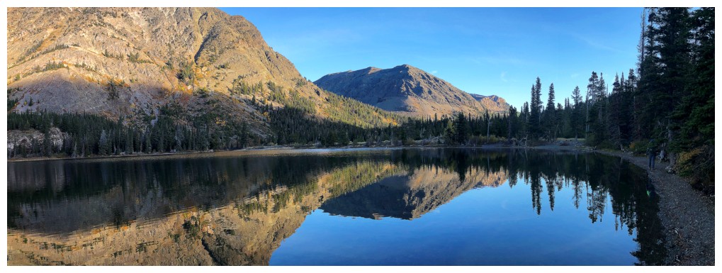
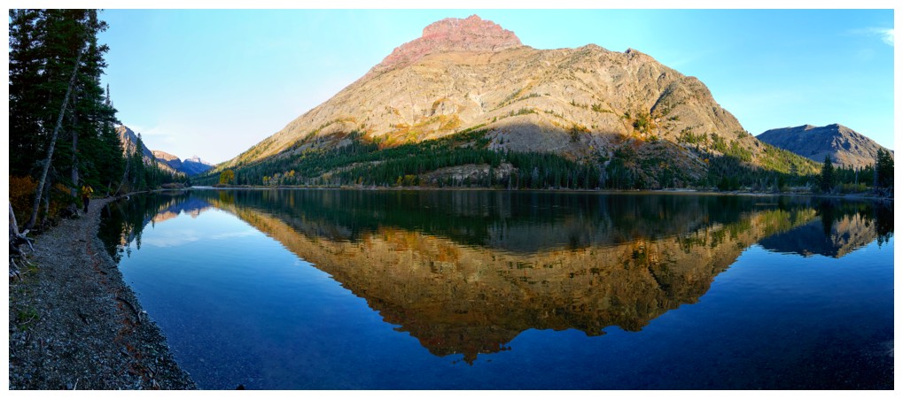
Hiking around Pray Lake
Rising Wolf Mountain towers over the lake (photo by Doug)
Sinopah Mountain is also clearly visible (photo by Doug)
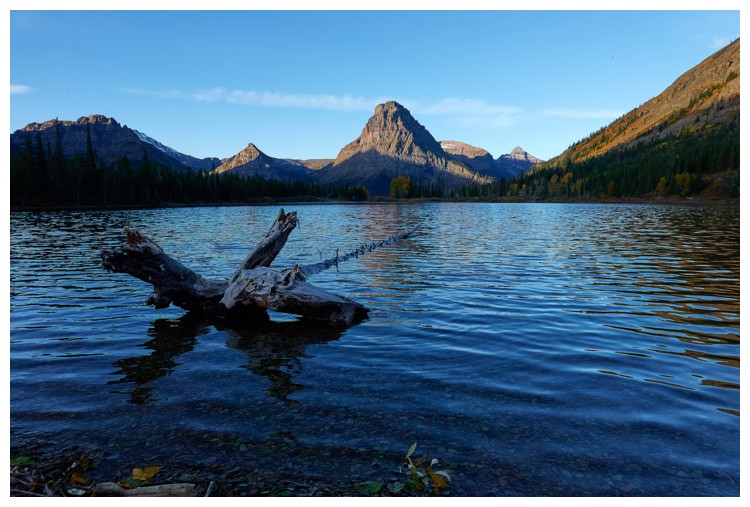
Crossing the lake outlet, with the east end of Rising Wolf Mountain ahead
The
trail goes around the east side of Rising Wolf and then up the valley
on the north side of the massive mountain (photo by Doug)
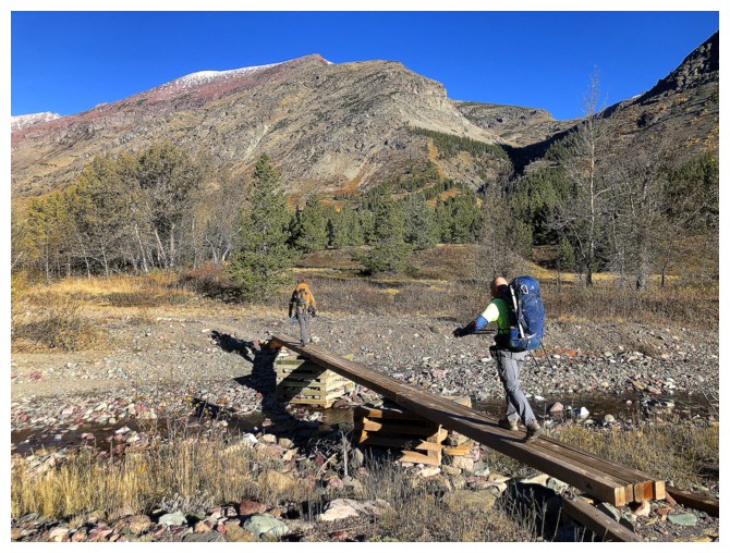
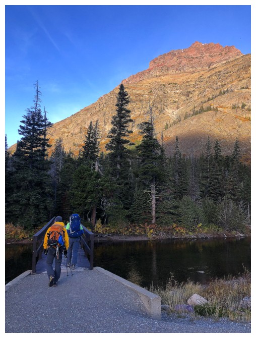
Crossing a very low creek. Doug uses his hiking poles for balance on the extremely exposed bridge!
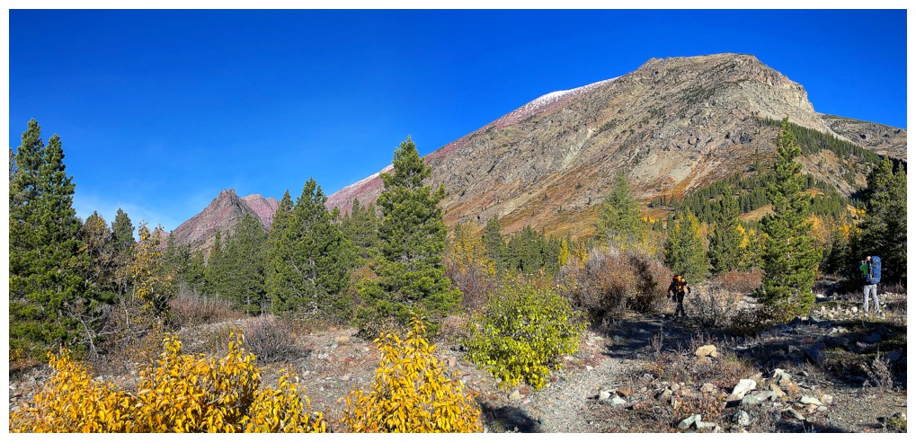
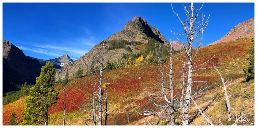
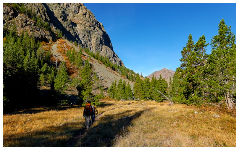
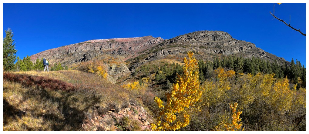
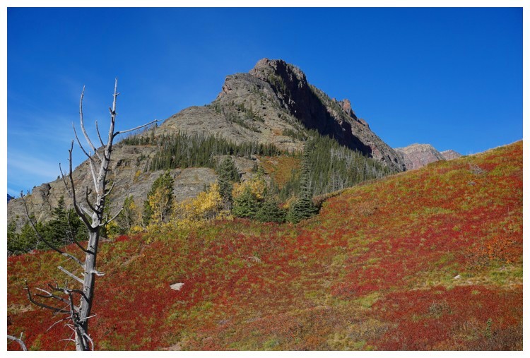
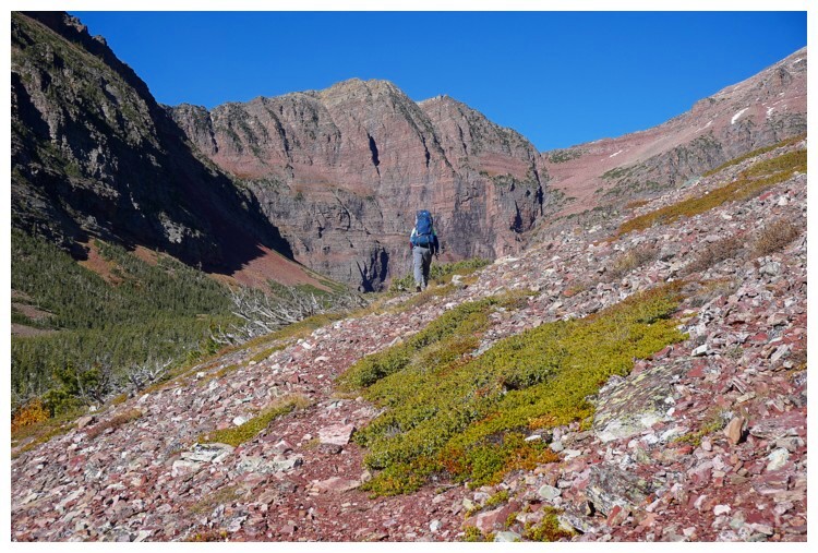
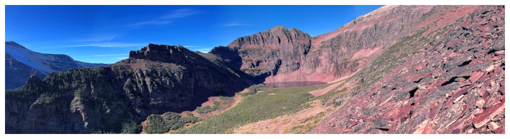
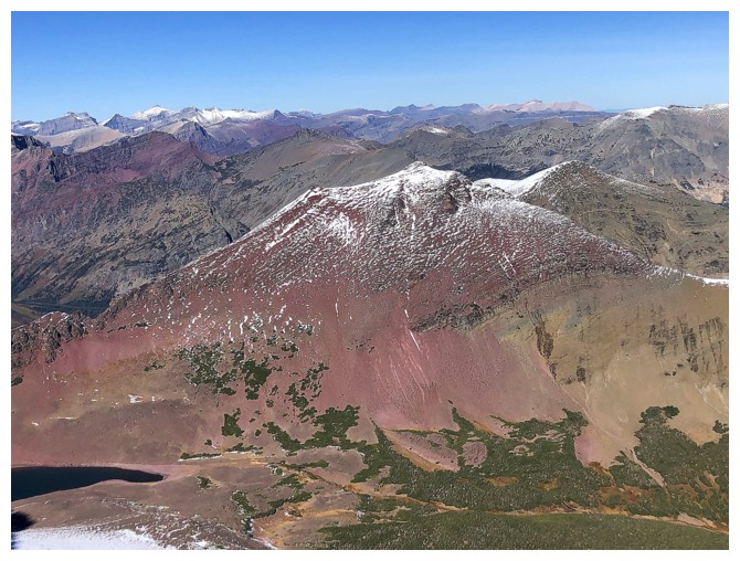
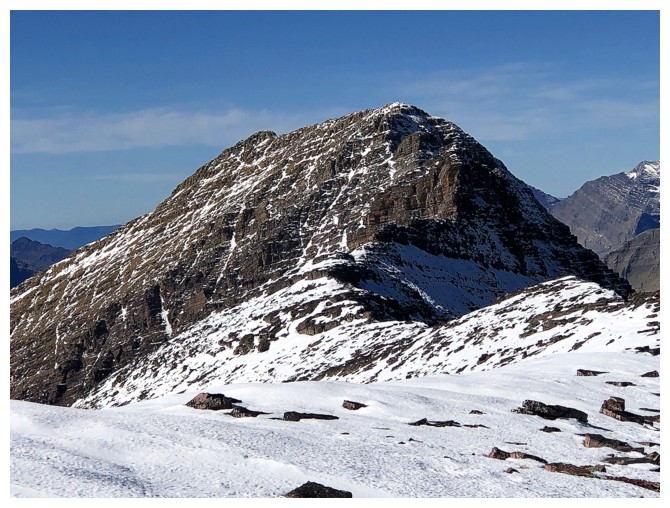
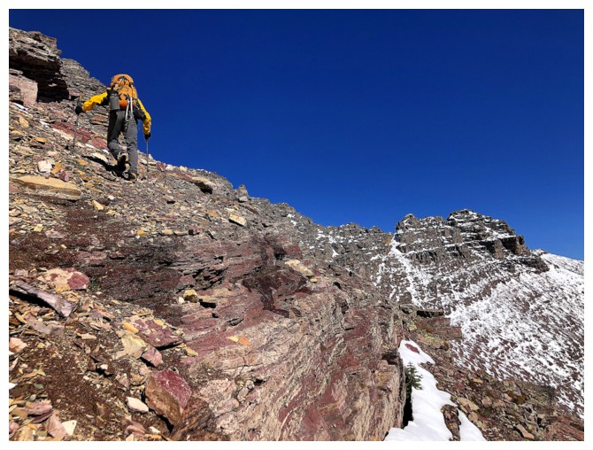
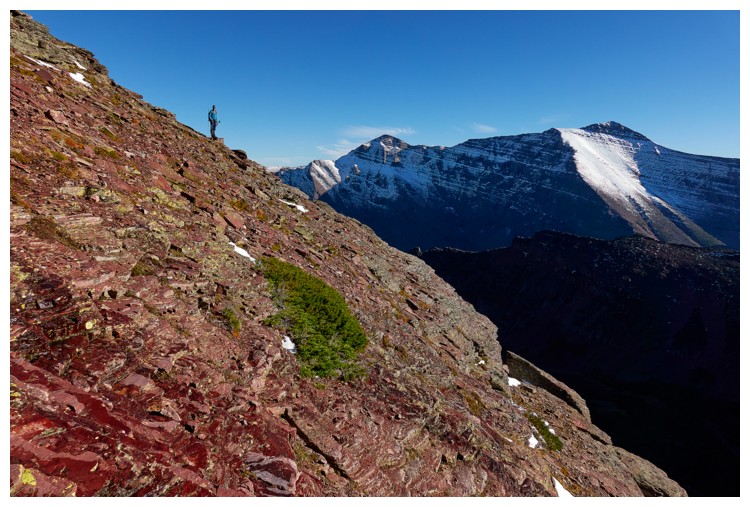
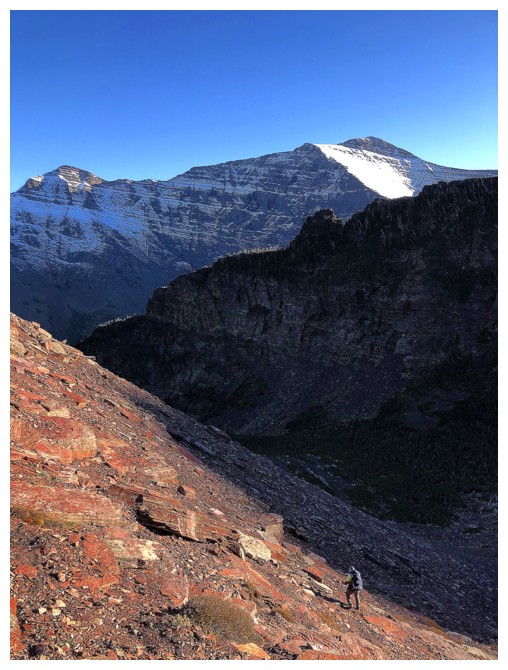
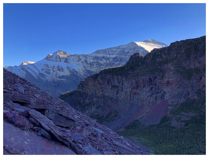
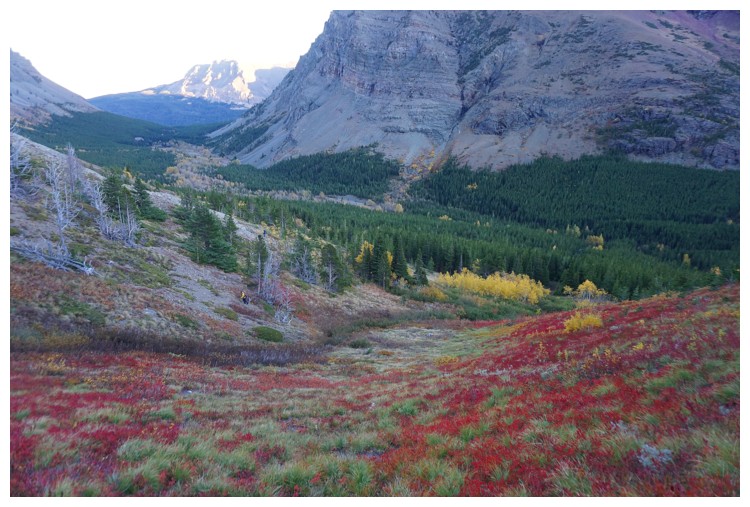
Red Mountain is stretched out in front, but its a big mountain and the summit is many, many, many steps away!
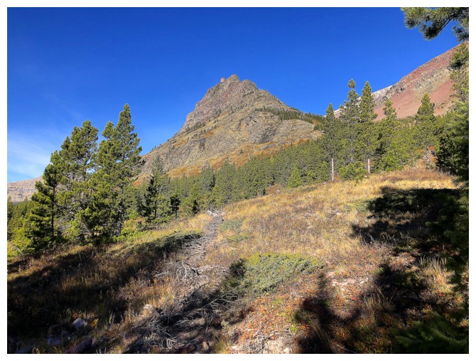
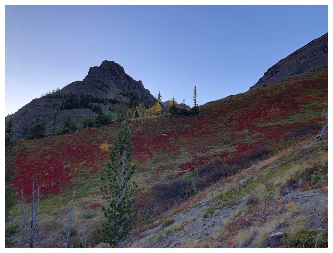
An outlier of Red that provided lots of visual entertainment
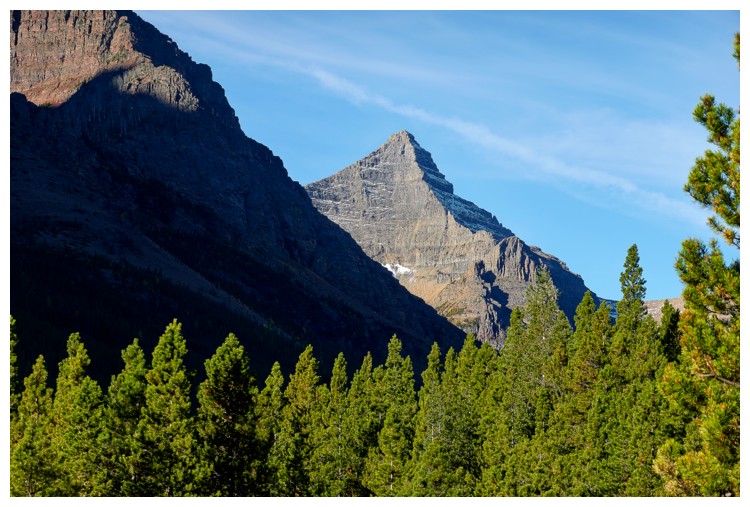
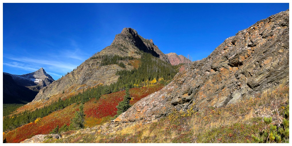
First view of the aesthetic form of Flinsch Peak (photo by Doug)
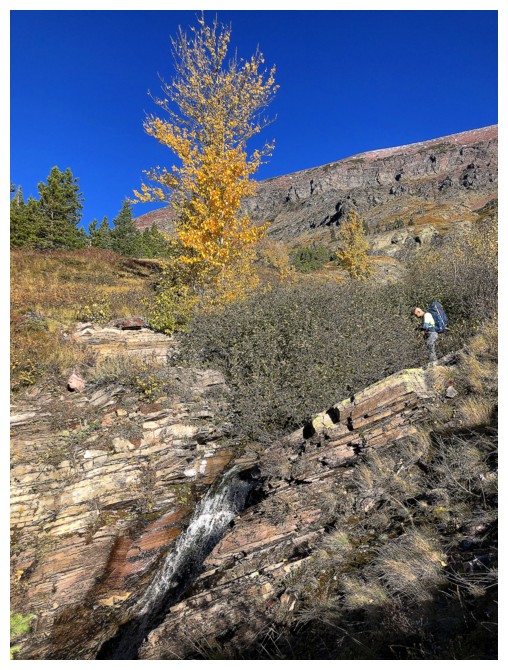
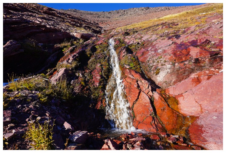
Doug checks out a small waterfall and the a wonderfully colourful tree
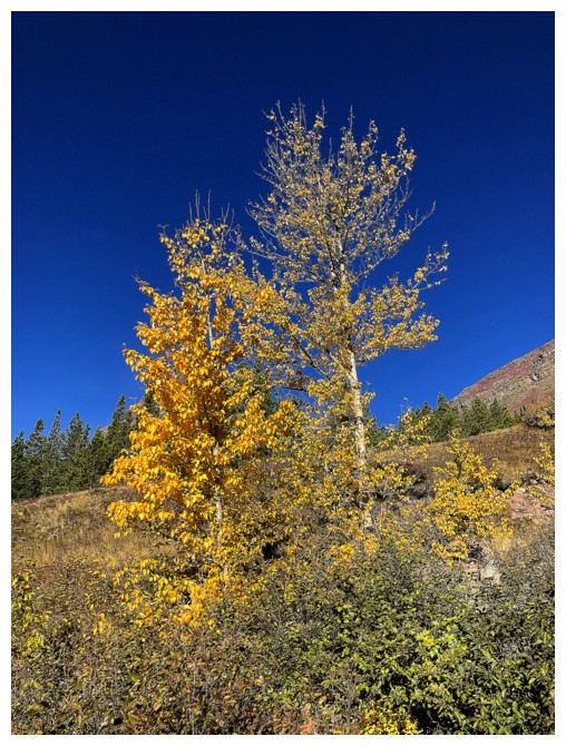
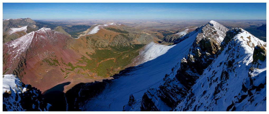
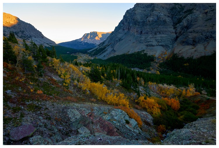
More of Red and the great colours
Exploring the drainage to the right looked oh so tempting! (photo by Raff)
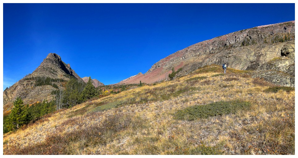
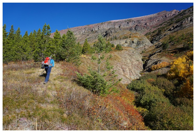
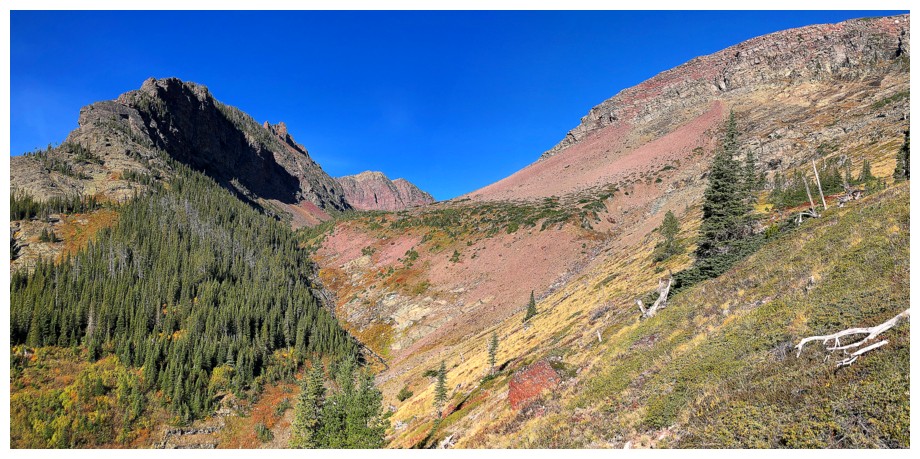
The route gains some elevation, then goes up the valley, south of Red's summit and north of the outlier (left)
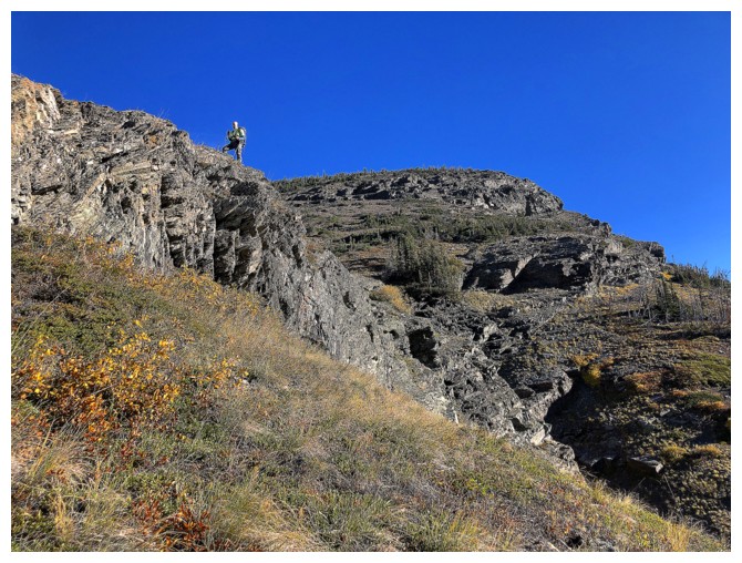
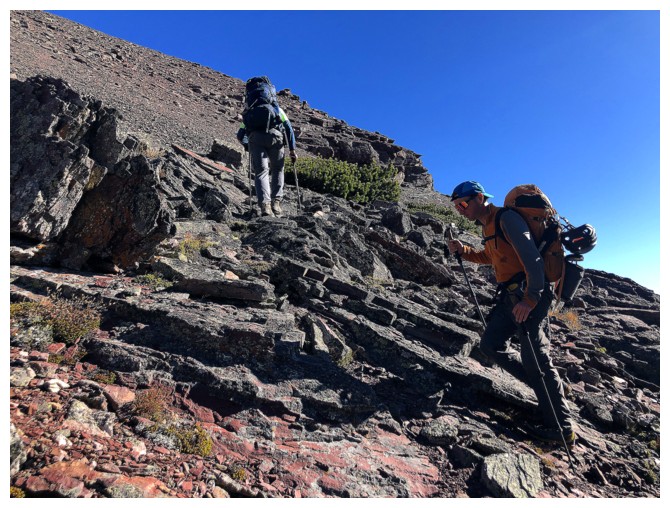
Doug atop a rock band
Doug's view from above (photo by Doug)
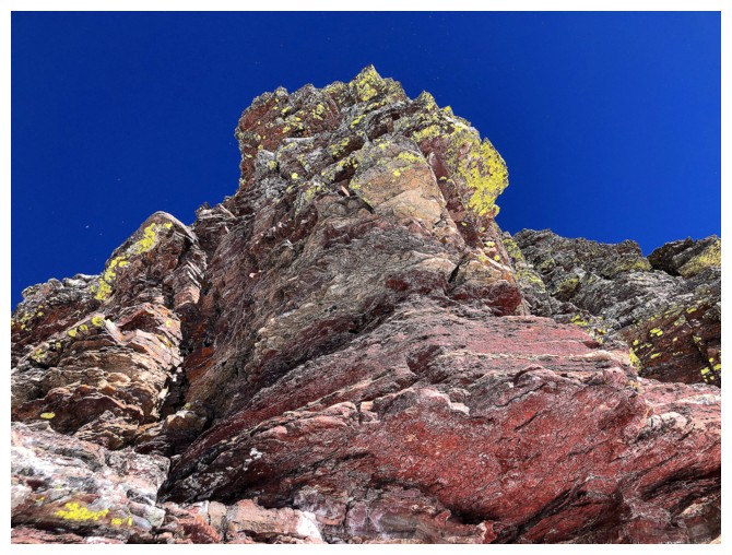
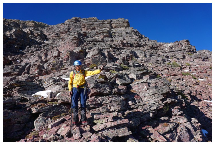
First RED sighting
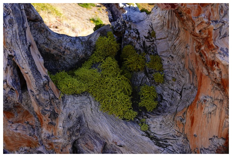
Moss on the dead tree. Even the wood has some red in it! (photo by Doug)
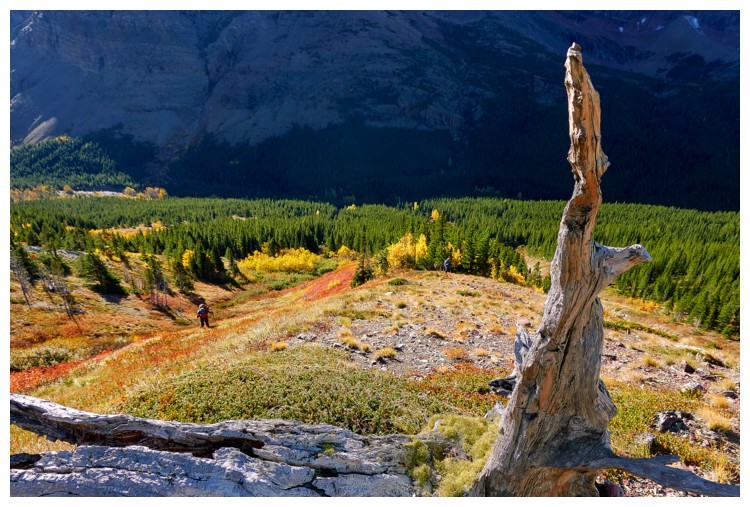
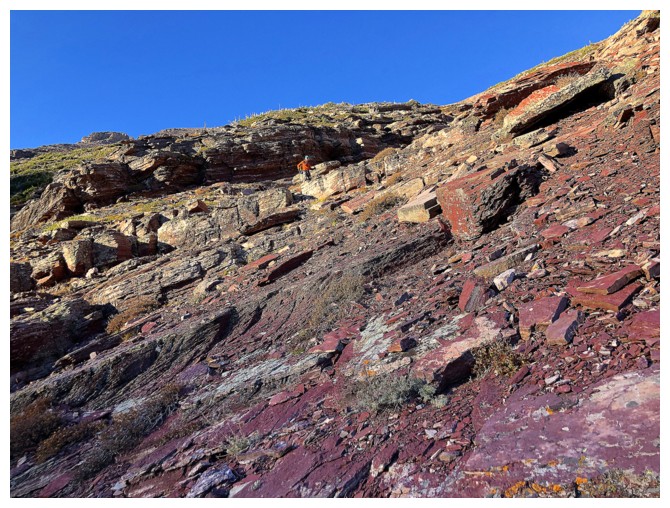
Whoa! Wasn't expecting this level of RED, this early on!
Close-up of the RED and the outlier (photo by Raff)
Raff passes the RED
Cool shot by Doug (photo by Doug)
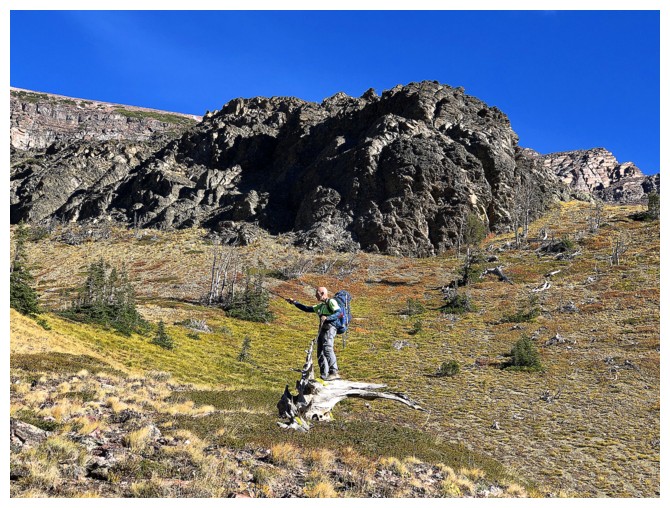
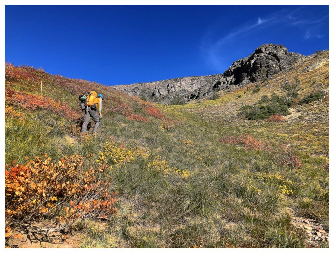
Doug points out his line of ascent. I stayed a little lower in hopes of
intersecting a creek coming down from the valley, but it turned
out to be too much extra work.
More RED!!! (photo by Doug)
We need to get to the middle here. The creek I wanted to see close-up is just right of the trees.
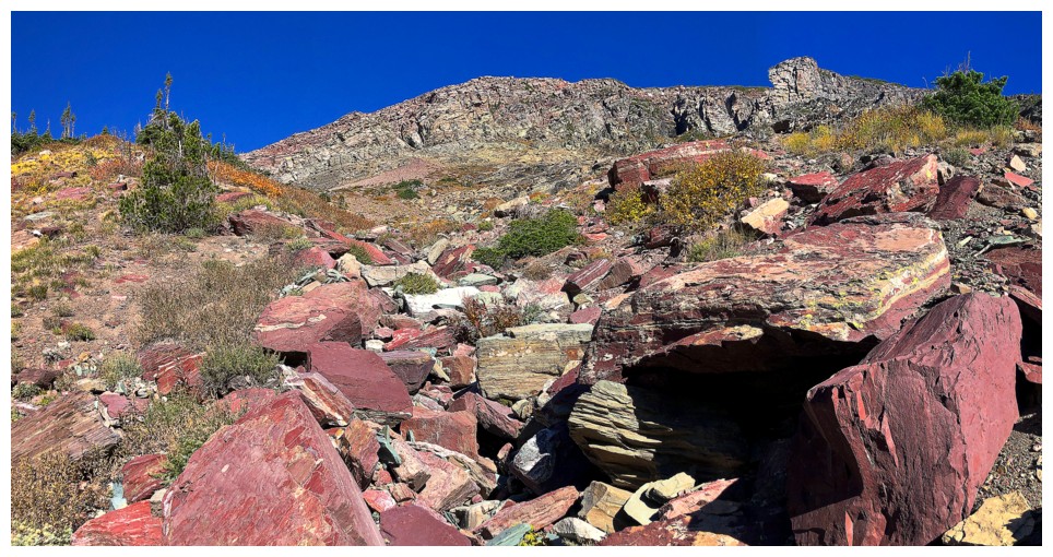
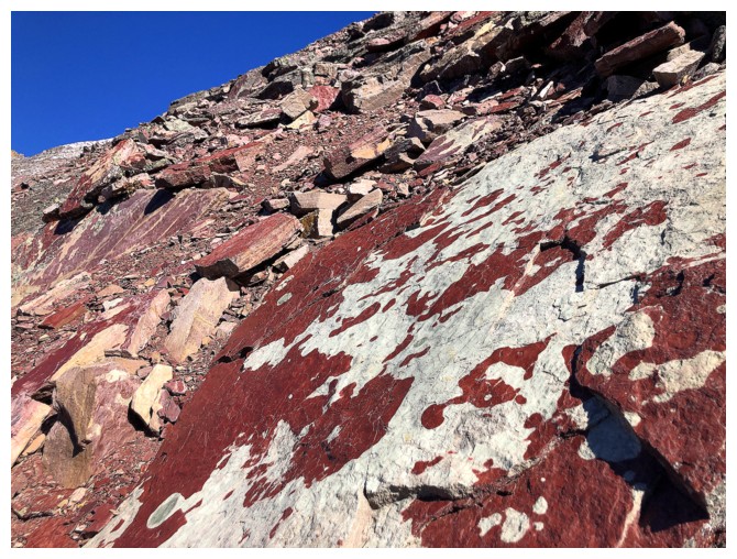
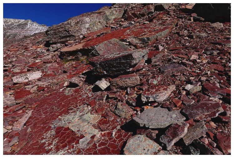
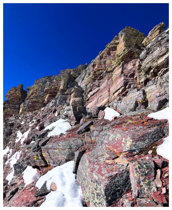
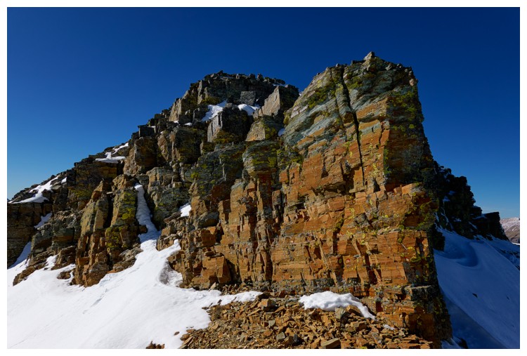
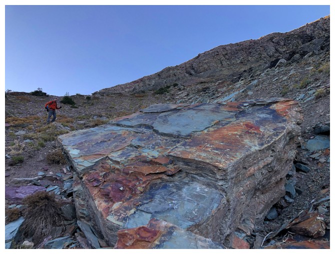
RED argillite - finally!
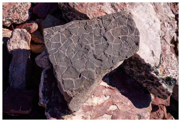
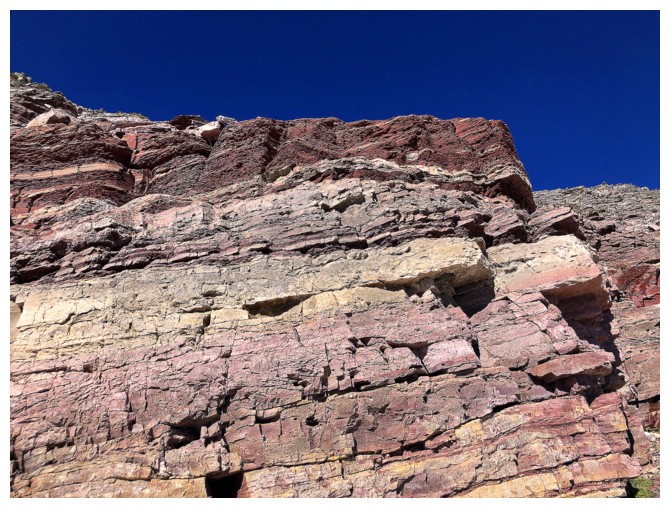
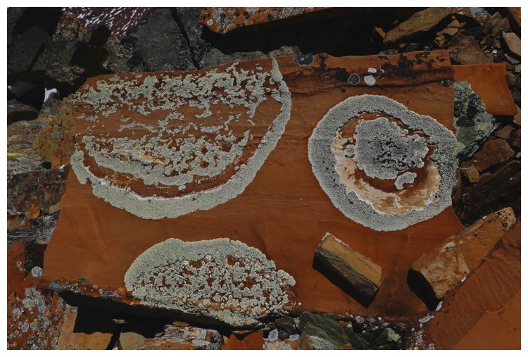
Interesting patterns in the rock (photo by Doug)
The Gulliver of red argillite!
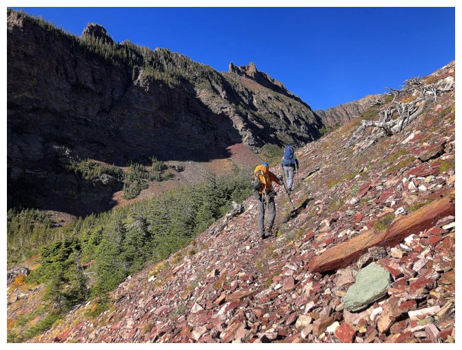
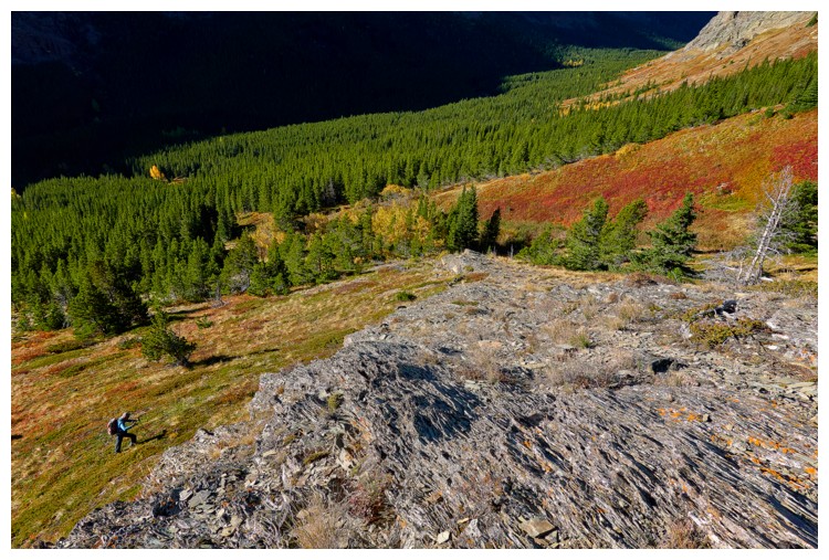
Doug and Raff traverse into the valley southeast of Red
Doug leads us into paradise! (photo by Raff)
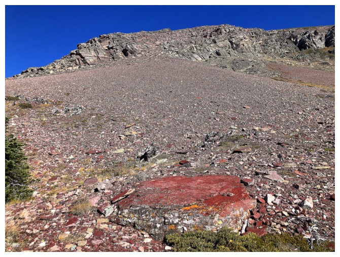
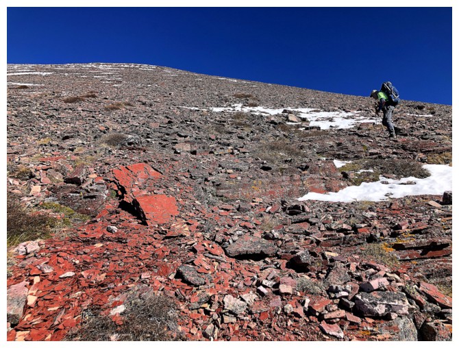
The next section, however, was not paradise! - a long, steep, foreshortened slog up to the ridge
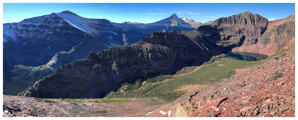
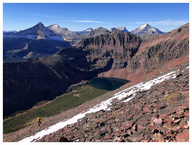
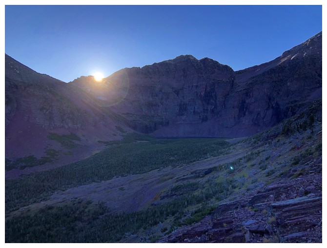
The unnamed lake is over there, somewhere
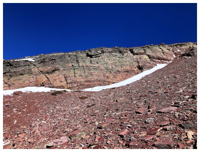
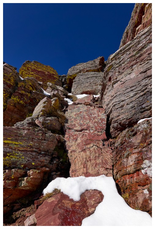
If you are going to slog up steep, foreshortened slopes, it might be well on rock this beautiful
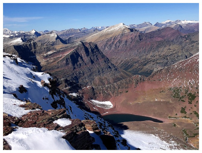
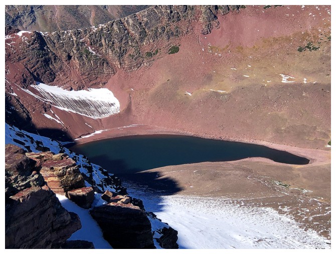
There's the unnamed lake
Ooh! (photo by Doug)
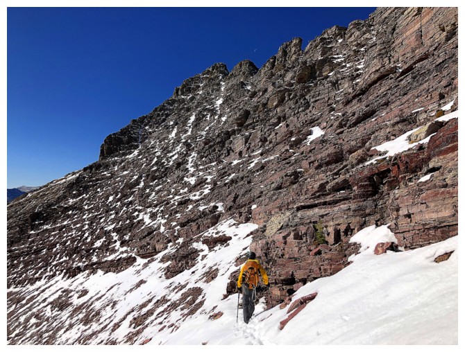
The typical grade of the slopes. Rising Wolf behind.
Some parts of the slope had stable rock, other not so much. This section was quite stable (photo by Raff).
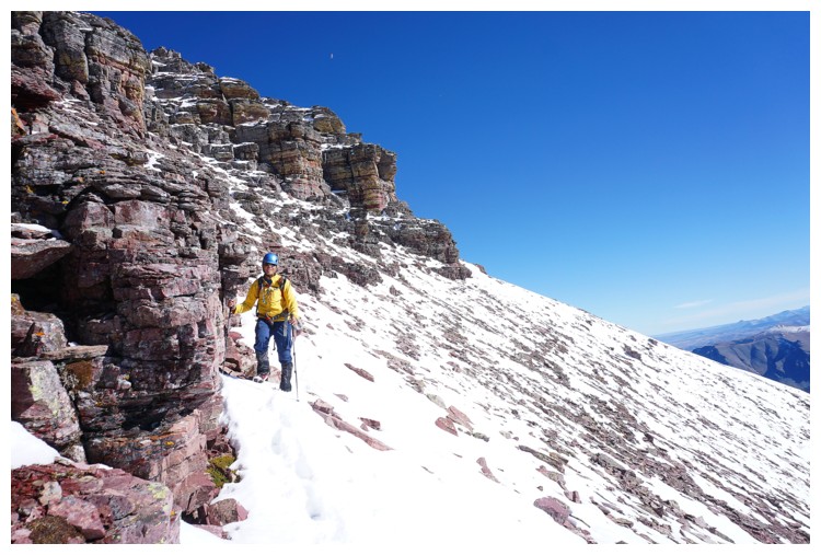
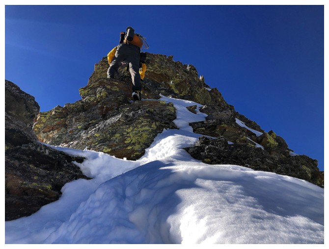
Snow and a cool rock band - I'm going that way
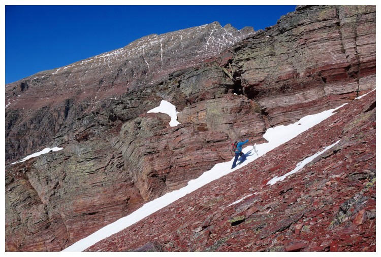
The
slick snow was not much better than the scree, but might as well start
preparing my feet for the cold of the upcoming Canadian winter (photo
by Raff)
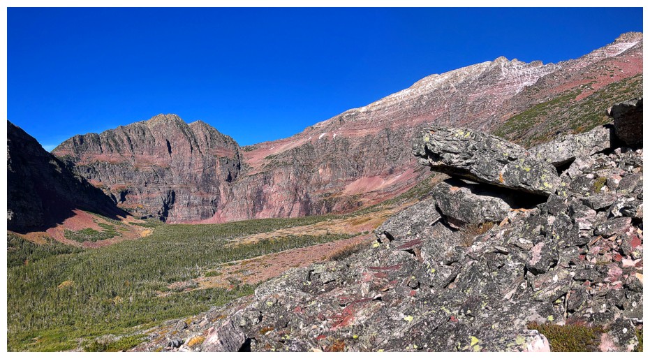
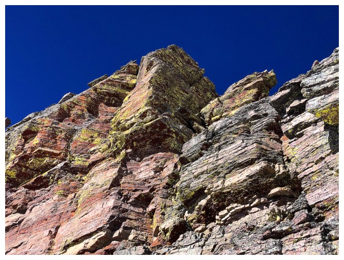
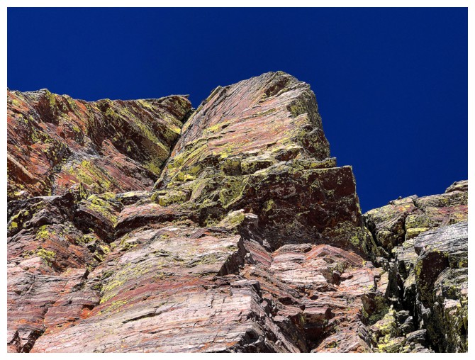
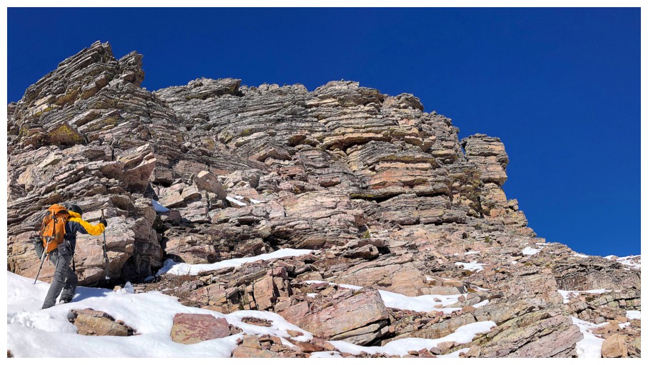
The rock band was super colourful and made up of severely folded rock. Doug is up there on the skyline.
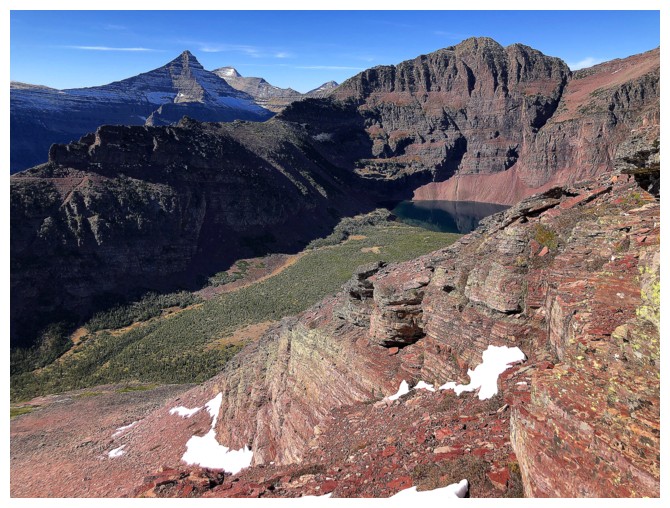
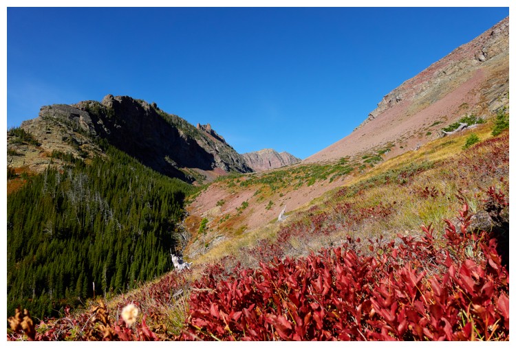
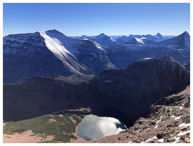
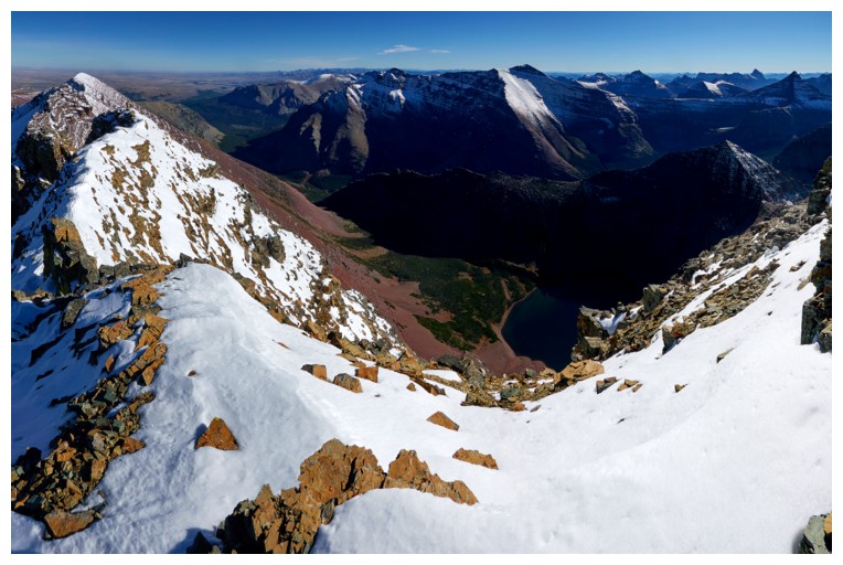
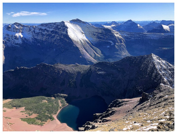
Flinsch Peak, the lake, and the outlier of Red above the lake. We had
faint hopes of reaching the outlier as part of an alternate descent
route, but that was not meant to be.
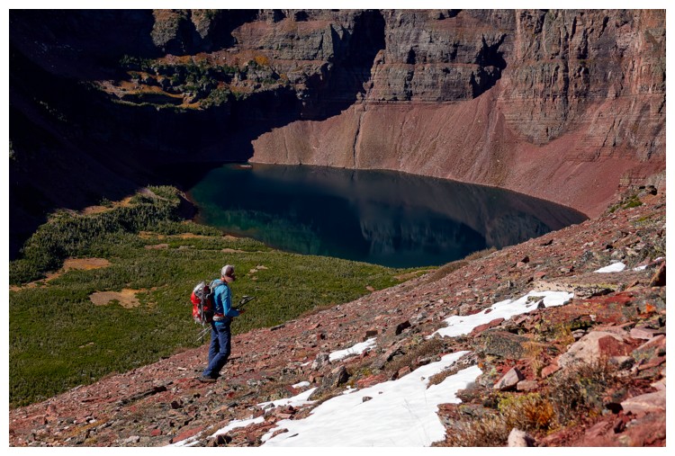
I
also wanted to visit the shores of the beautiful, green/blue lake before
ascending Red, but that was not meant to be either! (photo by Doug)
Still a long way to go to reach the ridge
But Raff is all smiles!
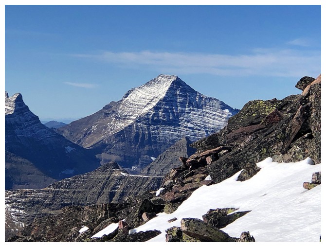
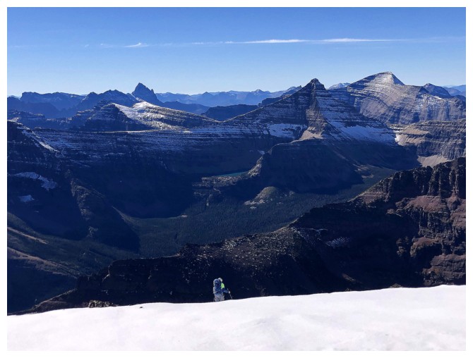
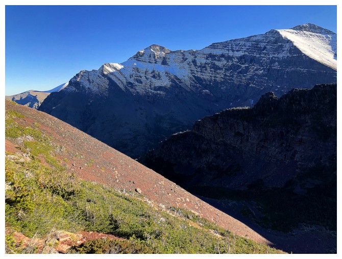
Massive Mount Stimson - one of the six mountains in Glacier that are over 10,000 feet
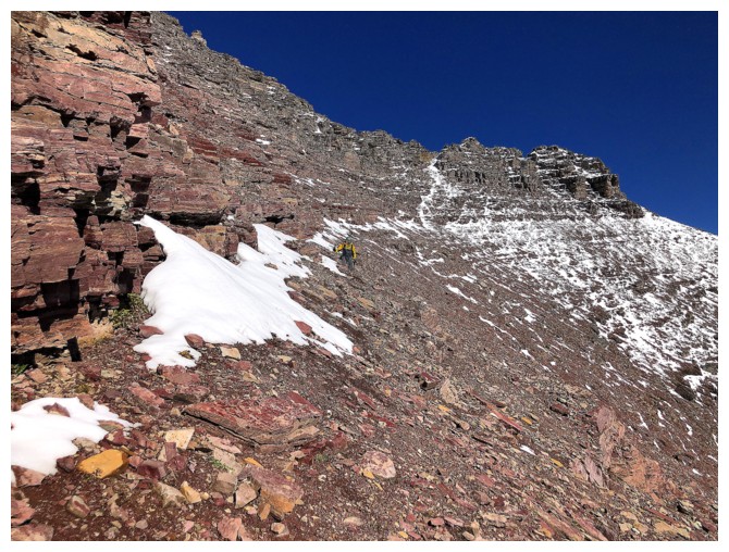
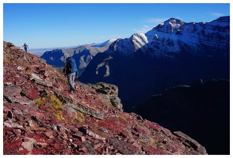
The slogging never seems to end but the view gets better and better
Doug reaches the ridge (photo by Doug)
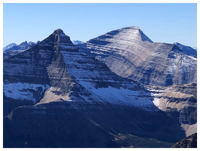
Mount Phillips (right of Flinsch) is also a huge mountain
I hit the ridge further east
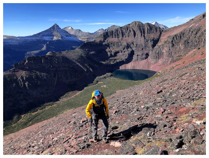
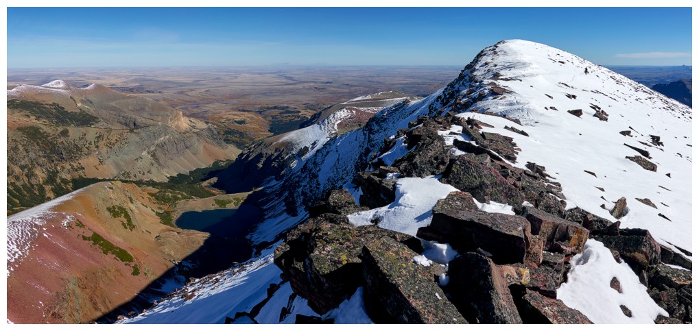
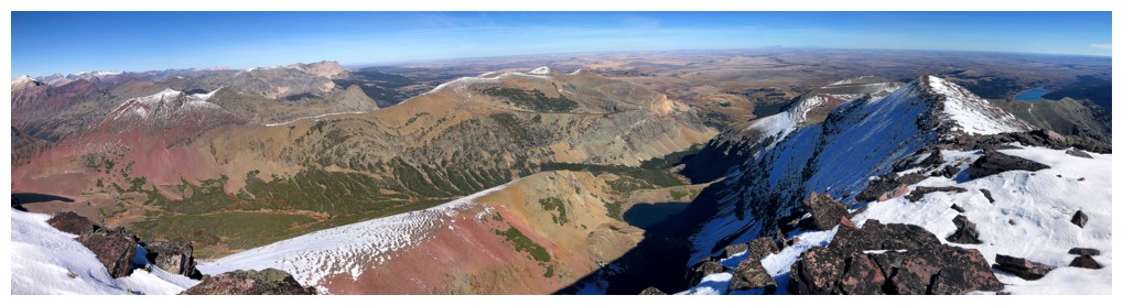
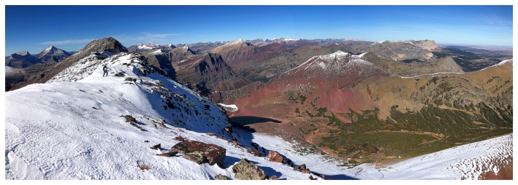
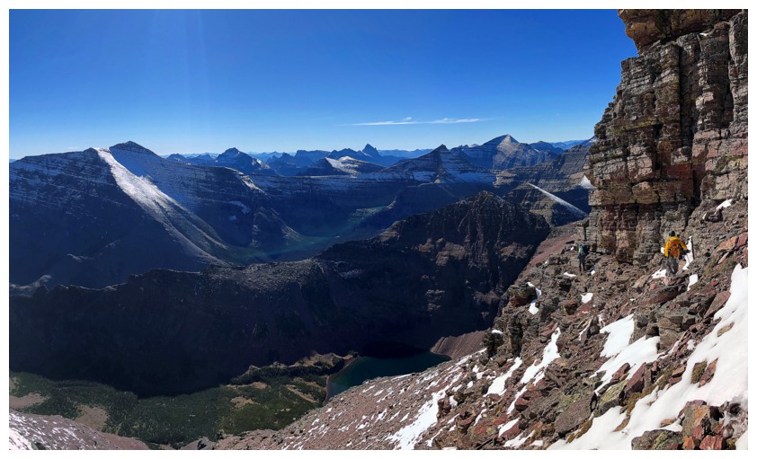
Great views to the northwest. Running Crane Lake in the valley below.
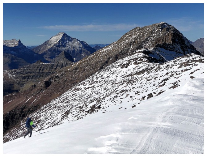
Eagle Plume Mountain is also a mass of red argillite
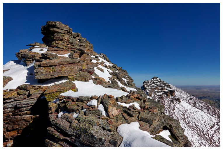
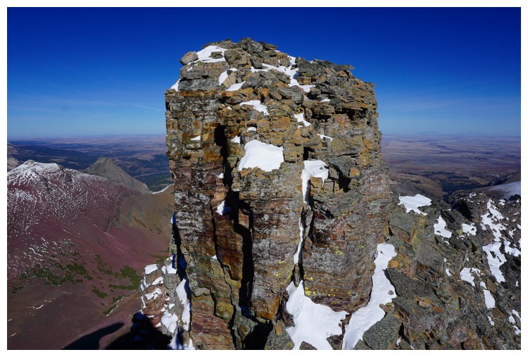
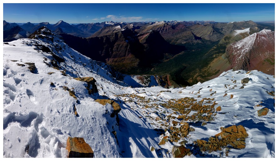
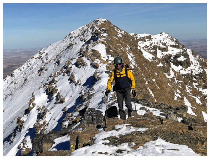
The summit block of Red, looking way closer than it really is
Running Crane Lake
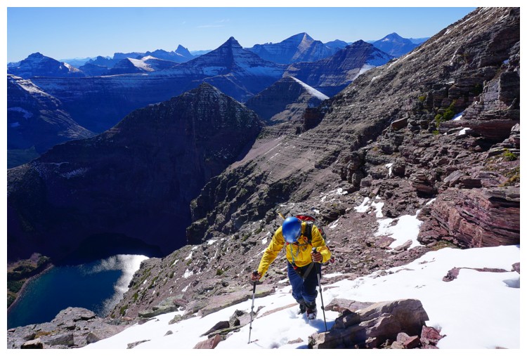
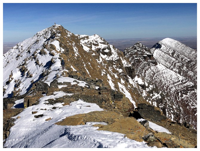
Zoomed in shot of the ridge to the summit (far left). It took us 2 hours, 20 minutes to reach the top from here.
Doug traverses some snow slopes
Doug gaining the ridge again
Raff follows Doug (photo by Raff)
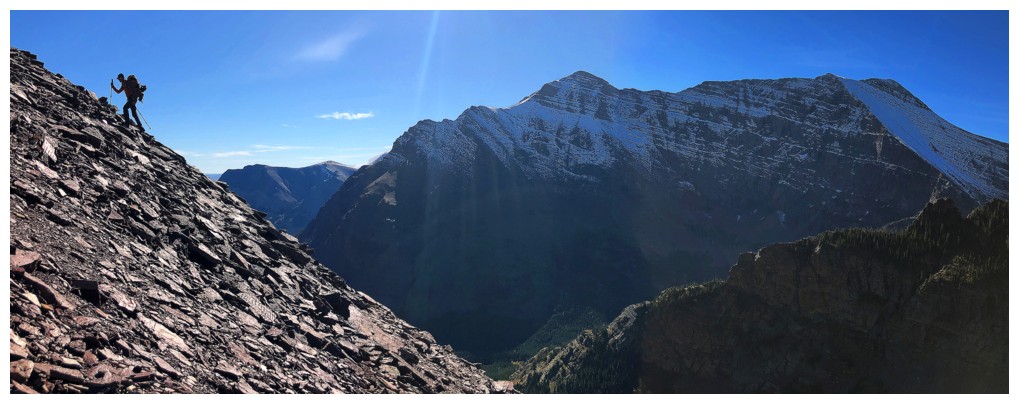
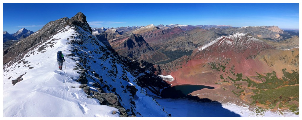
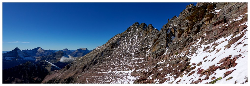
Wicked view! Easier to see why we were still over 2 hours from the summit at this point.
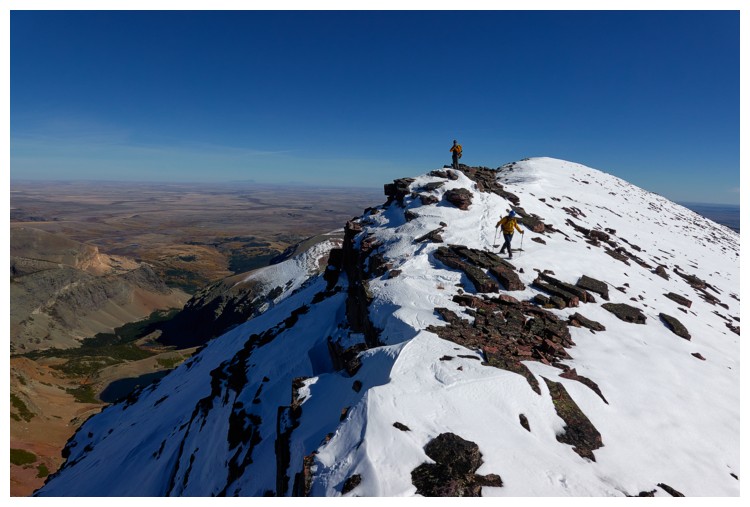
East and scenic ridgewalking (photo by Doug)
Same as above, but in the direction of travel (photo by Raff)

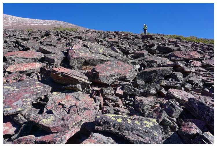
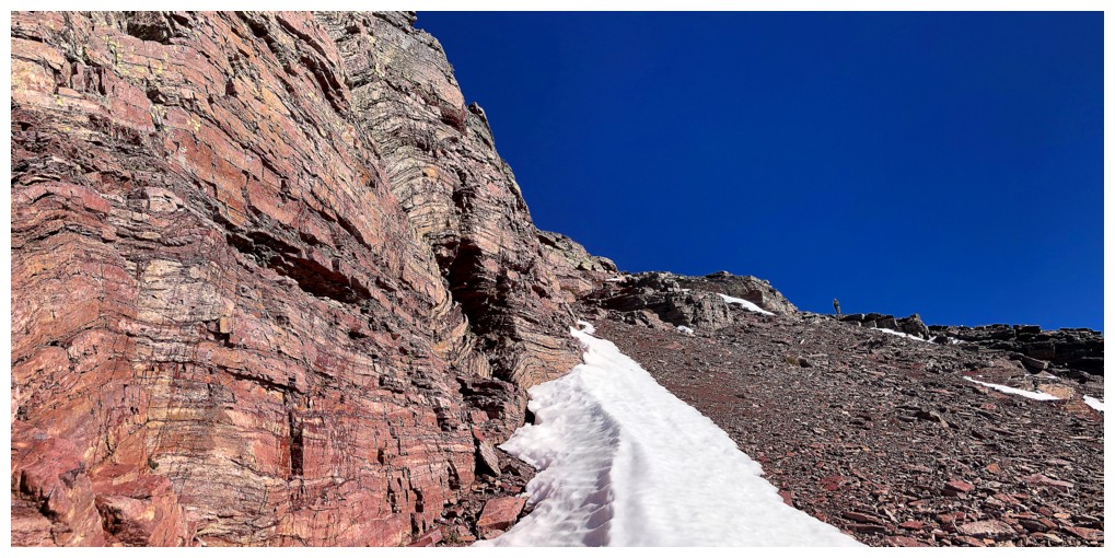
Although the snow is covering lots of the red rock, there is no escaping it!
Circumvented that one
Couldn't get enough of this view
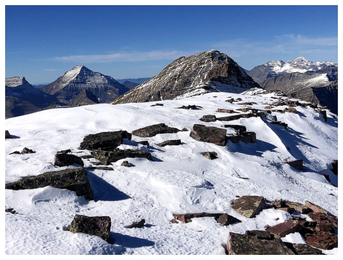
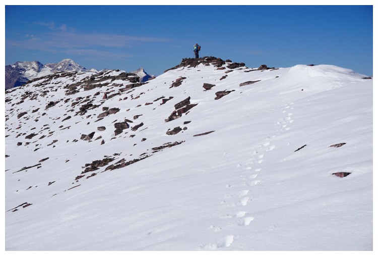
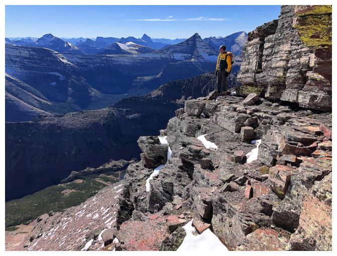
Me and Doug atop a minor highpoint (photo by Raff)
Here comes Raff
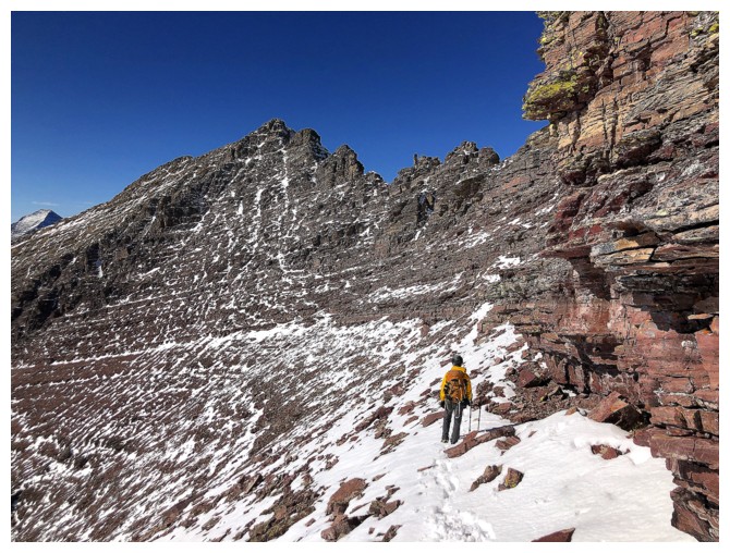
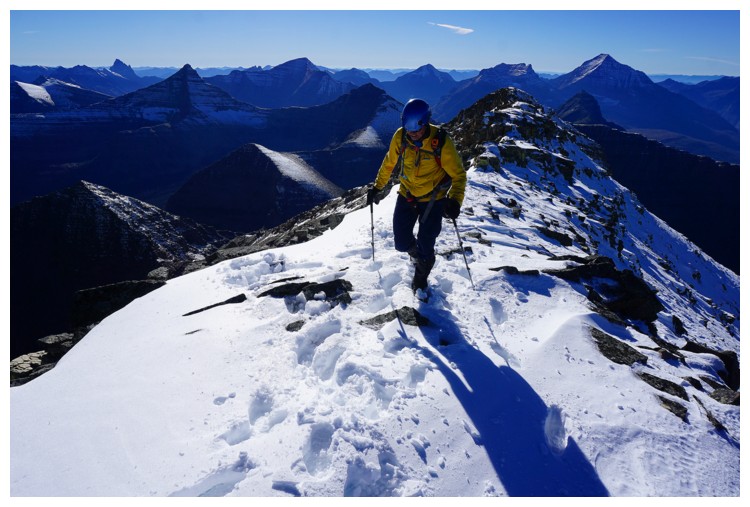
Approaching the more serious section of the ridge (photo by Raff)
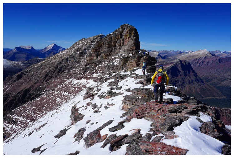
Same as above (photo by Raff)
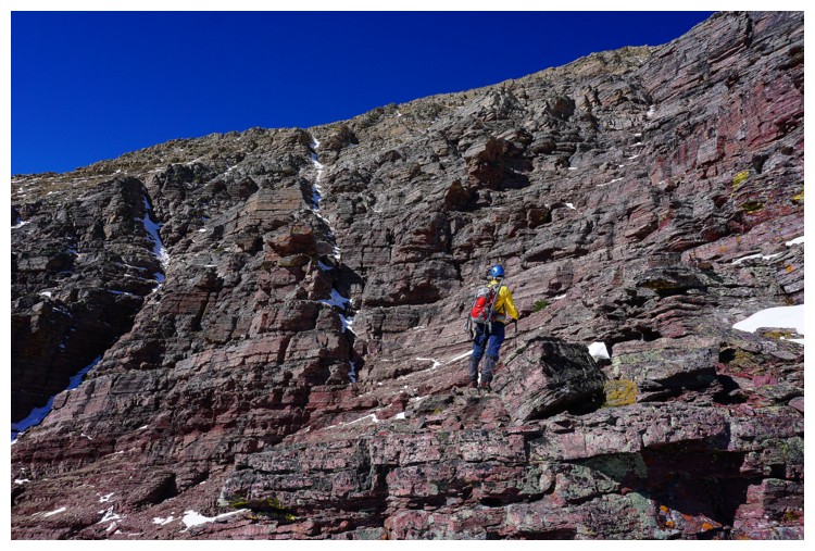
As stated, you cannot escape the beautiful rock (photo by Doug)
Same as above
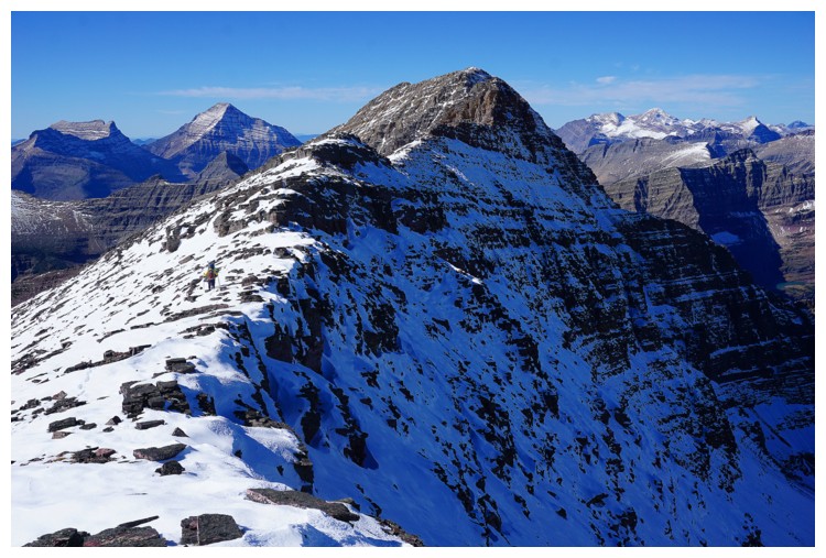
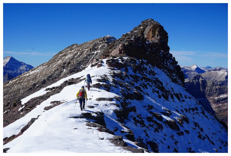
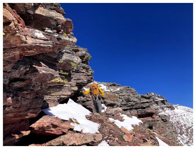
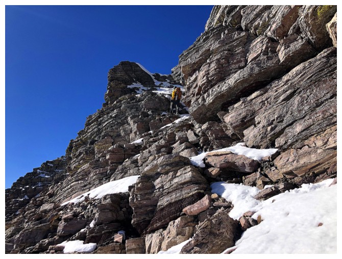
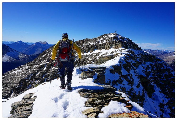
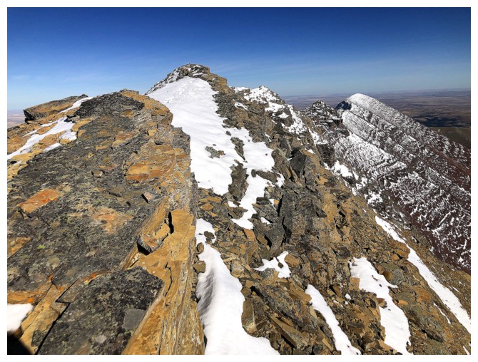
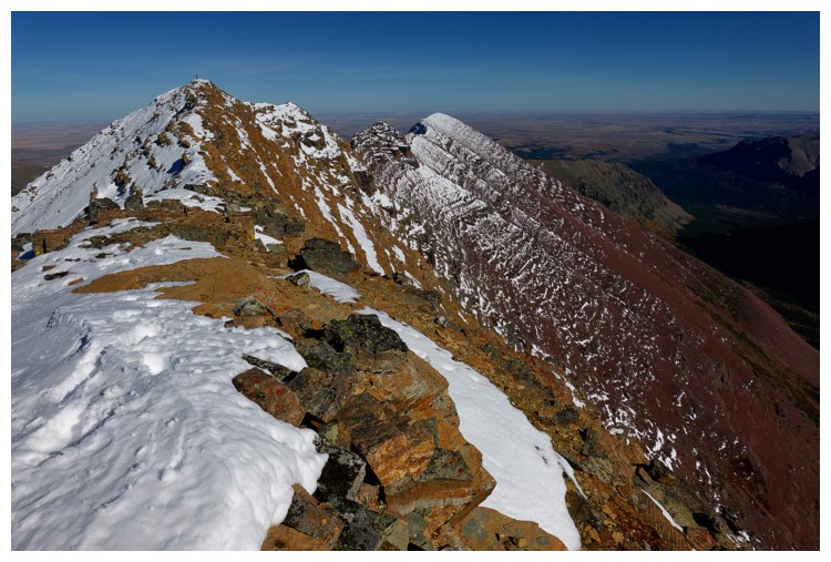
Staying on the ridge became increasingly challenging
Doug did an awesome job of maximizing his time on the ridge
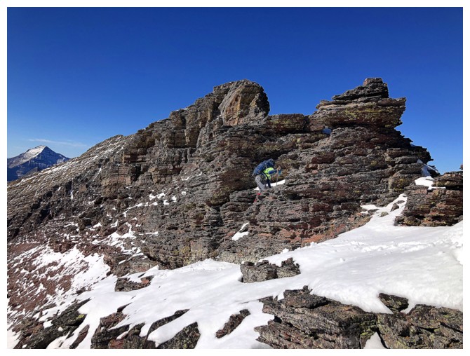
Unfortunately, "Every man has his breaking point." The highpoint ahead was not scrambling terrain and we had to circumvent it. The summit is not yet visible.
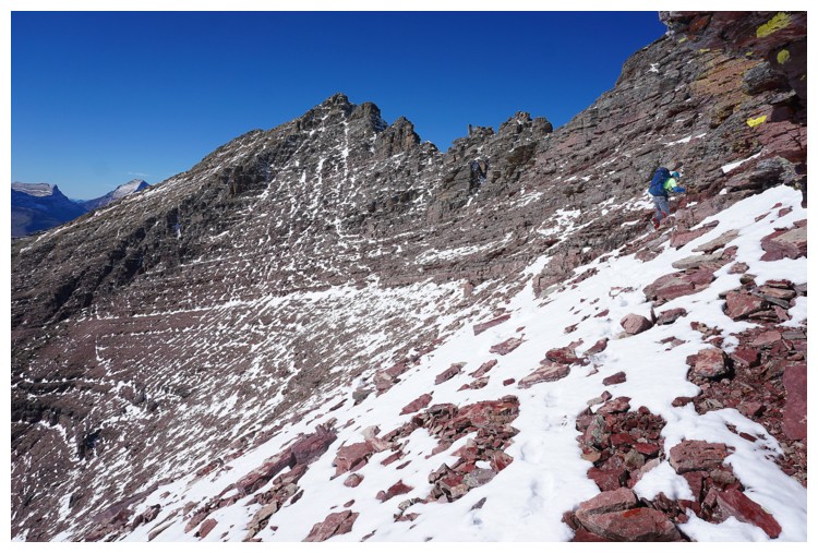
Raff on the ridge
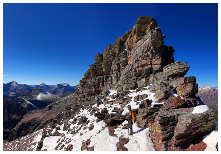
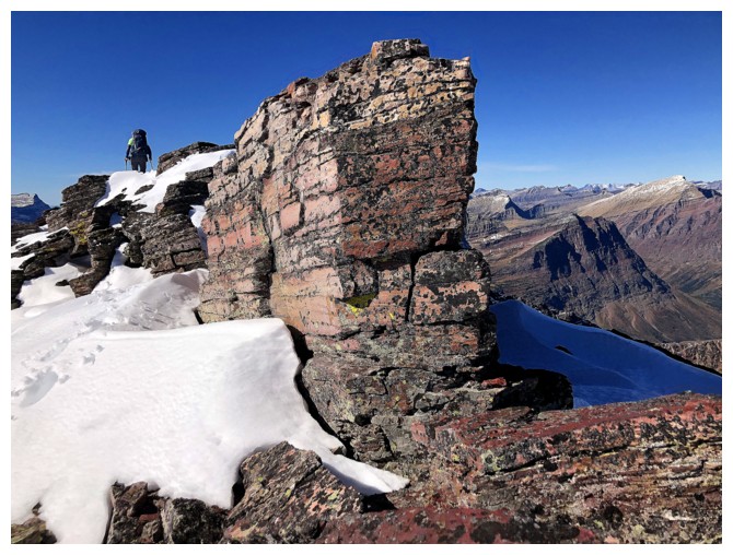
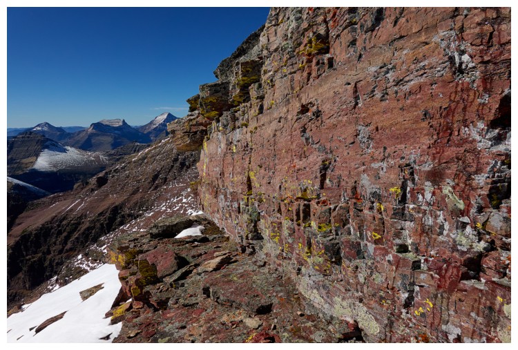
Doug leads the route around the stunning rock
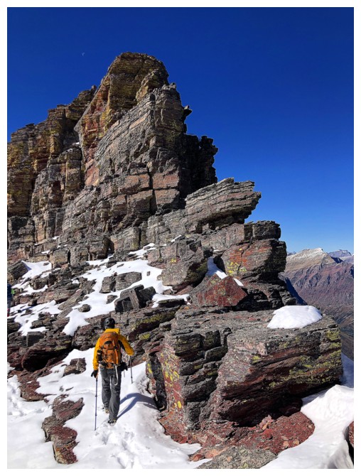
Raff follows
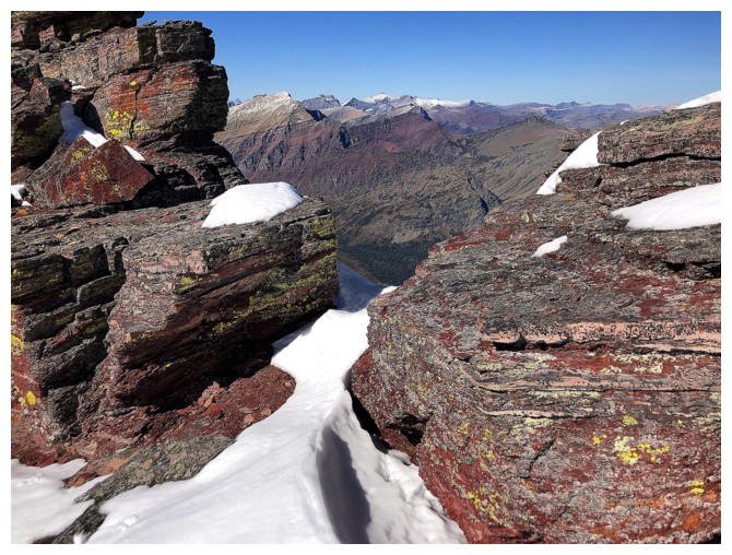
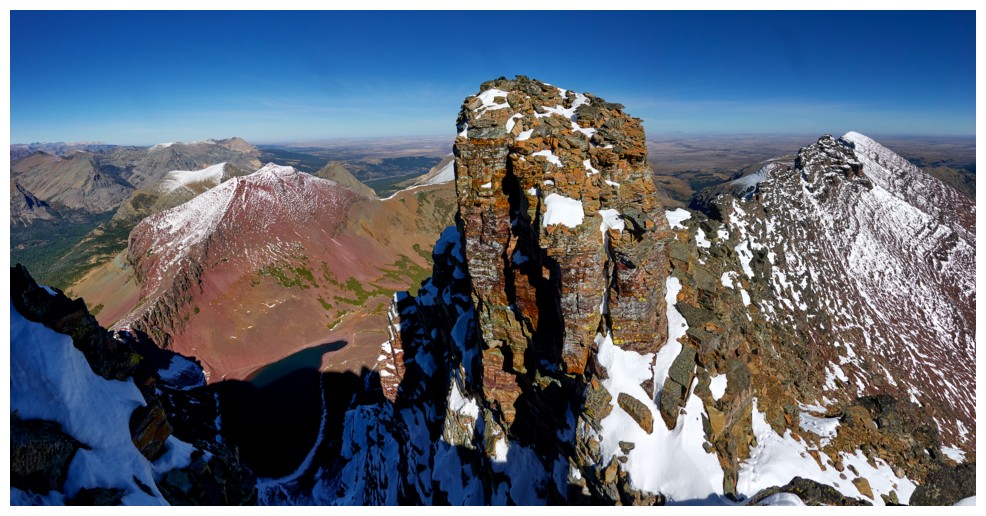
A small gap between the red argillite magic reveals Mount James, Amphitheater Mountain, and Little Amp Peak
Back to the magic
Traversing below the magic (photo by Raff)
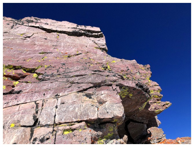
The only thing missing was yellow lichen and there it is!
Same as above
Sweet lord!
Doug did his best to stay high, right below the base of the rock band, but eventually we did have to lose some elevation
Raff takes in the view before rounding the corner to lose the elevation
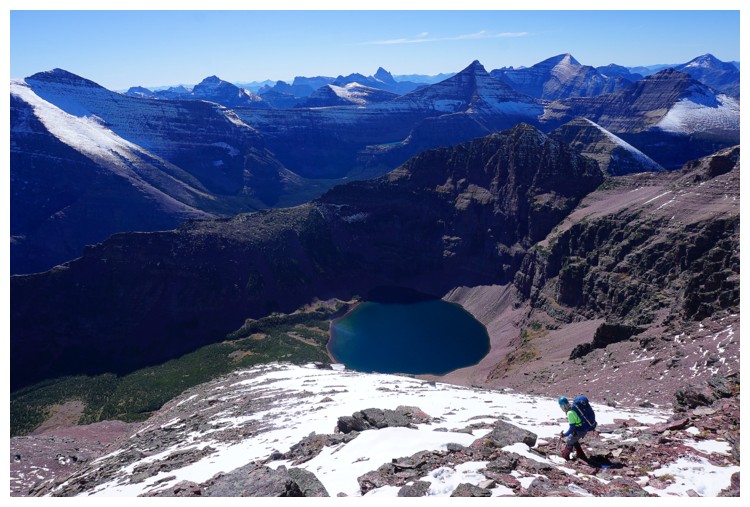
Heading down, That's a very circular lake! (photo by Raff)
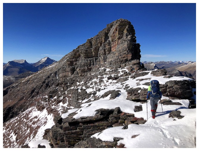
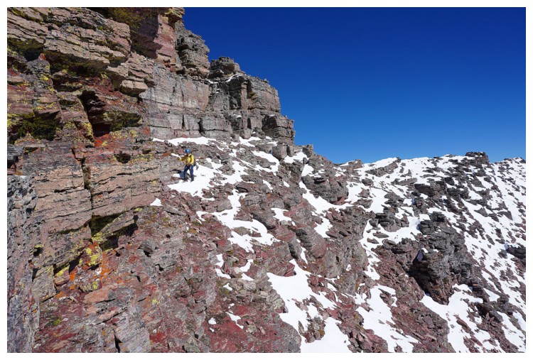
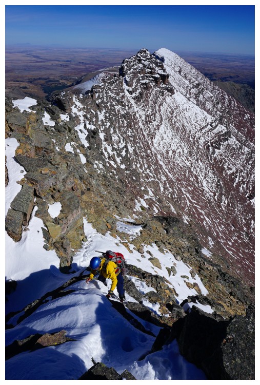
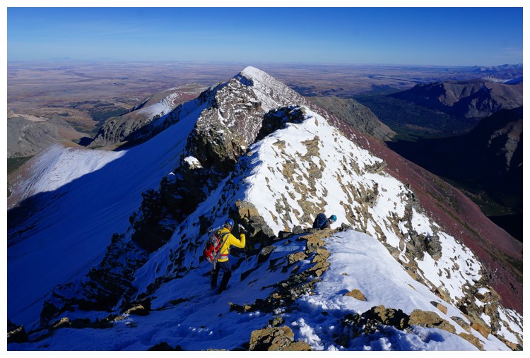
The summit is finally in visual range and getting there does not appear to be a cakewalk! (photo by Doug)
Raff checks out the route ahead
Doug heads up towards the ridge, following Keegan's route (photo by Raff)
Sweet lord again!!
Raff leads the low route
Some of the terrain Doug was confronted with (photo by Doug)
He's back on the ridge (photo by Doug)
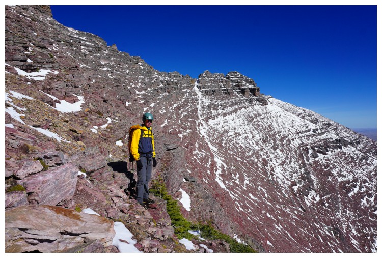
Raff and I had easier terrain to deal with, but our route was somewhat circuitous (photo by Raff)
...but still littered with amazing rock
Looking back across the slightly descending traverse to Sonny's route
We soon reached terrain that seemed to be beyond scrambling (photo by Raff)
However, Raff found the easy route going up to the right
I follow (photo by Raff)
From
this vantage point the traverse we just did appears to be on very steep
terrain, but it's an illusion and far easier than appearances dictate
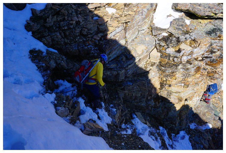
Doug runs into more terrain that must be circumvented (photo by Doug)
Again, the terrain looks steeper than it really is
Glare on the lake, but it still looks cool
Raff approaches the ridge
Finally turning up and left towards the summit ridge
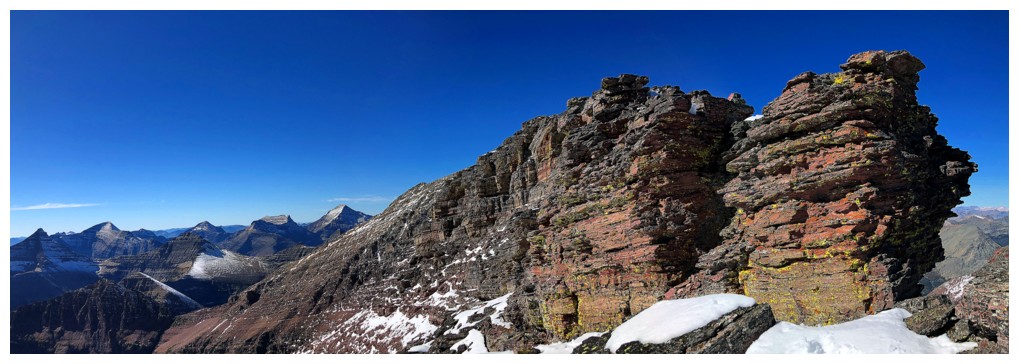
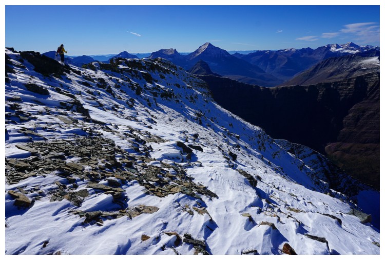
More of this awesome upper ridge (photo by Doug)
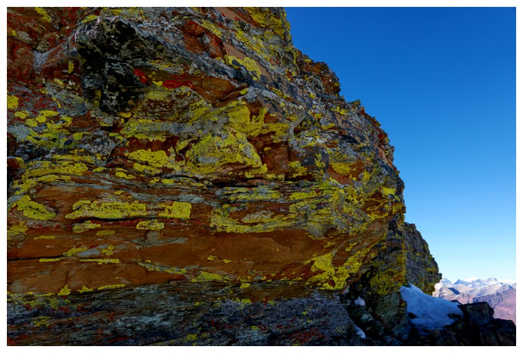
And a good dose of lichen (photo by Doug)
Green/gray lichen on rust coloured rock? That's a new for me! (photo by Doug)
Raff scrambles up a small step
I do the same (photo by Raff)
Doug gets a great view of Eagle Plume and the summit of Red at the far left (photo by Doug)
Looking back along Red's east ridge (photo by Doug)
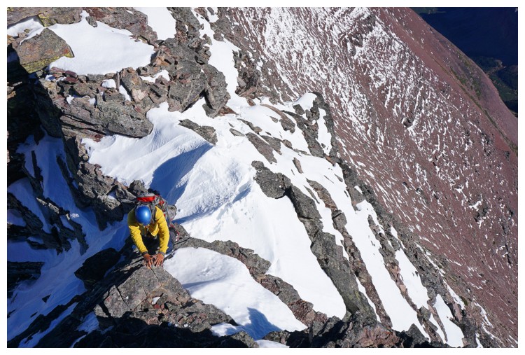
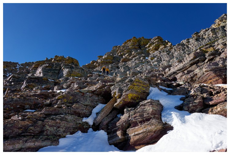
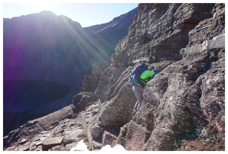
Another step of enjoyable hands-on scrambling (photo by Raff)
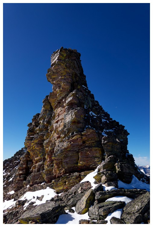
Another stunning rock feature that we were forced to circumvent (photo by Raff)
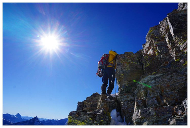
Doug is seconds away from the top (photo by Doug)
I'm minutes away (photo by Raff)
But not before tackling another minor step (photo by Raff)
Final few steps for Raff
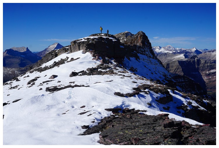
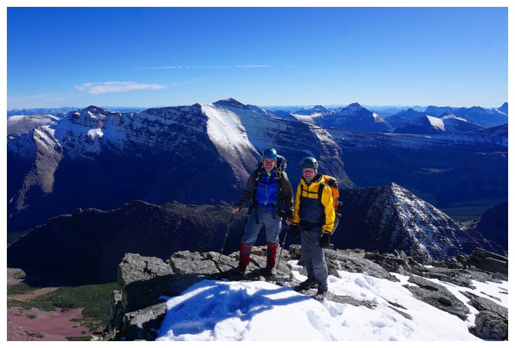
Success! (photo by Doug)
Raff signs the register book Doug brought with him
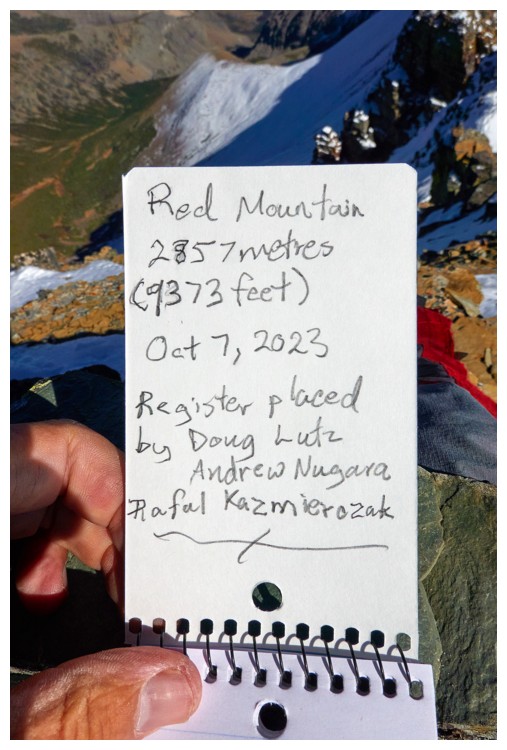
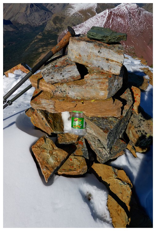
The new register book and makeshift register placed by Doug in the cairn (photos by Doug)
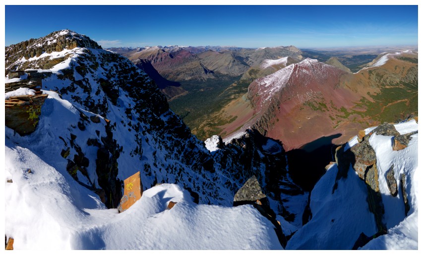
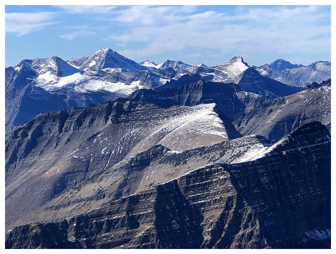
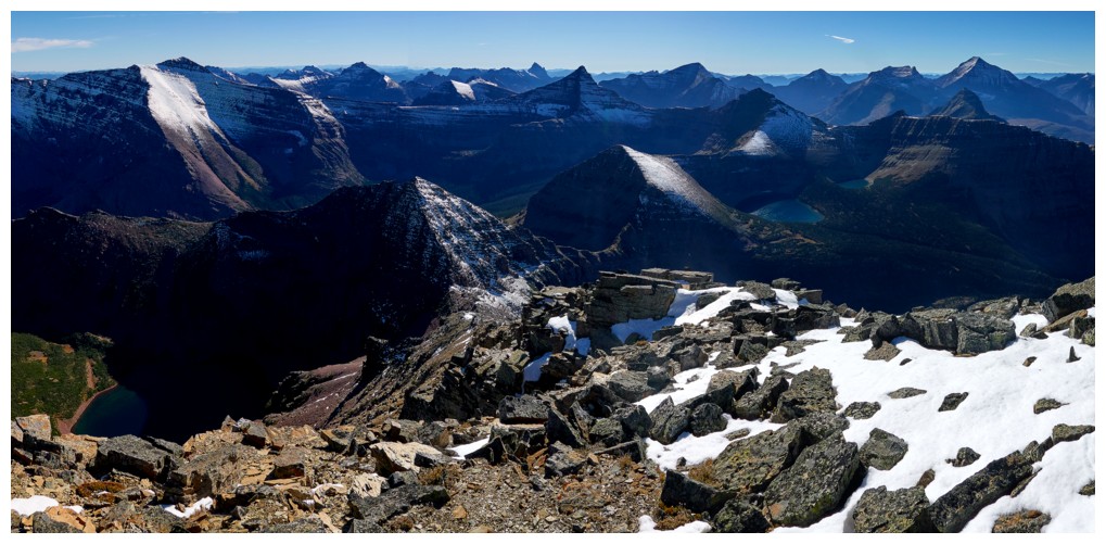
Eagle Plume, Bad Marriage, Kupunkamint, White Calf, and Divide can all be seen to the north
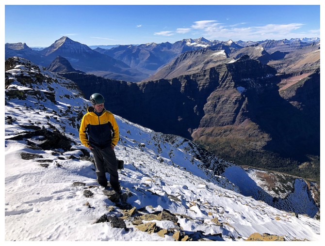
Raff and the view to the southwest
Blackfoot, Jackson, and Logan in the distance
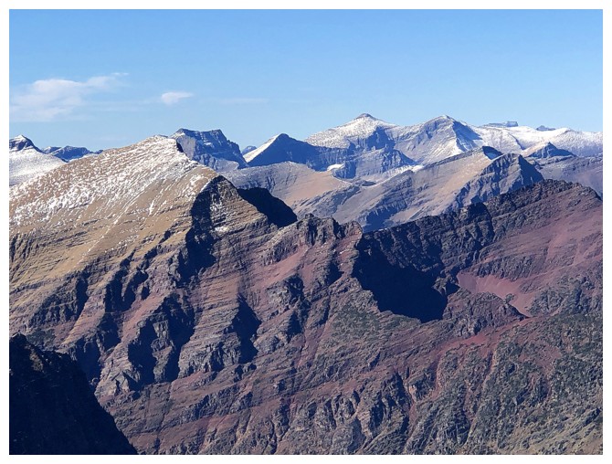
James at the left and I think that's Little Chief just right of centre
Closer look at Kupunkamint and White Calf
Yellow and Chief are very distant but clearly visible
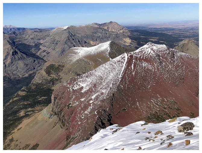
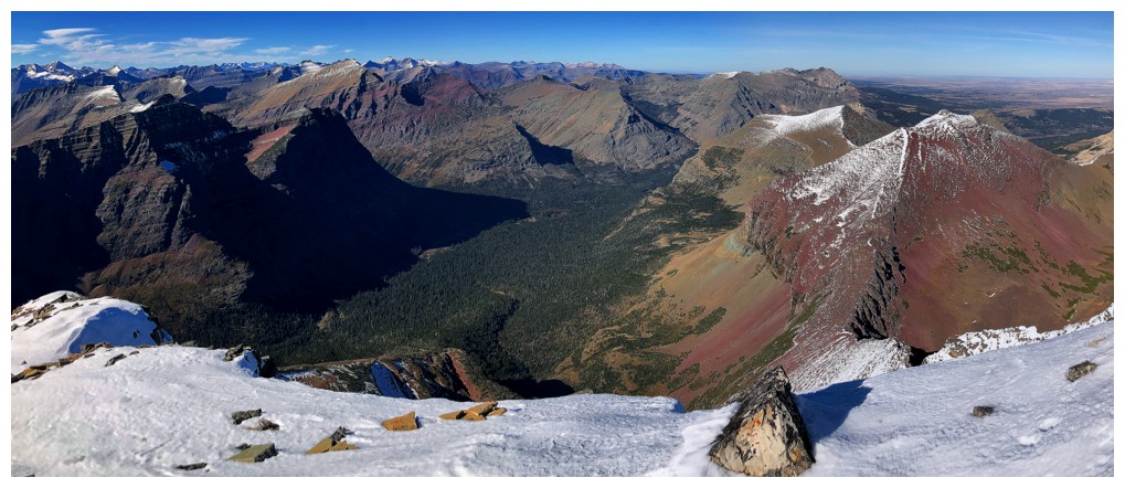
Summit view to the southeast (photo by Doug)
Summit view to the northwest (photo by Doug)
South
East (photo by Doug)
Northeast (photo by Doug)
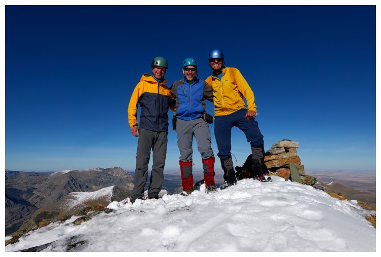
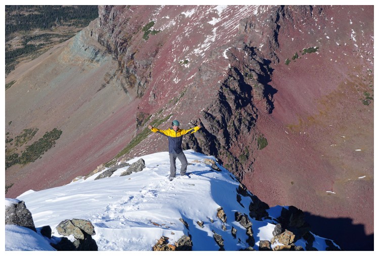
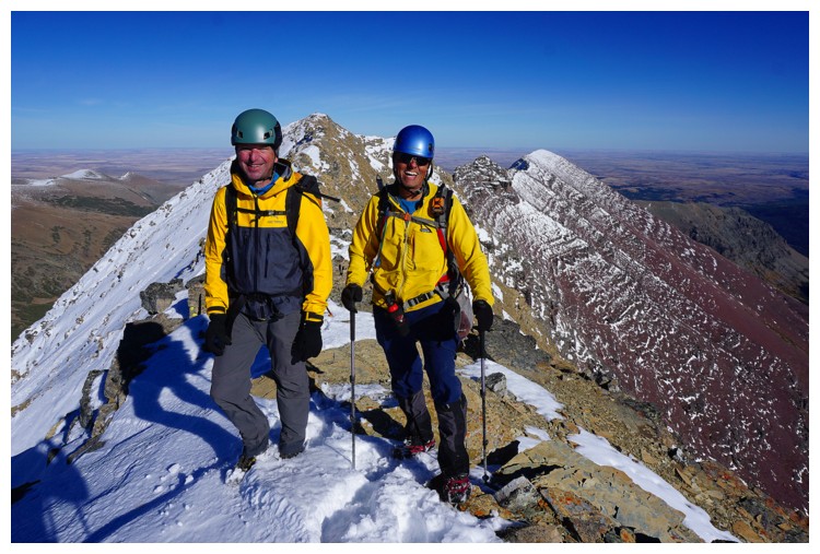
A very happy summit trio. Shocking that Doug is the only one that got the RED memo! (photo by Doug)
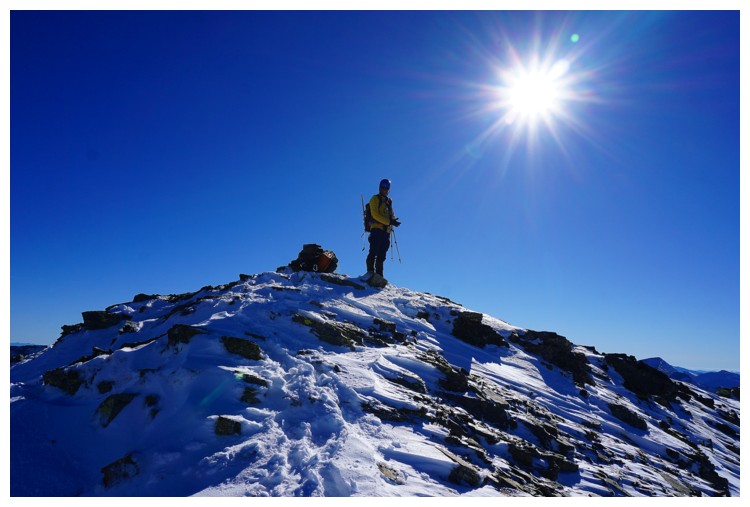
Raff's camera does a nice job with the Sun (photo by Raff)
Doug descends a short distance north to the scenic vantage point (photo by Raff)
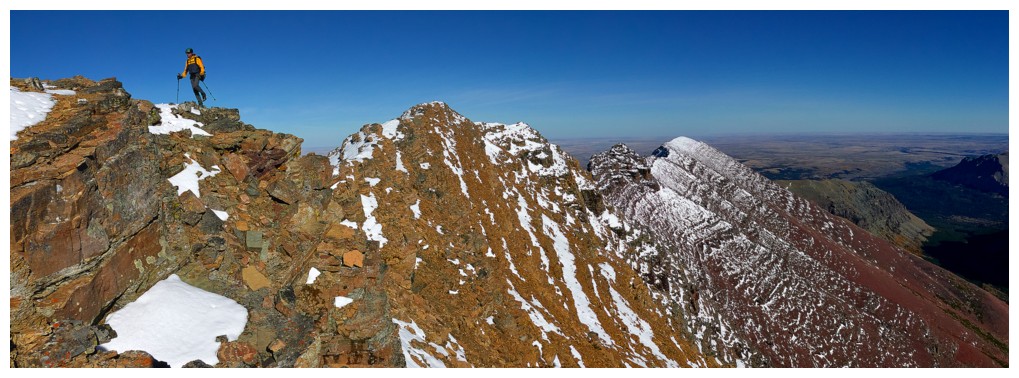
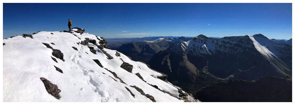
 Meanwhile I'm racing off to the west summit (photo by Raff)
Raff goes to the scenic point (photo by Doug)
Close-up (photo by Doug)
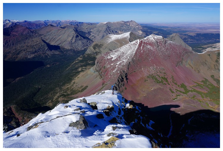
View back to the summit from the traverse
Same as above
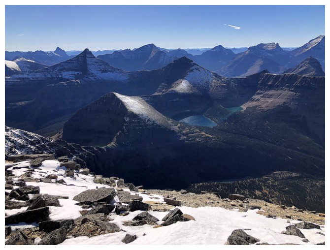
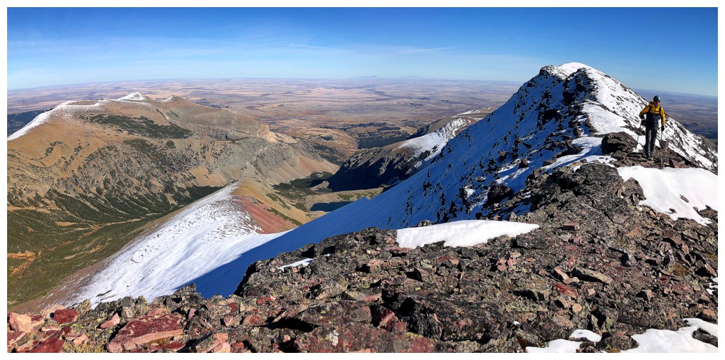
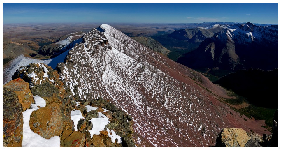
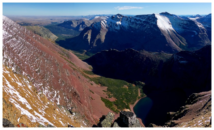
The lure of the west summit is the additional lakes you see
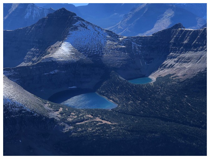
Below Mount Morgan sit Pitamakan Lake (left) and Seven Winds Of The Lake
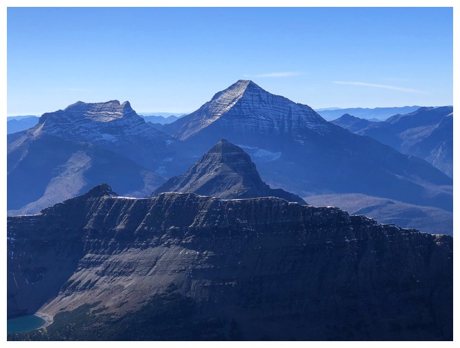
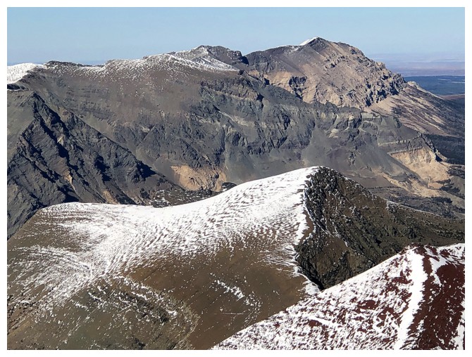
Tinkham Mountain in front of Stimson, Mount Pinchot to the left
Another round of summit views. East (photo by Doug).
Southwest (photo by Doug)
West-south-west (photo by Doug)
North and northwest
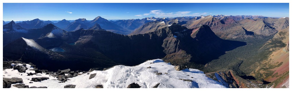
West
Raff arrives at the west summit
Two thirds of the summit team
Also two thirds of the summit team! Confusing? (photo by Doug)
Returning to the true summit (photo by Raff)
Same as above (photo by Raff)
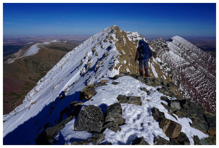
Leaving the summit (photo by Raff)
Definitely some terrain on descent that requires care (photo by Raff)
And some terrain that can be descended quickly (photo by Doug)
My turn to point out a potential route down (photo by Raff)
Heading in that direction (photo by Doug)
Same as above. We lost elevation and then traversed, essentially taking Sonny's route (photo by Raff)
Doug downclimbs a small step (photo by Raff)
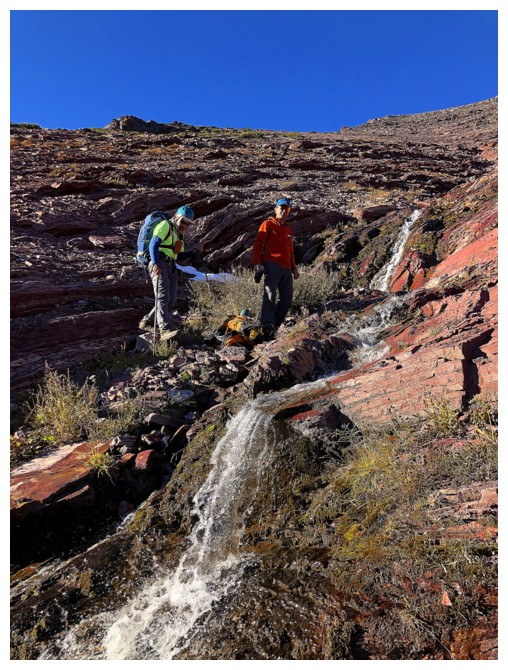
Perfect timing as our water supplies were running low (photo by Raff)
Close-up
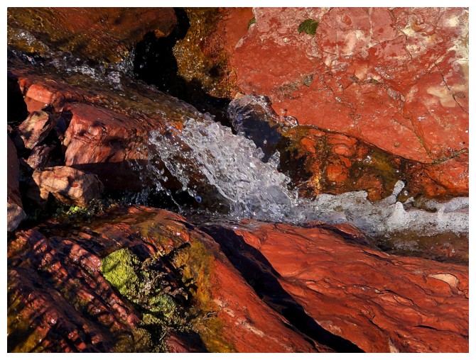
A beautiful stream
Still traversing and slowly losing elevation
Doug is about lose the warming rays of the Sun
Farewell Sun
Raff is enjoying a few extra minutes
So is Rising Wolf
Still lots of time for cool rock encounters

The colours are muted without the Sun (photo by Raff)
Spot Mountain gets its last rays
Back to the first RED section (photo by Raff)
Farewell RED
Hello YELLOW (photo by Doug)
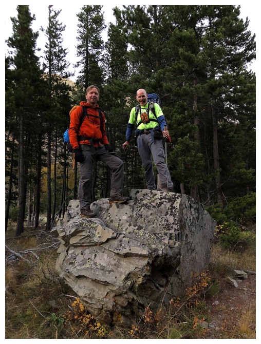
Doug and Raff still had enough energy to boulder the boulder. I had
enough energy to photograph the event and then curl up in the fetal
position for 10 minutes!
The End
LOG