Redwood Peak IV
April 29, 2023
Mountain height: 2340 m
Elevation gain: approximately
900 m
Round-trip time: 7:45
Same as above
Solo scramble.
Trembling from a healthy dose of fear and trepidation
after reading the avalanche bulletin for the weekend, I headed south, where the
conditions were likely to be more benign. I expected the Southern Alberta
mountains to be holding less snow than those farther north, but many in fact
were holding little to no snow. This was great news – time to pick an
objective.
As has become the case more often than not, I drove
into the East Castle without an objective in mind, but then recalled a failed
attempt to find a direct route up to the middle summit of the lengthy Drywood
Mountain massif. Brad had nicknamed the peak “Redwood” - game on!
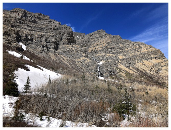
 After biking the 4 km gas road, I started up the Bovin
Lake Trail. Initially, I intended to hike to a point immediately southeast of
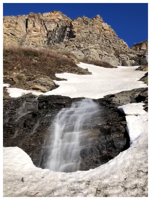
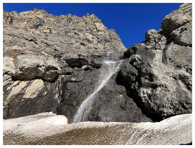
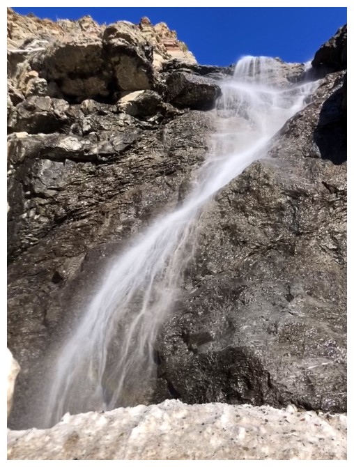
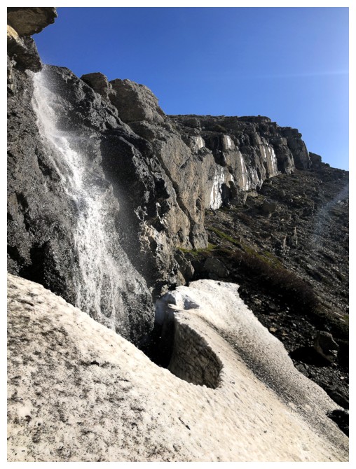
Redwood and then start up the mountain. However, a waterfall caught my
attention and not checking it out was not an option. Upon reaching the fall, I
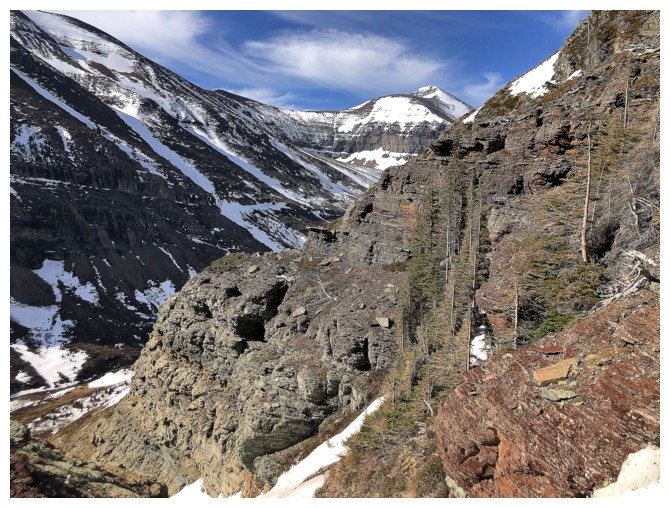
started a tedious traverse below the colourful but near vertical rock lining
the mountain’s south face.
After biking the 4 km gas road, I started up the Bovin
Lake Trail. Initially, I intended to hike to a point immediately southeast of
Redwood and then start up the mountain. However, a waterfall caught my
attention and not checking it out was not an option. Upon reaching the fall, I
started a tedious traverse below the colourful but near vertical rock lining
the mountain’s south face.
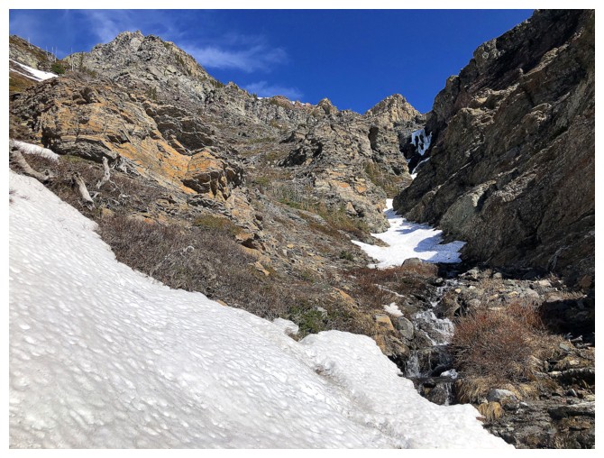
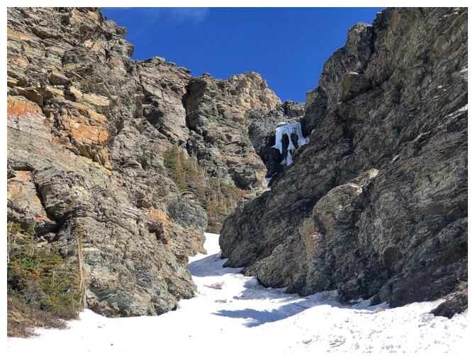
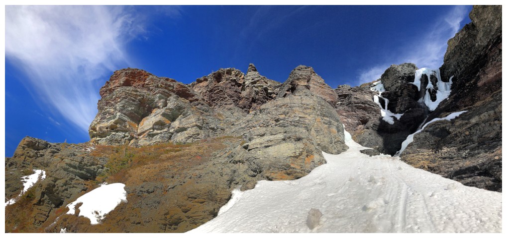
I didn’t make it to the intended ascent line, lured up
the mountain by a beautiful snow gully in canyon-like terrain. I expected to
reach an impasse at some point, but there were plenty of easy routes out of the
gully and onto easier terrain on both sides of it. The remnants of what clearly
what once was an impressive frozen waterfall was eventually reached. 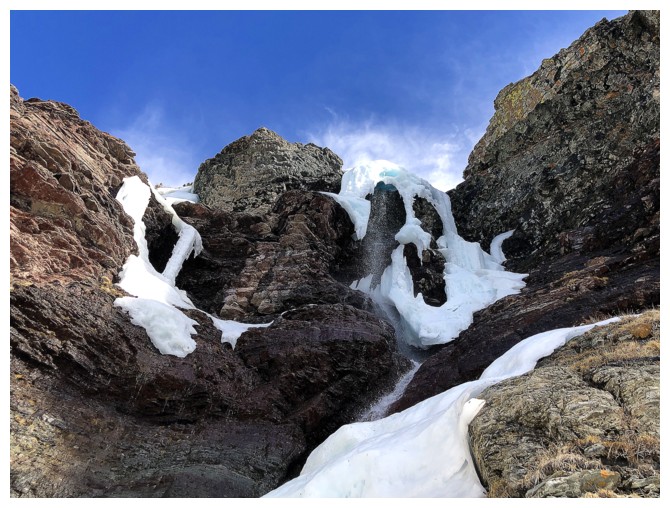 This did
present an impasse, but I only had to back up a short distance to get around
it.
This did
present an impasse, but I only had to back up a short distance to get around
it.
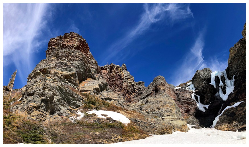
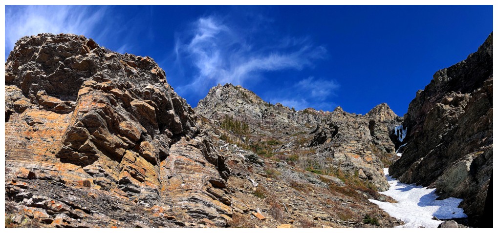
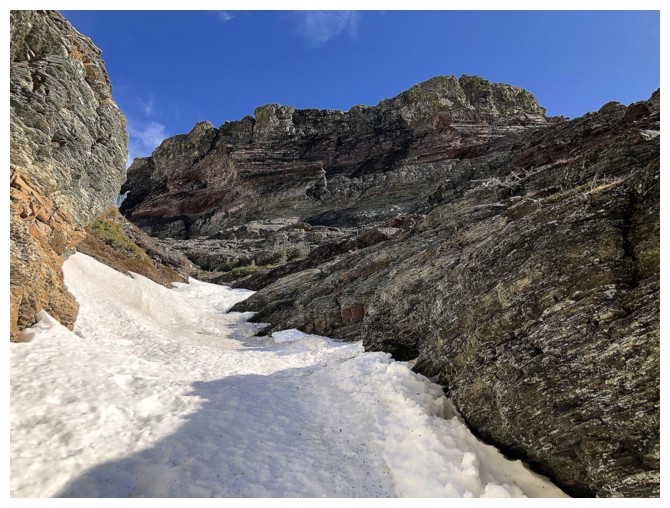
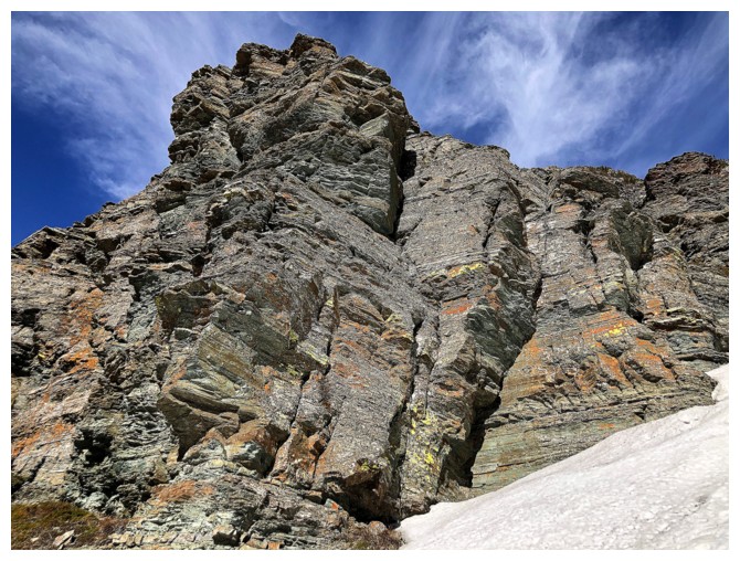
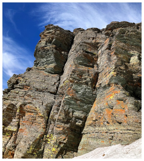
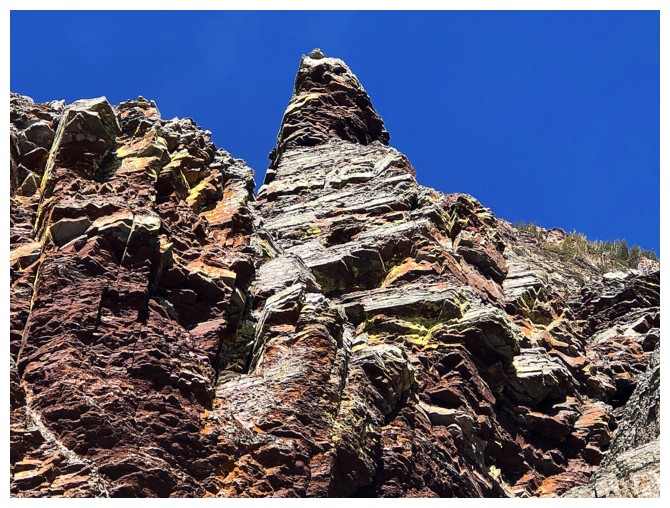
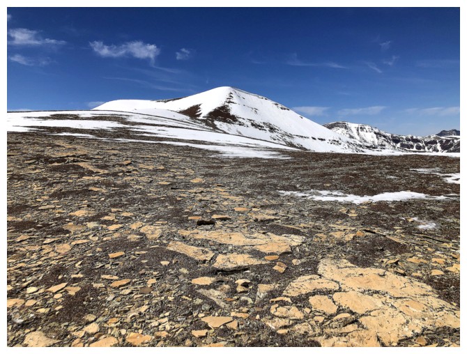
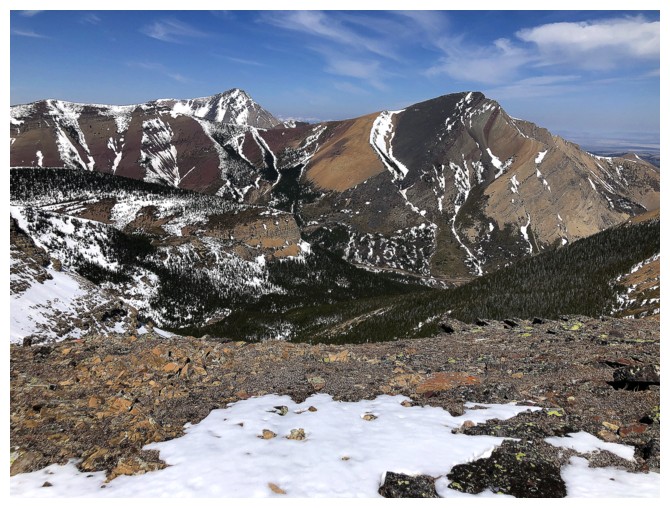
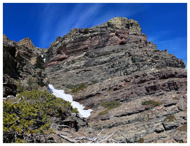
Travel up the mountain continued to impress, featuring
what is expected of all Castle area ascents: colourful rock in striking layers
with terrific views in every direction. Also impressive was the insane rate at
which I was gasping for breath on each step! By the time I reached the ridge,
physical depletion had long since passed (and it took any desire to continue
the trip with it). Nevertheless, the summit of Redwood was within striking
distance, and I so plodded slowly up to the summit at an excruciatingly slow
pace.
I had planned on looking for a different way down the
mountain, but my body was saying, “Not on my watch!”. The prospect of getting
cliffed out on an experimental route down and then having to reascend the
mountain didn’t sit well with any aspect of my being. Good thing too, because
shockingly both of my almost new crampons broke near the top of the route!
Luckily, I had microspikes and was also able to avoid all the really steep
snow slopes by sticking to as much rock as possible and taking a slightly
different route down.
Besides my unexpected level of physical exhaustion, an
excellent day of engaging exploration on one of my favourite southern Alberta
mountains.
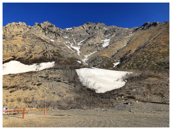
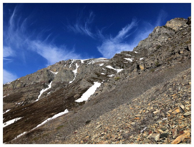
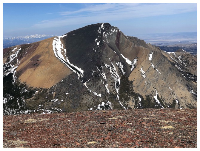
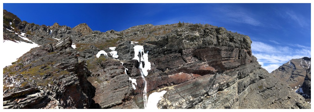
Looking up my down track for a recent ascent of Drywood Mountain
The "normal" route
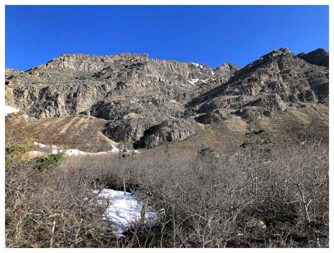
Heading up to the first of several melting out waterfalls
#1
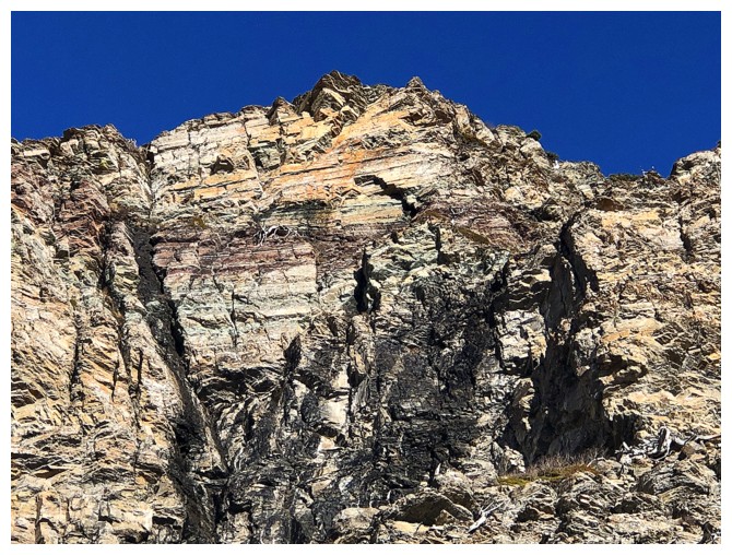
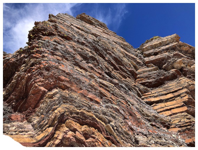
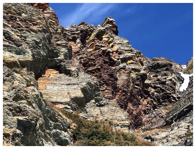
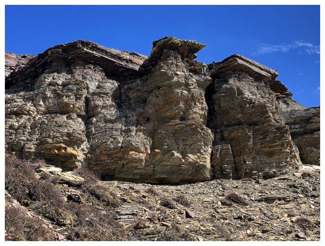
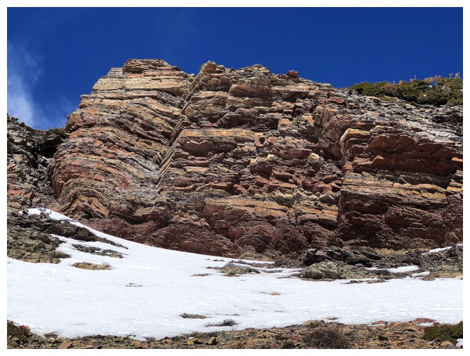
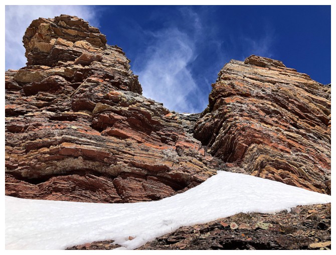
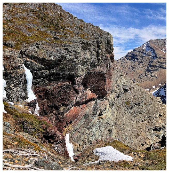
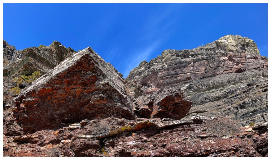
Awesome layers of rock up high
#2
Close-up
#2 and the infamous limestone rock band
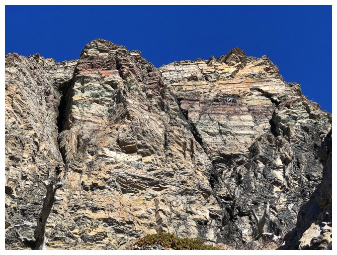
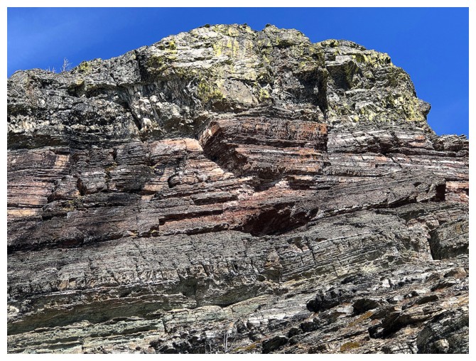
More awesome layers of rock
Traversing below the limestone band
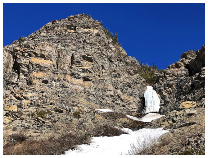
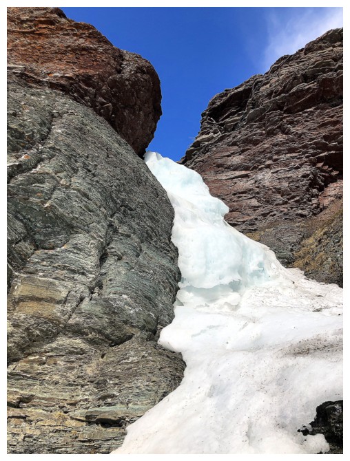
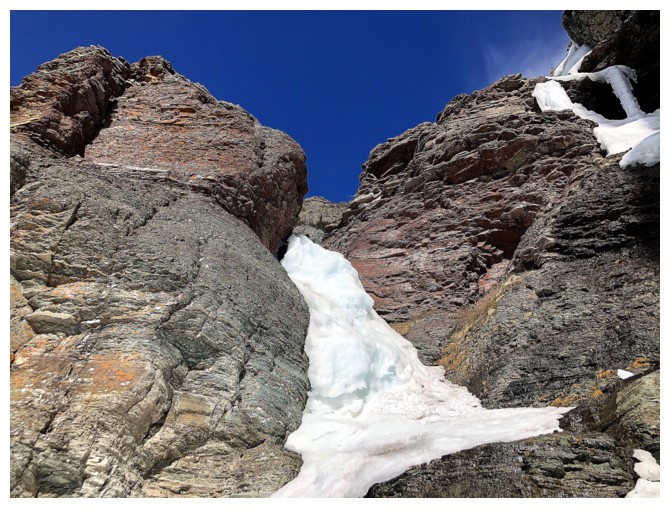
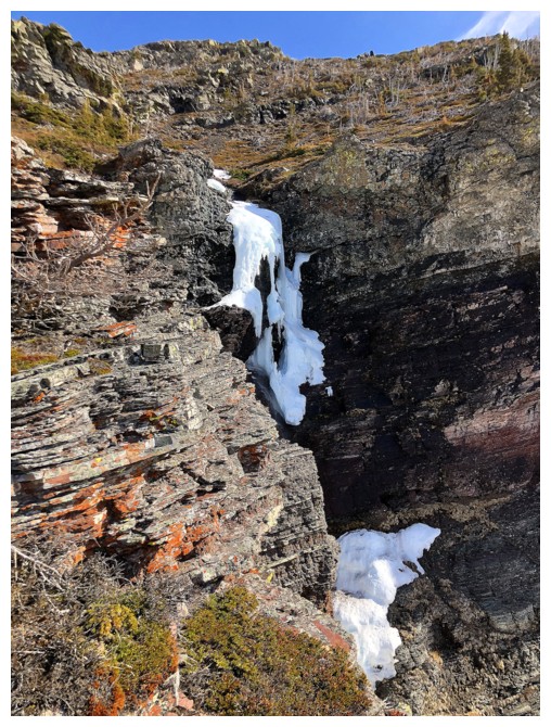
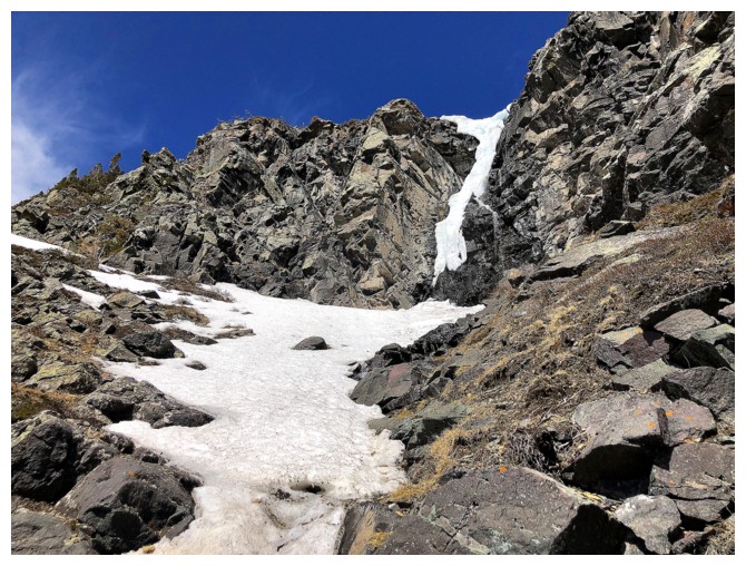
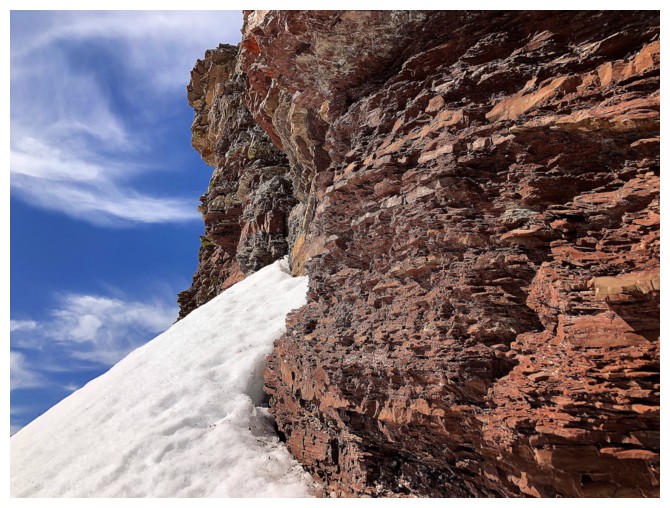
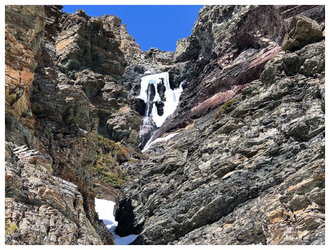
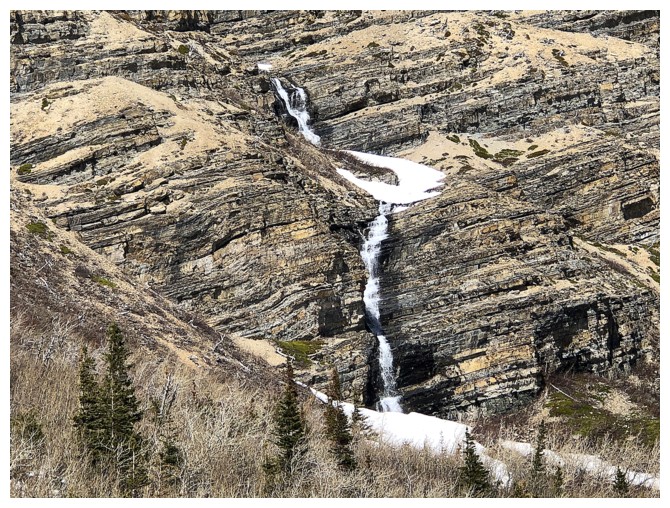
Passing a frozen waterfall, but it's starting to melt out
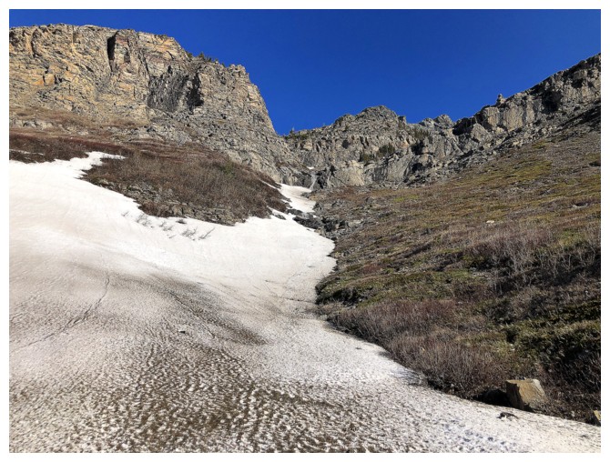
The goal was to traverse over to the left side of the photo, but I ended up going up a gully where the big snow patch is
There it is
Starts easy
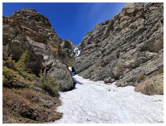
And then becomes more canyon-like
Getting steeper but nothing too alarming
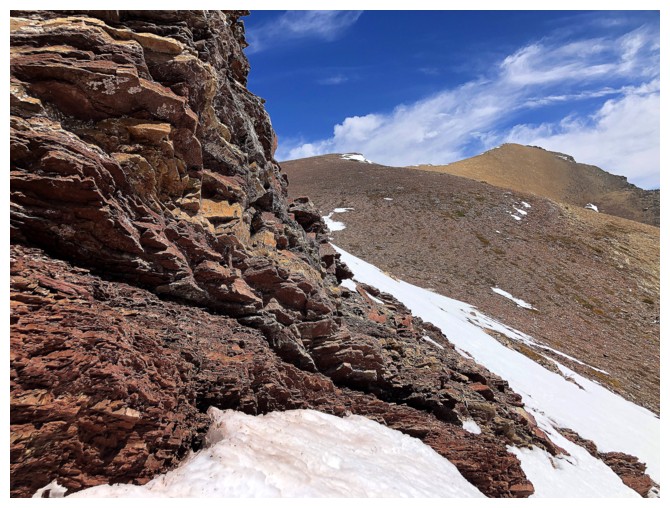
Checking out one of the bailout routes, in case things got dicey
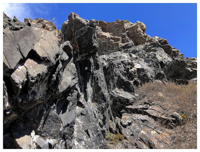
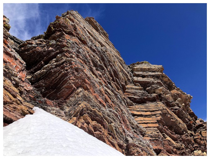
The rock on both sides of the canyon was impressive
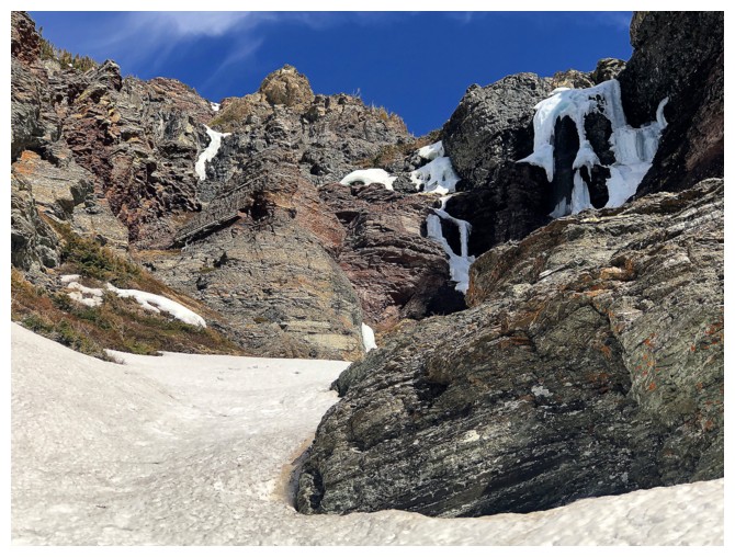
Approaching the remnants of the frozen waterfall
The walls are getting steeper
...and more colourful
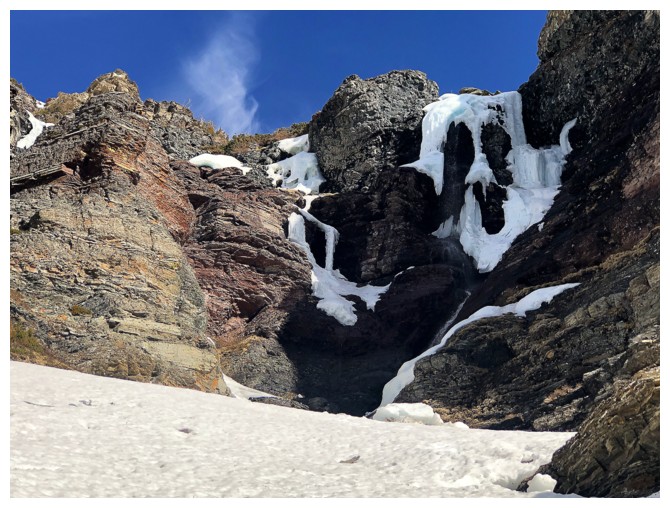
Nearing the end of the line. The snow at the right reminds me a little of the movie series "Scream"!

Why the long face???
Thought I might be able to squirm my way up the right side of this ice
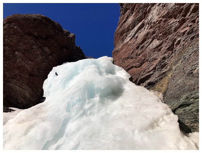
...unfortunately, not without two ice tools and crampons
Backed up and went this way
 \
\
A different snow gully to ascend
Passing the "Scream" face
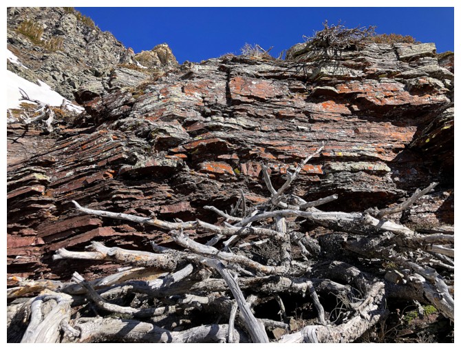
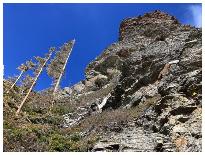
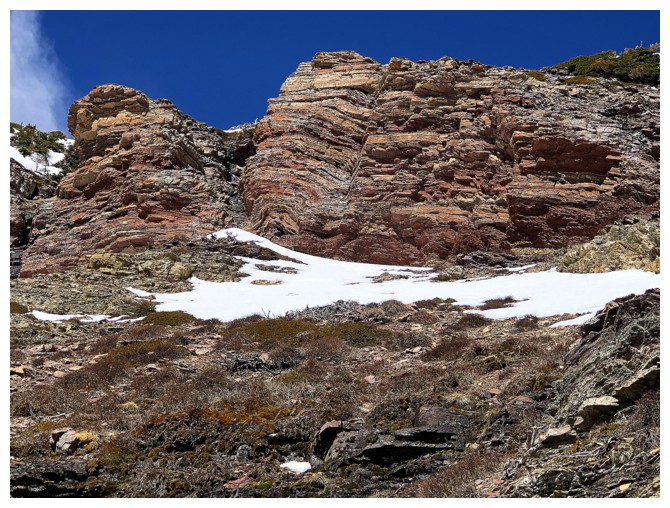
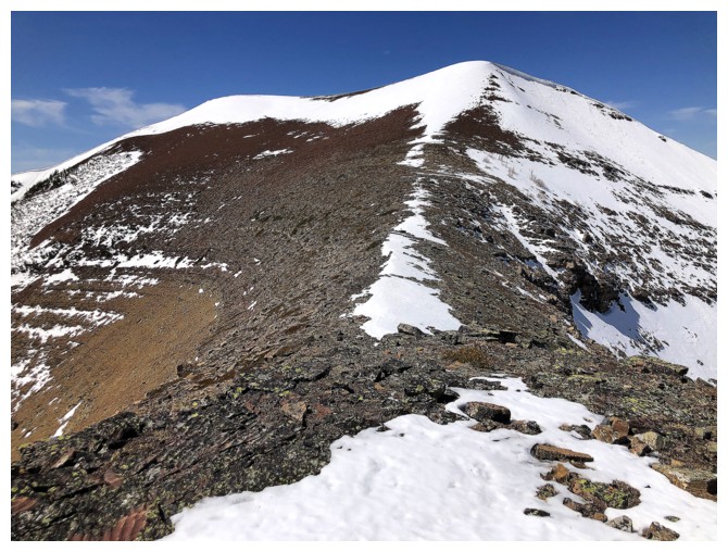
Not surprisingly, the red argillite encounters increase higher up the mountain
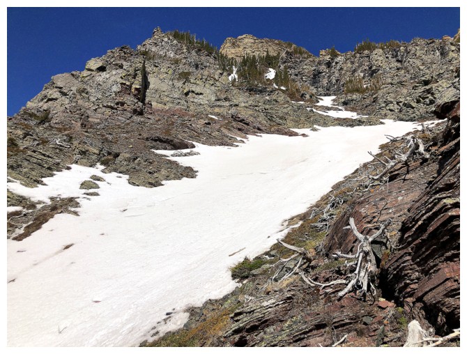
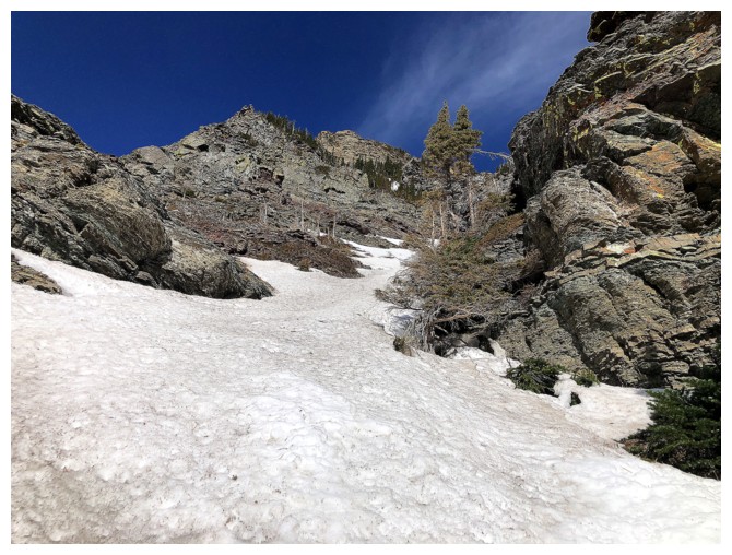
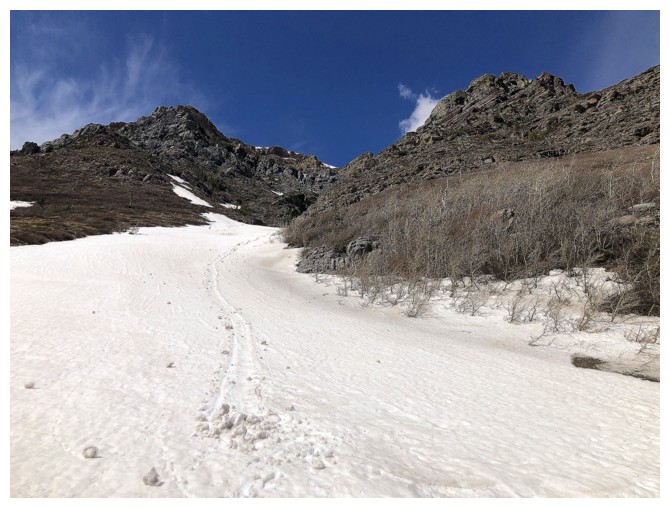
Continuing up the snow
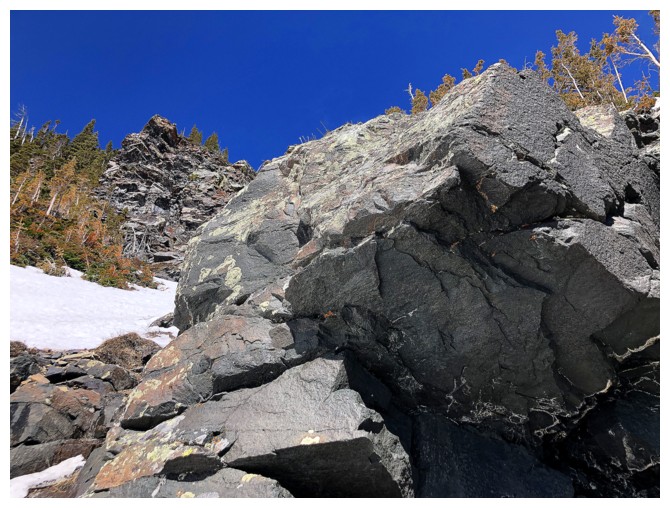
The equally infamous gabbro rock band
Was tempted to go left here
...but went right
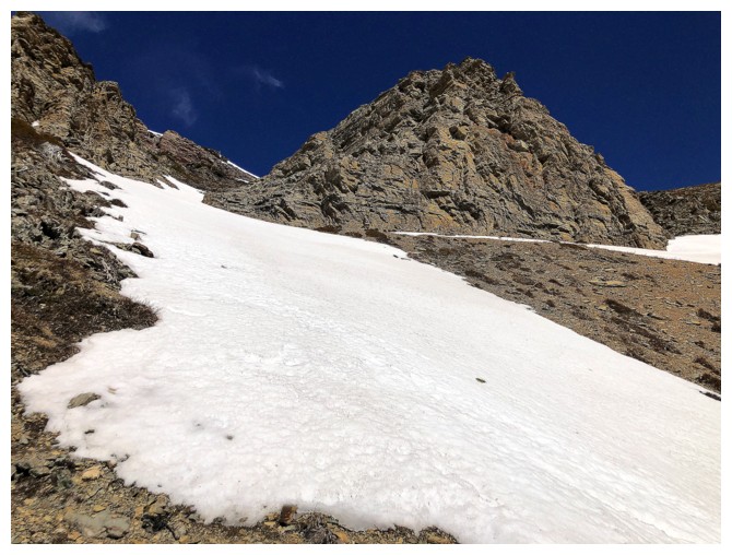
The snow here made travel easy
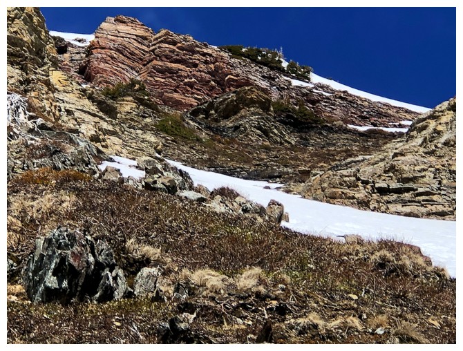 The ridge is lined with a spectacular argillite band
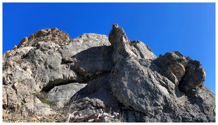
But first, an interesting outcrop of shale and dolostone
Simply had to get to the base of this rock band
But first, a view back to the east
Closing in
Arrived
Awesome!
Had I more energy (or any at all at this point!) I would have explored this area more thoroughly
Went around the easy right side instead and crawled up to the ridge
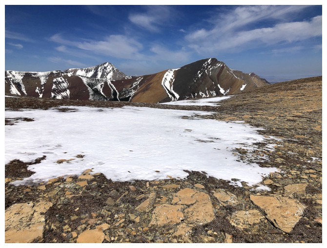
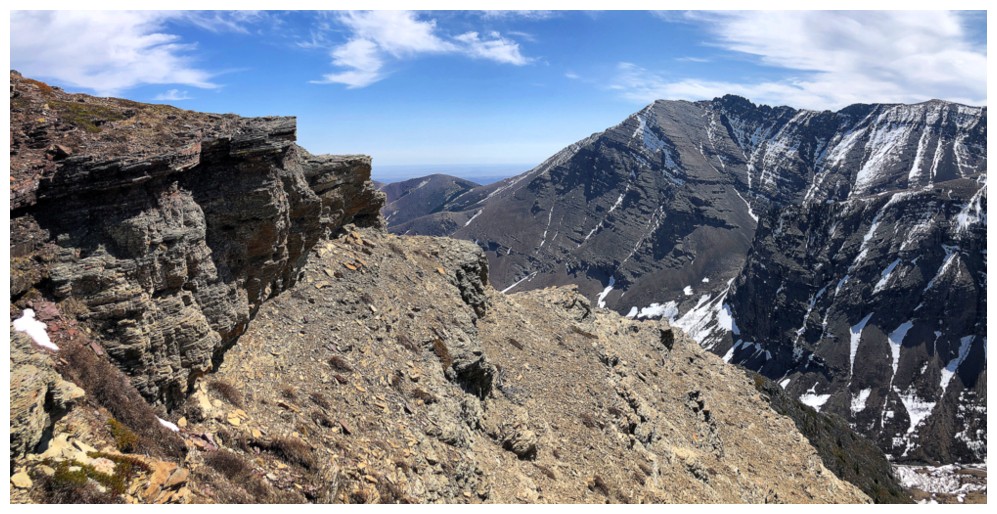
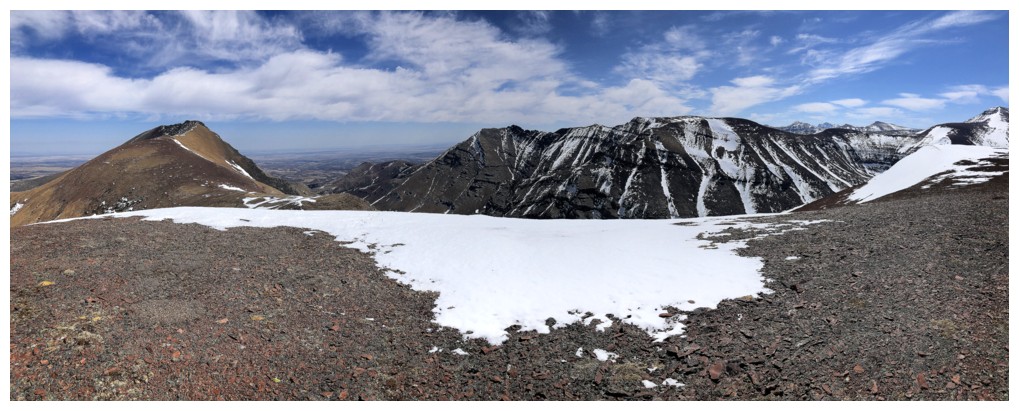
On the ridge. Victoria Peak and Pincher Ridge are the first mountains you see.
Redwood looked to be a million kilometres away in my present state!
So I just hung around photographing Victoria and Pincher
But then decided to finish the ascent
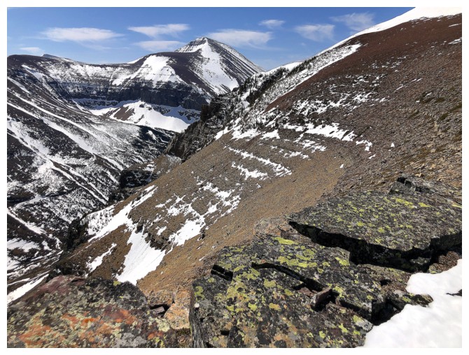
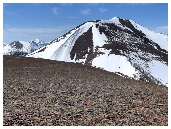
Loaf Mountain
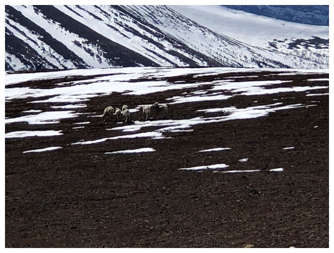
A group of sheep near the summit
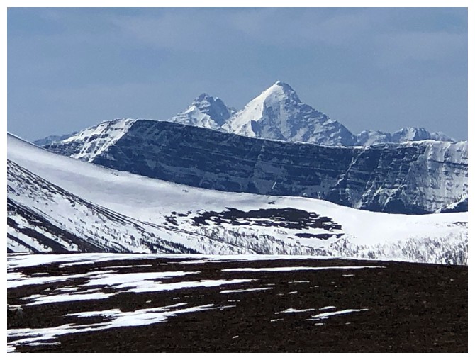
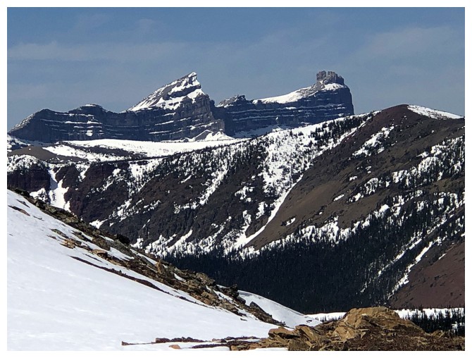
Distant King Edward and Starvation peaks
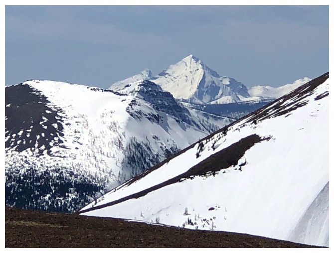
Kenow and Miskwasini peaks
True summit of Drywood and the east end of Loaf
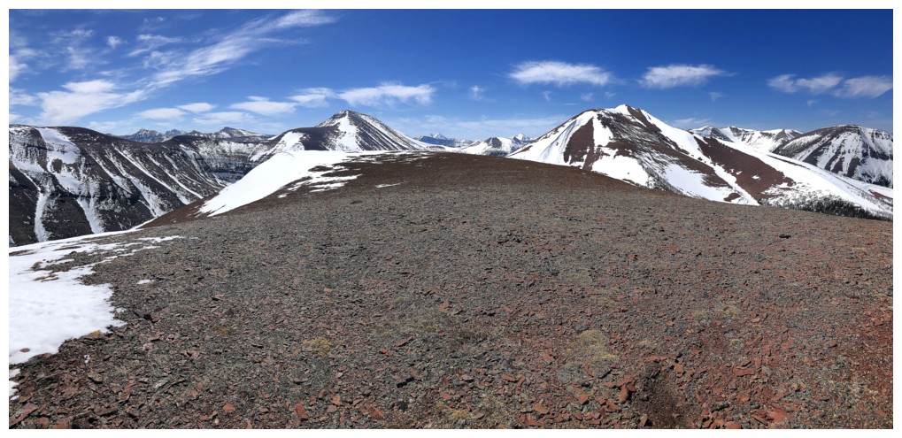
True summit of Loaf and the west end of Drywood
Several of the gems of the east Castle
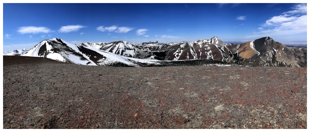
Looking west to the southwest summit - less than zero motivation at this point to continue on to it!
Close-up of Pincher Ridge
Windsor Mountain and Castle Peak
The colourful rock alongside the ascent gully looks better on descent, now with the Sun on it
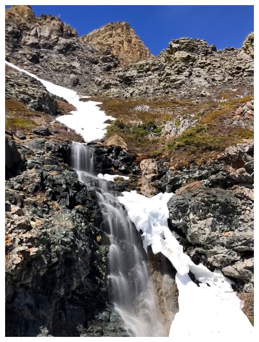
Lots of melting during the day means better waterfall scenery on descent
Still the long face?!
Great rock, again, courtesy of my broken crampons and need to find a snow-free route down
Same as above
Same as above
Back in the snow gully
Last look at the long face
Got a pretty decent glissade once onto gentler terrain
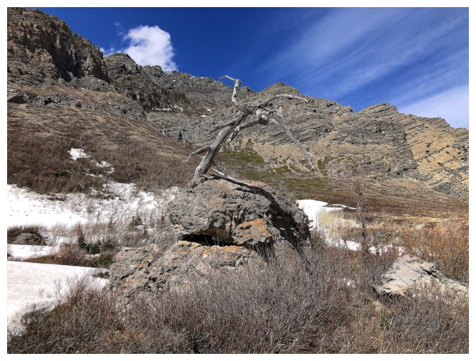
The famous "tree growing out of a rock"
Almost back to the tart of the normal route
Significant increase in the volume of water coming down this waterfall
The End
LOG