Drywood Southwest III
Little Bo Blue III
Bo Peak II
July 6, 2021
Mountain heights: 3152 m
Elevation gain: approximately
1200 m
Round-trip time: 6:15
Solo scramble.
At times a semi-frustrating day, but
everything worked out in the end, so two thumbs up.
Driving around the east side of The Castle,
riding a high of indecisiveness was not a great start to the day. Eventually, I
decided to attempt a direct route up the middle peak of the Drywood Mountain
massif – sometimes referred to as “Redwood Peak”. I knew Dave,
Brad, and Lance had been up this way but 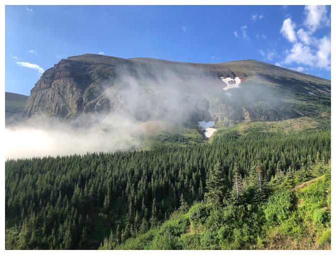 unfortunately did not know their
general route up. That lack of knowledge and some interesting weather conditions would lead to the semi-frustrating
part of the day. Heavy rain the previous night left all vegetation in the area drenched
and I simply couldn’t find a route up that wouldn’t leave me in the same state.
unfortunately did not know their
general route up. That lack of knowledge and some interesting weather conditions would lead to the semi-frustrating
part of the day. Heavy rain the previous night left all vegetation in the area drenched
and I simply couldn’t find a route up that wouldn’t leave me in the same state.
In resignation, I opted to bike to 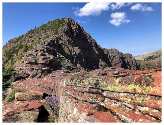 Bovin Lake
and then ascend the southwest summit of Drywood instead. My last visit to that
summit was part of a super rewarding day with Amber, Janina, and Scott, in
2009 and a return trip was overdue.
Bovin Lake
and then ascend the southwest summit of Drywood instead. My last visit to that
summit was part of a super rewarding day with Amber, Janina, and Scott, in
2009 and a return trip was overdue.
The slightly smoky skies were a little disappointing
throughout, but the scrambling from the summit of Drywood West, up and over the
delightful outliers (“Little Bo-Blue” and “Bo Peak”) above Bovin Lake more than
compensated.
Wanting to hike around most Bovin Lake before
the bike ride back to the start I tried a shortcut route down to the lake instead
of the obvious cutline – won’t do that again! It almost ended very badly when I
went into an involuntary glissade down a very slick and steep grassy slope. Luckily, I was able
to grab onto a tree to stop the ride. The bike ride back was far
less traumatizing!
A good day, even if most of it didn’t go as
planned. I’m sure I’ll return someday to find that route up Redwood.
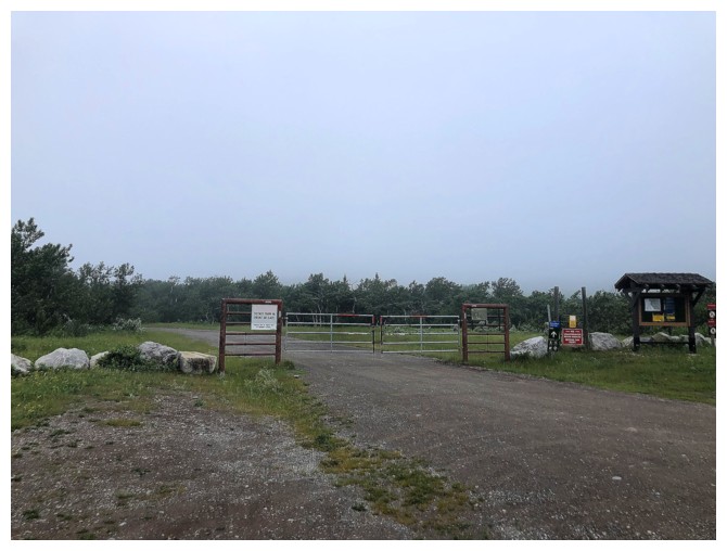
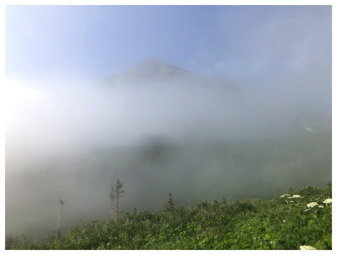
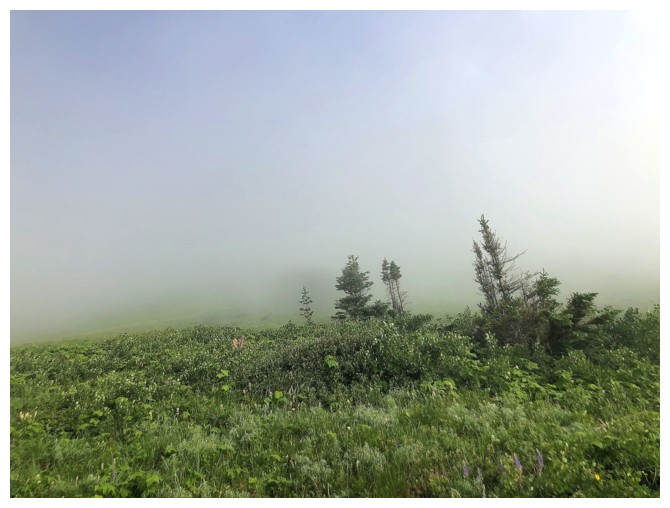
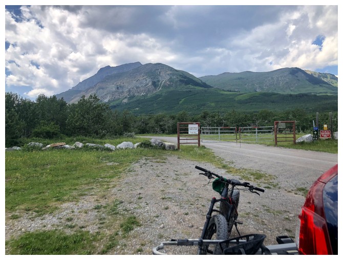
Super foggy at the trailhead. Drywood and Loaf are usually fully visible from here.
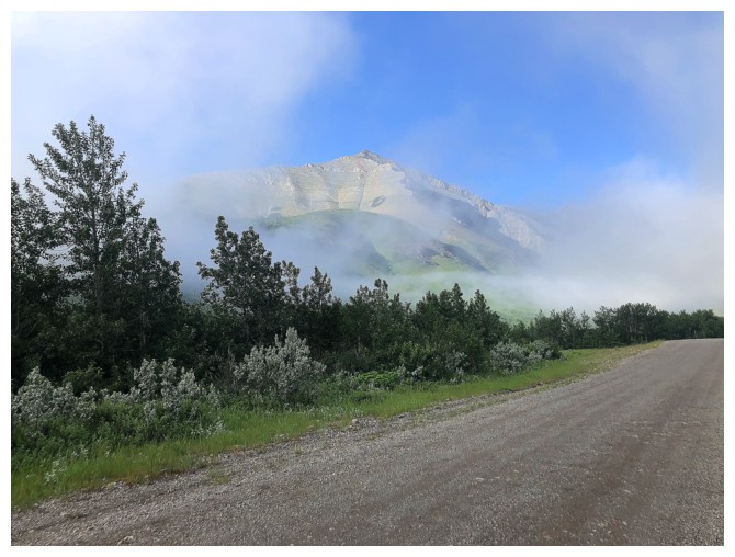
The fog starts to lift
Same as above
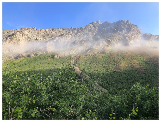
Looking at the "normal" route up Drywood
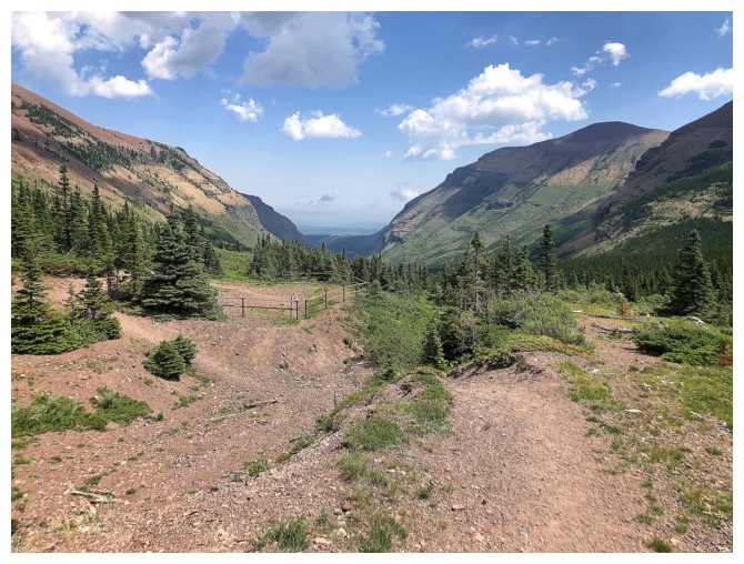
Looking up the South Drywood Creek valley
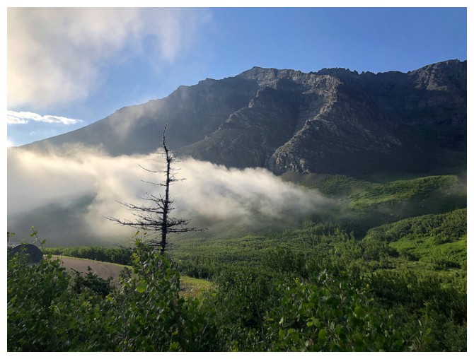
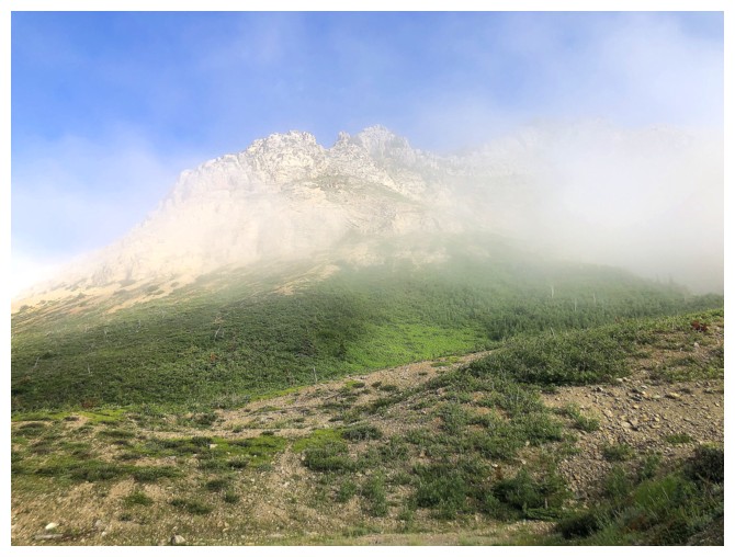
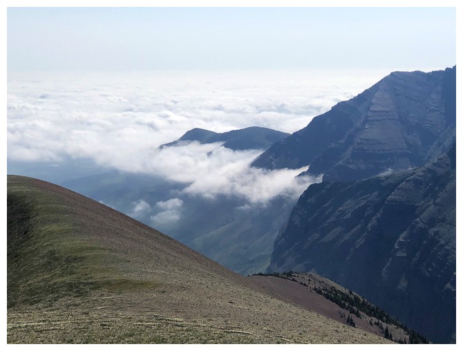
The misty/foggy weather continues to be a source of entertainment
And a source of reduced visibility
Extreme at times!
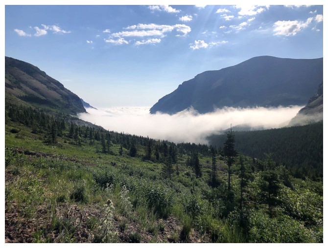
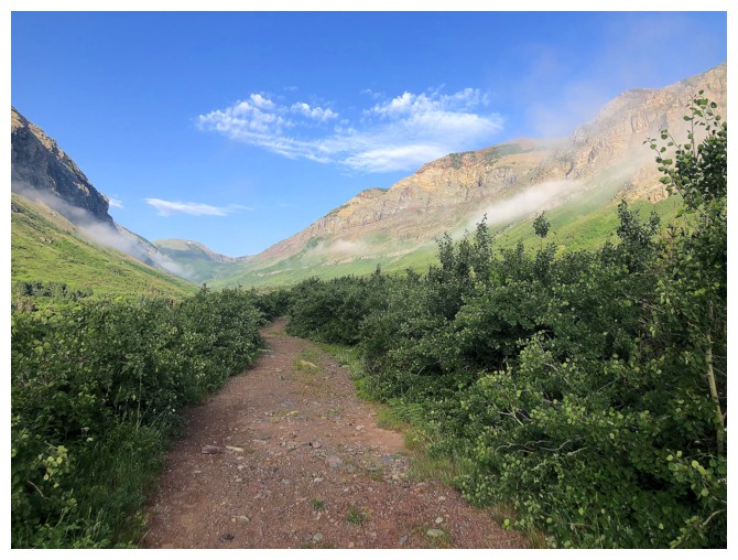
Fog persists to the east but now its cloudless skies for much of the trip ahead
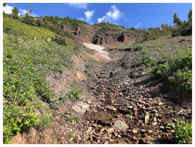
The gully I eventually used to get to Drywood Southwest
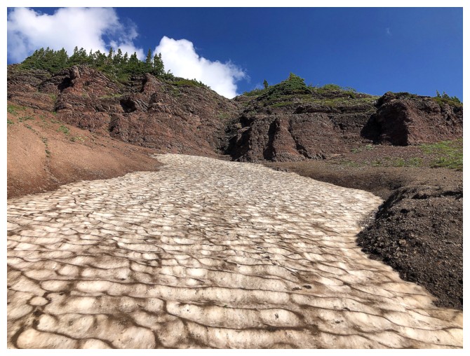
Still a little snowy
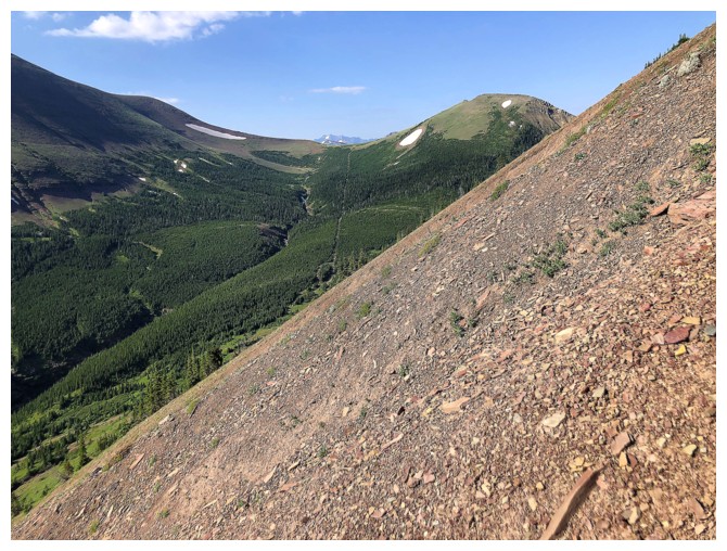
The terrain was not difficult to ascend, but the grade relentlessly steep
Nice, steppy rock makes life easier
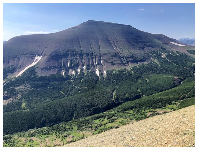
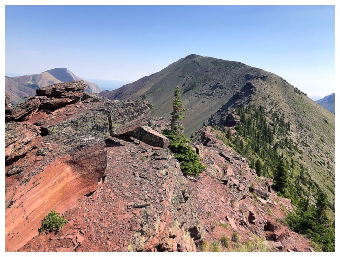
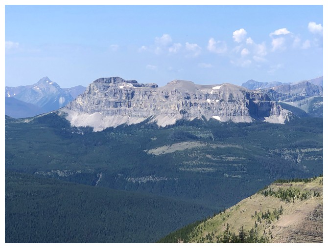
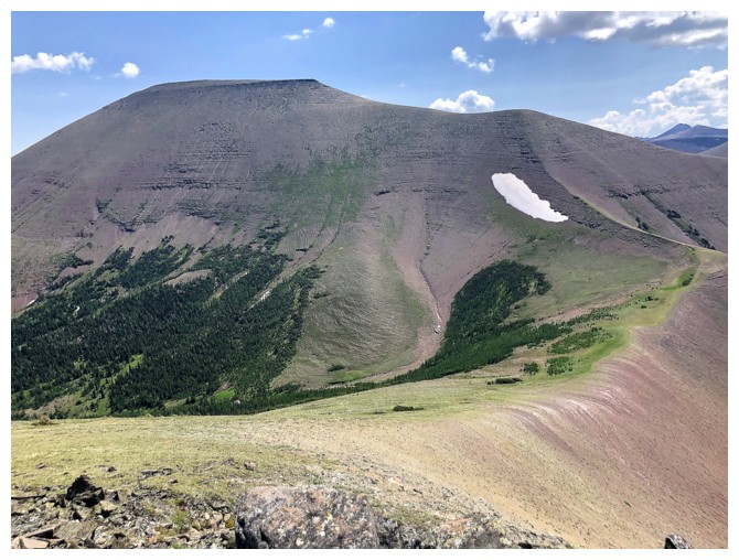
Loaf Mountain
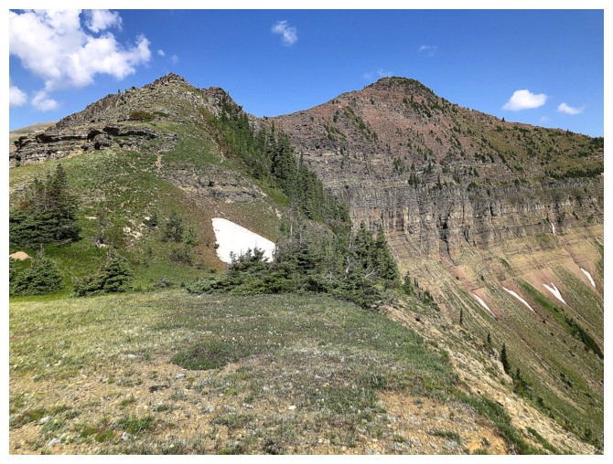
On the ridge
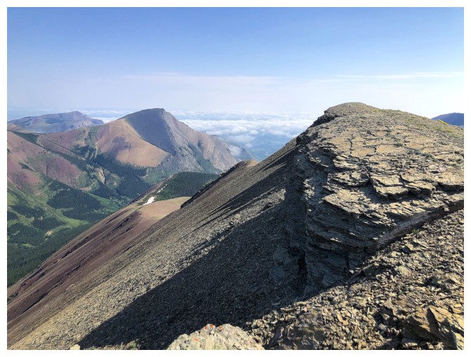
Short hike to the summit
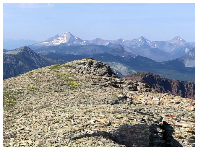
View to the north features Victoria Peak, near the right
Almost there
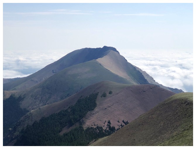
The true summit of Drywood to the east
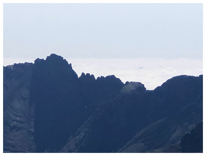
Still cloudy in some sections to the east
But generally clear
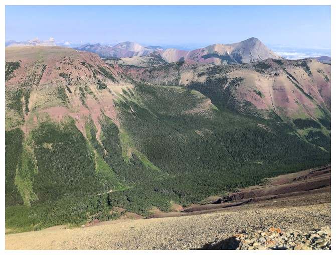
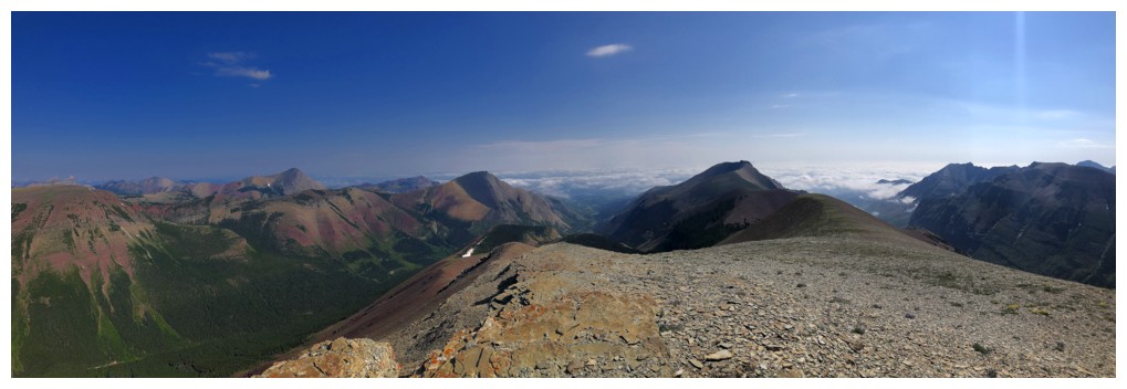
Summit view to the north
The elusive summit at the east end of Loaf Mountain
View to the southwest
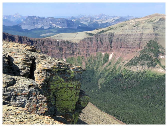
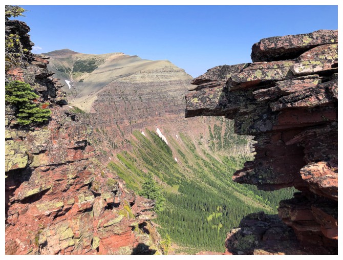
Lichen in the foreground and the steep east-facing wall that connects "Little Bo-Blue" to the summit of Victoria Ridge
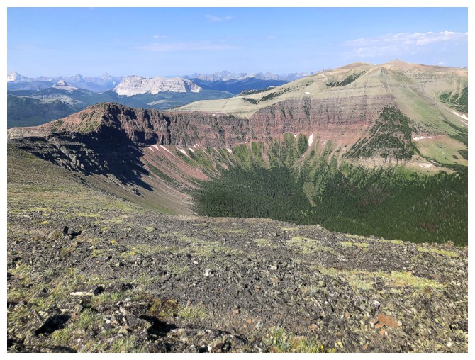
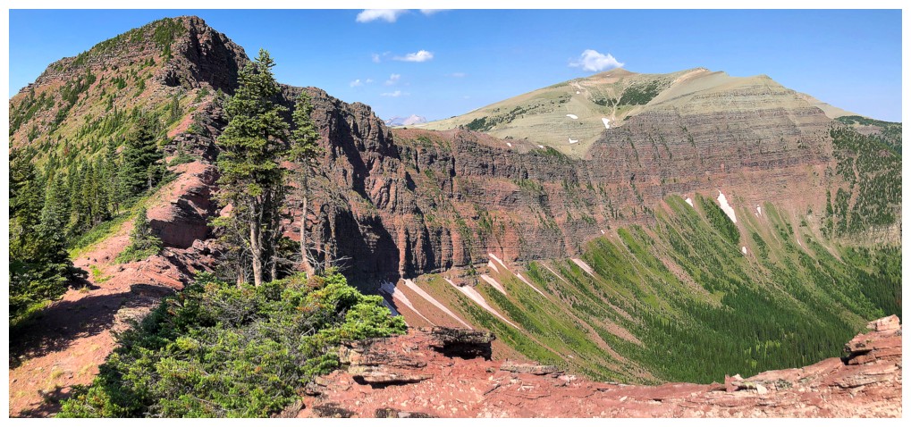
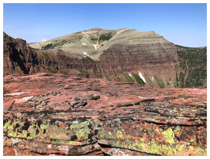
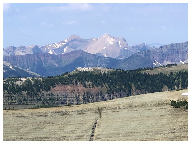
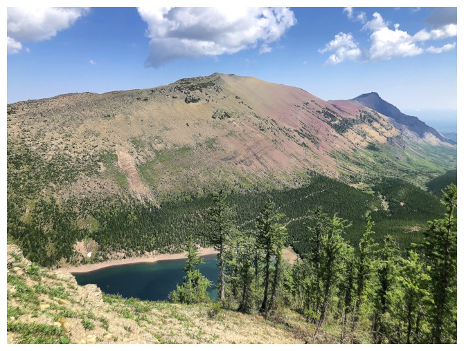
Pincher Ridge (right of centre) is one of the most strikingly colourful mountains in The Castle
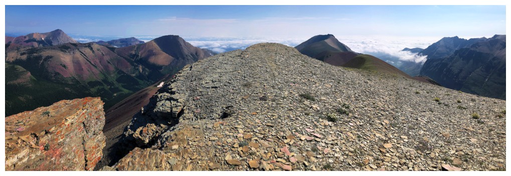
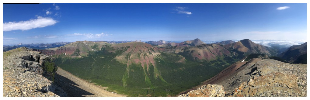
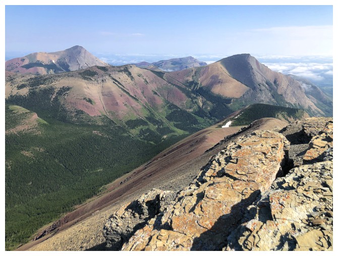
Summit view south, southwest, and south
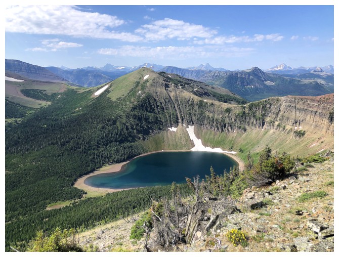
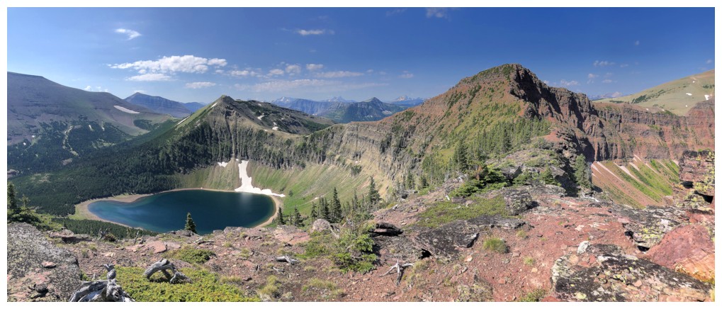
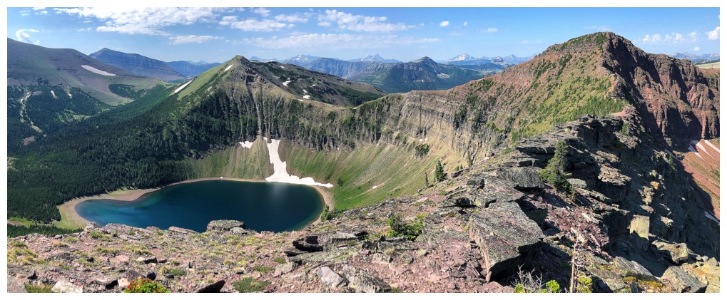
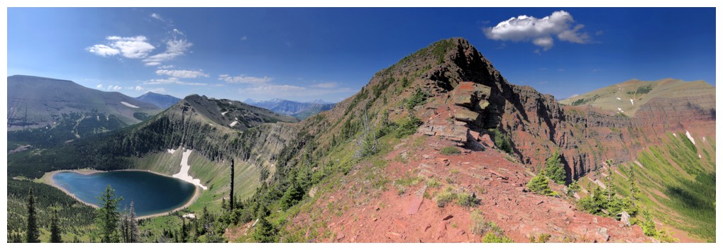
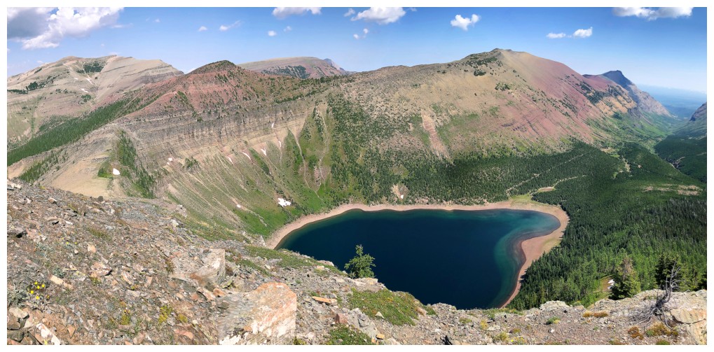
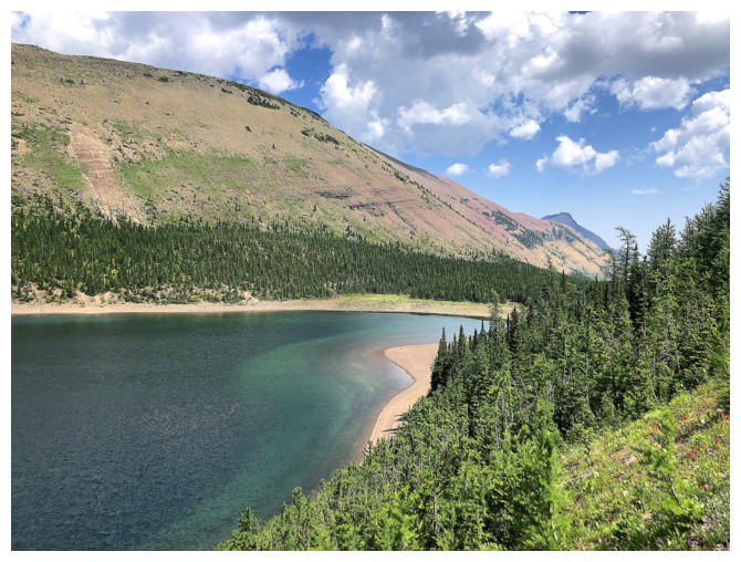
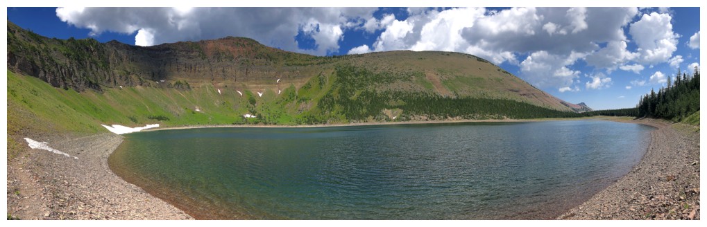
Bovin Lake
Delightful travel towards Little Bo Blue (left)
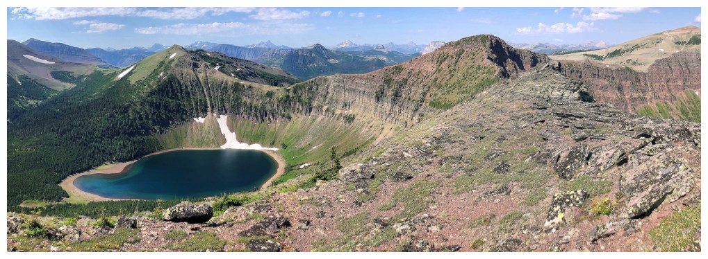
Bovin Lake is going to get tons of attention from hereon
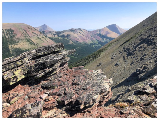
Hard to ignore Pincher too
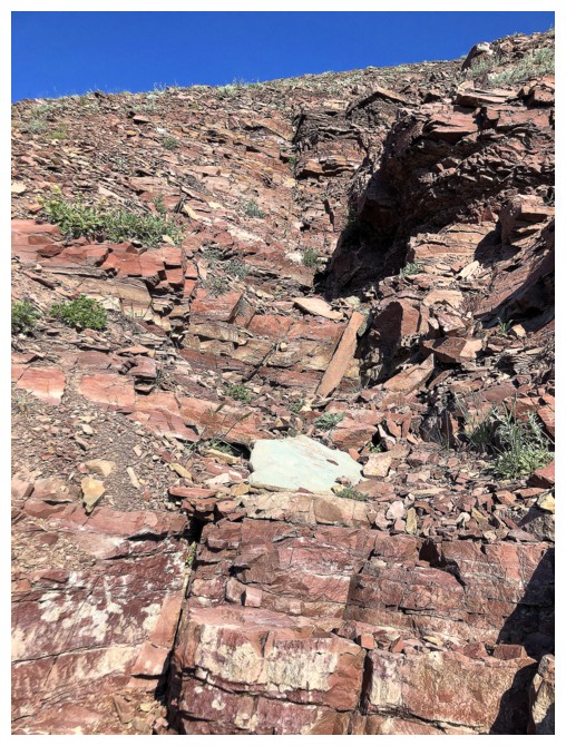
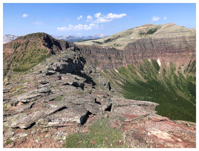
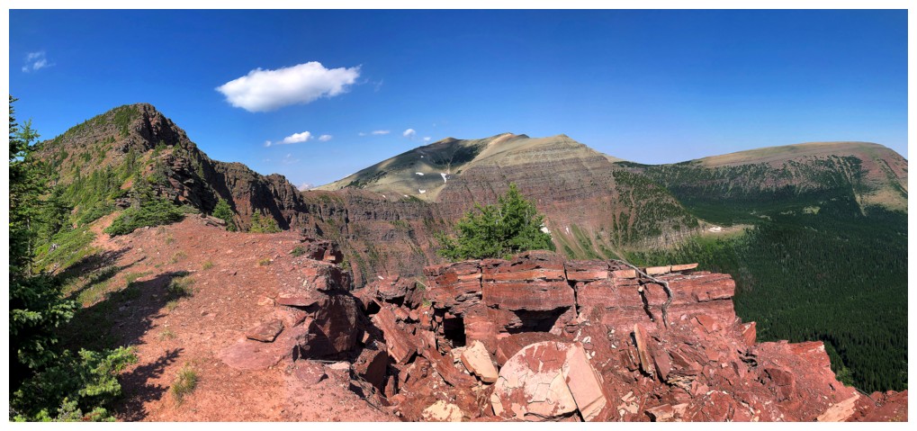
The connecting ridge has several geological points of interest
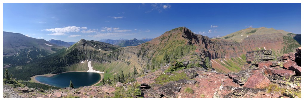
...and Bovin Lake!
Looking back
Looking forward
Victoria Ridge in the centre. With increased challenges to access the Victoria Ridge Trail from the north, this route from Little Bo-Blue to Victoria Ridge may become more popular.
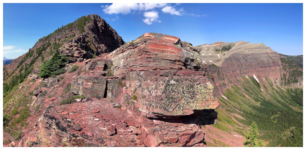
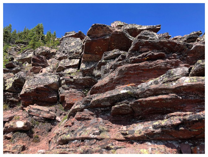
The primary attraction of Little Bo-Blue is that its all red argillite
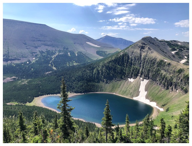
Another view of the lake
Here comes the argillite!
with some lichen
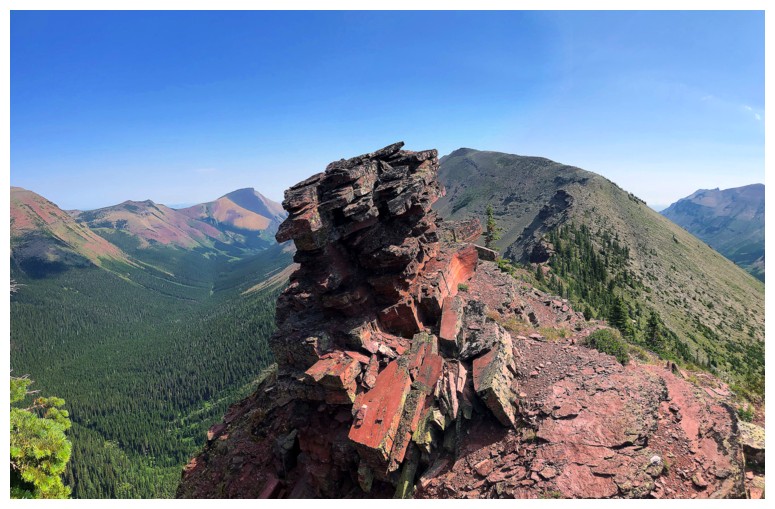
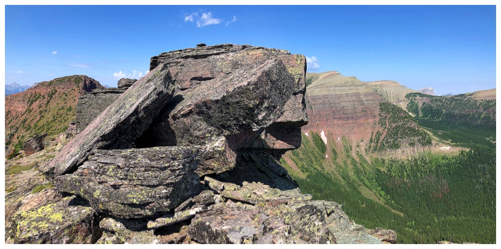
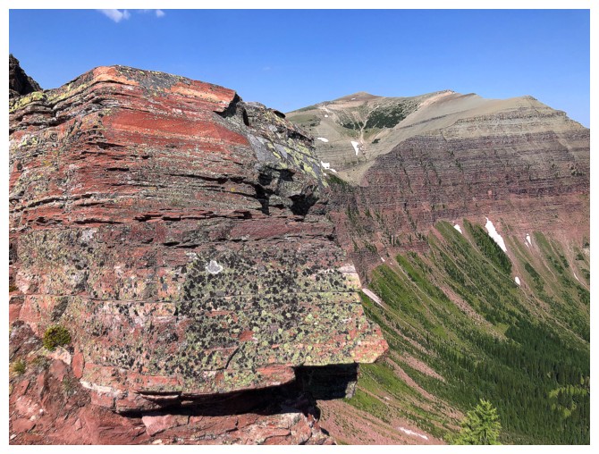
This little beaut sits atop a section of the ridge that is slowly
peeling away from the mountain. I wouldn't mess around on that one!
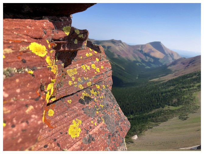
Yellow lichen on red argillite, with Pincher Ridge in the background. Doesn't get much better for me!
Typical, scrambly terrain ascending Little Bo-Blue
Mount Matkin
Scarpe and Jake Smith
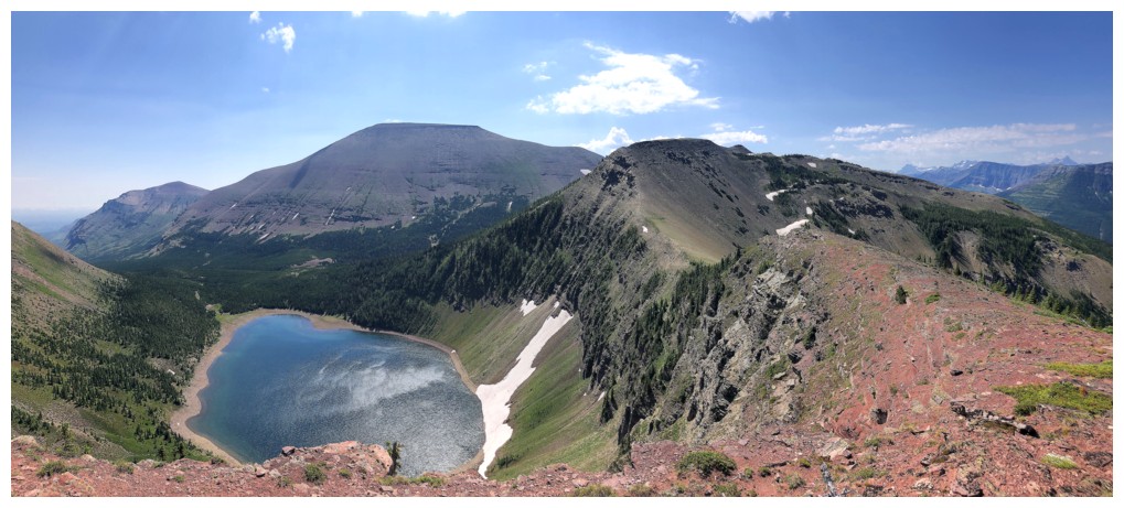
Summit view. The lengthy of the awesome Victoria Peak to Ridge traverse can be seen.
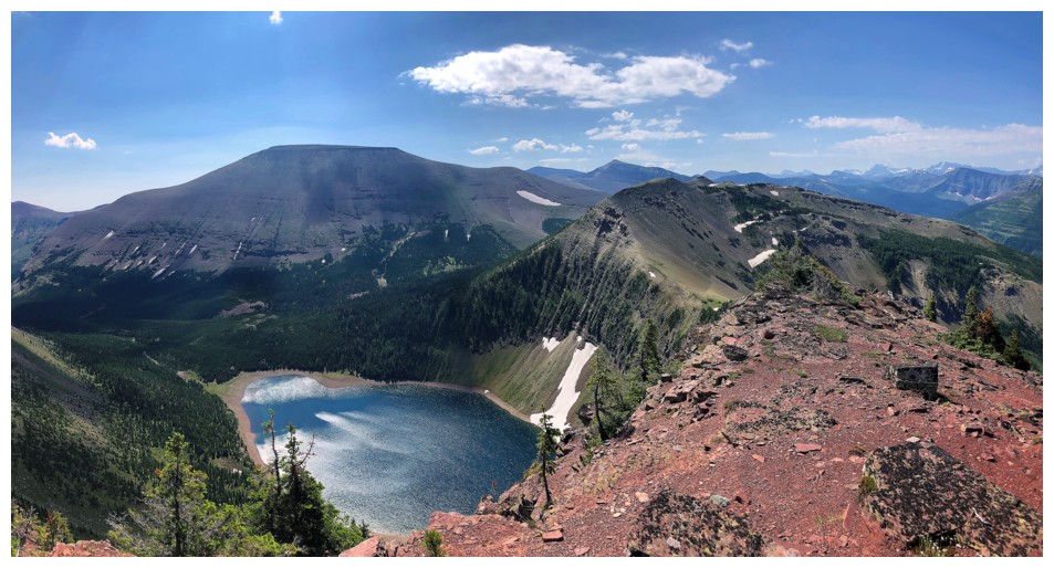
Summit view over Bovin Lake and Loaf Mountain
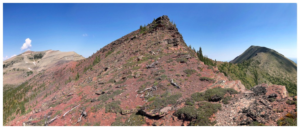
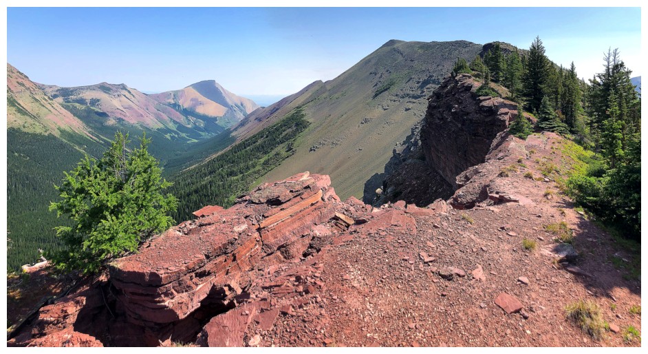
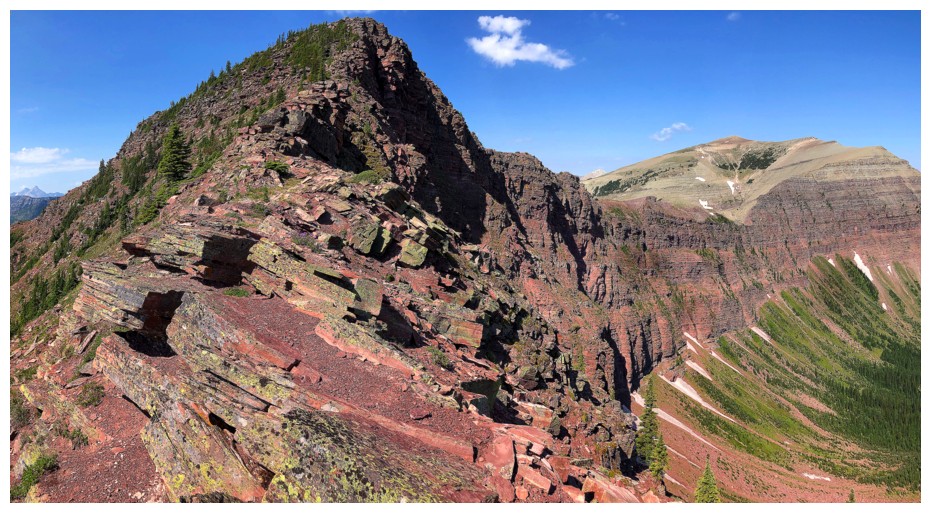
Leaving Little Bo-Blue for Bo Peak
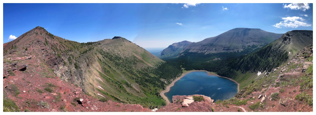
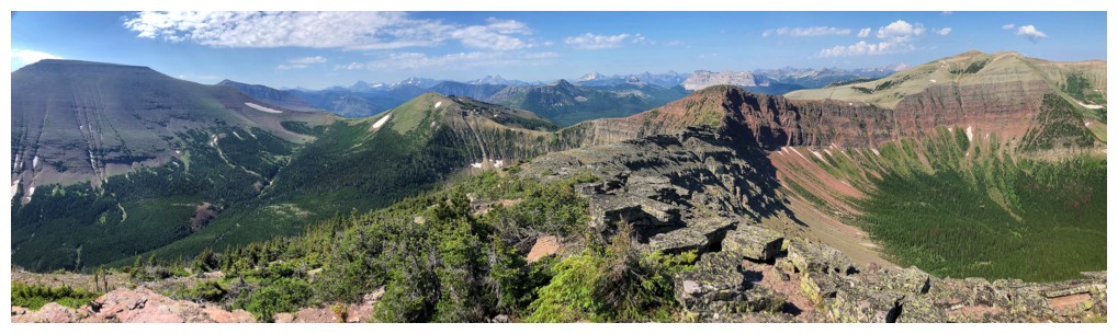
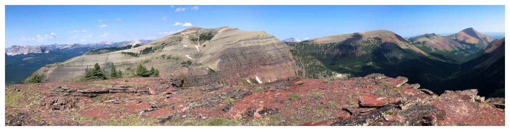
Pano from the connecting ridge
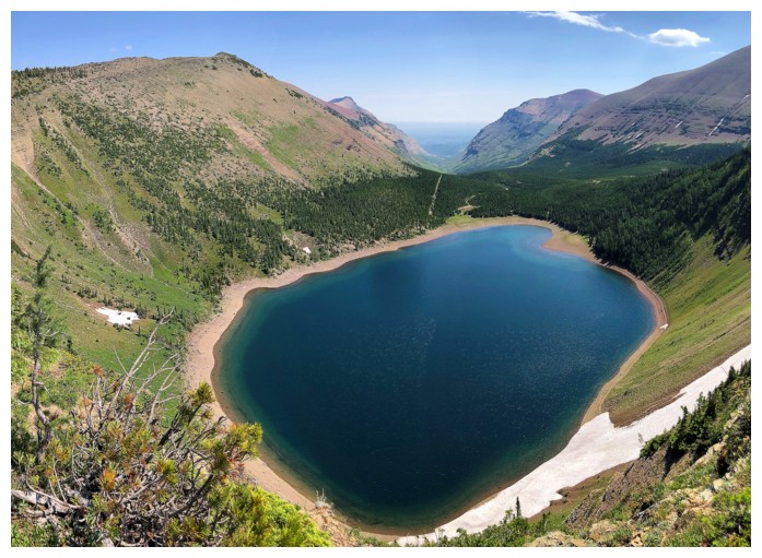
Yet another view of the lake
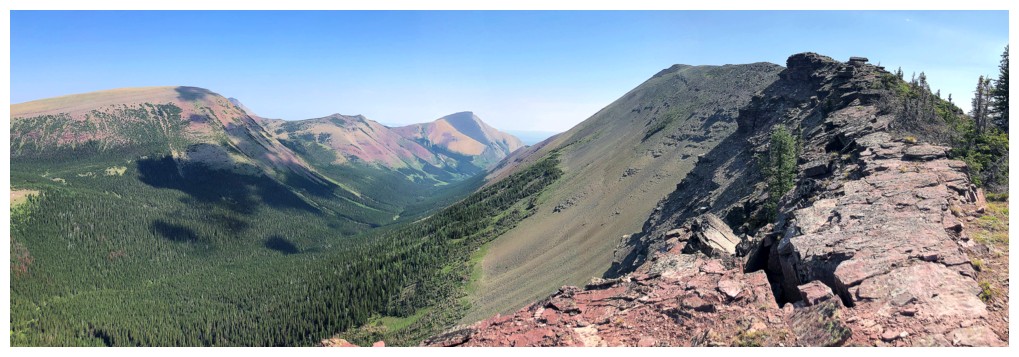
Looking back at both Bo Peak and Little Bo-Blue
Much of the day's route is visible from this point
Heading towards to Bo Peak/Loaf Mountain col. I should have maintained that line!
Decided instead to go down this way, eventually ending up on very steep, wet grassy slopes
Almost at the lake after my short, involuntary glissade
On the west side of Bovin Lake
Almost back at my bike for the easy ride down
Back at the start, the fog has been replaced with clouds
The End
LOG