Mount Romulus
October 10, 2022
Mountain height: 2842 m
Elevation gain: approximately
1000 m
Ascent time: 4:45
Descent time: 3:00
Scrambling with
Mark.
Mount Romulus
has for a long time resided on the “only when bad weather persists to the west”
list. A stellar forecast turned to crap the morning of, meant that October 10,
2022 was the day to try Romulus.
We decided on Bill Kerr’s increasingly popular shortcut route instead as Kane’s longer route via the Romulus campground –
and what a great route it turned out to be! 10 km of easy biking and a shockingly
easy ford of the Little Elbow River preceded a longish but enjoyable hike up
the drainage southeast of the objective.
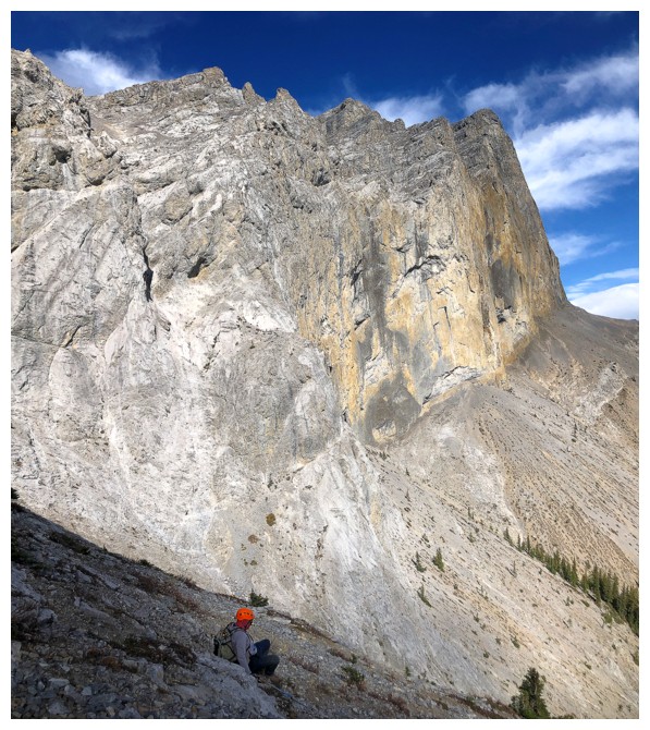
The great thing
about Bill’s route is that you spend much of the ascent awe-struck by the huge,
vertical, and seemingly impenetrable walls of rock guarding the summit. It is
only very high on the mountain that the key weakness through the walls is
revealed. We went a little astray at one point, venturing too far to the right.
Getting back on track required some tricky side-sloping., but once back on track
and higher up, we spotted the obvious weakness and proceeded with ease up to
the summit ridge. Another kilometre and 240 metres of elevation gain later and
we reached the top.
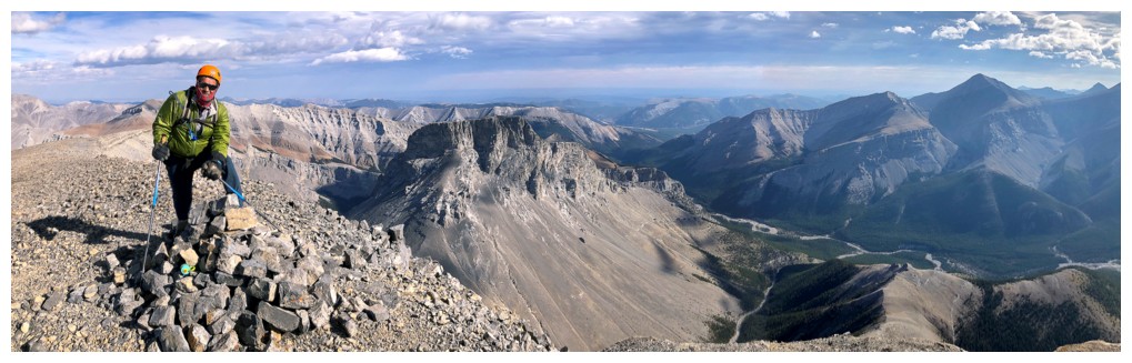
Views were excellent,
but a brisk and cold wind prompted us to take shelter below the ridge for some
food. We returned the same way, minus the unpleasant detour, and were back at our
bikes in reasonable time. Needless to say, the return bike ride was a breeze.
A super day out.
Big thanks to Mr. Kerr for this awesome route!
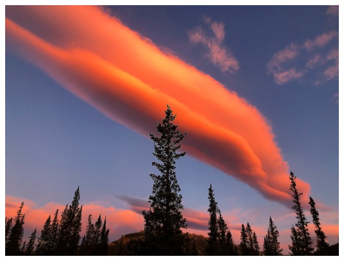
Captivating morning hues
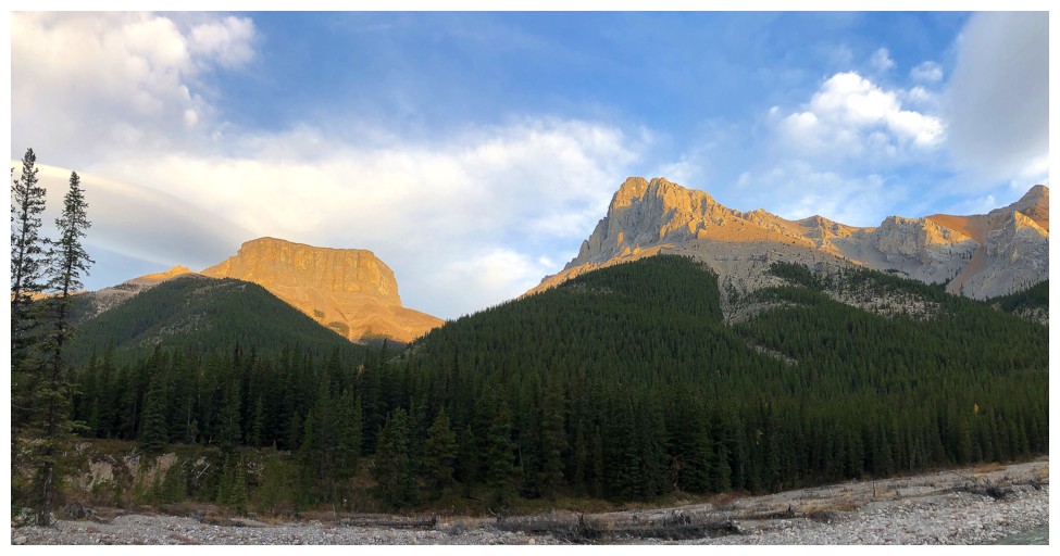
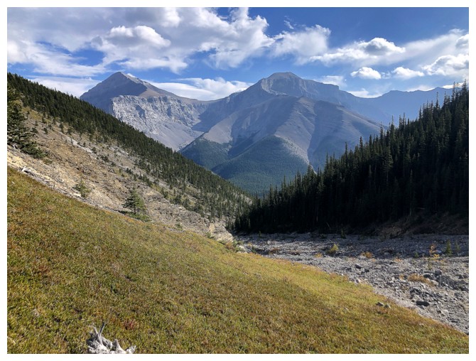
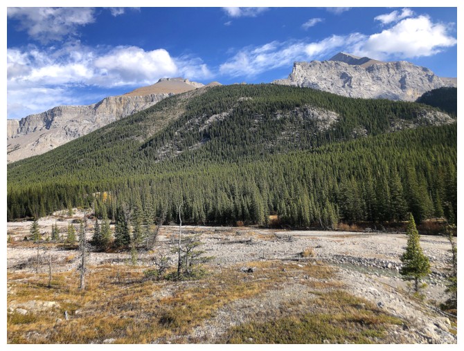
Mounts Romulus (left) and Remus from the approach trail
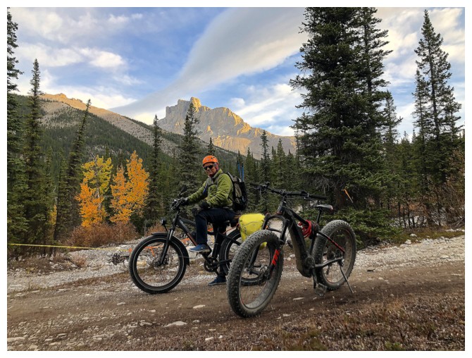
At the end of about 10 km of easy (e)biking
Heading to the Little Elbow River for an...
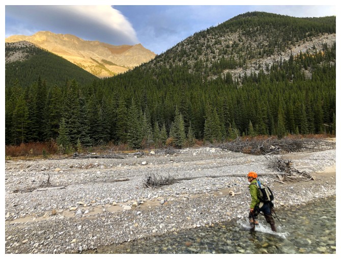
...unexpectedly easy crossing
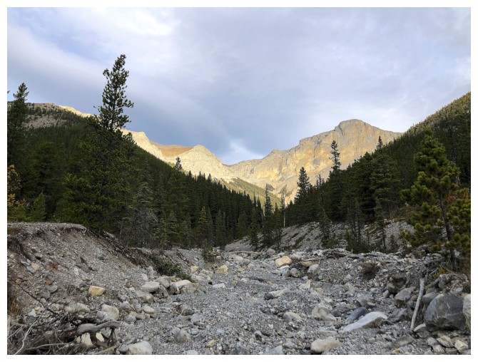
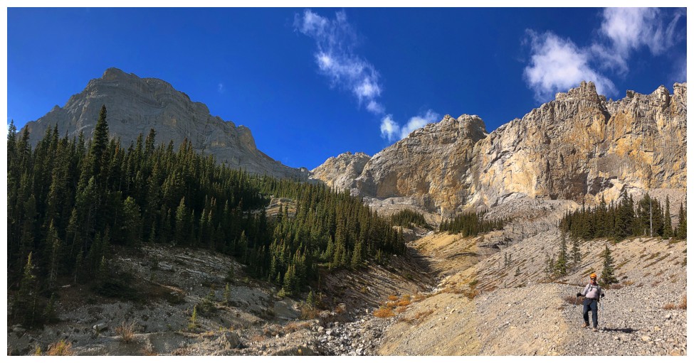
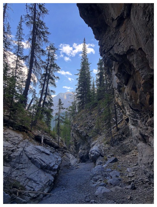
The start of the drainage
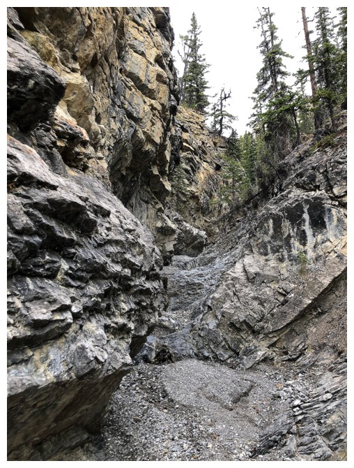
Fun and interesting terrain to ascend in the canyon-like drainage
Same as above
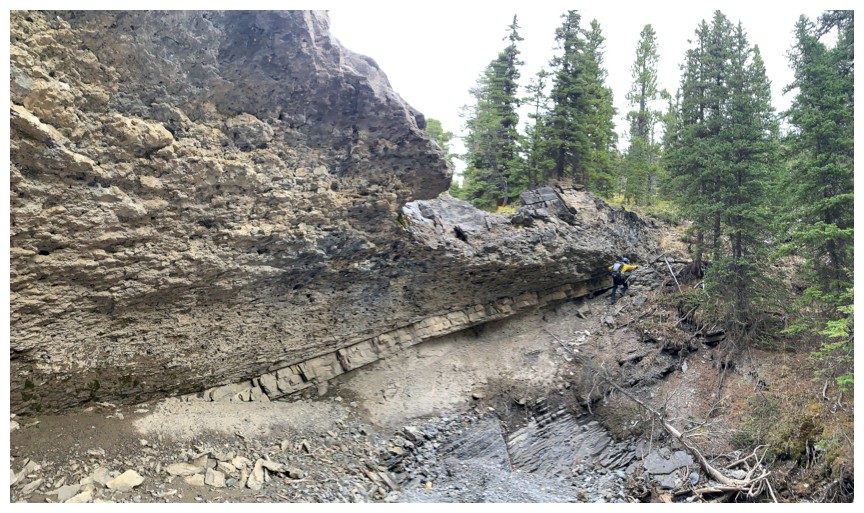
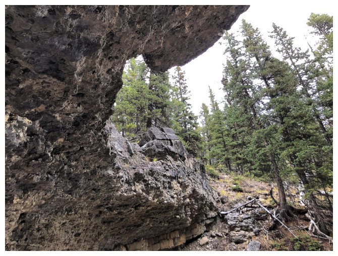
A few obstacles in the drainage must be circumvented
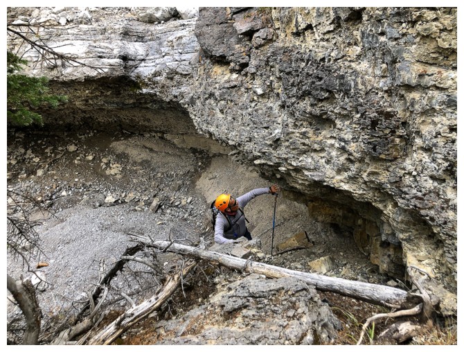
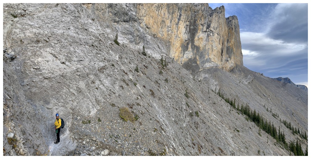
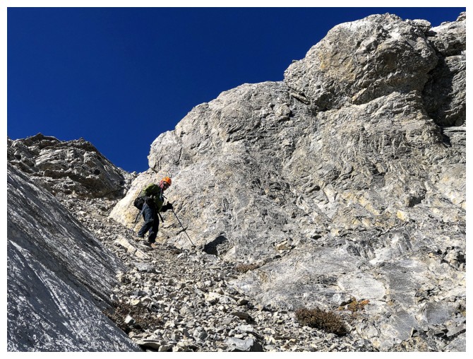
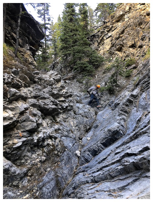
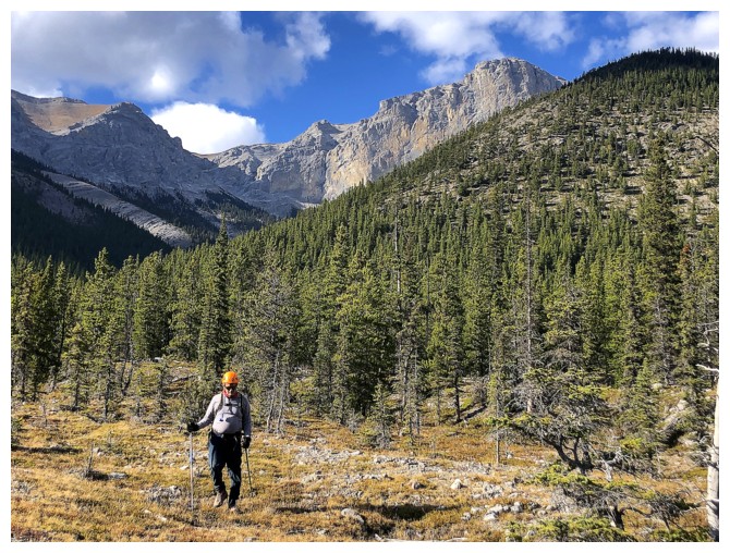
Mark ascends the steep terrain
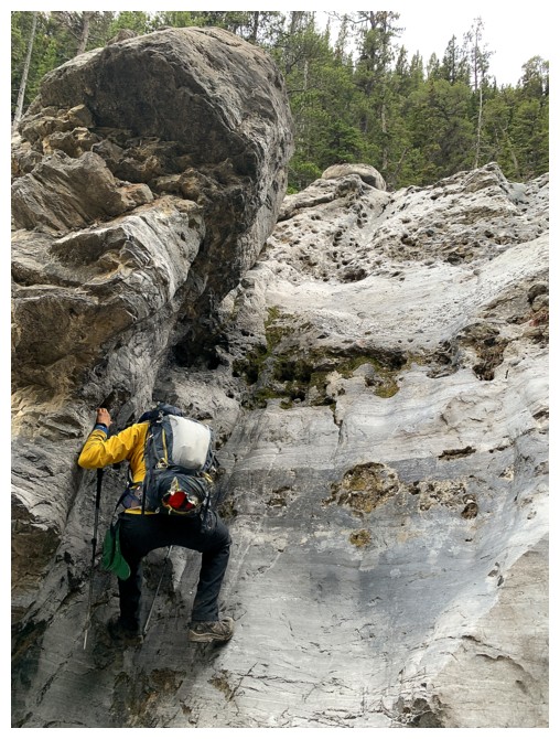
I thought I could scramble up this but the rock was too smooth
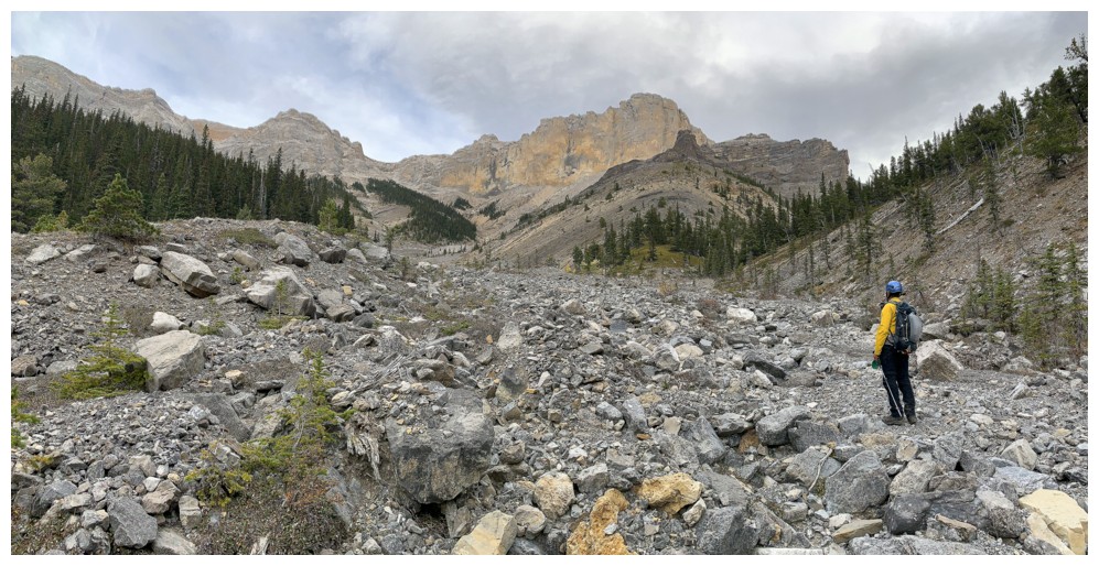
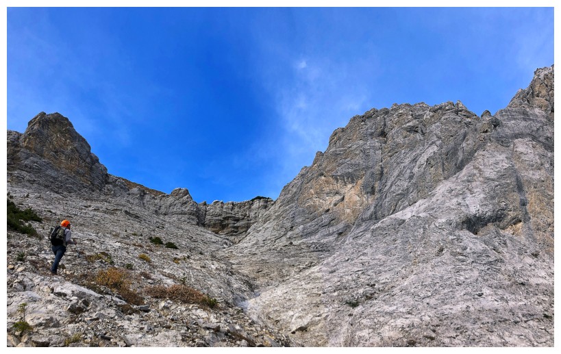
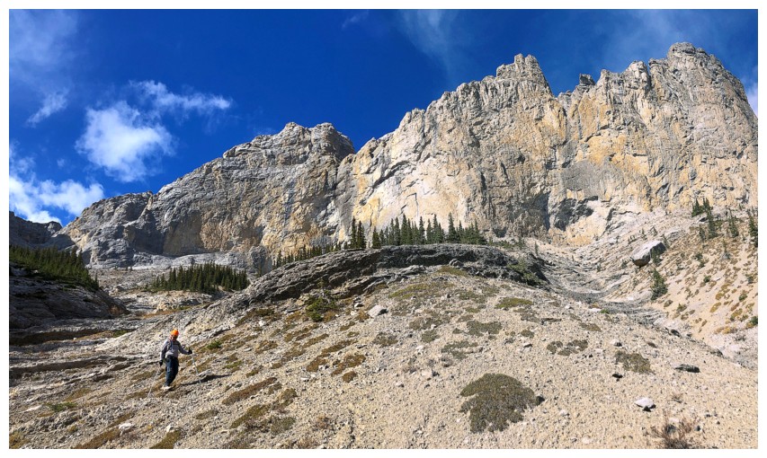
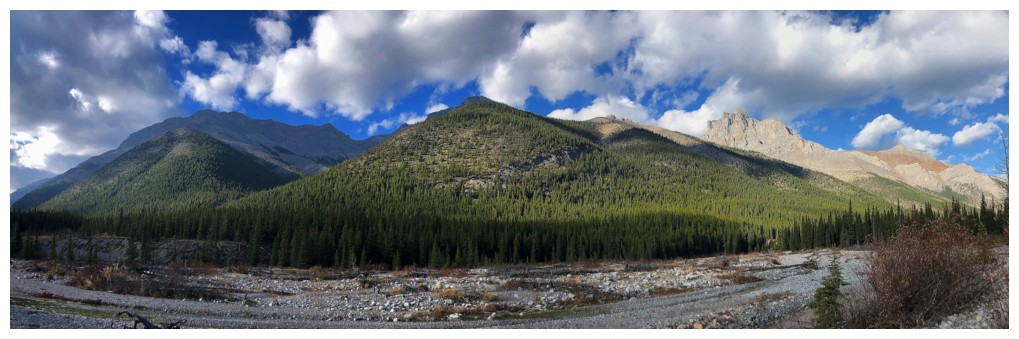
The drainage opens up
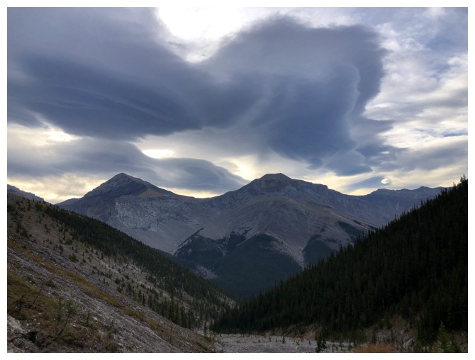
Menacing but cool clouds to the east
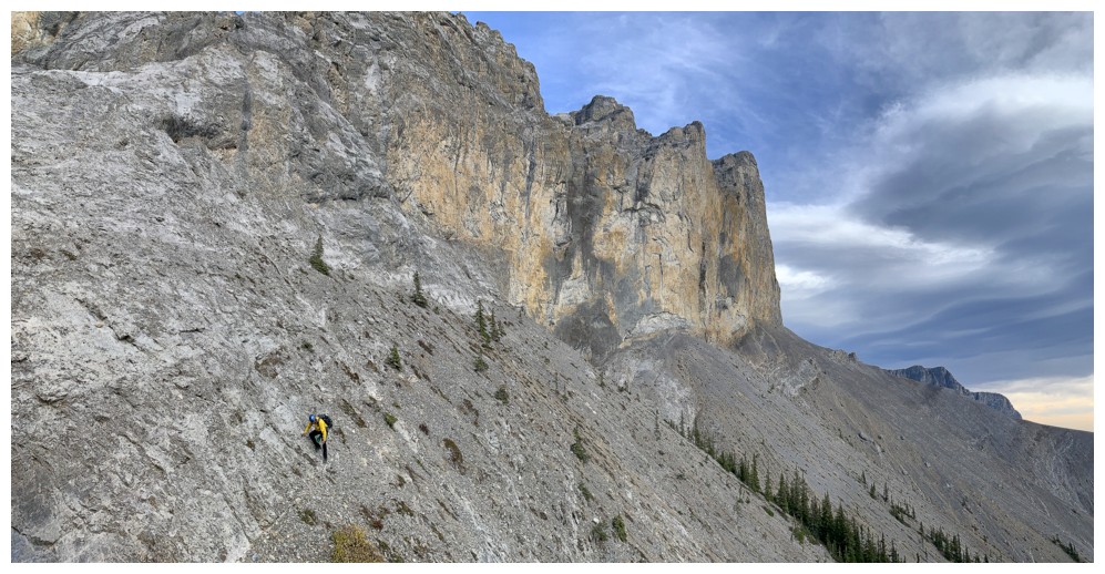
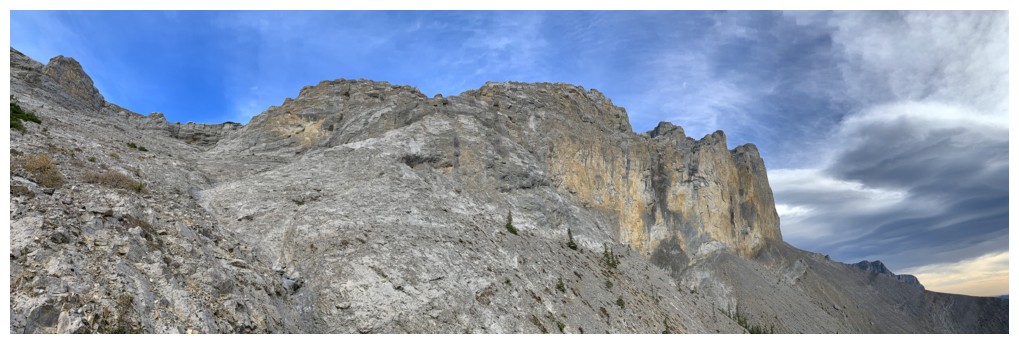
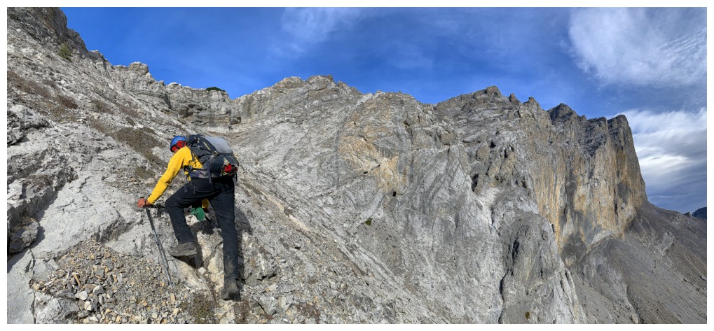
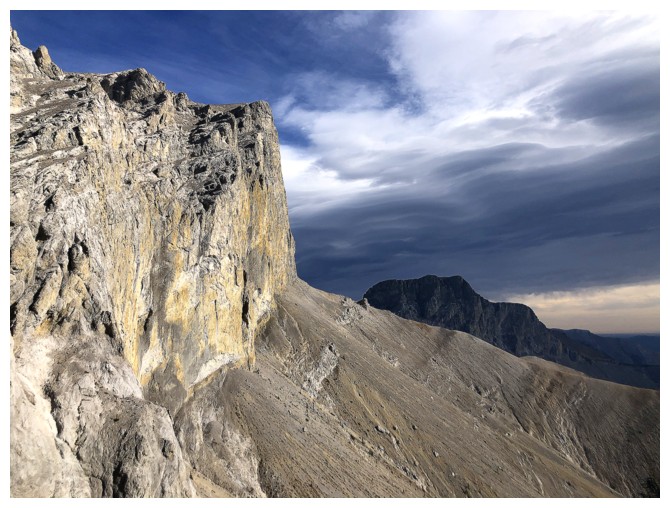
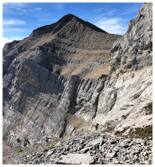
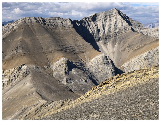
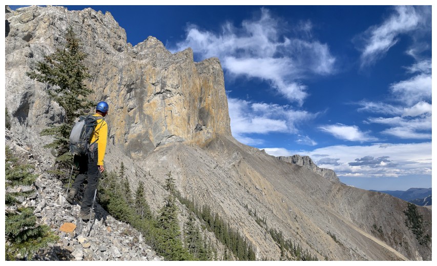
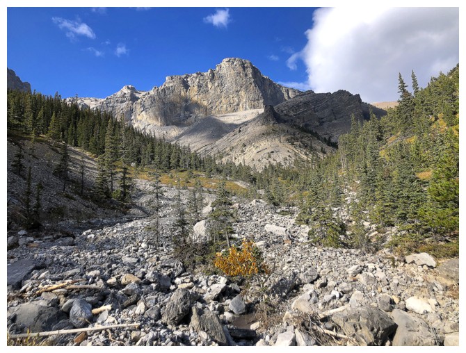
The immense, vertical walls of rock ahead are going to be a source of awe for some time
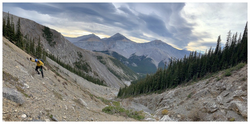
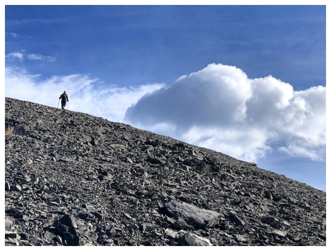
A steep grind with the menacing clouds behind
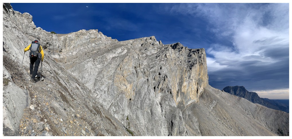
At this point we chose to trend right, but should have stayed to the left
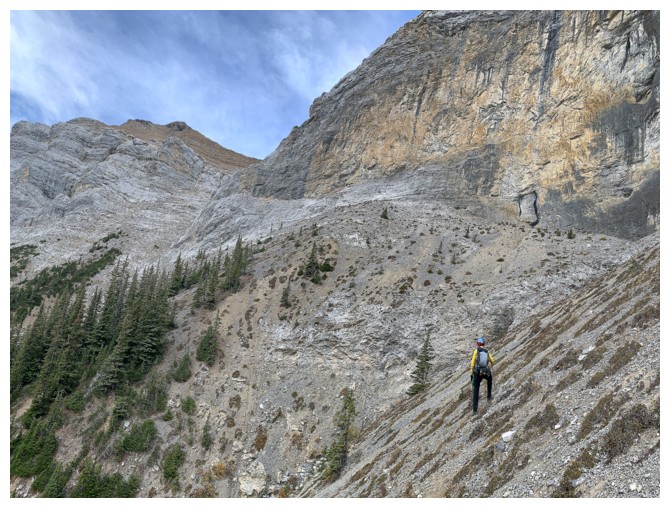
Oops! We need to be well over to the left.
Side-sloping tricky terrain to get back on track
Same as above
...and more
Mark makes it over to safer terrain first
I'm lagging behind
Heading upwards again
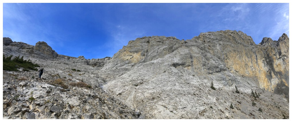
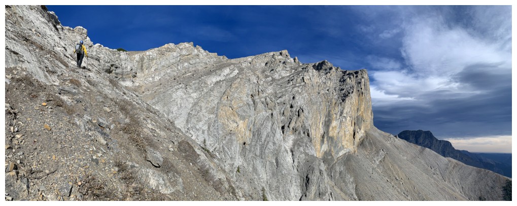
The weakness is still not visible but it's quite obvious where it is
There is some minor scrambling en route
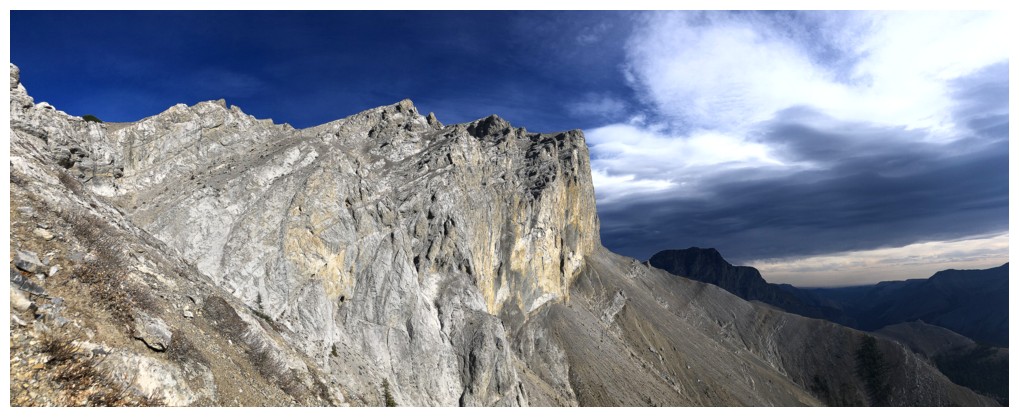
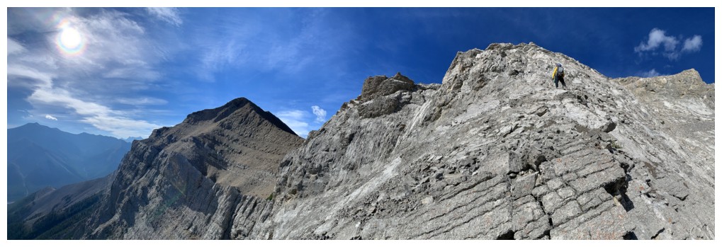
The weakness at the left and interesting clouds at the right
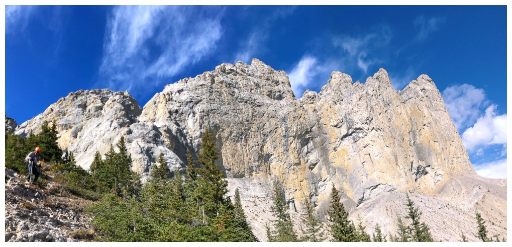
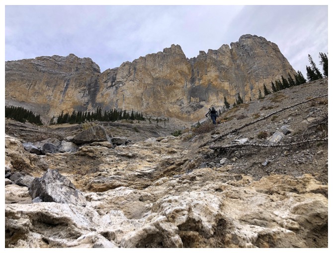
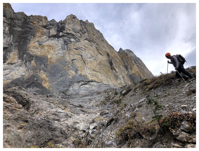
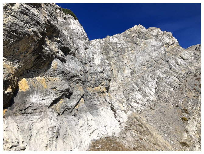
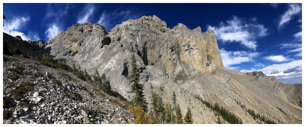
Super cool walls of rock
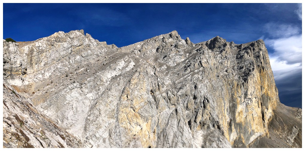
Heading for the weakness
And still awestruck by the vertical walls
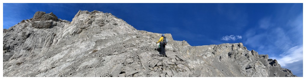
The easy scree ramp that breaks through the vertical terrain
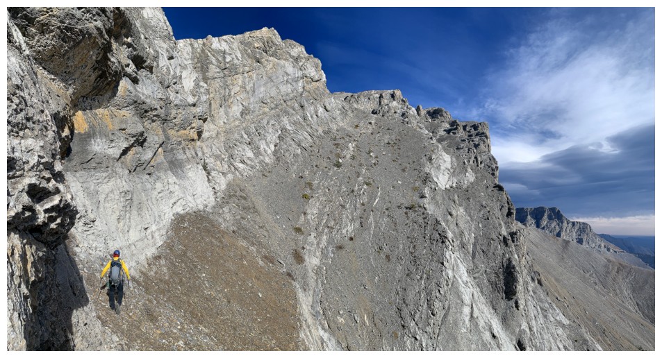
Mark ascends the ramp
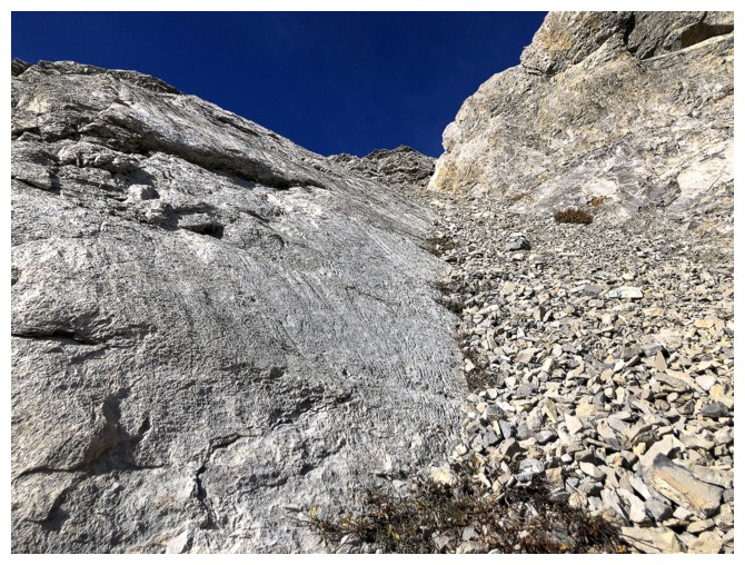
The best footing was at the base of the rock wall
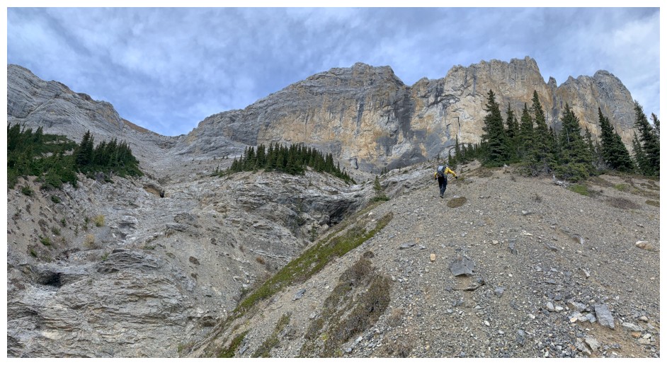
Checking out the terrain around the corner that leads to the ridge
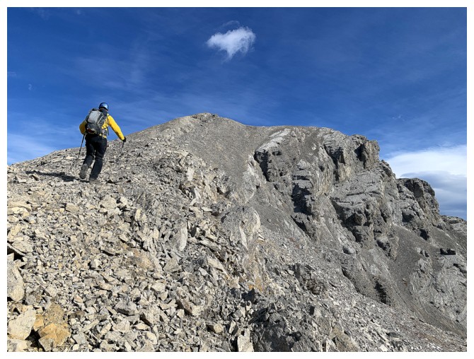
Heading up
One of the keys is this steep but easy scree ramp
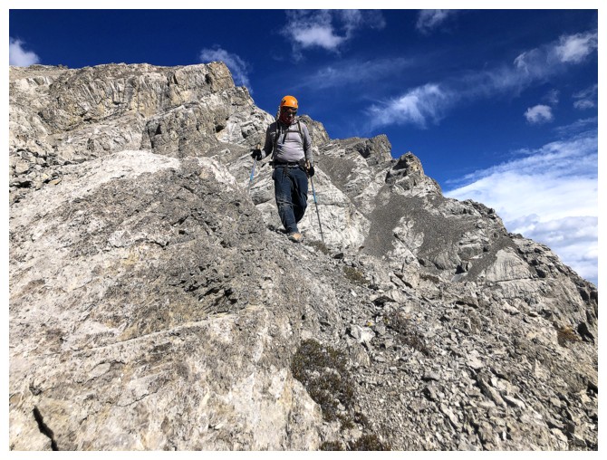
On the ridge. The peak behind is an outlier of Romulus that you would
come up and over if doing the longer route via the Romulus Campground.
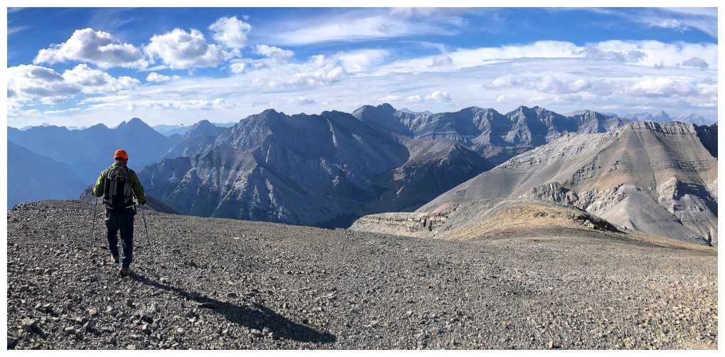
The summit is not far, but it's not a short distance either!
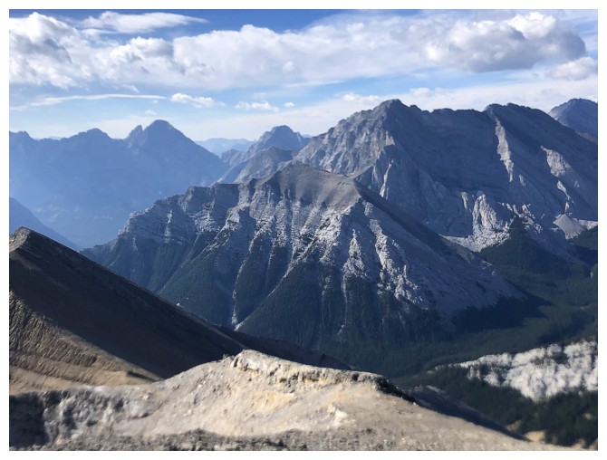
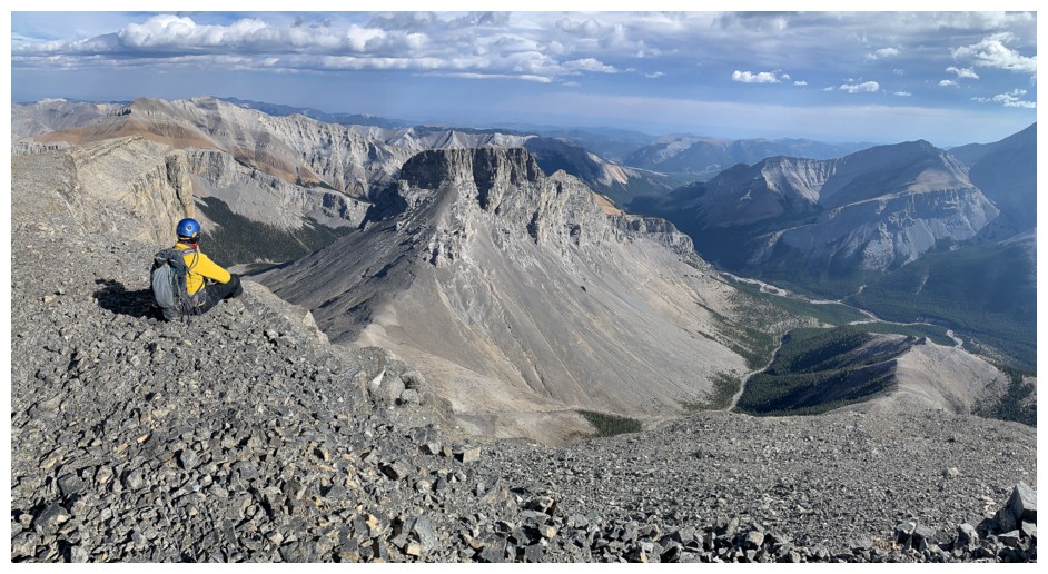
At least there are great views of statuesque Fisher Peak to the northwest
Getting close to the top
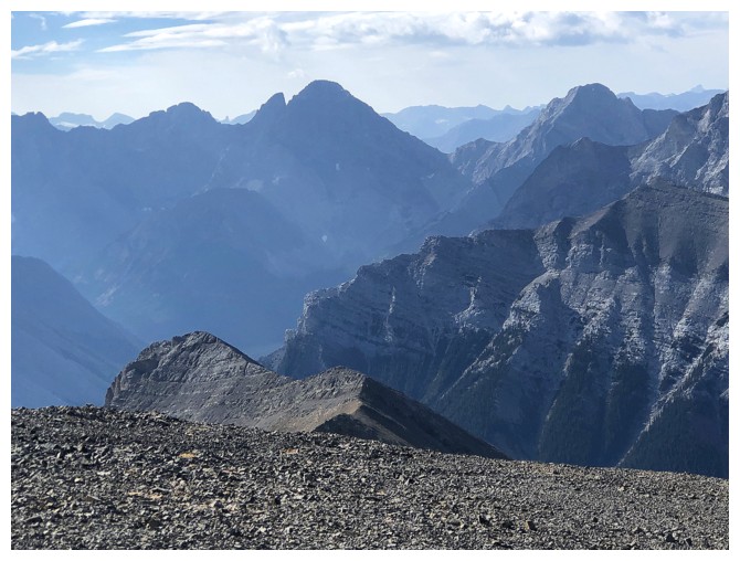
Northwest outlier of Romulus
The view of "Little Evan" and "Ripsaw" to the south provided some grand, 13 year-old nostalgia
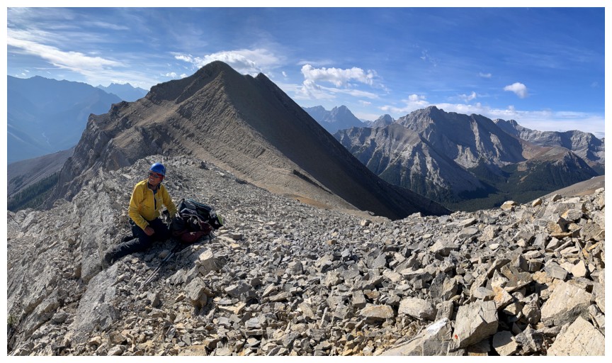
Mark at the summit
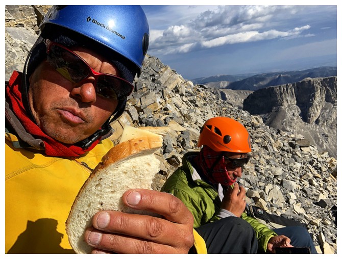
Swiss cheese sandwich seflie near the summit
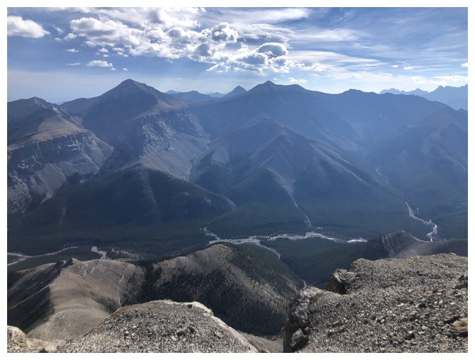
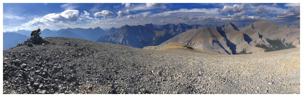
View to the east
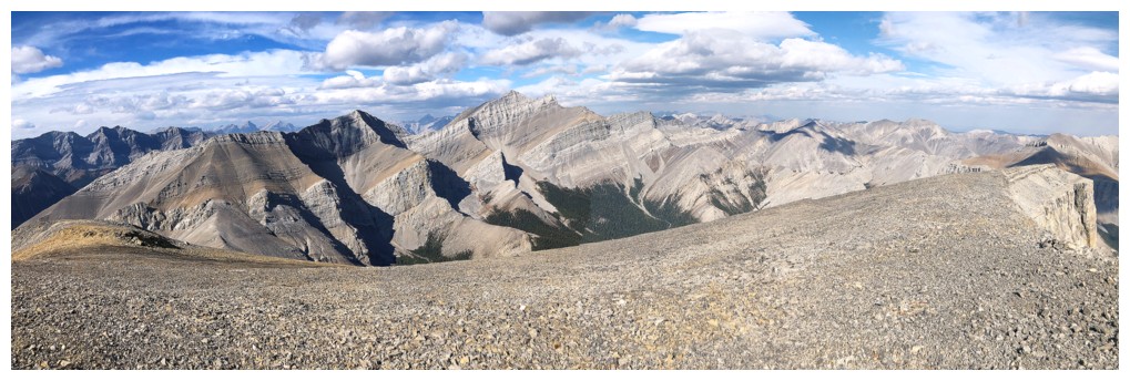
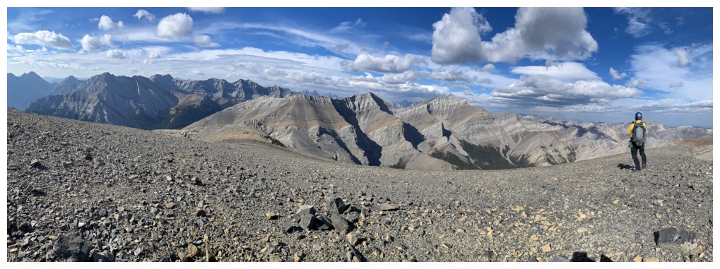
Pano to the north and northwest
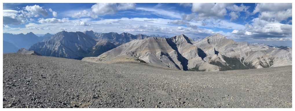
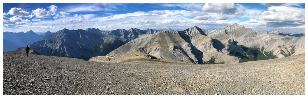
Pano to the northwest and west
My turn for a super contrived summit pose. Mount Remus in the centre - more nostalgia.
Still enjoying the views
And again
Heading down
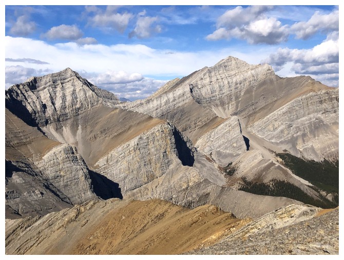
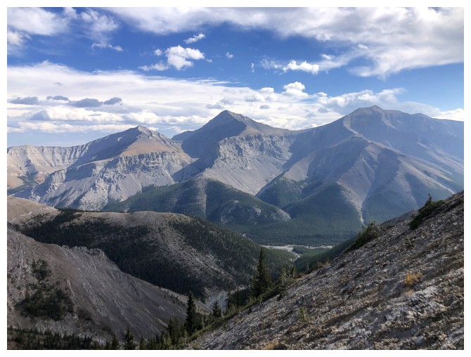
The Blade and Mount Blane (centre) are immediately recognizable. Mount Brock to the right.
Back down that upper scree ramp
And then back towards the major scree ramp
Mounts Glasgow (centre) and Cornwall (right) to the southeast
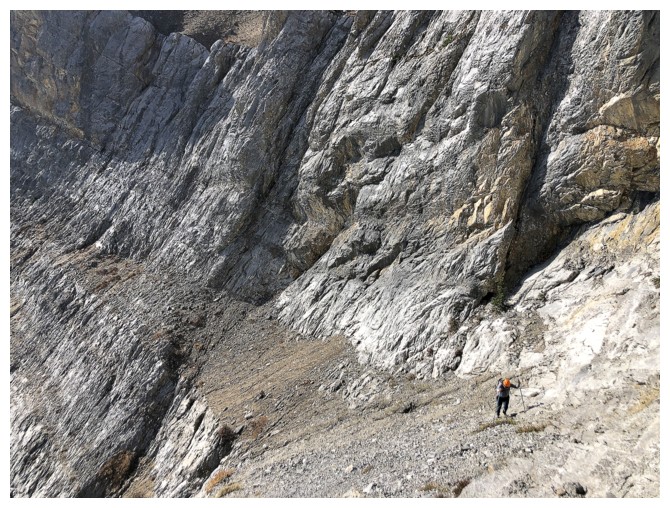
Carefully making our way down the steepest part of the descent, having hiked the scree ramp
Round 2 of the vertical walls
Same as above
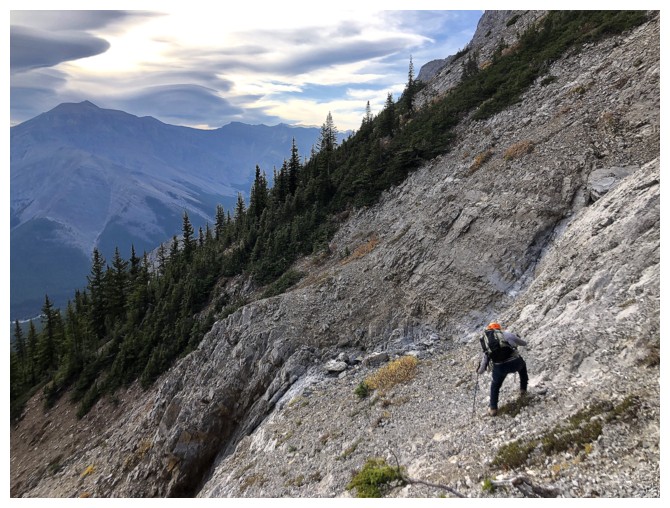
Mark on much easier terrain
Same as above

Same as above
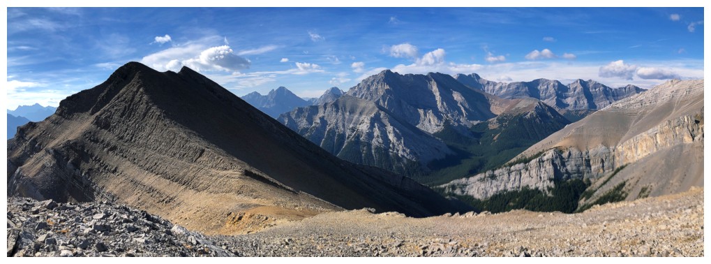
Glasgow and Cornwall again
Looking back to Romulus
Descending the canyon
Almost back to the river crossing (felt more like a minor creek crossing on this day!)
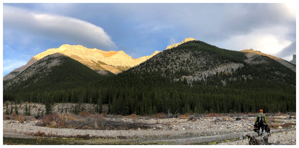
Last look at Romulus
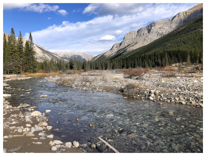
The Little Elbow River
Last look to the west before the super fast and easy bike ride back to the start
The End
LOG