Takakkaw Peak
August 18, 2022
Mountain height: 2730 m
Total elevation gain: approximately
1400 m (includes several detours)
Ascent time:
5:35
Descent
time: 6:30
(includes a few hours of exploration)
Solo scramble.
Unfinished
business. I failed to reach the summit of this unofficial peak in 2017 (unnamed
at GR367-092 in David Jones’ Rockies West, p. 74). And in retrospect that
failure was a good thing. 2017 was one of the worst summers for forest fire
smoke in recent memory (possibly eclipsed only by awful 2021). The views and
scenery in 2017 were very disappointing due to the smoke.
Such was not the
case for 2022. In fact, up until the second week of August, the summer of 2022
had been the sunniest and least smoky I can remember. Attempting the mountain
again on August 19 was a bit of a gamble, as forest fire smoke had by that time
inundated much of the Rockies. 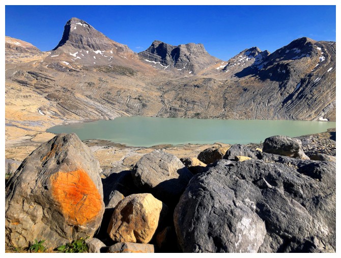 However, the skies seemed quite clear as I drove
west and thus the decision was made and the scene was set.
However, the skies seemed quite clear as I drove
west and thus the decision was made and the scene was set.
I did (very
briefly) consider a route change for the approach. Apparently, there is a gully
south of Takakkaw Falls that grants access to the upper valley. However, this
route would require two river fords, both of which could have been downright
treacherous. As well, the previous approach I took visits one of the Canadian Rockies’
coolest geological marvels – the Angels Staircase Falls – another trek up the falls
had enormous appeal. Another decision made.
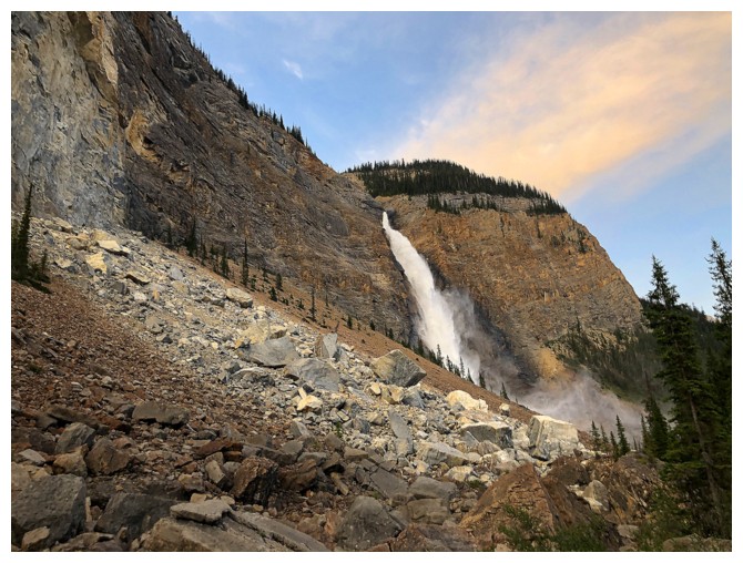
The approach to
Angels Staircase was once again a little tedious in sections, but
straightforward. Starting up the falls, I tried to commit to a relatively rapid
ascent with minimal diversions – who was I kidding! 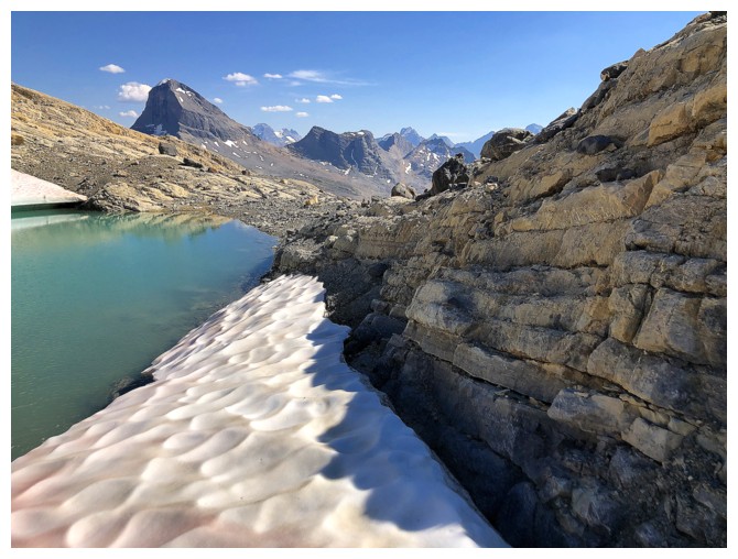 The scenery here is unbelievable
and the scrambling top-notch. You would have to be a robot to resist a thorough
exploration of this amazing geological phenomenon. Water carves out such cool
things! I spent 1 hour, 45 minutes ascending the falls, gaining about 360
vertical metres in the process. The falls were definitely going to be the
highlight of the trip – or were they? More to come….
The scenery here is unbelievable
and the scrambling top-notch. You would have to be a robot to resist a thorough
exploration of this amazing geological phenomenon. Water carves out such cool
things! I spent 1 hour, 45 minutes ascending the falls, gaining about 360
vertical metres in the process. The falls were definitely going to be the
highlight of the trip – or were they? More to come….
The remainder of
the ascent to the false summit (the highest point I reached in 2017) unfolded
much the same as the previous attempt, with one glaring exception: no smoke and
therefore awe-inspiring views in every direction. The moment of truth was now
at hand. The terrain between the false summit and true summit looked
interesting, to say the least, and I was somewhat skeptical it would go as a
scramble. Thankfully, I was wrong and after some route-finding on both sides of
the ridge and one step of exposed scrambling I made it to the top. Needless to
say, the summit view was excellent, especially towards Mount Balfour.
Besides Balfour
and numerous other big, glaciated peaks, another eye-catching element of the
summit view was several glacial tarns below Takakkaw Peak. No way was I leaving
the area without visiting at least one. As such, I tried to descend the north
ridge of the peak, hoping to make a nice loop route out of the upper section of
the trip.
The descent
started well but eventually I reached a drop-off along the ridge at the
high-end of scrambling. Attempts to downclimb the step failed, mostly because I
have become an exceedingly conservative scrambler when doing solo trips – a
younger version of myself would have searched longer or tried one of the
available routes. Instead, I decided to look for an alternate route down.
This turned into
quite an adventure. I lost a huge amount of elevation down the east side of the
peak before suddenly getting cliffed-out. Given I forgot to pack a parachute, the
only option at this point was to return to the north ridge and hope I had
circumvented the difficulties. Gaining all that elevation back kinda’ sucked
but mission accomplished in terms of avoiding the tricky terrain. It also
kinda’ sucked to see the summit cairn again, only about 400 horizontal and less
than 50 vertical metres away, a full hour after leaving it!
However, the
next few hours were simply magical, starting with an awesome walk down
beautiful, glacially scoured rock to the first tarn. I thought that one was
cool, but the second was even better. And the third – crystal clear water, with
a deep blue/green hue and surrounded by rock ground down to a fine sand. You
would swear you were walking on Daytona Beach! With more time, I totally would
have gone for a dip in this tarn – it looked so inviting.
Unfortunately,
time was not in abundance and as much it I would have loved to see up close
where the Daly Glacier empties into massive Takakkaw Lake, that detour would
have ensured a headlamp descent down Angels Staircase Falls. Instead, I set a
course back to the south ridge of Takakkaw Peak to see the fifth and final tarn.
Some of the terrain underfoot here was incredible and unlike anything I’ve ever
seen in the mountains. Glaciers leave very cool things behind! That said, I’d
put the tarns and the glacially scoured terrain of the basin in a tie with
Angels Staircase for the highlight of the day.
After leaving
the fifth tarn I was able to make up some time and arrived back at the top of
the Angels Staircase with plenty of time to spare before the Earth’s rotation
deprived the area of Sunlight. Though quite steep at the top, the fastest way
to descend the Staircase is to not descend the Staircase. Instead, I barreled
down forested slopes a little south of the Falls. At the 12.5-hour mark of the
day, exhaustion had long set in, and I assumed a zombie-like gait with the
occasional moan for the 3 km hike back to the start. Gone is my full head of
dark brown hair and it took with it any stamina I had for these long days!
Overall, a
totally amazing day of fantastic rock, stunning glaciers, brilliant water
scenery, and breath-taking views.
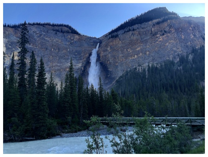
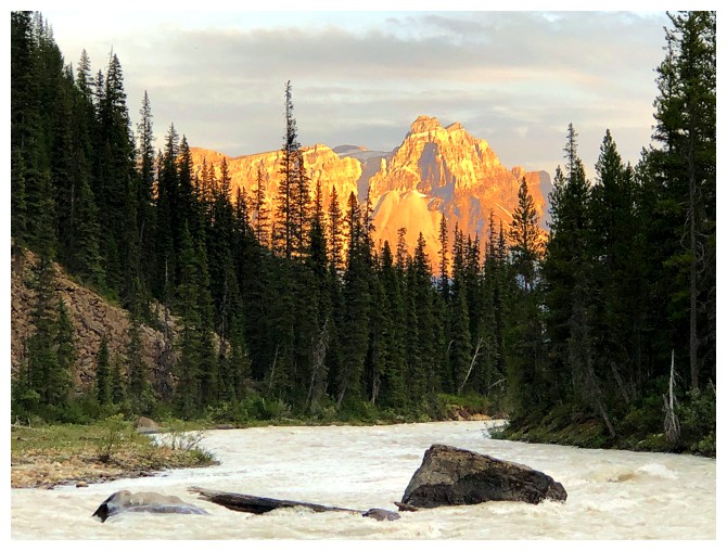
The trip starts at famed Takakkaw Falls
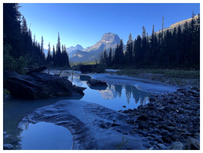
Wapta Mountain partially reflected in a puddle
The northeast side of The Vice President joins the show
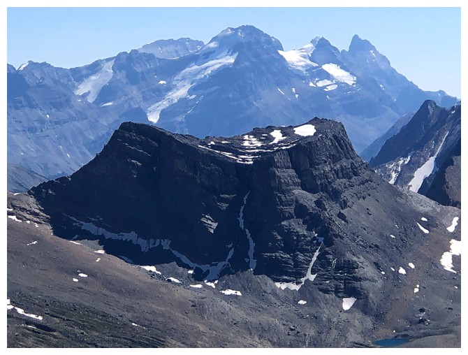
Thanks to its lowly stature and a 5.6 summit block Trollltinder Mountain will probably never have many visitors
Close-up of Trolltinder
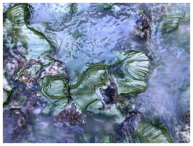
Algae forming on rocks at the banks of the Yoho River
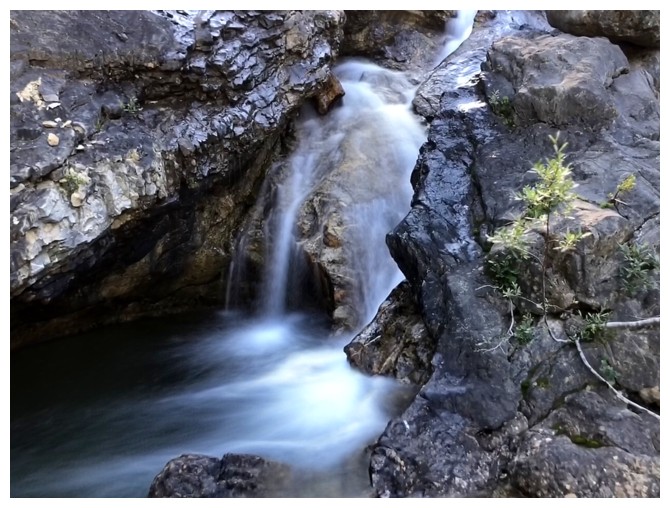
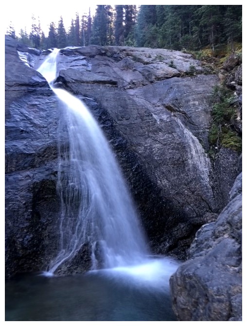
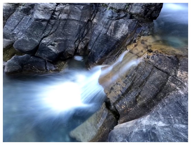
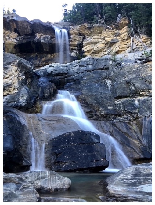
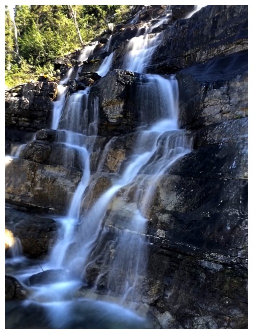
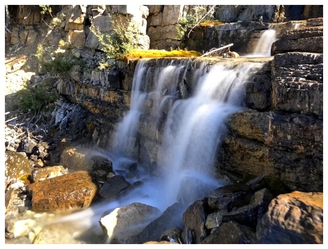
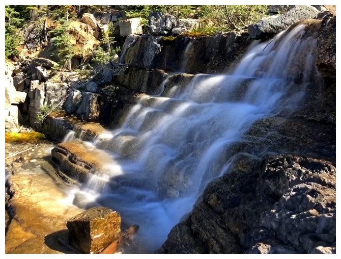
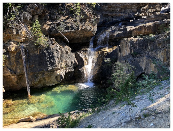
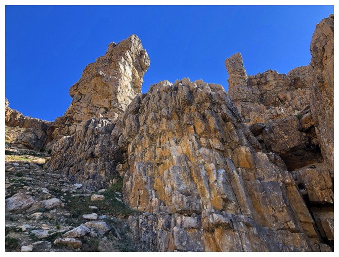
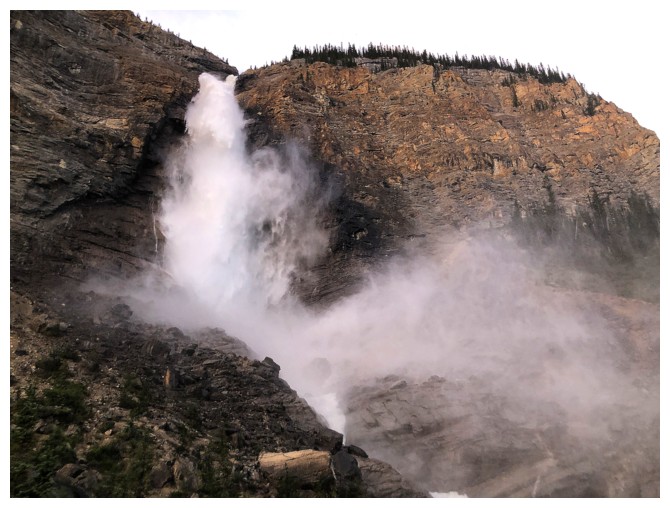
The first section of Angels Staircase Falls
Prepare for a ton of gratuitous, long-exposure photos of the incredible falls
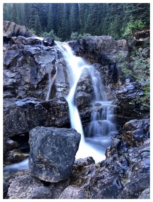
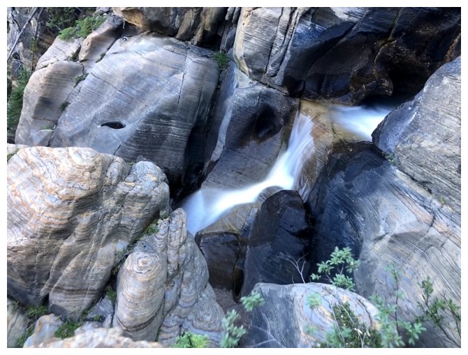
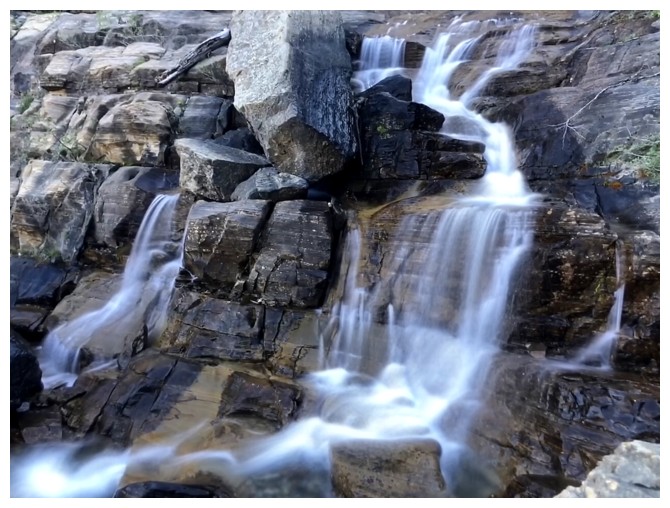
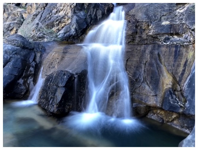
The middle section
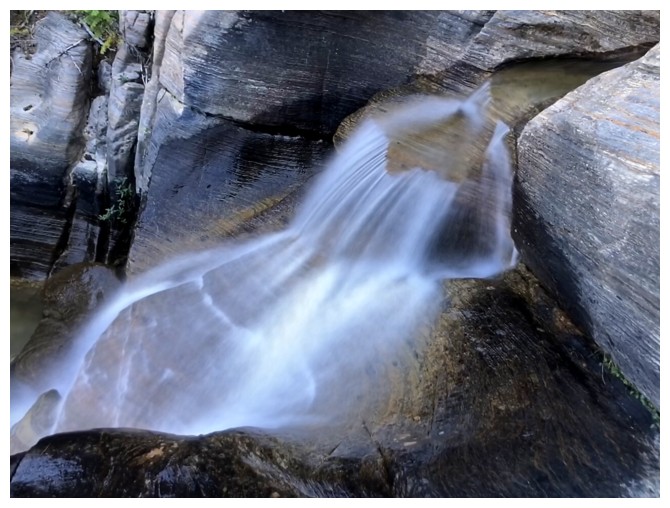
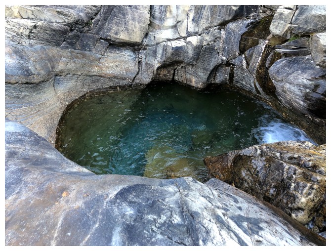
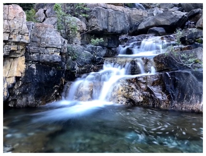
Water has carved out deep pools everywhere. They all looked so inviting.
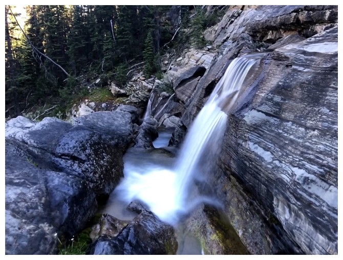
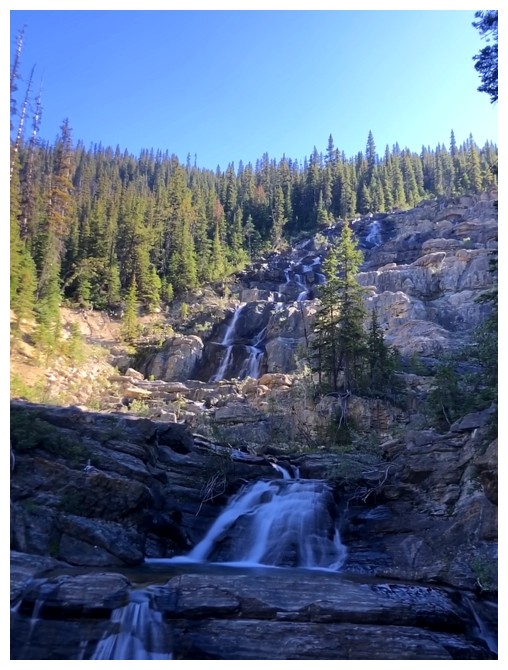
The upper section
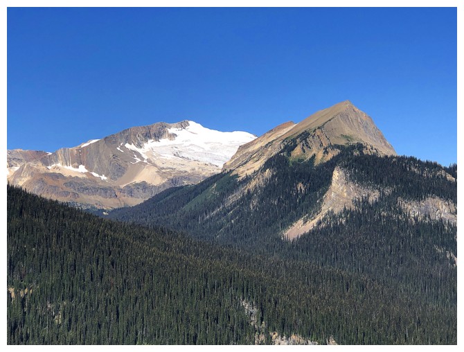
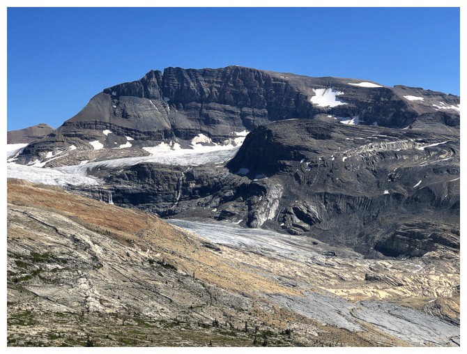
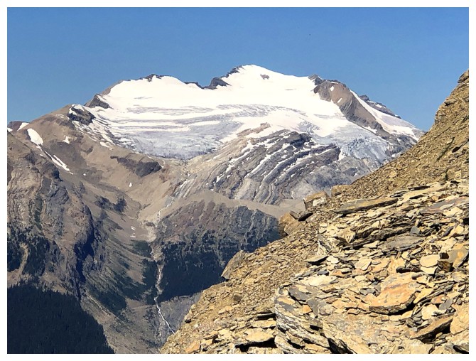
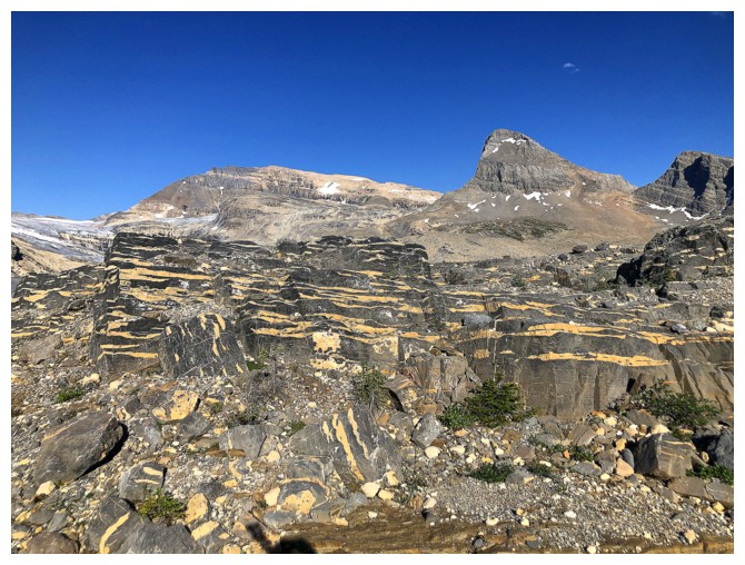
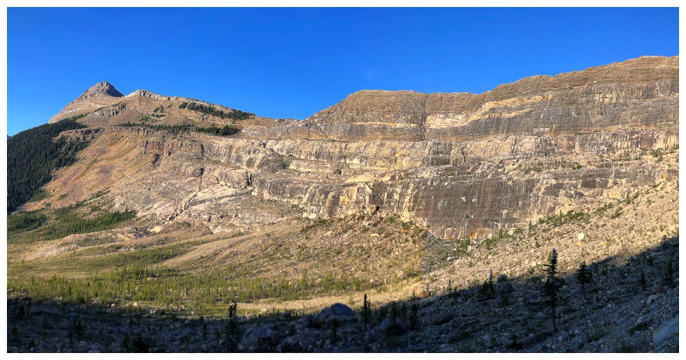
Glaciated Mount McArthur and Whaleback Mountain\
The rapidly shrinking Emerald Glacier on the east side of The Vice President
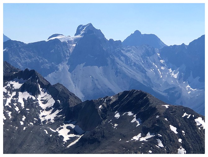
Arete Peak, Mont des Poilus, Yoho Peak, and Mount Collie are distant but distinctive
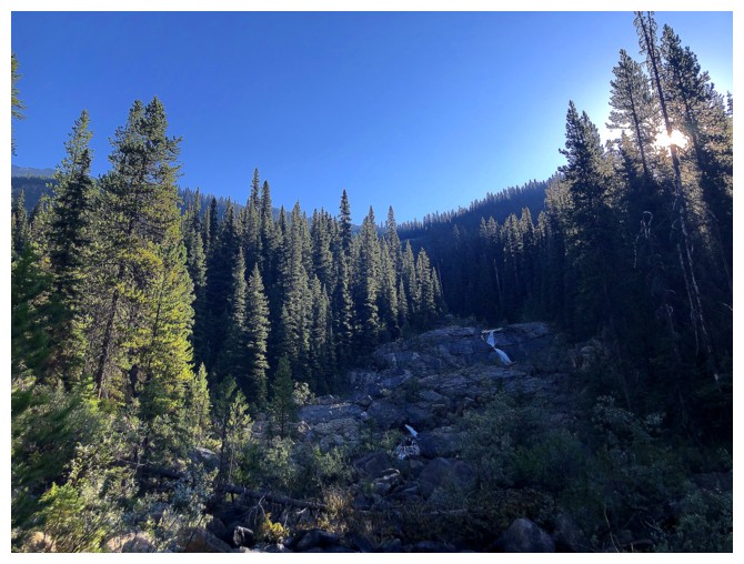
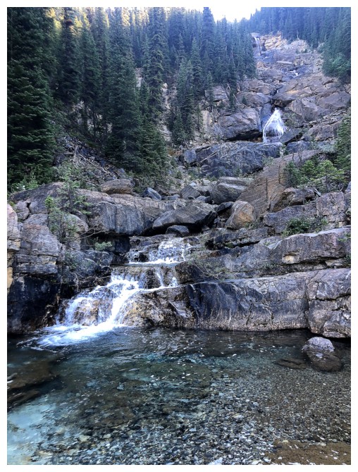
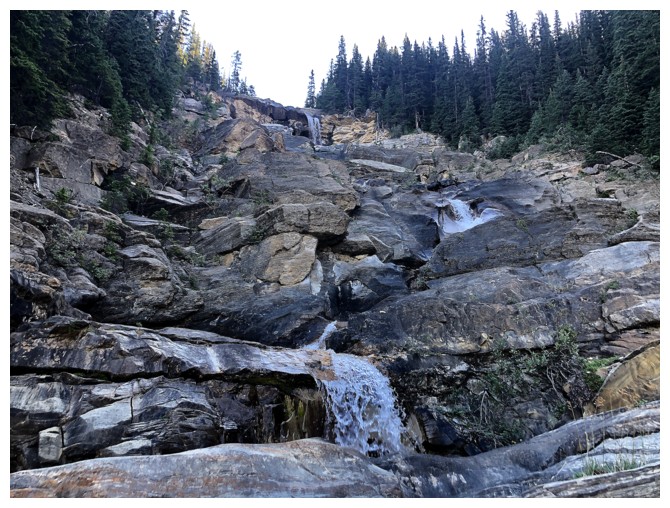
The creek and the falls continue
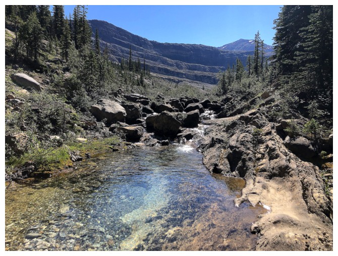
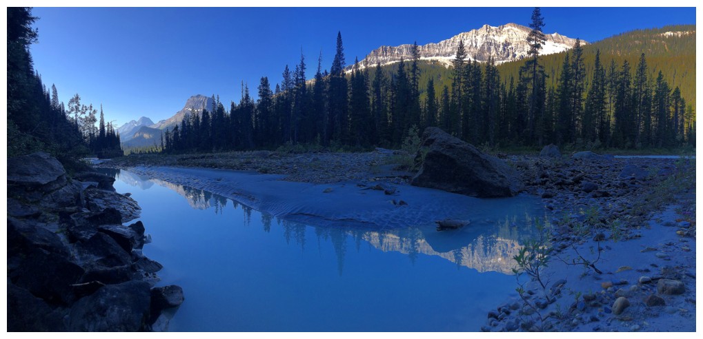
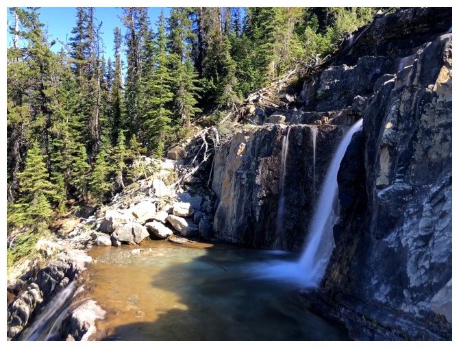
The open valley above the falls
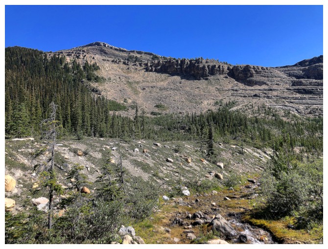
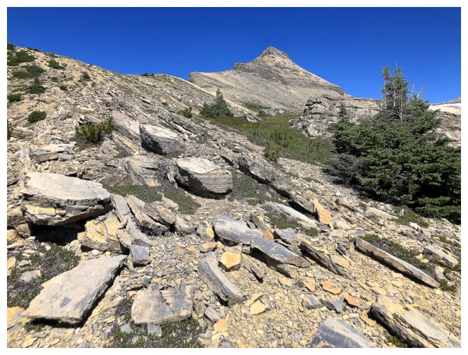
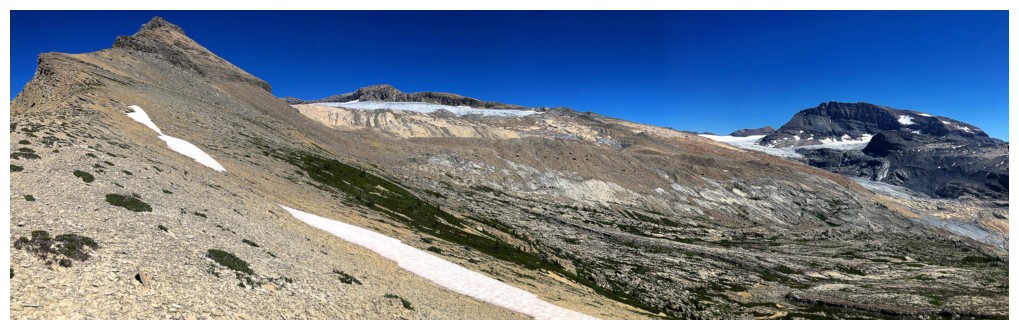
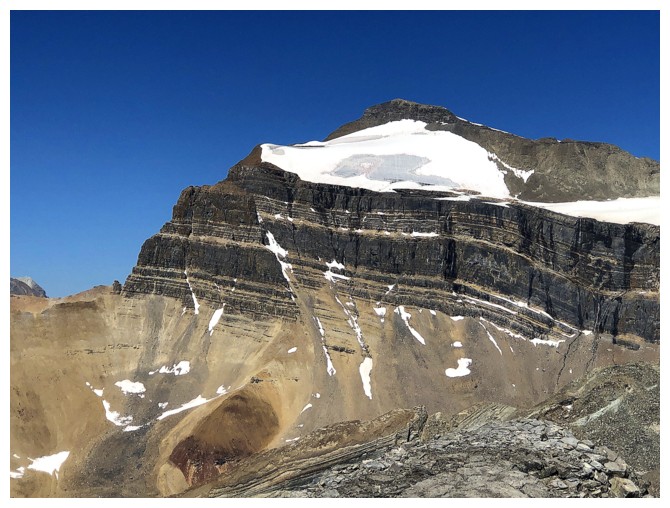
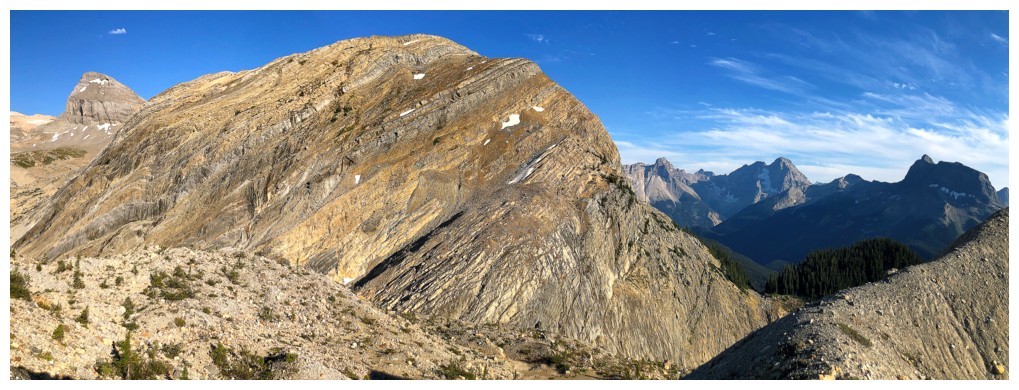
The first part of the route up Takakkaw Peak goes up the scree/rubble slope at the left
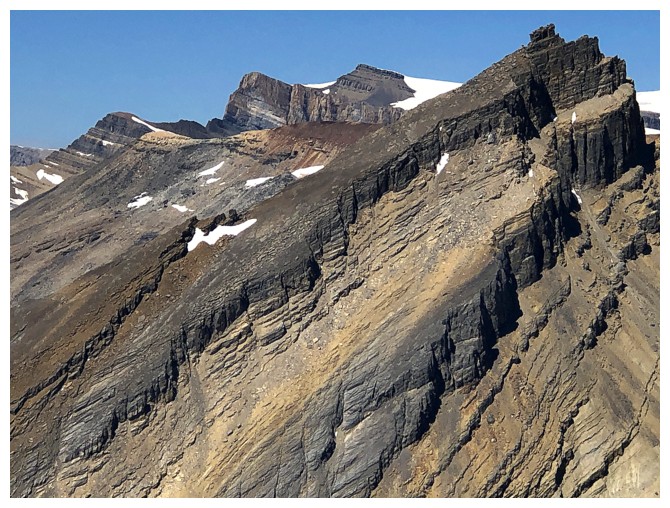
Many interesting rock pinnacles at the top of the slope
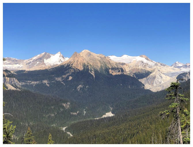
The view really opens at this point
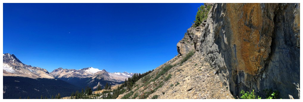
Confronted with the a wall of rock I could have went up the base
....but chose to go down and around to gain the south ridge of the objective
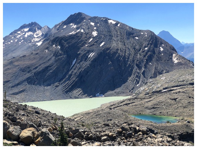
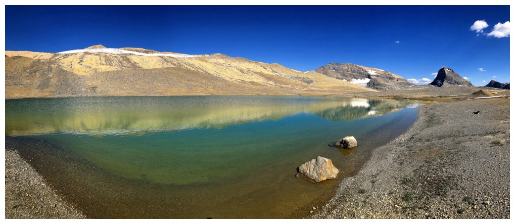
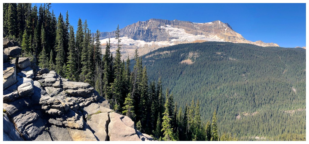
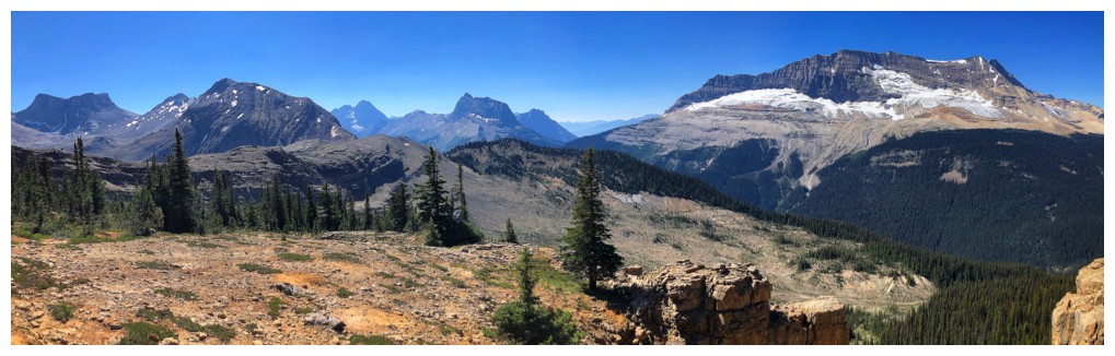
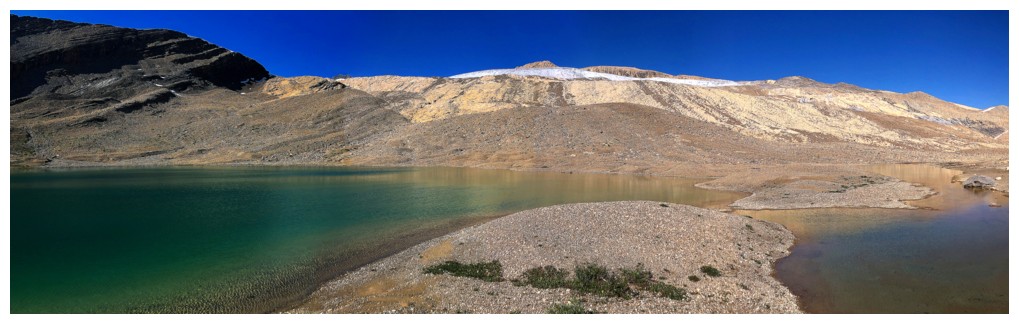
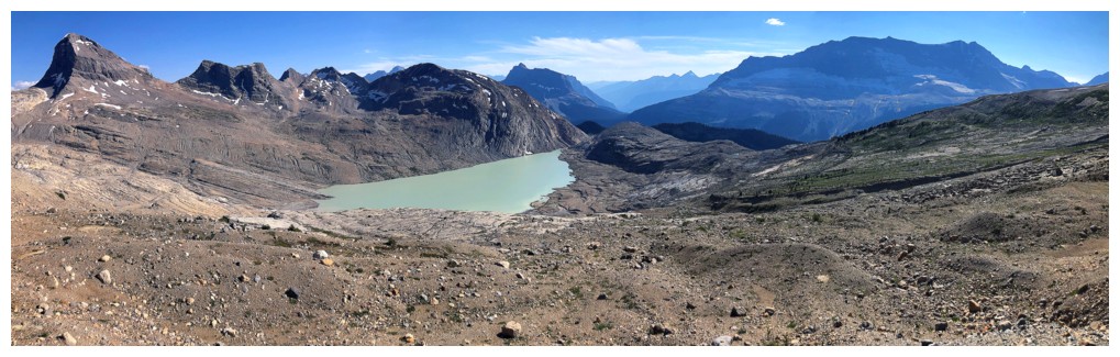
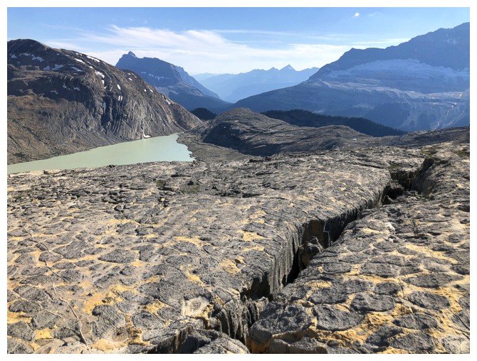
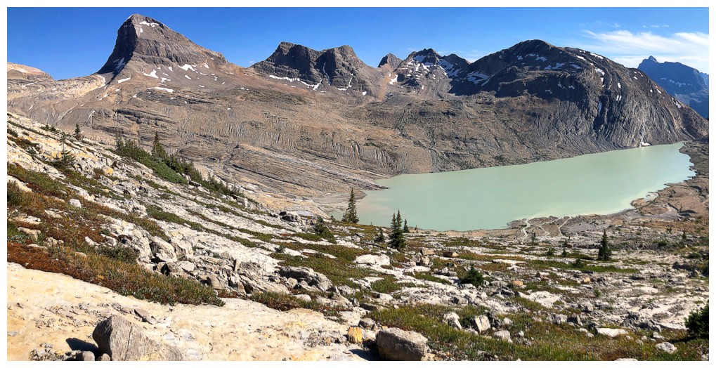
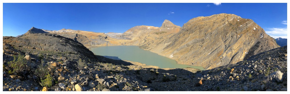
Impressive-looking outlier west of Mount Niles above the silty waters of Takakkaw Lake
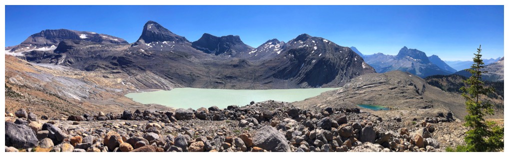
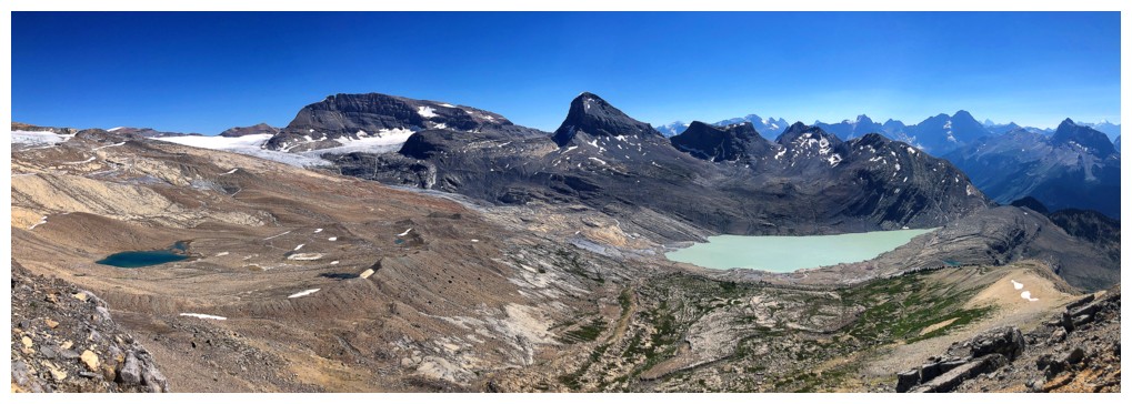
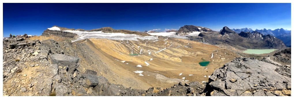
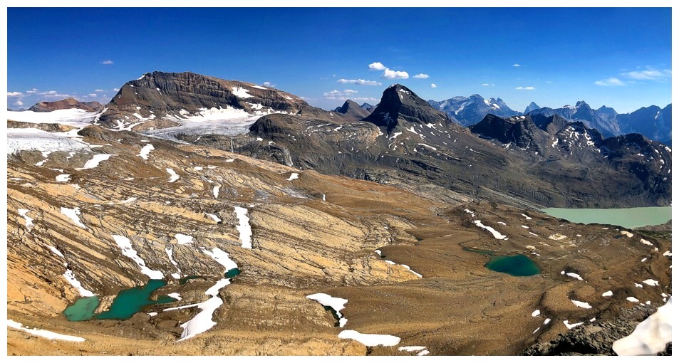
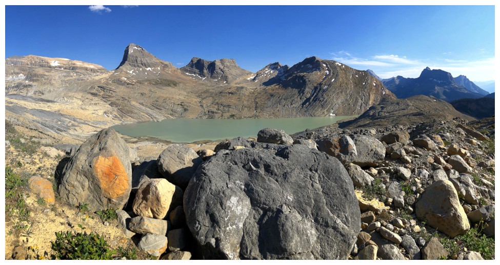
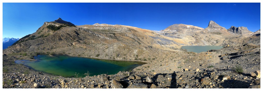
The view from the base of the south ridge includes Daly, Niles, Profile, Wolverine, the outlier, and Wapta.
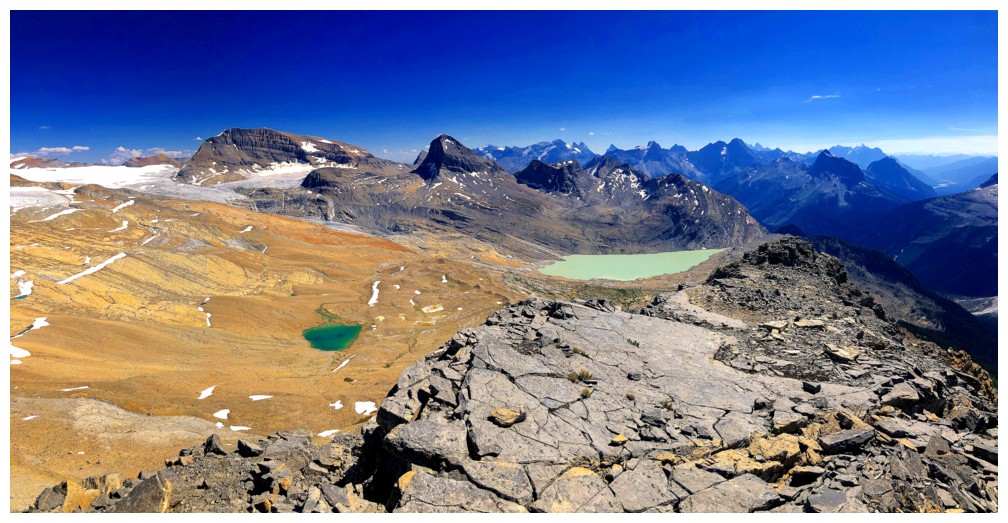
Takakkaw Lake is obvious and the fourth tarn can also be seen.
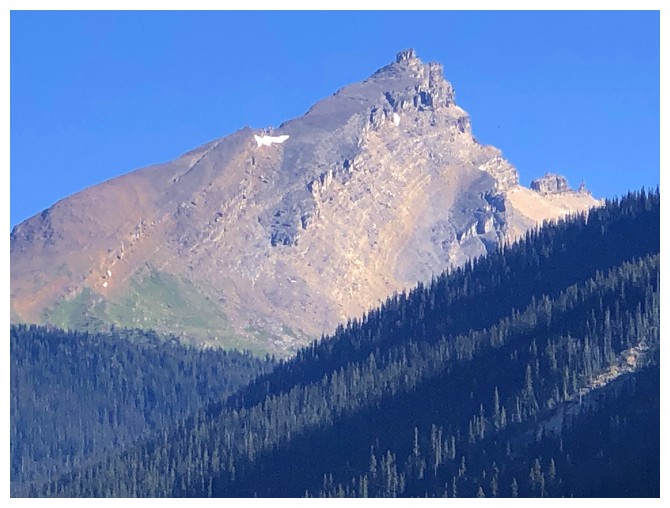
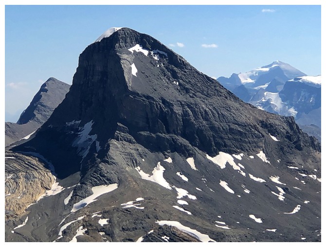
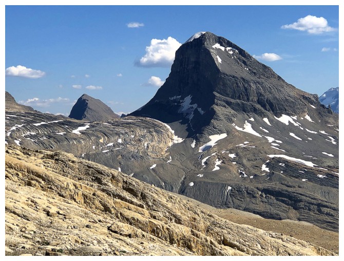
Takakkaw Peak is dead ahead
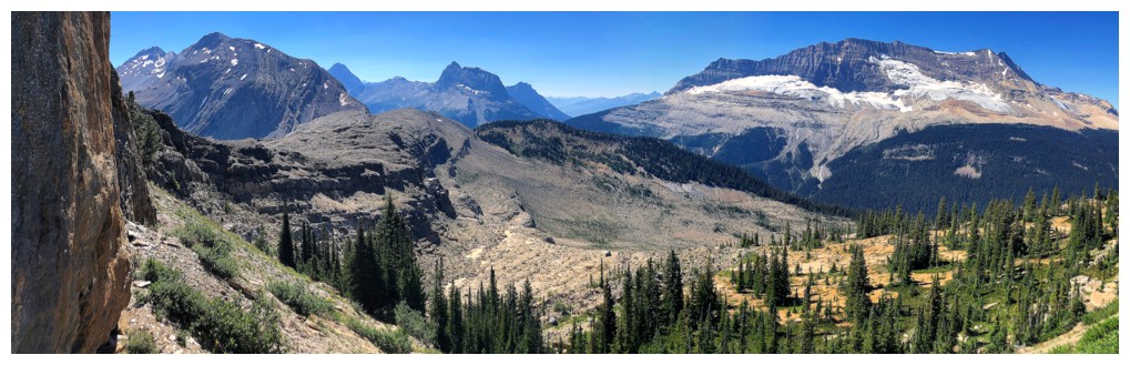
Mount Daly is going to get lots of photo attention
Takakkaw (left), Daly (right), and the terrain between them
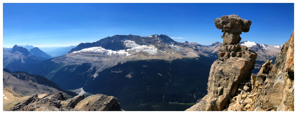
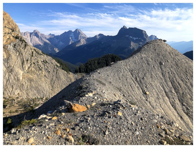
Mont des Poilus - a very long day trip!
Mount Collie
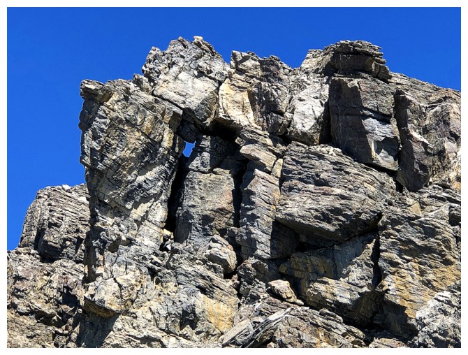
Small rock window on the ridge
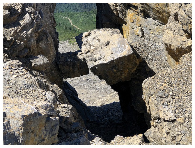
Two chockstones playing a very dangerous game!
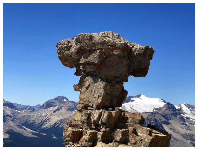
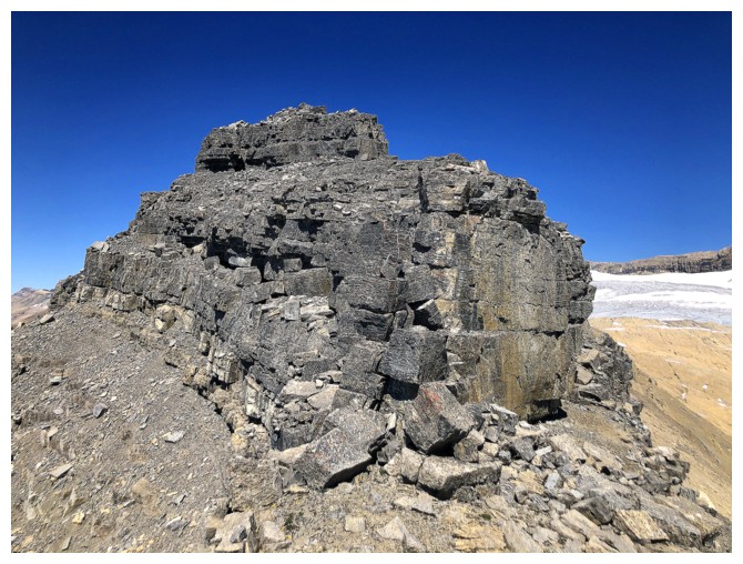
Interesting formation of rock to take my mind off all the loose rock everywhere else
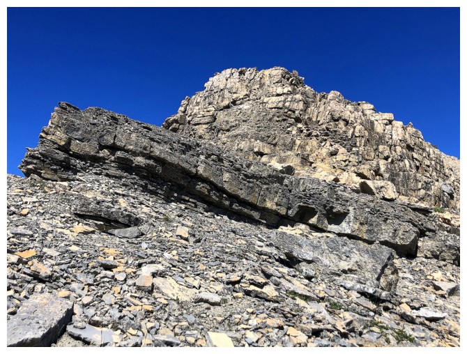
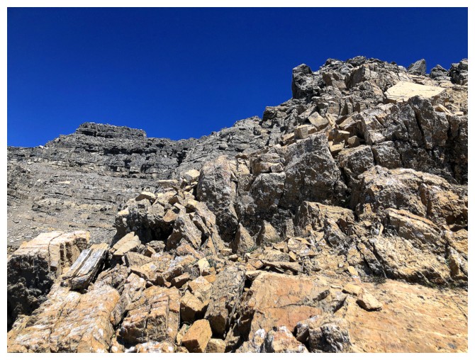
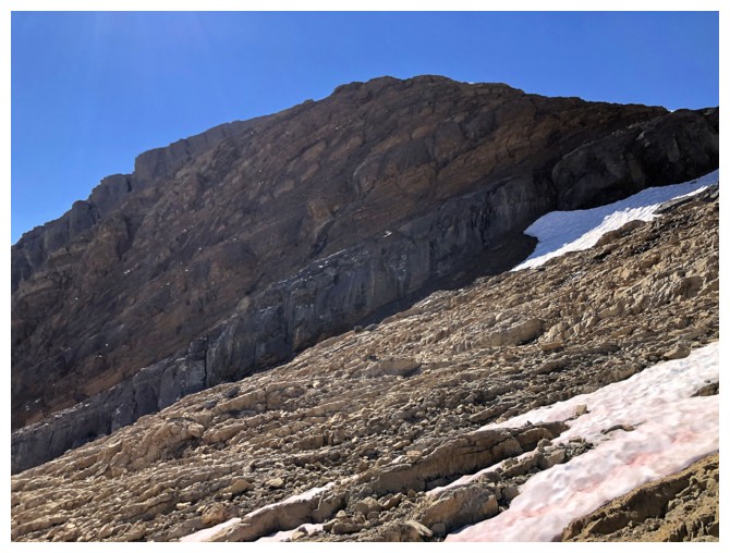
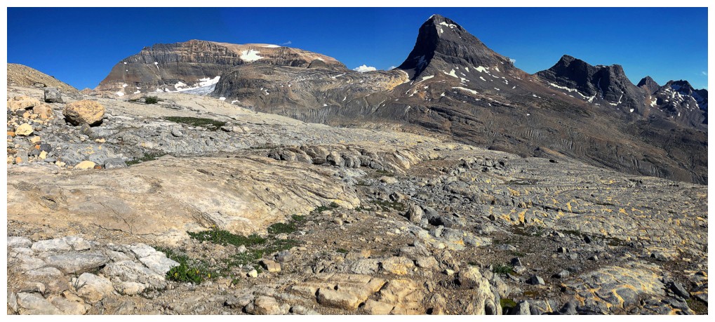
Typical terrain going up to the false summit
Typical views while going up to the false summit
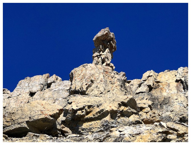
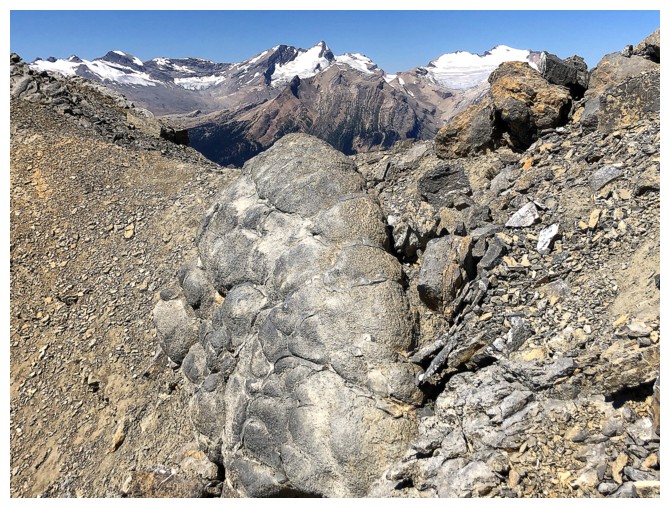
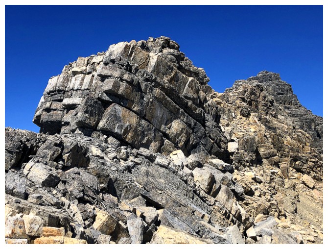
Another eye-cathcing rock formation
Same as above from higher up
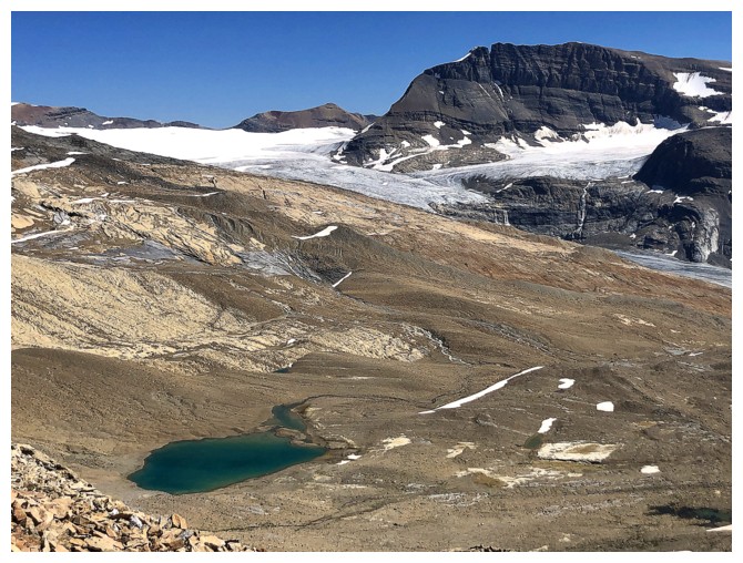
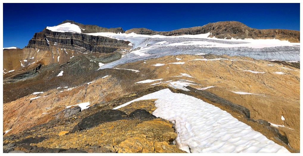
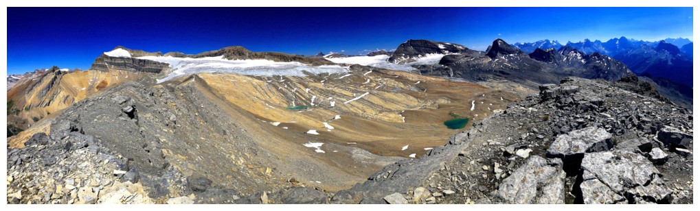
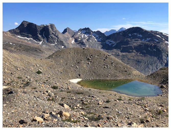
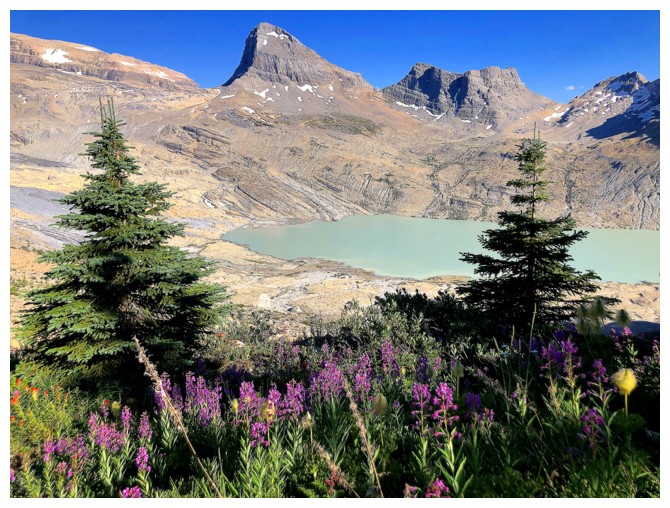
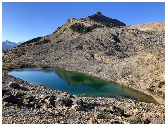
The Daly Glacier starts to appear. The glacial tarn at the lower left provided the motivation to make a loop route.
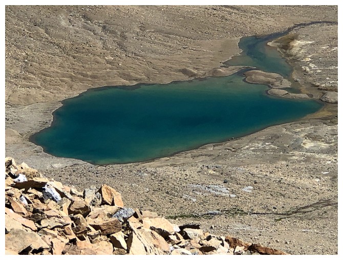
Close-up of that tarn
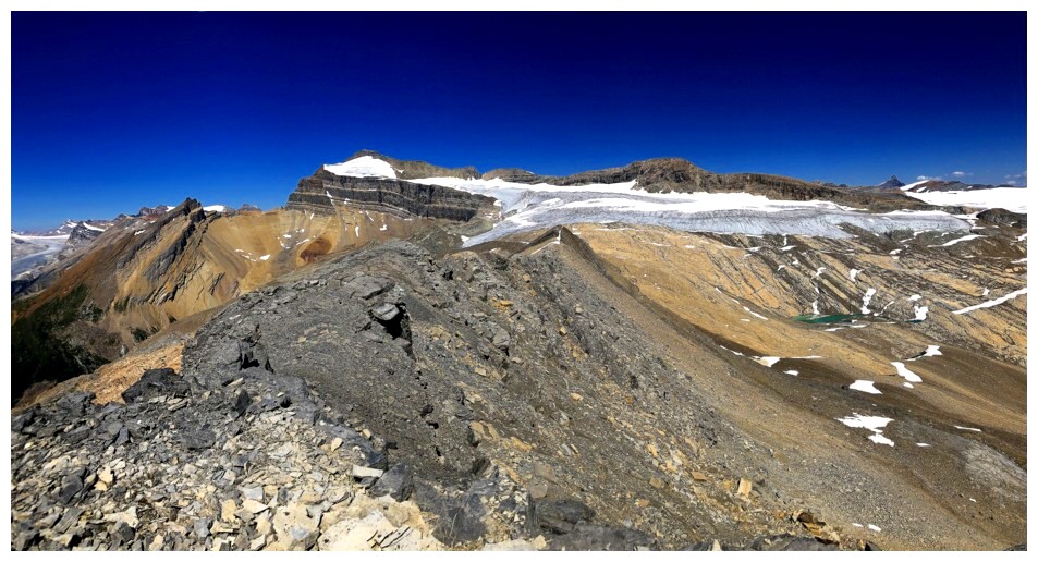
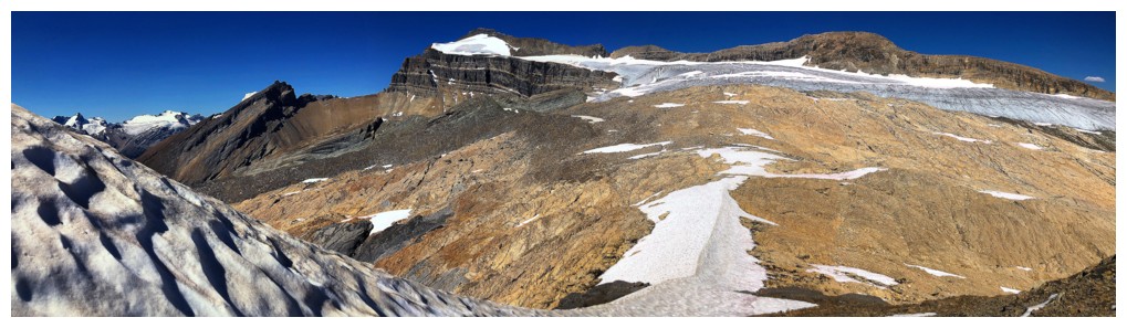
At the false summit, with the remainder of the ascent stretched out in
front. Mount Balfour peaking over the top of Takakkaw Peak.
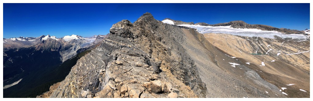
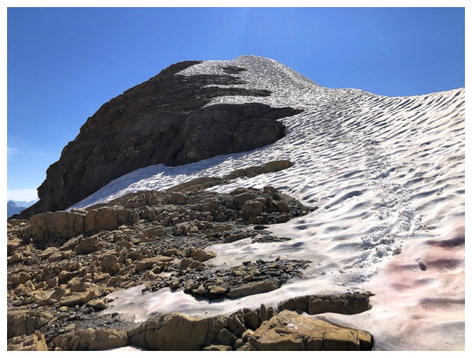
Typical terrain on the summit ridge. Lots of the traverse takes place on either side of the ridge.
On the left side
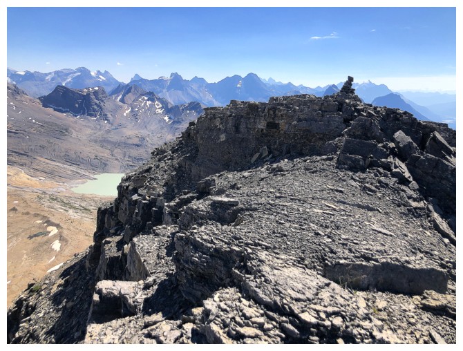
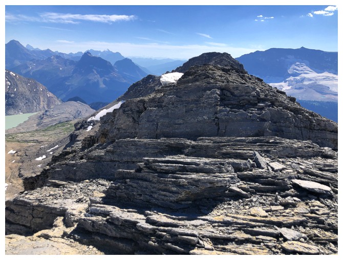
Back on the ridge with the summit a short distance away
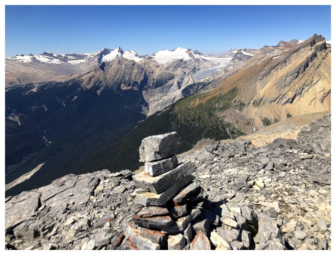
Success
The summit view features Mount Balfour (left), the beautiful, glacially
scoured valley below Balfour and a host of wonderful peaks to the
southeast
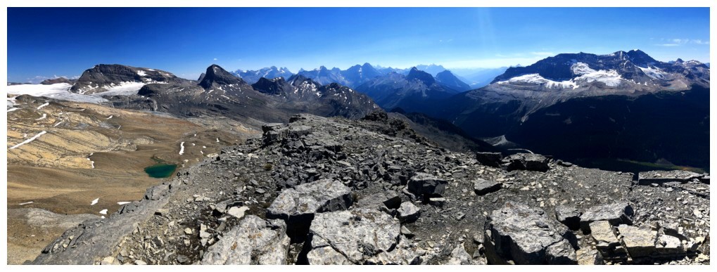
View to the south
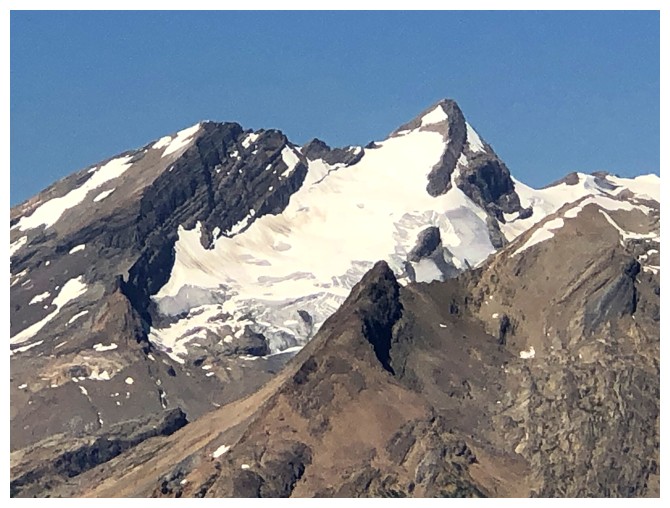
Closer look at Balfour and the Fairy Glacier
Even closer
Cathedral Mountain - still one of our most memorable days ever in the mountains
The impressive north side of Mount Niles
Profile Peak in the foreground and a bunch of 11,000 ers (Lefroy, Victoria, Huber, and Hungabee) in the background
Trolltinder again
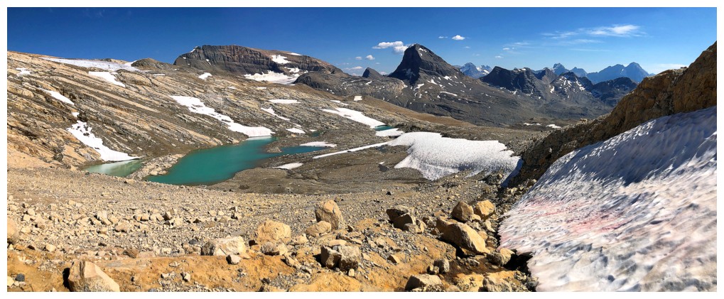
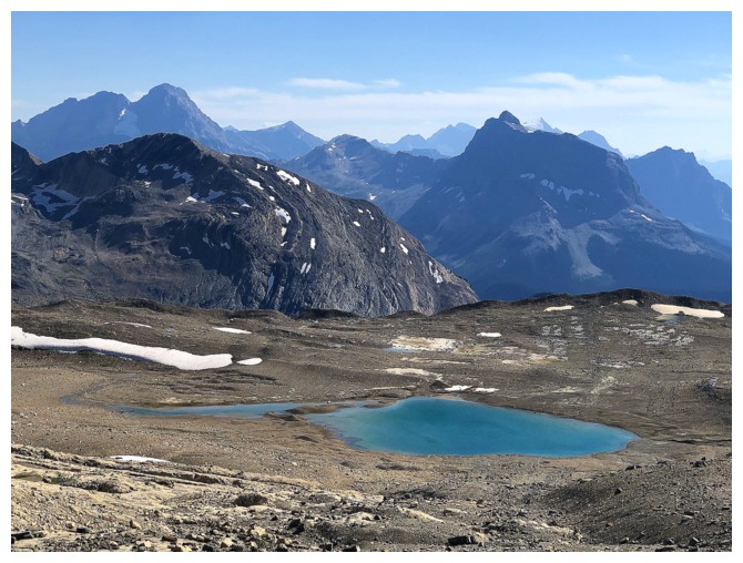
Last look from the top. Several of the tarns are visible.
Leaving the summit in search of an alternate descent route to get to the tarns below
An hour later I'm slogging back up to the ridge, having lost a huge amount of elevation and then getting cliffed-out
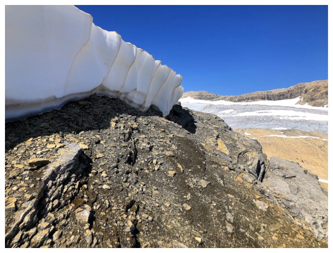
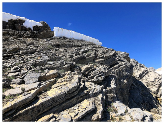
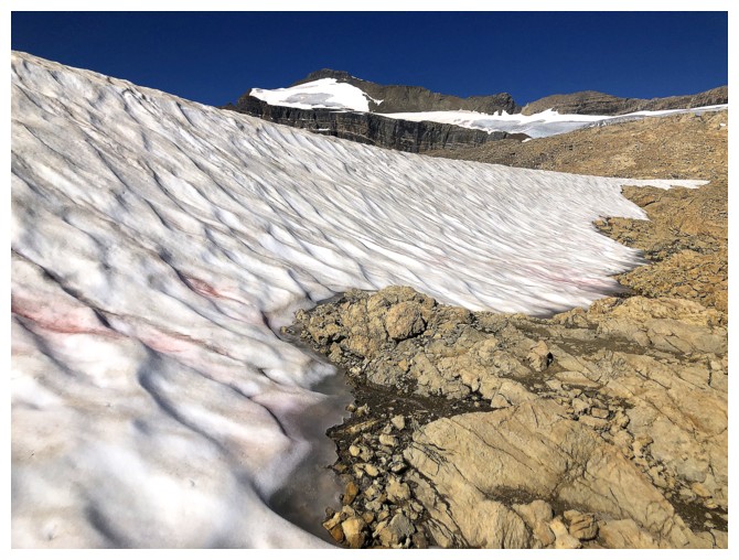
A very tenacious cornice is still hanging around in late August
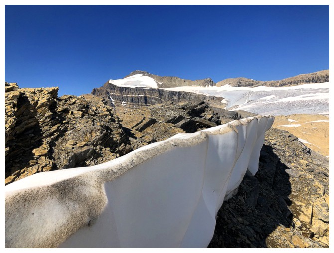
Same as above
Back on the ridge more than an hour after leaving it and the summit is still within spitting distance!
Heading down the north ridge
The tarn at the left will be visited first
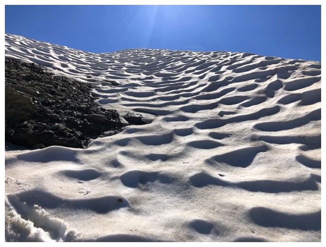
Cool Sun cups
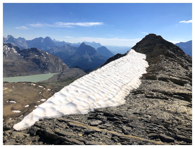
The remaining snow along the north ridge made easy work of the descent
Same as above
Leaving the snow
Looking back up the northeast side of Takakkaw. I descended to the lower left before having to re-ascend up to the upper right.
Heading down to the first tarn
This glacially-scoured terrain was fantastic to descend
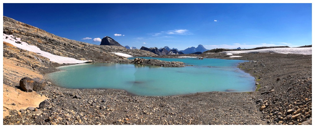
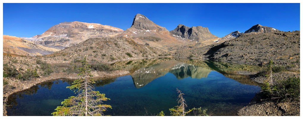
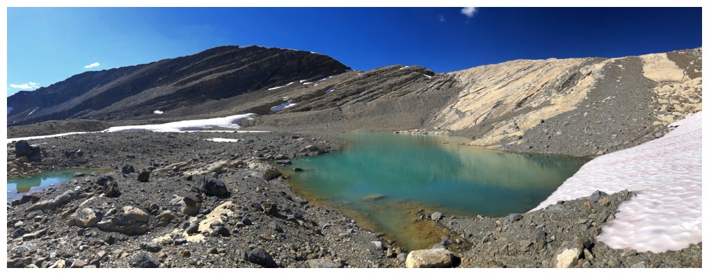
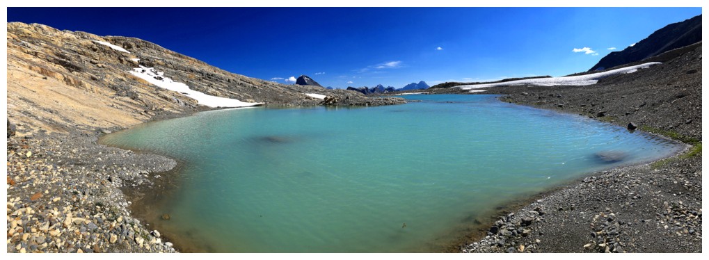
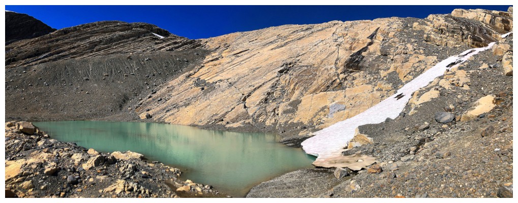
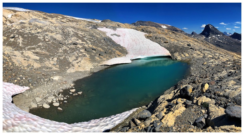
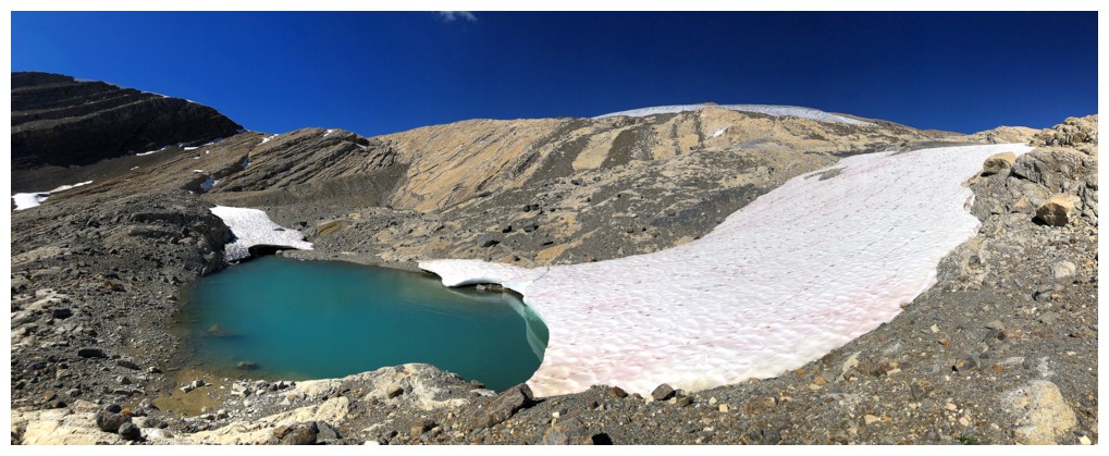
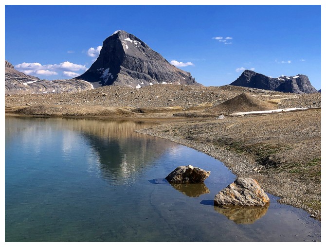
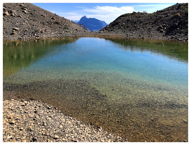
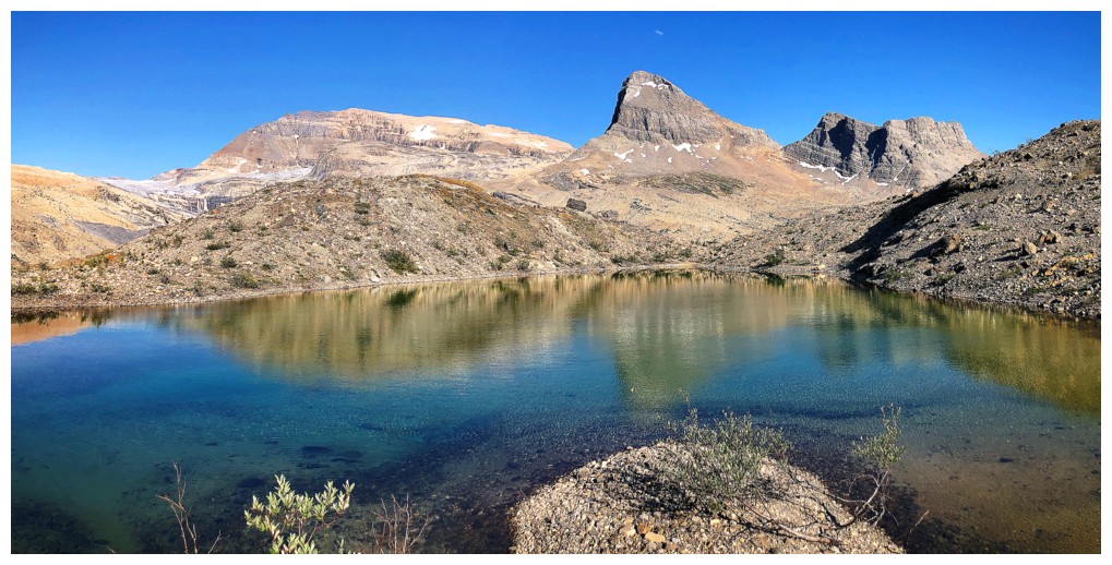
Tarn 1
Mount Stephen in the distance
Still admiring the first tarn
Going around the east side of tarn 1 to get to tarn 2
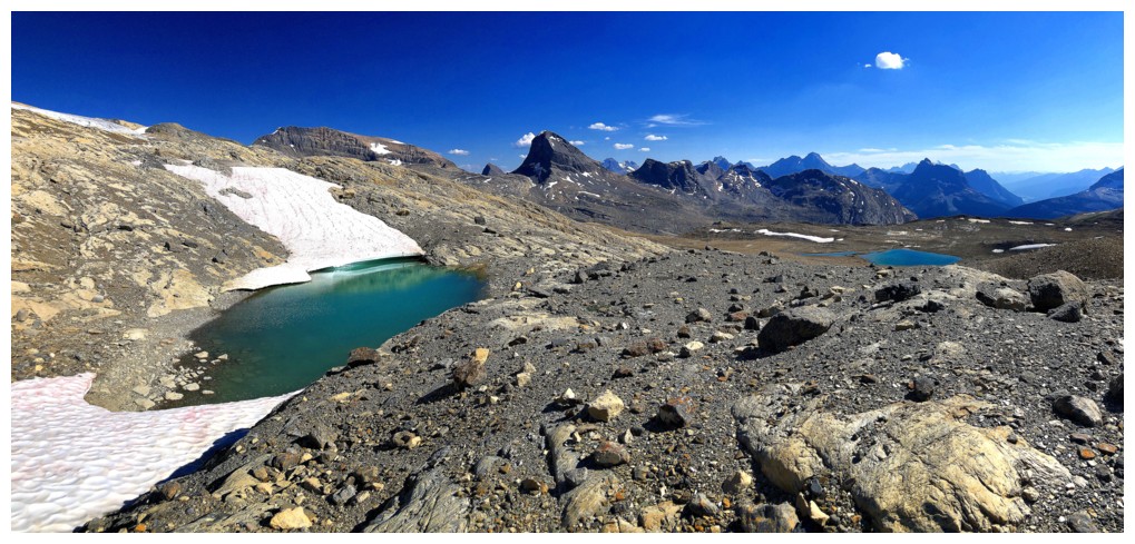
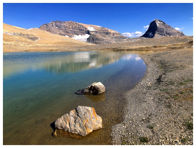
Tarn 2 at the left and 3 at the right
Tarn 2
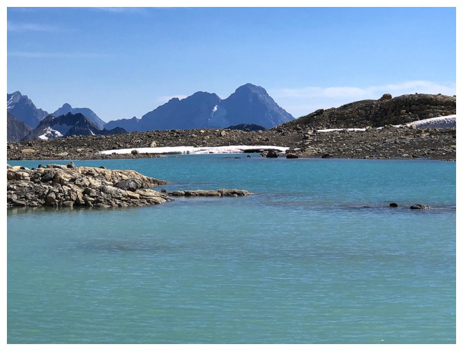
Niles and an unnamed peak southeast of Daly
Tarn 3 is a bit of a hike away
Exploring the perimeter of tarn 2
Same as above
You definitely wanted to be to the left here!
Looking back to tarn 2
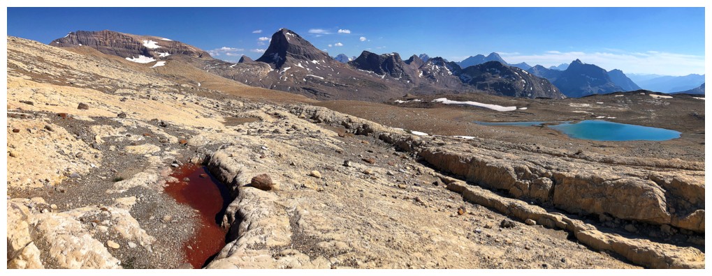
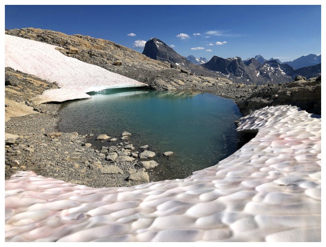
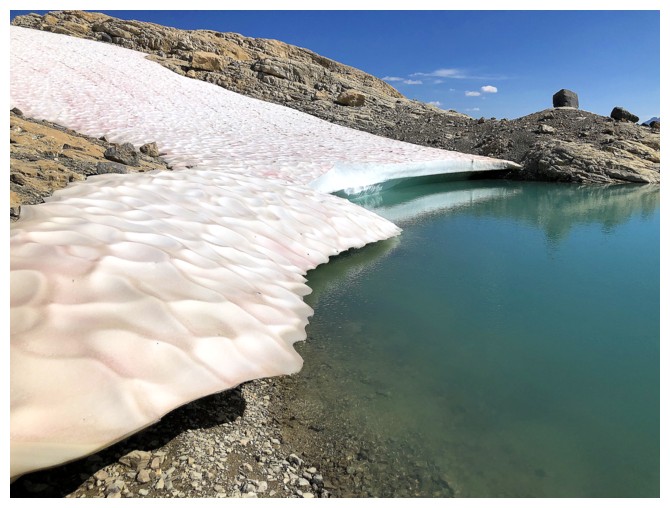
Approaching tarn 3 and a pool of red-tinged algae
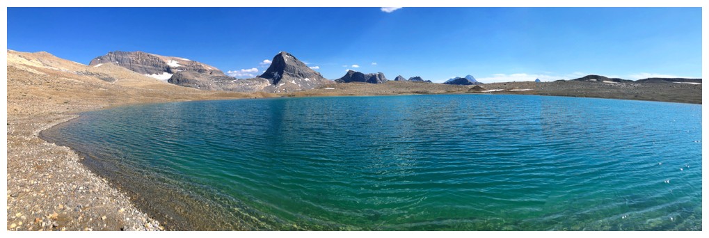
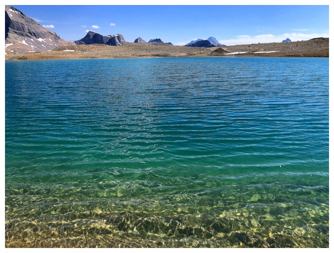
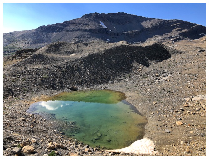
Tarn 3
It may not look like Daytona Beach, but the sand here was as fine
Here too
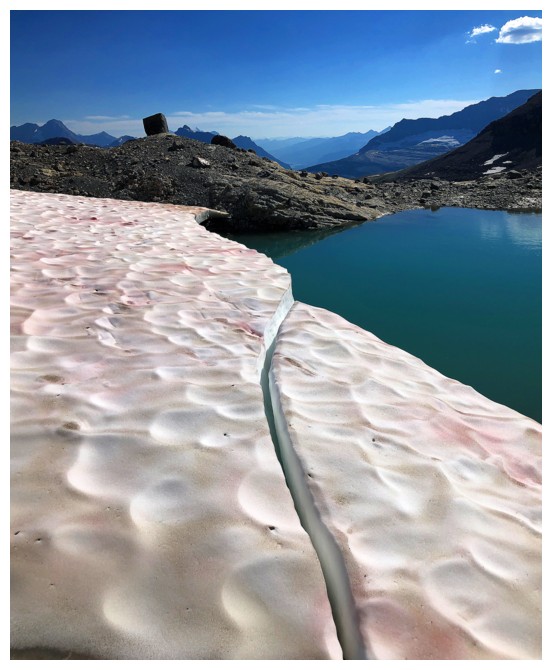
Exploring the third tarn was an awesome experience
Same as above
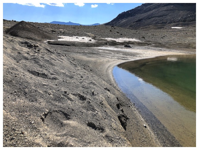
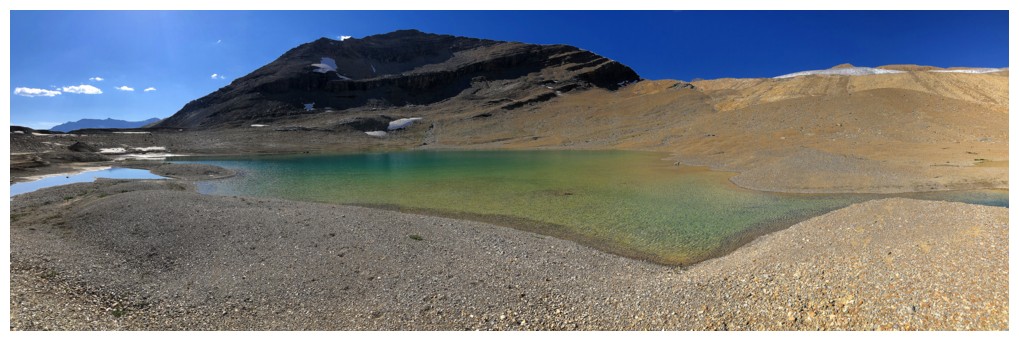
The fourth tarn was not as impressive as the others but still warranted a look
Wapta Mountain through the gap
Looking down on 4 with Takakkaw Peak above
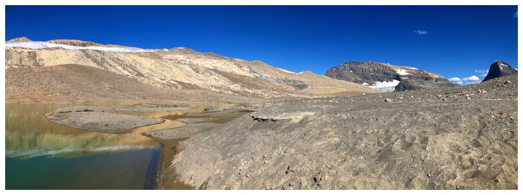
Time to start heading back, even though I wanted to visit the shores of Takakkaw Lake
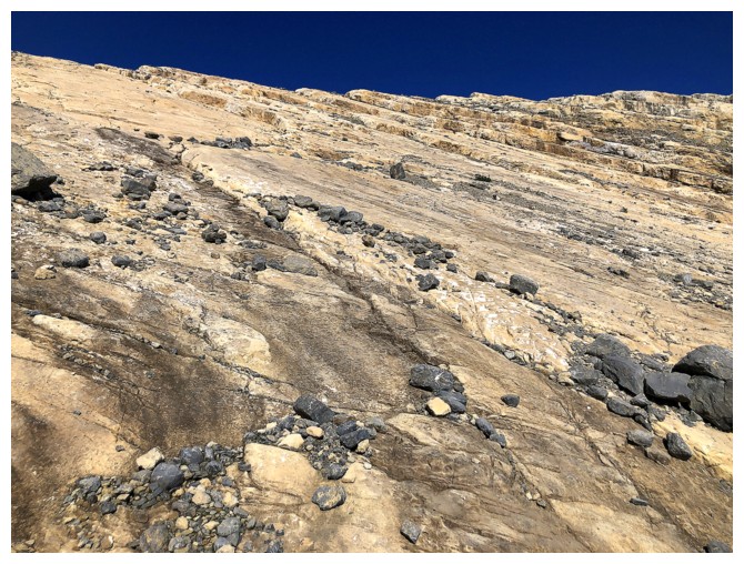
The start of the insanely interesting traverse across glacial remains
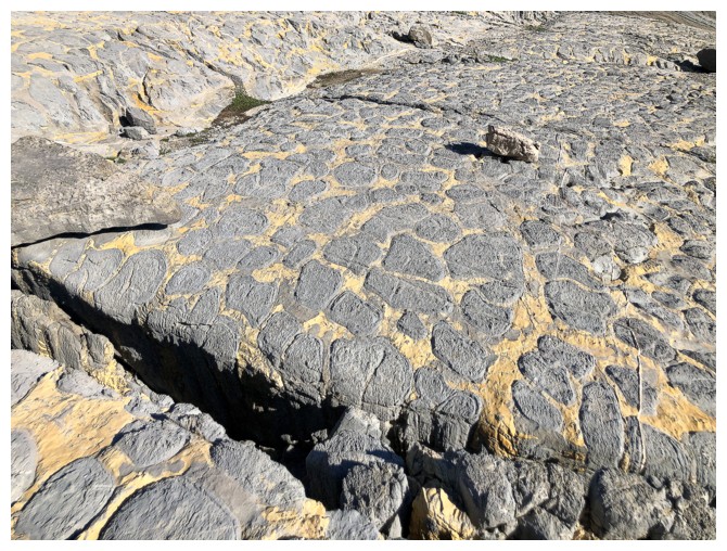
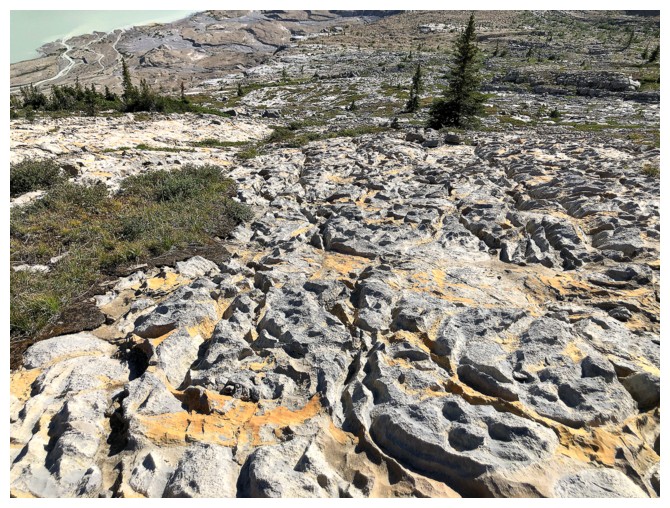
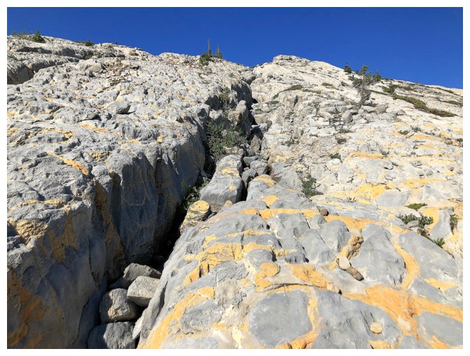
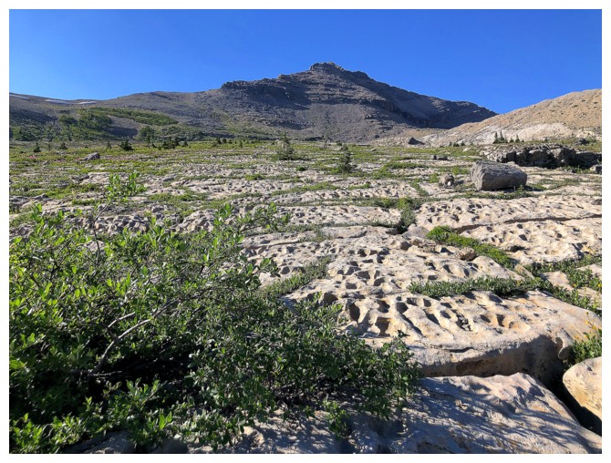
First time I had ever seen this type of terrain underfoot
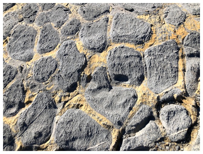
Nature's handiwork
Same as above
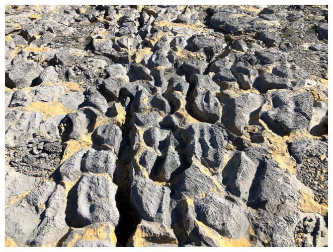
Same as above
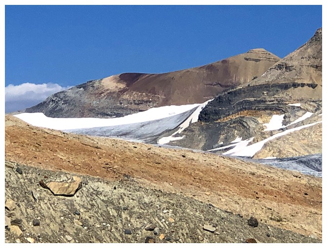
That unnamed peak peeks over the north Shoulder of Mount Daly
When you are this big, they call you a "lake"!
Still mesmerized by the cool rock
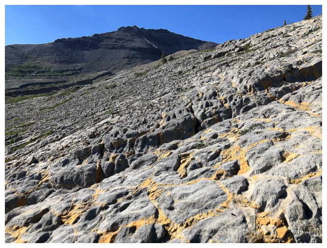
Same as above
Same as above
Nice to see some flowers
The late day Sun enhanced views to the south
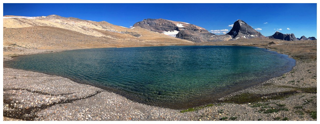
Tarn 5
Tarn 5 and Takakkaw Lake
Tarn 5 and Takakkaw Peak
Not yet done with the stunning rock
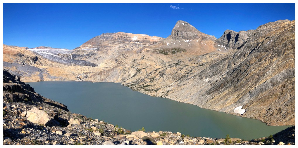
Takakkaw Lake is huge. I couldn't see what the lake outlet looked like but I can't imagine fording it would have been easy.
Last look at the peak, the lake, Niles, and another unnamed outlier of Wolverine Peak
The terrain underfoot has now changed to hard-packed glacial moraine - not pleasant!
The northern outlier of Wolverine
Almost back down to the valley
And then back down to the Yoho River
Seeing Takakkaw Falls more than 13 hours after leaving was a big relief
The Falls are raging!
The End
LOG